Article

Dynamic Assessment of Near-Surface Icing Risk in High-Mountain Regions Using Multi-Source Remote Sensing and an Energy–Moisture Coupling Model

1
Northwest Institute of Eco-Environment and Resources, Chinese Academy of Sciences, Lanzhou 730000, China
2
National Cryosphere Desert Data Center, Lanzhou 730000, China
3
Xinjiang Transportation Planning Survey and Design Institute, Urumchi 830094, China
4
Xinjiang Key Laboratory for Safety and Health of Transportation Infrastructure in Alpine and High-Altitude Mountainous Areas, Urumchi 830094, China
5
University of Chinese Academy of Sciences, Beijing 100049, China
*
Author to whom correspondence should be addressed.
Remote Sens. 2026, 18(12), 2026; https://doi.org/10.3390/rs18122026
Submission received: 2 May 2026 / Revised: 12 June 2026 / Accepted: 12 June 2026 / Published: 17 June 2026
(This article belongs to the Special Issue Remote Sensing for High-Mountain Hazards)

Abstract

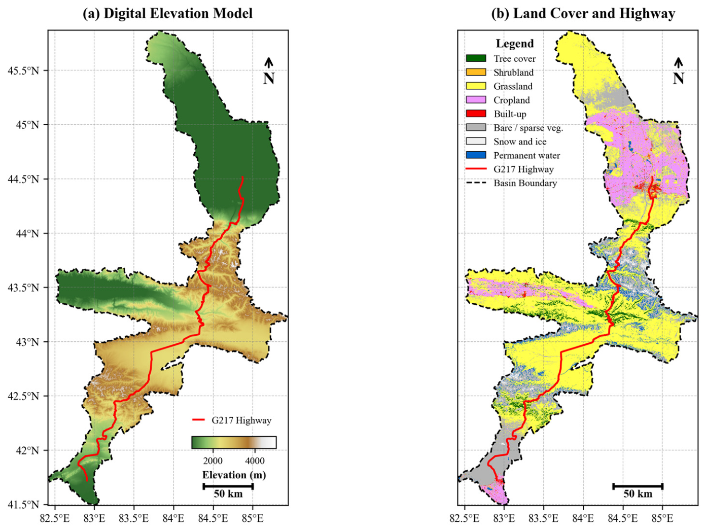
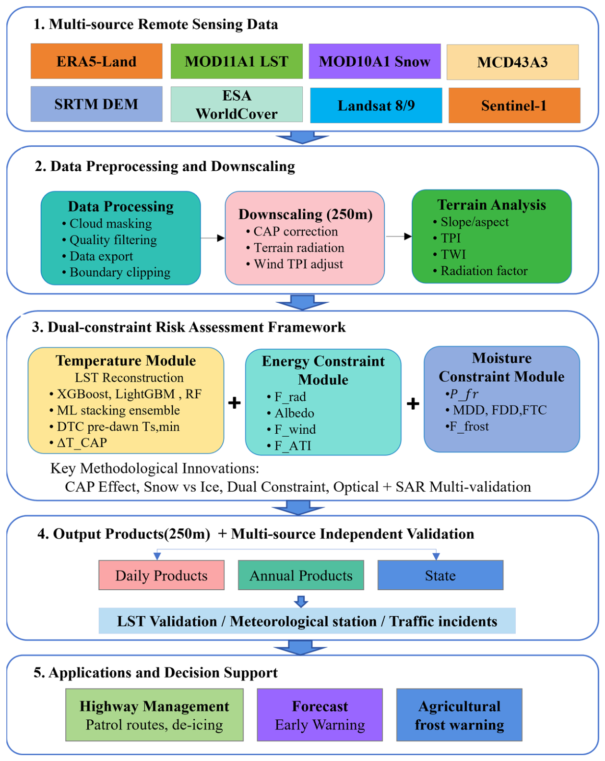
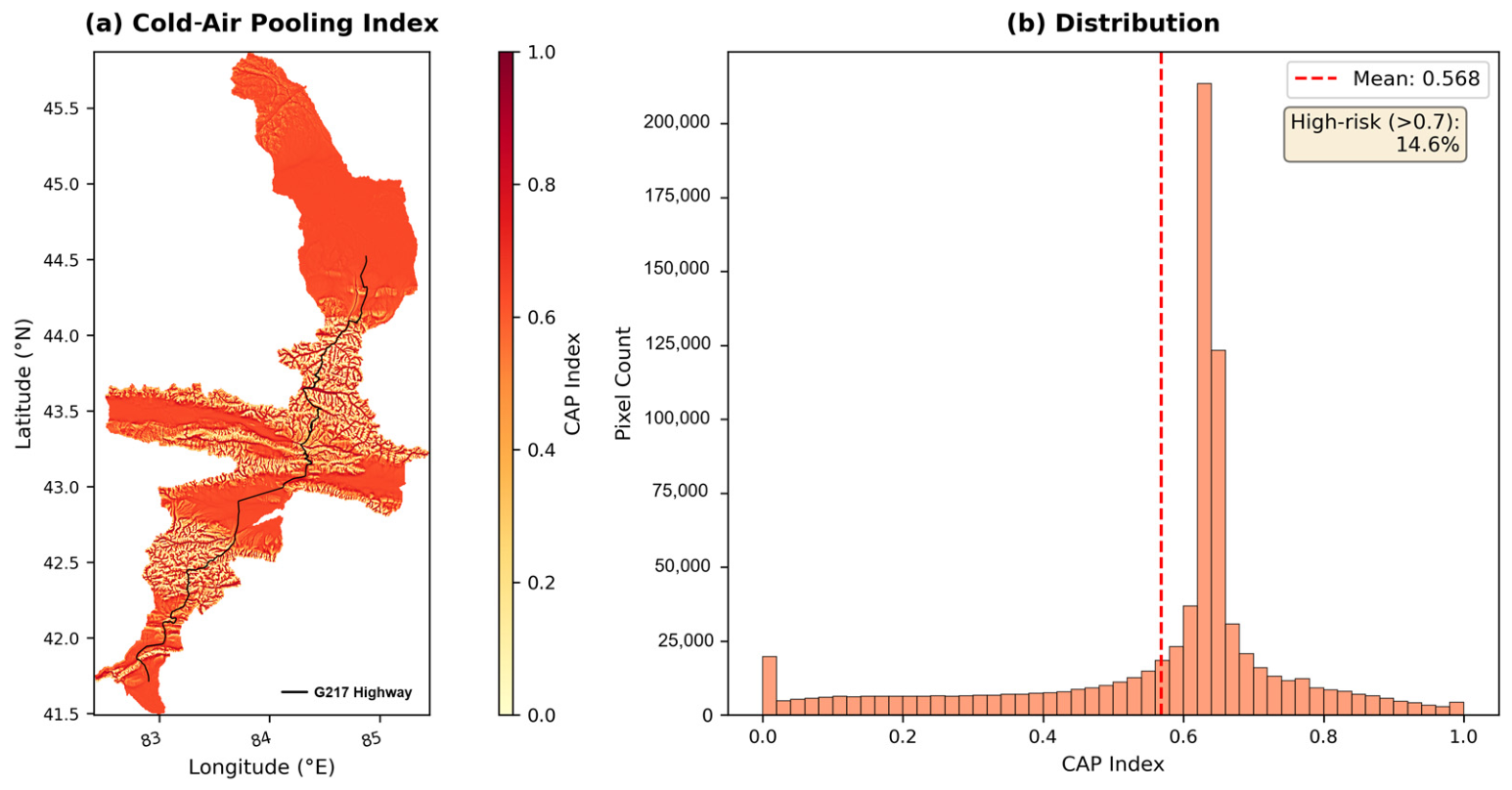
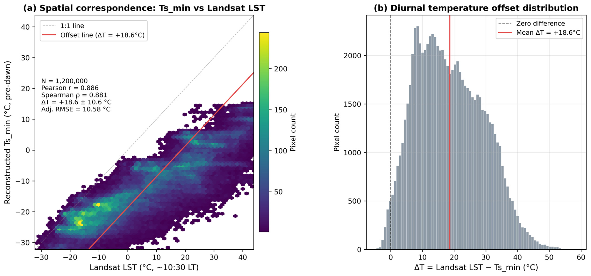
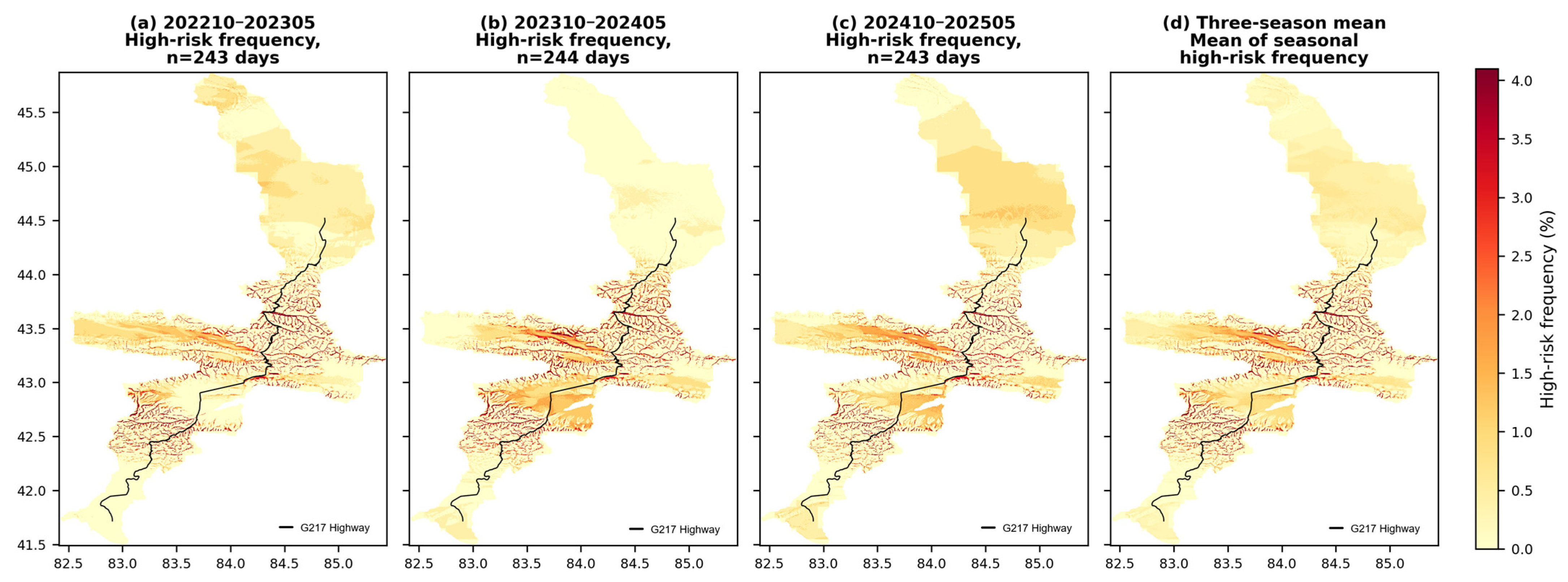
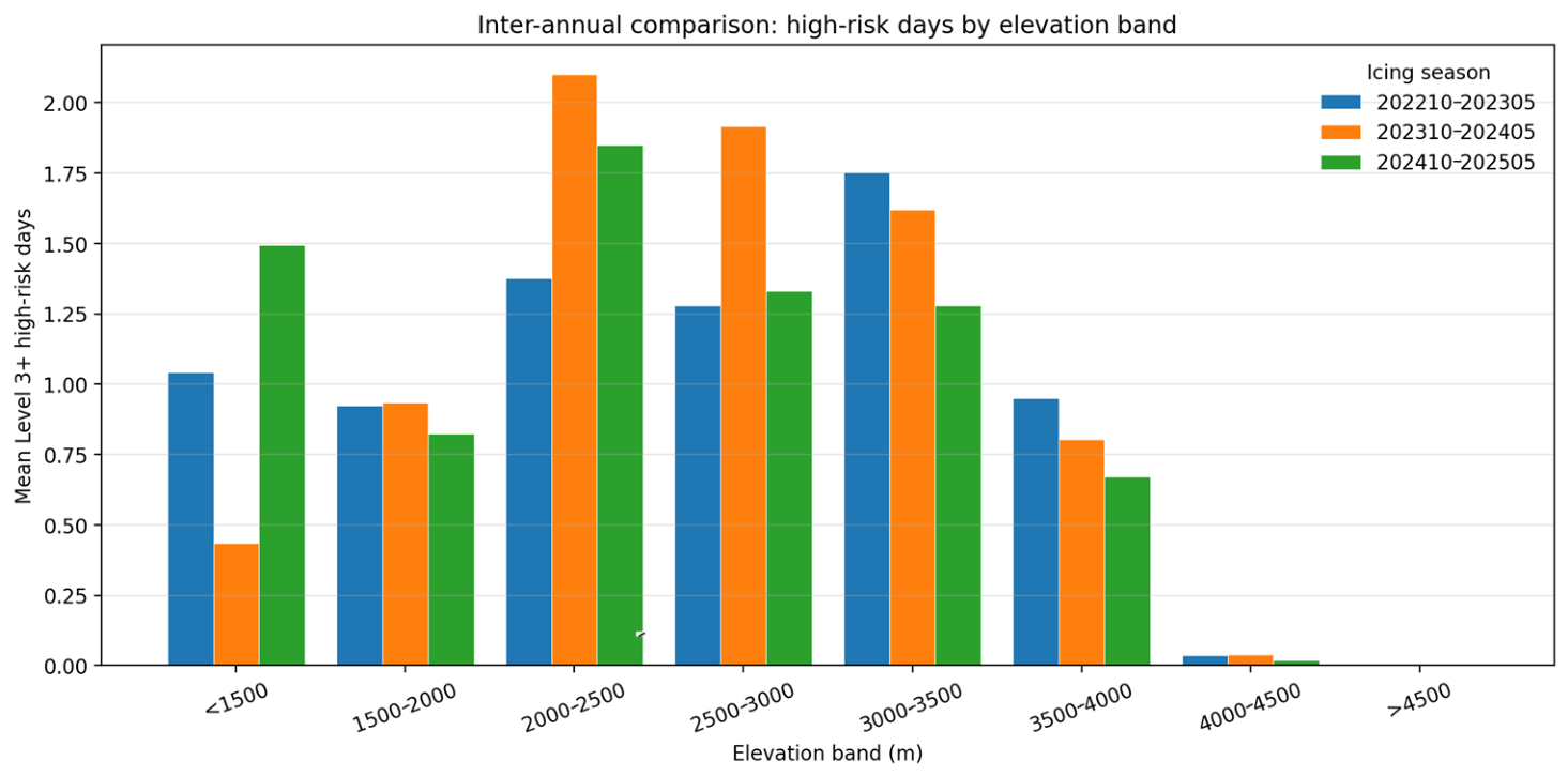
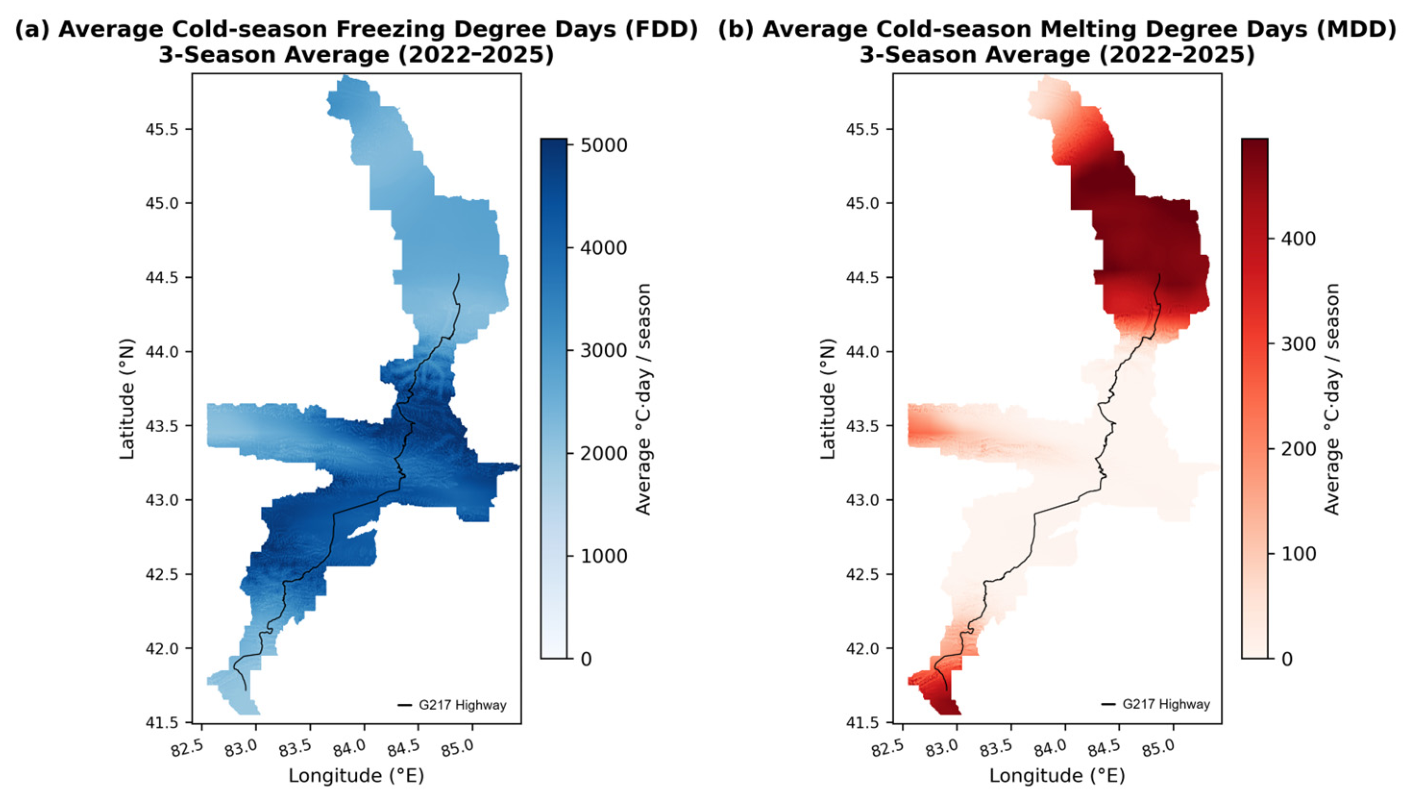
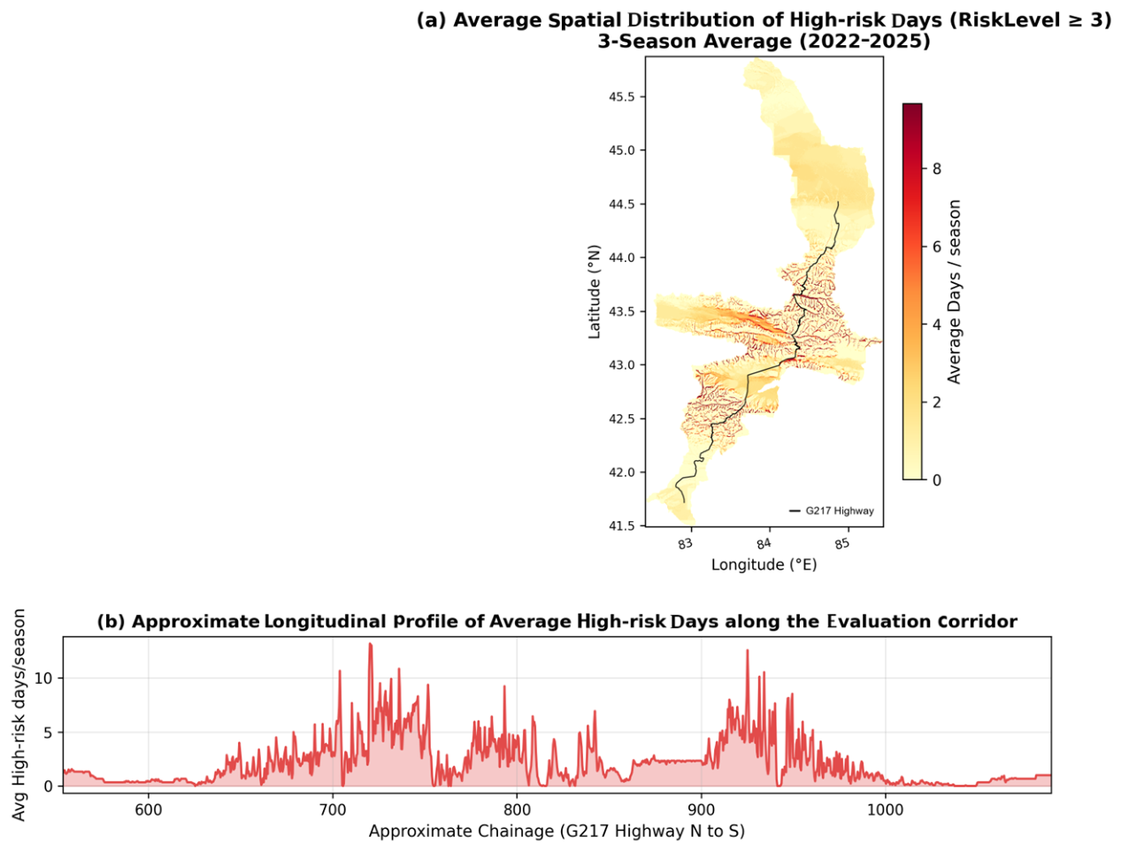
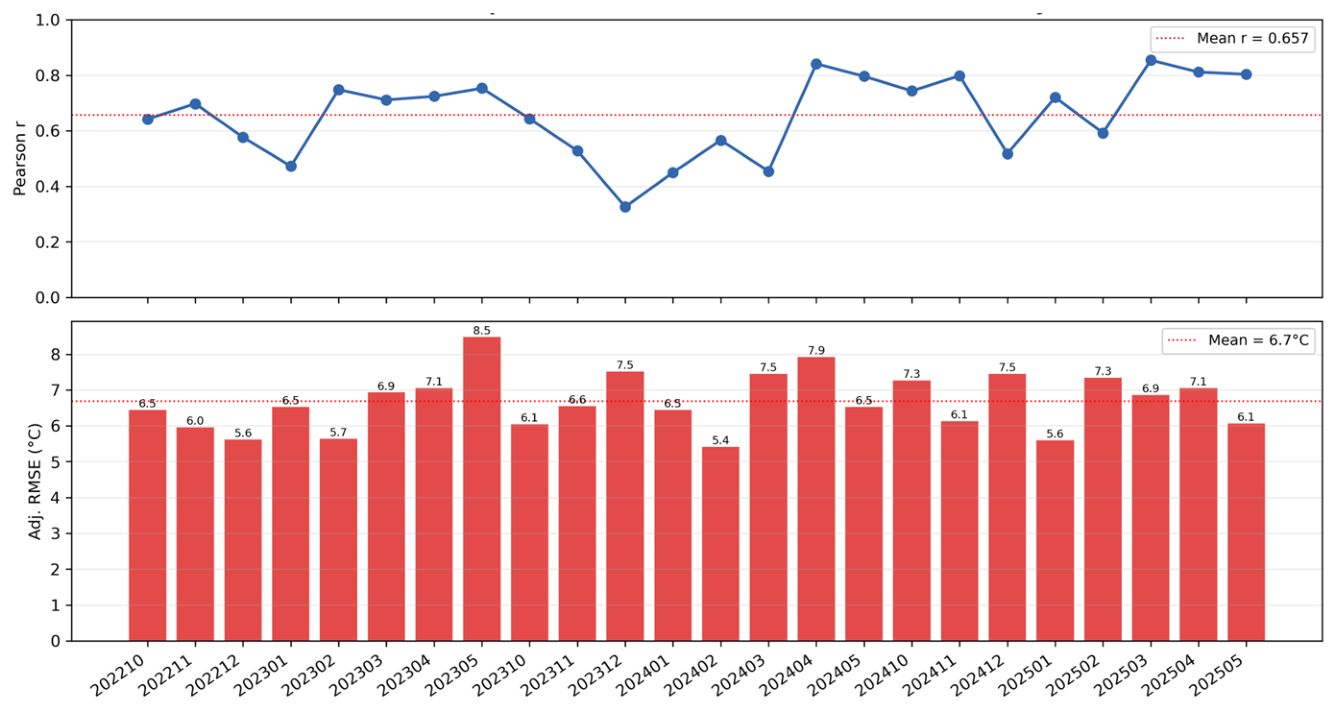
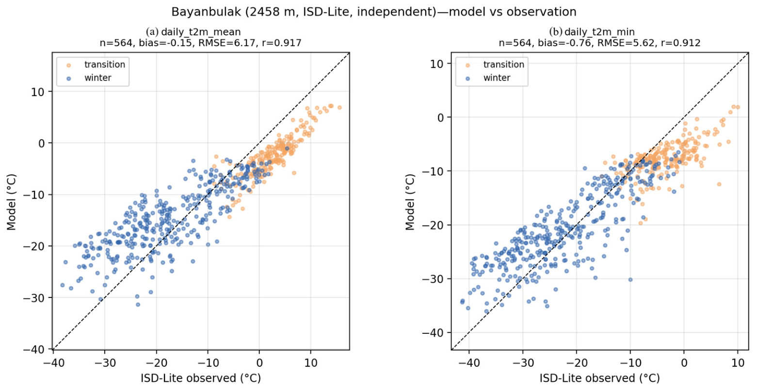
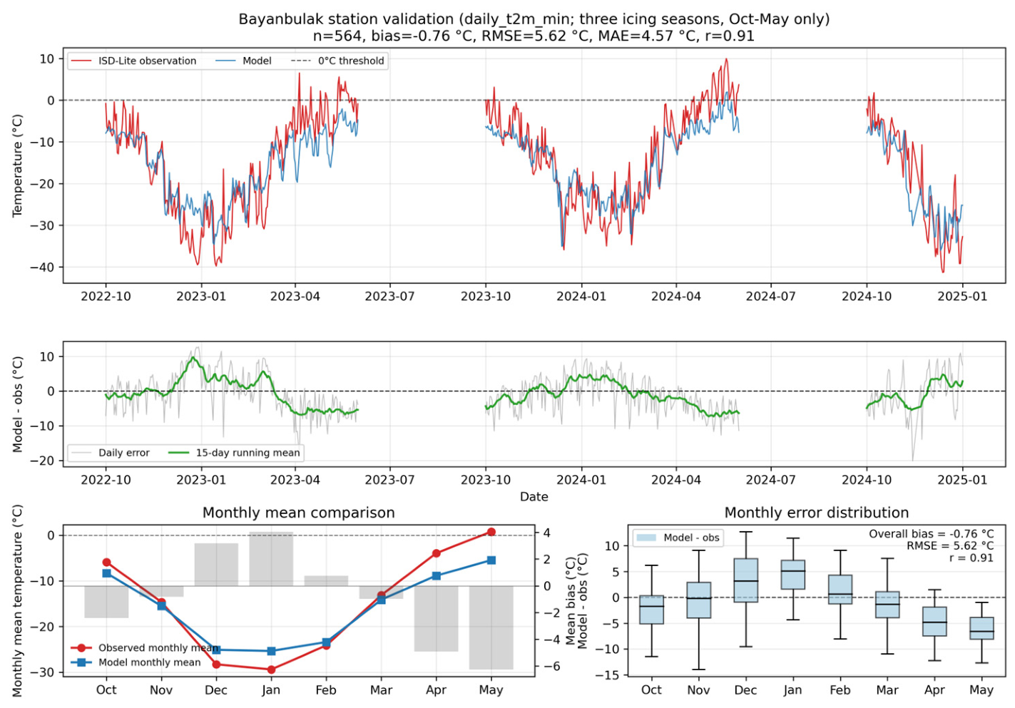
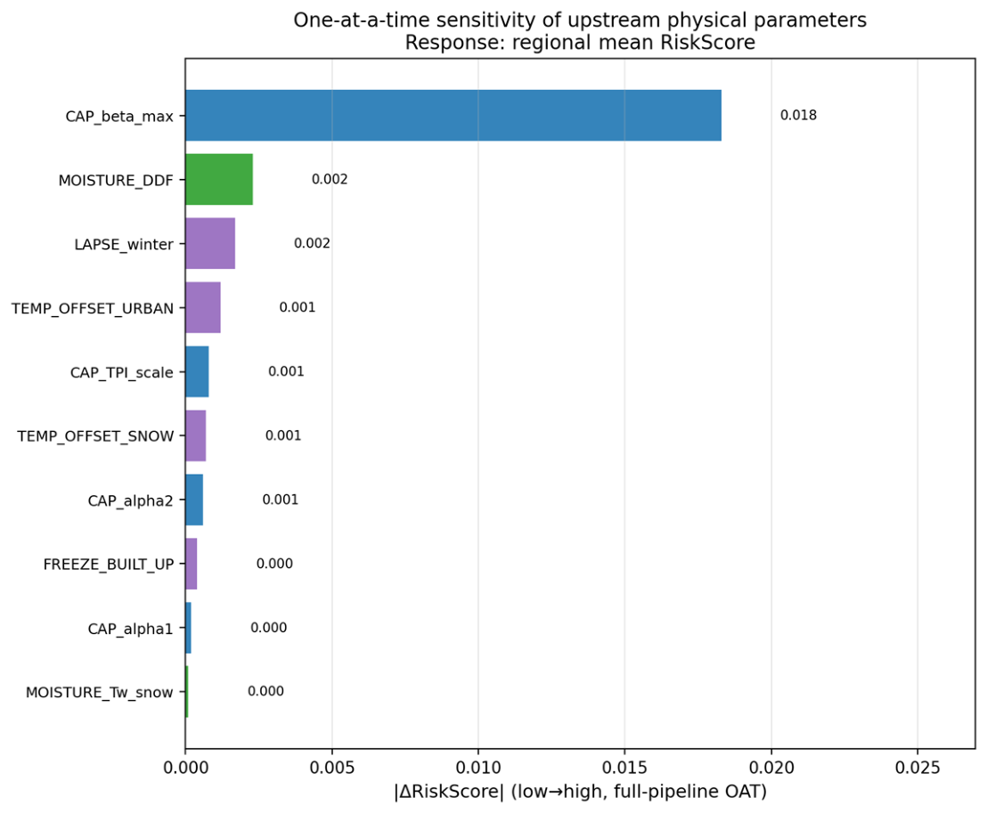
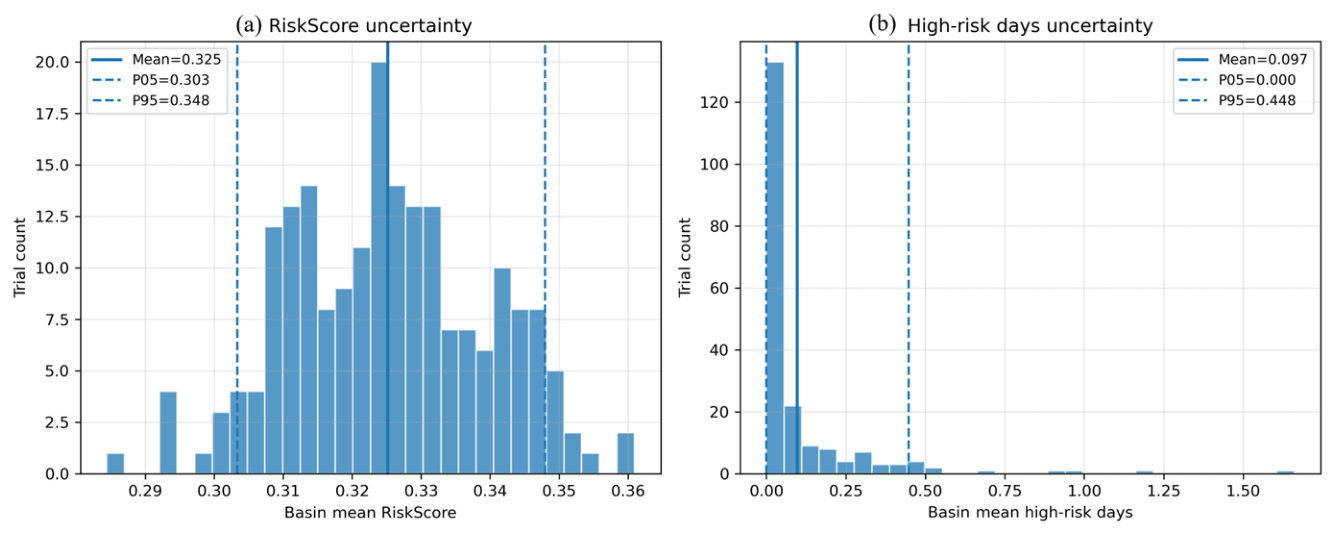
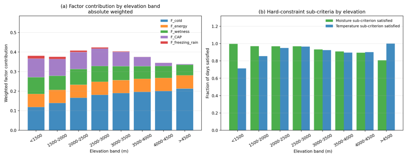
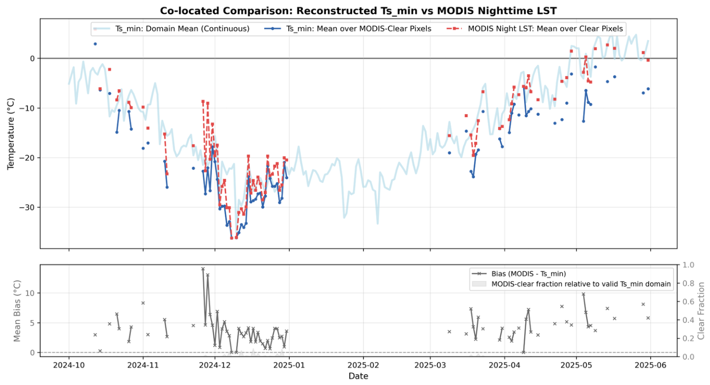
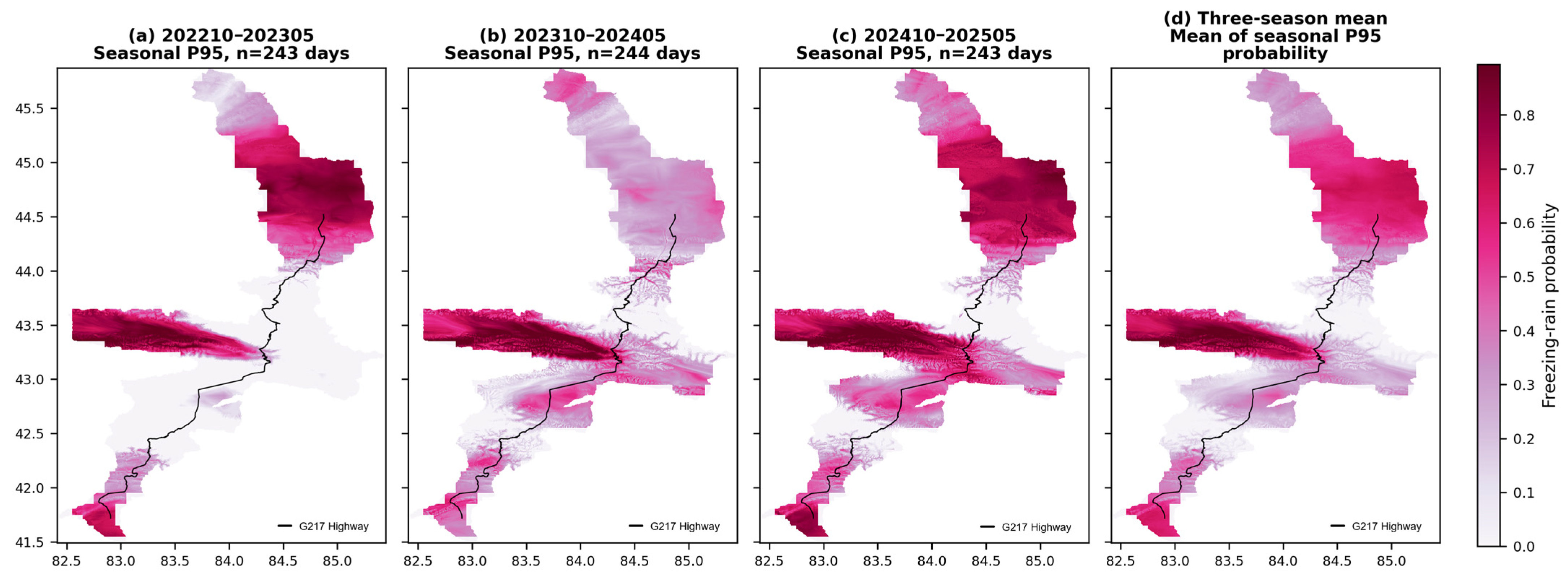
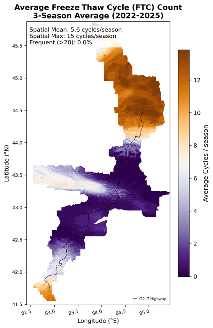
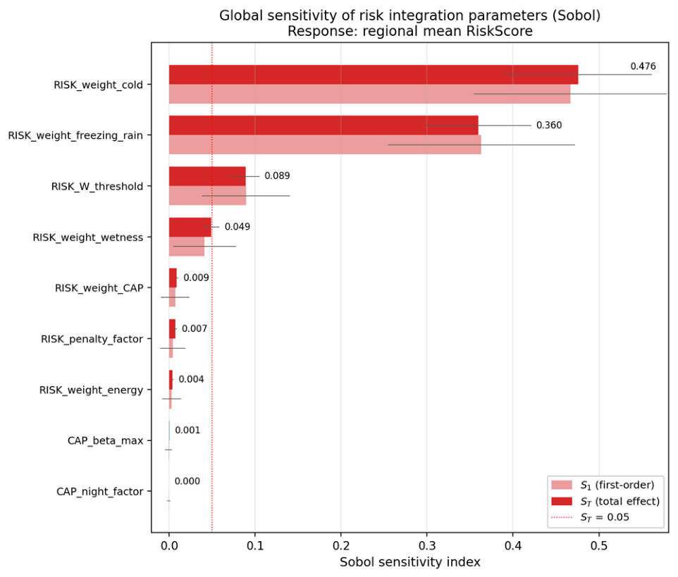
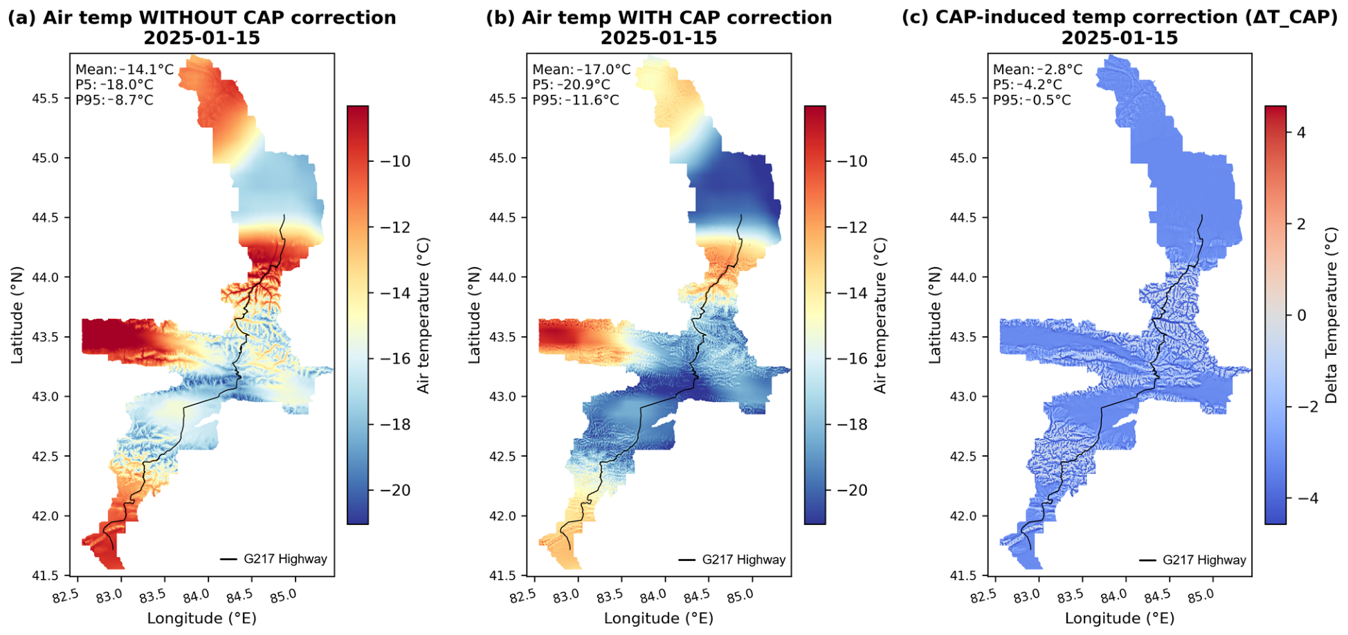
In summary, near-surface icing risk in complex alpine terrain is jointly controlled by freezing conditions, moisture supply, freeze–thaw transitions, and topographic energy processes. Traditional approaches relying on sparse station data or single temperature thresholds fail to capture spatial heterogeneity, and frequent cloud cover together with topographic errors severely limit the application of thermal infrared remote sensing. Taking the area along the Duku Highway in the Tianshan Mountains as the study region, a daily icing risk assessment framework at 250 m resolution was constructed using multi-source remote sensing, ERA5-Land reanalysis data, topographic correction, and an energy–moisture dual-constrained model. A diurnal temperature cycle model, the CAP index, and physics-constrained machine learning were integrated to reconstruct the daily minimum land surface temperature (Ts,min) at 250 m resolution under all weather conditions. A probabilistic two-tier risk assessment model was then established by incorporating moisture, topography, and freeze–thaw transitions. The results show that high-risk zones occur primarily in valleys and topographically constrained corridors rather than the coldest elevations. Validation against Landsat LST (r = 0.886) and the Bayanbulak station (bias −0.76 °C, RMSE 5.62 °C, r = 0.91) confirms spatial and seasonal accuracy. Sensitivity and Monte Carlo analyses indicate the RiskScore is mainly controlled by the low-temperature weight, while upstream parameters are less influential. The framework is best applied as a screening and early-warning product to identify sub-kilometer potential icing corridors, complementing point measurements and short-range forecasts.
Keywords: near-surface icing; land surface temperature; physically constrained machine learning; cold-air pool; multi-source remote sensing; Tianshan Mountains; risk assessment near-surface icing; land surface temperature; physically constrained machine learning; cold-air pool; multi-source remote sensing; Tianshan Mountains; risk assessment