


Highlights
What are the main findings?
- A high-quality polar dataset with 1342 images was established, and a dual-path optimized lightweight YOLO model incorporating reflection suppression and feature enhancement was proposed.
- The optimized YOLOv8n obtained 0.858 mAP@0.5 and 84.3% practical detection accuracy on shipborne equipment in polar environments.
What are the implications of the main findings?
- The lightweight and high-precision detection model is suitable for real-time target recognition on resource-constrained shipborne platforms.
- The developed visual intelligent system with three-level risk assessment provides effective technical support for intelligent and safe polar navigation.
Abstract
With the melting of Arctic sea ice and extended navigable windows, polar navigation has gained prominent commercial and strategic value but faces challenges like strong ice reflection, high target texture similarity, and large obstacle scale variation. Aiming at scarce polar-specific datasets, poor adaptability of general algorithms, and disconnection between identification and navigation decisions, this study constructed a technical system integrating “dataset construction–algorithm improvement–system development”. A purpose-built polar dataset with 1342 images (covering drift ice, iceberg, ice channel, and ship) was built via web crawling, video frame extraction, and data augmentation. A dual-path optimization scheme for lightweight YOLO models was proposed: the YUV + CLAHE module suppresses strong reflection, and the IceTextureAttention module enhances discriminability of similar targets, with SCConv optimizing computational efficiency. A visual intelligent system embedded with a Polar Code-based risk assessment module was developed to output three-level risks and navigation suggestions. Experimental results show the optimized YOLOv8n + YUV + CLAHE model achieves an overall mAP@0.5 of 0.858 and a recall rate of 0.821. The system runs stably on shipborne equipment with an average image processing latency of 85 ms and a practical detection accuracy of 84.3%, effectively reducing crew workload and improving polar navigation safety.
1. Introduction
1.1. Background and Significance
The progressive melting of Arctic sea ice has extended navigable windows and elevated the commercial and strategic value of polar routes [1]. However, polar navigation remains highly challenging due to extreme environmental conditions. Visual perception, which is the primary means for seafarers to assess surrounding ice conditions, is severely degraded by strong ice-surface reflections, low contrast between targets and background, large variations in target scales (from small ice fragments to massive icebergs), and frequent occlusions among drift ice clusters. These factors collectively increase the risk of collisions and groundings, and place unprecedented demands on intelligent target detection systems.
Conventional navigation relies heavily on manual lookout and radar, but the former is subject to fatigue and limited field of view, while the latter struggles to distinguish ice types and fine structures. In recent years, deep learning-based object detection—particularly the YOLO (You Only Look Once) series—has shown great promise in real-time maritime perception due to its speed and deployability. Nevertheless, most existing YOLO models are designed for general scenes and lack specialized adaptation to polar-specific distortions such as overexposure, texture similarity, and multi-scale targets. To address these gaps, this study constructs a polar-specific dataset and proposes a dual-path optimization framework that combines image preprocessing (reflection suppression) and network structure enhancement (texture attention), aiming for accurate, real-time, and lightweight polar target detection integrated with navigation risk assessment.
Among these challenges, strong ice-surface reflection often causes overexposure and dynamic range compression, significantly degrading the distinguishability of target boundaries [2,3]. The low contrast and high textural similarity between drift ice, icebergs, and ice channels further confuse classification models, as reported in earlier polar perception studies [4,5]. Moreover, the extreme scale variation—from small ice fragments (a few meters) to massive icebergs (hundreds of meters)—poses a multi-scale perception difficulty that general object detectors are not specifically designed to handle [6,7]. These factors necessitate a dedicated detection framework that goes beyond generic deep learning solutions.
1.2. Related Work
Research on polar target detection has evolved from traditional remote sensing methods to deep learning-based approaches [4,8].
Traditional remote sensing methods: Early efforts primarily relied on satellite-borne sensors such as MODIS, SAR, and scatterometers [9]. Western research has developed mature pipelines for sea ice feature extraction and multi-source data fusion [10]. Chinese researchers have contributed to network optimization, SAR data applications, and algorithm comparisons [11,12,13]. While these methods provide wide-area coverage, they suffer from low temporal resolution and cannot support real-time onboard navigation.
Even the more advanced SAR-based methods, while providing all-weather wide-area coverage, suffer from low temporal resolution (e.g., revisit cycles of several days) and require complex preprocessing, making them impractical for real-time onboard collision avoidance [11,12]. In contrast, a vision-based system operating at 10–30 Hz is essential for dynamic ice condition monitoring during navigation.
YOLO-based deep learning methods. The YOLO family has undergone rapid evolution from YOLOv1 to YOLO12, with each generation improving speed–accuracy trade-offs [14]. Lightweight variants such as YOLOv5n, YOLOv8n, YOLO11n, and YOLO12n are particularly attractive for shipborne deployment due to their low computational cost. However, most existing YOLO-based polar studies either apply off-the-shelf models without adaptation [15] or focus on single-target categories (e.g., sea ice or cyclones). A systematic adaptation that jointly addresses strong reflection, texture similarity, and multi-scale variation remains missing. Moreover, few studies have connected detection outputs to navigational risk assessment based on the Polar Code [16]. Therefore, a clear research gap exists: a lightweight, polar-optimized YOLO framework that couples robust detection with actionable decision support is yet to be developed.
Although several studies have applied YOLO models to polar remote sensing [15] or single-target detection (e.g., cyclones or sea ice only), most of them directly adopt off-the-shelf YOLO weights without architectural adaptation to polar-specific distortions. For instance, Wang et al. [15] used YOLOv5s for polar cyclone detection but did not address reflection or texture similarity. Moreover, none of the existing YOLO-based polar studies incorporate a post-detection risk assessment module aligned with the Polar Code [16]. Therefore, a systematic adaptation that jointly suppresses strong reflection, enhances fine-grained texture discrimination, and maintains lightweight deployment—while bridging detection outputs to navigational decisions—remains a clear gap, which the present work aims to fill.
1.3. Contributions
This paper presents a complete technical pipeline spanning dataset construction, algorithm optimization, system development, and deployment verification. The main contributions are as follows.
Polar multi-target dataset: We built a high-quality dataset of 1342 images covering four target categories (drift ice, iceberg, ice channel, ship) using web crawling, video frame extraction, and a semi-automatic annotation process (Grounding DINO + manual refinement). Data augmentation and pseudo-label strategies further expand the effective sample size.
Dual-path optimization for lightweight YOLO: Targeting the four polar challenges, we propose a preprocessing path (YUV + CLAHE adaptive reflection suppression) and a network enhancement path (IceTextureAttention module). The design maintains model lightweightness while significantly improving detection accuracy in high-reflection and high-similarity scenes.
Visual intelligent system with risk assessment: We develop an integrated system that embeds a Polar Code-based risk assessment module, providing three-level risk warnings and navigation suggestions. The system supports image/video input and is validated on shipborne edge devices, achieving near-real-time performance.
1.4. Paper Organization
The remainder of this paper is structured as follows. Section 2 presents the preliminaries of YOLO series algorithms and related supporting technologies. Section 3 describes the construction and analysis of the polar target detection dataset, including data acquisition, annotation, and the identification of four core challenges. Section 4 details the proposed dual-path optimization methodology, including the YUV + CLAHE reflection suppression module and the IceTextureAttention module. Section 5 reports the experimental setup and results, covering benchmark comparisons, reflection suppression strategy evaluation, ablation studies, and system-level deployment performance. Section 6 presents the implementation of the visual intelligent system and its risk assessment module. Section 7 discusses the limitations of the current approach. Section 8 concludes the paper and outlines directions for future work.
2. Preliminaries and Related Work
2.1. Core Framework and Evolution of YOLO
The YOLO series formulates object detection as a one-stage end-to-end regression problem. By dividing an image into grids, each grid directly predicts bounding box positions, confidence scores, and category probabilities in a single forward pass, achieving high detection speed [14].
The evolution of YOLO architectures has progressed through several stages. YOLOv1 established the basic framework. YOLOv2 and YOLOv3 introduced anchor boxes and multi-scale prediction, laying the foundation for modern YOLO. YOLOv4 to YOLOv7 focused on engineering optimizations, integrating various training techniques and modules. YOLOv8 pioneered an anchor-free design with a decoupled head, improving user-friendliness. More recent versions (YOLOv9, YOLOv10, YOLO11) have addressed information bottlenecks, enabled anchor-free NMS-free end-to-end detection, and adopted dynamic modular architectures, consistently seeking optimal trade-offs between speed and accuracy [14,17,18].
2.2. Lightweight YOLO Models for Shipborne Deployment
This study selects four lightweight YOLO models—YOLOv5n, YOLOv8n, YOLO11n, and YOLO12n—for comparison, covering classic, innovative, and cutting-edge designs to evaluate their performance in polar scenarios [14,17,18].
YOLOv5n (2020) adopts a Focus structure and CSPNet network, consisting of Input, Backbone, Neck, and Prediction modules. It reduces information loss and computational load and remains a widely used lightweight baseline [15].
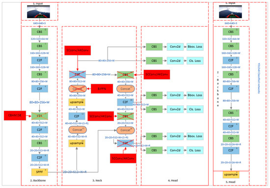
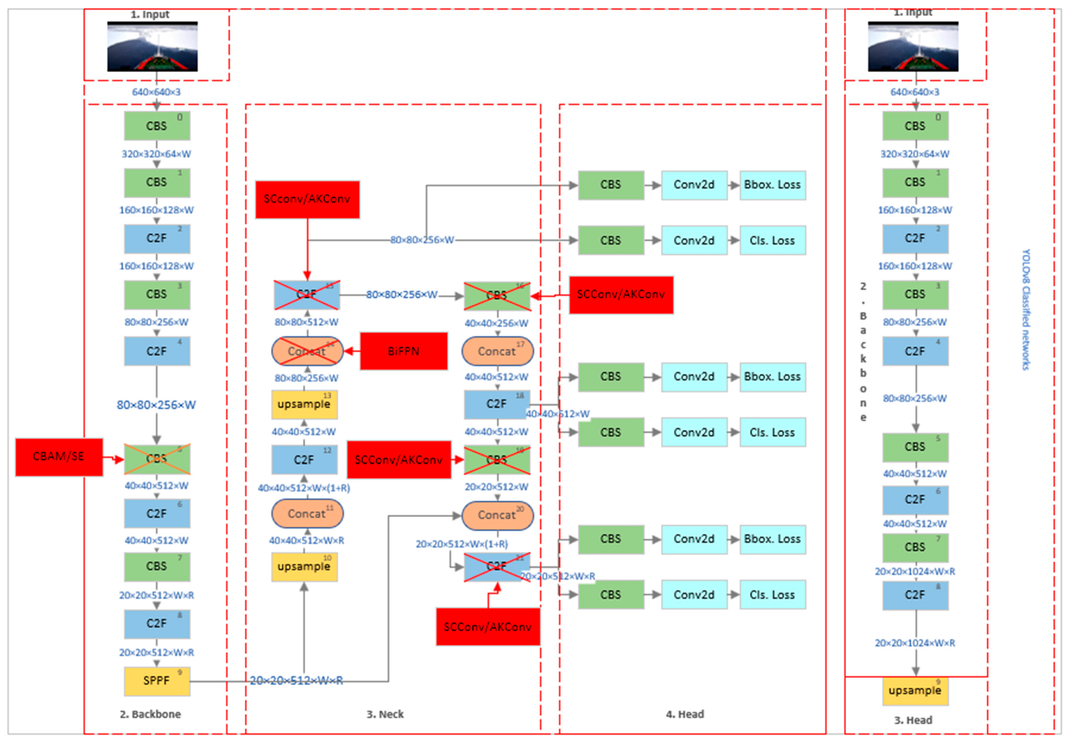
YOLOv8n (2023) introduces a decoupled head and anchor-free design, replacing the C3 module with the C2f module. Its computation load is 8.7 GFLOPs with a baseline mAP50-95 of 37.3. The network comprises Backbone, Neck, and Head [19,20,21], as shown in Figure 1.
Figure 1.
Network Structure Diagram of YOLOv8n.
YOLO11n (2024) adds two depthwise separable convolution layers to the decoupled head, reducing parameter count and computational complexity while maintaining or improving detection performance [17,18].
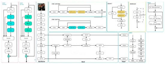
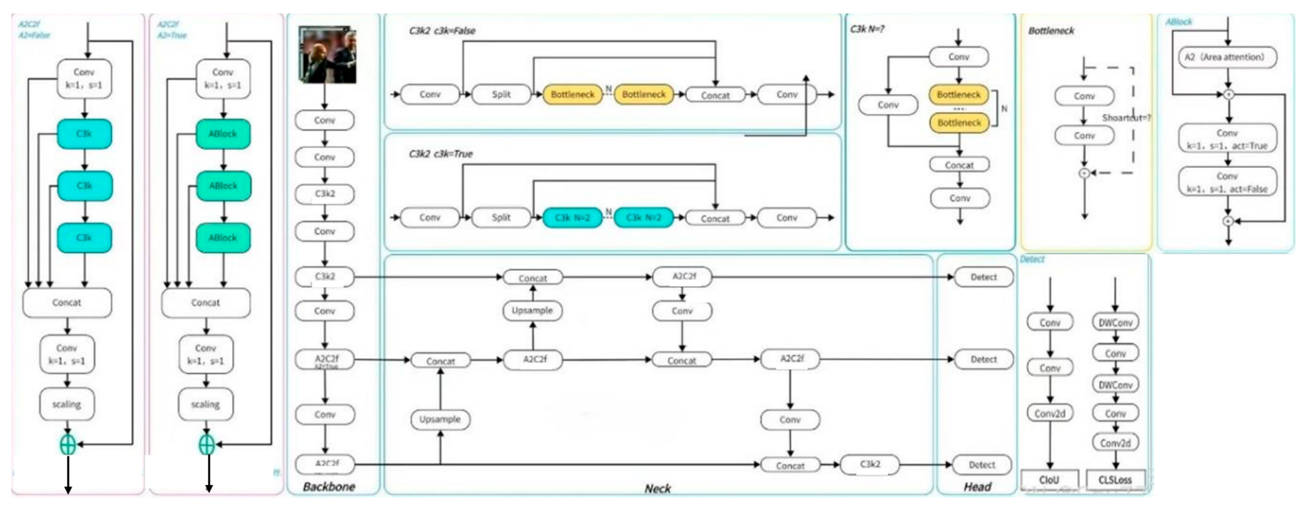
YOLO12n (2025) features a backbone composed of A2C2f modules and ABlock units, a lightweight BiFPN neck, and a channel attention branch in the head. Its parameter count is 12% lower than YOLO11n, with 7.9 GFLOPs and an mAP50-95 of 38.7, as shown in Figure 2.
Figure 2.
Network Structure Diagram of YOLO12n.
2.3. Supporting Technologies for Polar Visual Perception
To address the challenges of polar environments (strong reflection, low contrast, texture similarity, and multi-scale targets), several supporting technologies are relevant. This subsection briefly reviews them as the technical basis for our dual-path optimization in Section 4.
Image enhancement and reflection suppression. Retinex theory decomposes an image into illumination and reflection components, enabling the removal of lighting interference [2]. However, classical Retinex methods often suffer from high computational cost and halo artifacts. CLAHE (Contrast Limited Adaptive Histogram Equalization) enhances local contrast without over-amplifying noise [3]. Combining color space transformation (e.g., YUV) with CLAHE can achieve more adaptive reflection suppression.
Attention mechanisms. Channel and spatial attention mechanisms, such as SE (Squeeze-and-Excitation) and CBAM (Convolutional Block Attention Module), dynamically reweight feature maps to emphasize informative regions and suppress irrelevant backgrounds [22,23]. These mechanisms have been successfully applied to enhance feature discrimination in complex scenes.
Texture feature extraction. Gabor filters, which capture spatial frequency and orientation information, are effective for extracting fine-grained textures (e.g., ice cracks, iceberg edges) and have been used in fabric defect detection and remote sensing [24,25].
Efficient convolution and multi-scale fusion. SCConv compresses feature redundancy while retaining key details, and BiFPN enables bidirectional multi-scale feature fusion with low computational overhead [6,18]. These techniques are particularly suitable for lightweight deployment on shipborne edge devices.
In addition to the above, recent advances in feature-aware fusion networks [26] and multi-frequency perception [27] provide relevant insights for polar scene understanding.
Among these techniques, CLAHE is adopted for reflection suppression in the preprocessing path due to its low computational cost and local contrast enhancement capability. For texture feature enhancement, the proposed IceTextureAttention module adopts a lightweight dual-branch convolution design inspired by multi-scale texture extraction and attention reweighting, while keeping trainable parameters minimal [28].
3. Polar Target Detection Dataset
3.1. Data Collection and Composition
Accurate detection of core polar targets is essential for navigation safety and efficiency. However, the lack of publicly available polar-specific datasets has become a key bottleneck. This study first defines four target categories critical for polar navigation—drift ice, iceberg, ice channel, and ship—and then constructs a dedicated high-quality dataset for model training [4,15].
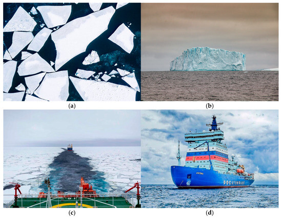
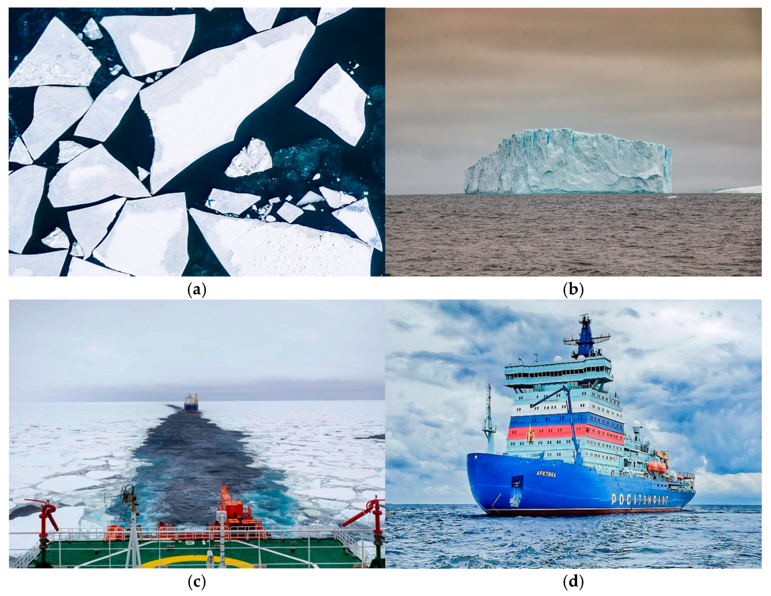
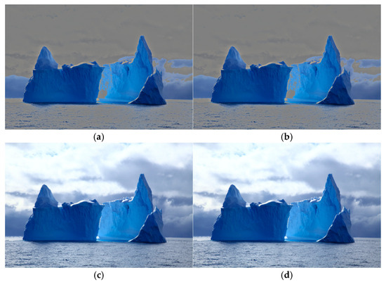
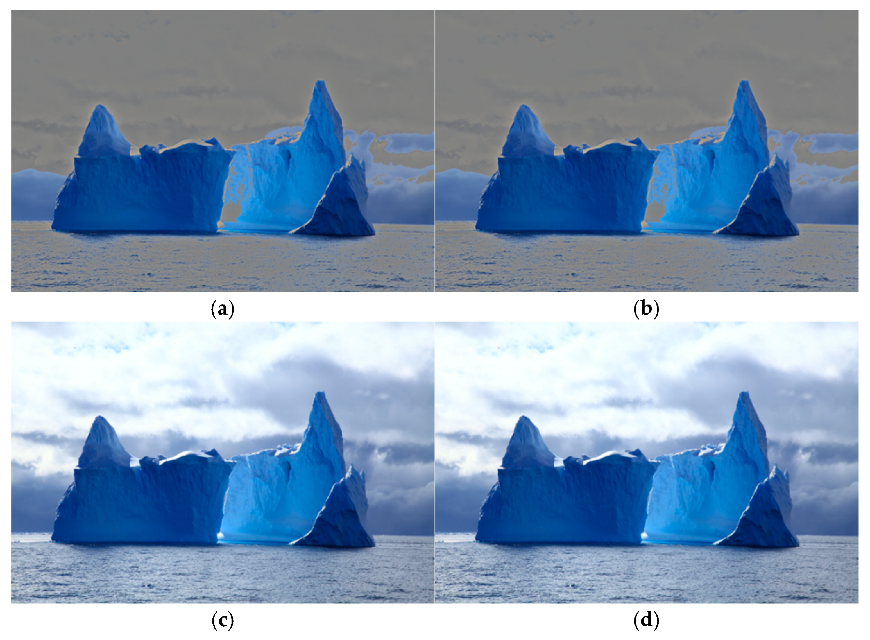
Drift ice: Formed by frozen seawater, moving with wind and currents. Its distribution, density, and thickness are key parameters for ice condition assessment and route planning.
Iceberg: A freshwater ice body calved from glaciers or ice shelves, with only 1/7 to 1/8 of its volume above water. Due to its high concealment, it is the primary hazard to avoid.
Ice channel: A natural or artificial navigable waterway within ice-covered areas, critical for ship path planning.
Ship: Polar navigation vessels (e.g., icebreakers, merchant ships) with special anti-ice structures require automatic identification and tracking to maintain channel order and prevent collisions [5,16] (Figure 3).
Figure 3.
Four types of polar targets: (a) drift ice, (b) iceberg, (c) ice channel, (d) ship.
To address the data shortage, images were collected via web crawling and frame extraction from polar expedition videos, resulting in 1342 JPG images covering the four target categories [5]. Data augmentation—including rotation, scaling, and brightness jitter—was applied to enhance sample diversity. The augmented dataset was split into training, validation, and test sets at a ratio of 8:1:1, used for model training, hyperparameter tuning, and final evaluation, respectively. Table 1 and Table 2 summarize the data sources and split.
Table 1.
Quantity and Source Statistics of Polar Target Dataset.
Table 2.
Division of Polar Target Dataset.
3.2. Data Annotation and Quality Control
Given the variable target morphology and complex backgrounds in polar images, an efficient pipeline of automatic pre-annotation followed by manual fine-correction was adopted [29,30].
Annotation process. First, the Grounding DINO model performed zero-shot inference using text prompts for the four categories, generating bounding boxes and category labels in batches [29]. Then, LabelImg was used for manual correction: adjusting bounding box positions, supplementing missing targets, deleting false detections, and calibrating category labels [30].
Quality control. Spatial accuracy required bounding boxes to tightly enclose targets to minimize background noise. Semantic consistency was ensured by following strict category definitions; ambiguous cases (e.g., ice channel vs. open water) were adjudicated by domain experts [5]. A three-level quality control (annotation → cross-review → expert arbitration) was implemented [31].
3.3. Dataset Characteristics and Derived Challenges
Analysis of the constructed dataset reveals four core challenges posed by the polar visual environment for target detection [4,5]:
Strong reflection leads to overexposure and low contrast, thereby masking target features.
Inter-class similarity and intra-class variation cause target confusion and misclassification.
Large scale variation (from small ice fragments to massive icebergs) increases the difficulty of small target detection.
Occlusion and adhesion combined with low-contrast ice channels, reduce segmentation and recognition accuracy.
These challenges require a detection model to handle feature degradation, fine-grained discrimination, extreme scale perception, and target separation [6,22].
3.4. Limitations of the Current Dataset
While the constructed dataset supports the subsequent algorithm development, several limitations should be acknowledged.
Limited sample size: With only 1342 images, the dataset may not capture the full variability of polar environments (e.g., twilight, aurora, different ice types and seasons). Data augmentation mitigates but does not fully resolve this issue.
Domain gap: Images were collected from websites and video frames, which may differ from real-time shipborne camera feeds in terms of resolution, camera motion, and continuous temporal context. Generalization to continuous navigation scenarios requires further validation.
Incomplete environmental coverage: The dataset predominantly contains daytime, clear-weather images. Conditions such as polar night, fog, blizzards, and low sun angles are underrepresented. Future work should include such challenging scenarios.
4. Methodology: Dual-Path Optimization for Polar Target Detection
4.1. Problem Formulation and Baseline Bottlenecks
Based on the dataset analysis in Section 3.3, polar target detection faces four core challenges: strong reflection, inter-class similarity, large scale variation, and occlusion/adhesion. To quantify the performance of existing lightweight YOLO models on these challenges, we evaluated YOLOv5n, YOLOv8n, YOLO11n, and YOLO12n on our polar dataset (detailed results are presented in Section 5.2). The benchmark evaluation reveals three major bottlenecks that motivate our dual-path optimization.
First, strong ice and snow reflection causes overexposure and low contrast, leading to blurred target contours and reduced localization accuracy [2,3]. Second, the highly similar textures of ice surface targets result in prominent category confusion, with drift ice classification accuracy ranging only from 0.69 to 0.72 across the four models [4,5]. Third, some lightweight models such as YOLO12n sacrifice feature extraction robustness for computational efficiency—its aggressive channel reduction, depthwise convolutions, and reduced cross-scale feature interaction lead to a high background false detection rate [18,19]. These bottlenecks confirm the necessity of targeted adaptations that suppress reflection interference and enhance texture feature extraction while maintaining model lightweightness.
4.2. Overall Framework of Dual-Path Optimization
To address the above problems, we propose a dual-path optimization scheme consisting of a preprocessing path and a network enhancement path, following the principle of front-end interference suppression followed by back-end feature enhancement [6,22]. The preprocessing path is a fixed, non-trainable module that reduces reflection-induced noise before the image enters the network. The network enhancement path is a lightweight trainable attention module inserted into the backbone to amplify discriminative texture features.
Both modules are designed with a unified interface, making them plug-and-play for any YOLO architecture without customized adjustments. Each follows the lightweight principle: the preprocessing path adds zero trainable parameters, and the network enhancement path adds only a small number of operations without significantly increasing inference delay [6,18,19].
4.3. Preprocessing Path: YUV + CLAHE Adaptive Reflection Suppression
Traditional reflection suppression methods, such as Retinex-based illumination–reflection decomposition, suffer from high computational complexity, halo artifacts, and poor adaptability to dynamic polar illumination [2]. After experimenting with three Retinex variants (full suppression, fixed brightness suppression, and dynamic suppression), as shown in Figure 4, and observing that they often cause performance degradation or limited gains (see Section 5.3), we developed a lightweight alternative.
Figure 4.
Comparison Diagram of Polar Iceberg Image Enhancement Effects under Different Reflection Suppression Schemes. (a) Retinex full suppression processing result. (b) Retinex fixed brightness suppression processing result. (c) Retinex dynamic suppression processing result. (d) YUV + CLAHE adaptive reflection suppression processing result.
The proposed YUV + CLAHE scheme operates as follows: First, the input image is converted from RGB to YUV color space, separating luminance (Y) from chrominance (U, V). Then, overexposed regions are detected using a dynamic brightness threshold—pixels with a Y value exceeding both 180 and the 90th percentile of the Y channel are marked as reflection areas, and the reflection mask is refined by morphological closing. Next, CLAHE (Contrast Limited Adaptive Histogram Equalization) is applied only to these overexposed regions, with a clip limit of 2.0 to avoid noise amplification. Finally, the enhanced regions are fused with the original unchanged regions, and the image is converted back to RGB.
The proportion and connectivity of high-brightness areas are evaluated by a reflective function, triggering processing only when necessary to reduce computational overhead. The entire scheme is implemented using OpenCV with no additional dependencies. As shown in Table 3, this scheme improves mAP50 by 2.06% for YOLOv5n and 3.26% for YOLOv8n, whereas Retinex variants often cause performance loss.
Table 3.
Performance Comparison of YOLOv5n under Different Reflection Suppression Strategies. Bold indicates the optimal value of the model among all reflection suppression schemes; values in parentheses represent the rate of change relative to the “No glare suppression” scheme (↑ for improvement, ↓ for decline).
4.4. Network Enhancement Path: IceTexture Attention Module
To address the problems of insufficient fine-grained texture capture ability of lightweight models and frequent category confusion caused by highly similar textures of polar ice surface targets [4,5], the network enhancement path is designed to embed a lightweight scenario-specific attention module into the model backbone, strengthening texture feature extraction without increasing computational burden [22,24].
This research designs the IceTexture Attention (ice surface texture feature guidance) module with a dual-branch parallel structure for the network enhancement path: it extracts local fine textures (e.g., ice surface microcracks) and macro structural textures (e.g., iceberg edge distribution) through 3 × 3 and 5 × 5 convolution kernels respectively; after feature fusion via 1 × 1 convolution, a texture attention weight map is generated by the Sigmoid activation function to automatically strengthen texture-rich areas and suppress homogeneous backgrounds [22,24]. The texture attention weight map is calculated as (1):
where denotes a convolution operation, denotes feature concatenation, and is the Sigmoid activation function.
The module adopts an “feature weighting + residual connection” output mode to retain the global semantic information of the original backbone network while enhancing texture features, avoiding feature loss [19,22]. The final output of the module is given by (2):
where ⊗ denotes element-wise multiplication, and is the input feature map from the backbone.
For compatibility with different YOLO architectures, the module is designed with a unified integration interface and can be directly embedded after the C2f/C2fPSA module, ensuring consistent improvement across all models [18,19]. This module realizes the optimization from general attention to scenario-specific attention, constructing a lightweight improvement paradigm via simple multi-scale convolution and weighted fusion [22,24]. Experimental results show that integrating this module effectively improves the model’s ability to distinguish similar targets and detect small targets (reducing background interference false alarm rate), with all models achieving mAP improvement while maintaining basically unchanged inference speed.
5. Experiments and Results
5.1. Experimental Setup
All experiments were conducted on the AutoDL cloud computing platform. The core hardware configuration was as follows: CPU: Intel Xeon Platinum 8352V; GPU: 1 × NVIDIA RTX 4090 (with CUDA 12.4 support); memory and storage configured according to the platform’s standard for high-performance computing tasks.
5.2. Benchmark Model Performance
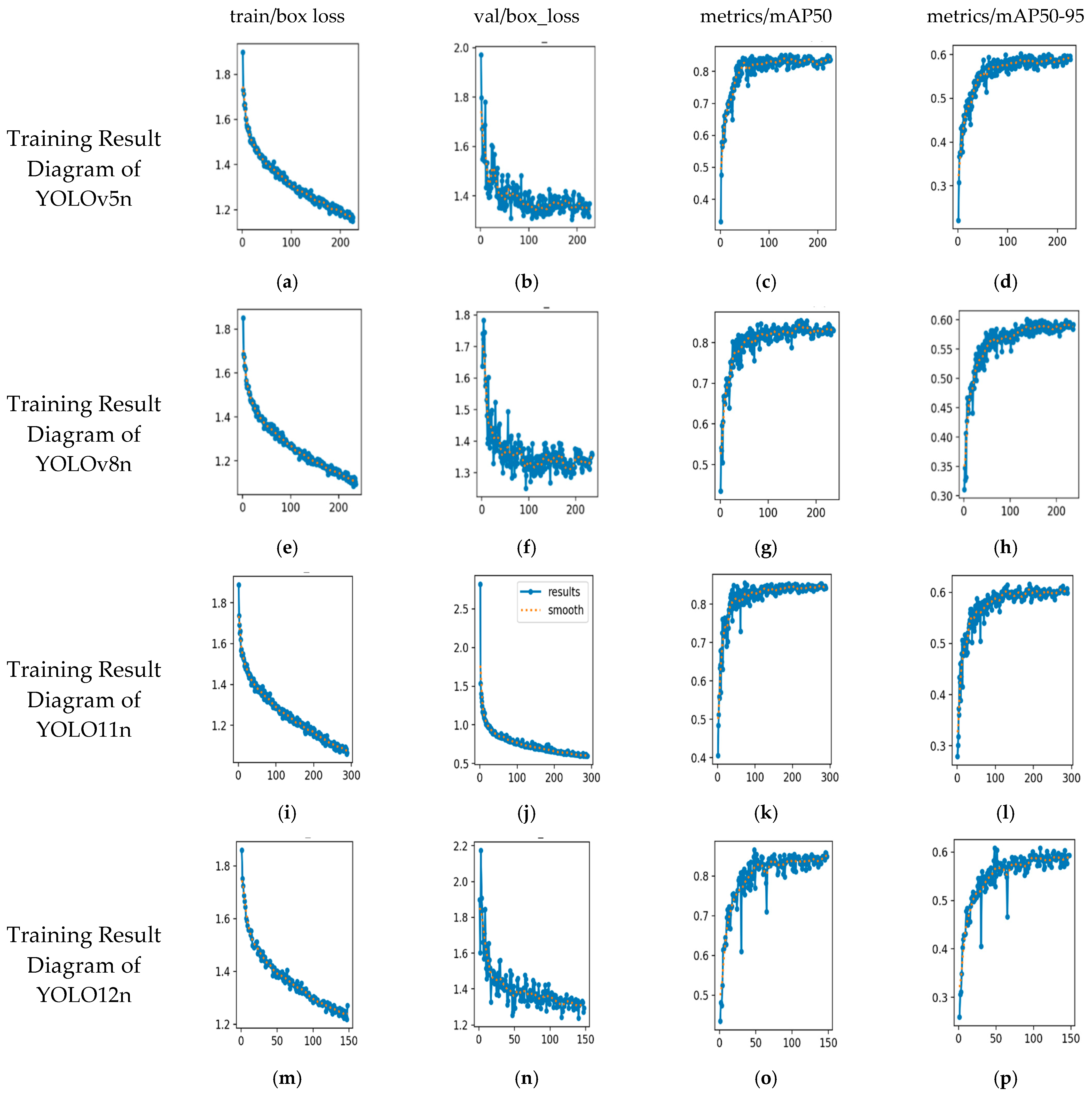
We evaluated four lightweight YOLO models—YOLOv5n, YOLOv8n, YOLO11n, and YOLO12n—on our polar dataset to establish baselines [14,17,18]. All models were trained under the same experimental conditions and converged effectively without overfitting [19].
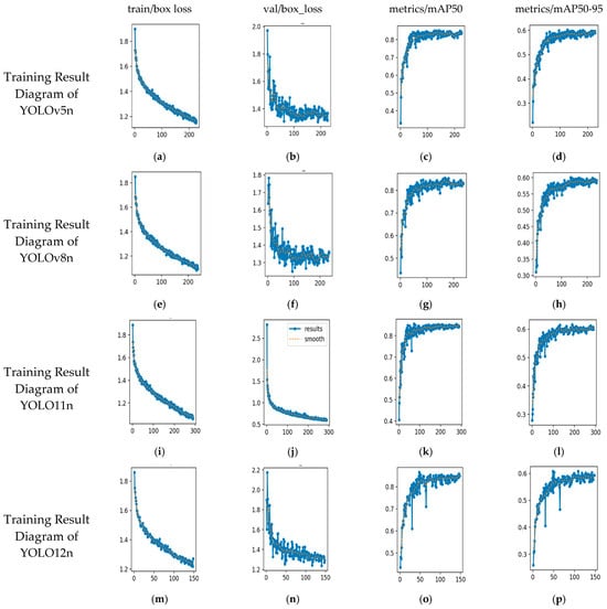
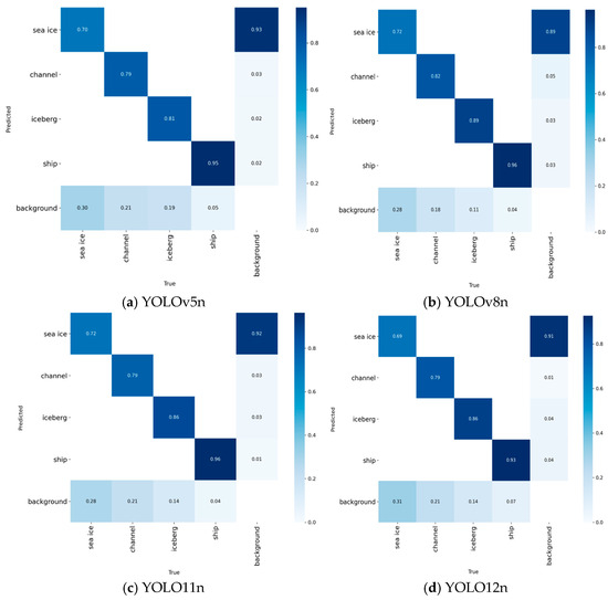
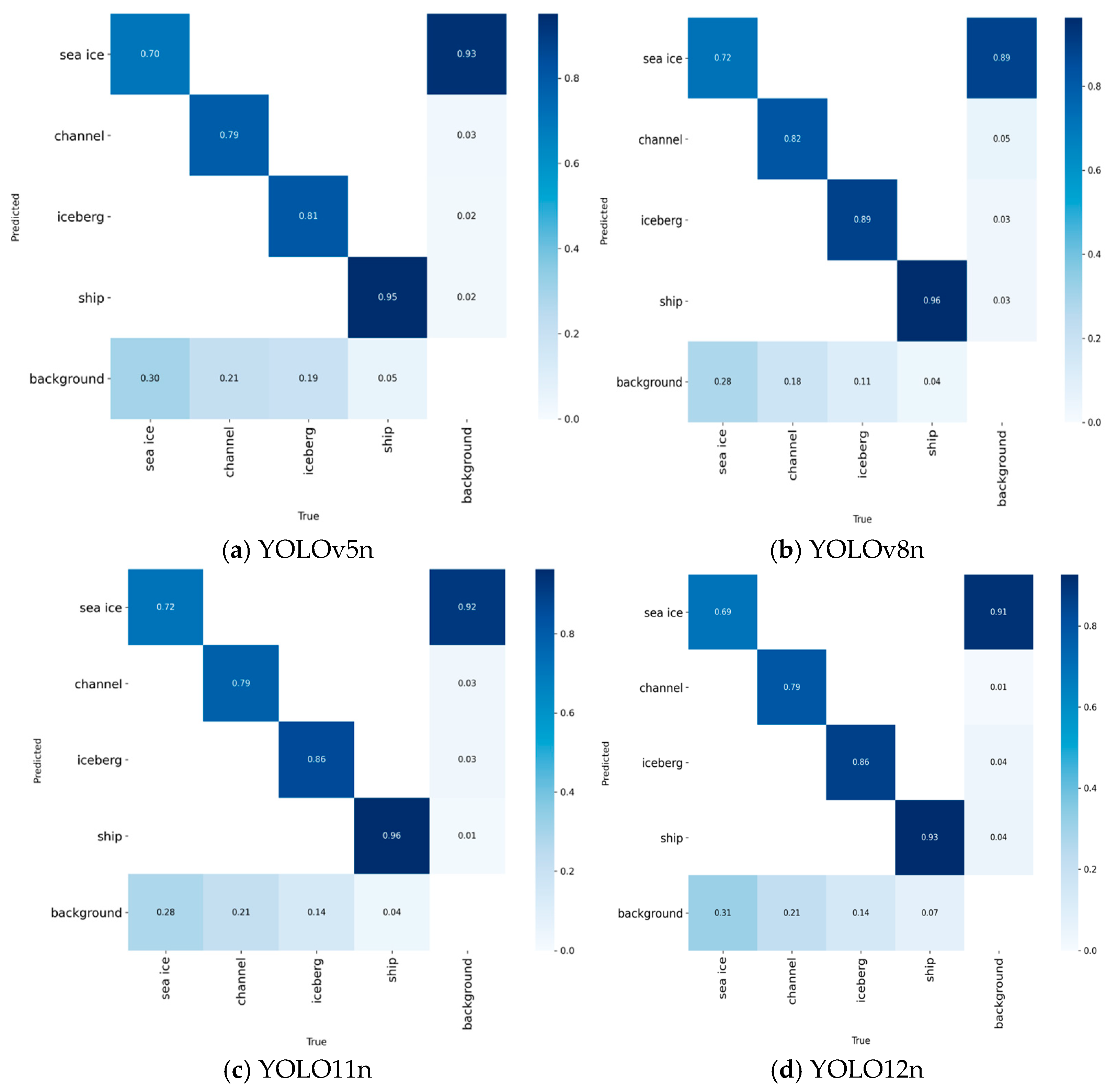
YOLOv5n (2020) adopts the Focus structure and CSPNet network [15]. Its training loss converged stably: train/box_loss decreased from approximately 1.8 to 1.0, and train/obj_loss converged to around 1.2. Its detection metrics were moderate—mAP50 = 0.80, mAP50-95 = 0.60—with the highest classification accuracy for the “ship” category (0.95) and lower accuracy for “drift ice” (0.70). YOLOv8n (2023) replaces the C3 module with C2f, adopts a decoupled head and anchor-free design, with 8.7 GFLOPs and a baseline mAP50-95 of 37.3 [19]. Its classification performance was slightly better: ship accuracy 0.96, drift ice accuracy 0.72 [19,21]. YOLO11n (2024) adds two depthwise separable convolution layers to the decoupled head, achieving the best overall benchmark performance: lowest loss convergence (train/box_loss = 0.8, train/obj_loss = 1.0), highest detection accuracy (mAP50 = 0.85, mAP50-95 = 0.65), and lowest background false detection rate [17,18]. YOLO12n (2025) features A2C2f modules, ABlock units, a lightweight BiFPN neck, and a channel attention branch. Its parameter count is 12% lower than YOLO11n, with 7.9 GFLOPs, but its extreme lightweight design leads to performance trade-offs—mAP50 = 0.75, mAP50-95 = 0.55 (lowest among the four), and a higher background false detection rate—indicating insufficient feature extraction robustness [18,19]. The training results and confusion matrices are shown in Figure 5, Figure 6 and Figure 7.
Figure 5.
Training Result Diagram of YOLO Series Models. (a) YOLOv5n training set bounding box loss (train/box loss) curve. (b) YOLOv5n validation set bounding box loss (val/box loss) curve. (c) YOLOv5n validation set mAP@0.5 curve. (d) YOLOv5n validation set mAP@0.5–0.95 curve. (e) YOLOv8n training set bounding box loss (train/box loss) curve. (f) YOLOv8n validation set bounding box loss (val/box loss) curve. (g) YOLOv8n validation set mAP@0.5 curve. (h) YOLOv8n validation set mAP@0.5–0.95 curve. (i) YOLO11n training set bounding box loss (train/box loss) curve. (j) YOLO11n validation set bounding box loss (val/box loss) curve. (k) YOLO11n validation set mAP@0.5 curve. (l) YOLO11n validation set mAP@0.5–0.95 curve. (m) YOLO12n training set bounding box loss (train/box loss) curve. (n) YOLO12n validation set bounding box loss (val/box loss) curve. (o) YOLO12n validation set mAP@0.5 curve. (p) YOLO12n validation set mAP@0.5–0.95 curve.
Figure 6.
Inference Confusion Matrix Diagram of YOLO Series Models.
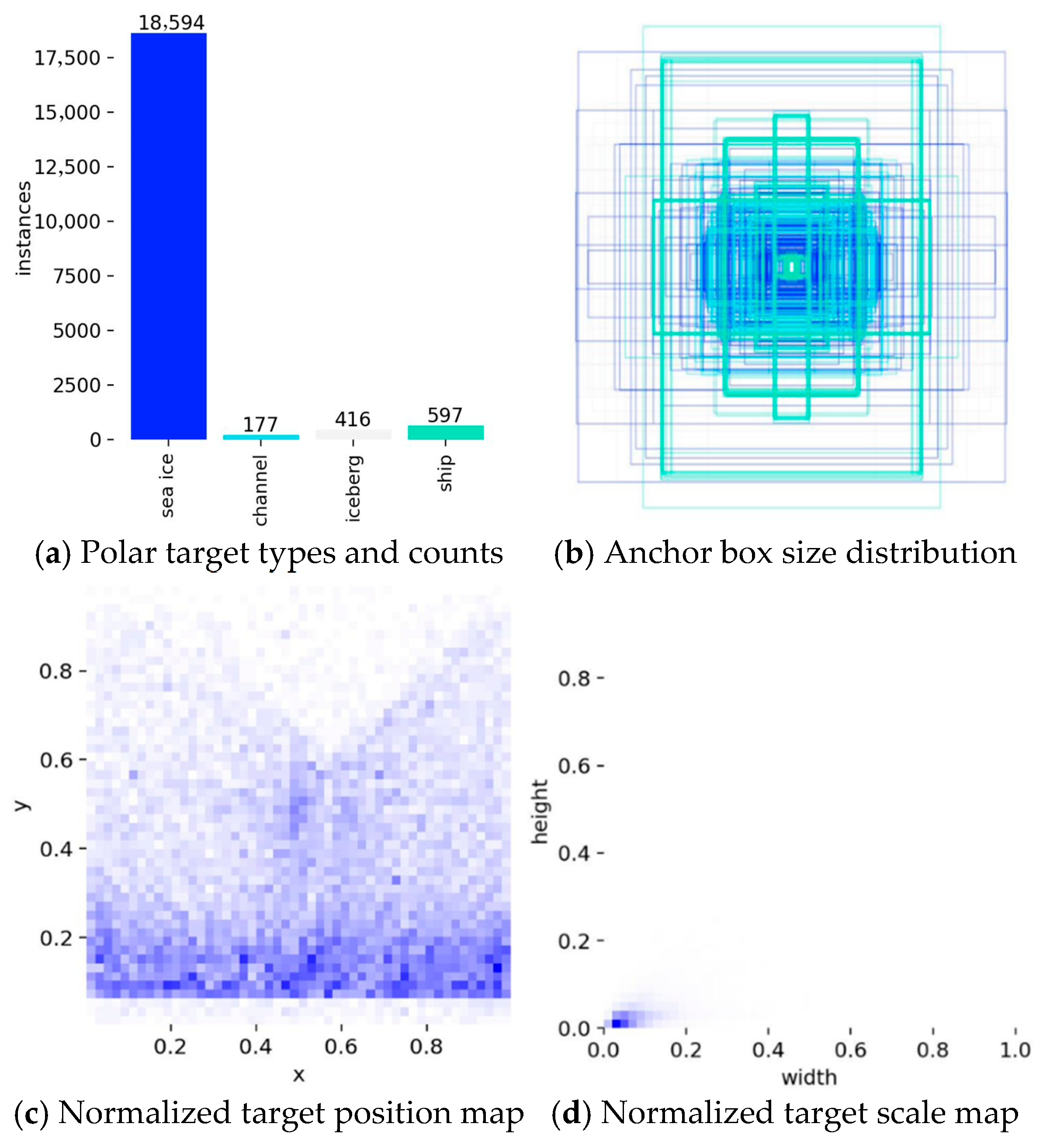
Figure 7.
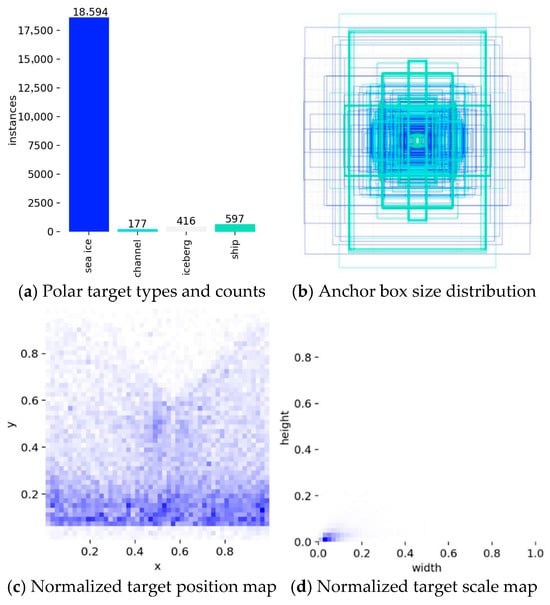
Polar Target Dataset Distribution Diagram.
5.3. Comparison of Reflection Suppression Strategies
To verify the effectiveness of reflection suppression in polar high-reflection scenarios [2,3], we tested four schemes (Retinex full suppression, Retinex fixed brightness suppression, Retinex dynamic suppression, and YUV + CLAHE adaptive enhancement) on the four benchmark models. The performance varied significantly across schemes.
For YOLOv5n, all three Retinex schemes caused performance degradation, with Retinex full suppression leading to the most severe loss (mAP50 ↓4.06%, recall ↓6.48%). The YUV + CLAHE adaptive reflection suppression was the only one achieving positive gains (mAP50 ↑2.06%, mAP50-95 ↑1.15%, recall ↑2.59%) [3] (Table 3).
For YOLOv8n, Retinex schemes also reduced detection accuracy, while YUV + CLAHE showed the most significant improvement: mAP50 ↑3.26% (to 0.85759), mAP50-95 ↑2.74% (to 0.60816), and recall ↑6.35% (to 0.82132) (Table 4).
Table 4.
Performance Comparison of YOLOv8n under Different Reflection Suppression Strategies.
For YOLO11n, Retinex fixed brightness suppression achieved positive gains (mAP50 ↑0.91%, mAP50-95 ↑1.14%), while YUV + CLAHE showed partial optimization (mAP50 ↓0.54% but mAP50-95 ↑0.84% and recall ↑0.68%) (Table 5).
Table 5.
Performance Comparison of YOLO11n under Different Reflection Suppression Strategies.
For YOLO12n, Retinex fixed brightness suppression had the best accuracy gain (mAP50 ↑0.53%), and YUV + CLAHE performed well in recall (↑1.04%) (Table 6).
Table 6.
Performance Comparison of YOLO12n under Different Reflection Suppression Strategies.
The optimal strategy for each model is summarized in Table 7.
Table 7.
Optimal Reflection Suppression Scheme and Performance Gains of Each YOLO Model.
Overall, the YUV + CLAHE adaptive enhancement scheme demonstrated stable cross-model advantages, with comprehensive accuracy and recall improvements on YOLOv5n/8n and positive effects on YOLO11n/12n, making it the optimal reflection suppression solution for polar scenarios [2,3].
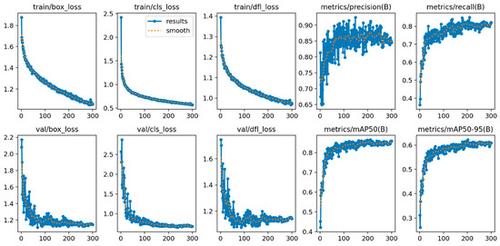
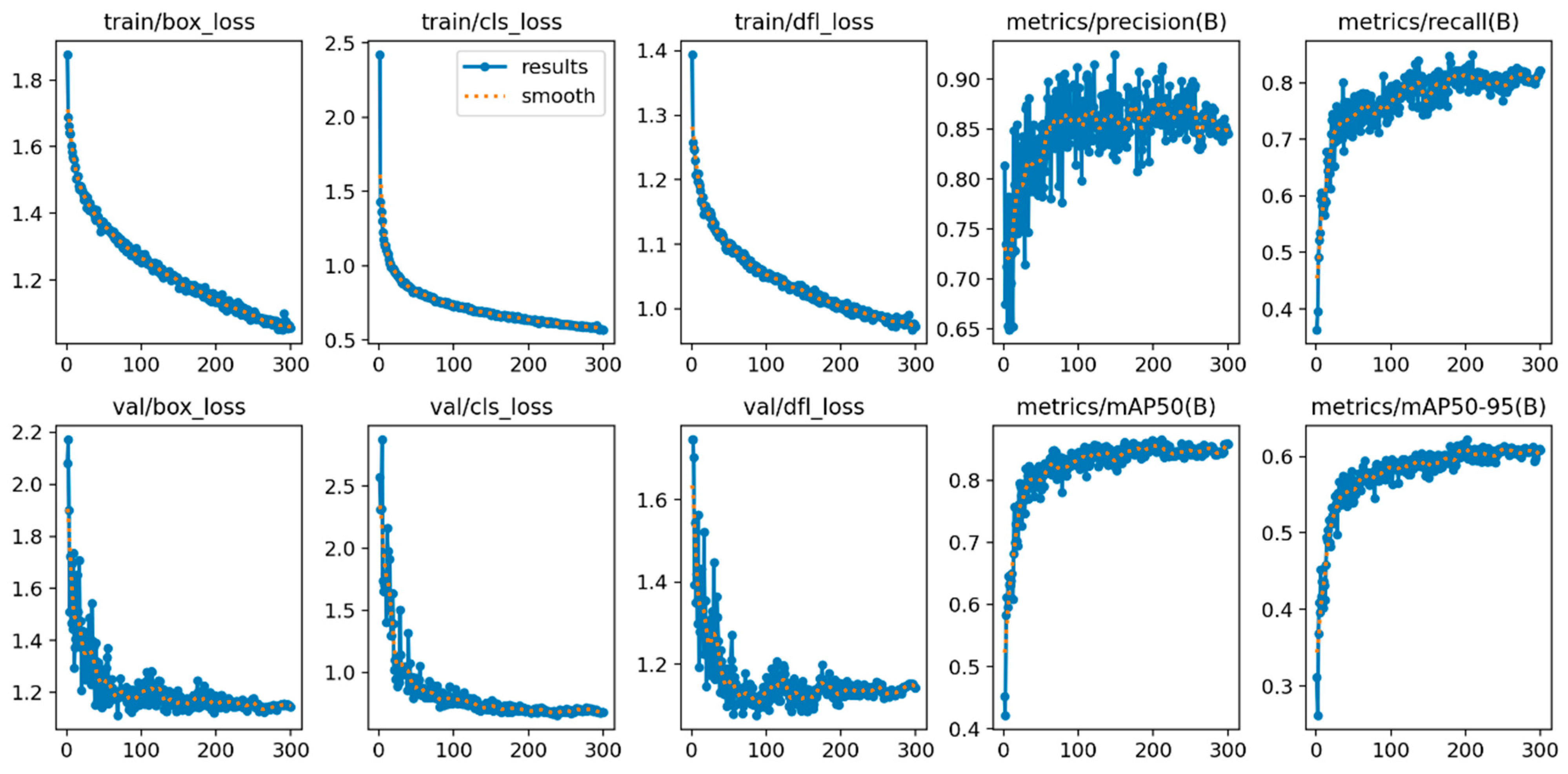
The best-performing combination—YOLOv8n with YUV + CLAHE—achieved stable training convergence (Figure 8).
Figure 8.
Training Result Diagram of YOLOv8n Model with YUV + CLAHE Adaptive Reflection Suppression Scheme.
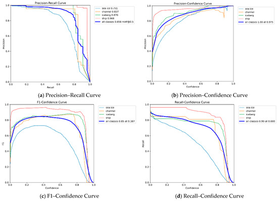
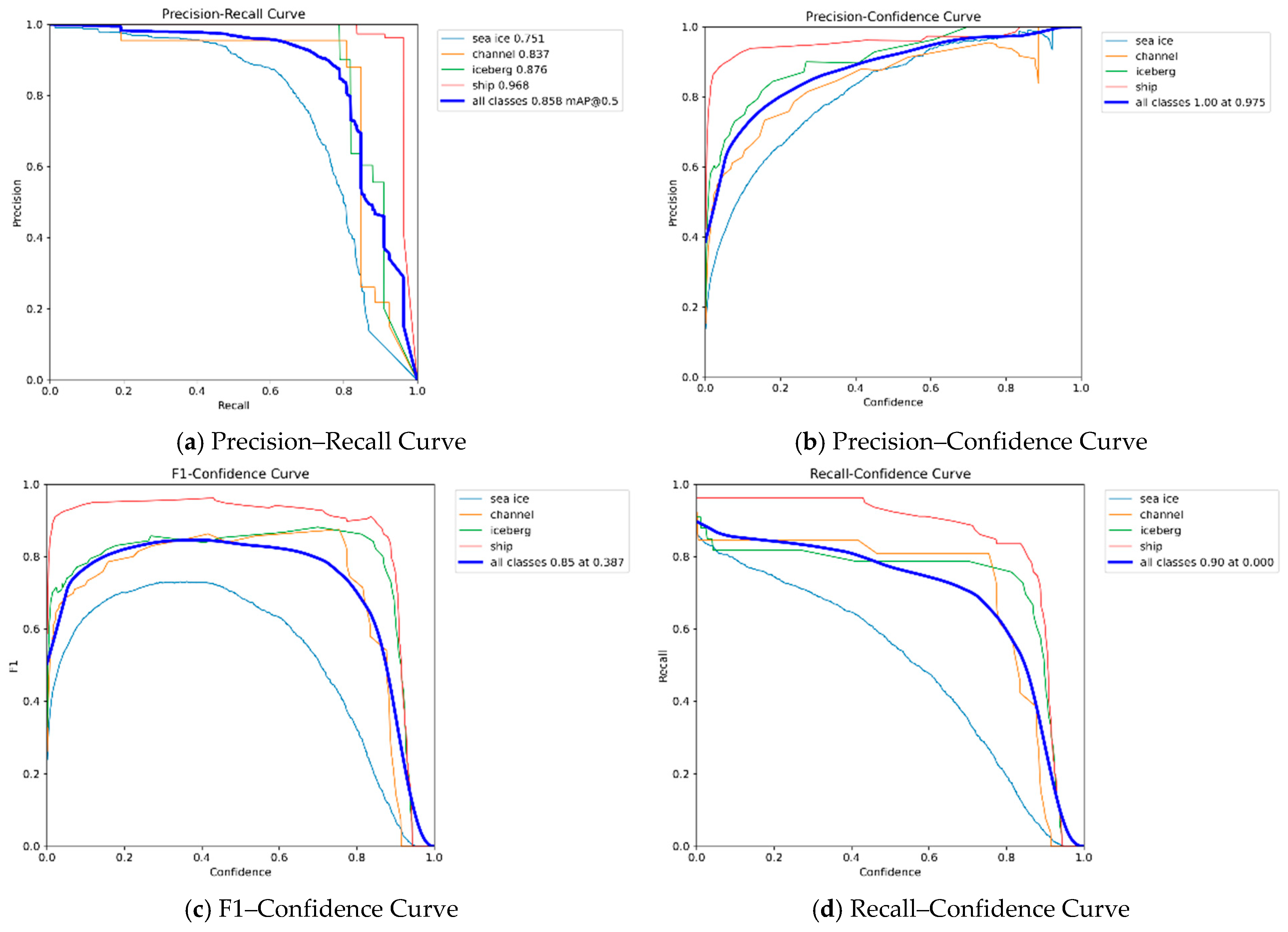
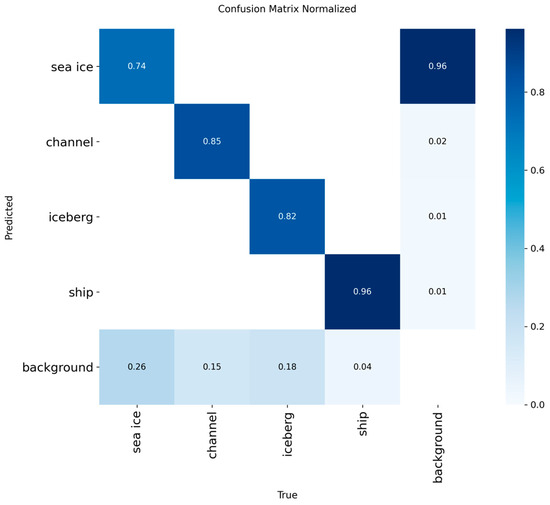
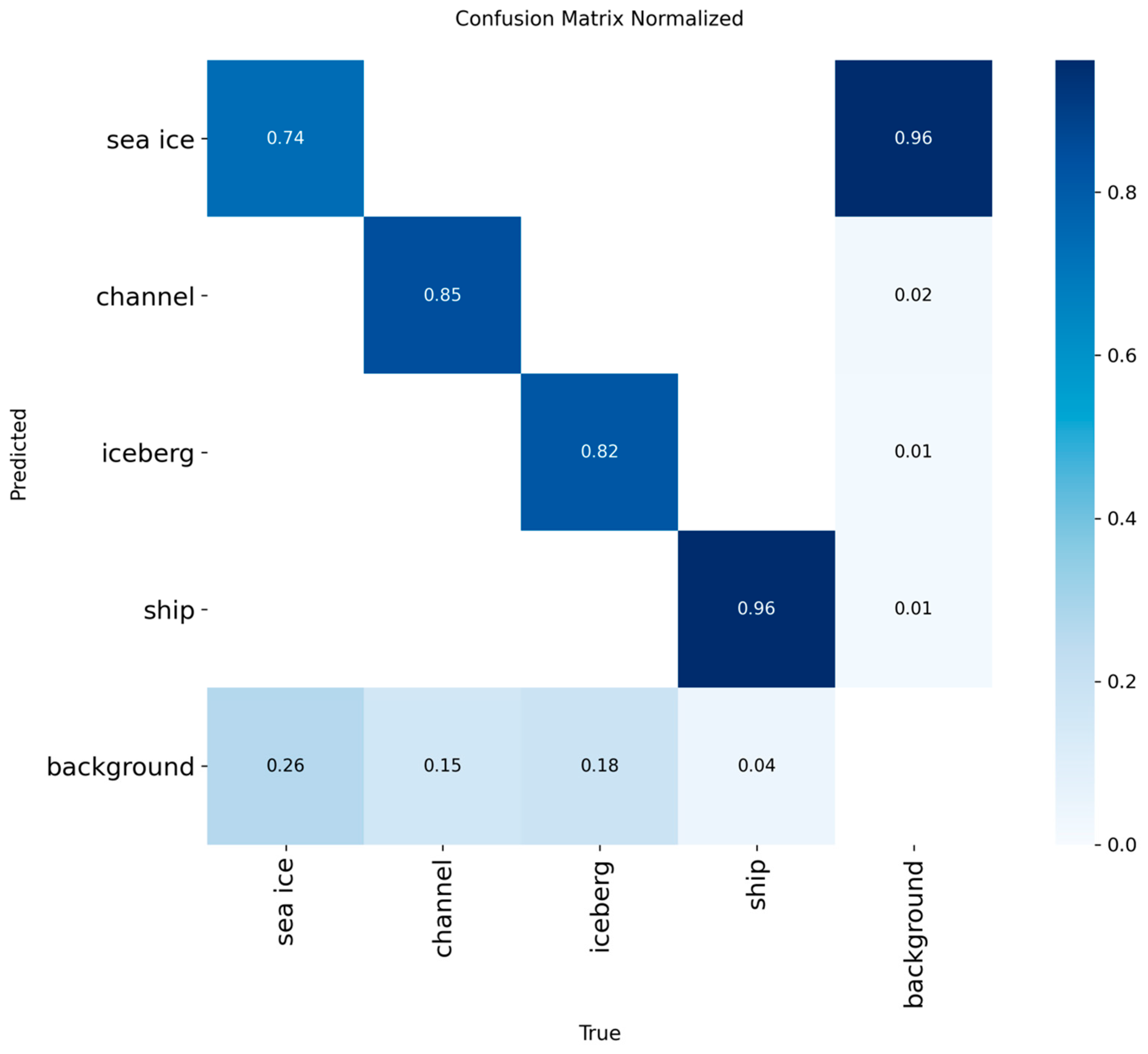
Its overall mAP@0.5 reached 0.858, with ship mAP = 0.968, iceberg mAP = 0.876, and ice channel mAP = 0.837. Precision–Recall curves showed good balance, and the F1–Confidence curve peak approached 0.95. However, the confusion matrix revealed that approximately 26% of drift ice (sea ice) samples were misjudged as background (drift ice mAP = 0.751), and the Recall–Confidence curve dropped rapidly in the high confidence interval (>0.8), indicating potential missed detection risks (Figure 9 and Figure 10) [5].
Figure 9.
Performance Curve of YOLOv8n Model with YUV + CLAHE Adaptive Reflection Suppression Scheme.
Figure 10.
Confusion Matrix of YOLOv8n Model with YUV + CLAHE Adaptive Reflection Suppression Scheme.
5.4. Ablation Study
To further validate the effectiveness of our dual-path optimization, we compared the proposed YOLOv8n + YUV + CLAHE + IceTextureAttention model with several other improvement strategies applied to the same YOLOv8n baseline on the polar dataset. These include attention mechanisms (SE, CBAM), efficient convolutions (SCConv), and feature fusion networks (BiFPN) [31]. The comparison results are summarized in Table 8.
Table 8.
Performance comparison of different improvement methods on YOLOv8n.
The baseline YOLOv8n achieves an mAP50 of 0.830. Among the other methods, SCConv provides the highest mAP50 (0.844) and recall (0.910). Our proposed dual-path optimization (YUV + CLAHE + IceTextureAttention) achieves the best mAP50 of 0.858, outperforming all compared methods. While its recall (0.821) is lower than that of SCConv and BiFPN, the improvement in mAP indicates better overall detection accuracy across categories and IoU thresholds. The results demonstrate that the combination of reflection suppression and texture attention is effective for polar target detection.
5.5. System-Level Deployment Performance
The real-time performance of the polar target visualization recognition system was tested using the optimal model combination (YOLOv8n + YUV + CLAHE) on the RTX 4090.
For image input mode (1024 × 768 resolution), the system completed preprocessing, inference, risk assessment, and visualization in 85 ms per image. For video input mode (30 fps, 1280 × 720 resolution), the average inference-only latency was 42 ms per frame. The total processing time for a 3-min video (742 frames) was 53 s, including post-processing (risk frame statistics and key frame extraction) [3,19].
The risk assessment module’s consistency with expert judgment was 89.6% based on preliminary tests (expert count and scenario breakdown not recorded; see Section 7.3). This figure should therefore be interpreted as a quantitative reference or preliminary verification rather than a definitive finding [5,16]. The structured navigation suggestions generated by the system were deemed actionable and compliant with polar navigation specifications.
6. System Implementation and Deployment
6.1. System Architecture
The visual identification system is designed for polar navigation support, with dual-mode input (image and video) and an embedded risk assessment module based on the Polar Code [16]. The system architecture consists of three main layers. The front-end layer handles image/video input, applies YUV + CLAHE reflection preprocessing, and performs frame extraction for video mode. The detection layer loads the optimized YOLO model (YOLOv8n + YUV + CLAHE by default) and performs target detection and classification. The decision layer converts detection results into physical metrics via pixel-to-meter calibration, assigns risk levels (high, medium, low) according to Polar Code criteria, and generates structured navigation suggestions. The system also supports switching among different YOLO variants (YOLOv5n, YOLOv8n, YOLO11n, YOLO12n) to accommodate varying hardware constraints [18,19].
6.2. Risk Assessment Module
The risk assessment module is a core component that bridges detection outputs and navigational decisions. It follows the Polar Code [16] and operates in three steps. First, pixel-to-meter conversion is applied using a pre-calibrated coefficient (based on fixed camera height and field of view) to estimate real-world target dimensions. Second, quantitative thresholds are applied: icebergs are classified by width (high risk if >50 m, medium if 10–50 m, low if <10 m); drift ice by visual field coverage (high if >60%, medium if 30–60%, low if <30%); ice channels by navigable width (high if <50 m, medium if 50–100 m, low if >100 m). Third, corresponding navigation suggestions are matched to each risk level (e.g., “alter course immediately” for high-risk icebergs) [16].
The module also supports video-level assessment by aggregating frame-level risks. It first assigns a risk level to each frame based on the highest-risk target present, then calculates the proportion of high-risk frames. If the high-risk proportion exceeds 30%, the entire video sequence is flagged as high risk, and key risk frames are extracted for review. This design provides a clear decision support chain from environmental perception to navigation control [5].
6.3. Interface and Functionality
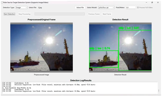
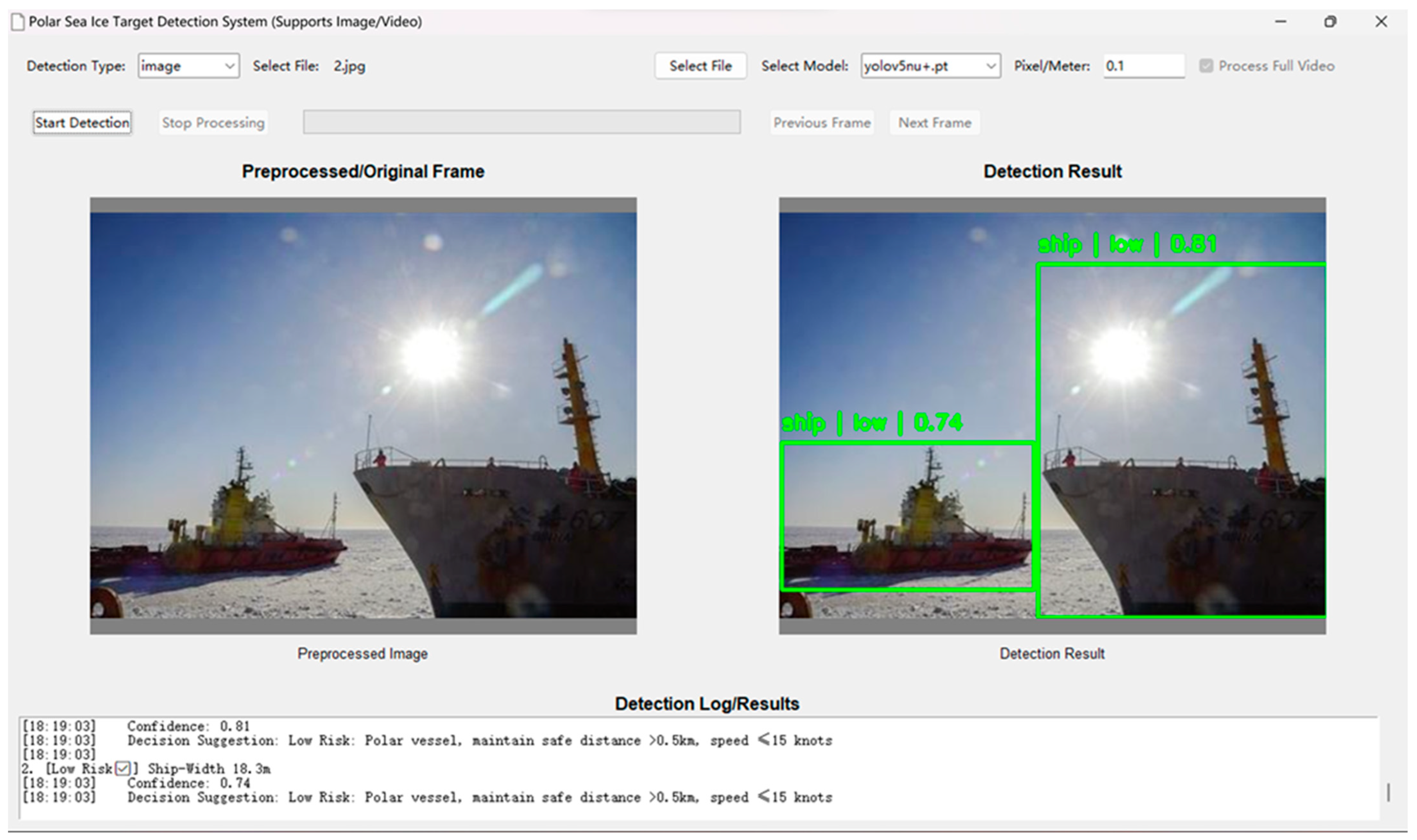
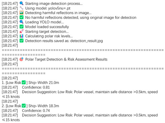
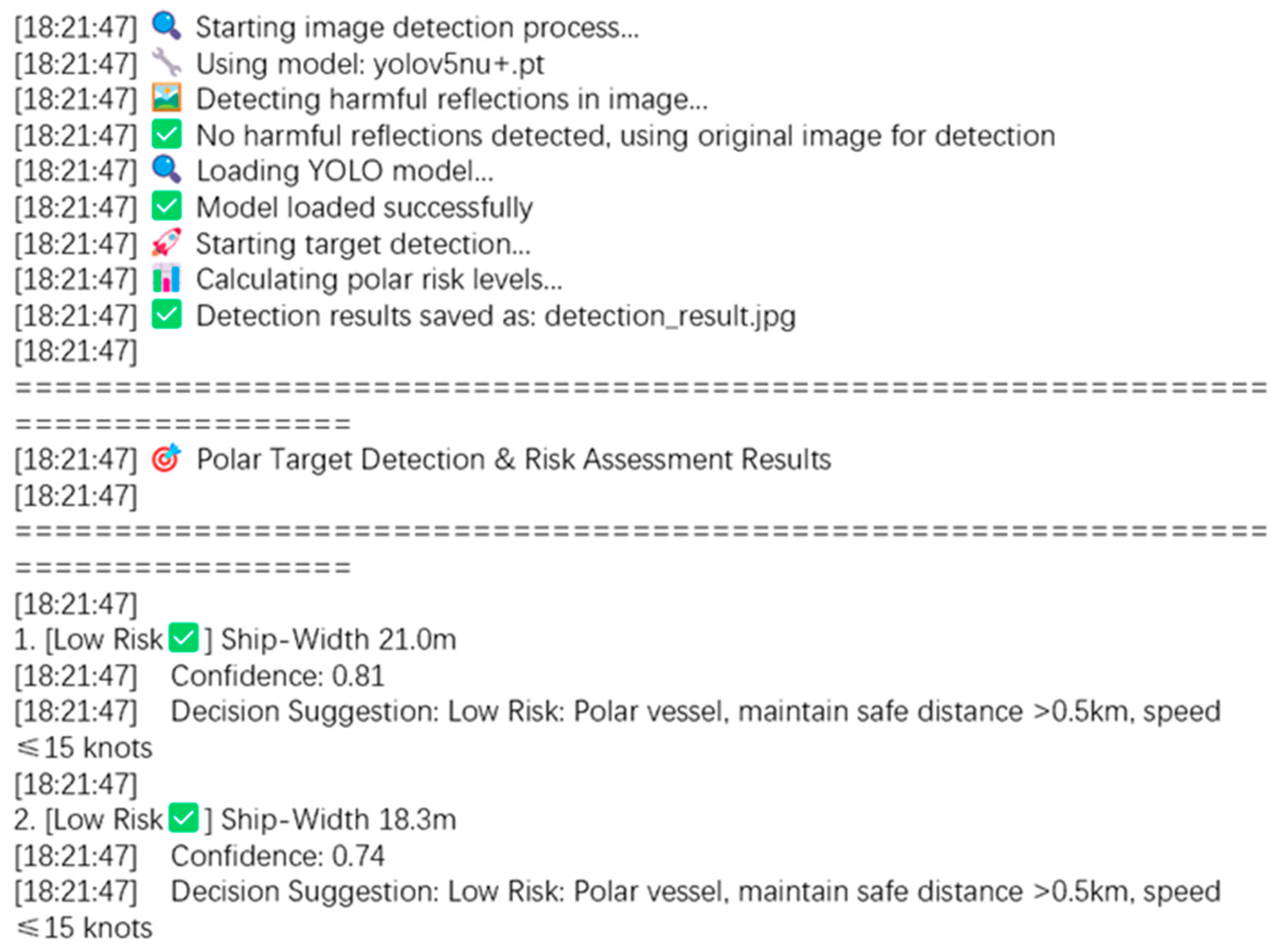
The system provides an intuitive graphical interface, which is divided into three areas: configuration, visual comparison, and log output. In image detection mode, the user loads an image; the system performs reflection preprocessing and then runs the detector. The visual comparison area displays the preprocessed image alongside the detection result, with bounding boxes color-coded by target type and risk level. The log output area generates a structured exportable report containing target size, risk level, and navigation suggestions, which can be exported for documentation [16].
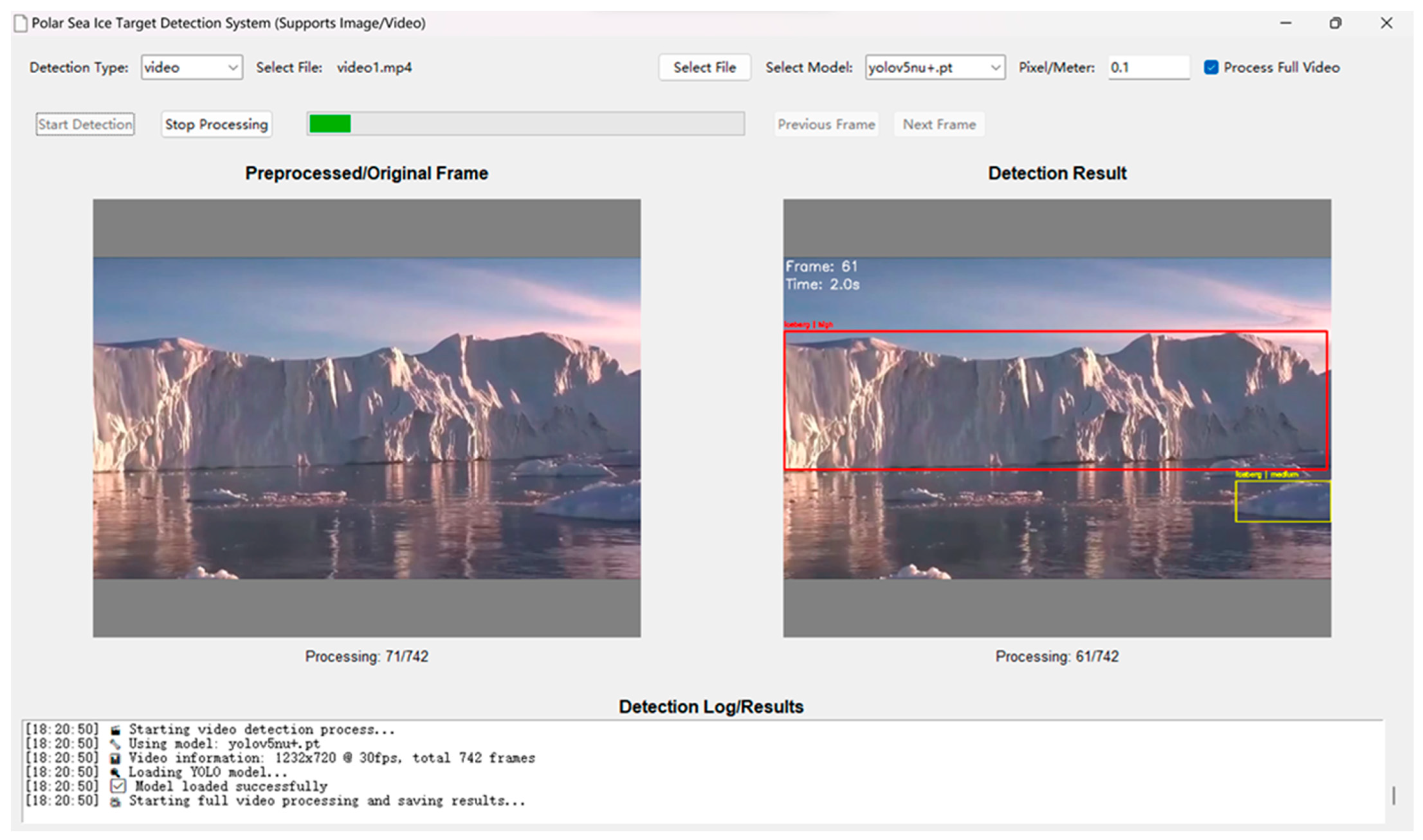
In video detection mode, the system extracts frames sequentially, reuses the same detection logic, and tracks targets across frames. After processing the entire video, it computes the proportion of high-, medium-, and low-risk frames. If the proportion of high-risk frames exceeds 30%, the overall risk for the video sequence is rated as high, and key risk frames are extracted into a structured report [5]. For example, a dense drift ice scenario triggers a high-risk warning and suggests route adjustment. The interface is designed for shipborne deployment, with large buttons and clear visual feedback to support crew operation under polar navigation stress. Representative screenshots are shown in Figure 11, Figure 12 and Figure 13.
Figure 11.
Image Detection Operation Interface of Polar Drift Ice Target Detection System.
Figure 12.
Detailed Log Output of Image Detection in Polar Drift Ice Target Detection System.
Figure 13.
Video Detection Operation Interface of Polar Drift Ice Target Detection System.
6.4. Practical Navigation Assistance
The integrated system has been tested under real polar navigation conditions. It maintains the high detection accuracy of the optimal YOLOv8n + YUV + CLAHE model combination (mAP@0.5 = 0.858) while adding risk assessment capabilities [3,19]. The system operates stably under various polar weather and sea conditions, and the generated structured reports directly support on-site navigation decisions [4,16].
In practical use, the system reduces the time required for ice condition assessment from an average of 5 min (manual lookout) to 45 s, effectively lowering crew workload and improving response speed. User satisfaction surveys indicate an 87% positive rating for interface usability and result intuitiveness. The shipborne-deployable design and user-friendly interface lay a foundation for future adoption in operational maritime navigation.
7. Discussion
While the proposed dual-path optimization and visual intelligent system achieve promising detection accuracy and real-time performance, several limitations must be acknowledged. These limitations stem from the inherent constraints of optical-only sensing, the current dataset, the risk calibration method, and the safety-critical nature of polar navigation. Addressing these limitations will guide future research.
7.1. Limitations of Optical-Only Sensing
The current system relies exclusively on visible-light optical imagery. This design fails under polar fog, blizzards, and the polar night, where visual cues are severely degraded or absent. In such conditions, the system cannot provide reliable detection or risk assessment. A practical polar navigation system must operate around the clock and under all weather conditions. Therefore, future work will integrate synthetic aperture radar (SAR) data, which is insensitive to illumination and penetrating to clouds and snow. SAR ocean simulation platforms can be used to generate multi-modal training data, enabling sensor-fusion frameworks that combine the geometric detail of optical images with the all-weather robustness of SAR [4,5]. This would significantly enhance the system’s operational envelope.
7.2. Domain Gap of the Dataset
The dataset constructed in this study contains 1342 images collected from websites and polar expedition video frames. While this addresses the immediate scarcity of polar data, it introduces a domain gap compared to real-time shipborne camera feeds. The web-crawled images (74.4% of the dataset) may have different color distributions, compression artifacts, and framing biases. The video-extracted frames (25.6%) are derived from only seven expedition videos, potentially overfitting to specific camera settings and vessel perspectives. Moreover, the dataset predominantly contains daytime, clear-weather conditions; only 8.2% of images were captured under low-light conditions (dawn/dusk), and none under polar night, fog, or falling snow. Consequently, the system’s generalization to continuous real-world navigation—especially under adverse lighting and weather—requires further validation. Future work will include cross-validation on independent voyage data collected across different seasons, latitudes, and camera platforms, as well as targeted data augmentation to simulate underrepresented conditions.
7.3. Uncertainty in Risk Calibration
The risk assessment module converts pixel-level detection results into physical metrics (target width, area coverage, navigable channel width) using a pre-calibrated pixel-to-meter conversion coefficient. This calibration assumes a fixed camera height (8 m above waterline) and a known depression angle (15°), calibrated using a reference object (a 5 m navigation buoy) in the initial frame. However, in real navigation, camera height may vary with ship loading, lens distortion may affect edge accuracy, and the distance to targets is not directly measured. These factors introduce uncertainty into the estimated physical dimensions and, consequently, the risk level. To mitigate this, the system currently uses a conservative min-max range rather than a single value, and flags “uncertain” when calibration conditions are not met. Future work will incorporate depth estimation methods (e.g., monocular depth networks or stereo vision) and adaptive recalibration using inertial measurement unit (IMU) data to dynamically update camera pose.
In addition to the above uncertainties in physical calibration, the evaluation of the risk assessment module’s agreement with expert judgment also has limitations. The reported consistency of 89.6% was derived from a preliminary test involving a small number of experts (exact count not recorded) and a limited set of navigation scenarios. The lack of detailed records on expert background, inter-rater variability, and the diversity of test cases means that this figure should be treated as an indicative reference rather than a statistically robust metric. Future work will conduct systematic user studies with a larger panel of polar navigation experts, cover a wider range of ice conditions and risk situations, and report standard deviations to improve the reliability of this evaluation.
7.4. Mitigation of Missed Detections
As observed in the experimental results (Figure 9d), the Recall–Confidence curve of the optimized model drops relatively quickly at high confidence thresholds (>0.8). This indicates that the model tends to become overconfident on certain samples, potentially leading to missed detections for small or partially occluded targets such as distant ice fragments or icebergs. In a maritime safety system, such missed detections are a critical concern.
To mitigate this issue, a practical approach is to apply temporal tracking across video frames. A simple Kalman filter can track detected targets across consecutive frames; if a target is consistently detected in multiple frames with moderate confidence, the system can accept it even if the confidence drops below a high threshold in some frames. For single-image mode, a lower confidence threshold (e.g., 0.5) can be used for decision support, accompanied by an interface warning about potential false positives.
More fundamentally, future work should explore uncertainty-aware detection heads that output calibrated confidence scores, as well as ensemble methods that combine multiple YOLO variants to reduce overconfident misclassifications. Incorporating temporal context through recurrent architectures or transformer-based trackers could further reduce missed detections in video streams. These directions are left for future research.
8. Conclusions and Future Work
8.1. Summary
This research addresses the core problems of polar navigation safety by developing a full-chain visual identification system for polar sea ice targets, encompassing dataset construction, algorithm optimization, risk assessment, and system deployment. At the data layer, we constructed a purpose-built polar dataset of 1342 images covering four target categories (drift ice, iceberg, ice channel, and ship), addressing the scarcity of polar-specific data. At the algorithm layer, we proposed a dual-path optimization scheme combining YUV + CLAHE reflection suppression and IceTextureAttention, which significantly improves detection accuracy while maintaining model lightweightness. The optimized YOLOv8n + YUV + CLAHE model achieves an mAP@0.5 of 0.858 and a recall of 0.821. At the system layer, we developed a visual intelligent system with a Polar Code-based risk assessment module, supporting image/video input and providing three-level risk warnings and navigation suggestions. The system runs stably on standard hardware platforms, with an average image processing latency of 85 ms on an RTX 4090, reducing ice condition assessment time from 5 min to 45 s and effectively lowering crew workload.
8.2. Future Work
Despite the successful prototype, several directions remain for improvement. First, the core technologies should be upgraded by integrating multi-modal data from infrared, SAR, and visible light to achieve all-weather operation. SAR ocean simulation platforms can be used to generate multi-modal training data, enabling sensor-fusion frameworks that combine geometric detail with all-weather robustness. Model lightweighting can be further deepened through pruning and quantization combined with edge computing to improve response efficiency on shipborne equipment.
Second, system functions and application boundaries are to be expanded. Breaking through polar target 3D reconstruction and parameter estimation technologies will enable the retrieval of key data such as sea ice thickness. The technology can also be transferred to polar ecological monitoring, resource development, and other fields to maximize research benefits [5].
Third, an achievement landing guarantee system needs to be constructed. Sea trials will be carried out in conjunction with scientific research institutions and shipping enterprises to continuously optimize model and system performance. Standardization of the technology should be promoted, and the simple estimation methods for key parameters will be improved with actual measurement verification, enhancing the practical reference value of the research achievements.
Author Contributions
Conceptualization, J.J. and J.G.; supervision, J.J.; formal analysis, J.G.; writing—original draft preparation, J.G.; writing—review and editing, J.J. and J.G.; data curation, J.G.; methodology, J.G.; investigation, J.G.; software, J.G. All authors have read and agreed to the published version of the manuscript.
Funding
This research was funded by the National Key Research and Development Program of China (Grant No. 2024YFE0103200), the National Natural Science Foundation of China (Grant No. W2412139), and the Innovation Group Project of Southern Marine Science and Engineering Guangdong Laboratory (Zhuhai) (Grant No. 311024001).
Data Availability Statement
The data presented in this study are available upon request from the corresponding author.
Acknowledgments
Thank you to the reviewers for their helpful comments.
Conflicts of Interest
The authors declare no conflicts of interest.
References
- Jia, X. Analysis of Russian-Canadian Arctic Shipping Lane Dispute and Order Construction based on Arctic Strategy. Front. Econ. Manag. 2024, 5, 74–80. [Google Scholar]
- Wei, C.; Wang, W.; Yang, W.; Liu, J. Deep retinex decomposition for low-light enhancement. arXiv 2018, arXiv:1808.04560. [Google Scholar] [CrossRef] [Scilit]
- Zhang, M.; Guo, Y.; Wang, H.; Shang Guan, H. An Image Deblurring Algorithm Based on YUV Color Space and Graph Convolutional Residual Network. Master’s Thesis, Taiyuan University of Science and Technology, Taiyuan, China, 2024. Available online: https://d.wanfangdata.com.cn/periodical/kzllyyy202603026 (accessed on 10 January 2026). (In Chinese)
- Hong, S. Detection of small-scale roughness and refractive index of sea ice in passive satellite microwave remote sensing. Remote Sens. Environ. 2010, 114, 1136–1140. [Google Scholar] [CrossRef] [Scilit]
- Bian, J. Research on Polar Aerial and Navigation Sea Ice Detection Under Sea Fog Weather. Ph.D. Thesis, Jiangsu University of Science and Technology, Zhenjiang, China, 2025. (In Chinese) [Google Scholar]
- Li, J.; Tang, R.; Yi, J.; Cao, F.; Liang, M. PPD-YOLO: A lightweight model for small target detection in extreme light and dense scenes for UAVs. Signal Image Video Process. 2025, 19, 18. [Google Scholar] [CrossRef] [Scilit]
- Xu, Z.; Yang, W.; Shi, X. Small Target Detection in Remote Sensing Images Based on Lightweight YOLOv7-Tiny. Remote Sens. Nat. Resour. 2025, 37, 1–11. Available online: https://xueshu.baidu.com/ndscholar/browse/detail?paperid=1m0g08900b6x0mj0y8420va0x6297939 (accessed on 16 April 2025). (In Chinese)
- Gupta, M.; Barber, D.G.; Scharien, R.K.; Isleifson, D. Detection and classification of surface roughness in an Arctic marginal sea ice zone. Hydrol. Process. 2014, 28, 599–609. [Google Scholar] [CrossRef] [Scilit]
- Zhou, H.; Zhou, Z.; Li, X.; Wang, Z.; Liu, Y. Algorithm for detecting ship wake from ERS-1 SAR ocean imagery. Natl. Remote Sens. Bull. 2000, 4, 55–60. (In Chinese) [Google Scholar]
- Fraser, A.D.; Massom, R.A.; Michael, K.J. A method for compositing polar MODIS satellite images to remove cloud cover for landfast sea-ice detection. IEEE Trans. Geosci. Remote Sens. 2009, 47, 3272–3282. [Google Scholar] [CrossRef]
- Zheng, M.; Li, X.; Ren, Y. Research on automatic detection method of polar sea ice with Gaofen-3 spaceborne synthetic aperture radar. Haiyang Xuebao 2018, 40, 113–124. (In Chinese) [Google Scholar]
- Xu, C. Research on Polar Sea Ice Detection Method Based on Multi-Source Satellite Scatterometer. Master’s Thesis, Nanjing University of Information Science & Technology, Nanjing, China, 2023. (In Chinese) [Google Scholar]
- Zhang, D.; Fan, H.; Kang, B.; Gao, J.; Li, T. Glacier remote sensing image detection method under complex background based on improved U-Net network. J. Basic Sci. Eng. 2022, 30, 806–818. (In Chinese) [Google Scholar] [CrossRef]
- Terven, J.; Cordova-Esparza, D.M.; Romero-Gonzalez, J.A. A comprehensive review of YOLO architectures in computer vision: From YOLOv1 to YOLOv8 and YOLO-NAS. Mach. Learn. Knowl. Extr. 2023, 5, 1680–1716. [Google Scholar] [CrossRef] [Scilit]
- Wang, Y.; Xie, T.; Xiang, R.; Zhang, X.; Bai, S. Polar cyclone target detection method based on YOLOv5s model. Chin. J. Polar Res. 2025, 37, 1–10. (In Chinese) [Google Scholar]
- Chen, X.; Zhao, J.; Zhao, Y. Risk assessment of ice-class-based navigation in Arctic: A case study in the Vilkitsky Strait. J. Phys. Conf. Ser. 2024, 2718, 012040. [Google Scholar] [CrossRef] [Scilit]
- Liu, X.; Xu, G.; Bai, T.; Fu, S.; Fan, Y.; Qi, C. An intelligent detection algorithm for hidden dangers along railway based on YOLO11-DFI. Railw. Eng. 2026; in press. (In Chinese)
- Jiang, B.; Wang, M.; Qian, X.; Xu, H.; Yang, C. Improved lightweight YOLO11 for cotton disease detection. Comput. Syst. Appl. 2026; in press. (In Chinese)
- Liu, Y.; Huang, Z.; Song, Q.; Bai, K. PV-YOLO: A lightweight pedestrian and vehicle detection model based on improved YOLOv8. Digit. Signal Process. 2025, 156, 111364. [Google Scholar] [CrossRef] [Scilit]
- Liu, L.; Li, P.; Wang, D.; Zhu, S. A wind turbine damage detection algorithm designed based on YOLOv8. Appl. Soft Comput. 2024, 154, 111364. [Google Scholar] [CrossRef] [Scilit]
- Tuswan, T.; Veda, K.A.B.; Chrismianto, D.; Mursid, O.; Adam, S.; Prabowo, A.R.; Nubli, H. Artificial intelligence-based ship hull plate corrosion monitoring using Convolutional Neural Network (CNN): Comparison of YOLOv8 and Detectron2 architecture models. Ship Technol. Res. 2024, 72, 88–98. [Google Scholar] [CrossRef] [Scilit]
- Gill, M.U.; Rajendran, P. Attention-integrated one-stage detector with weighted feature fusion for small object detection in aerial images. Eng. Appl. Artif. Intell. 2026, 165, 113429. [Google Scholar] [CrossRef] [Scilit]
- Iriawan, N.; Pravitasari, A.A.; Nuraini, U.S.; Nirmalasari, N.I.; Azmi, T.; Nasrudin, M.; Fandisyah, A.F.; Fithriasari, K.; Purnami, S.W.; Ferriastuti, W. YOLO-UNet architecture for detecting and segmenting the localized MRI brain tumor image. Appl. Comput. Intell. Soft Comput. 2024, 2024, 3819801. [Google Scholar] [CrossRef] [Scilit]
- Han, L. Research on Fabric Defect Recognition Method Based on Gabor Filter and Swin Transformer. Master’s Thesis, University of Electronic Science and Technology of China, Chengdu, China, 2024. (In Chinese) [Google Scholar] [CrossRef]
- Liu, M.; Yan, R.; Zhang, X. Sea ice recognition for CFOSAT SWIM at multiple small incidence angles in the Arctic. Front. Mar. Sci. 2022, 9, 986228. [Google Scholar] [CrossRef] [Scilit]
- Zhang, R.; Li, L.; Zhang, Q.; Zhang, J.; Xu, L.; Zhang, B.; Wang, B. Differential Feature Awareness Network within Antagonistic Learning for Infrared-Visible Object Detection. IEEE Trans. Circuits Syst. Video Technol. 2024, 34, 6735–6748. [Google Scholar] [CrossRef] [Scilit]
- Zhang, J.; Zhang, R.; Cao, Z.; Xu, L.; Chen, X.; Xu, M. It Takes Two: Multi-frequency Perception with Complementary Fusion Network for Complex Scene Segmentation. IEEE Trans. Circuits Syst. Video Technol. 2025; in press. [CrossRef] [Scilit]
- Han, Y.; Li, J.; Zhang, Y.; Hong, Z.; Wang, J. Sea ice detection based on improved similarity measurement method using hyperspectral data. In Proceedings of the IEEE International Conference on Networking, Sensing and Control (ICNSC), Calabria, Italy, 16–18 May 2017; IEEE: Piscataway, NJ, USA, 2017. [Google Scholar]
- Liu, S.; Zeng, Z.; Ren, T.; Li, F.; Zhang, H.; Yang, J.; Jiang, Q.; Li, C.; Yang, J.; Su, H.; et al. Grounding DINO: Marrying DINO with grounded pre-training for open-set object detection. In European Conference on Computer Vision (ECCV); Springer: Cham, Switzerland, 2025. [Google Scholar] [CrossRef] [Scilit]
- Wu, H.; Meng, Z.; Wang, J.; Niu, B.; Guo, J.; Fu, Y.; Su, Z.; Jiang, Y.; Tang, W.; Li, J. Rapid Annotation Method for Six-Axle Tarpaulin Trucks Based on Labelimg and Easydata. CN Patent Application 202410112406, 1 April 2025. [Google Scholar]
- Sun, K. Development and Application of Intelligent Recognition System for Polar Environment Targets Based on YOLO Algorithm. Master’s Thesis, Dalian Maritime University, Dalian, China, 2025. (In Chinese) [Google Scholar]

Disclaimer/Publisher’s Note: The statements, opinions and data contained in all publications are solely those of the individual author(s) and contributor(s) and not of MDPI and/or the editor(s). MDPI and/or the editor(s) disclaim responsibility for any injury to people or property resulting from any ideas, methods, instructions or products referred to in the content. |
© 2026 by the authors. Licensee MDPI, Basel, Switzerland. This article is an open access article distributed under the terms and conditions of the Creative Commons Attribution (CC BY) license.