Article

Optimising Satellite-Derived Bathymetry Using Optical Imagery over the Adelaide Metropolitan Coast


Beach and Dune Systems (BEADs) Laboratory, College of Science and Engineering, Flinders University, Bedford Park, SA 5042, Australia
*
Author to whom correspondence should be addressed.
Remote Sens. 2025, 17(5), 849; https://doi.org/10.3390/rs17050849
Submission received: 3 December 2024 / Revised: 19 February 2025 / Accepted: 20 February 2025 / Published: 28 February 2025
(This article belongs to the Special Issue Satellite-Based Climate Change and Sustainability Studies)

Abstract

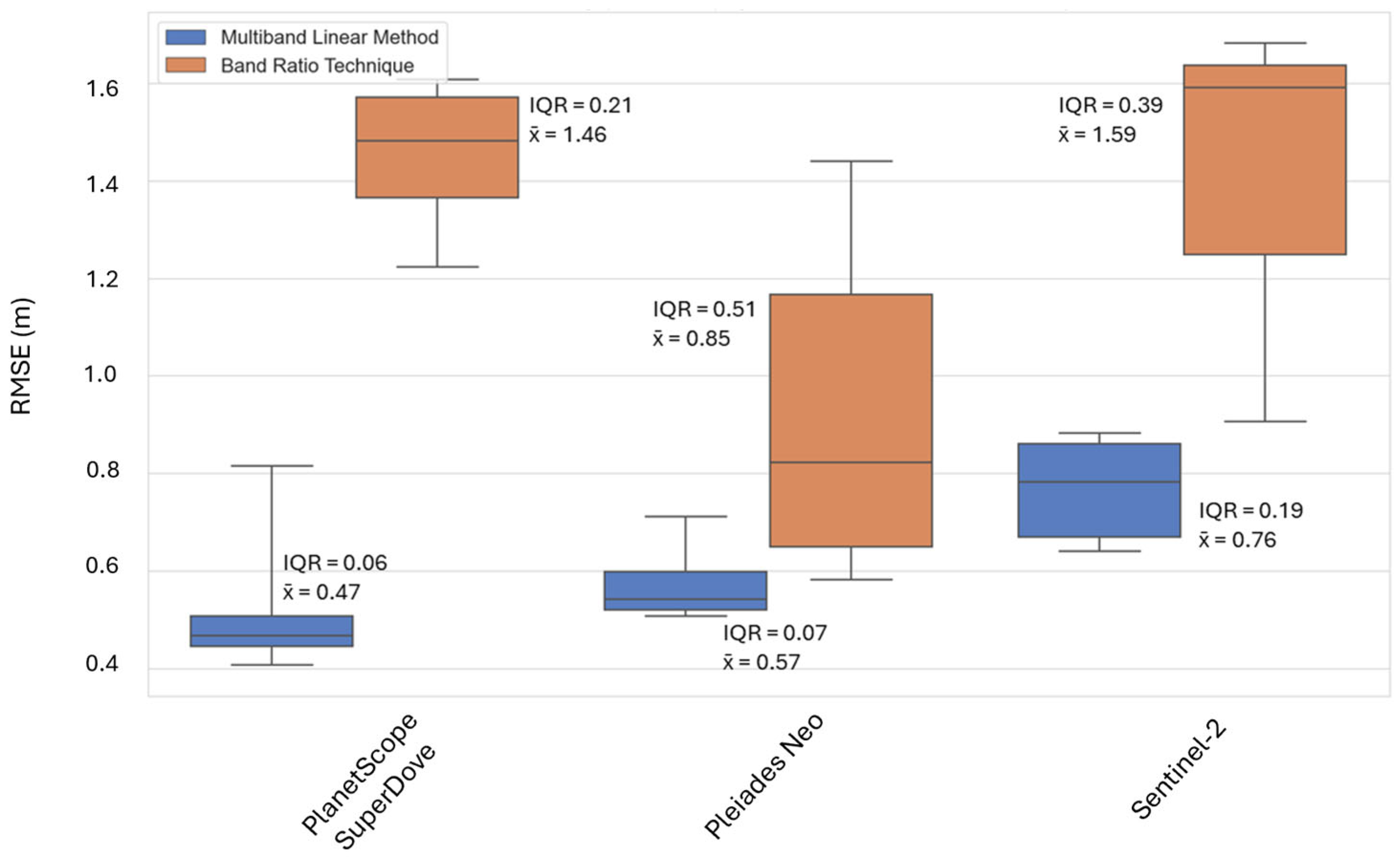
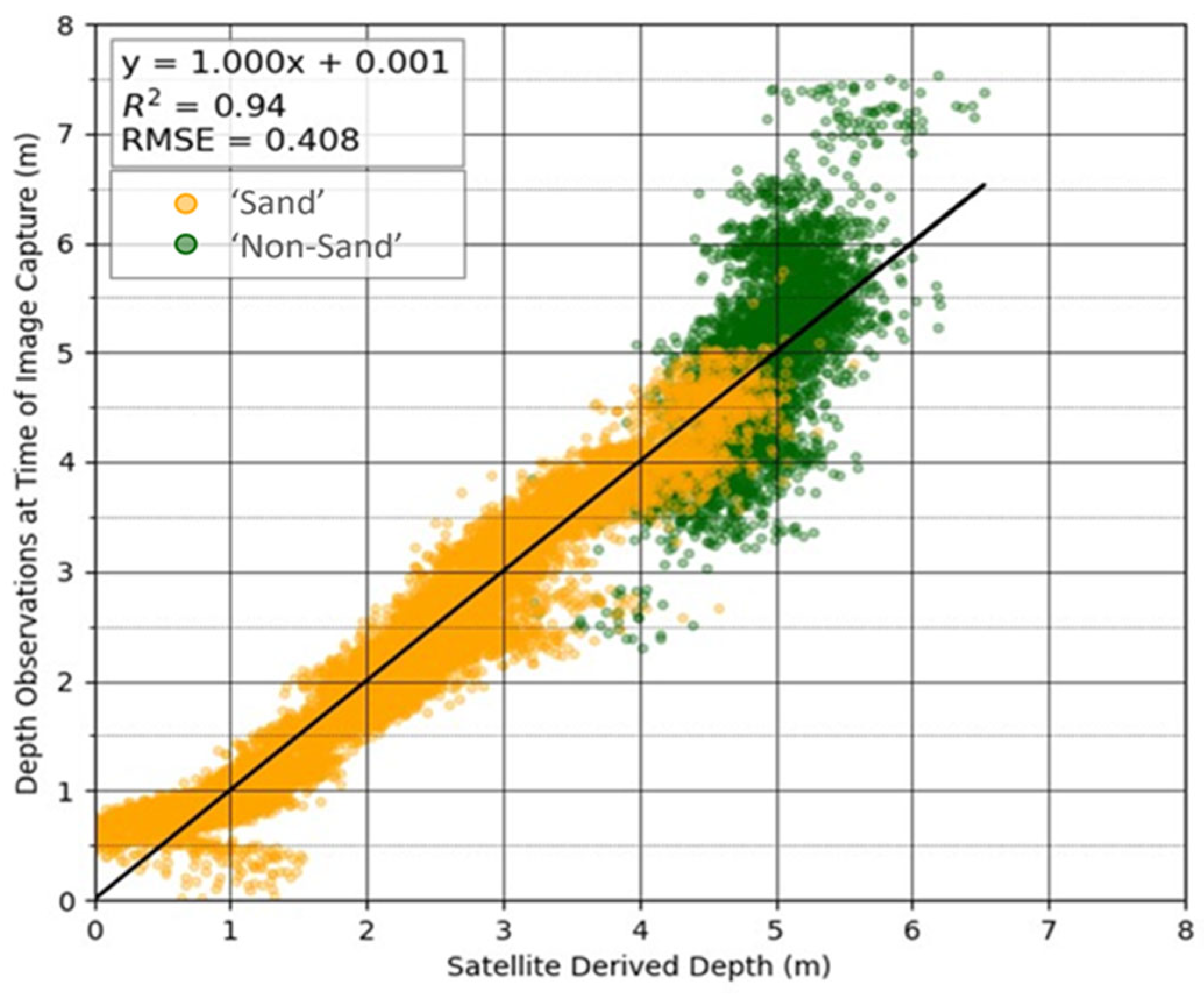
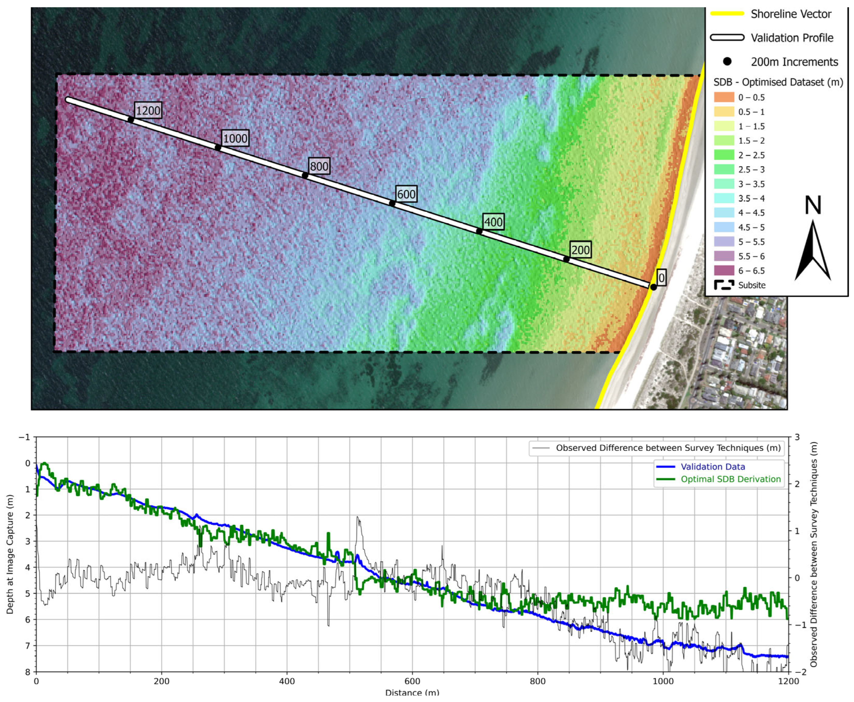
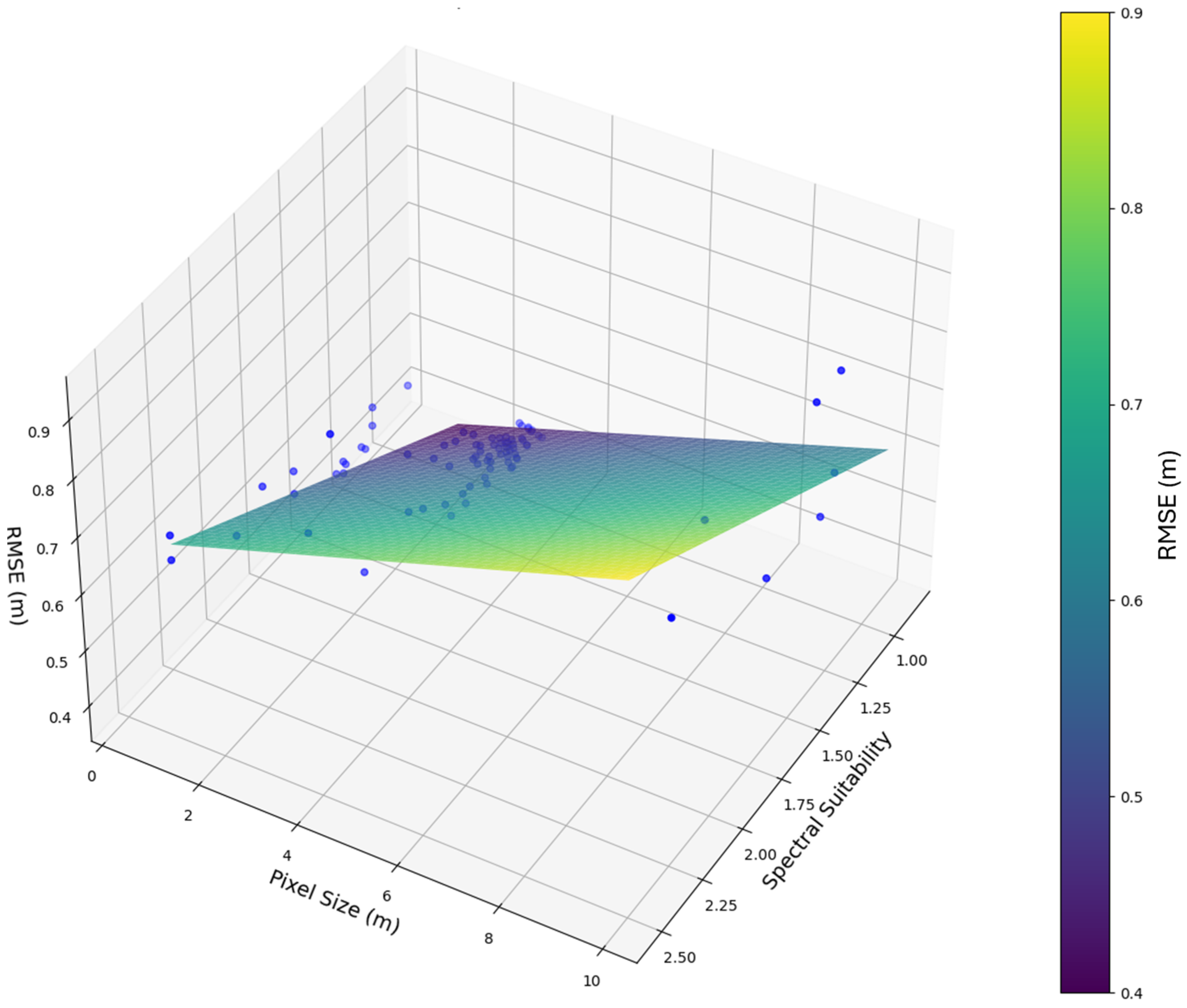
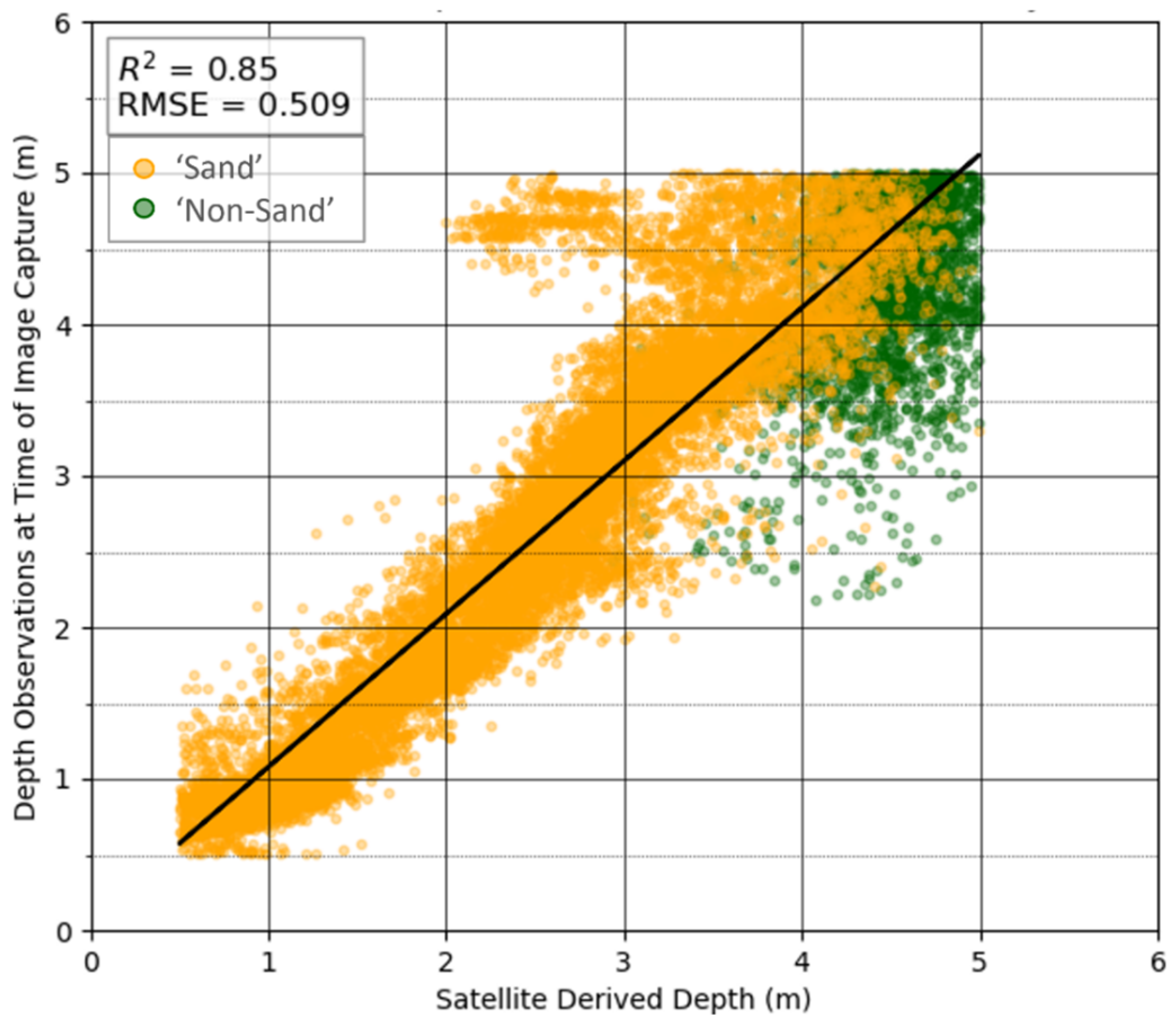
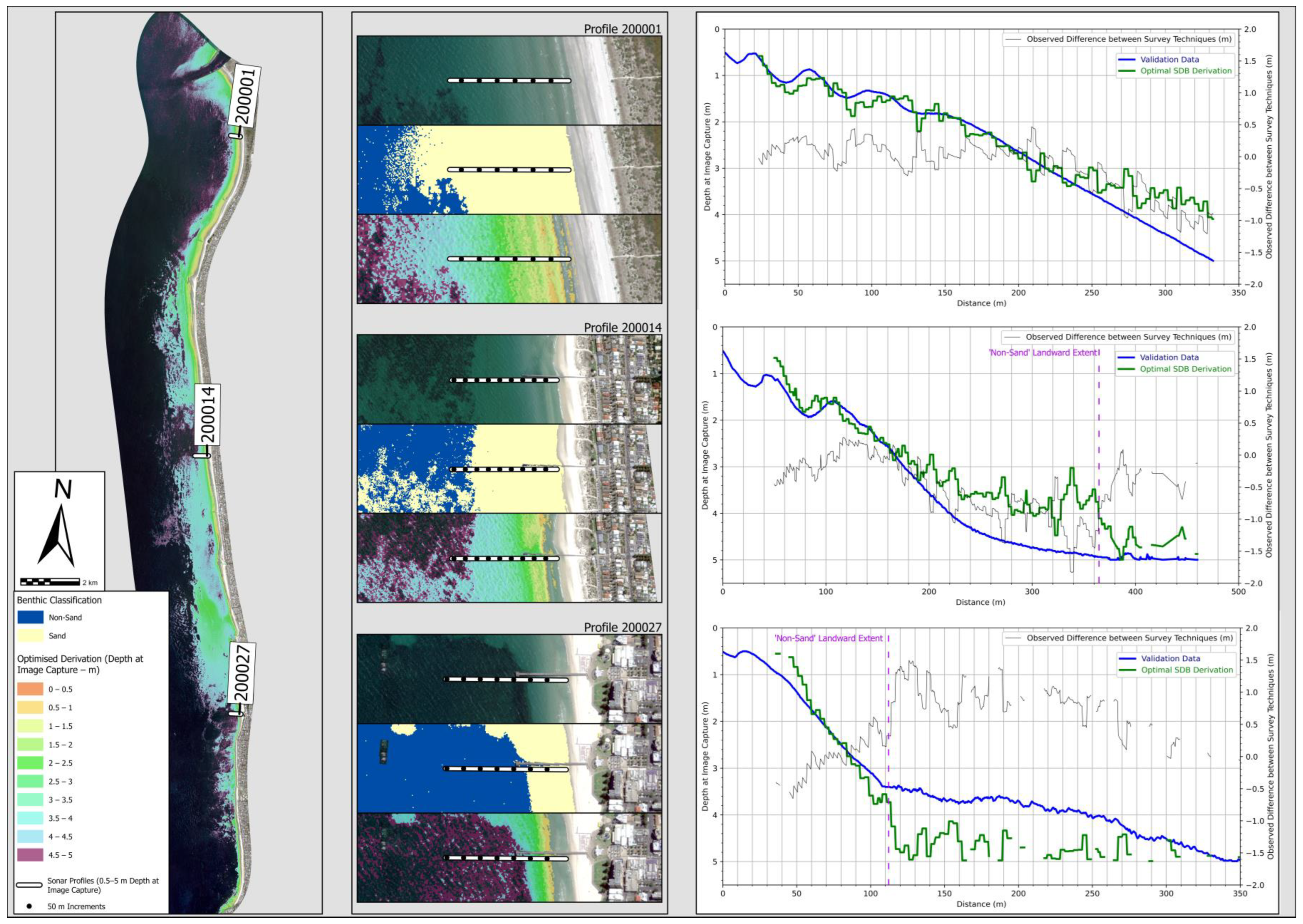
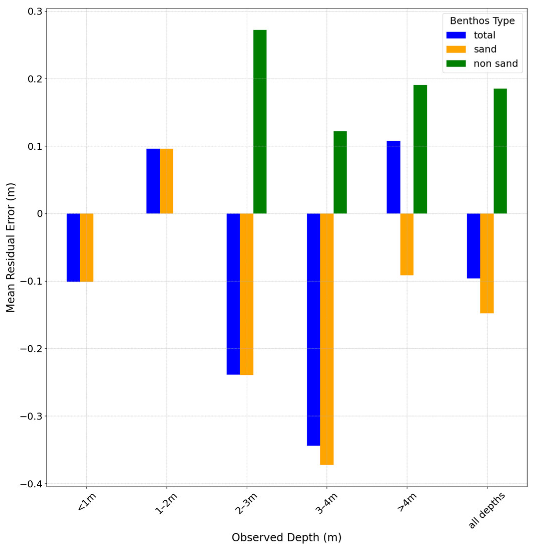
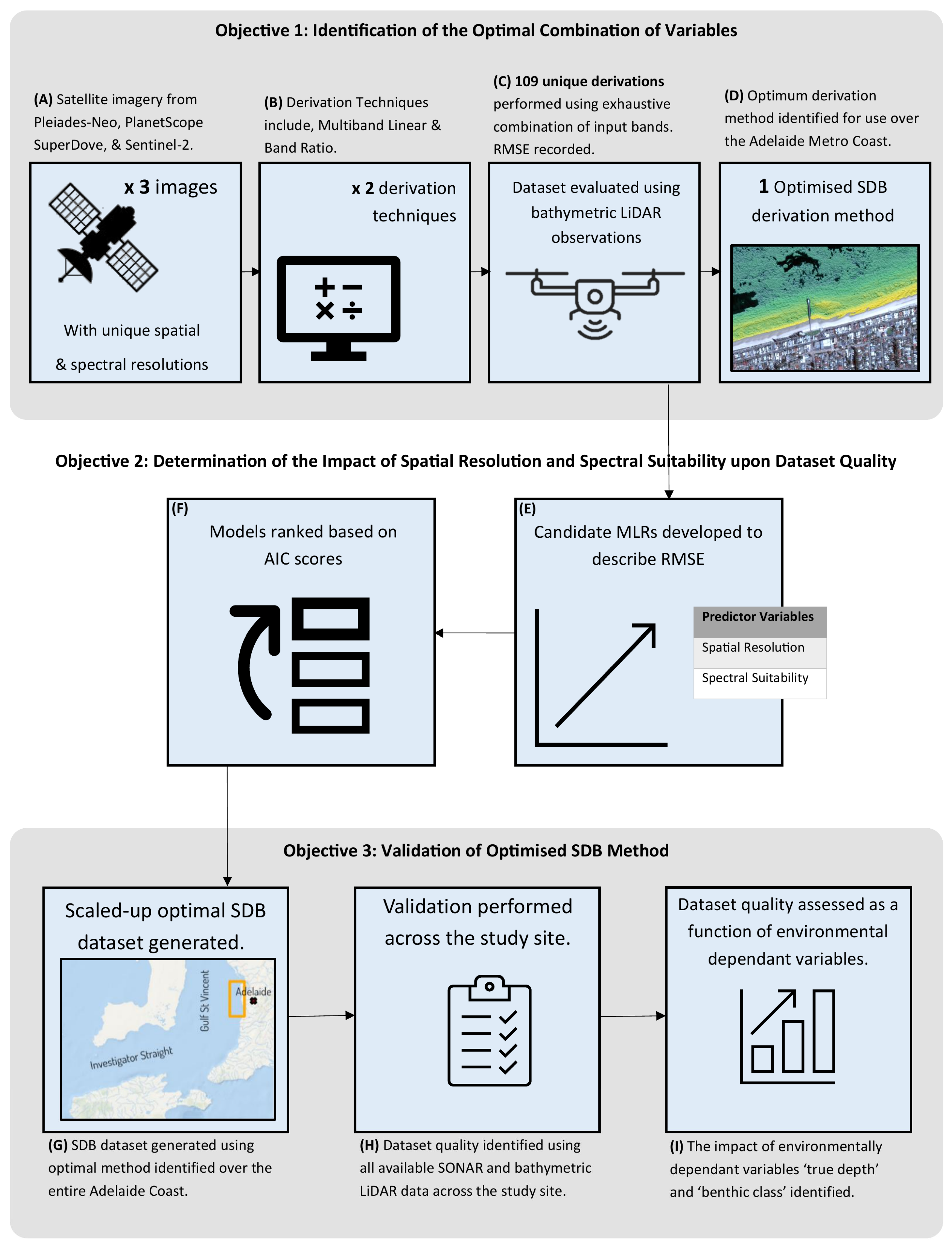
This study enhances the accuracy of optical satellite-derived bathymetric datasets in a shallow, mixed-bottom, low-wave-energy coastal environment by identifying the optimal combination of input satellite imagery, spectral bands, and empirical derivation techniques. A total of 109 unique derivations were performed based on an exhaustive combination of these variables. These derivations were calibrated and validated using 1,064,536 ground truth observations. The results revealed that the multiband linear technique consistently outperformed the band ratio technique, achieving the best results with input bands from PlanetScope SuperDove imagery. The top-performing derivation attained an R2 value of 0.94 and an RMSE of 0.41 m when compared with the ground truth data, surpassing the published RMSE values in similar environments. Further validation beyond the calibration site confirmed its effectiveness within depths of 0.5 m to 5 m, demonstrating an RMSE of 0.51 m, albeit with a gradual reduction in accuracy with increasing depth. This research not only identifies the optimal combination of variables but also provides valuable insights into how the number of input bands, their spatial resolution, and their specific spectral properties (central wavelength and bandwidth) influence the quality of satellite-derived bathymetry datasets. Challenges remain in accounting for mixed bottom types and their variable albedos.
Keywords: satellite-derived bathymetry (SDB); multi-spectral; empirical techniques; multiband linear technique; band ratio technique satellite-derived bathymetry (SDB); multi-spectral; empirical techniques; multiband linear technique; band ratio technique