Article

Deviations of Boundary Layer Height and Meteorological Parameters Between Ground-Based Remote Sensing and ERA5 over the Complex Terrain of the Mongolian Plateau


1
College of Resource and Environment, Northeast Agricultural University, Harbin 150030, China
2
State Key Laboratory of Atmospheric Environment and Extreme Meteorology, Institute of Atmospheric Physics, Chinese Academy of Sciences, Beijing 100029, China
3
Northwest Institute of Eco-Environment and Resources, Chinese Academy of Sciences, Beijing 100029, China
4
University of Chinese Academy of Sciences, Beijing 100049, China
5
Inner Mongolia Environmental Monitoring Center, Hohhot 010011, China
6
Laboratory for Supervision and Evaluation of Pollution Reduction and Carbon Reduction in Arid and Semi-Arid Regions, Inner Mongolia Environmental Monitoring Center, Hohhot 010011, China
*
Author to whom correspondence should be addressed.
These authors contributed equally to this work.
Remote Sens. 2025, 17(3), 393; https://doi.org/10.3390/rs17030393
Submission received: 5 December 2024 / Revised: 21 January 2025 / Accepted: 22 January 2025 / Published: 23 January 2025
(This article belongs to the Section Atmospheric Remote Sensing)

Abstract

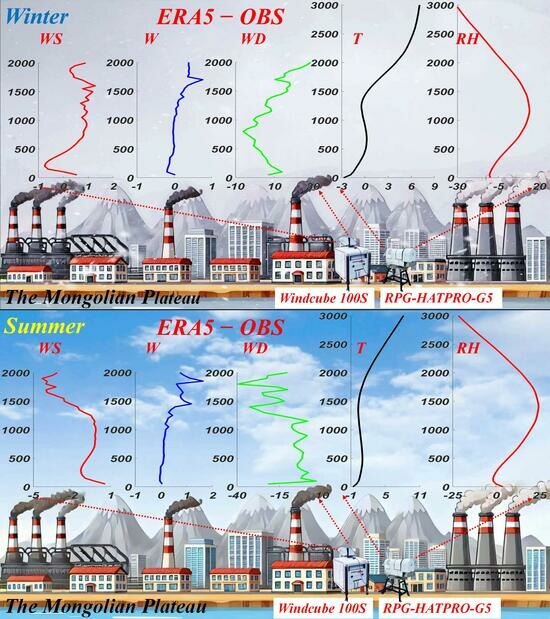
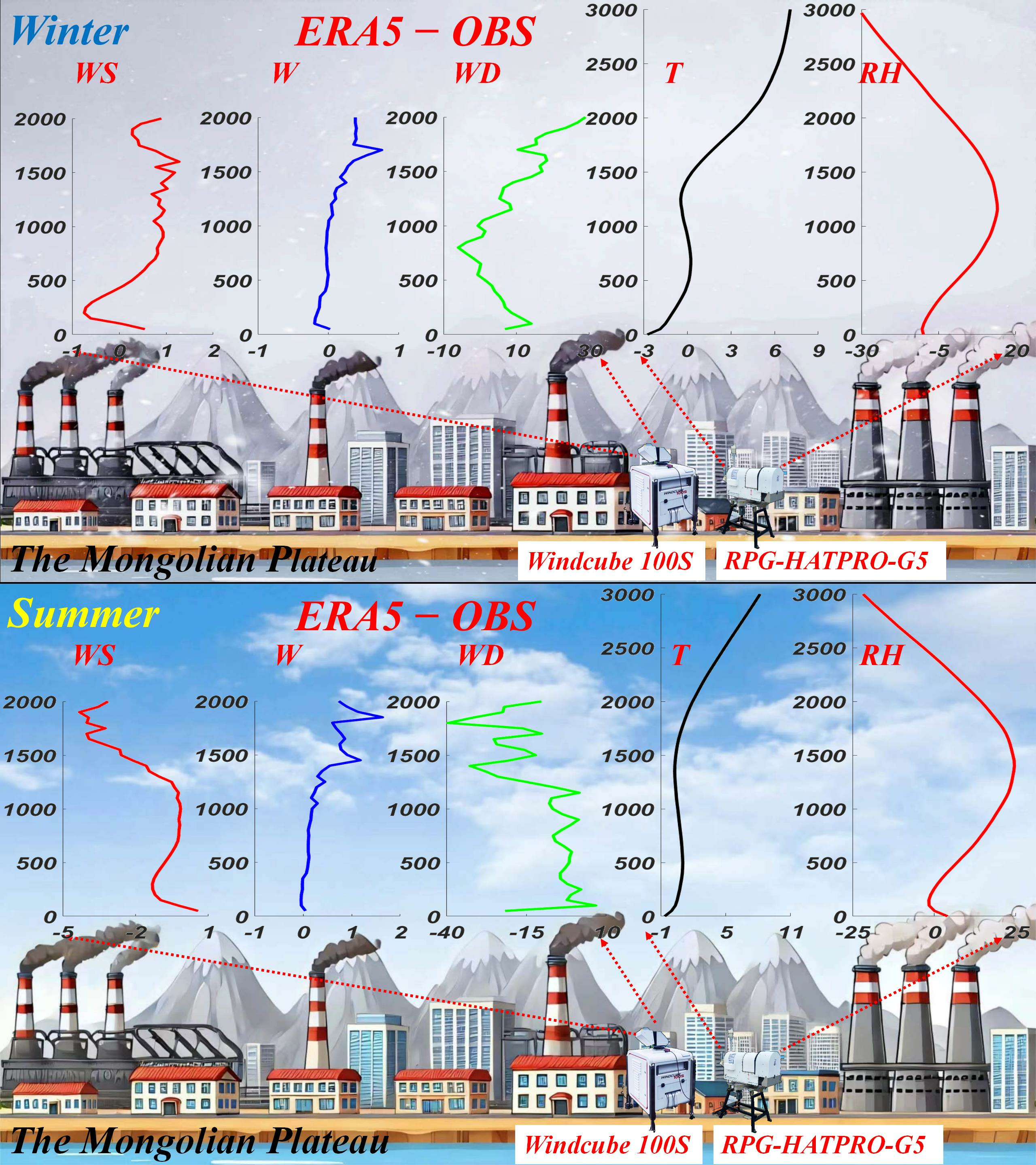
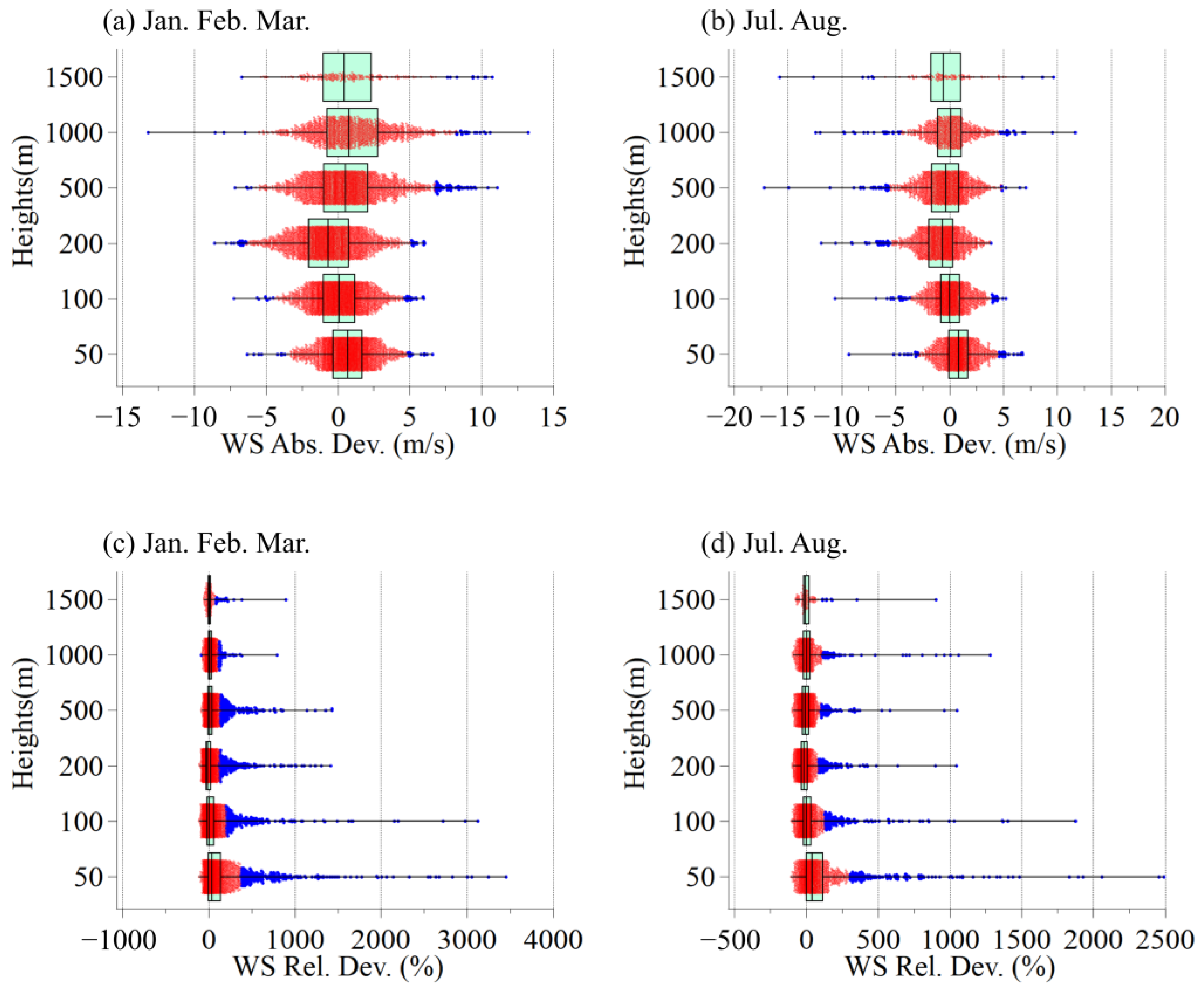
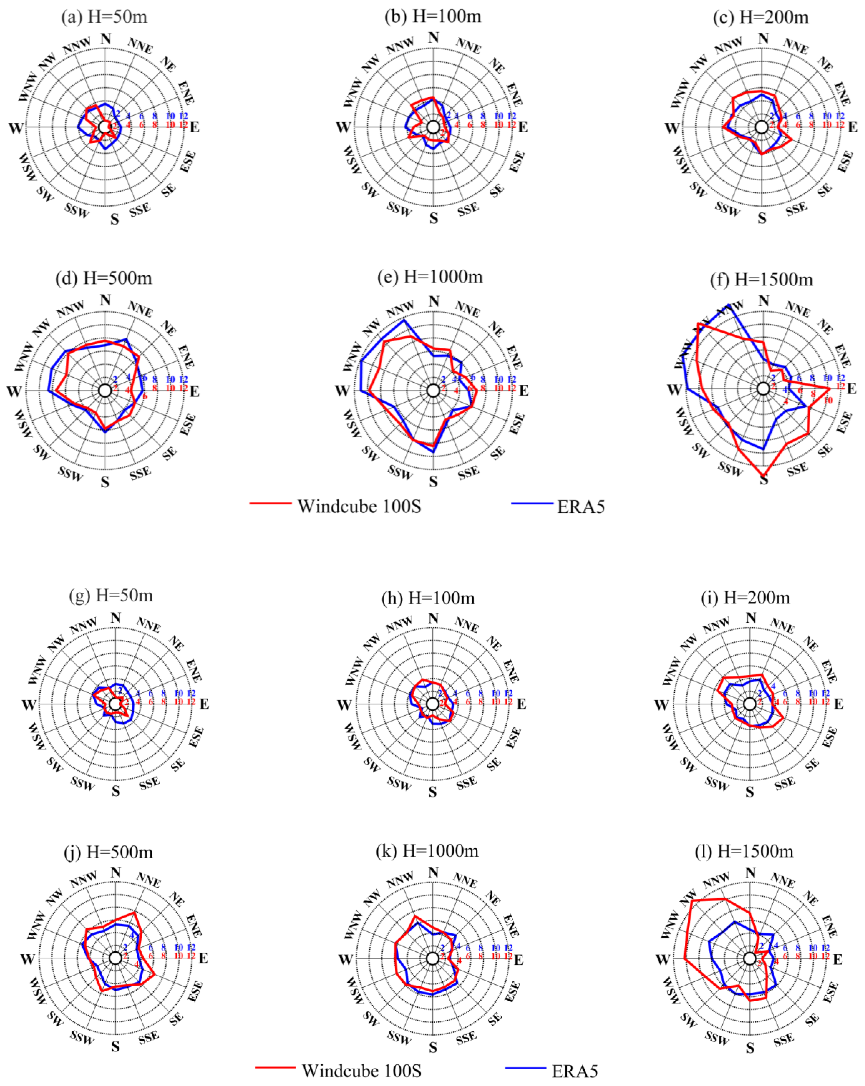
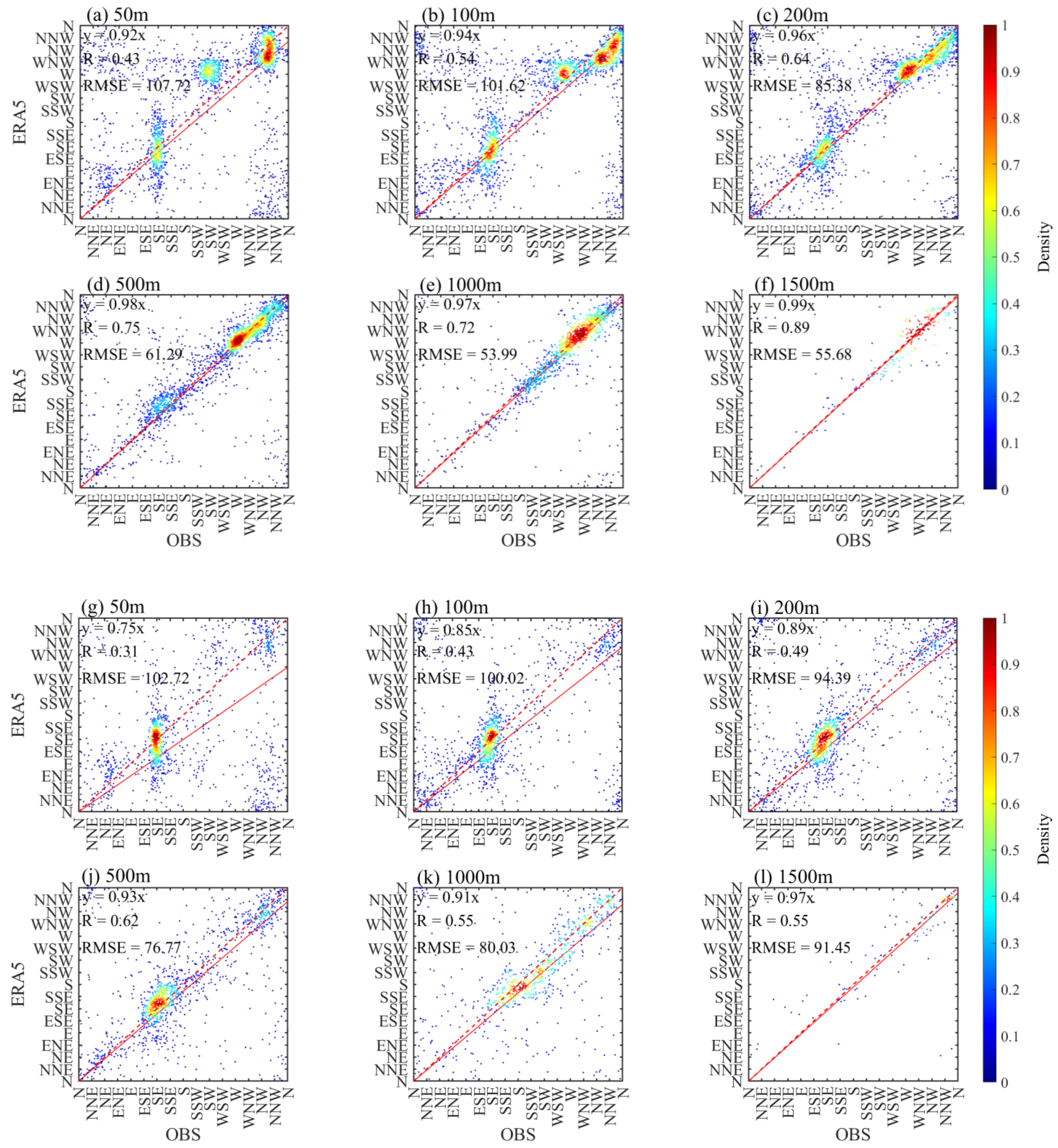
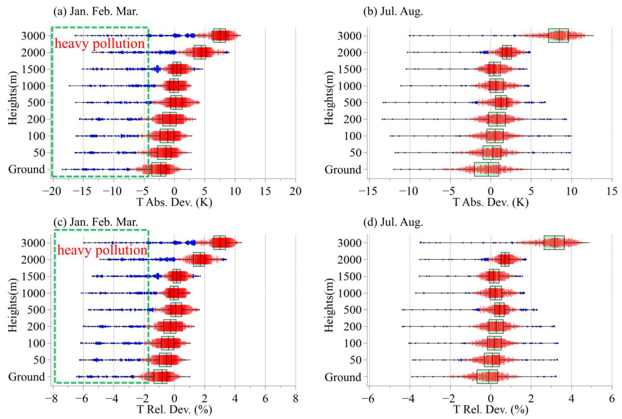
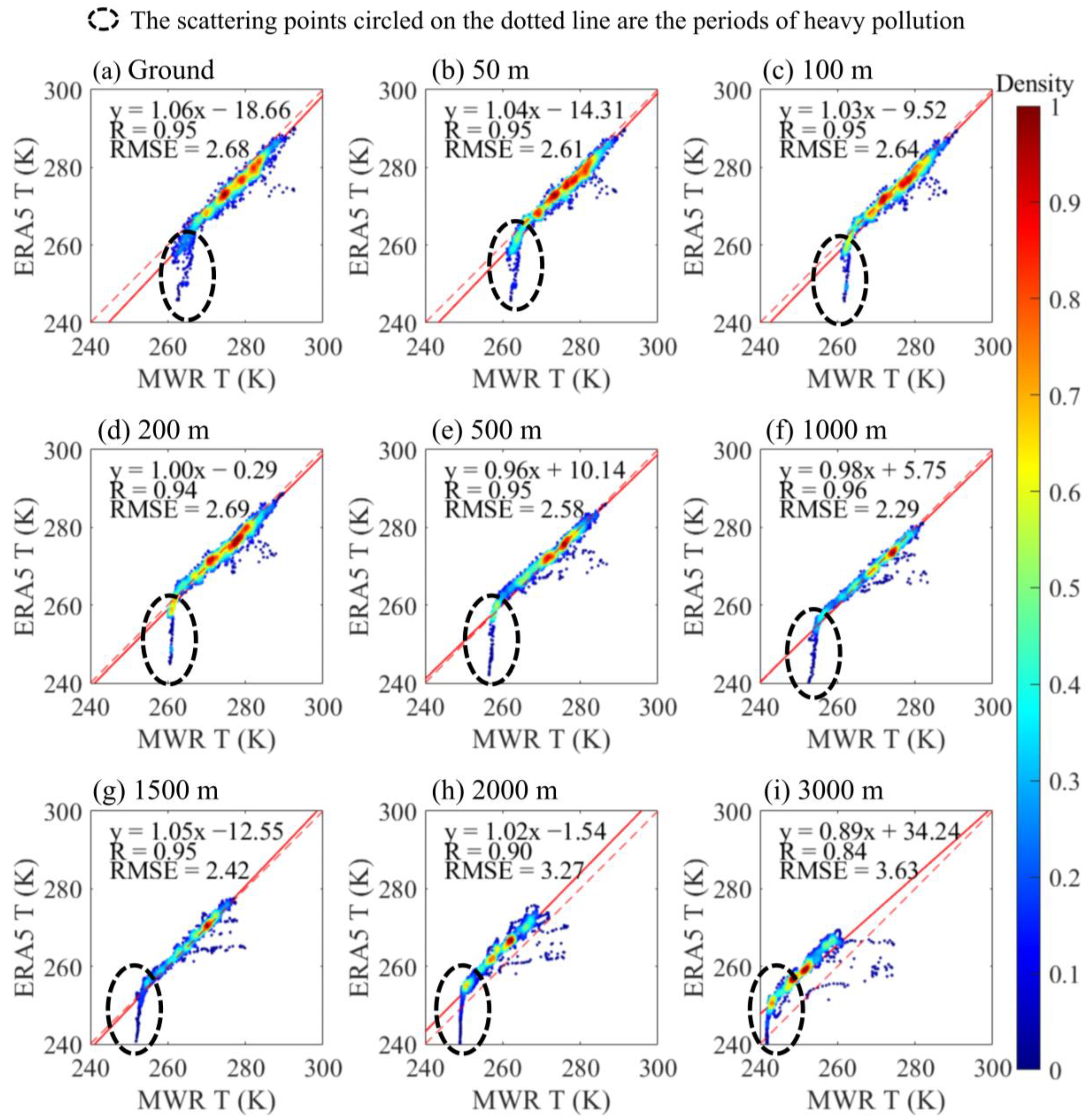
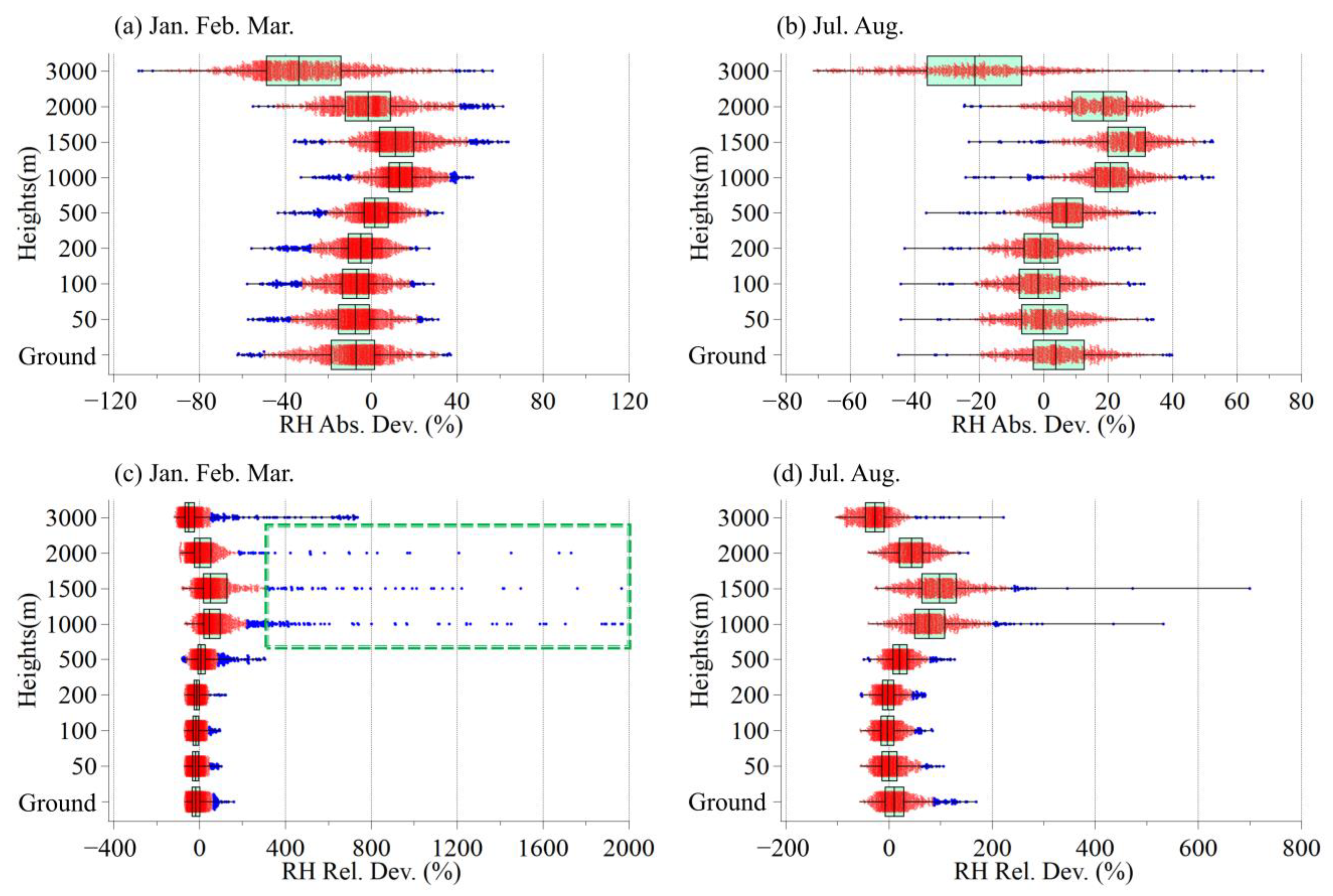
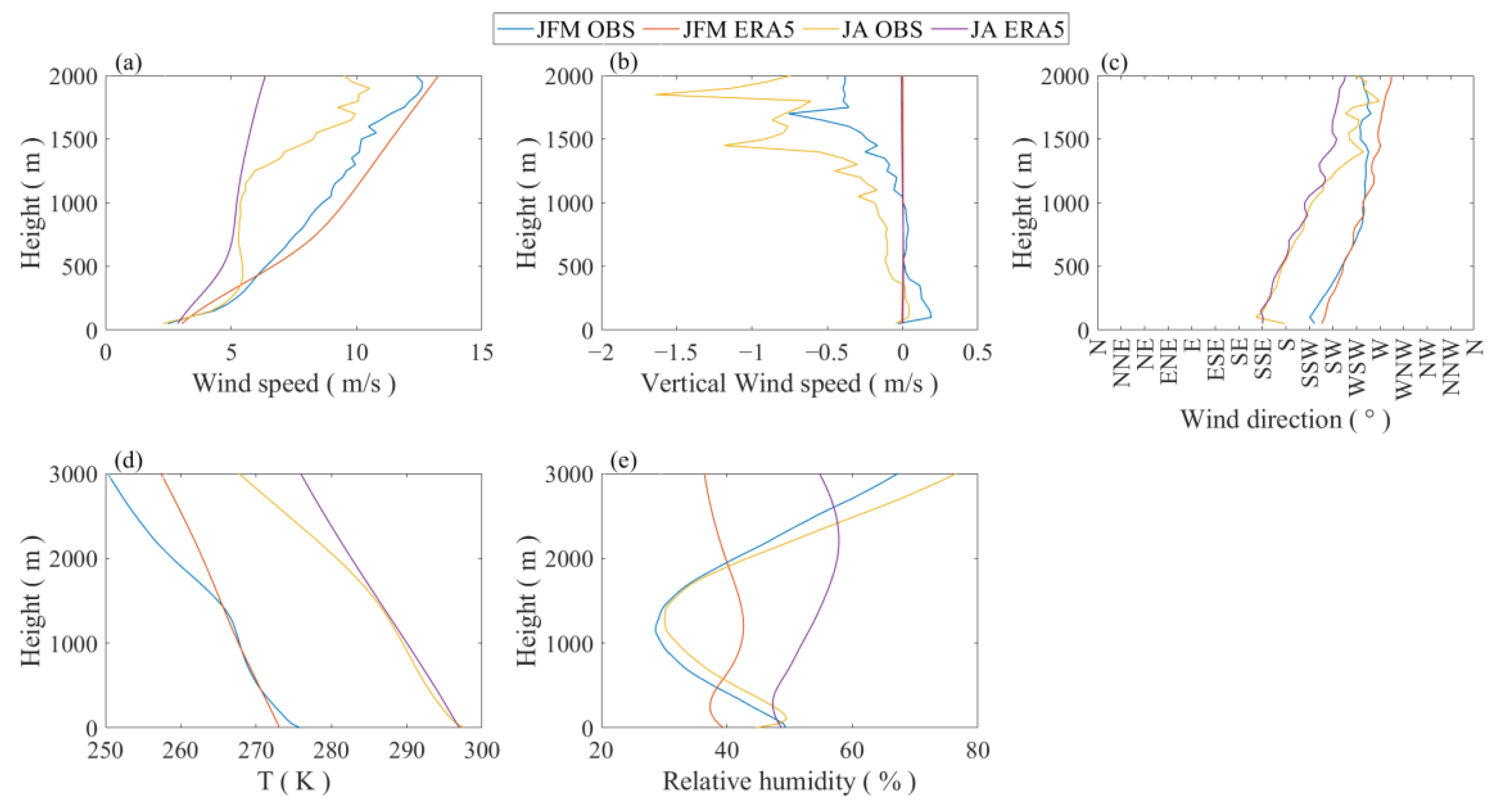
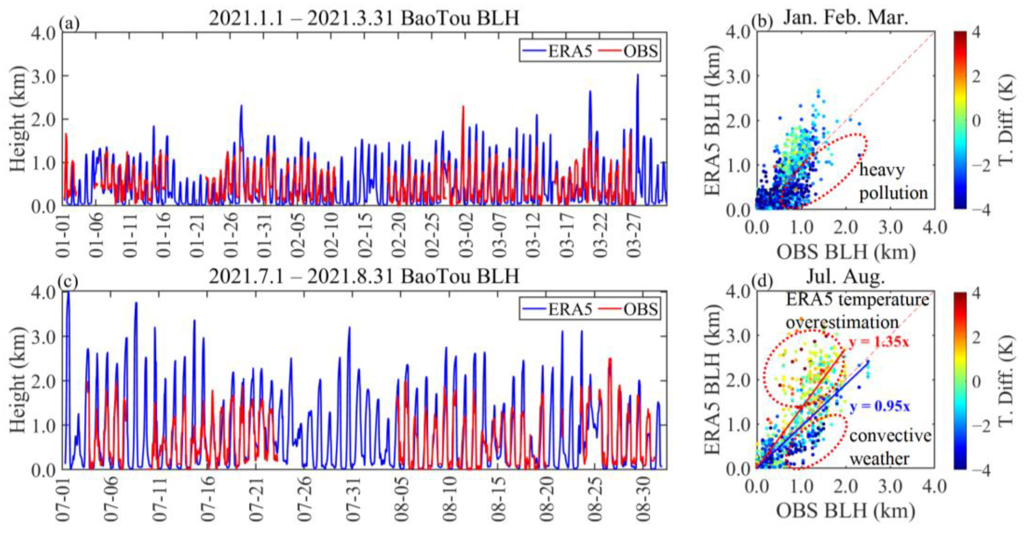
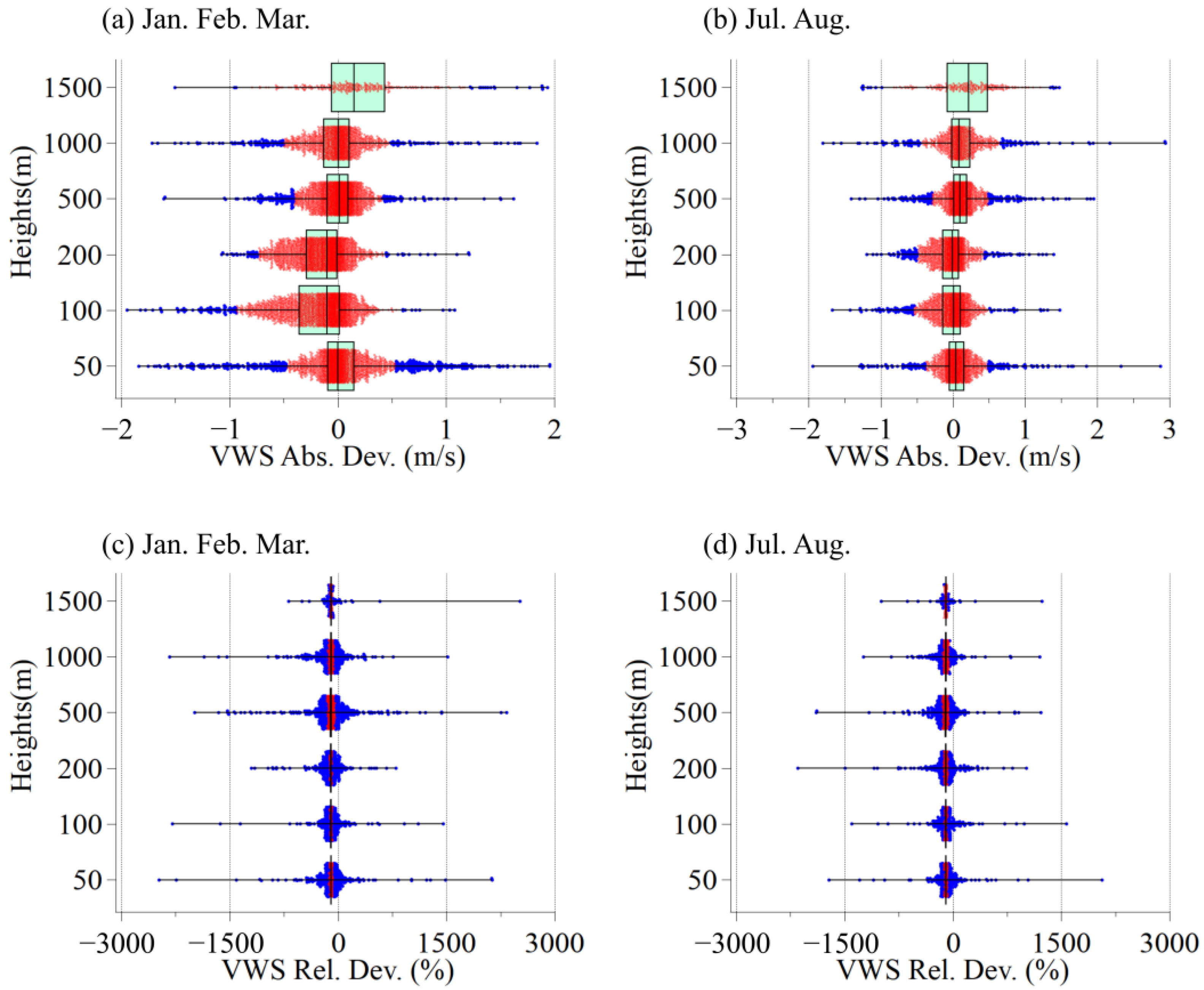
This study provides a comprehensive evaluation of the vertical accuracy of ERA5 reanalysis data for boundary layer height and key meteorological variables, based on high-precision observational data from Baotou, located on the Mongolian Plateau, during the winter (January–March) and summer (July–August) months of 2021. Results indicate that ERA5 exhibits significant biases in horizontal wind speed, with deviations ranging from −5 to 8 m/s at 50 m, primarily driven by sandstorms in winter and convective weather in summer. The most pronounced errors occur below 500 m. Vertical wind speeds are consistently underestimated in both seasons, with biases reaching up to 1 m/s, particularly during active summer convection. ERA5 also struggles to reproduce low-level wind directions accurately. In winter, correlation coefficients range from 0.43 to 0.64 below 200 m and improve to above 0.7 at 500 m. In summer, correlation coefficients are lower, ranging from 0.3 to 0.5 below 200 m, with reduced accuracy at 500 m compared to winter. Temperature deviations increase above 2000 m, with a relative overestimation of 3% at 3000 m. Relative humidity is generally overestimated by 5–20% between 1000 and 2000 m in winter and by 10–30% in summer. For boundary layer heights, ERA5 overestimates daytime mixed-layer heights by up to 2000 m in summer and 500–800 m in winter. In contrast, ERA5 captures nocturnal stable boundary layer heights well during winter. This comprehensive evaluation of the vertical structure accuracy of ERA5 reanalysis data, conducted in a heavily industrialized city on the Mongolian Plateau, offers essential insights for improving meteorological studies and refining climate models in the region. The findings provide valuable reference data for enhancing weather forecasting and supporting climate change research, particularly in complex terrain areas.
Keywords: ERA5 reanalysis data; industrial city; atmospheric remote sensing; Mongolia Plateau; boundary layer height ERA5 reanalysis data; industrial city; atmospheric remote sensing; Mongolia Plateau; boundary layer height
Graphical Abstract