
Refined Coseismic Slip Model and Surface Deformation of the 2021 Maduo Earthquake: Implications for Sensitivity of Rupture Behaviors to Geometric Complexity


 ,
, 
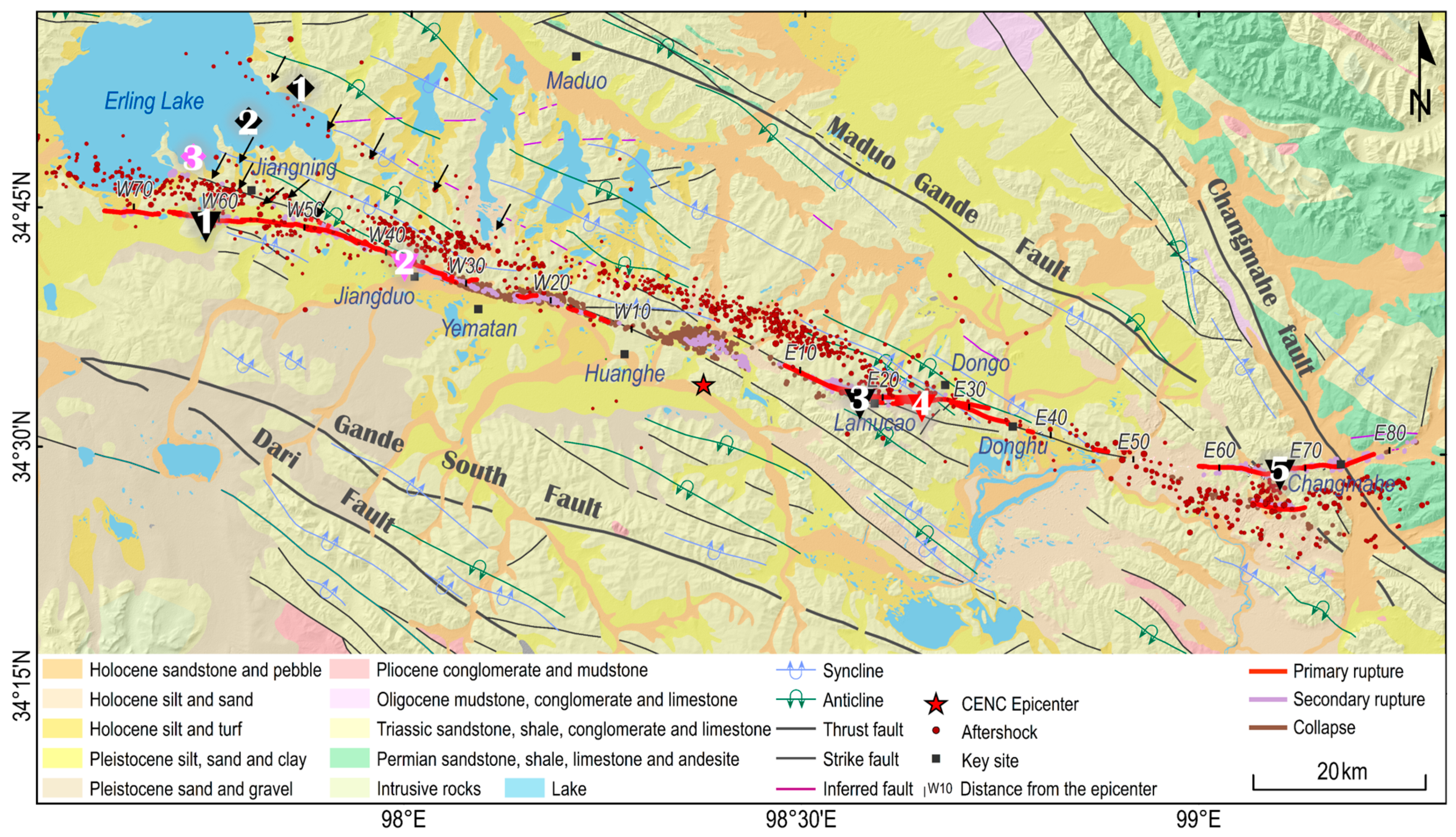
Abstract
Share and Cite
Liu, X.; Deng, D.; Jia, Z.; Liu-Zeng, J.; Mo, X.; Huang, Y.; Ruan, Q.; Liu, J. Refined Coseismic Slip Model and Surface Deformation of the 2021 Maduo Earthquake: Implications for Sensitivity of Rupture Behaviors to Geometric Complexity. Remote Sens. 2024, 16, 713. https://doi.org/10.3390/rs16040713
Liu X, Deng D, Jia Z, Liu-Zeng J, Mo X, Huang Y, Ruan Q, Liu J. Refined Coseismic Slip Model and Surface Deformation of the 2021 Maduo Earthquake: Implications for Sensitivity of Rupture Behaviors to Geometric Complexity. Remote Sensing. 2024; 16(4):713. https://doi.org/10.3390/rs16040713
Chicago/Turabian StyleLiu, Xiaoli, Debeier Deng, Zhige Jia, Jing Liu-Zeng, Xinyu Mo, Yu Huang, Qiaozhe Ruan, and Juntao Liu. 2024. "Refined Coseismic Slip Model and Surface Deformation of the 2021 Maduo Earthquake: Implications for Sensitivity of Rupture Behaviors to Geometric Complexity" Remote Sensing 16, no. 4: 713. https://doi.org/10.3390/rs16040713
APA StyleLiu, X., Deng, D., Jia, Z., Liu-Zeng, J., Mo, X., Huang, Y., Ruan, Q., & Liu, J. (2024). Refined Coseismic Slip Model and Surface Deformation of the 2021 Maduo Earthquake: Implications for Sensitivity of Rupture Behaviors to Geometric Complexity. Remote Sensing, 16(4), 713. https://doi.org/10.3390/rs16040713