Article

Combining the SHAP Method and Machine Learning Algorithm for Desert Type Extraction and Change Analysis on the Qinghai–Tibetan Plateau


1
Key Laboratory of Ecological Safety and Sustainable Development in Arid Lands, Northwest Institute of Eco-Environment and Resources, Chinese Academy of Sciences, Lanzhou 730000, China
2
University of Chinese Academy of Sciences, Beijing 100049, China
*
Author to whom correspondence should be addressed.
Remote Sens. 2024, 16(23), 4414; https://doi.org/10.3390/rs16234414
Submission received: 21 October 2024 / Revised: 15 November 2024 / Accepted: 22 November 2024 / Published: 25 November 2024

Abstract

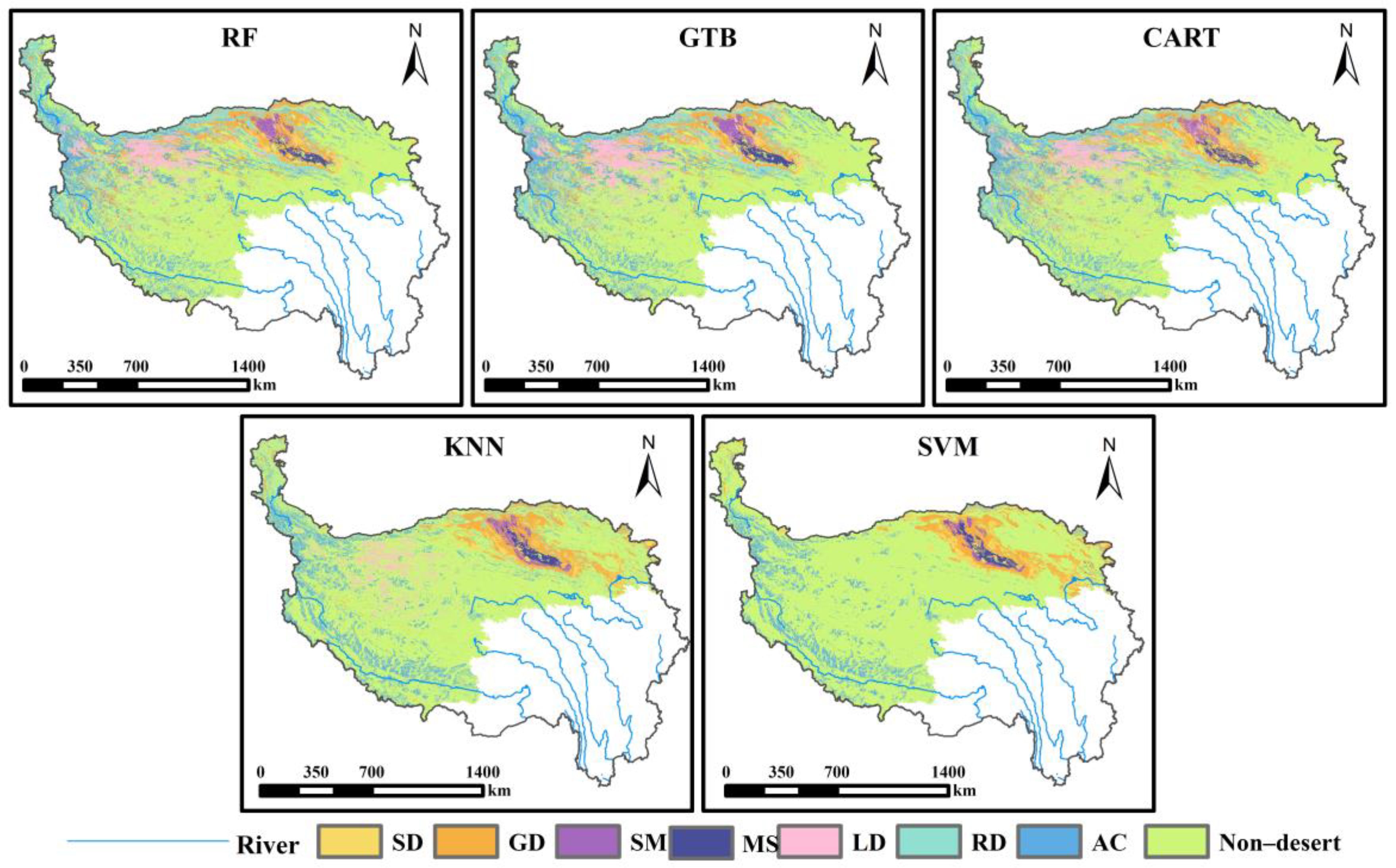
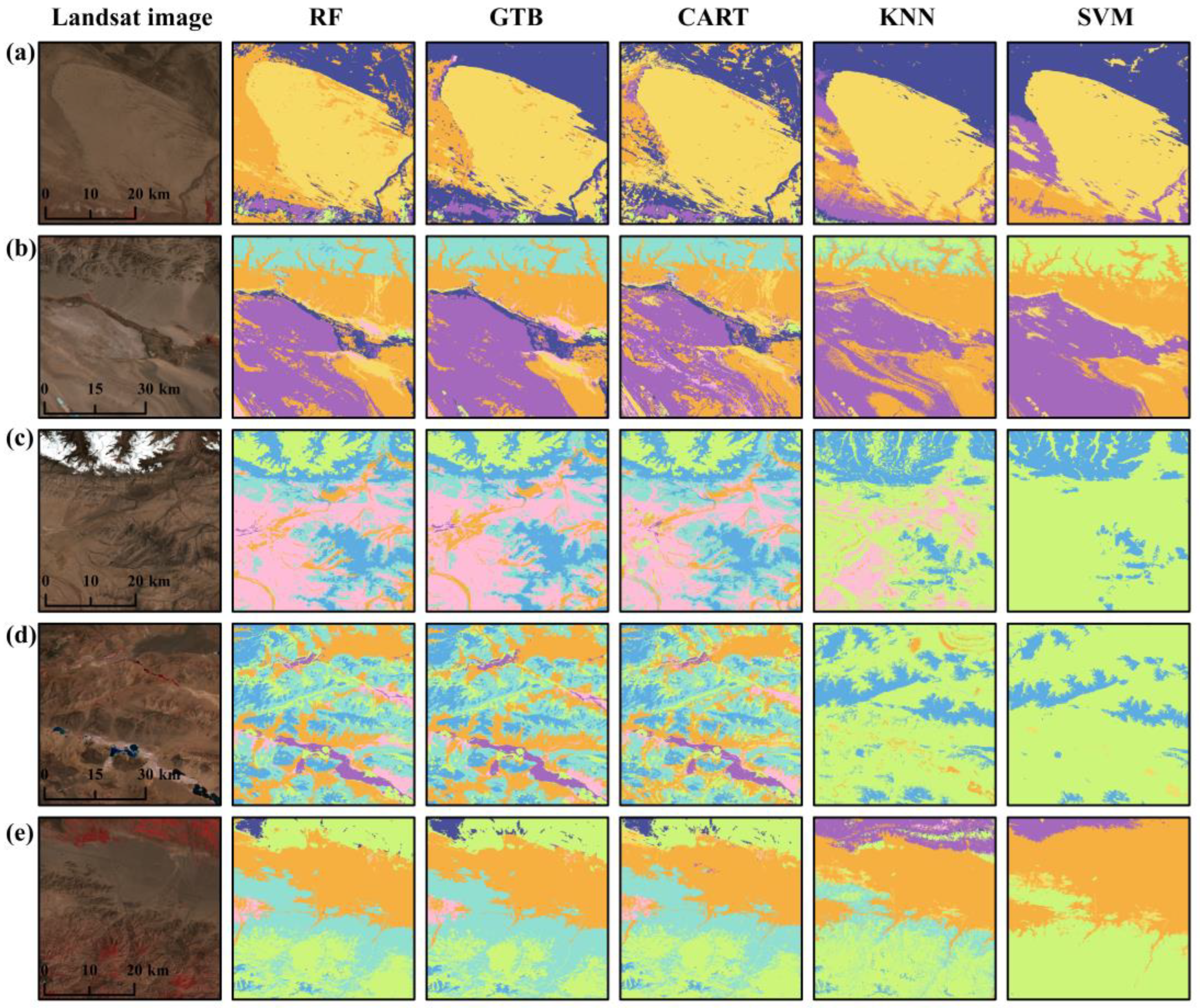
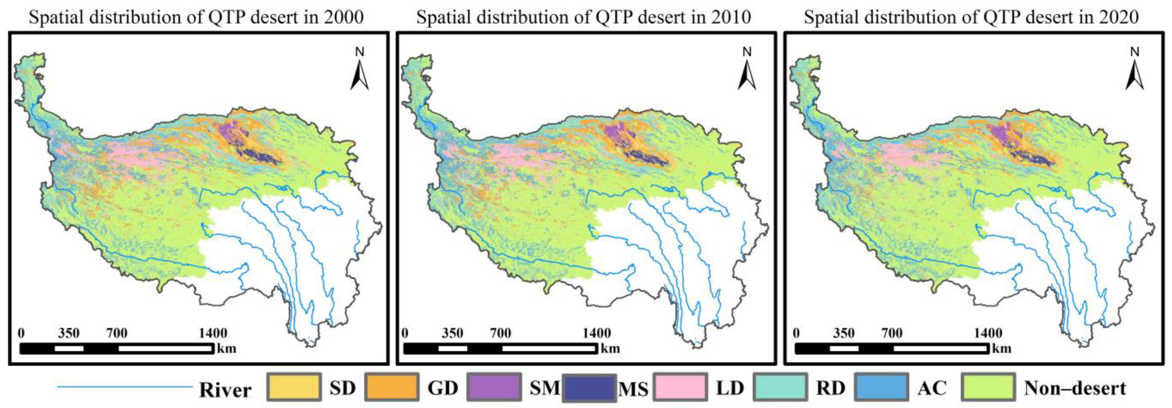
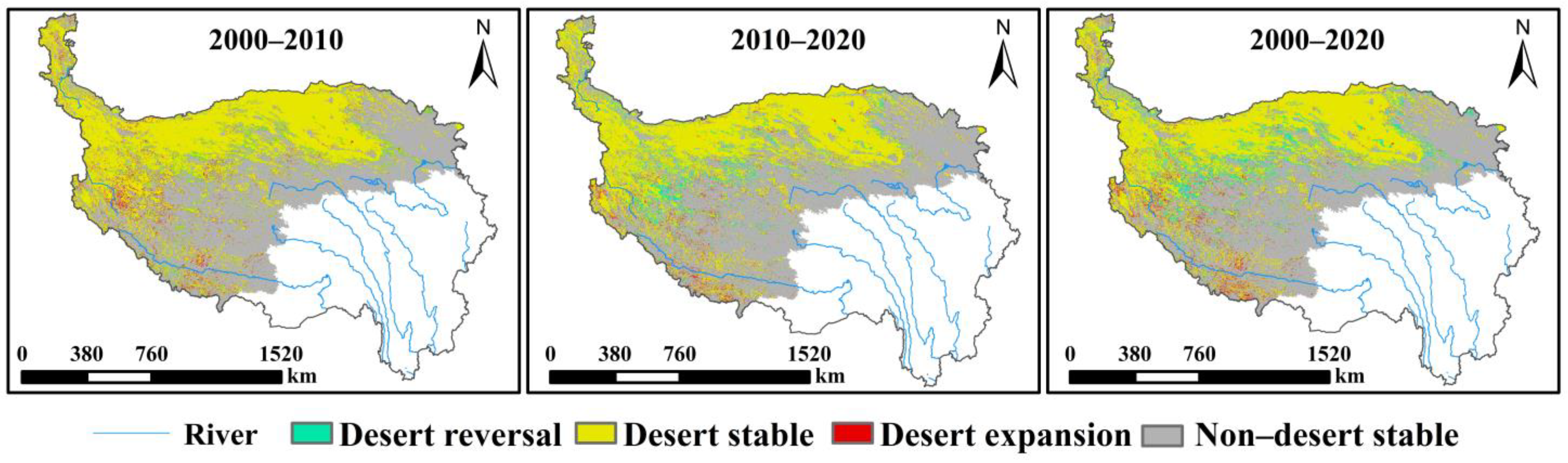
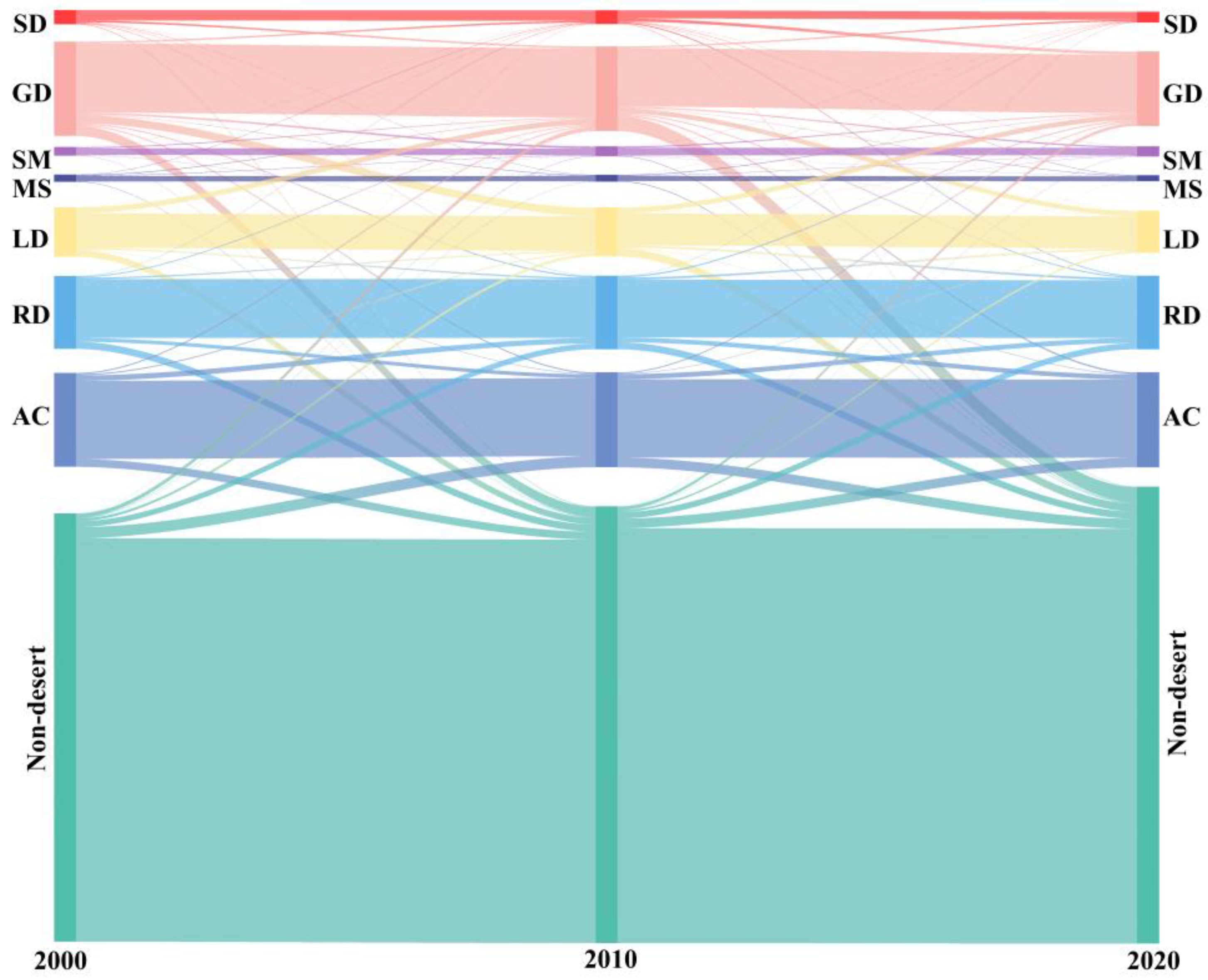
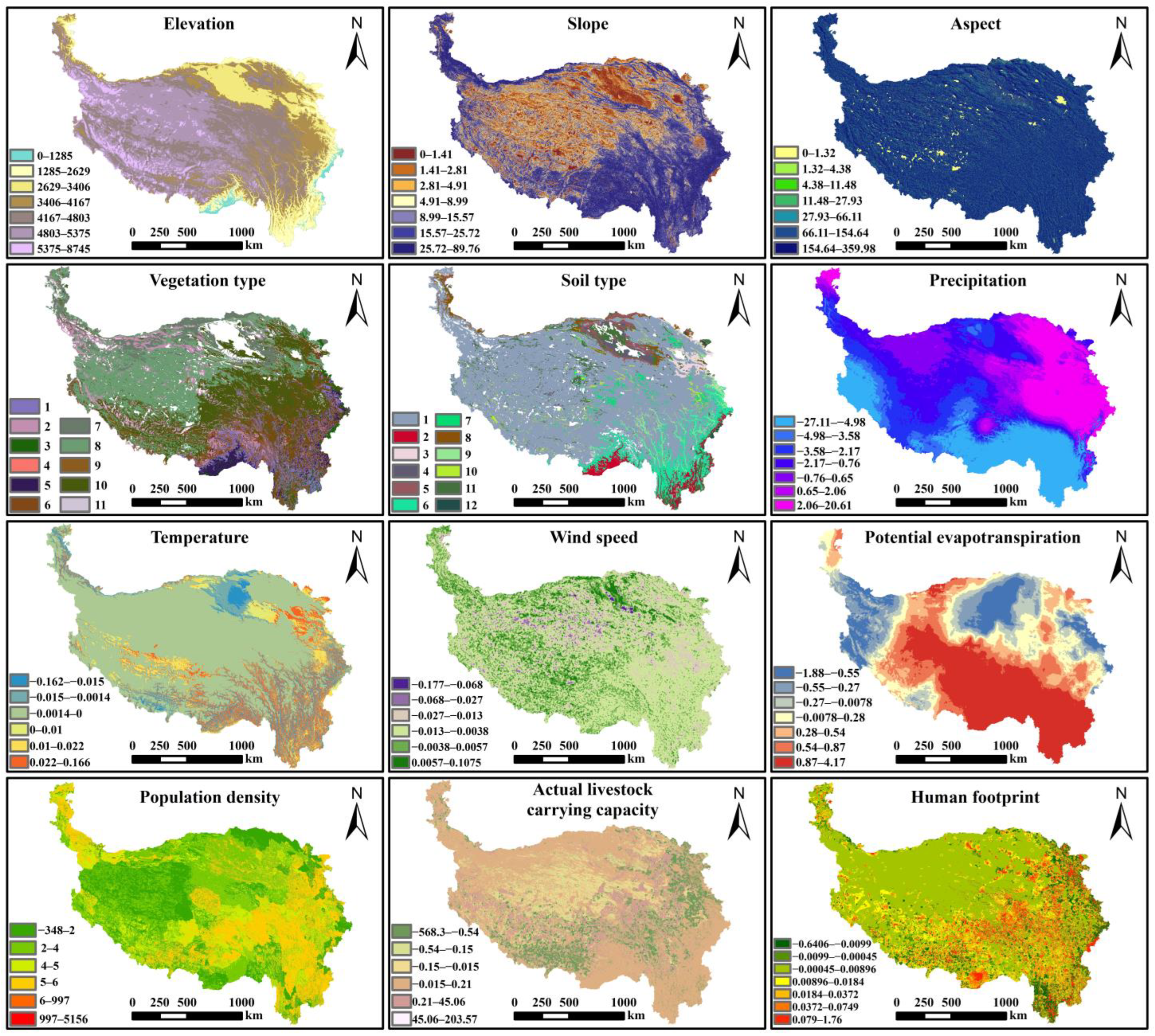
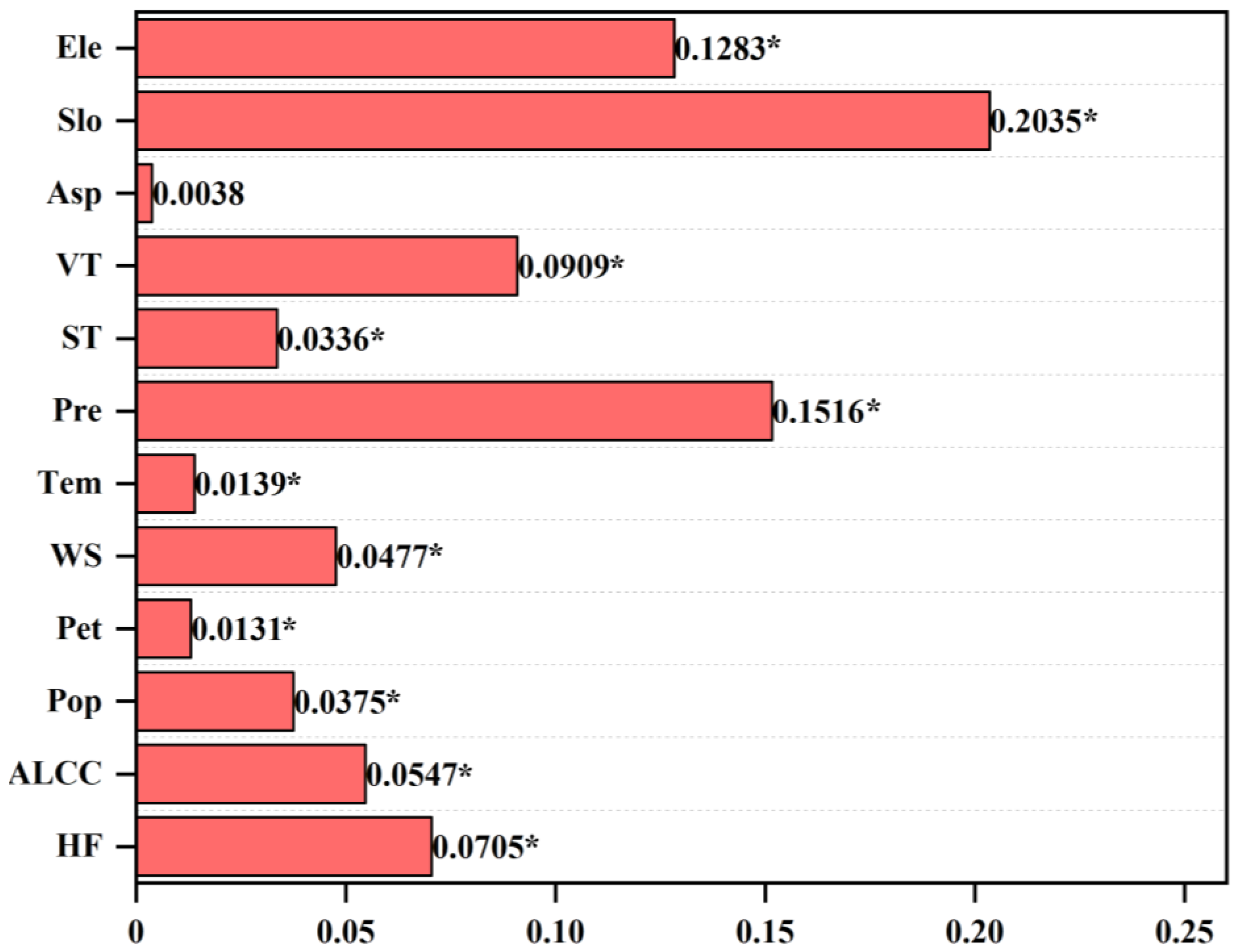
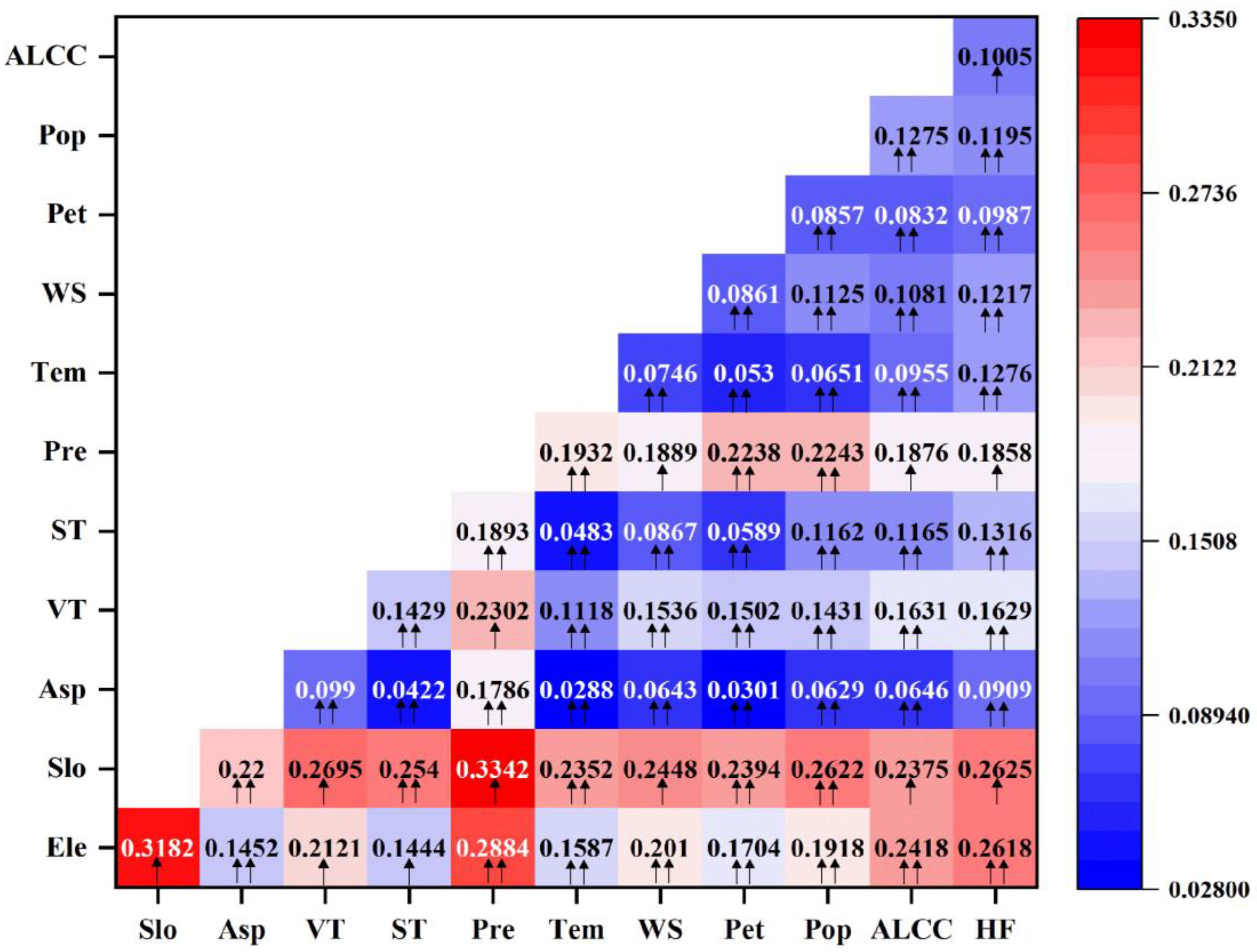
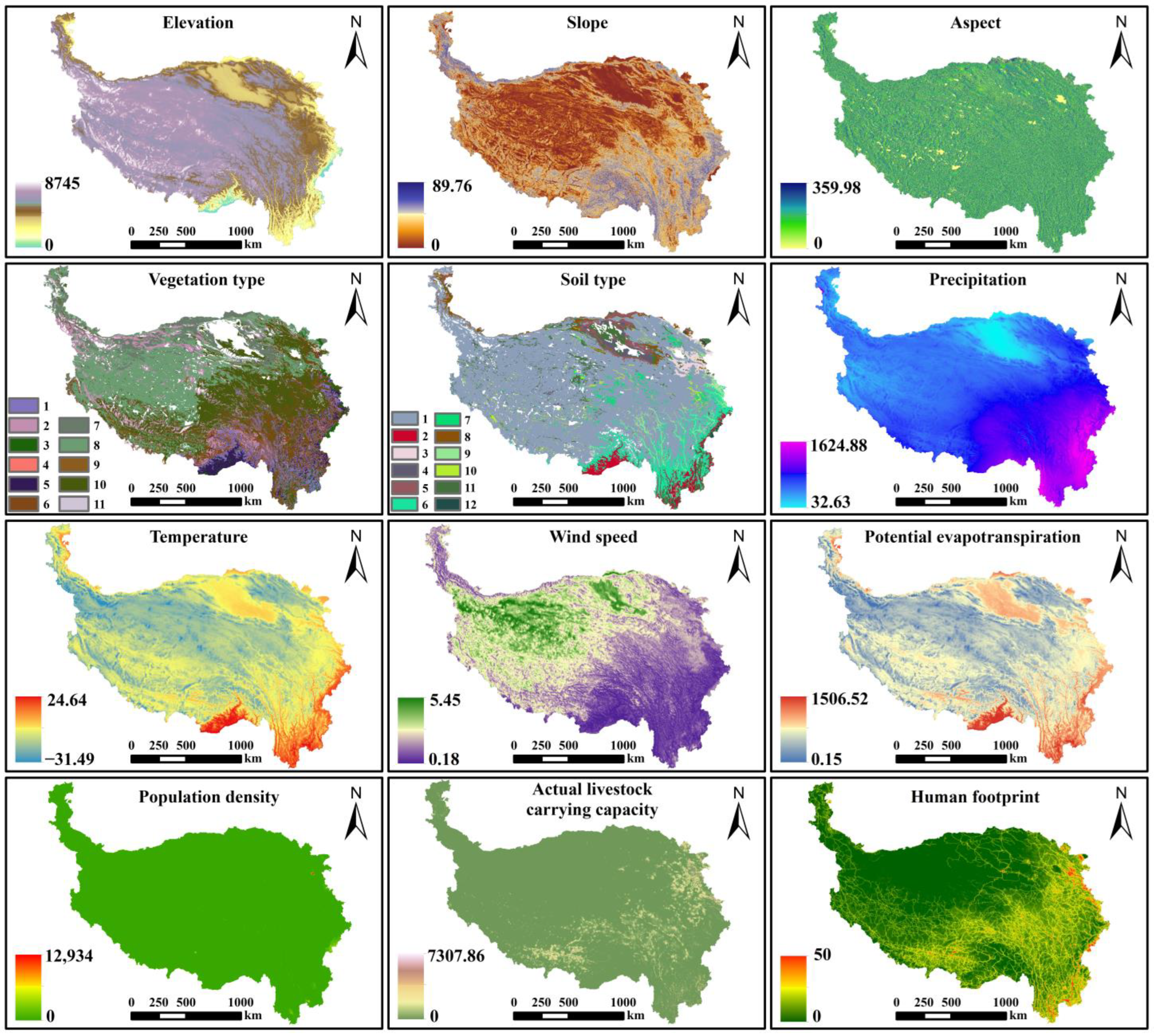
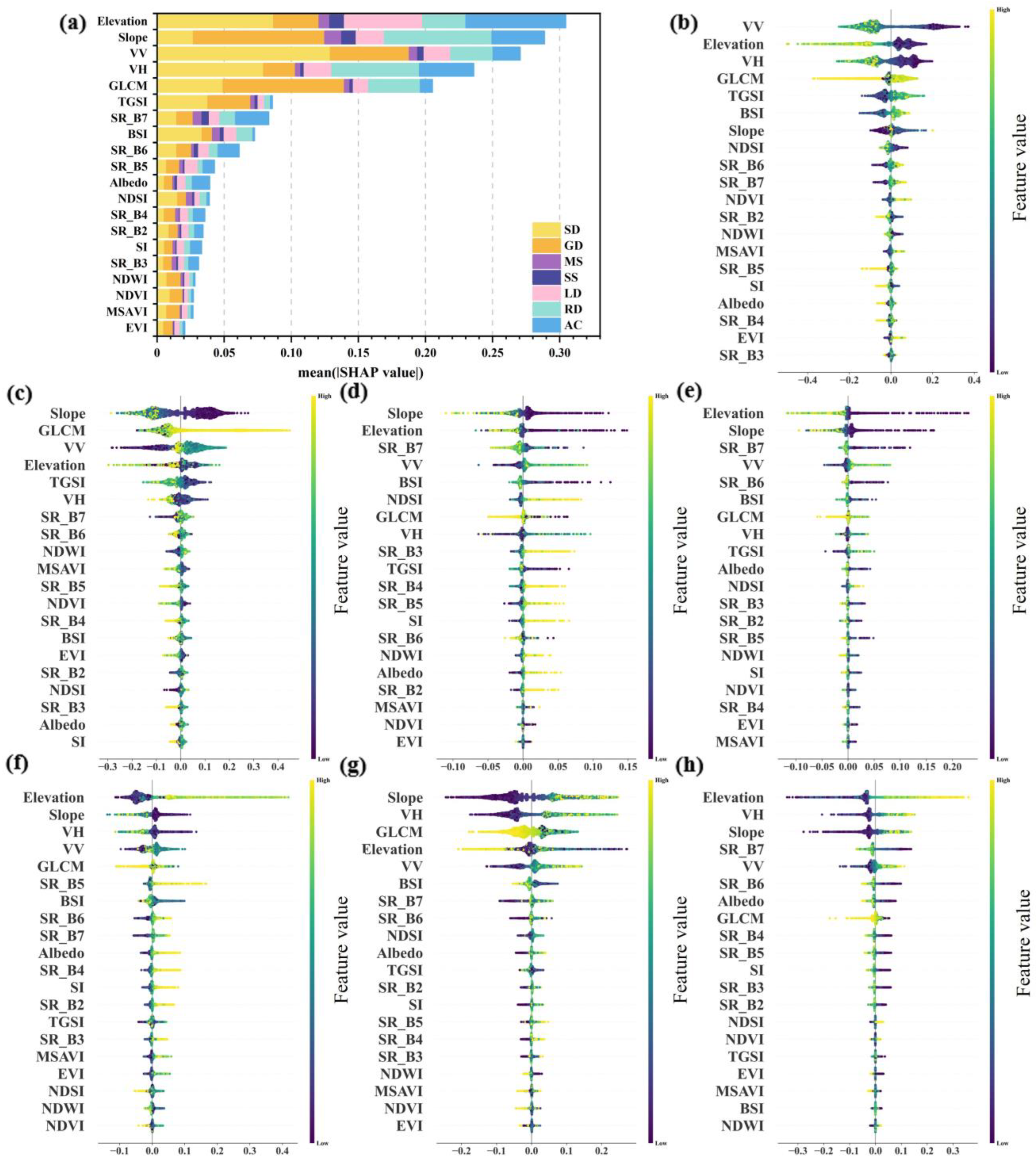
For regional desertification control and sustainable development, it is critical to quickly and accurately understand the distribution pattern and spatial and temporal changes of deserts. In this work, five different machine learning algorithms are used to classify different desert types on the Qinghai–Tibetan Plateau (QTP), and their classification performance is evaluated on the basis of their classification results and classification accuracy. Then, on the basis of the best classification model, the Shapely Additive Explanations (SHAP) method is used to clarify the contribution of each classification feature to the identification of desert types during the machine learning classification process, both globally and locally. Finally, the independent and interactive effects of each factor on desert change on the Qinghai-Tibetan Plateau during the study period are quantitatively analyzed via geodetector. The main results are as follows: (1) Compared with other classification algorithms (GTB, CART, KNN, and SVM), the RF classifier achieves the best performance in classifying QTP desert types, with an overall accuracy (OA) of 87.11% and a kappa coefficient of 0.83. (2) From the perspective of the overall classification of deserts, the five features, namely, elevation, slope, VV, VH, and GLCM, contribute most significantly to the features. In terms of the influence of each classification feature on the extraction of different types of deserts, the radar backscattering coefficient VV serves the most important role in distinguishing sandy deserts; the VH is helpful in distinguishing the four types of deserts: rocky desert, alpine cold desert, sandy deserts, and loamy desert; slope is more effective in distinguishing between the two desert types (rocky desert and alpine cold desert) and other types of deserts; and elevation has a significant role in the identification of alpine cold deserts; and the short-wave infrared band SR_B7 has an important role in the identification of salt crusts and saline deserts. (3) During the study period, the QTP deserts exhibited a reversing trend, and the proportion of desert area decreased from 28.62% to 26.20%. (4) Compared with other factors, slope, precipitation, elevation, vegetation type, and the human footprint have greater effects on changes in the QTP desert area, and the interactions among the factors affecting changes in the desert area all show bidirectional enhancement or nonlinear enhancement effects.
Keywords: desert classification; Qinghai-Tibetan Plateau; SHAP; geodetector desert classification; Qinghai-Tibetan Plateau; SHAP; geodetector