Article

A Framework for Fine-Grained Land-Cover Classification Using 10 m Sentinel-2 Images

1
School of Surveying and Land Information Engineering, Henan Polytechnic University, Jiaozuo 454000, China
2
State Key Laboratory of Remote Sensing Science, Aerospace Information Research Institute, Chinese Academy of Sciences, Beijing 100094, China
3
China Remote Sensing Satellite Ground Station, Aerospace Information Research Institute, Chinese Academy of Sciences, Beijing 100094, China
*
Author to whom correspondence should be addressed.
Remote Sens. 2024, 16(2), 390; https://doi.org/10.3390/rs16020390
Submission received: 23 November 2023 / Revised: 9 January 2024 / Accepted: 12 January 2024 / Published: 18 January 2024
(This article belongs to the Special Issue Deep Learning for Spectral-Spatial Hyperspectral Image Classification)

Abstract

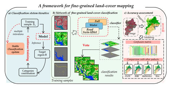
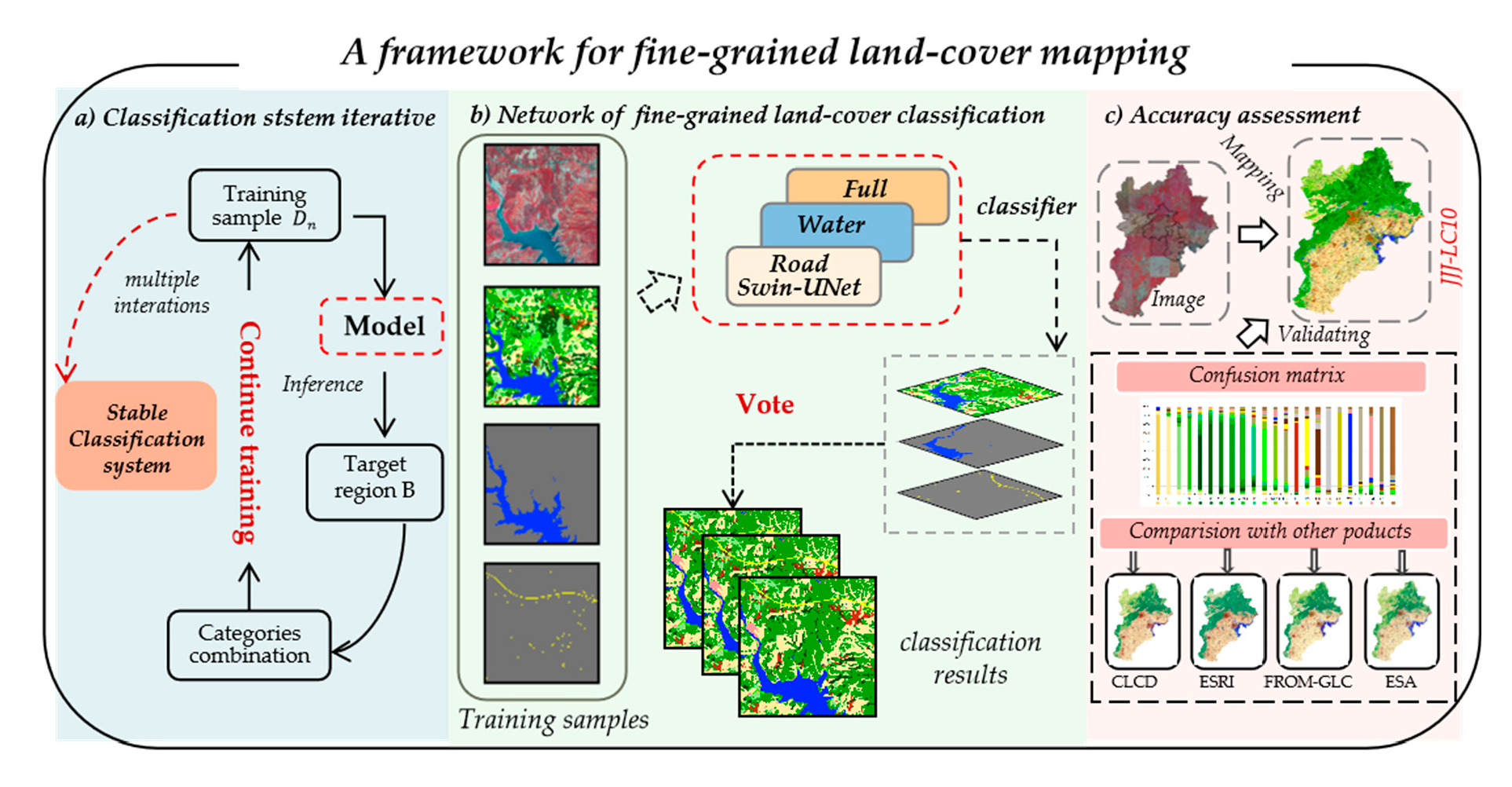
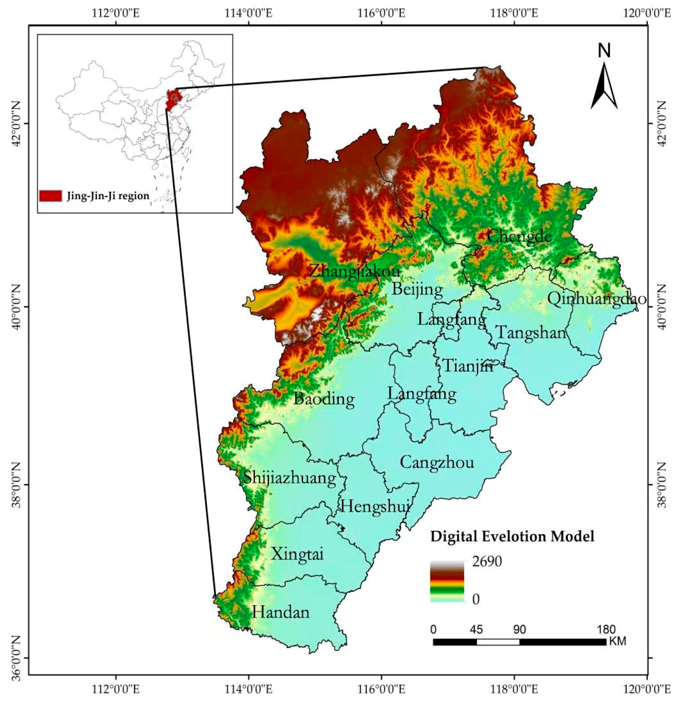
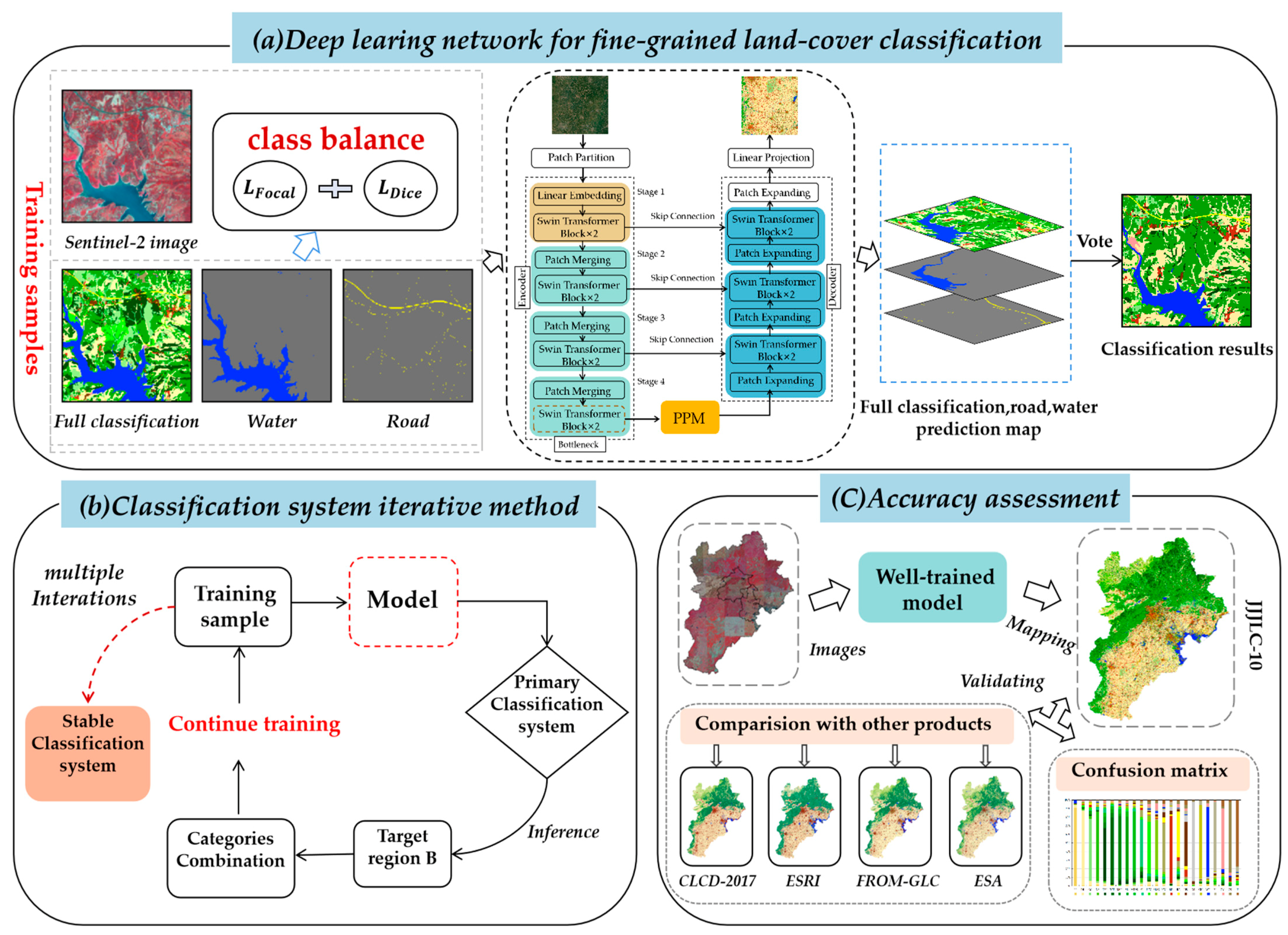
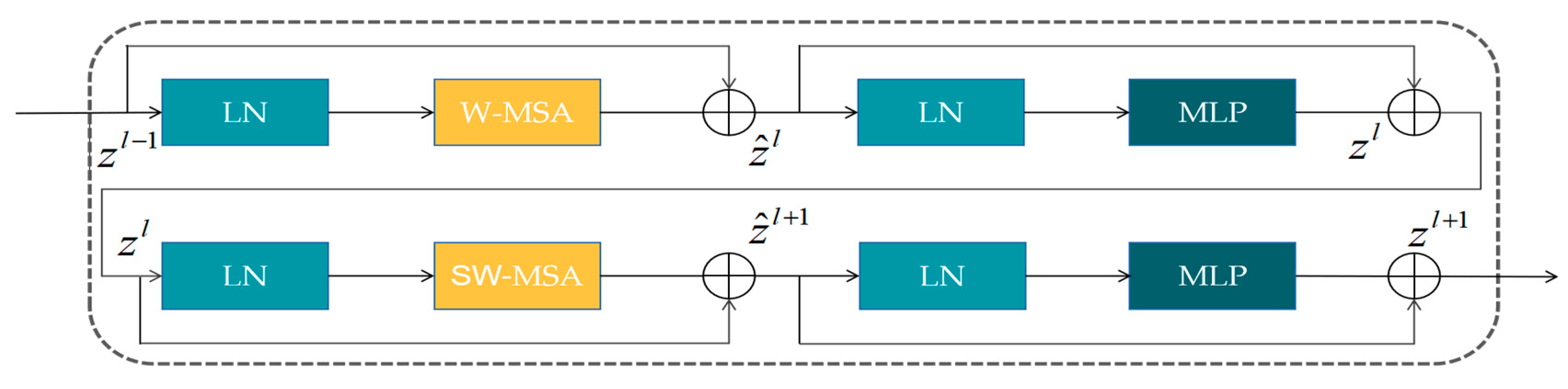
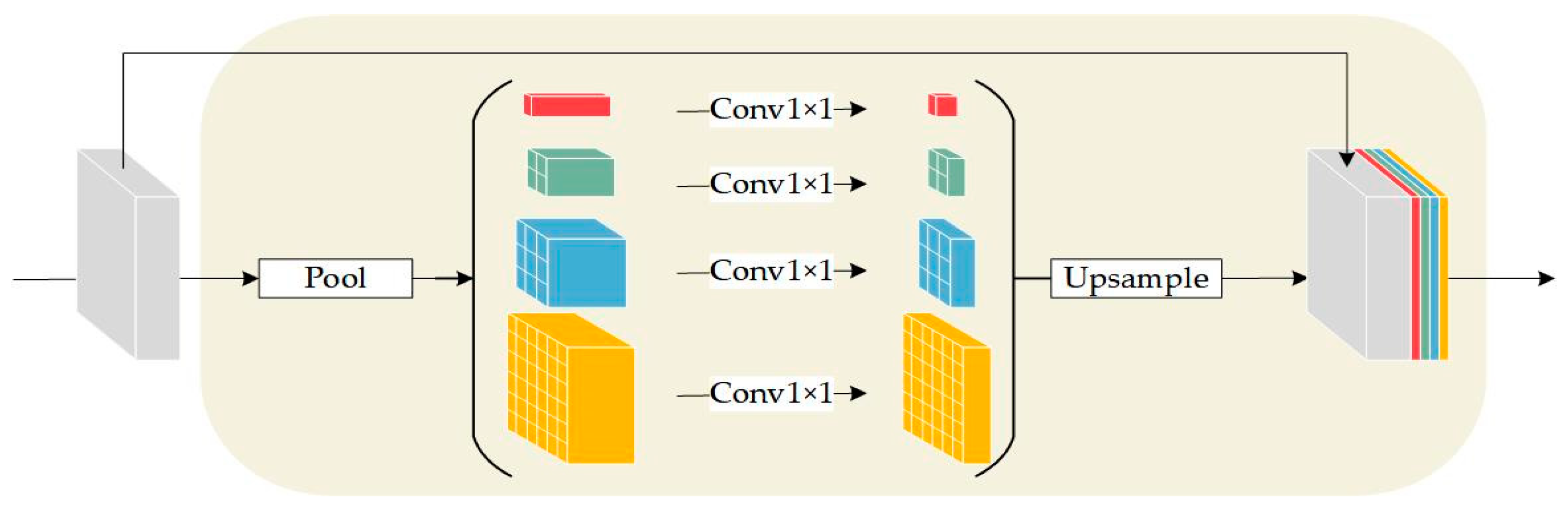
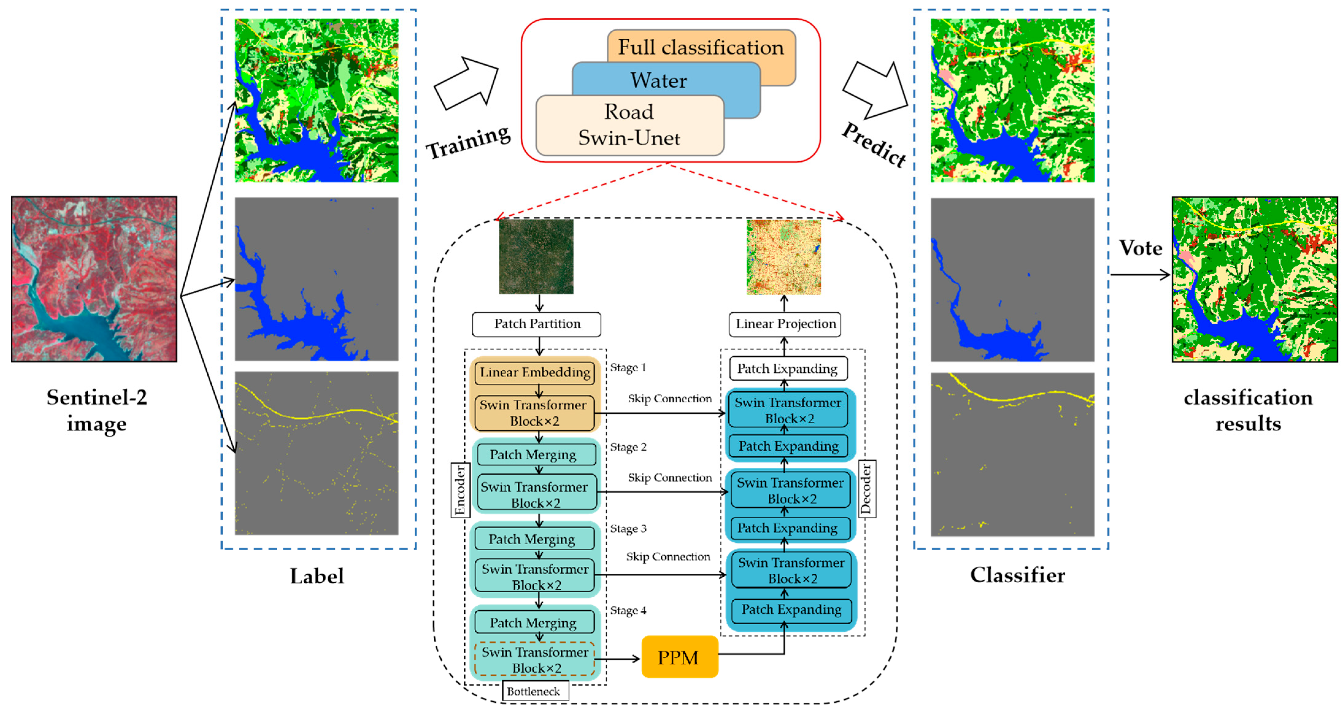
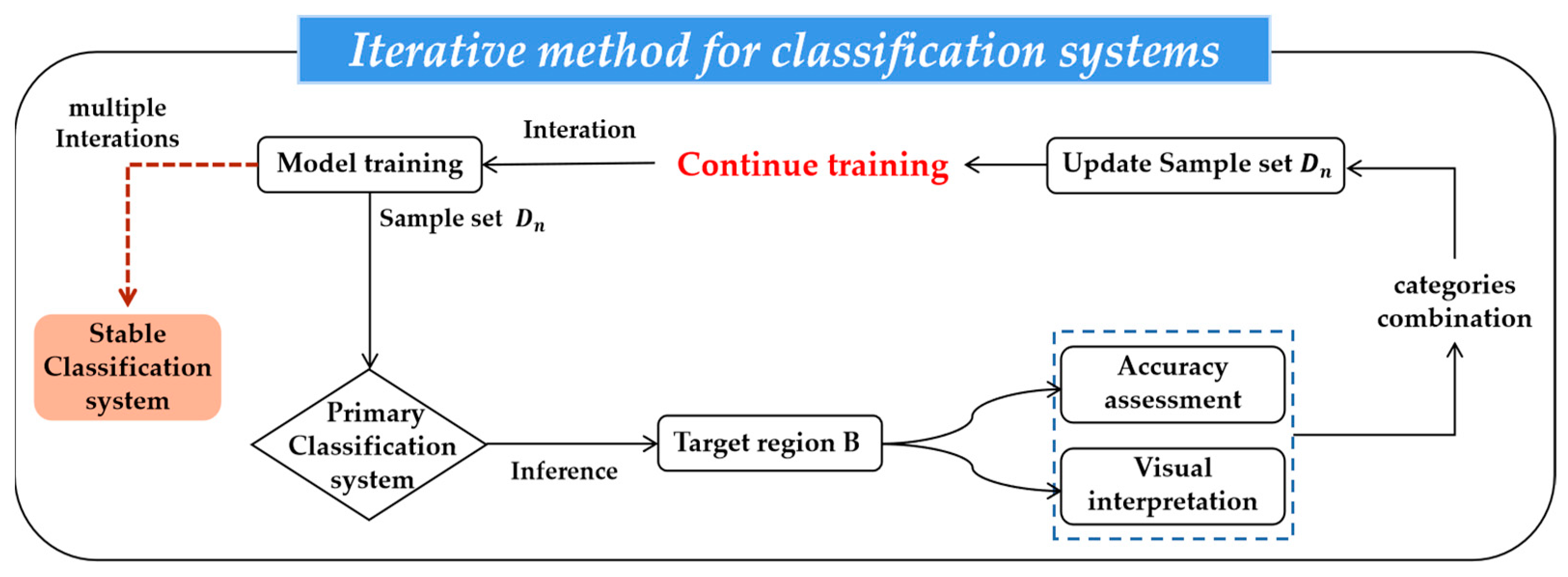
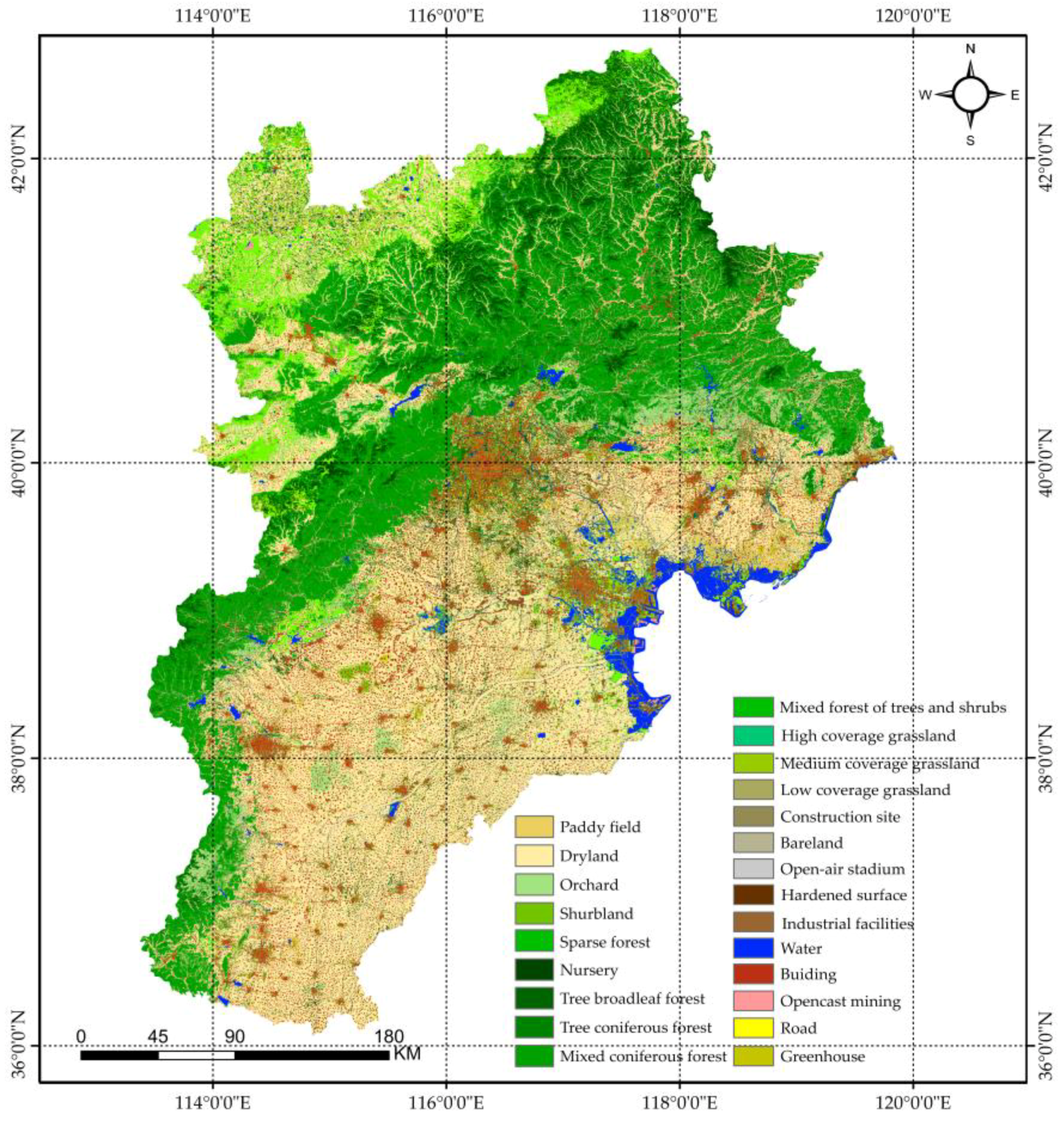
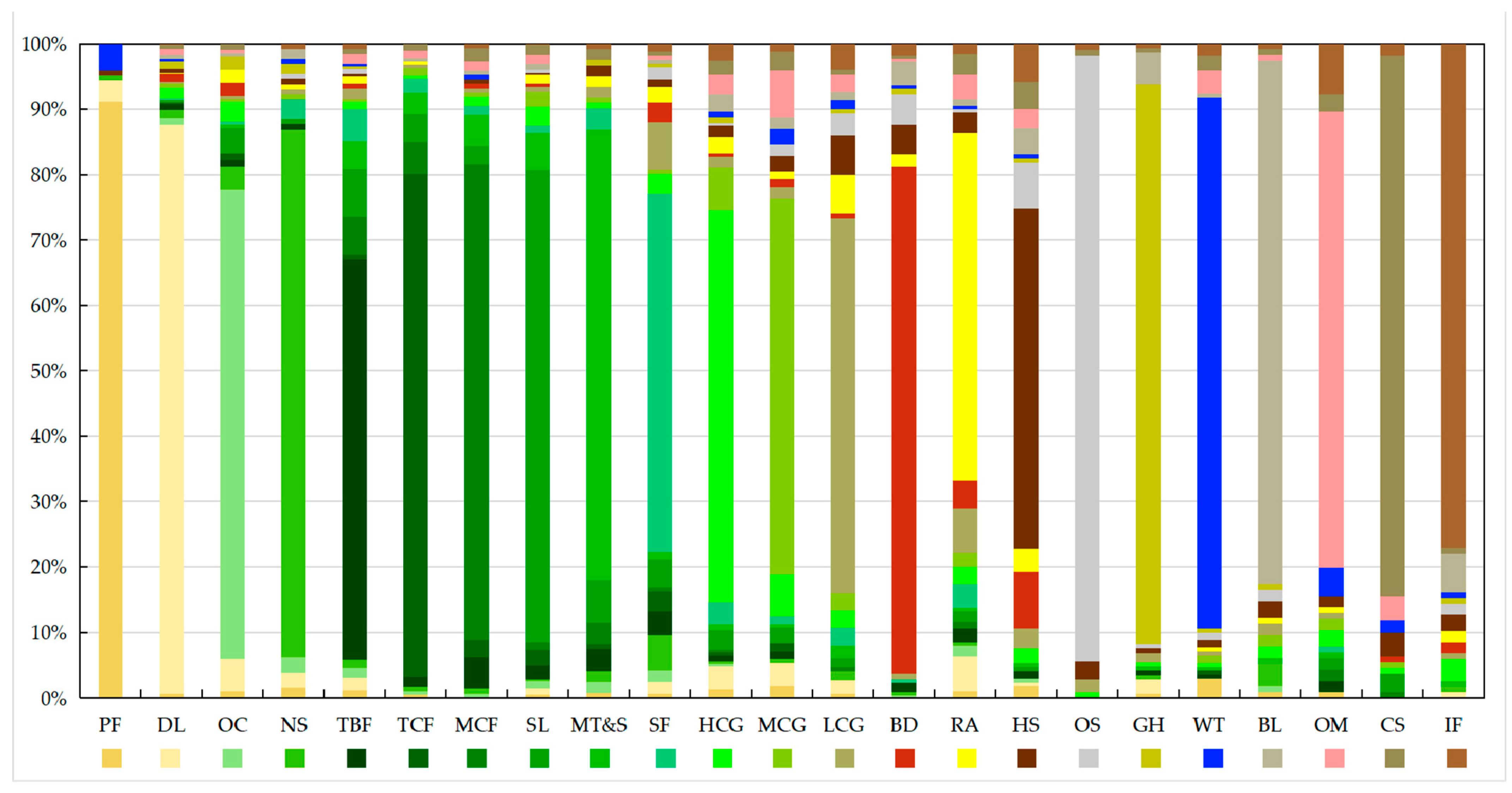
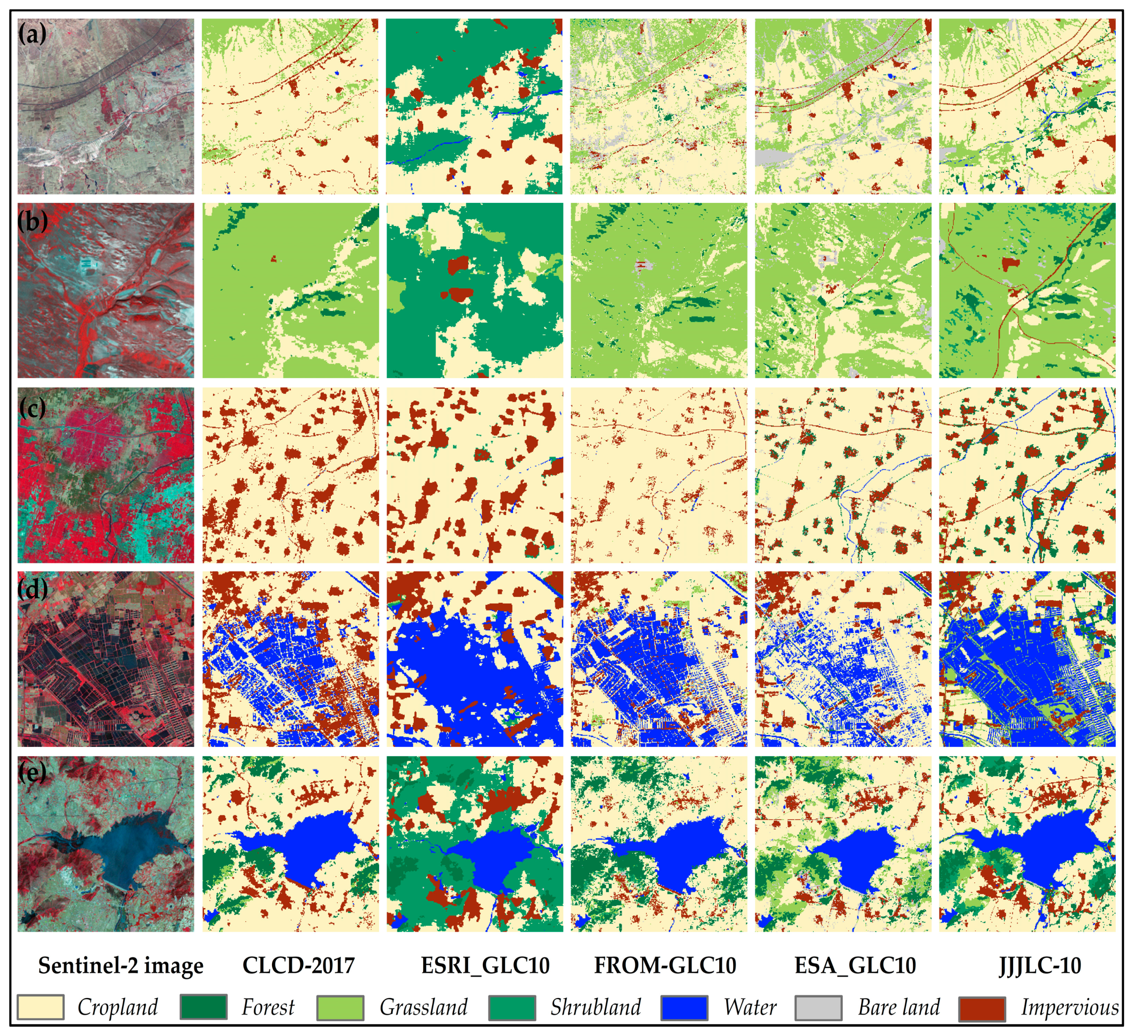
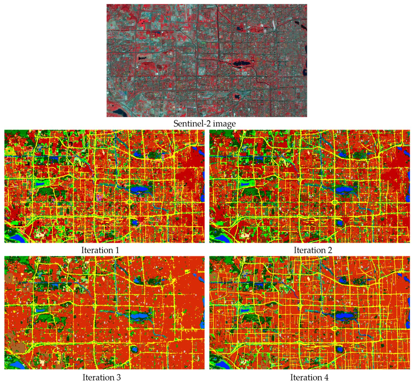
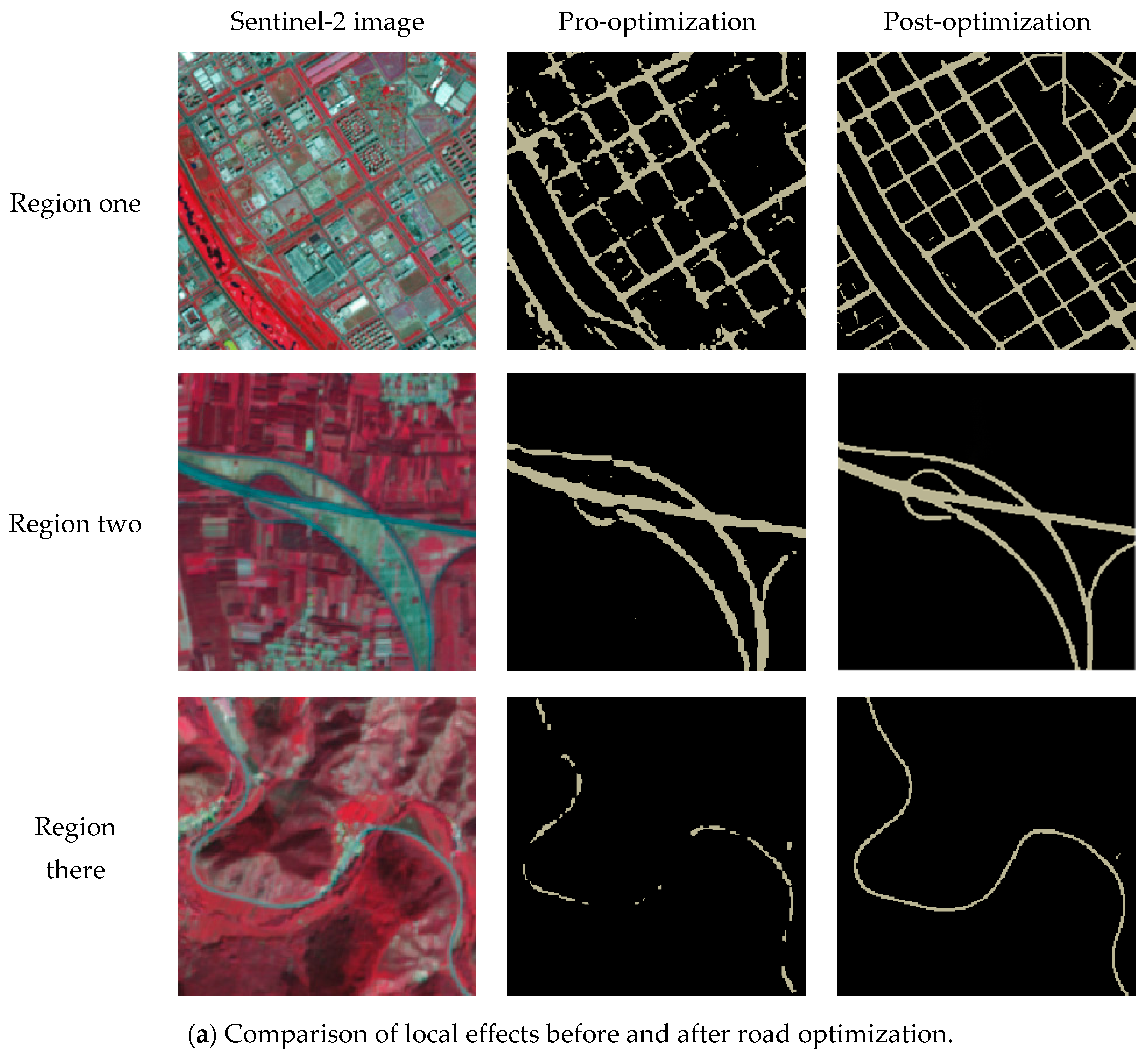
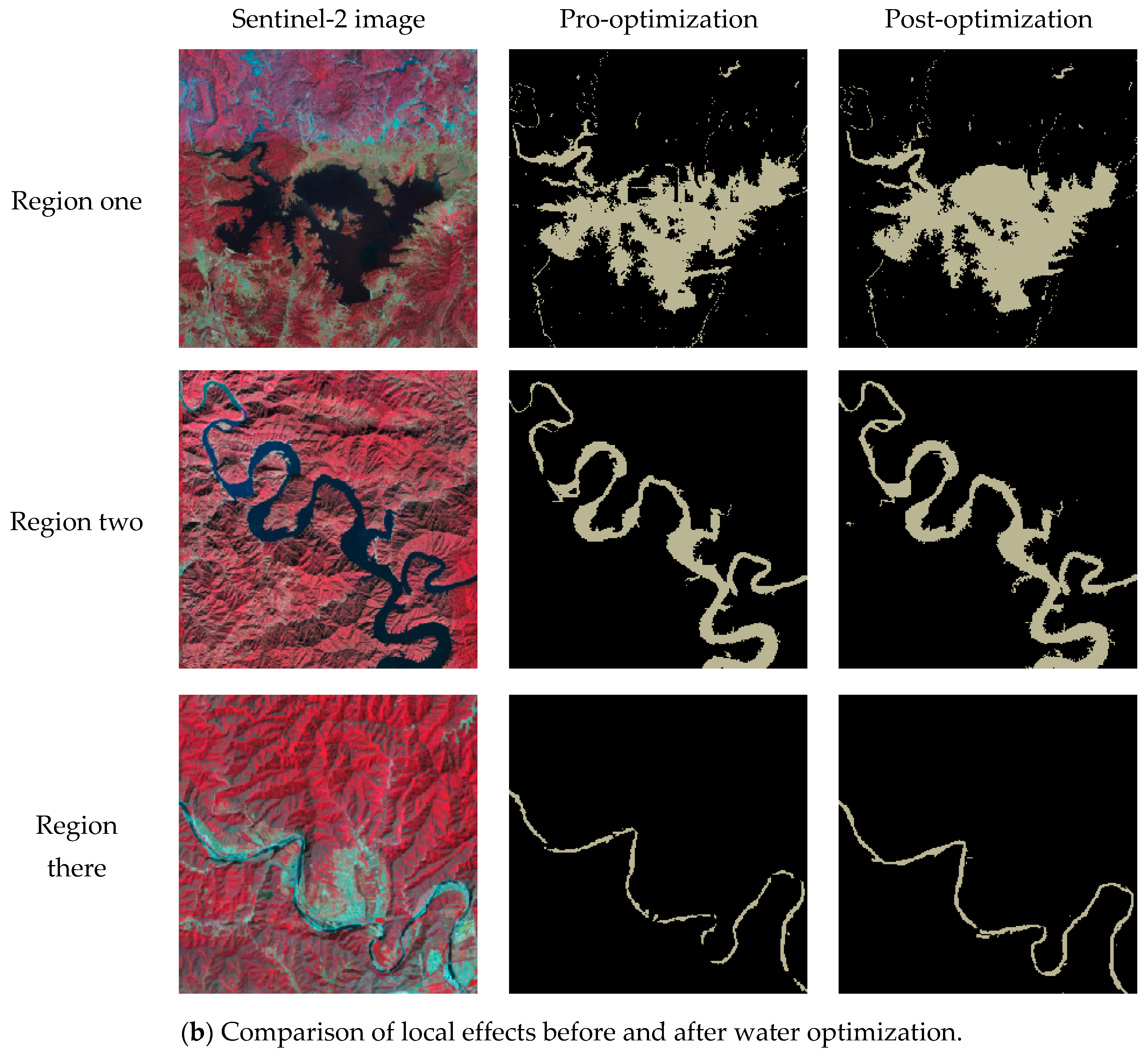
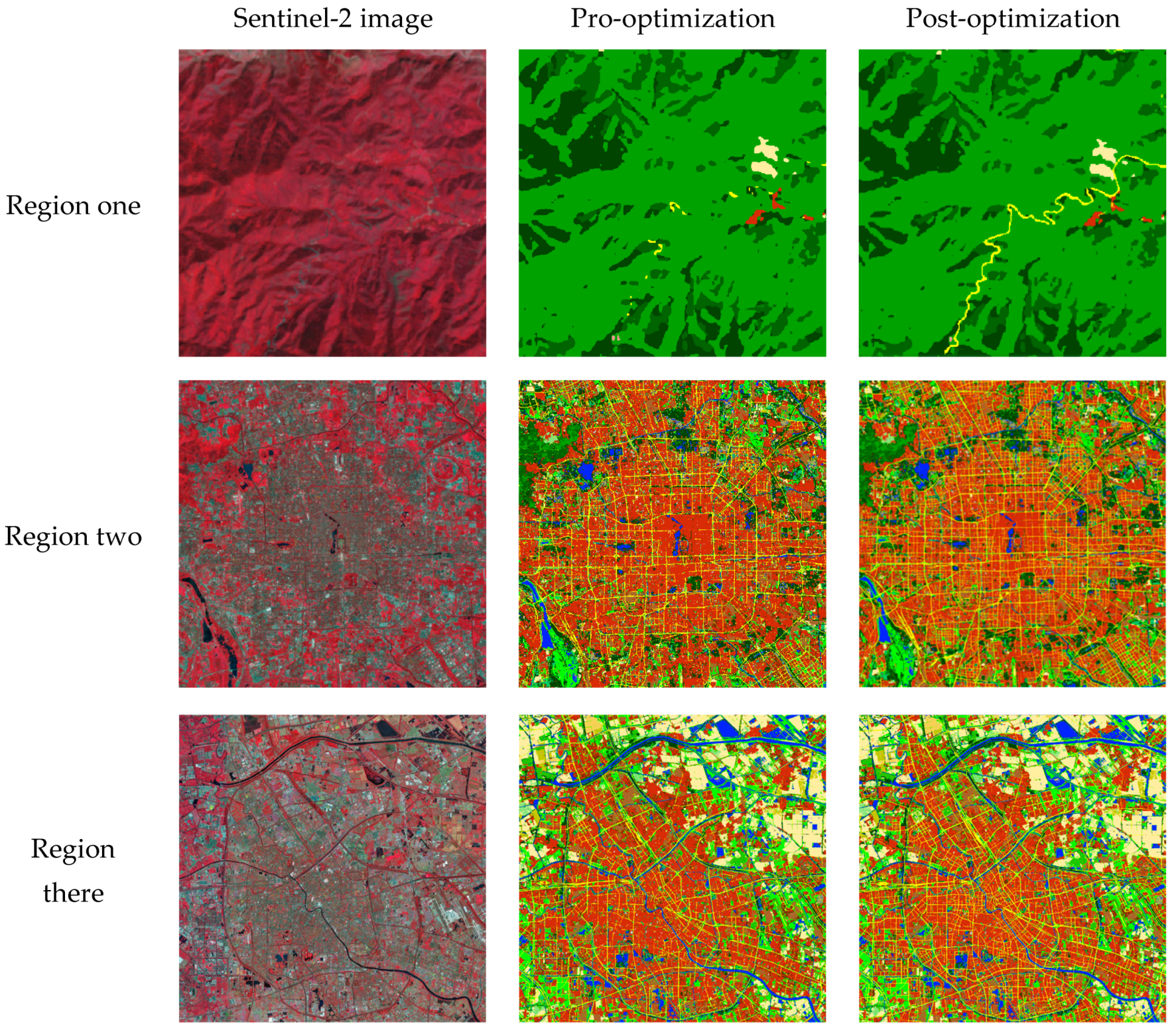
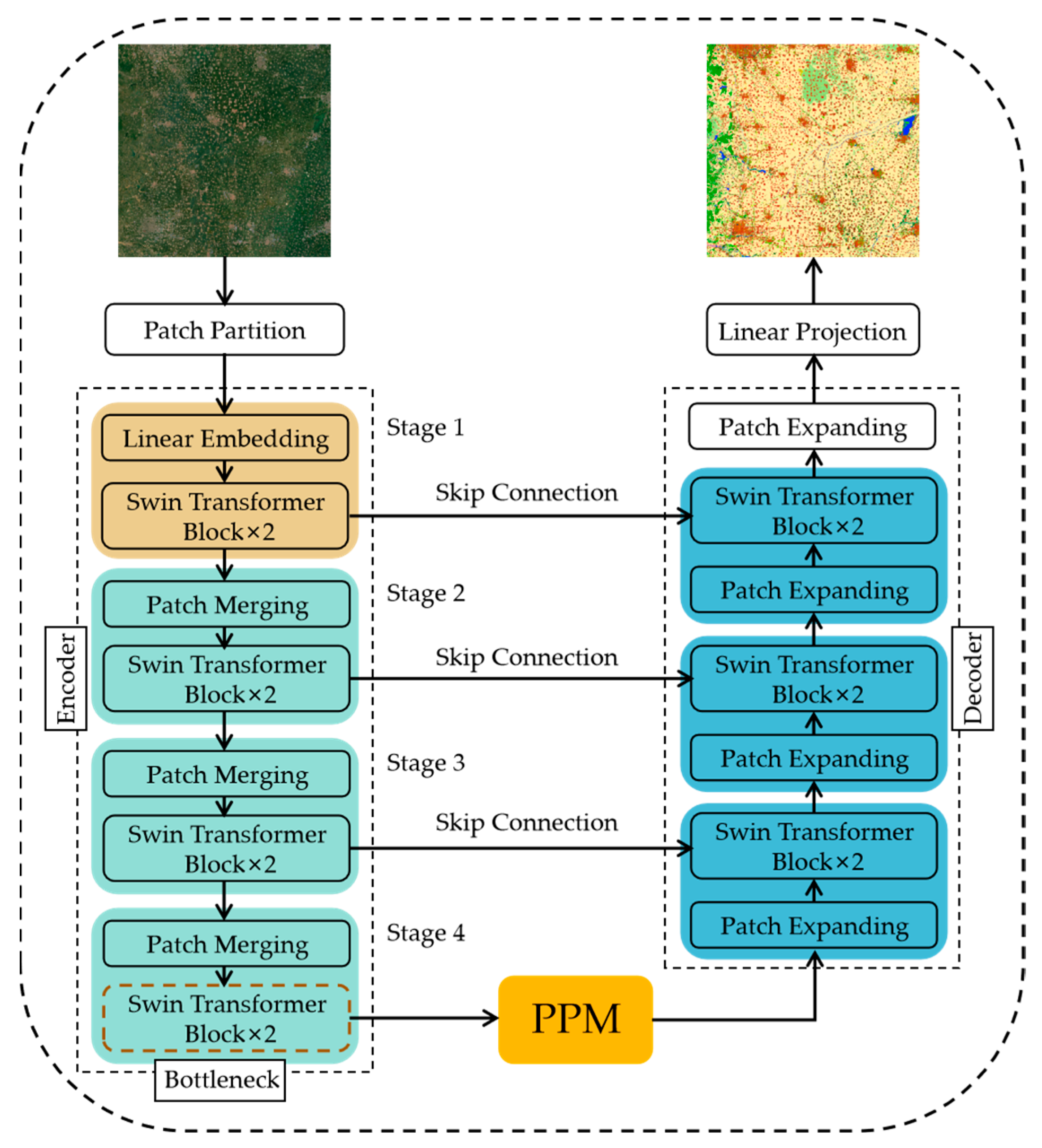
Land-cover mapping plays a crucial role in resource detection, ecological environmental protection, and sustainable development planning. The existing large-scale land-cover products with coarse spatial resolution have a wide range of categories, but they suffer from low mapping accuracy. Conversely, land-cover products with fine spatial resolution tend to lack diversity in the types of land cover they encompass. Currently, there is a lack of large-scale land-cover products simultaneously possessing fine-grained classifications and high accuracy. Therefore, we propose a mapping framework for fine-grained land-cover classification. Firstly, we propose an iterative method for developing fine-grained classification systems, establishing a classification system suitable for Sentinel-2 data based on the target area. This system comprises 23 fine-grained land-cover types and achieves the most stable mapping results. Secondly, to address the challenges in large-scale scenes, such as varying scales of target features, imbalanced sample quantities, and the weak connectivity of slender features, we propose an improved network based on Swin-UNet. This network incorporates a pyramid pooling module and a weighted combination loss function based on class balance. Additionally, we independently trained models for roads and water. Guided by the natural spatial relationships, we used a voting algorithm to integrate predictions from these independent models with the full classification model. Based on this framework, we created the 2017 Beijing–Tianjin–Hebei regional fine-grained land-cover product JJJLC-10. Through validation using 4254 sample datasets, the results indicate that JJJLC-10 achieves an overall accuracy of 80.3% in the I-level validation system (covering seven land-cover types) and 72.2% in the II-level validation system (covering 23 land-cover types), with kappa coefficients of 0.7602 and 0.706, respectively. In comparison with widely used land-cover products, JJJLC-10 excels in accurately depicting the spatial distribution of various land-cover types and exhibits significant advantages in terms of classification quantity and accuracy.
Keywords: land-cover mapping; fine-grained classification; Beijing–Tianjin–Hebei region; Sentinel-2 images; stable classification system land-cover mapping; fine-grained classification; Beijing–Tianjin–Hebei region; Sentinel-2 images; stable classification system
Graphical Abstract