Article

Estimating Leaf Area Index in Apple Orchard by UAV Multispectral Images with Spectral and Texture Information

1
College of Natural Resources and Environment, Northwest A&F University, Xianyang 712100, China
2
Key Laboratory of Plant Nutrition and Agri-Environment in Northwest China, Ministry of Agriculture, Xianyang 712100, China
*
Author to whom correspondence should be addressed.
Remote Sens. 2024, 16(17), 3237; https://doi.org/10.3390/rs16173237
Submission received: 1 August 2024 / Revised: 28 August 2024 / Accepted: 30 August 2024 / Published: 31 August 2024
(This article belongs to the Special Issue Application of Satellite and UAV Data in Precision Agriculture)

Abstract

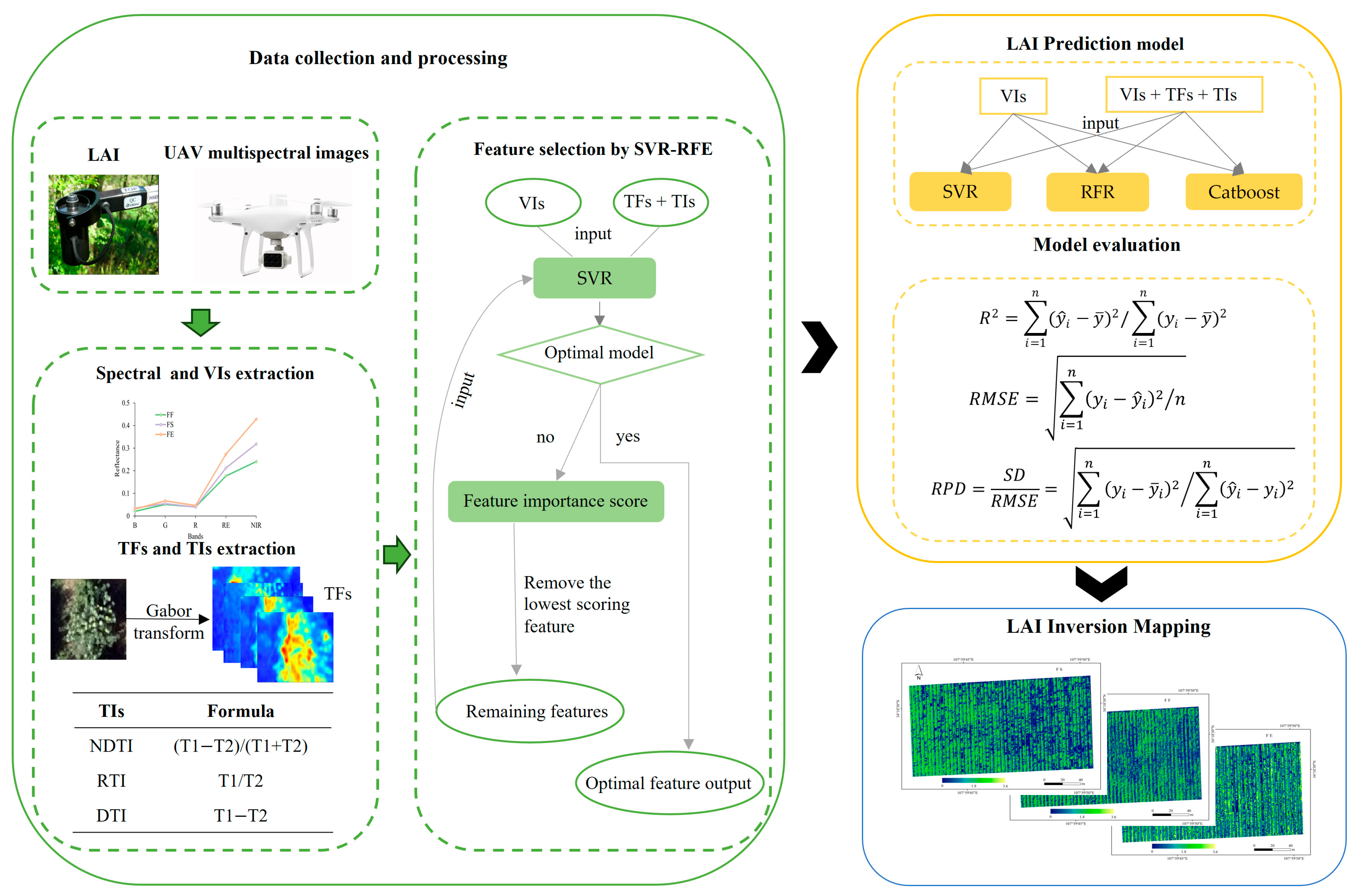
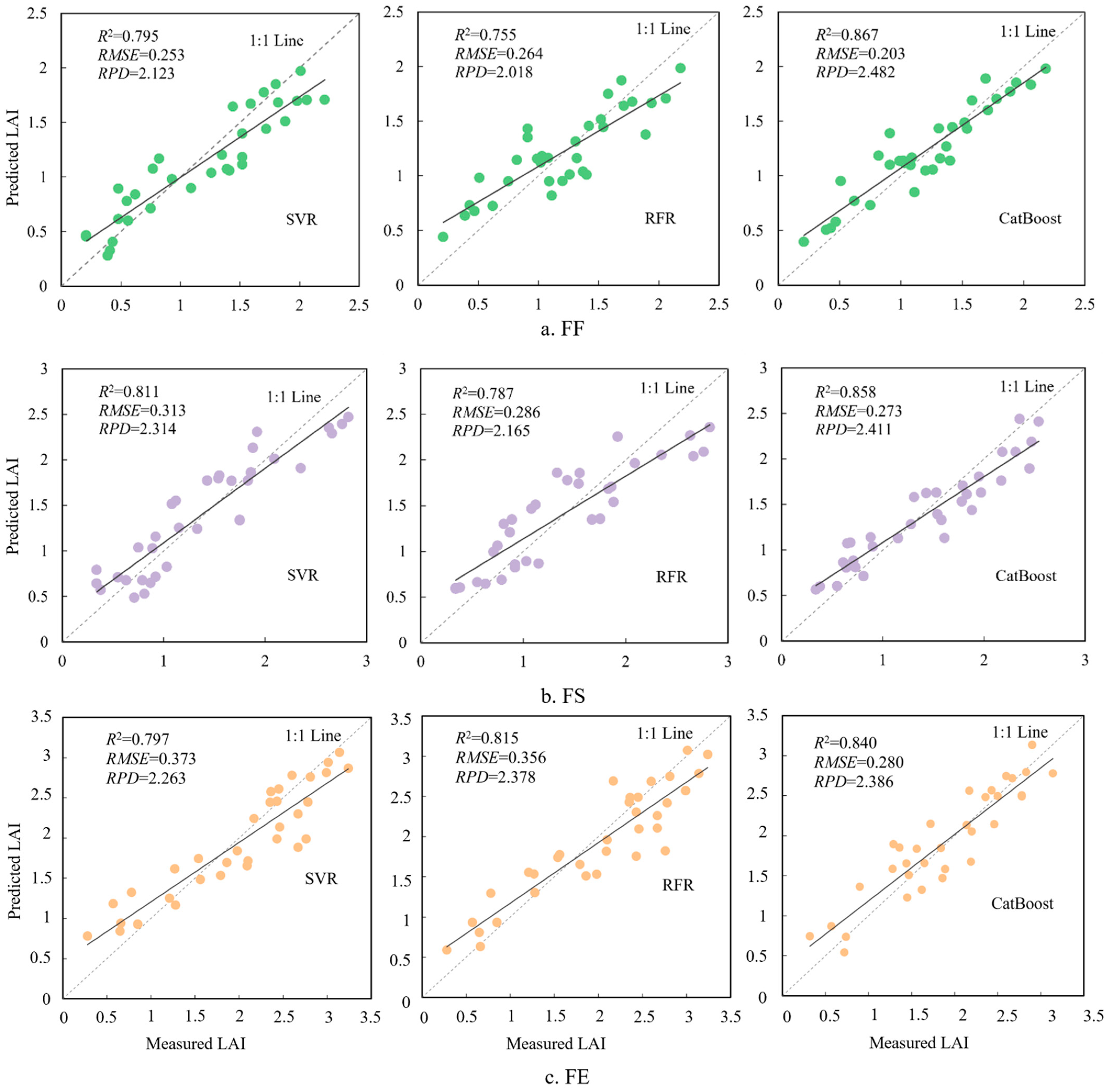
The Leaf Area Index (LAI) strongly influences vegetation evapotranspiration and photosynthesis rates. Timely and accurately estimating the LAI is crucial for monitoring vegetation growth. The unmanned aerial vehicle (UAV) multispectral digital camera platform has been proven to be an effective tool for this purpose. Currently, most remote sensing estimations of LAIs focus on cereal crops, with limited research on economic crops such as apples. In this study, a method for estimating the LAI of an apple orchard by extracting spectral and texture information from UAV multispectral images was proposed. Specifically, field measurements were conducted to collect LAI data for 108 sample points during the final flowering (FF), fruit setting (FS), and fruit expansion (FE) stages of apple growth in 2023. Concurrently, UAV multispectral images were obtained to extract spectral and texture information (Gabor transform). The Support Vector Regression Recursive Feature Elimination (SVR-REF) was employed to select optimal features as inputs for constructing models to estimate the LAI. Finally, the optimal model was used for LAI mapping. The results indicate that integrating spectral and texture information effectively enhances the accuracy of LAI estimation, with the relative prediction deviation (RPD) for all models being greater than 2. The Categorical Boosting (CatBoost) model established for FF exhibits the highest accuracy, with a validation set R2, root mean square error (RMSE), and RPD of 0.867, 0.203, and 2.482, respectively. UAV multispectral imagery proves to be valuable in estimating apple orchard LAIs, offering real-time monitoring of apple growth and providing a scientific basis for orchard management.
Keywords: LAI; UAV multispectral images; gabor transform; apple orchard; CatBoost LAI; UAV multispectral images; gabor transform; apple orchard; CatBoost