Article

Monitoring Land Use Changes in the Yellow River Delta Using Multi-Temporal Remote Sensing Data and Machine Learning from 2000 to 2020

1
School of Geography, Nanjing Normal University, Nanjing 210046, China
2
Key Laboratory of Digital Earth Science, Aerospace Information Research Institute, Chinese Academy of Sciences, Beijing 100094, China
3
International Research Center of Big Data for Sustainable Development Goals, Beijing 100094, China
4
University of Chinese Academy of Sciences, Beijing 100049, China
5
College of Land Science and Technology, China Agricultural University, Beijing 100193, China
6
Indian Council of Forestry Research and Education (ICFRE), Dehradun 248006, India
7
State Key Laboratory of Information Engineering in Surveying, Mapping and Remote Sensing, Wuhan University, Wuhan 430079, China
8
Department of Wildlife, Fisheries and Aquaculture, College of the Forest Resources, Mississippi State University, Starkville, MS 39762-9690, USA
9
State Key Laboratory of Efficient Utilization of Arid and Semi-Arid Arable Land in Northern China, Institute of Agricultural Resources and Regional Planning, Chinese Academy of Agricultural Sciences, Beijing 100081, China
10
Airborne Remote Sensing Center, Aerospace Information Research Institute, Chinese Academy of Sciences, Beijing 100094, China
*
Author to whom correspondence should be addressed.
Remote Sens. 2024, 16(11), 1946; https://doi.org/10.3390/rs16111946
Submission received: 3 April 2024 / Revised: 21 May 2024 / Accepted: 23 May 2024 / Published: 28 May 2024

Abstract

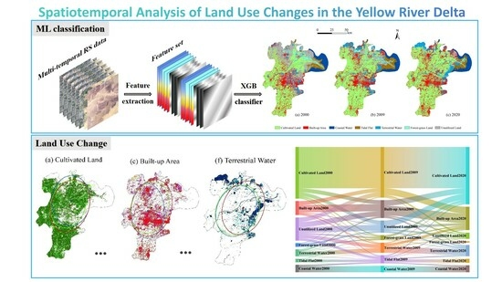
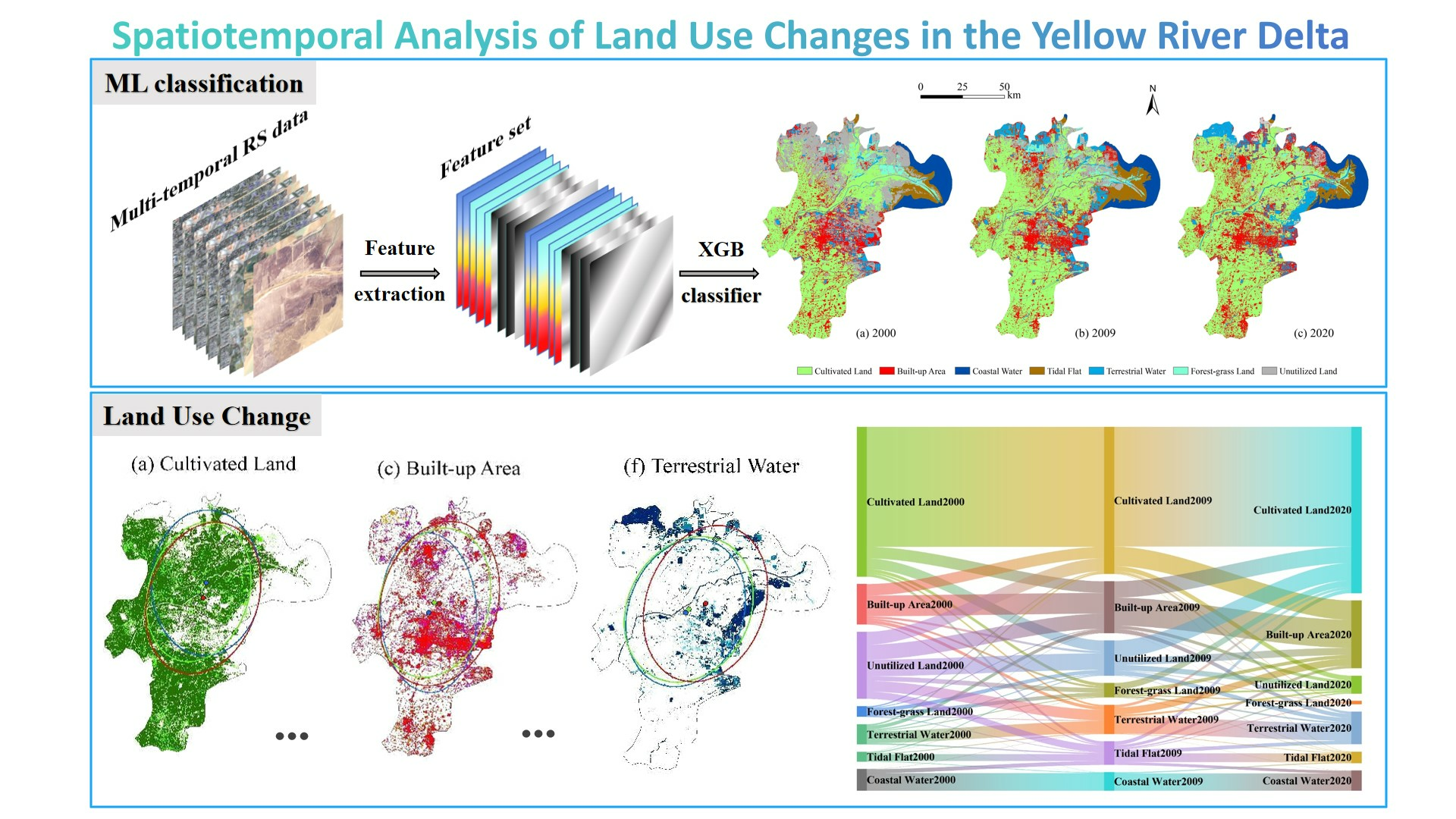
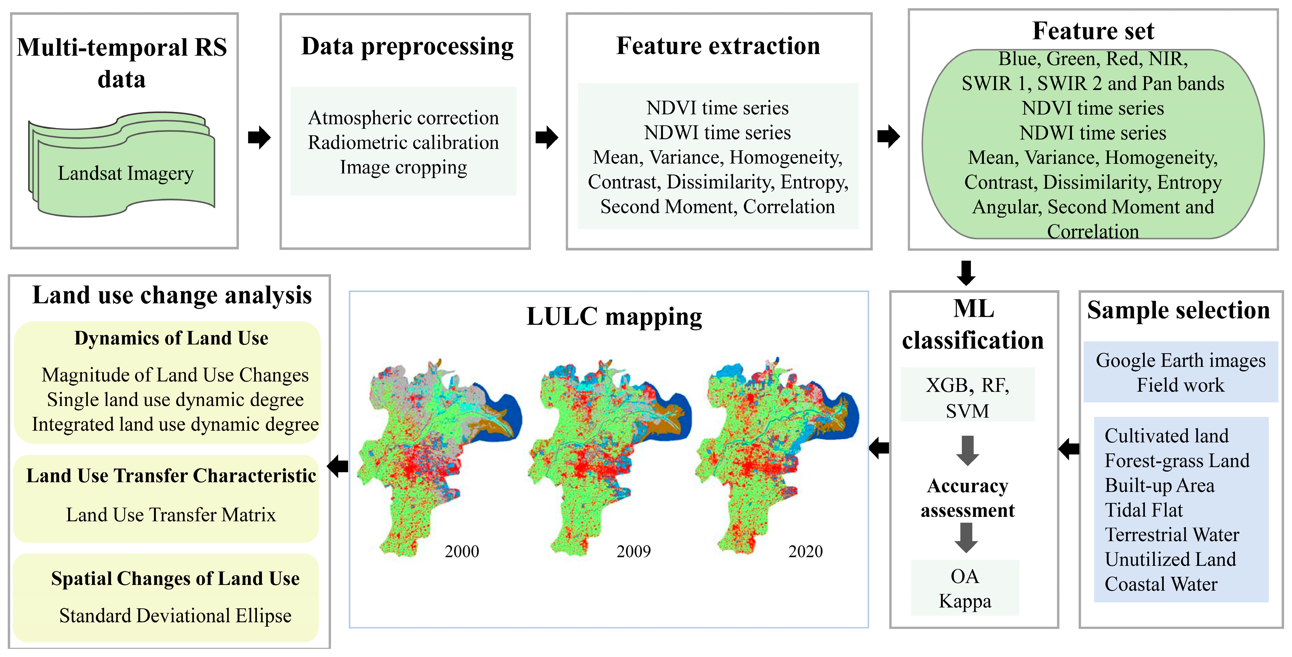
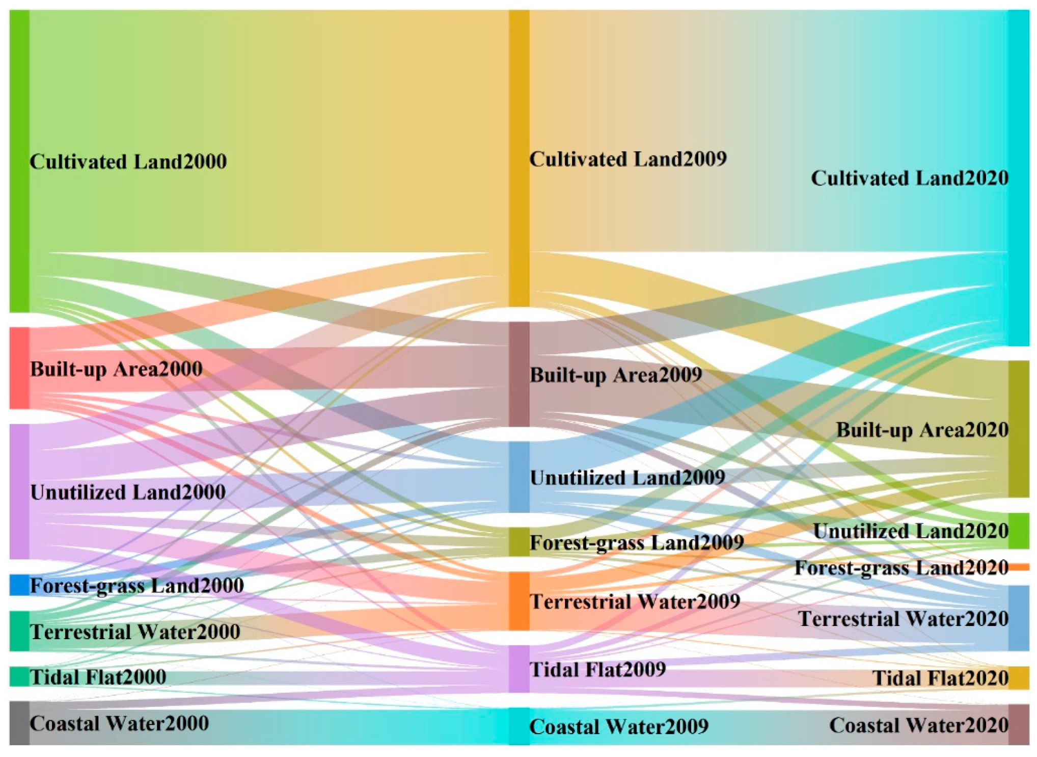
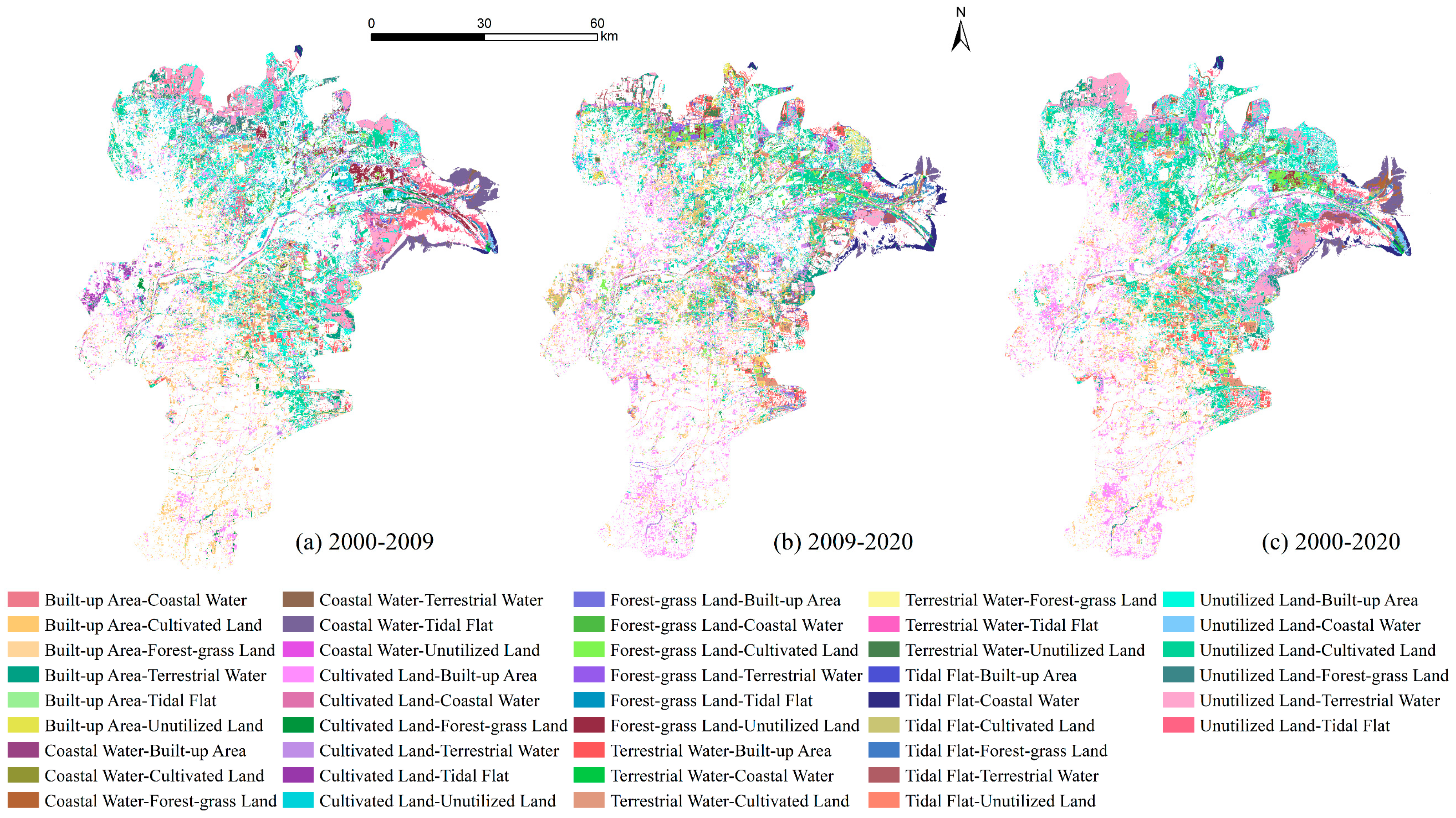
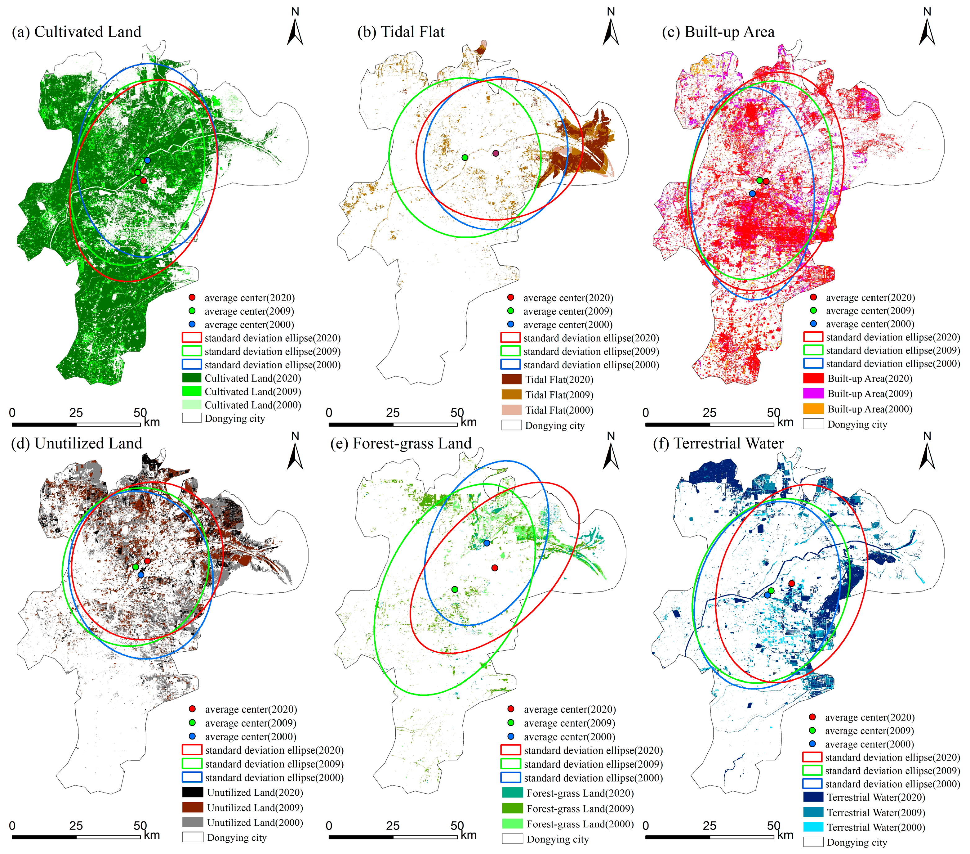
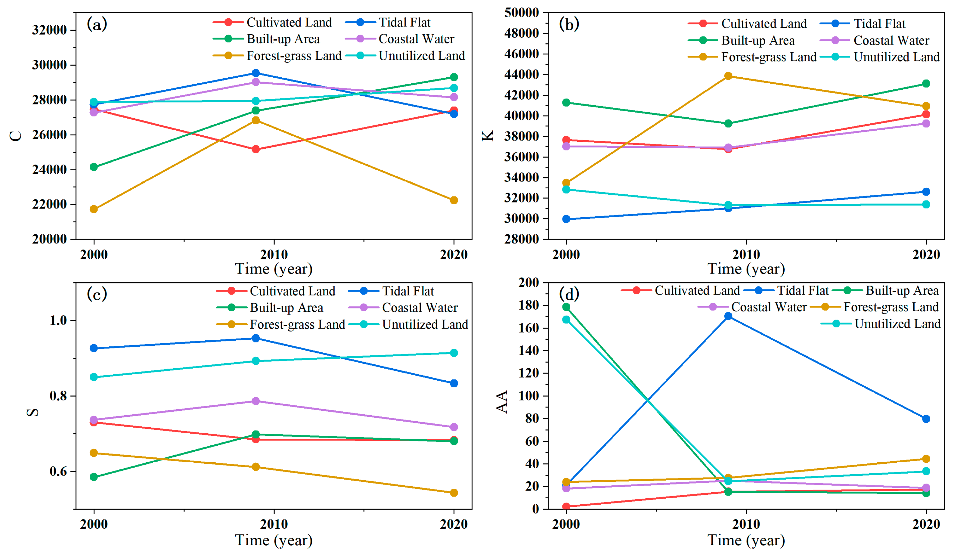
The Yellow River Delta (YRD), known for its vast and diverse wetland ecosystem, is the largest estuarine delta in China. However, human activities and climate change have significantly degraded the wetland ecosystem in recent decades in the YRD. Therefore, an understanding of the land use modifications is essential for the efficient management and preservation of ecosystems in this region. This study utilized time series of remote sensing data and the extreme gradient boosting method to generate land use maps of the YRD from 2000 to 2020. Several methods, including transition matrix, land use dynamic degree, and standard deviation ellipse, were employed to explore the characteristics of land use transitions. The results underscore significant spatial variations in land use over the past two decades. The most rapid increase was observed in built-up area, followed by terrestrial water and tidal flats, while unutilized land experienced the fastest decrease, followed by forest–grassland. The spatial distribution patterns of agricultural land, built-up area, terrestrial water, and forest–grassland demonstrated stronger directionality compared to other land use types. The wetlands have expanded in size and improved in structure. Unutilized land has been converted into artificial wetlands comprising ponds, reservoirs, salt ponds, shrimp and crab ponds, and natural wetlands featuring mudflats and forest–grassland. The wetland conservation efforts after 2008 have proven very effective, playing a positive role in ecological and environmental preservation, as well as in regional sustainable development.
Keywords: land use change; machine learning; XGBoost; sustainable development; Yellow River Delta land use change; machine learning; XGBoost; sustainable development; Yellow River Delta
Graphical Abstract