Review

Marine Infrastructure Detection with Satellite Data—A Review

1
German Remote Sensing Data Center (DFD), Earth Observation Center (EOC), German Aerospace Center (DLR), 82234 Wessling, Germany
2
Institute of Geography and Geology, University of Wuerzburg, 97074 Würzburg, Germany
*
Author to whom correspondence should be addressed.
Remote Sens. 2024, 16(10), 1675; https://doi.org/10.3390/rs16101675
Submission received: 4 March 2024 / Revised: 3 May 2024 / Accepted: 7 May 2024 / Published: 9 May 2024
(This article belongs to the Section Ocean Remote Sensing)

Abstract

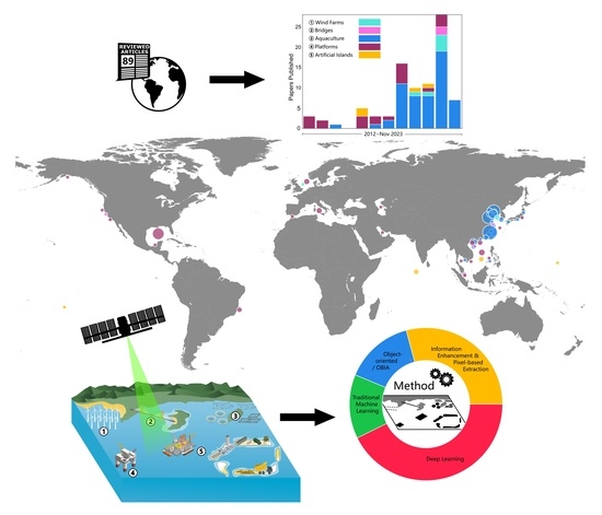
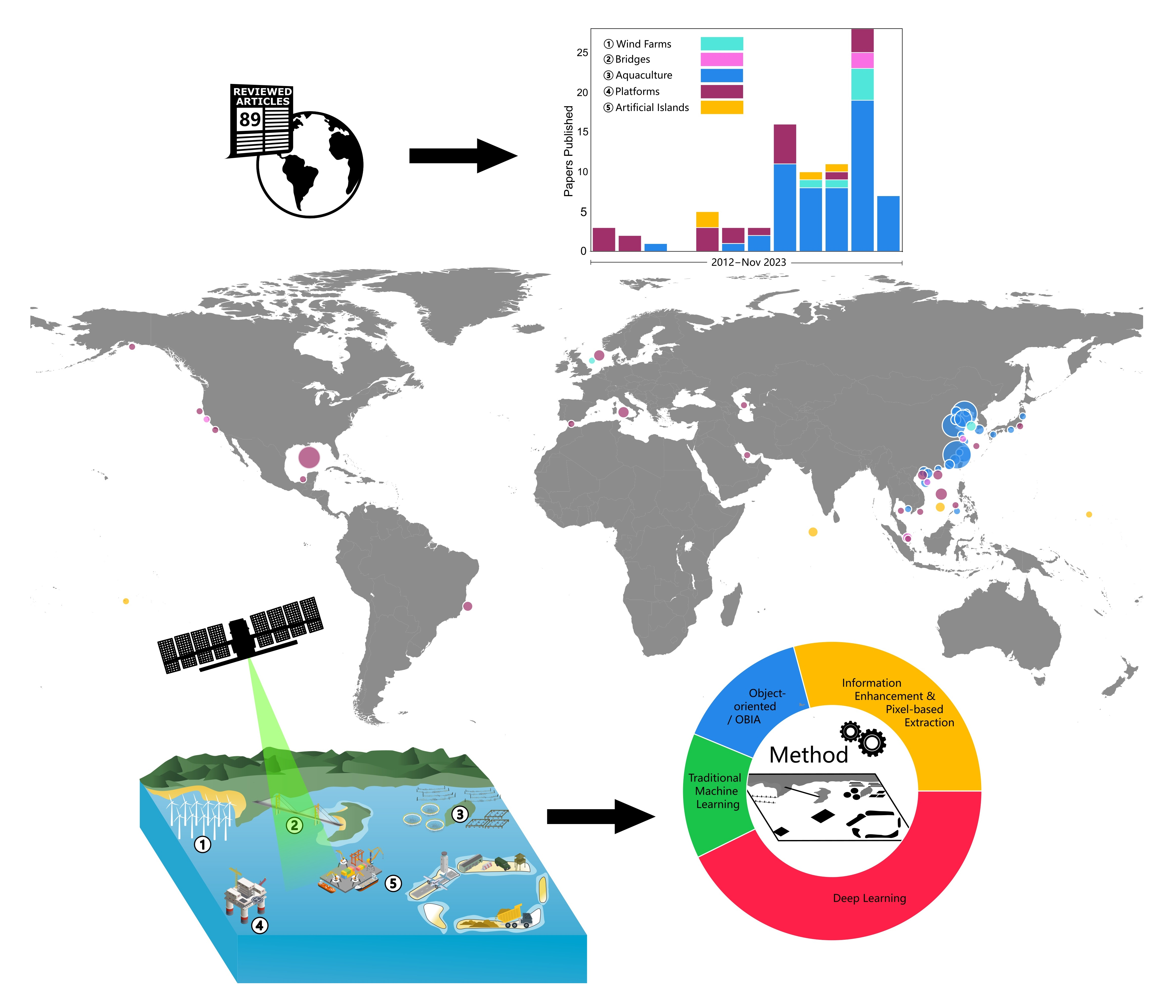
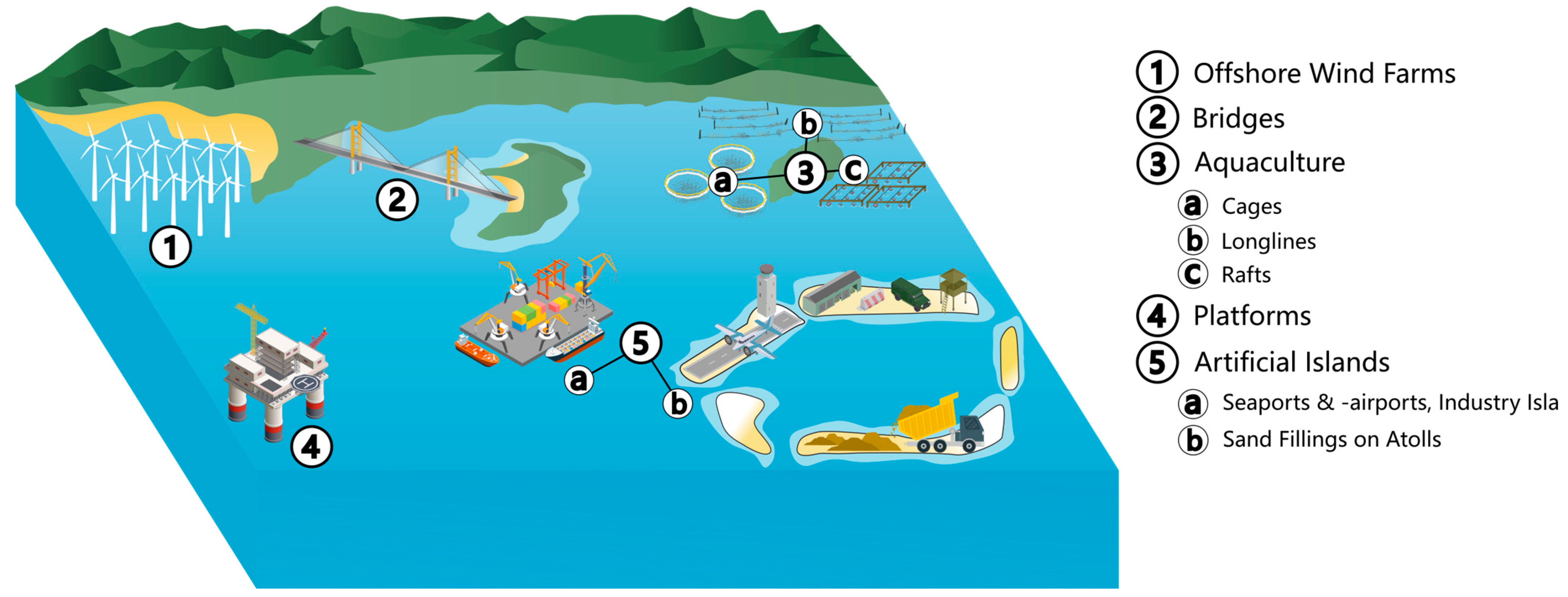
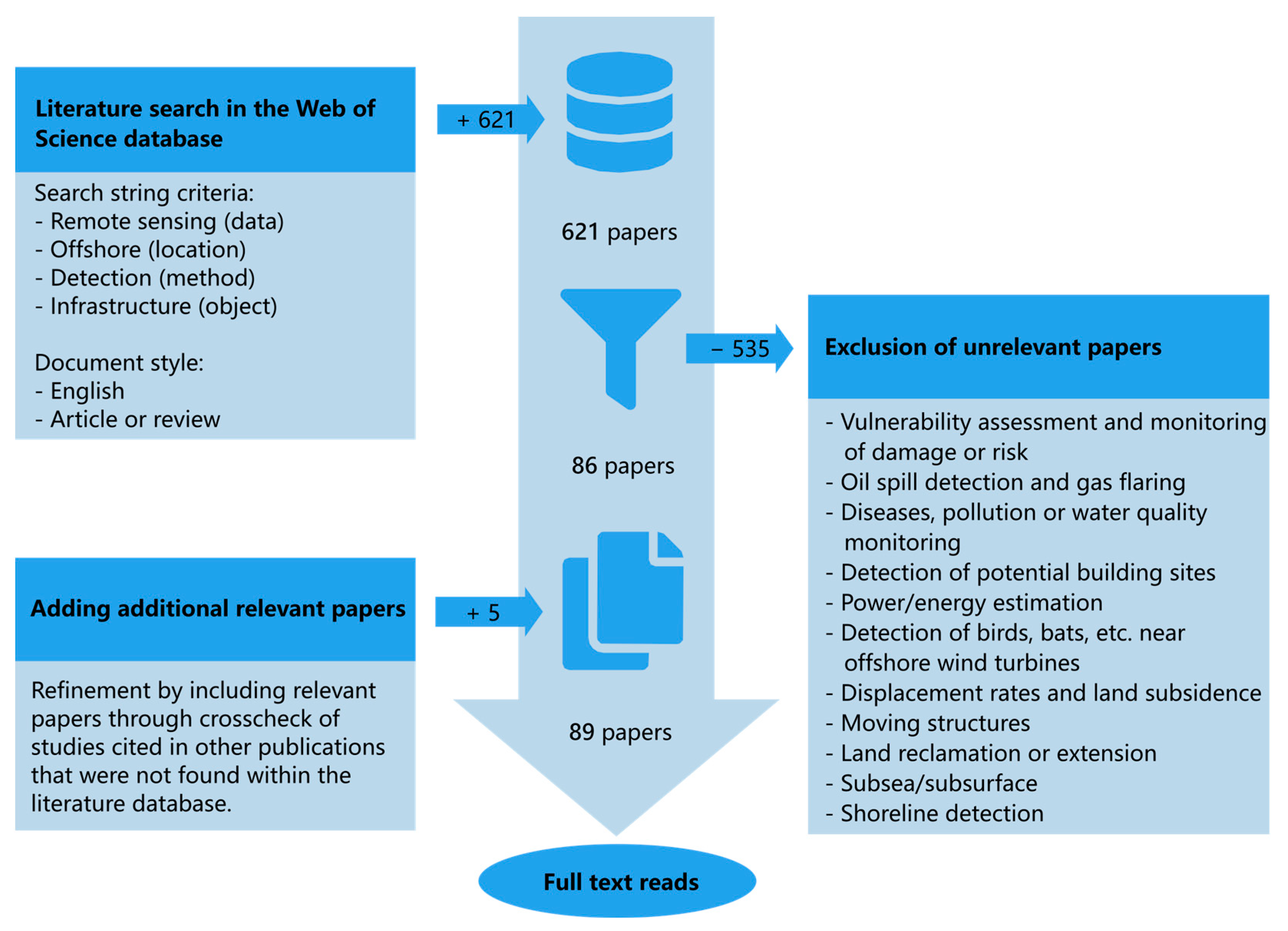
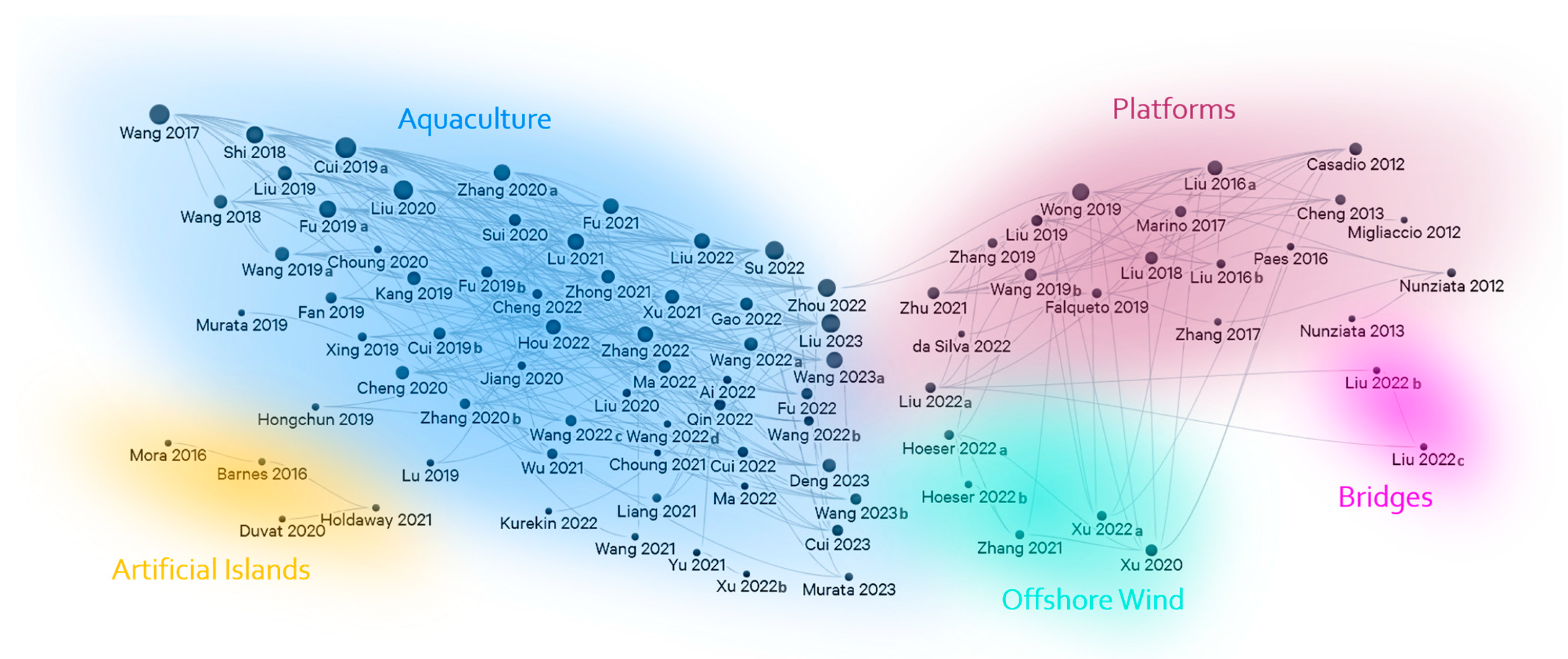
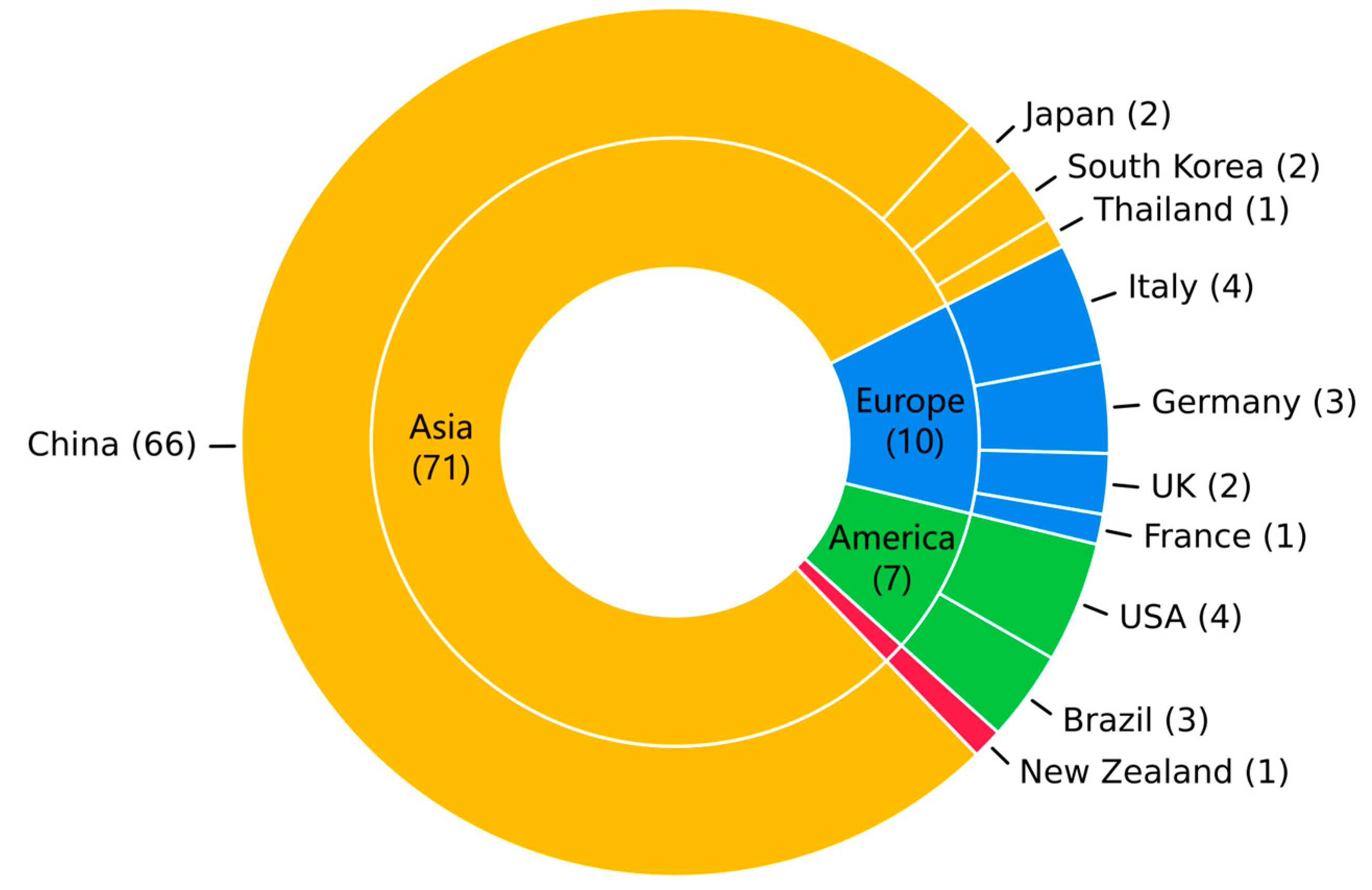
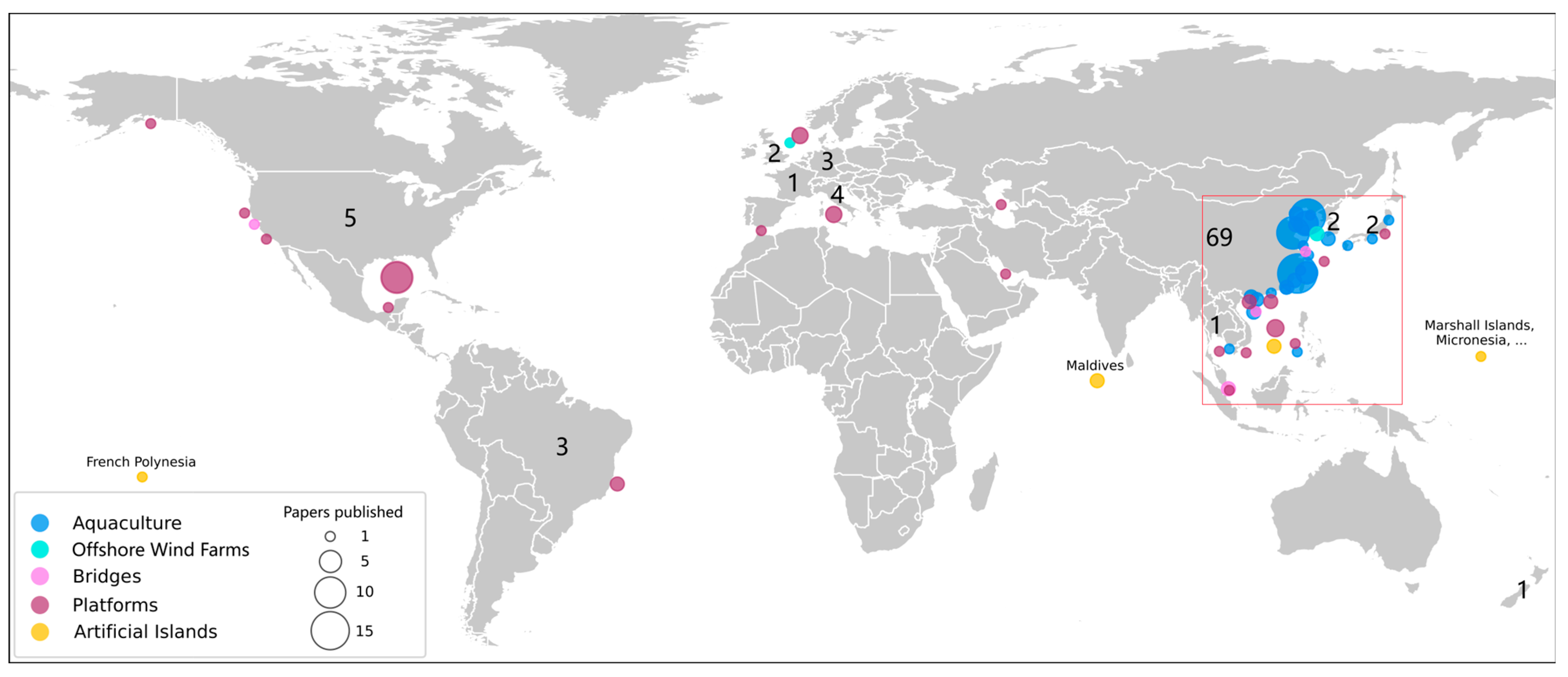
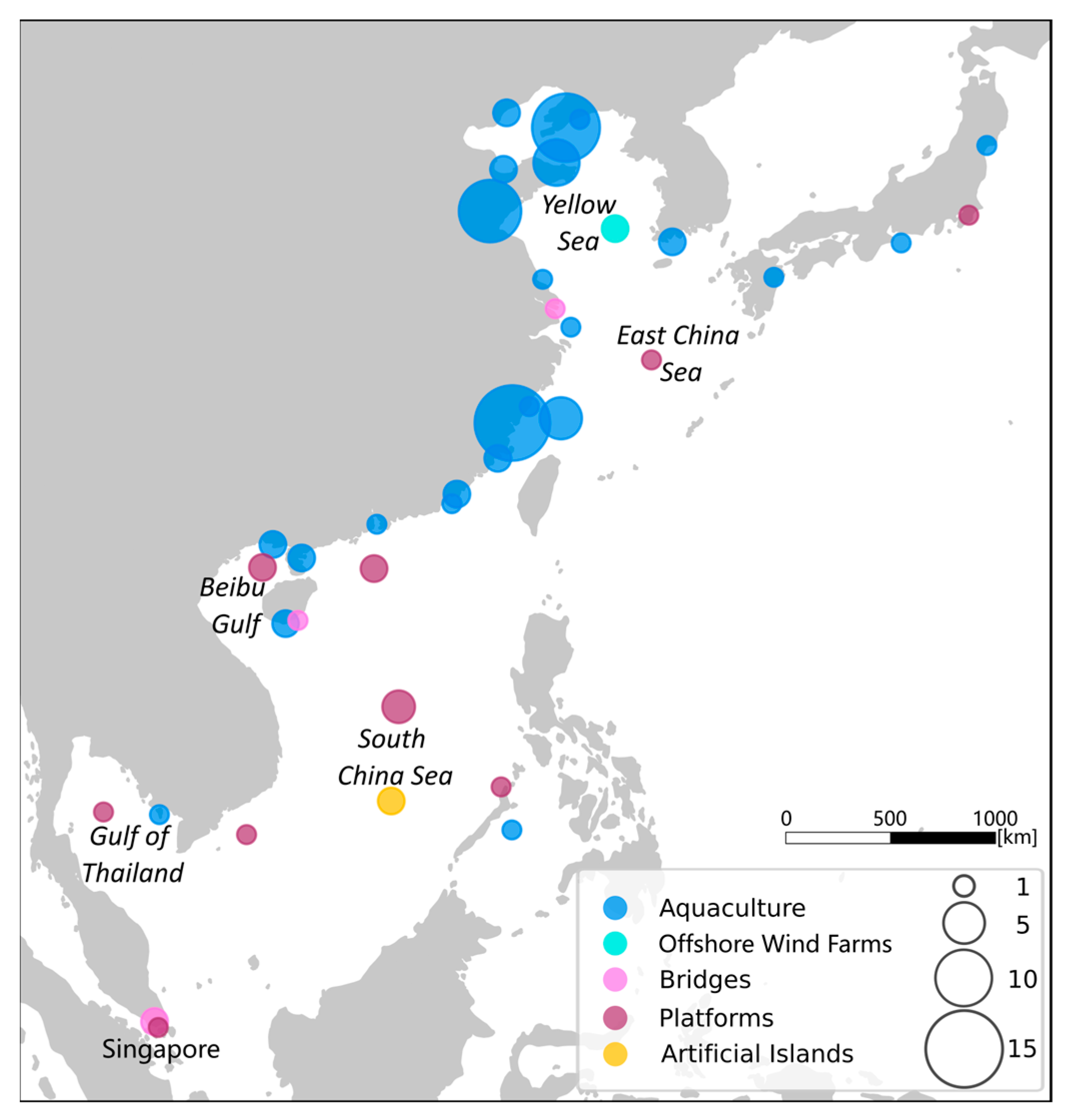
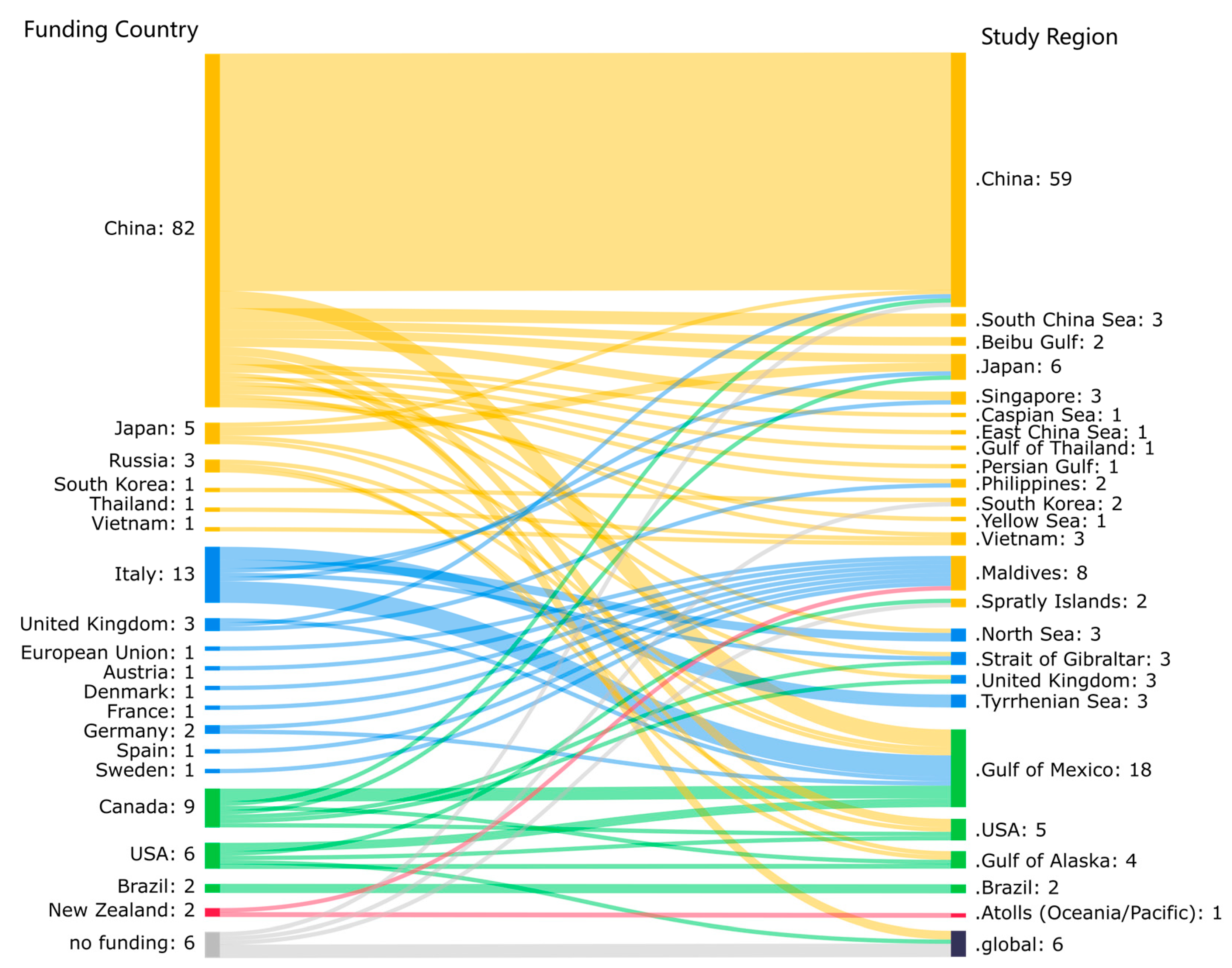
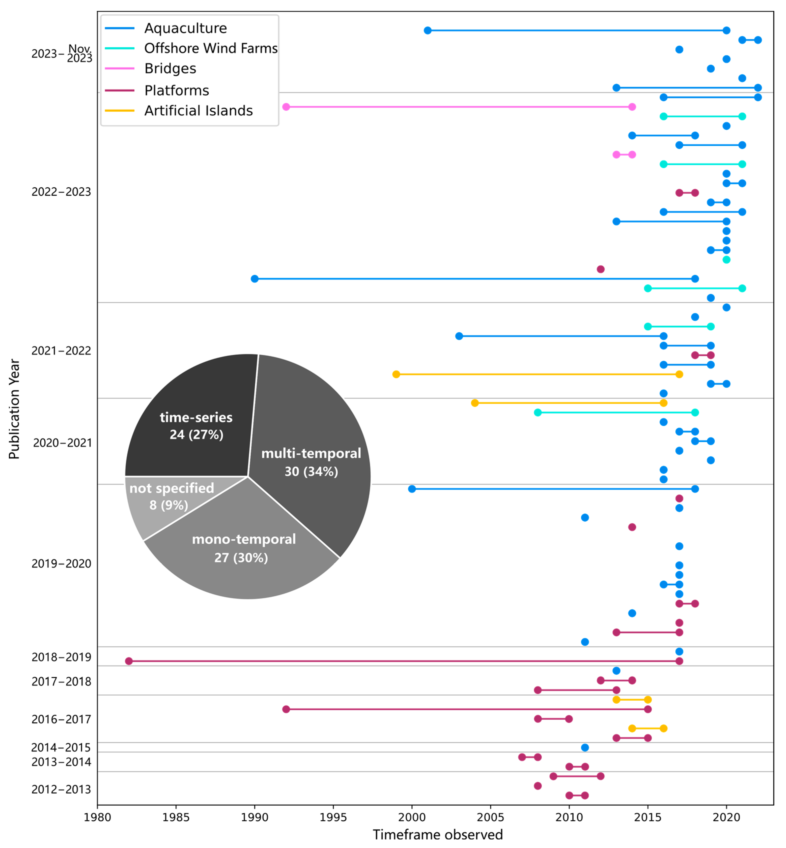
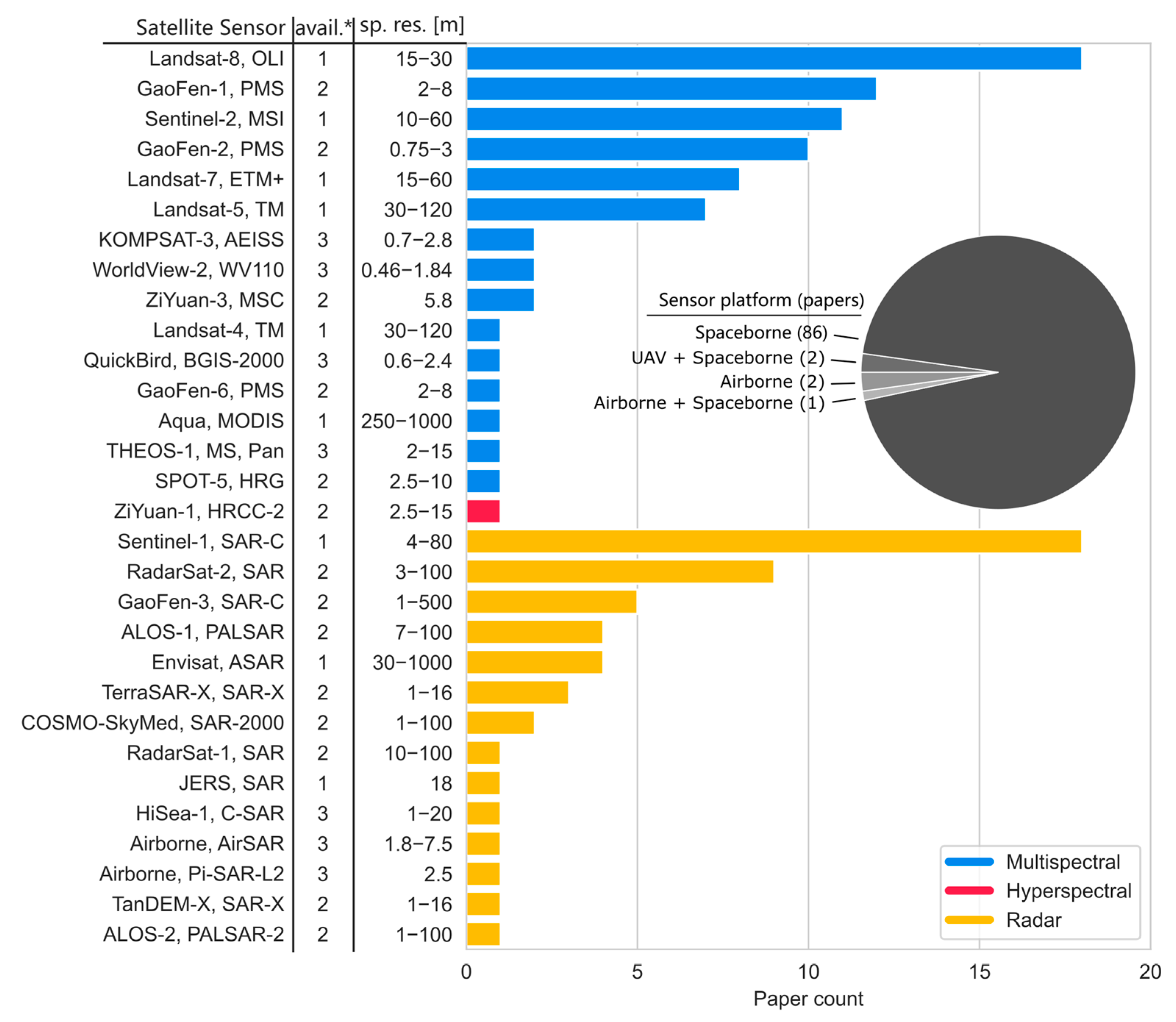
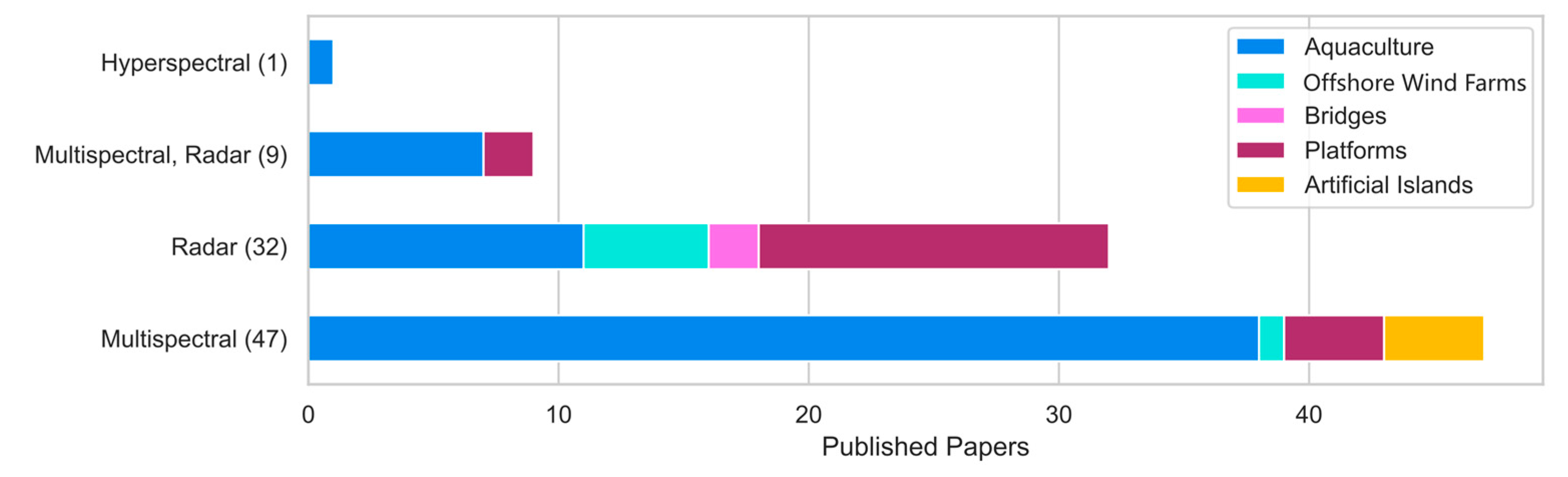
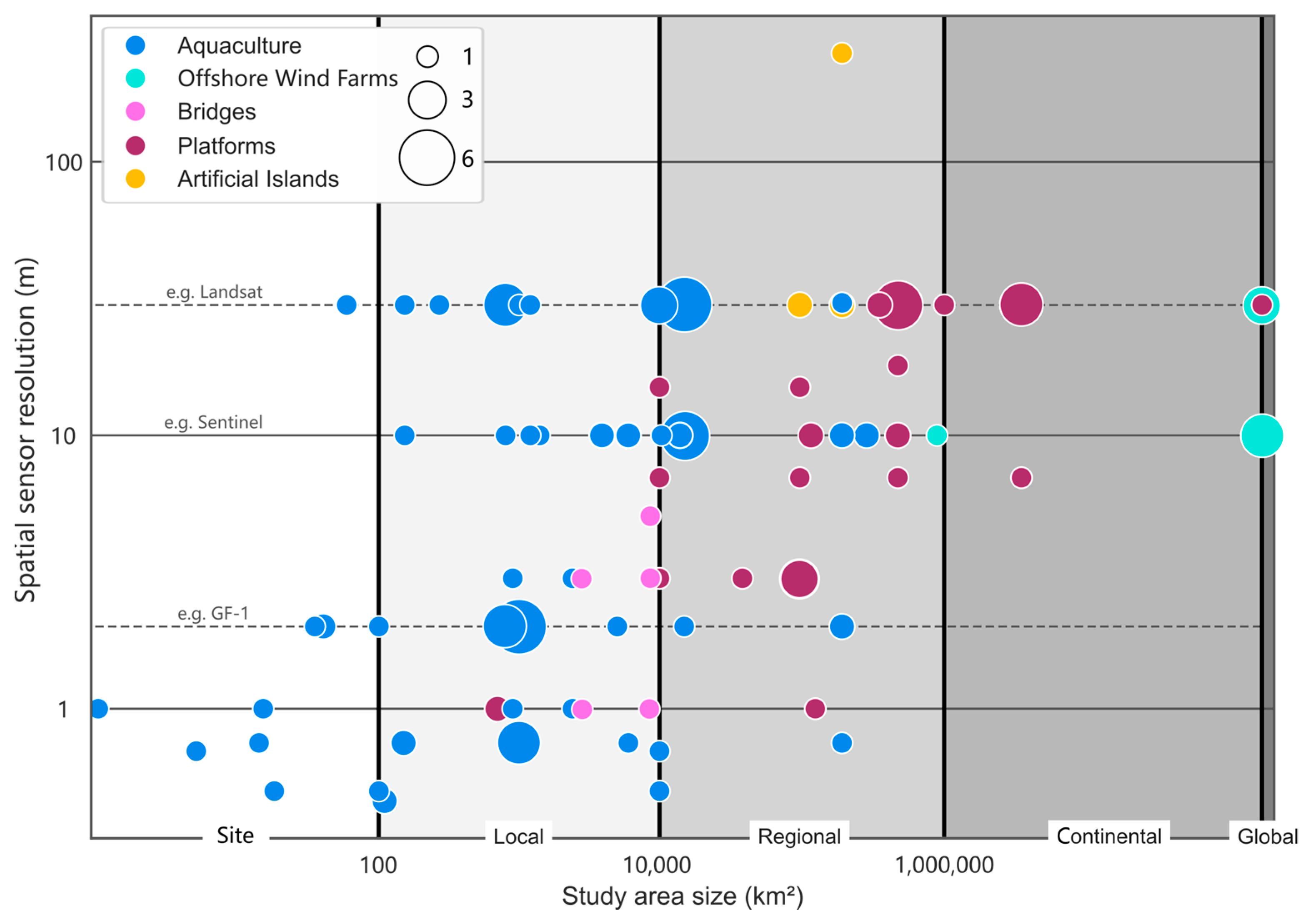
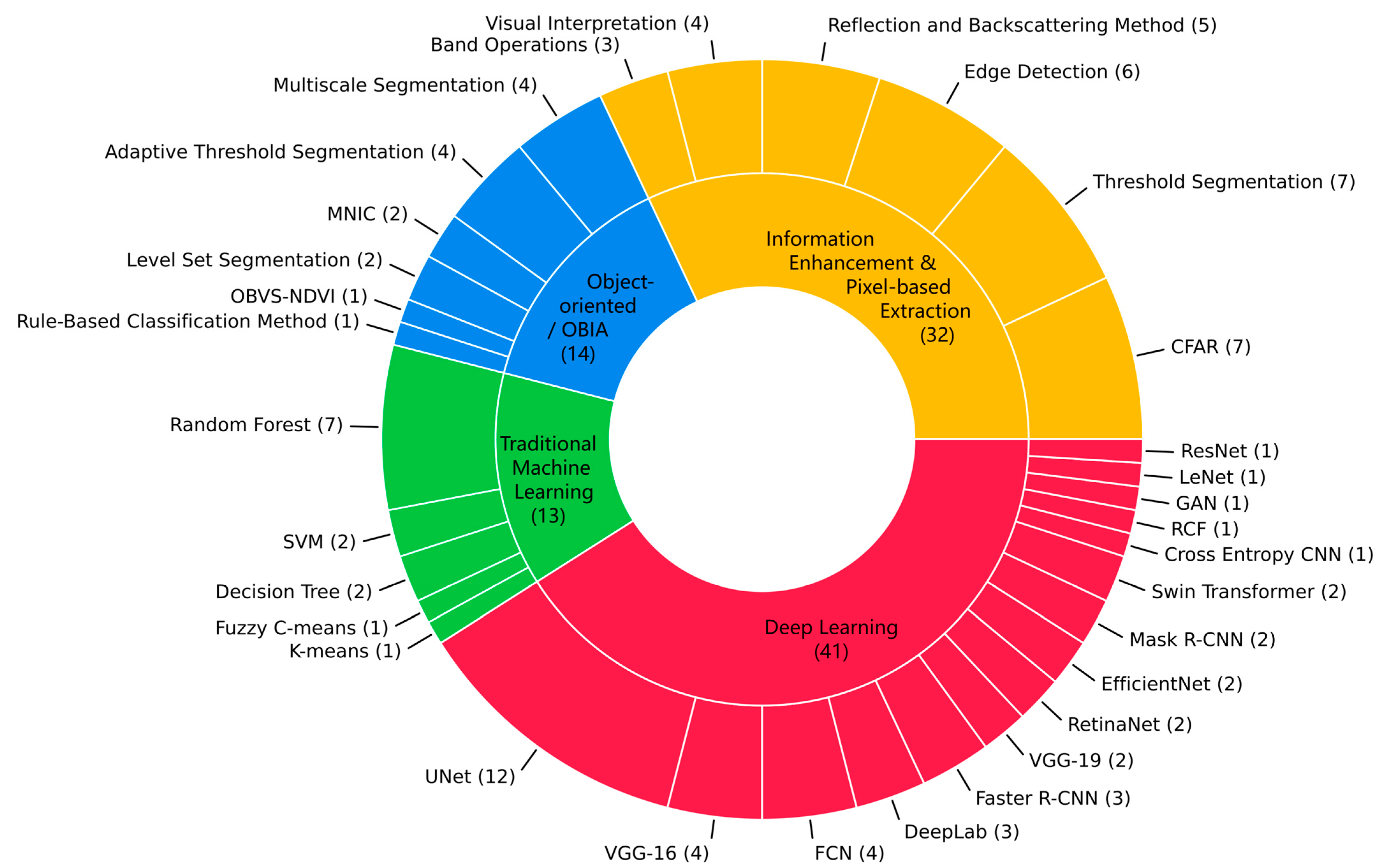
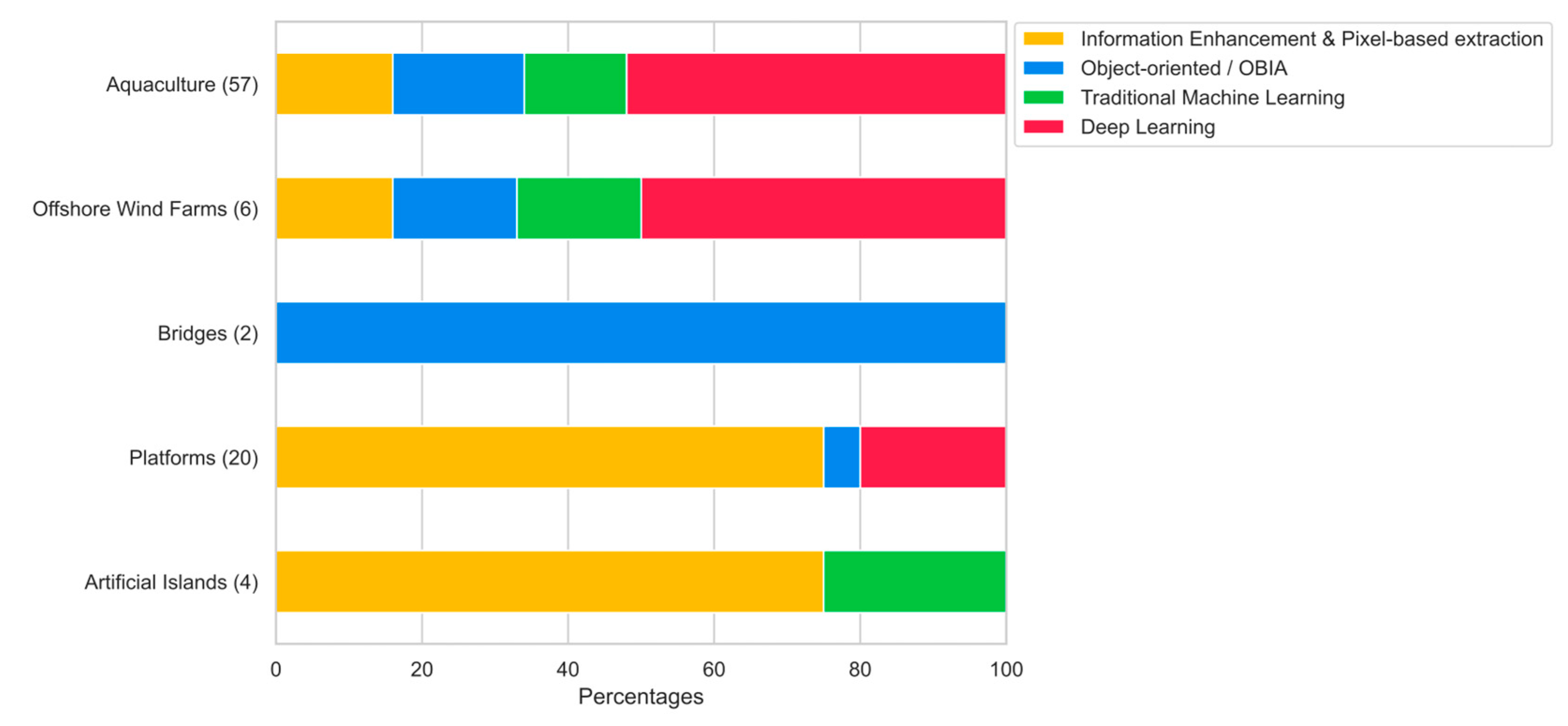
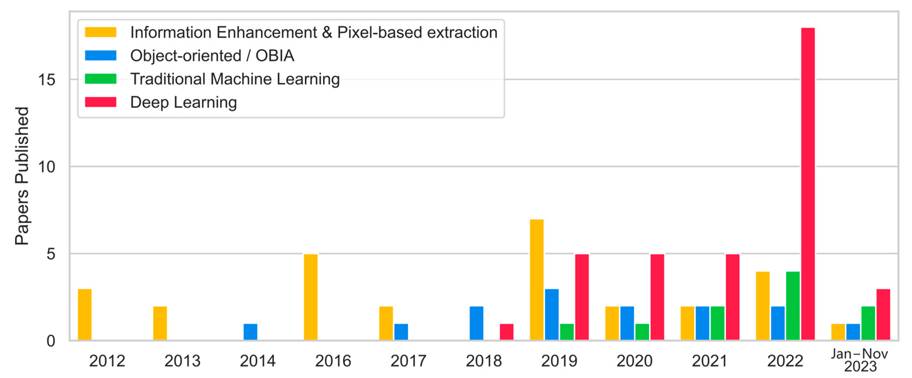
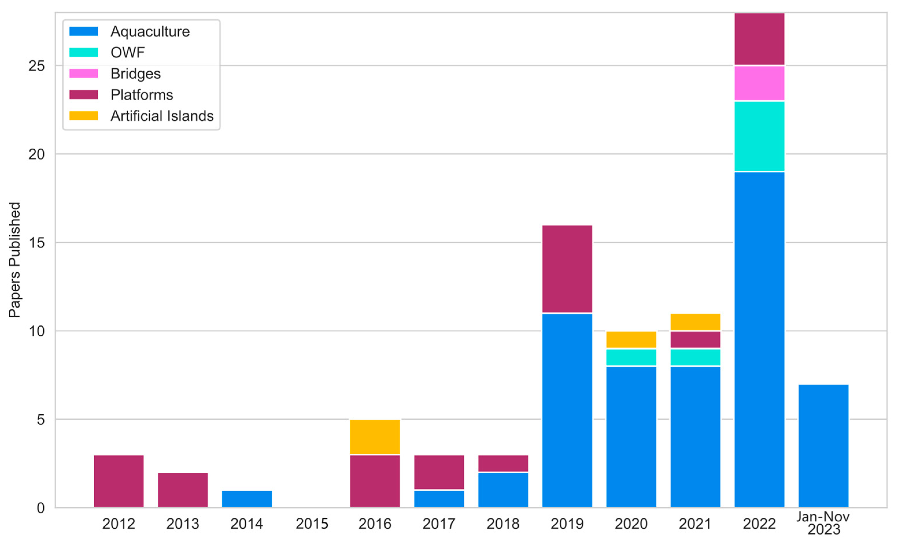
A rapid development of marine infrastructures can be observed along the global coasts. Offshore wind farms, oil and gas platforms, artificial islands, aquaculture, and more, are being constructed without a proper quantification of these human activities. Therefore, effective monitoring is required to maintain transparency towards environmental standards, marine resource management, inventorying objects, and global security. This study reviews remote sensing-based approaches to offshore infrastructure detection over the past 12 years. We analyzed 89 studies from over 30 scientific journals, highlighting spatial and temporal trends, methodological approaches, and regional and thematic research foci. Our results show a significant increase in research interest, especially since 2019. Asia, and especially China, is the predominant focus region in terms of first authorship, funding, and areas of investigation. Aquaculture is the most studied infrastructure, followed by platforms, offshore wind farms, and artificial islands. Gaofen, Sentinel, and Landsat are the most used satellite sensors for detection. The apparent shift towards automated detection methods, especially Deep Learning algorithms, reflects advances in computer vision. This study highlights the key role of earth observation in the field of off-shore infrastructure detection, which can contribute towards outlining effective monitoring practices for marine activities, as well as highlighting important knowledge gaps.
Keywords: remote sensing; earth observation; detection; offshore; infrastructure; aquaculture; platform; artificial island; windfarm; review remote sensing; earth observation; detection; offshore; infrastructure; aquaculture; platform; artificial island; windfarm; review
Graphical Abstract