Article

Mapping the Age of Subtropical Secondary Forest Using Dense Landsat Time Series Data: An Ensemble Model


1
Key Laboratory of Poyang Lake Wetland and Watershed Research (Ministry of Education), School of Geography and Environment, Jiangxi Normal University, Nanchang 330022, China
2
Jiangxi Forestry Resources Monitoring Center, Nanchang 330046, China
3
School of Geography, Nanjing Normal University, Nanjing 210034, China
4
Key Laboratory of Soil Erosion and Prevention, Jiangxi Academy of Water Science and Engineering, Nanchang 330029, China
*
Author to whom correspondence should be addressed.
Remote Sens. 2023, 15(8), 2067; https://doi.org/10.3390/rs15082067
Submission received: 24 March 2023 / Revised: 12 April 2023 / Accepted: 12 April 2023 / Published: 14 April 2023
(This article belongs to the Special Issue GeoAI and EO Big Data Driven Advances in Earth Environmental Science)

Abstract

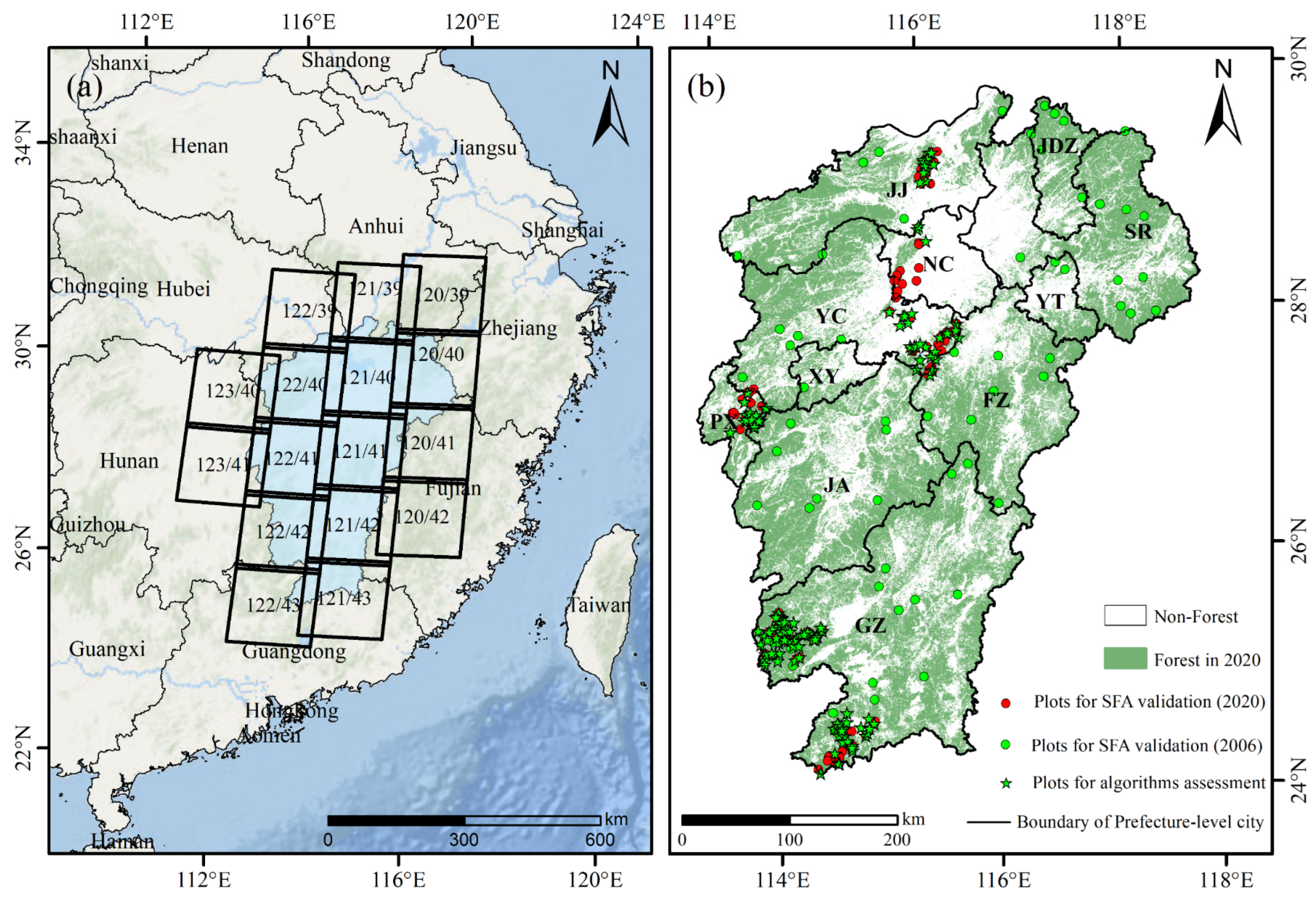
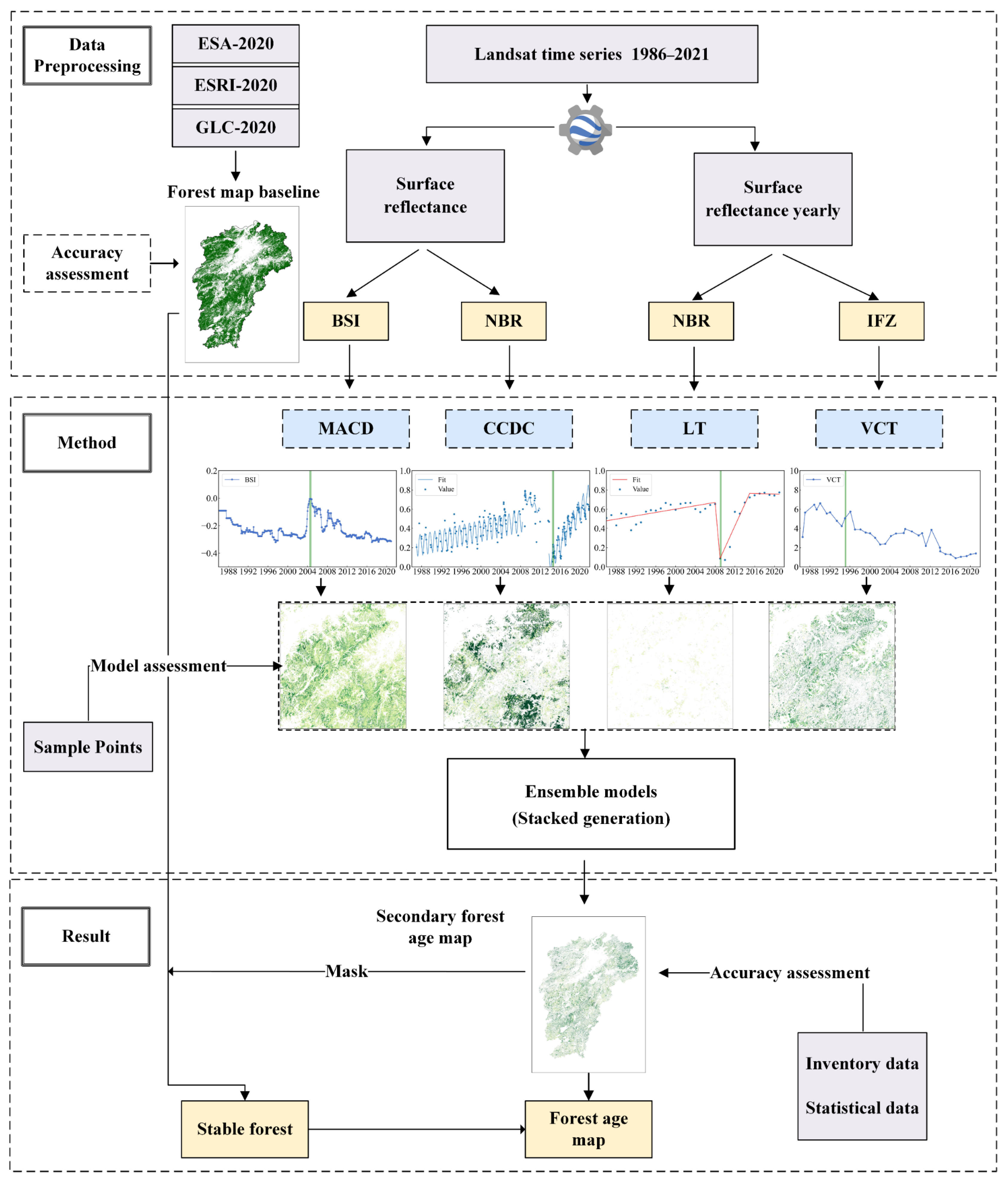
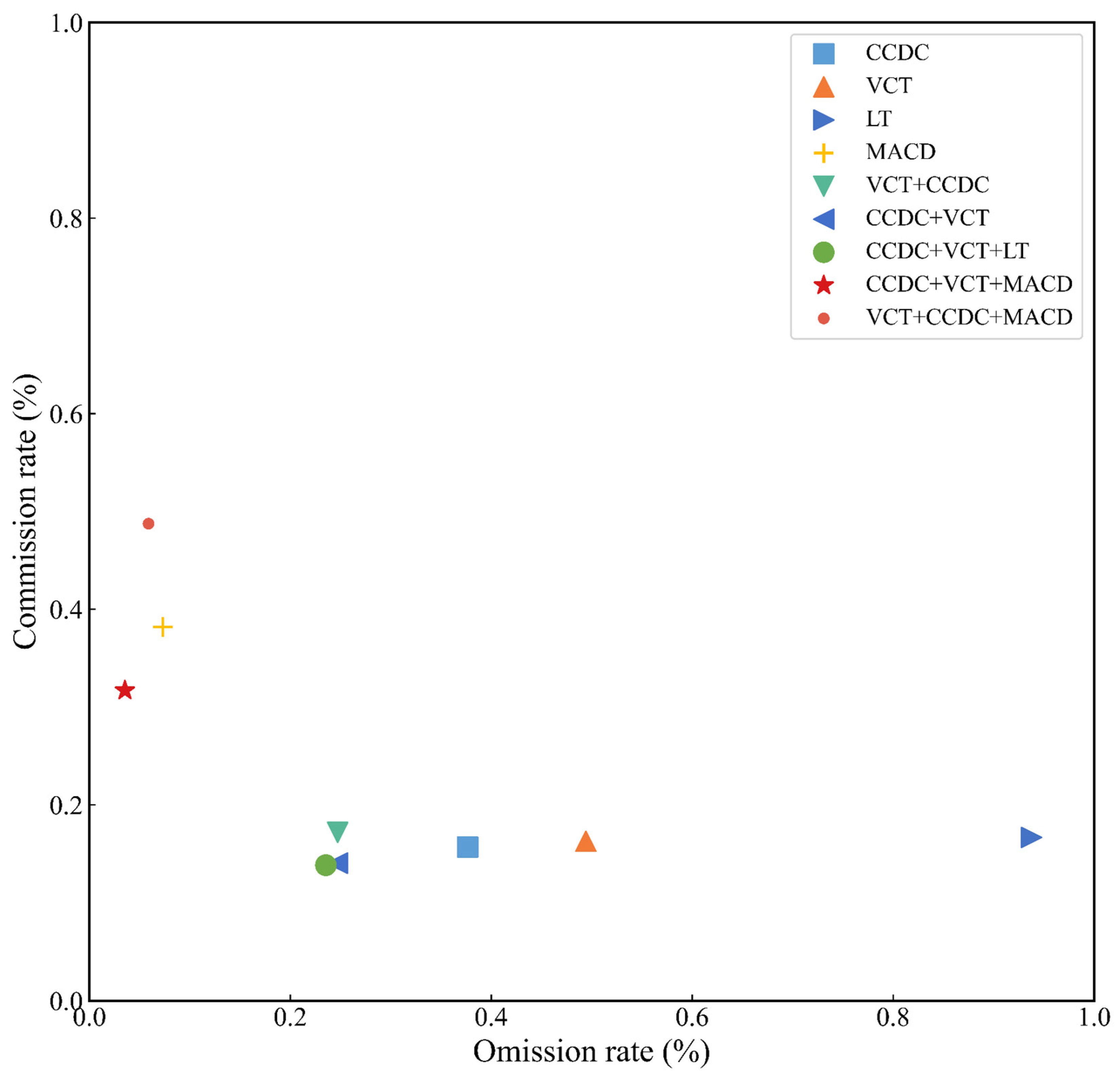
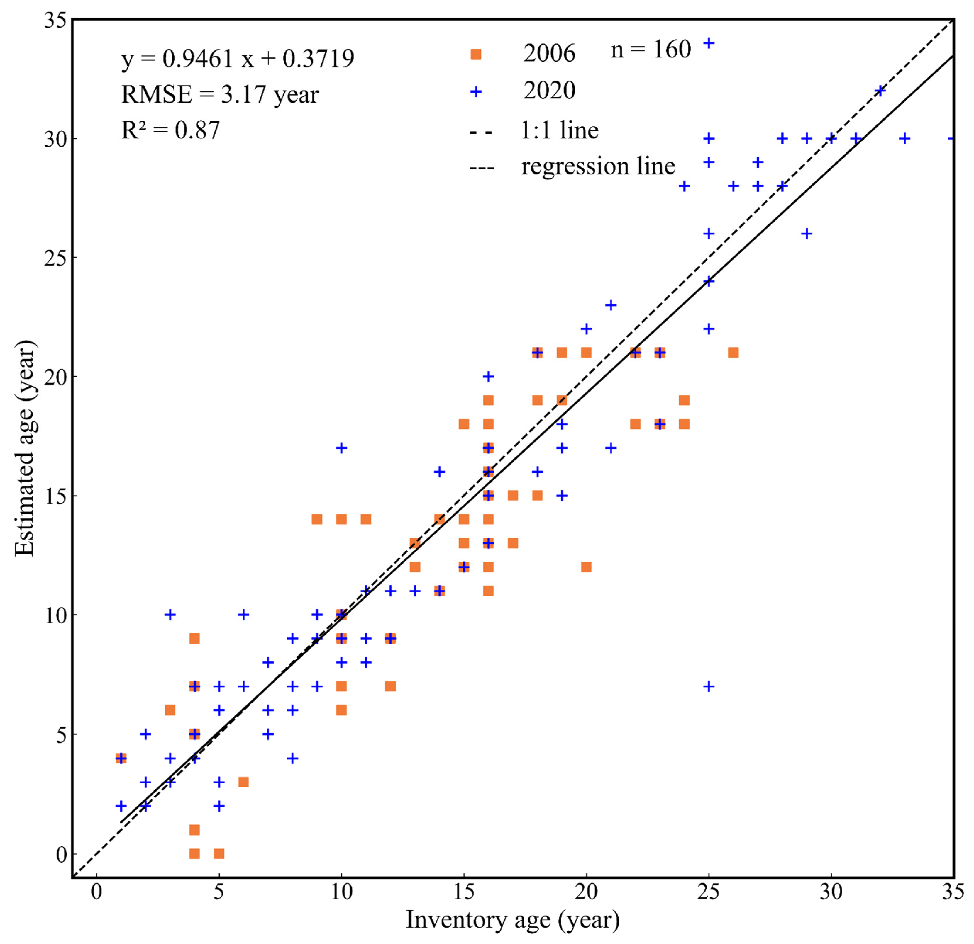
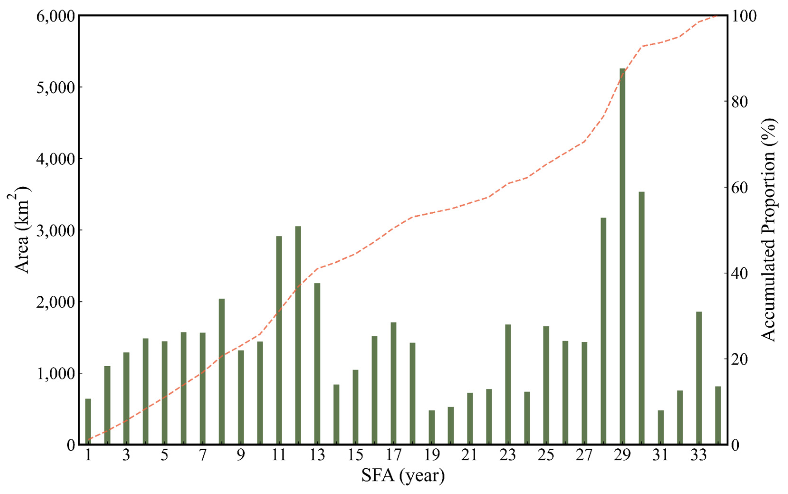
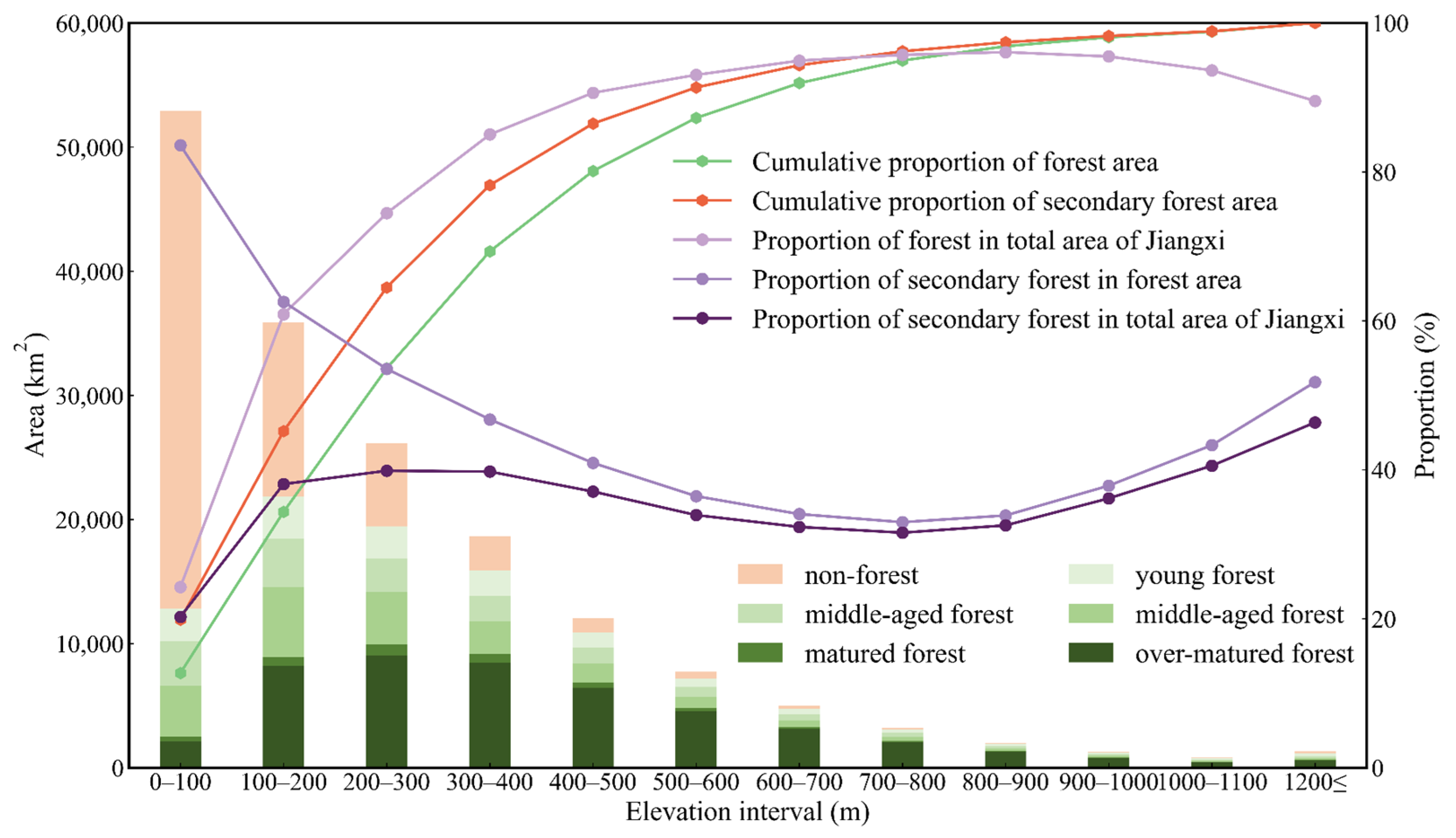
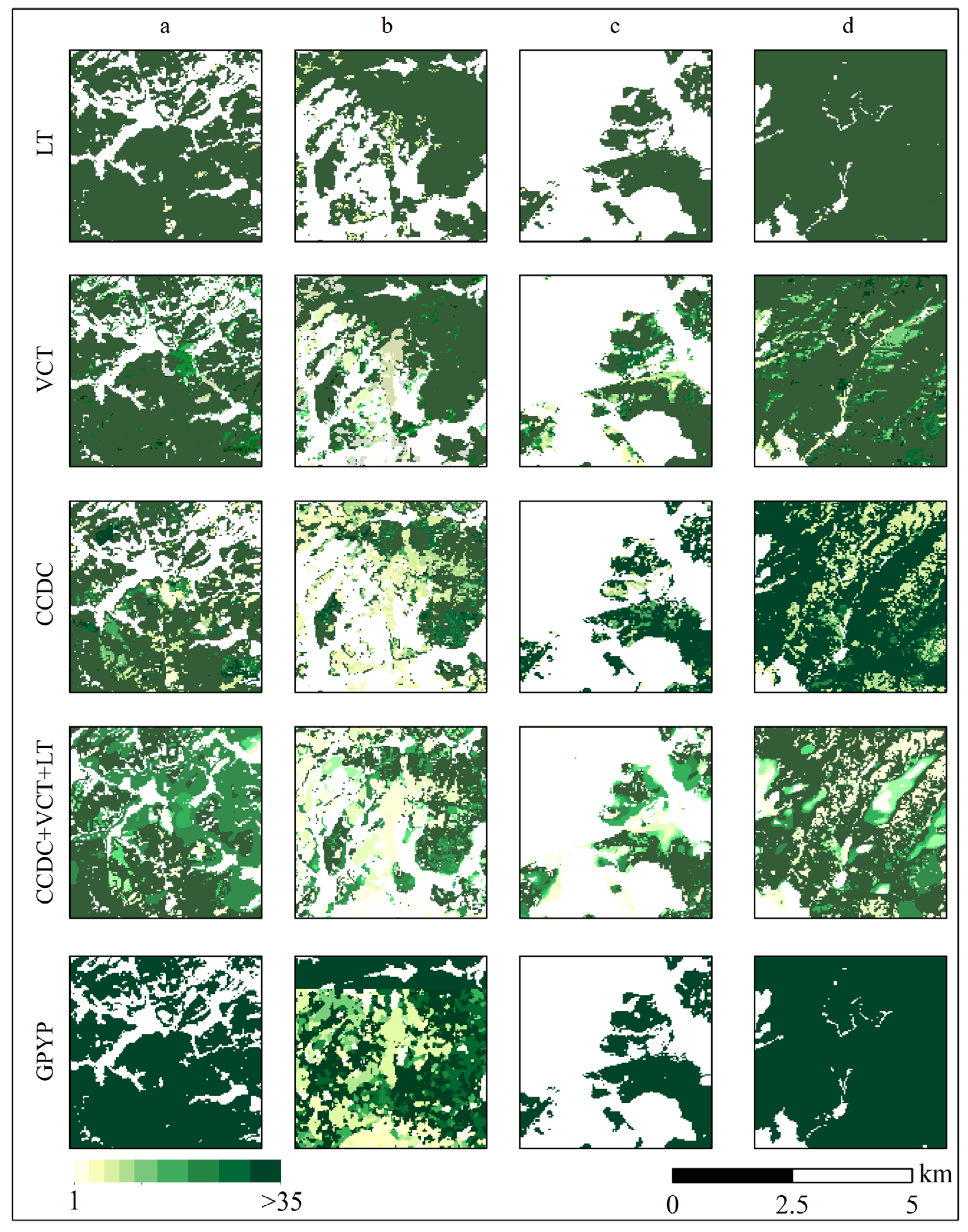
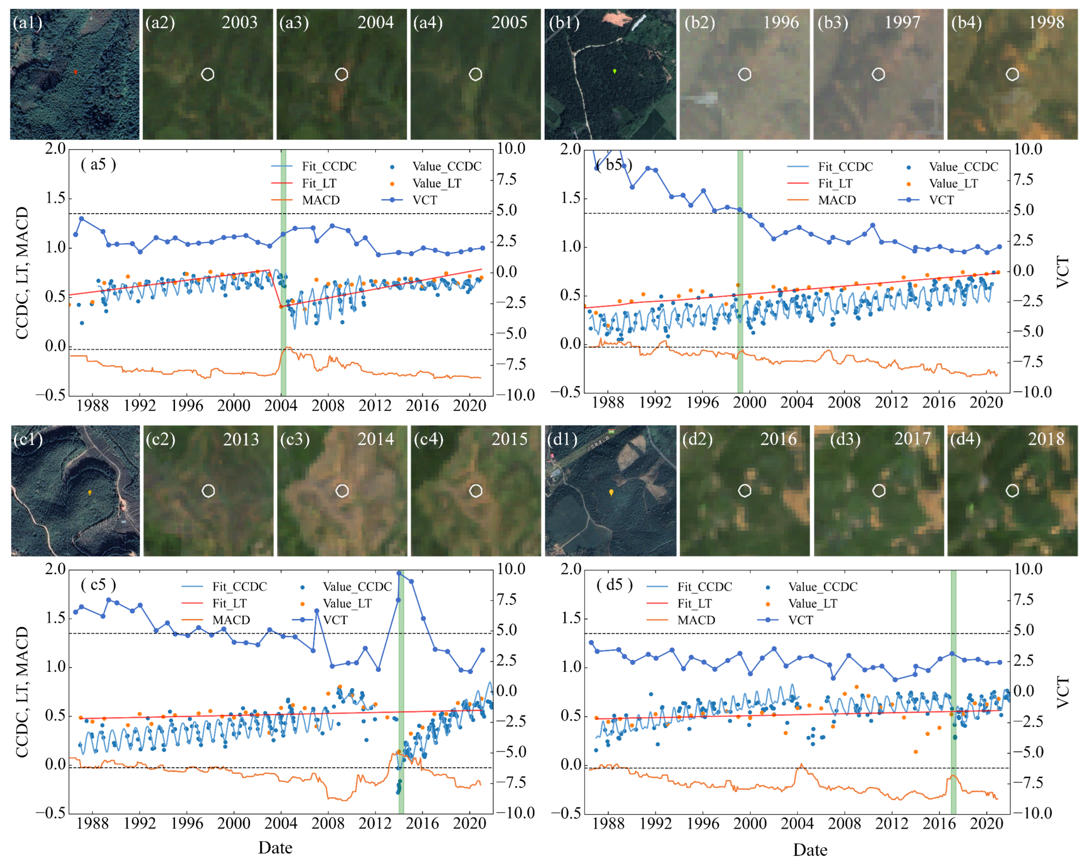
Quantifying secondary forest age (SFA) is essential to evaluate the carbon processes of forest ecosystems at regional and global scales. However, the successional stages of secondary forests remain poorly understood due to low-frequency thematic maps. This study aimed to estimate SFA with higher frequency and more accuracy by using dense Landsat archives. The performances of four time-series change detection algorithms—moving average change detection (MACD), Continuous Change Detection and Classification (CCDC), LandTrendr (LT), and Vegetation Change Tracker (VCT)—for detecting forest regrowth were first evaluated. An ensemble model was then developed to determine more accurate timings for forest regrowth based on the evaluation results. Finally, after converting the forest regrowth year to the SFA, the spatiotemporal and topographical distributions of the SFA were analyzed. The proposed ensemble model was validated in Jiangxi province, China, which is located in a subtropical region and has experienced drastic forest disturbances, artificial afforestation, and natural regeneration. The results showed that: (1) the developed ensemble model effectively determined forest regrowth time with significantly decreased omission and commission rates compared to the direct use of the four single algorithms; (2) the optimal ensemble model combining the independent algorithms obtained the final SFA for Jiangxi province with the lowest omission and commission rates in the spatial domain (14.06% and 24.71%) and the highest accuracy in the temporal domain (R2 = 0.87 and root mean square error (RMSE) = 3.17 years); (3) the spatiotemporal and topographic distribution from 1 to 34 years in the 2021 SFA map was analyzed. This study demonstrated the feasibility of using change detection algorithms for estimating SFA at regional to national scales and provides a data foundation for forest ecosystem research.
Keywords: secondary forest age (SFA); change detection; ensemble model; Landsat time series secondary forest age (SFA); change detection; ensemble model; Landsat time series