Article

Measuring the Distance between Trees and Power Lines under Wind Loads to Assess the Heightened Potential Risk of Wildfire
1
Division of Architecture & Urban Design, Incheon National University, 119 Academy-ro, Yeonsu-gu, Incheon 22012, Republic of Korea
2
Department of Construction Science, Texas A&M University, 3337 TAMU, College Station, TX 77843, USA
*
Author to whom correspondence should be addressed.
Remote Sens. 2023, 15(6), 1485; https://doi.org/10.3390/rs15061485
Submission received: 27 January 2023 / Revised: 24 February 2023 / Accepted: 6 March 2023 / Published: 7 March 2023
(This article belongs to the Topic AI Enhanced Civil Infrastructure Safety)

Abstract

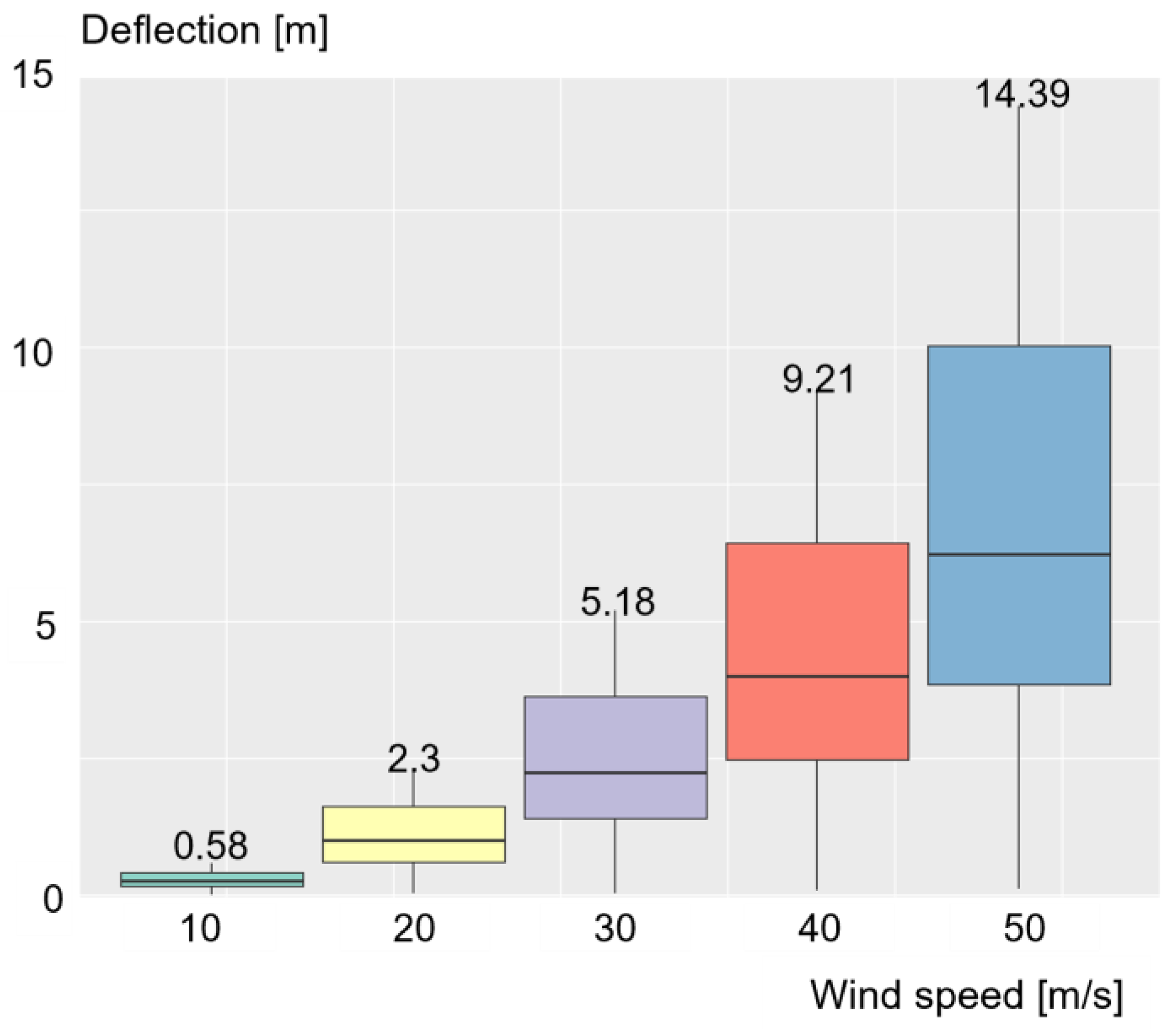
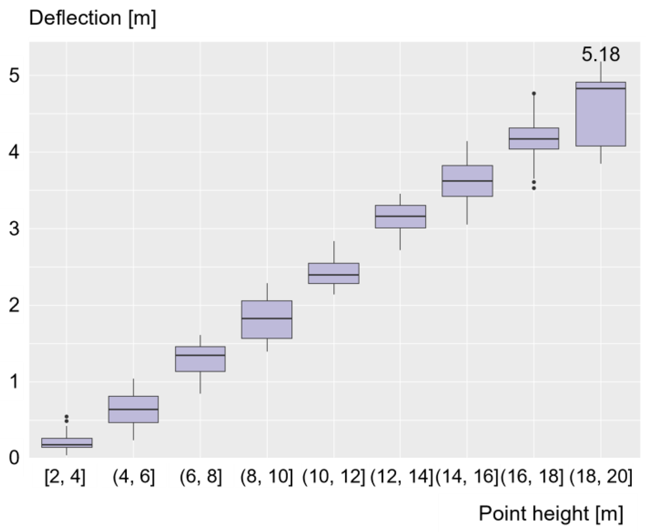
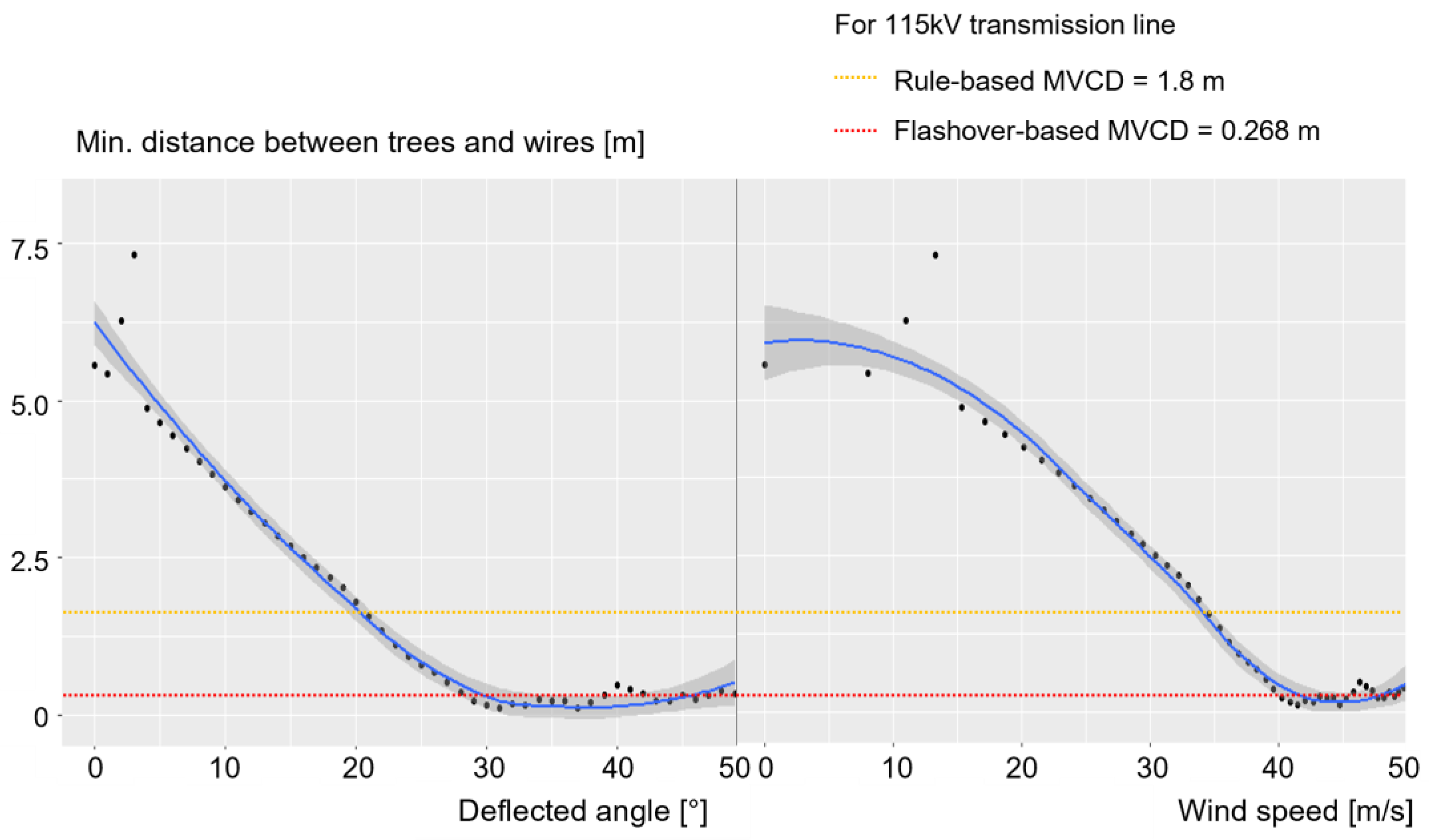
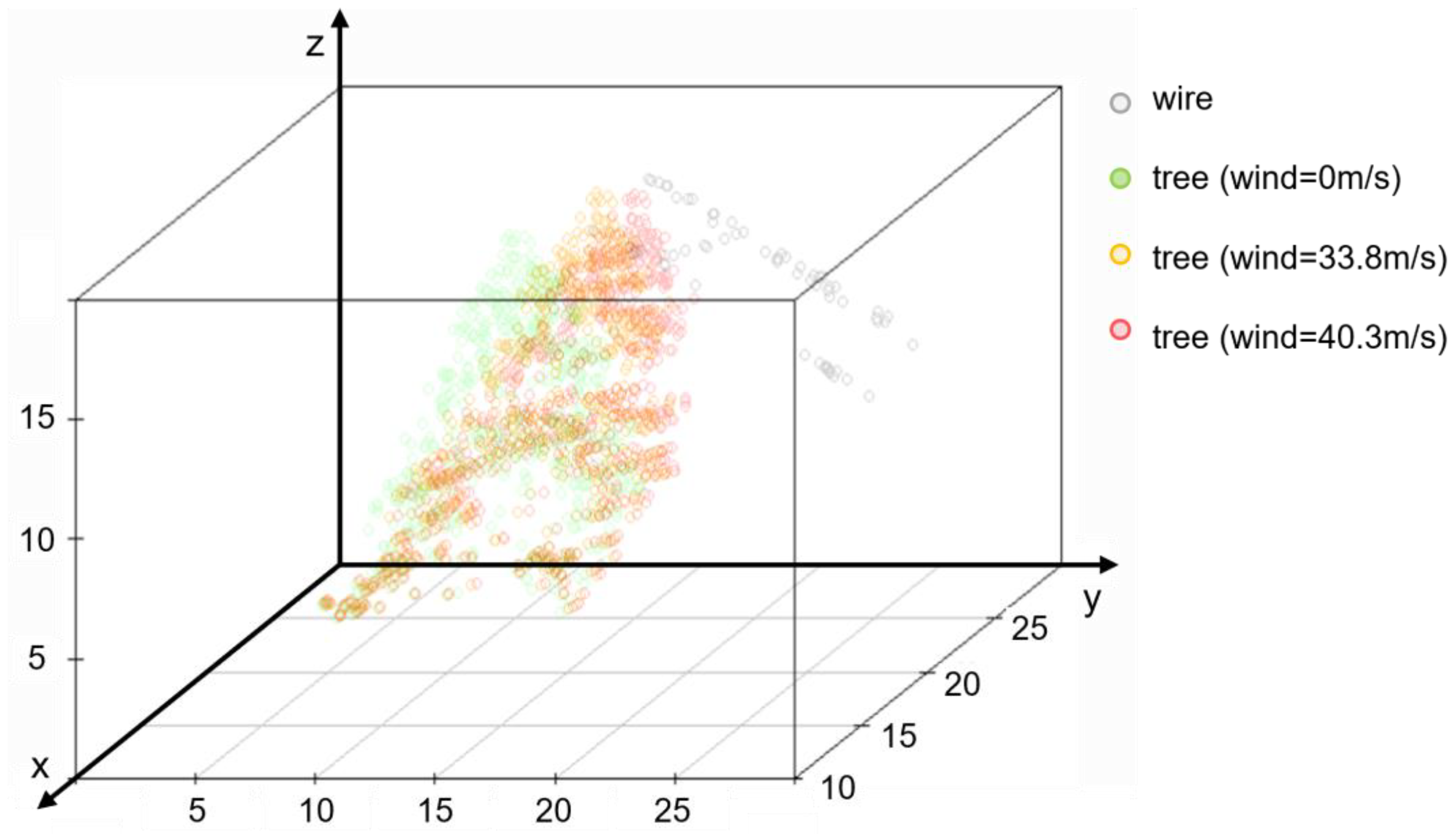
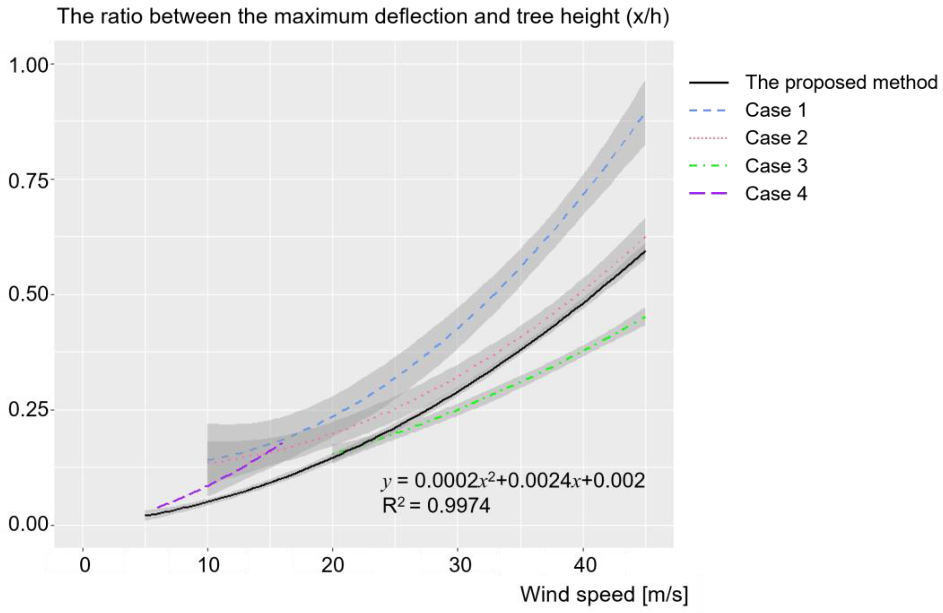
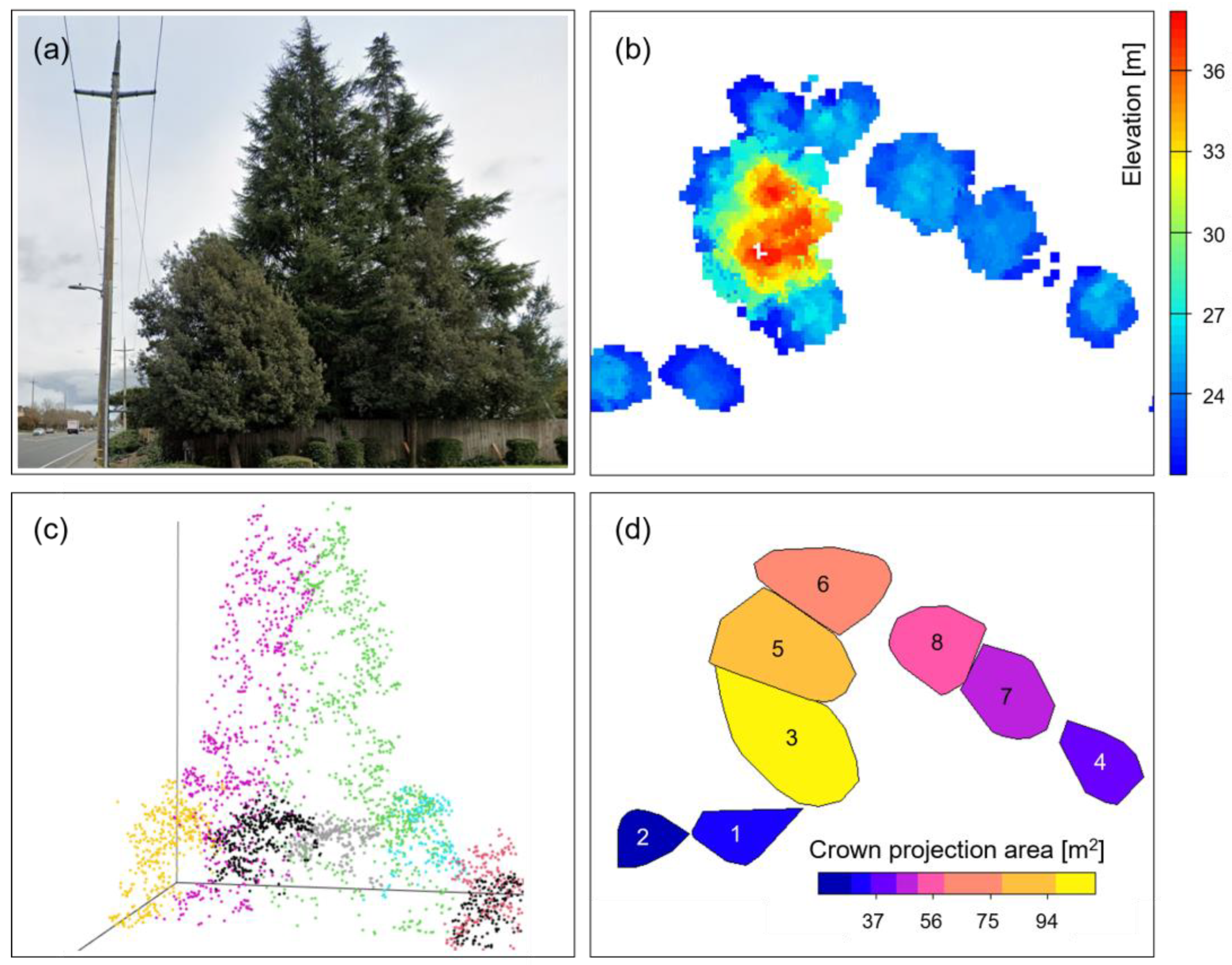
The incidence of wildfires caused by tree contact with high-voltage power lines has become an increasingly pressing issue in the United States. To prevent such incidents, local safety councils have established minimum clearance regulations between trees and power lines. While most studies have focused on the tree encroachment around power lines during normal weather conditions, recent catastrophic fires have been caused by strong winds. To address this gap in knowledge, we investigated the critical wind speed that heightens the risk of wildfires by calculating the distance between trees and wires. To conduct this study, we used airborne LiDAR data collected from Sonoma County in northern California and analyzed the behavior of a sample tree having a height of 19.2 m under wind loads. Our analysis showed that the main factor determining tree deflection is the ratio of the tree height to the trunk diameter. We also found that, although the probability of fire ignition is typically low under normal conditions, it is likely to increase at a wind speed of approximately 40.3 m/s. In conclusion, this research demonstrates the utility of point cloud data in identifying potentially dangerous trees and reducing the risk of fires.
Keywords: airborne LiDAR; point cloud data; tree deflection; power lines; wildfire; potential risk; wind load; disaster monitoring airborne LiDAR; point cloud data; tree deflection; power lines; wildfire; potential risk; wind load; disaster monitoring