Article

Prediction of Urban Forest Aboveground Carbon Using Machine Learning Based on Landsat 8 and Sentinel-2: A Case Study of Shanghai, China

1
State Key Laboratory of Subtropical Silviculture, Zhejiang A&F University, Hangzhou 311300, China
2
Key Laboratory of Carbon Cycling in Forest Ecosystems and Carbon Sequestration of Zhejiang Province, Zhejiang A&F University, Hangzhou 311300, China
3
School of Environmental and Resources Science, Zhejiang A&F University, Hangzhou 311300, China
4
Shanghai Academy of Landscape Architecture Science and Planning, Shanghai 200232, China
5
Shanghai Engineering Research Center of Landscaping on Challenging Urban Sites, Shanghai 200232, China
*
Author to whom correspondence should be addressed.
Remote Sens. 2023, 15(1), 284; https://doi.org/10.3390/rs15010284
Submission received: 15 December 2022 / Revised: 30 December 2022 / Accepted: 31 December 2022 / Published: 3 January 2023

Abstract

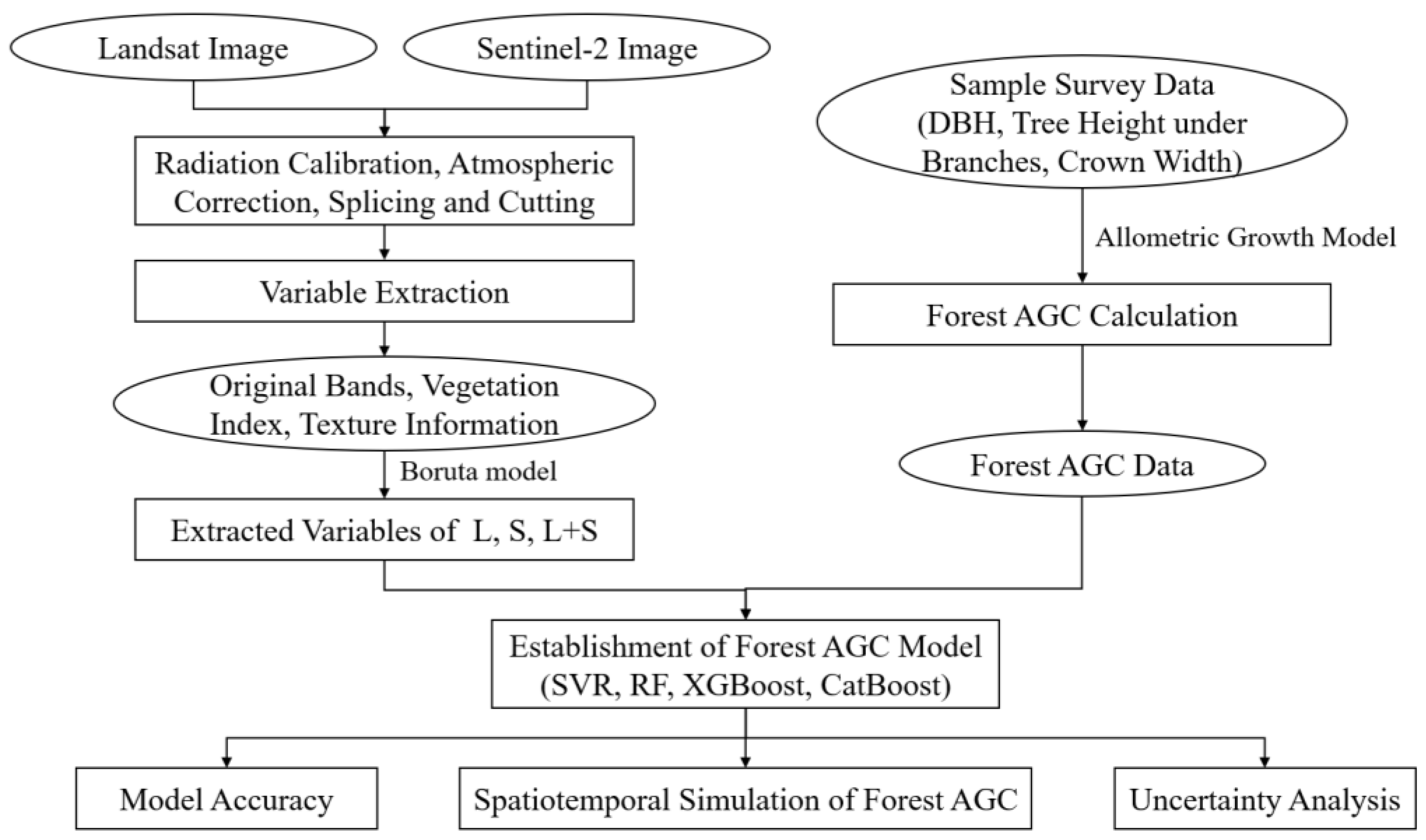
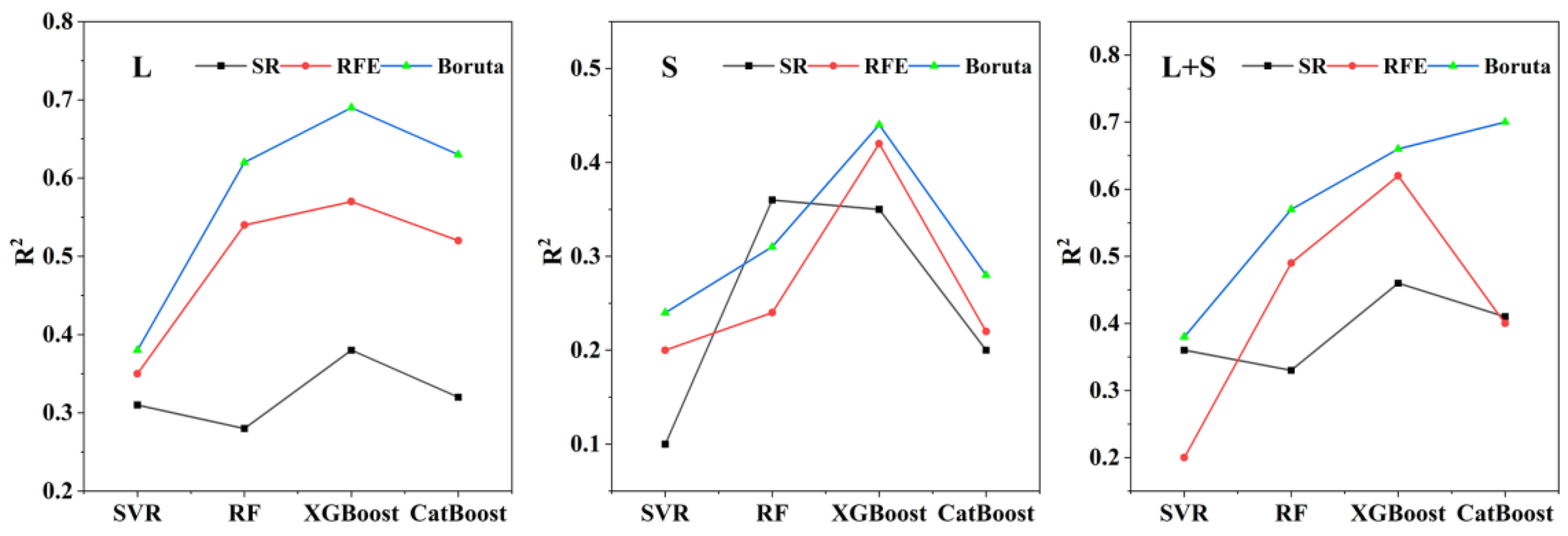
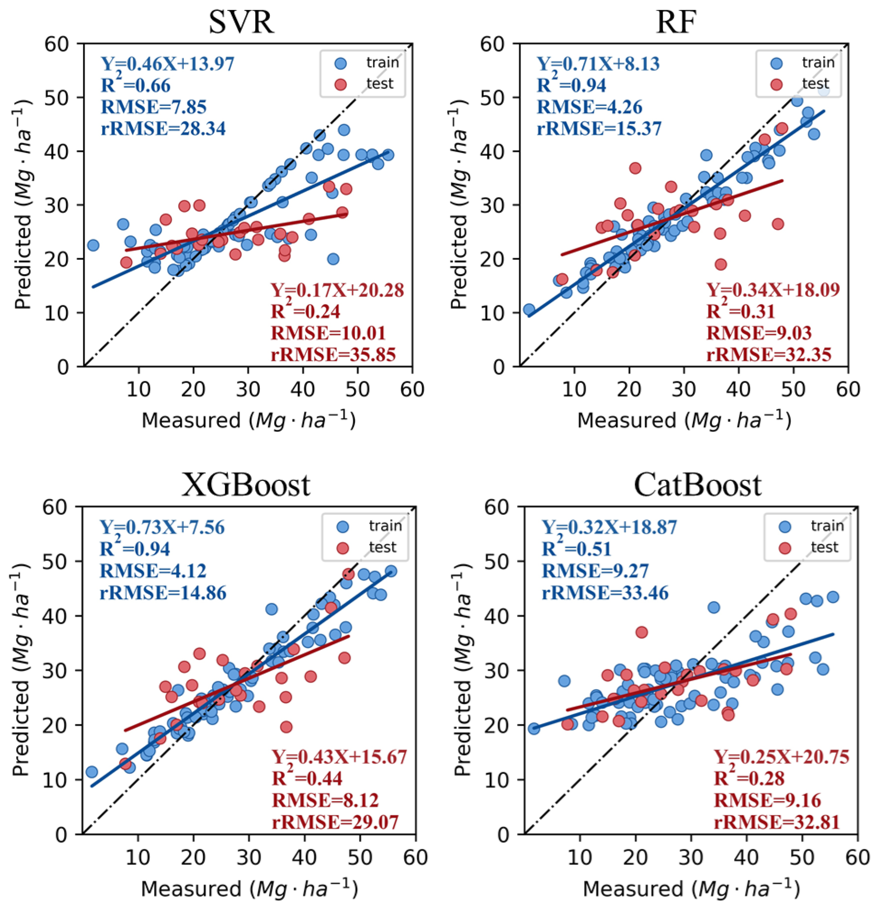
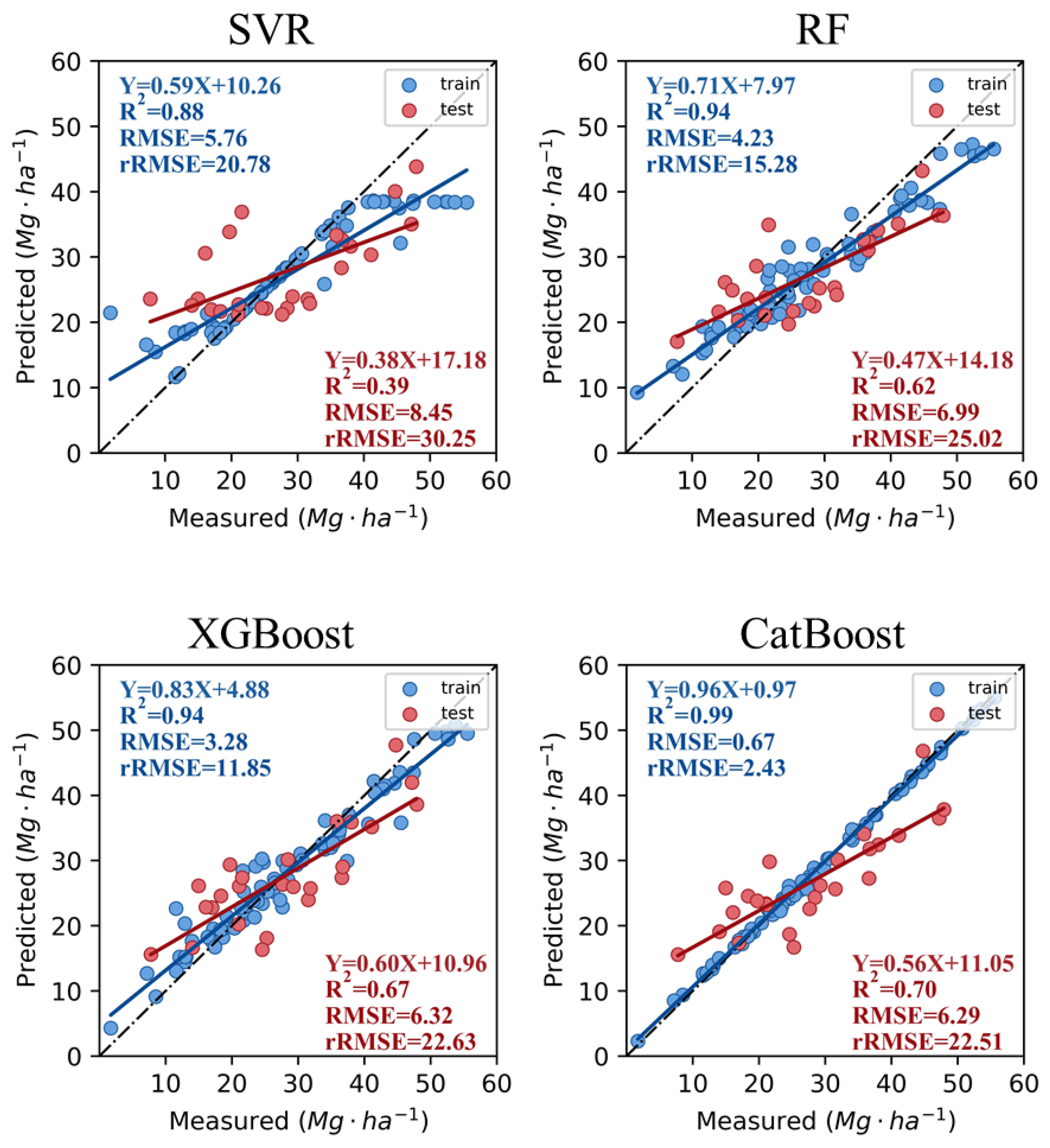
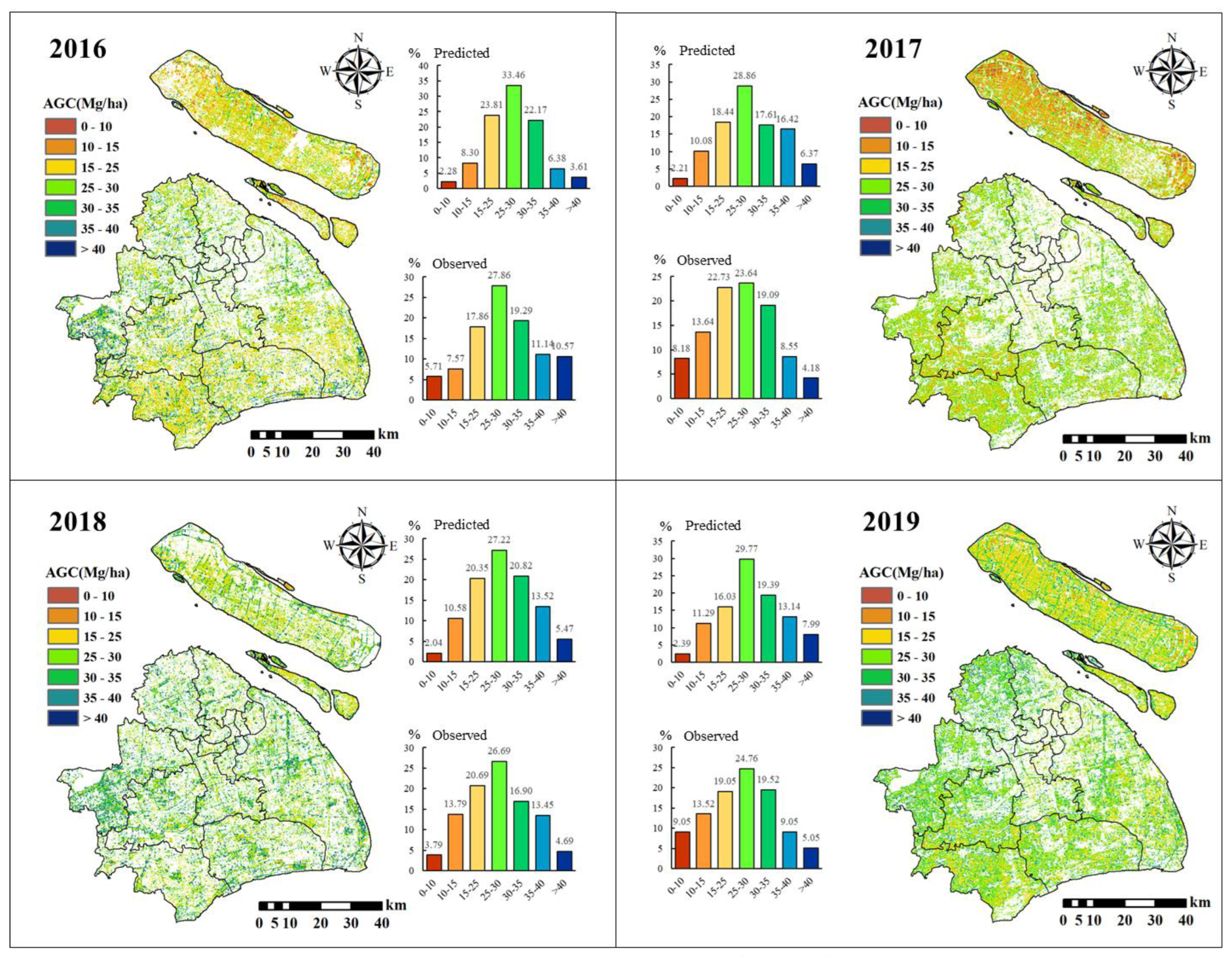
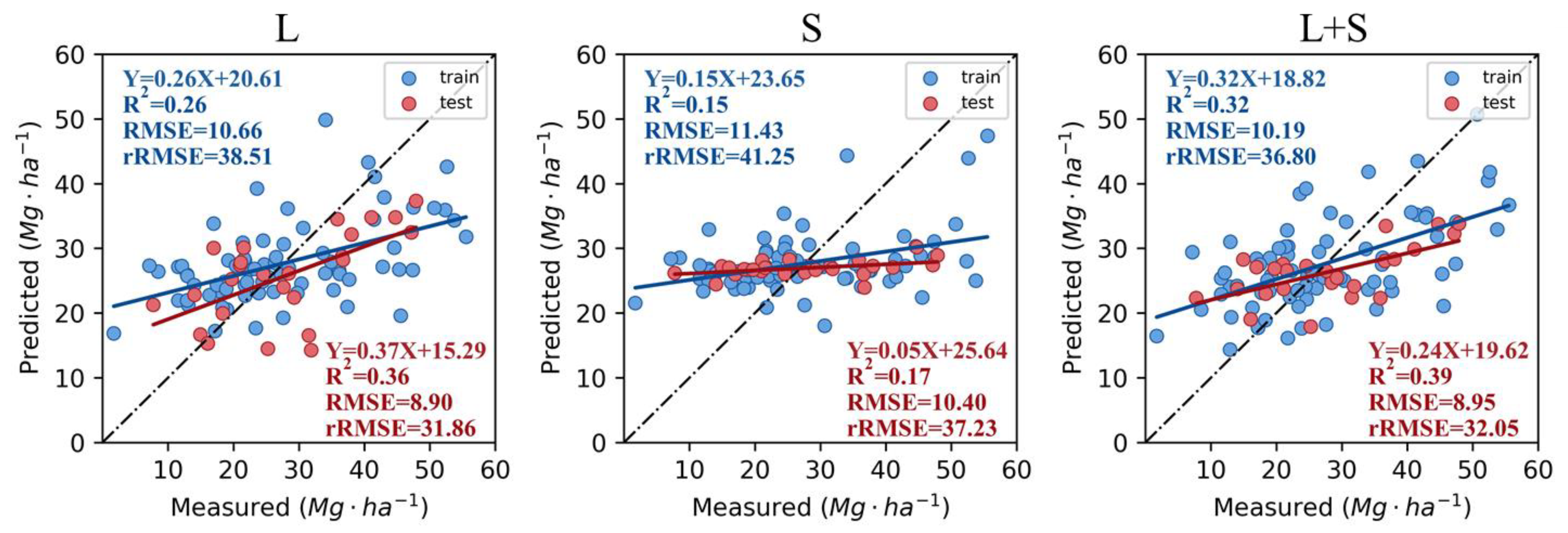
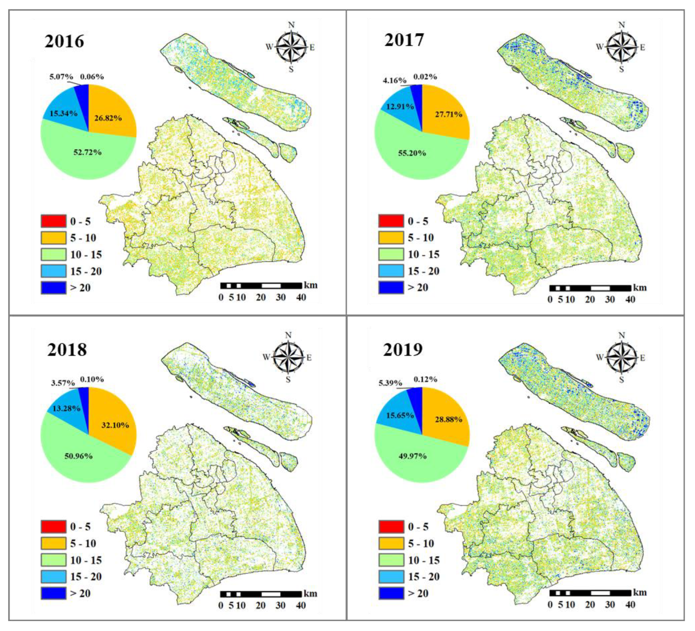
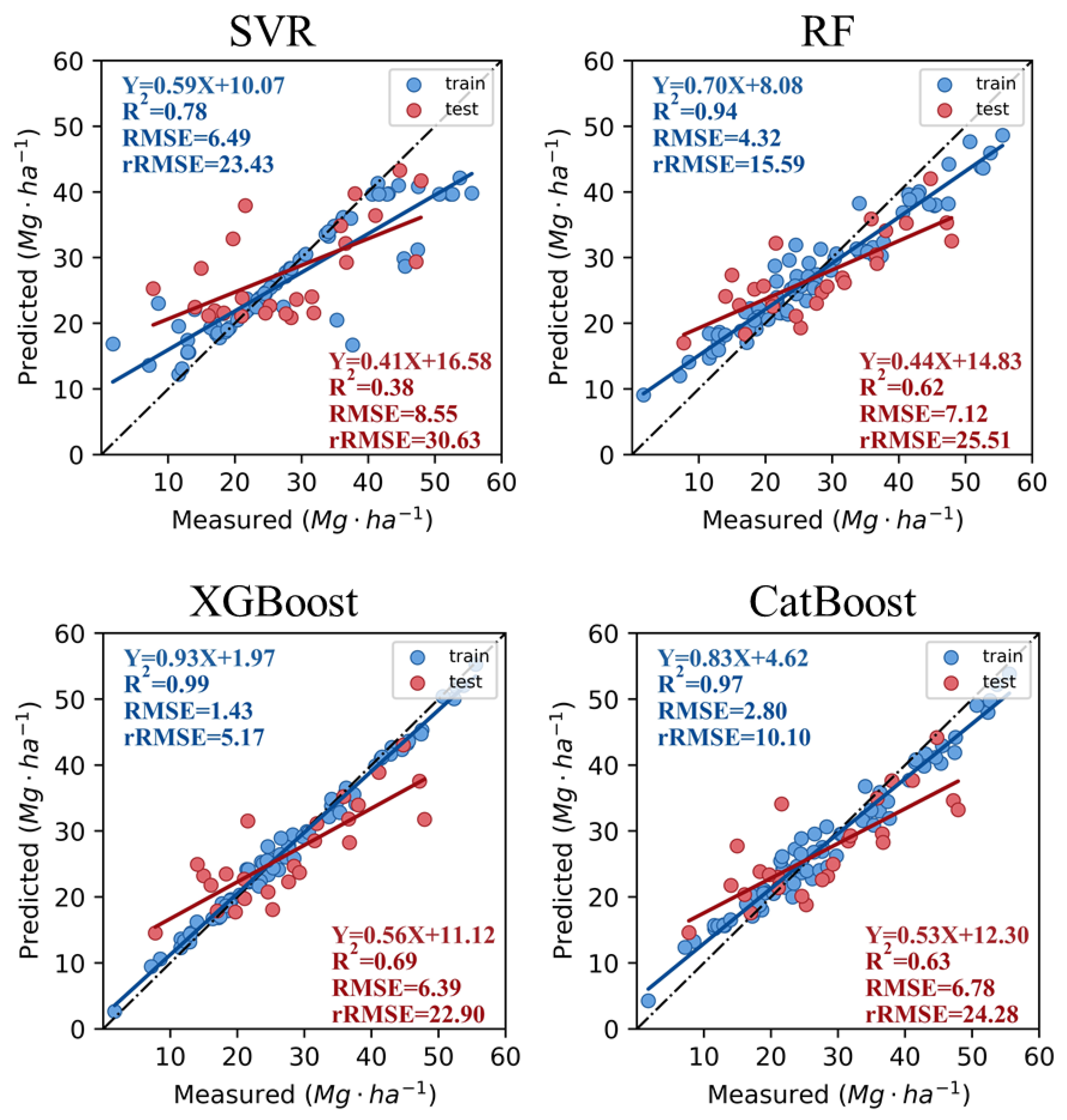
The aboveground carbon storage (AGC) of urban forests is an important indicator reflecting the ecological function of urban forests. It is essential to monitor the AGC of urban forests and analyze their spatiotemporal distributions. Remote sensing is a technical tool that can be leveraged to accurately monitor forest AGC, whereas machine learning is an important algorithm for the accurate prediction of AGC. Therefore, in this study, single Landsat 8 (L) remote sensing data, single Sentinel-2 (S) remote sensing data, and combined Landsat 8 and Sentinel-2 (L + S) data are used as data sources. Four machine learning methods, support vector regression (SVR), random forest (RF), XGBoost (extreme gradient boosting), and CatBoost (categorical boosting), are used to predict forest AGC based on two phases of forest sample plots in Shanghai. We chose the optimal model to predict the AGC and simulate the spatiotemporal distribution. The study shows that both machine learning models based on separate Landsat 8 OLI and Sentinel-2 satellite remote sensing data can accurately predict the AGC and spatiotemporal distribution of the Shanghai urban forest. Nevertheless, the accuracy of the combined data (L + S) and CatBoost-integrated AGC models is higher than the others, with fitting and validation accuracy R2 values of 0.99 and 0.70, respectively. The RMSE was also smaller at 0.67 and 6.29 Mg/ha, respectively. The uncertainty of the AGC spatial distribution in the Shanghai urban forest derived from the CatBoost model prediction from the 2016–2019 data was small and consistent with the actual situation. Furthermore, the statistics showed that the AGC of the Shanghai forest increased from 24.90 Mg/ha in 2016 to 25.61 Mg/ha in 2019.
Keywords: urban forest; AGC; remote sensing; machine learning urban forest; AGC; remote sensing; machine learning