Article

Estimating Ground Elevation in Coastal Dunes from High-Resolution UAV-LIDAR Point Clouds and Photogrammetry


1
Department of Civil and Coastal Engineering, University of Florida, Gainesville, FL 32611, USA
2
School of Forest Resourced and Conservation, University of Florida, Gainesville, FL 32611, USA
*
Author to whom correspondence should be addressed.
Remote Sens. 2023, 15(1), 226; https://doi.org/10.3390/rs15010226
Submission received: 24 October 2022 / Revised: 26 December 2022 / Accepted: 28 December 2022 / Published: 31 December 2022
(This article belongs to the Special Issue Accuracy Assessment of UAS Lidar)

Abstract

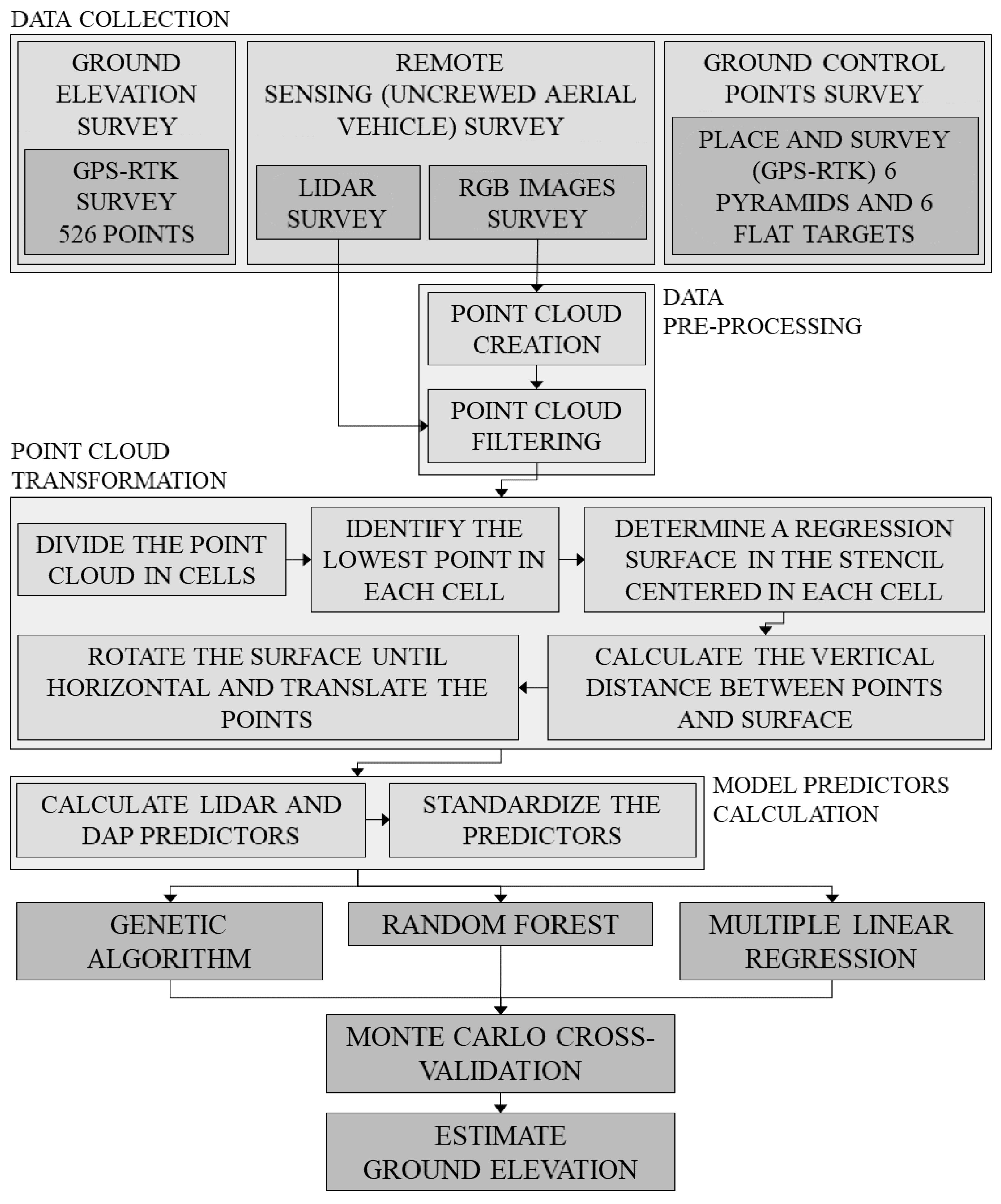
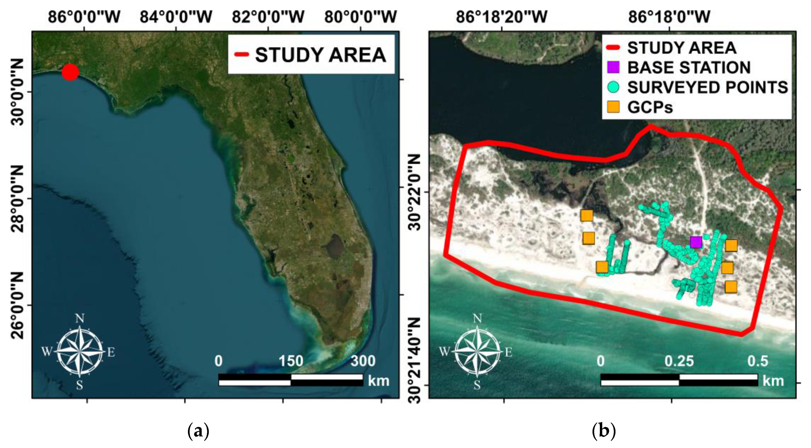
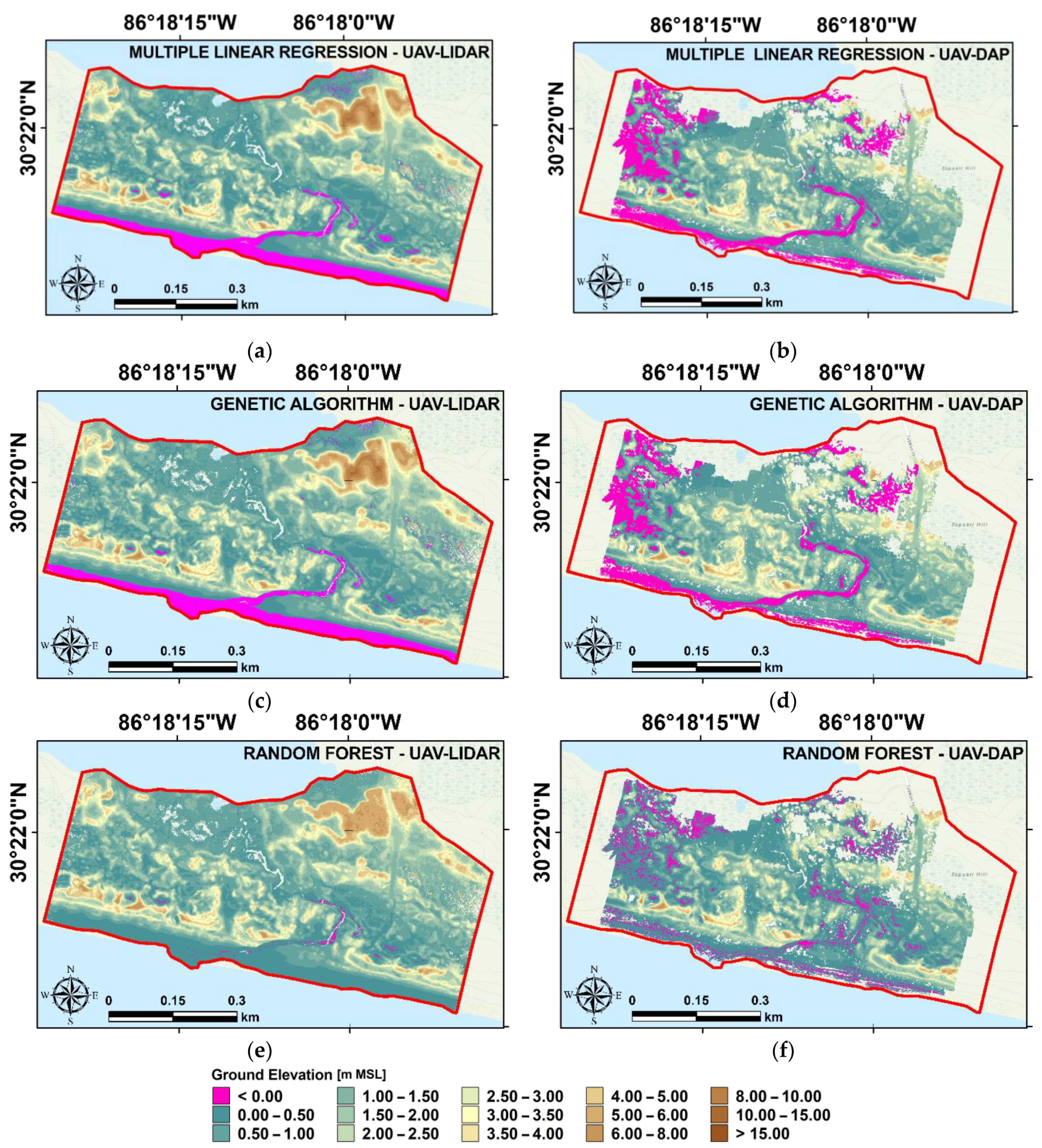
Coastal dune environments play a critical role in protecting coastal areas from damage associated with flooding and excessive erosion. Therefore, monitoring the morphology of dunes is an important coastal management operation. Traditional ground-based survey methods are time-consuming, and data must be interpolated over large areas, thus limiting the ability to assess small-scale details. High-resolution uncrewed aerial vehicle (UAV) photogrammetry allows one to rapidly monitor coastal dune elevations at a fine scale and assess the vulnerability of coastal zones. However, photogrammetric methods are unable to map ground elevations beneath vegetation and only provide elevations for bare sand areas. This drawback is significant as vegetated areas play a key role in the development of dune morphology. To provide a complete digital terrain model for a coastal dune environment at Topsail Hill Preserve in Florida’s panhandle, we employed a UAV, equipped with a laser scanner and a high-resolution camera. Along with the UAV survey, we conducted a RTK–GNSS ground survey of 526 checkpoints within the survey area to serve as training/testing data for various machine-learning regression models to predict the ground elevation. Our results indicate that a UAV–LIDAR point cloud, coupled with a genetic algorithm provided the most accurate estimate for ground elevation (mean absolute error ± root mean square error, MAE ± RMSE = 7.64 ± 9.86 cm).
Keywords: UAV; LIDAR; photogrammetry; coastal dunes; ground elevation; random forest; genetic algorithm; multiple linear regression UAV; LIDAR; photogrammetry; coastal dunes; ground elevation; random forest; genetic algorithm; multiple linear regression