Article

Classification of Alpine Grasslands in Cold and High Altitudes Based on Multispectral Landsat-8 Images: A Case Study in Sanjiangyuan National Park, China

1
Key Laboratory of Remote Sensing of Gansu Province, Northwest Institute of Eco-Environment and Resources, Chinese Academy of Sciences, Lanzhou 730000, China
2
College of Life Sciences, University of Chinese Academy of Sciences, Beijing 100049, China
3
University of Chinese Academy of Sciences, Beijing 100049, China
4
Lanzhou Information Center, Northwest Institute of Eco-Environment and Resources, Chinese Academy of Sciences, Lanzhou 730000, China
5
College of Geosciences, Qinghai Normal University, Xining 810008, China
*
Author to whom correspondence should be addressed.
Remote Sens. 2022, 14(15), 3714; https://doi.org/10.3390/rs14153714
Submission received: 30 June 2022 / Revised: 28 July 2022 / Accepted: 31 July 2022 / Published: 3 August 2022
(This article belongs to the Special Issue Remote Sensing for Mountain Vegetation and Snow Cover)

Abstract

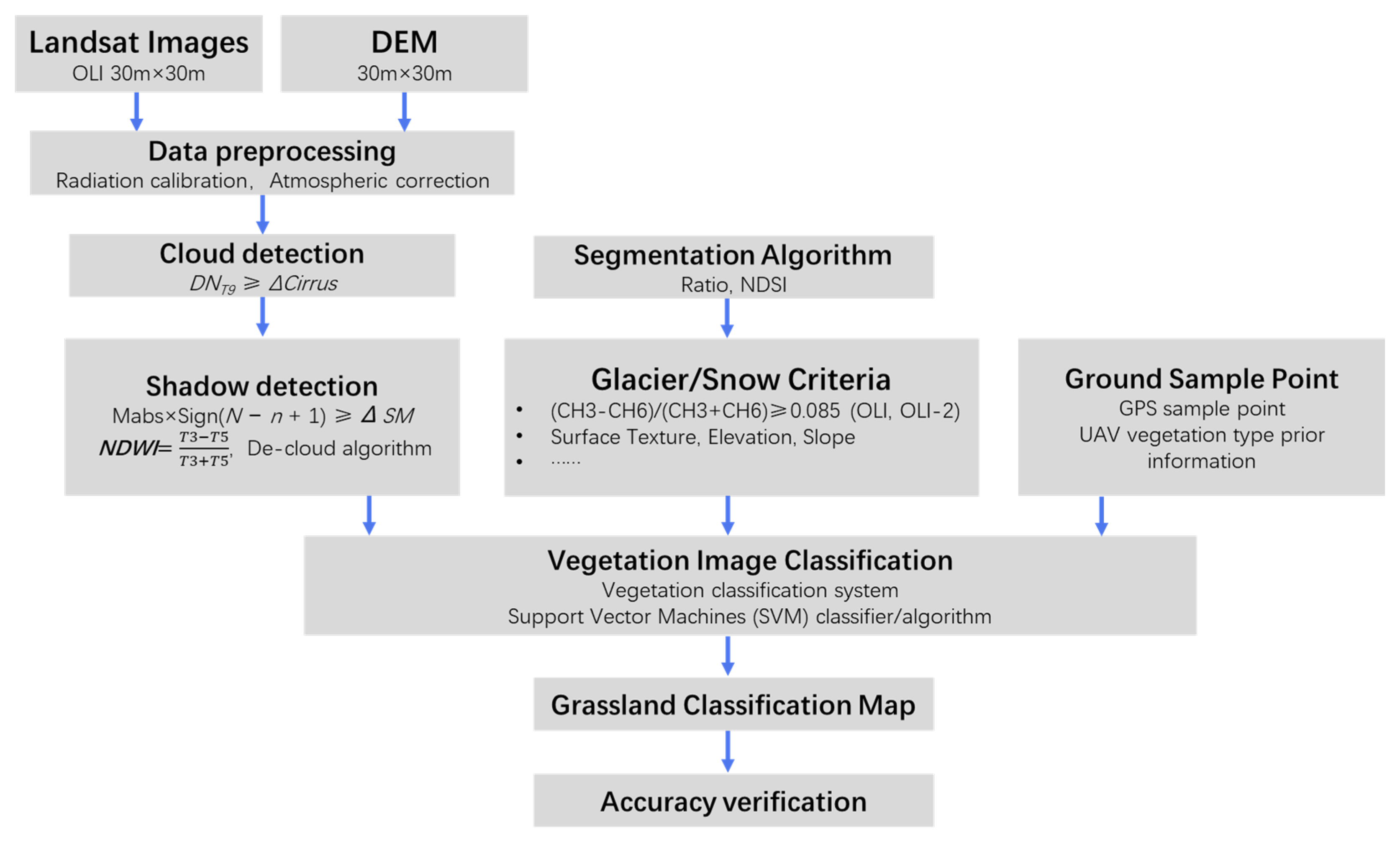
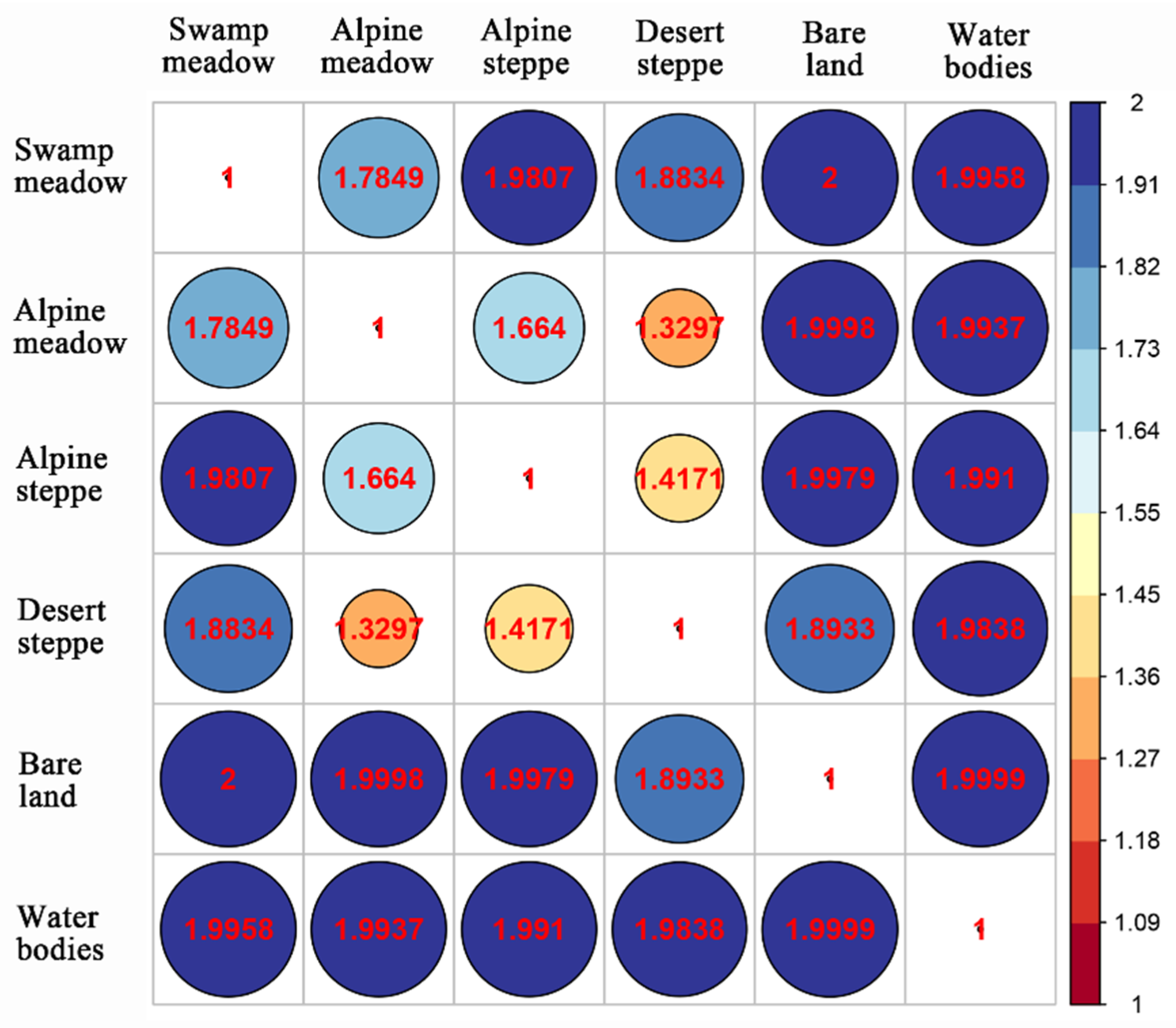
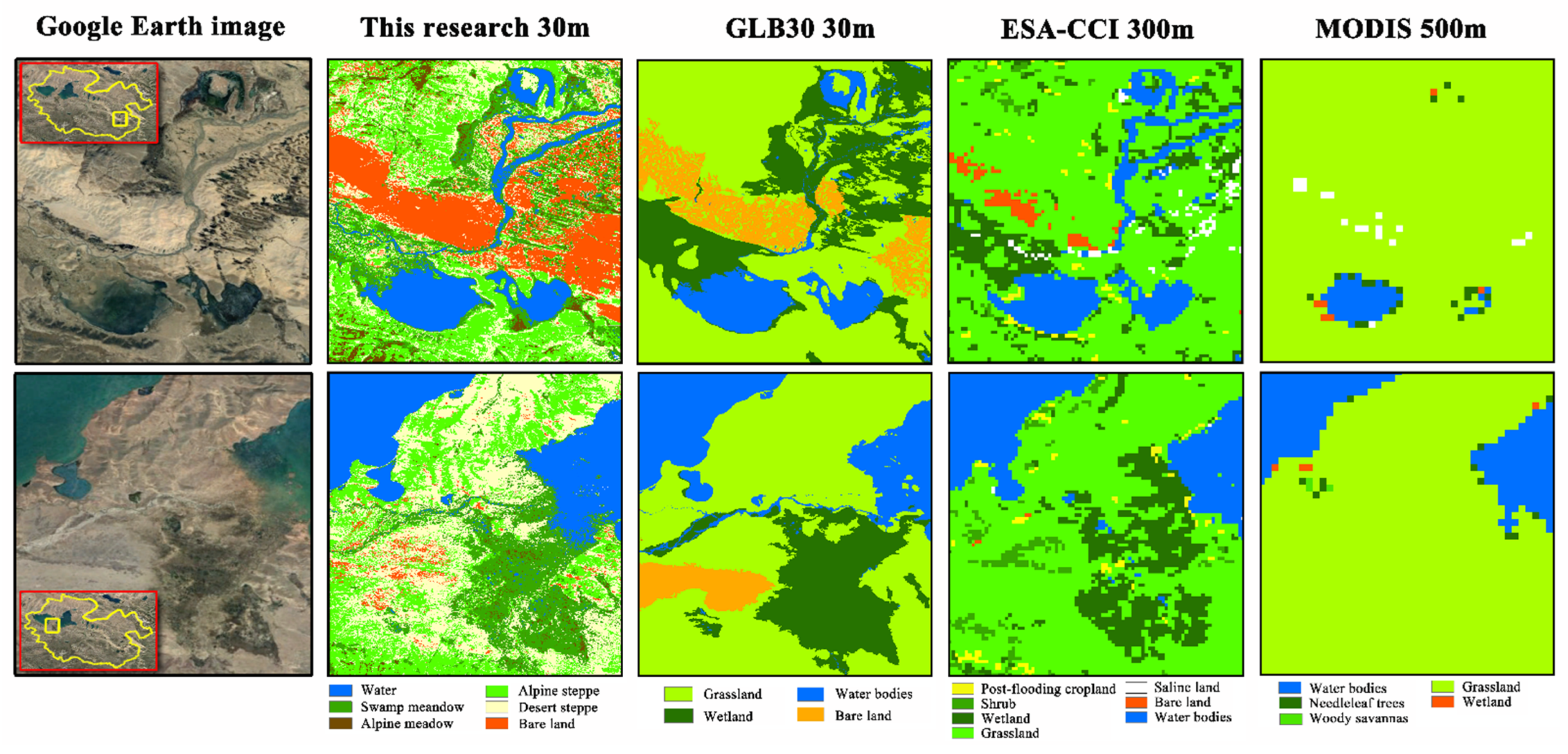
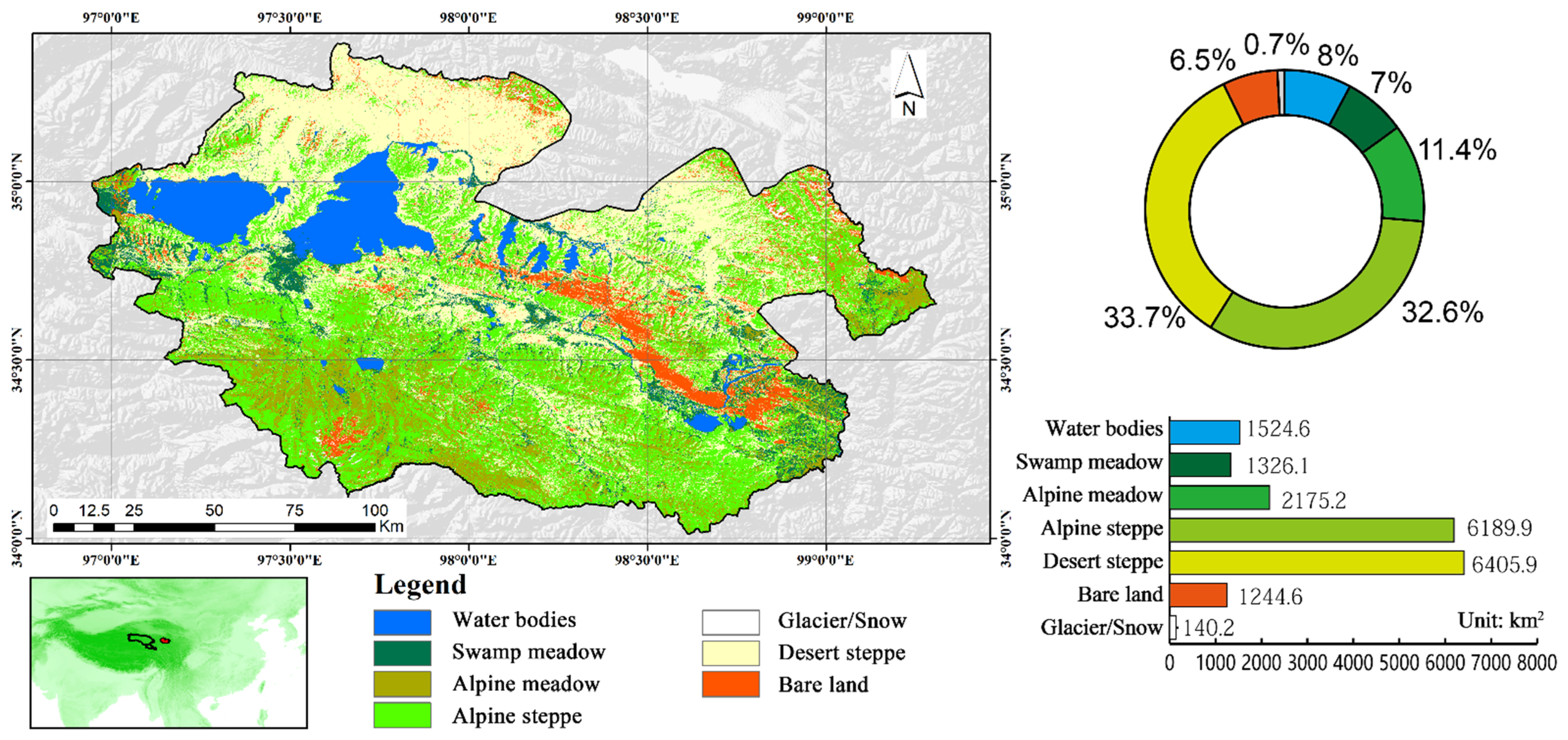
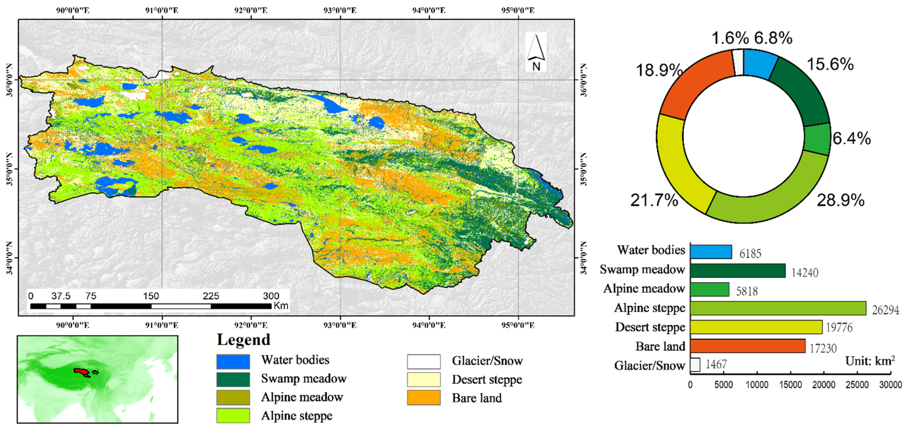
Land-use–cover change (LUCC)/vegetation cover plays a critical role in Earth system science and is a reflection of human activities and environmental changes. LUCC will affect the structure and function of ecosystems and a series of other terrestrial surface processes, such as energy exchange, water circulation, biogeochemical circulation, and vegetation productivity. Therefore, accurate LUCC mapping and vegetation cover monitoring are the bases for simulating the global carbon and hydrological cycles, studying the interactions of the land surface and climate, and assessing land degradation. Based on field GPS surveys and UAV data, with cloud-free and snow/glacier algorithms and the SVM classifier to train and model alpine grassland, the alpine grassland and LUCC were extracted by using Landsat-8 OLI satellite images in Sanjiangyuan National Park in this paper. The latest datasets of vegetation types with 30 m × 30 m spatial resolution in the three parks were prepared and formed. The classification results show that the SVM classifier could better distinguish the major land-use types, and the overall classification accuracy was very high. However, in the alpine grassland subcategories, the classification accuracies of the four typical grasslands were relatively low, especially between desert steppes and alpine meadows, and desert steppes and alpine steppes. It manifests the limitations of Landsat-8 multispectral remote sensing imageries in finer-resolution grassland classifications of high-altitude alpine mountains. The method can be utilized for other multispectral satellite imageries with the same band matching, such as Landsat 7, Landsat 9, Sentinel-2, etc. The method described in this paper can rapidly and efficiently process annual alpine grassland maps of the source areas of the Yellow River, the Yangtze River, and the Lancang River. It can provide timely and high-spatial-resolution datasets for supporting scientific decisions for the sustainable management of Sanjiangyuan National Park.
Keywords: multispectral remote sensing; grassland classification; alpine grassland; cloud-free algorithm; support vector machines (SVM); Sanjiangyuan National Park multispectral remote sensing; grassland classification; alpine grassland; cloud-free algorithm; support vector machines (SVM); Sanjiangyuan National Park