Article

Development and Evaluation of a New Method for AMSU-A Cloud Detection over Land
1
Centre of Data Assimilation for Research and Application, Nanjing University of Information Science and Technology, Nanjing 210044, China
2
National Meteorological Centre, China Meteorological Administration, Beijing 100081, China
3
Numerical Weather Prediction Centre, China Meteorological Administration, Beijing 100081, China
*
Author to whom correspondence should be addressed.
Remote Sens. 2021, 13(18), 3646; https://doi.org/10.3390/rs13183646
Submission received: 19 August 2021 / Revised: 8 September 2021 / Accepted: 9 September 2021 / Published: 12 September 2021

Abstract

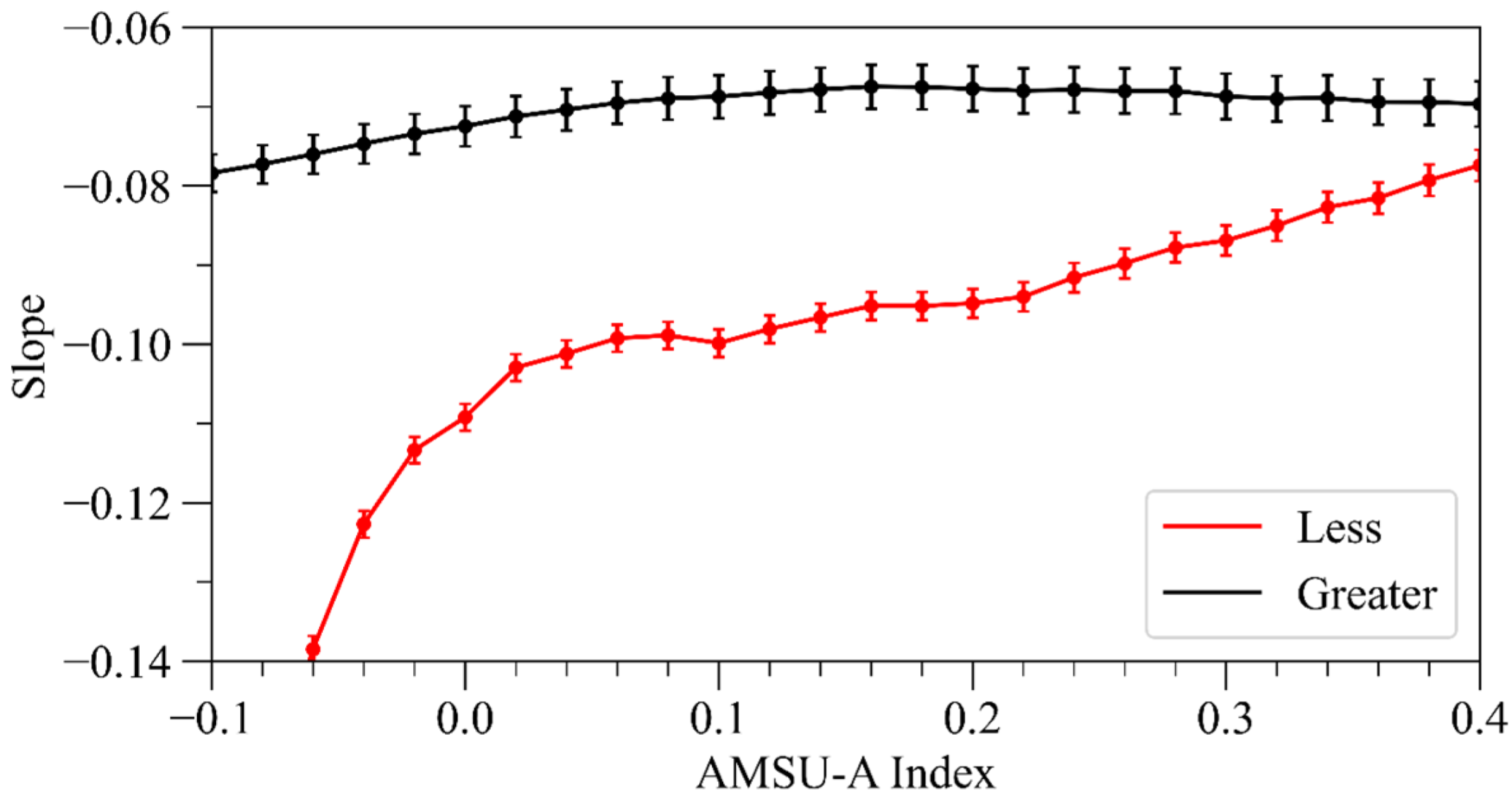
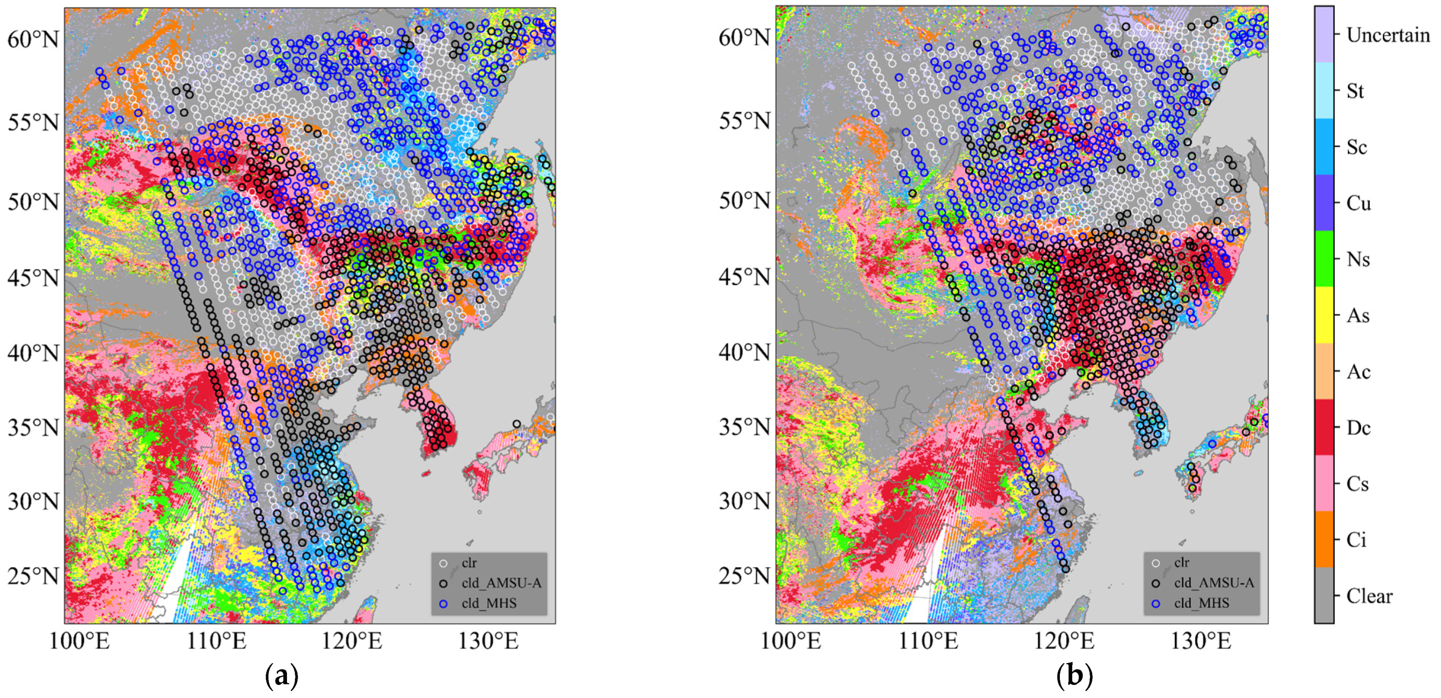
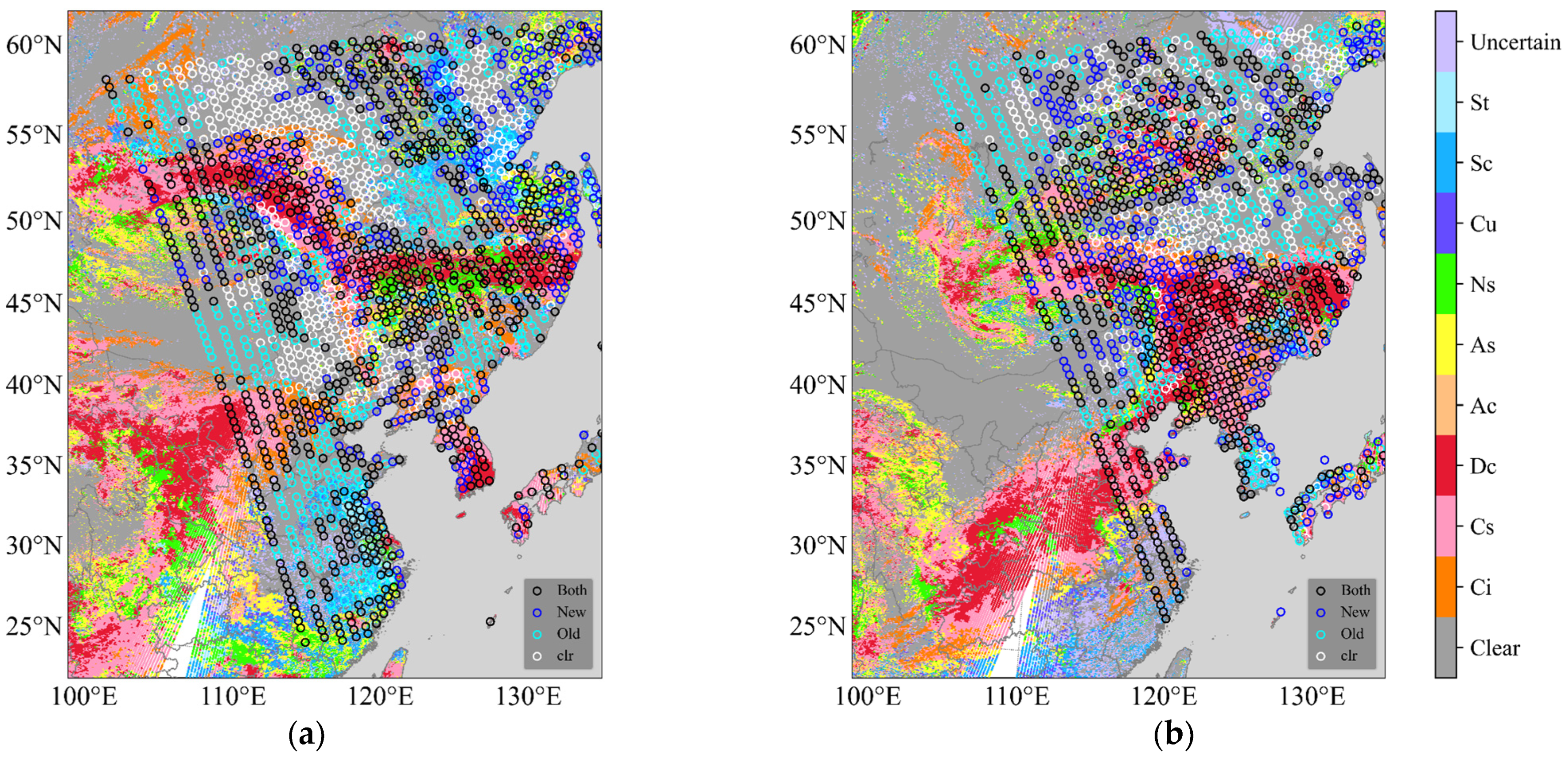
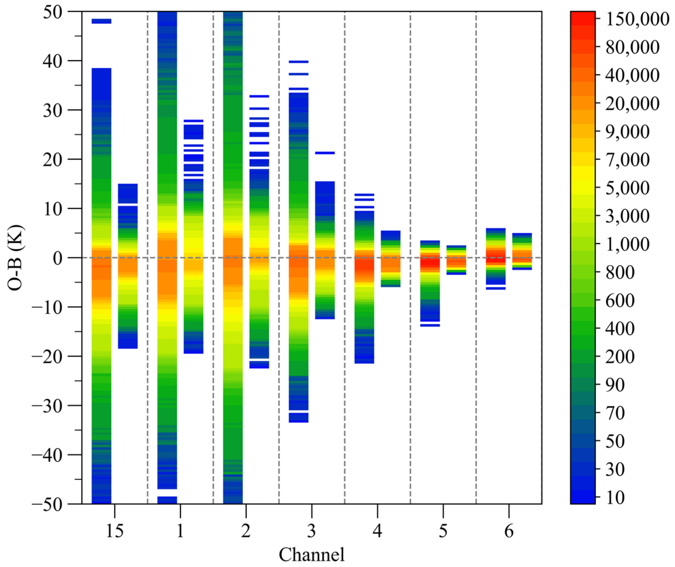
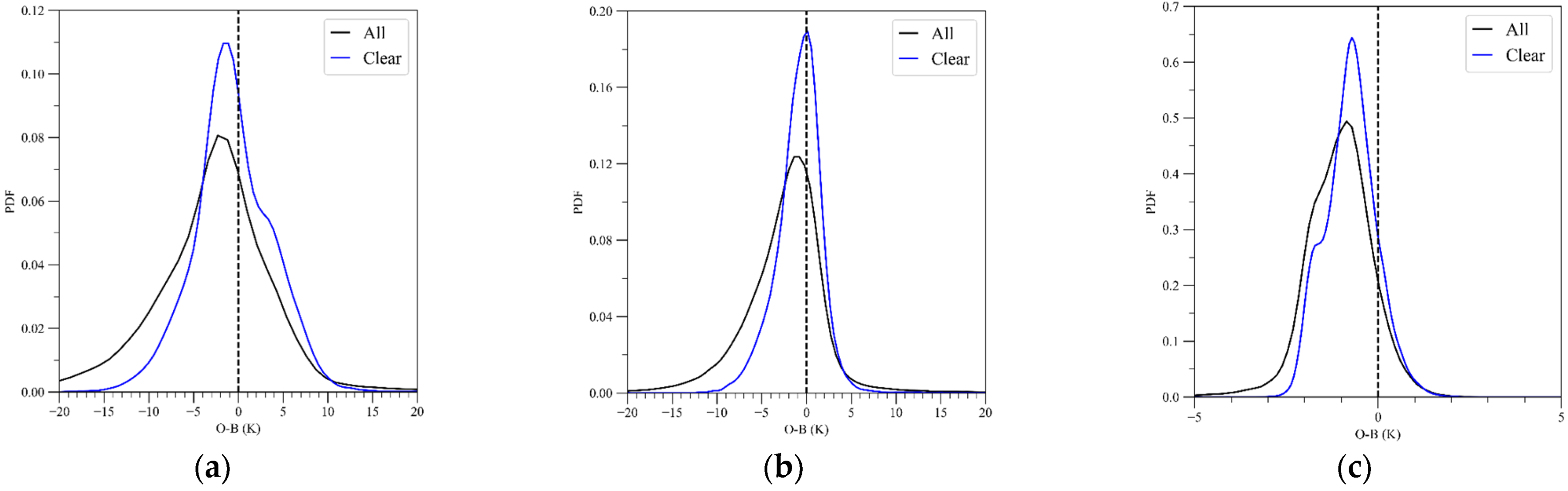
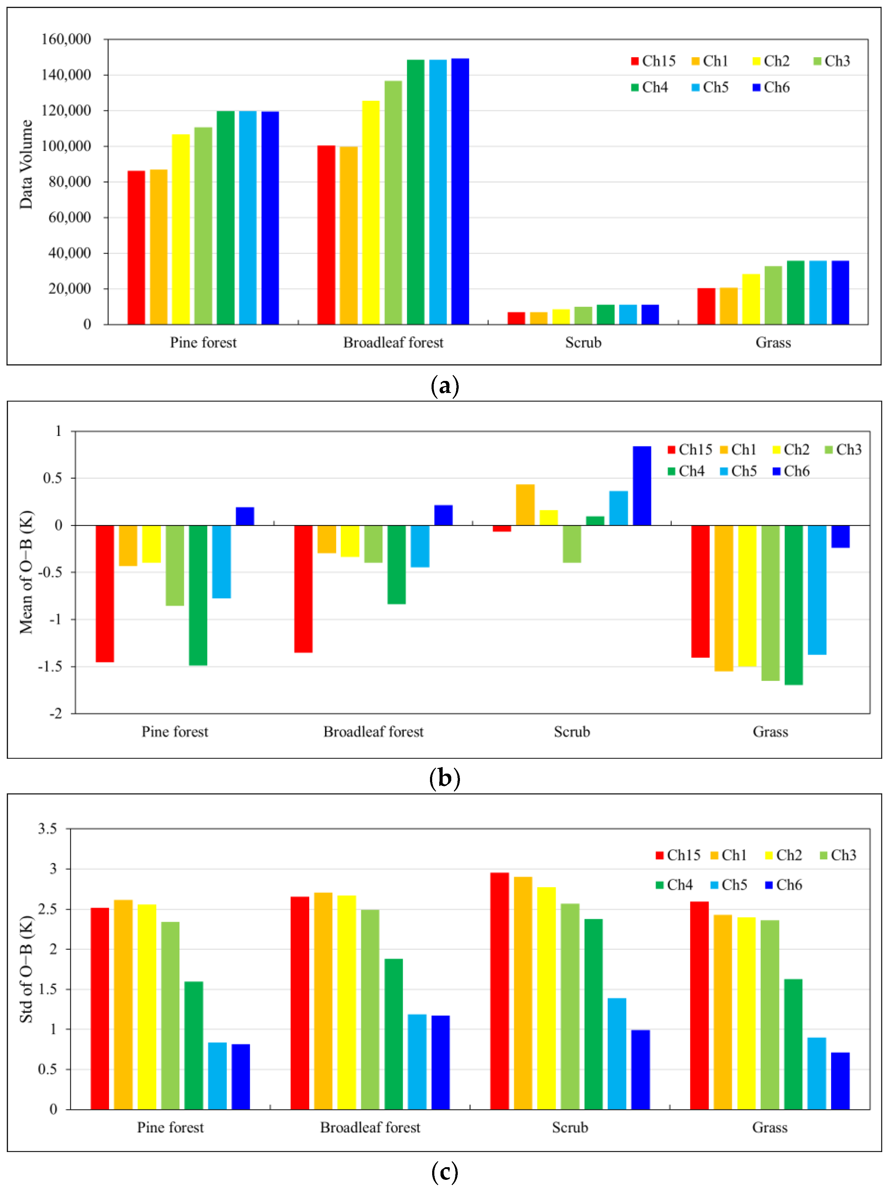
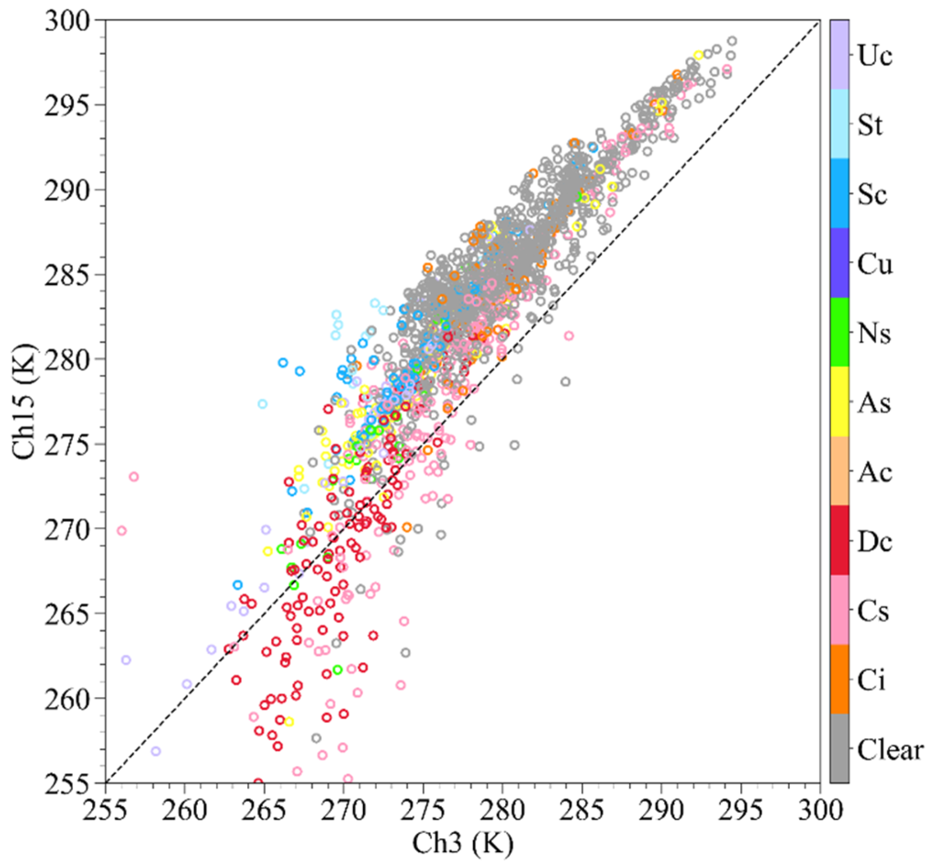
Satellite data are the main source of information for operational data assimilation systems, and Advanced Microwave Sounding Unit-A (AMSU-A) data are one of the types of satellite data that contribute most to the reduction of numerical forecast errors. However, the assimilation of AMSU-A data over land lags behind that over the ocean. In this respect, the accuracy of cloud detection over land is one of the factors affecting the assimilation of AMSU-A data, especially for the window and low-peaking channel (23–53.59 GHz and 89 GHz) data. Strong surface emissivity and high spatial and temporal variability make it difficult to distinguish between the radiative contributions of clouds and the atmosphere. Based on the differences in the response characteristics of different channels to clouds, five AMSU-A window and low-peaking channels (channels 1–4 and 15) were selected to develop a new index for cloud detection over land. Case studies showed that the AMSU-A cloud index can detect most of the convective clouds; additionally, by further matching the MHS (Microwave Humidity Sounder) cloud detection index, we can effectively distinguish between cloudy and clear-sky observations. Batch test results also verified the accuracy and stability of the new cloud detection method. By referring to the MODIS (Moderate Resolution Imaging Spectroradiometer) cloud product, the POD (probability of detection) of the cloud fields of view with the new method was nearly 84%. By using the new cloud detection method to remove the cloudy data, the bias and standard deviation of the observation-minus-simulated brightness temperature (O−B) were significantly reduced, with the bias of O−B for channels 2–4 being below 1.0 K and the standard deviation of channels 5 and 6 being nearly 1.0 K.
Keywords: brightness temperature; MHS; cloud index brightness temperature; MHS; cloud index