Article

Regional GNSS-Derived SPCI: Verification and Improvement in Yunnan, China
1
School of Geodesy and Geomatics, Wuhan University, Wuhan 430072, China
2
College of Geomatics, Xi’an University of Science and Technology, Xi’an 710054, China
3
Guangxi Key Laboratory of Spatial Information and Geomatics, Guilin University of Technology, Guilin 541000, China
*
Author to whom correspondence should be addressed.
Remote Sens. 2021, 13(10), 1918; https://doi.org/10.3390/rs13101918
Submission received: 27 March 2021 / Revised: 6 May 2021 / Accepted: 11 May 2021 / Published: 14 May 2021

Abstract

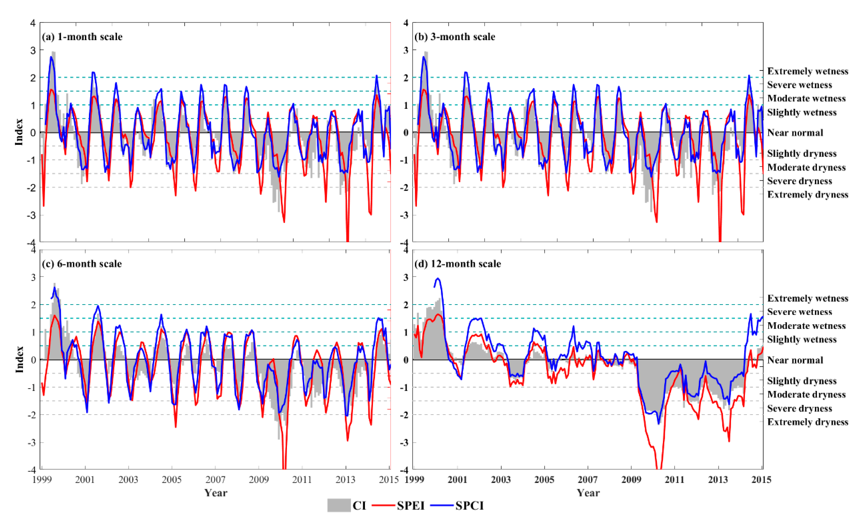
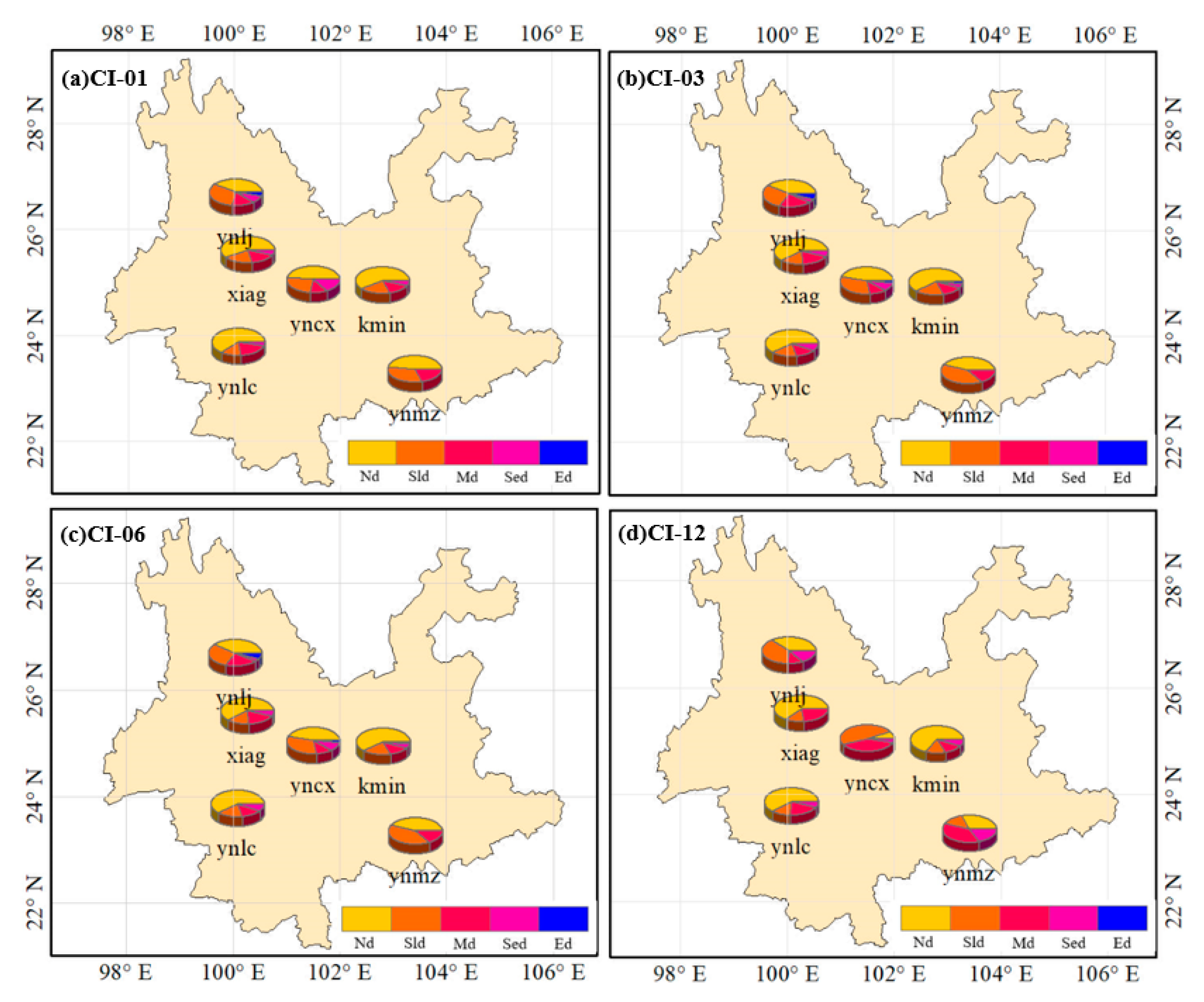
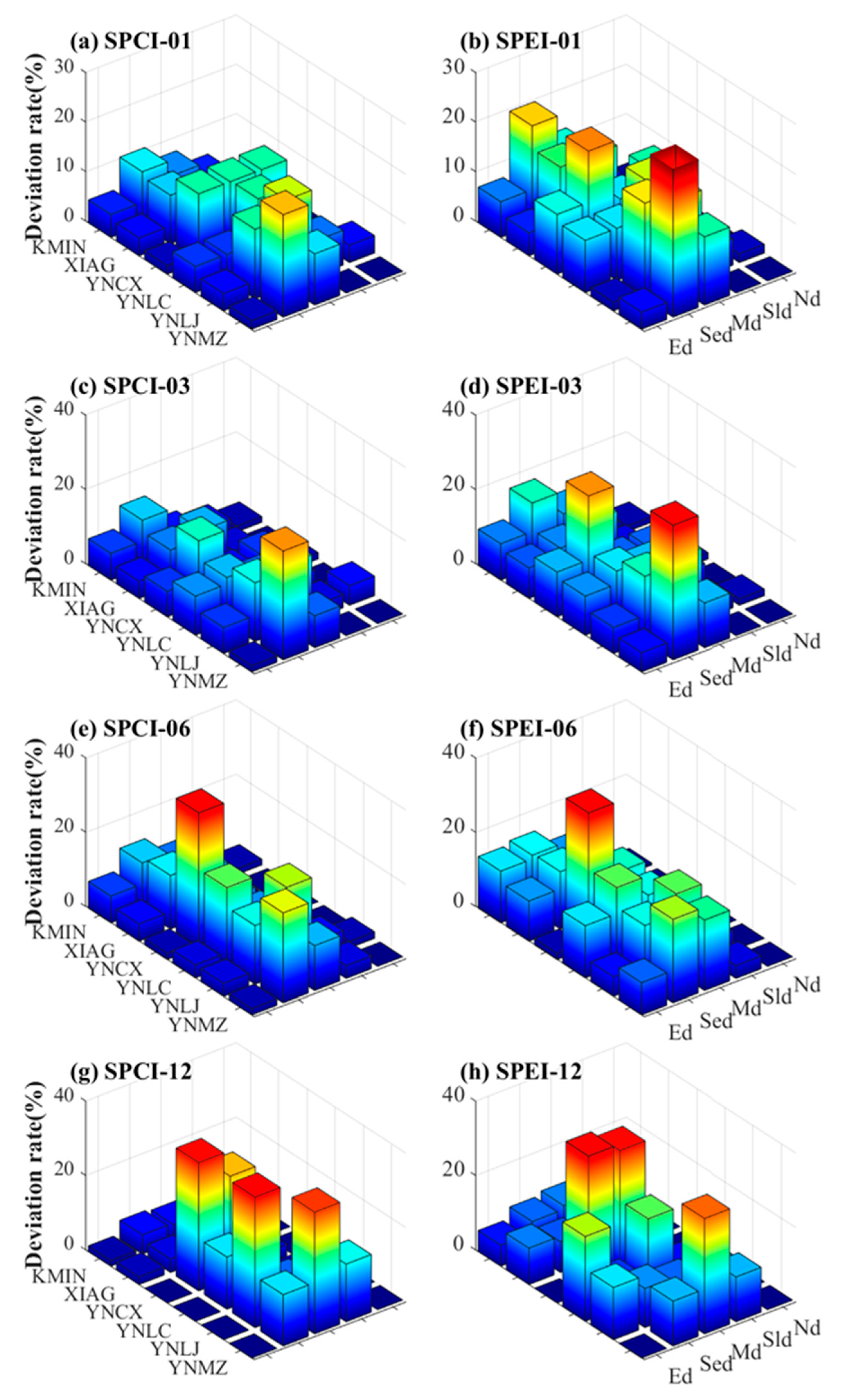
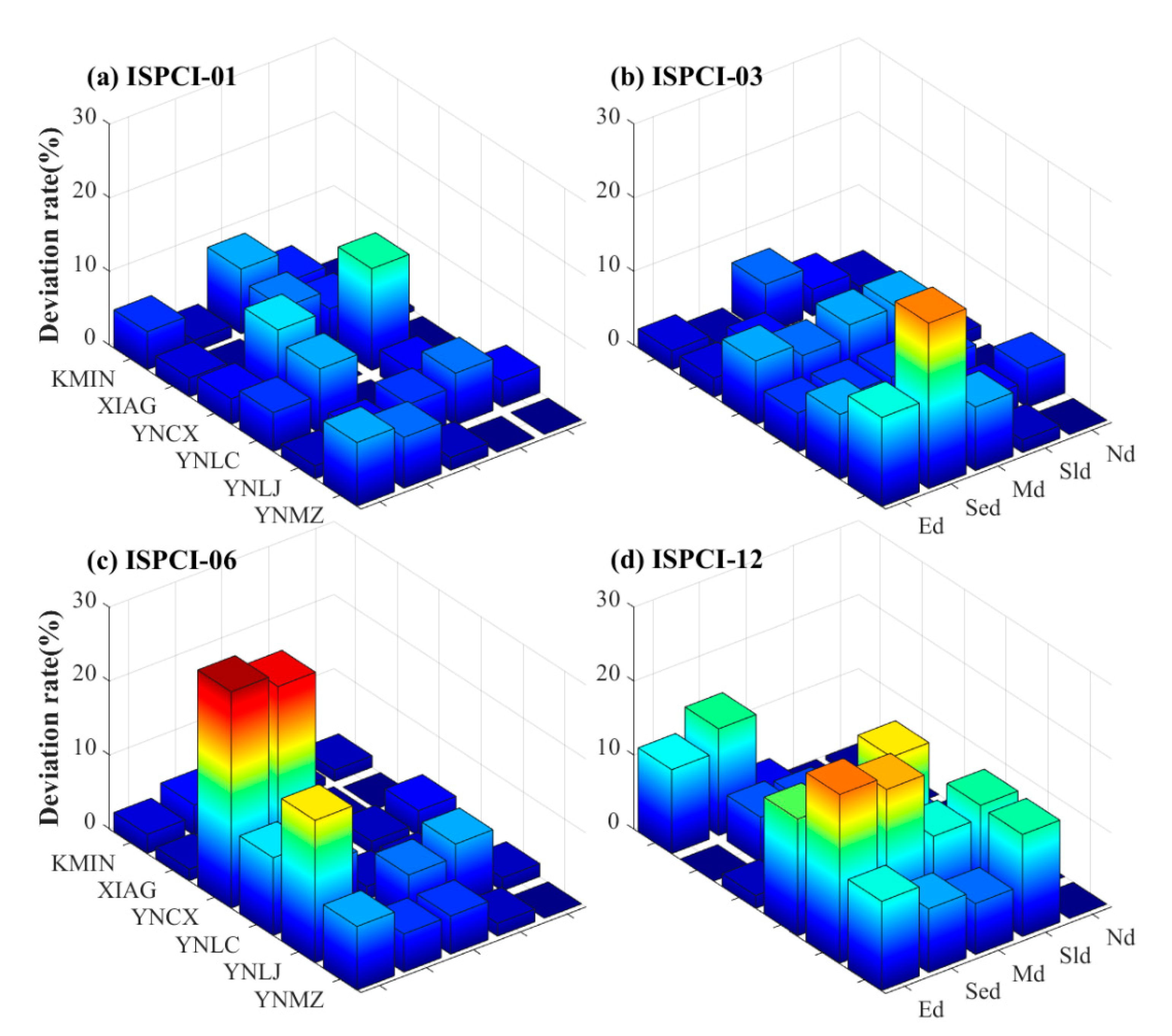
From the aspect of global drought monitoring, improving the regional drought monitoring method is becoming increasingly important for the sustainable development of regional agriculture and the economy. The standardized precipitation conversion index (SPCI) calculated by the Global Navigation Satellite System (GNSS) observation is a new means for drought monitoring that has the advantages of simple calculation and real-time monitoring. However, only SPCI with a 12-month scale has been verified on a global scale, while its capability and applicability for monitoring drought at a short time scale in regional areas have never been investigated. Therefore, this study aims to evaluate the performance of SPCI at other time scales in Yunnan, China, and propose an improved method for SPCI. The data of six GNSS stations were selected to calculate SPCI; the standardized precipitation evapotranspiration index (SPEI) and composite meteorological drought index (CI) are introduced to evaluate the SPCI at a short time scale in Yunnan Province. In addition, a modified CI (MCI) was proposed to calibrate the SPCI because of its large bias in Yunnan. Experimental results show that (1) SPCI exhibits better agreement with CI in Yunnan Province when compared to SPEI; (2) the capability of SPCI for drought monitoring is superior to that of SPEI in Yunnan; and (3) the improved SPCI is more suitable for drought monitoring in Yunnan, with a relative bias of 5.43% when compared to the MCI. These results provide a new means for regional drought monitoring in Yunnan, which is significant for dealing with drought disasters and formulating related disaster prevention and mitigation policies.
Keywords: drought; SPCI; precipitable water vapor; CI drought; SPCI; precipitable water vapor; CI
Graphical Abstract