Article

High-Resolution Inundation Mapping for Heterogeneous Land Covers with Synthetic Aperture Radar and Terrain Data


by
Fernando Aristizabal
1,*,
Jasmeet Judge
1 and
Alejandro Monsivais-Huertero
2
1
Center for Remote Sensing, University of Florida, Gainesville, FL 32611, USA
2
Instituto Politecnico Nacional, Escuela Superior de Ingeniería Mecánica y Eléctrica Unidad Ticomán, Mexico City, CDMX 07738, Mexico
*
Author to whom correspondence should be addressed.
Remote Sens. 2020, 12(6), 900; https://doi.org/10.3390/rs12060900
Submission received: 24 December 2019 / Revised: 4 March 2020 / Accepted: 4 March 2020 / Published: 11 March 2020
(This article belongs to the Special Issue Flood Mapping in Urban and Vegetated Areas)

Abstract

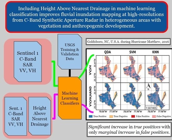
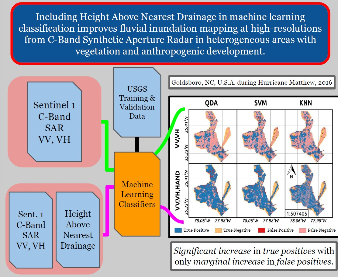
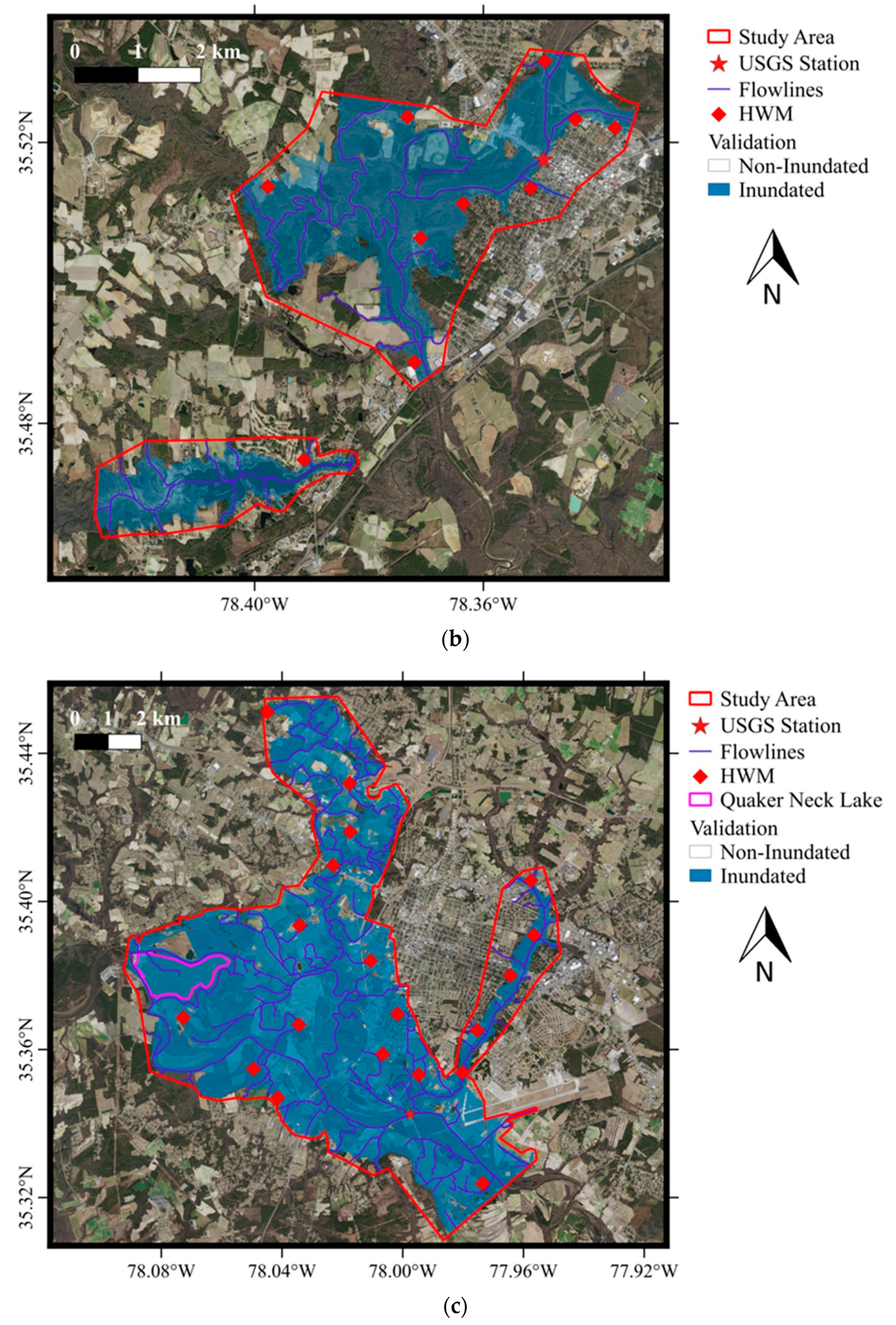
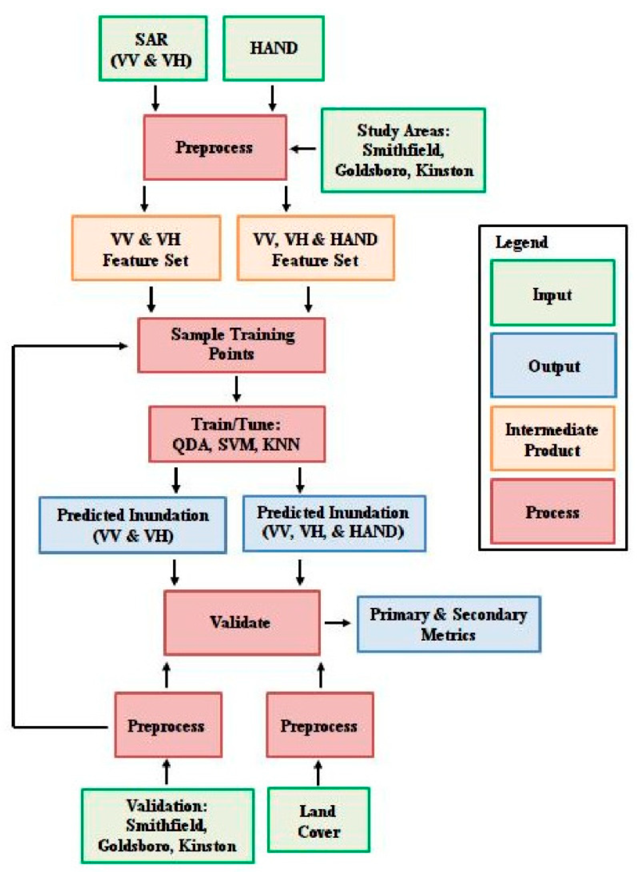
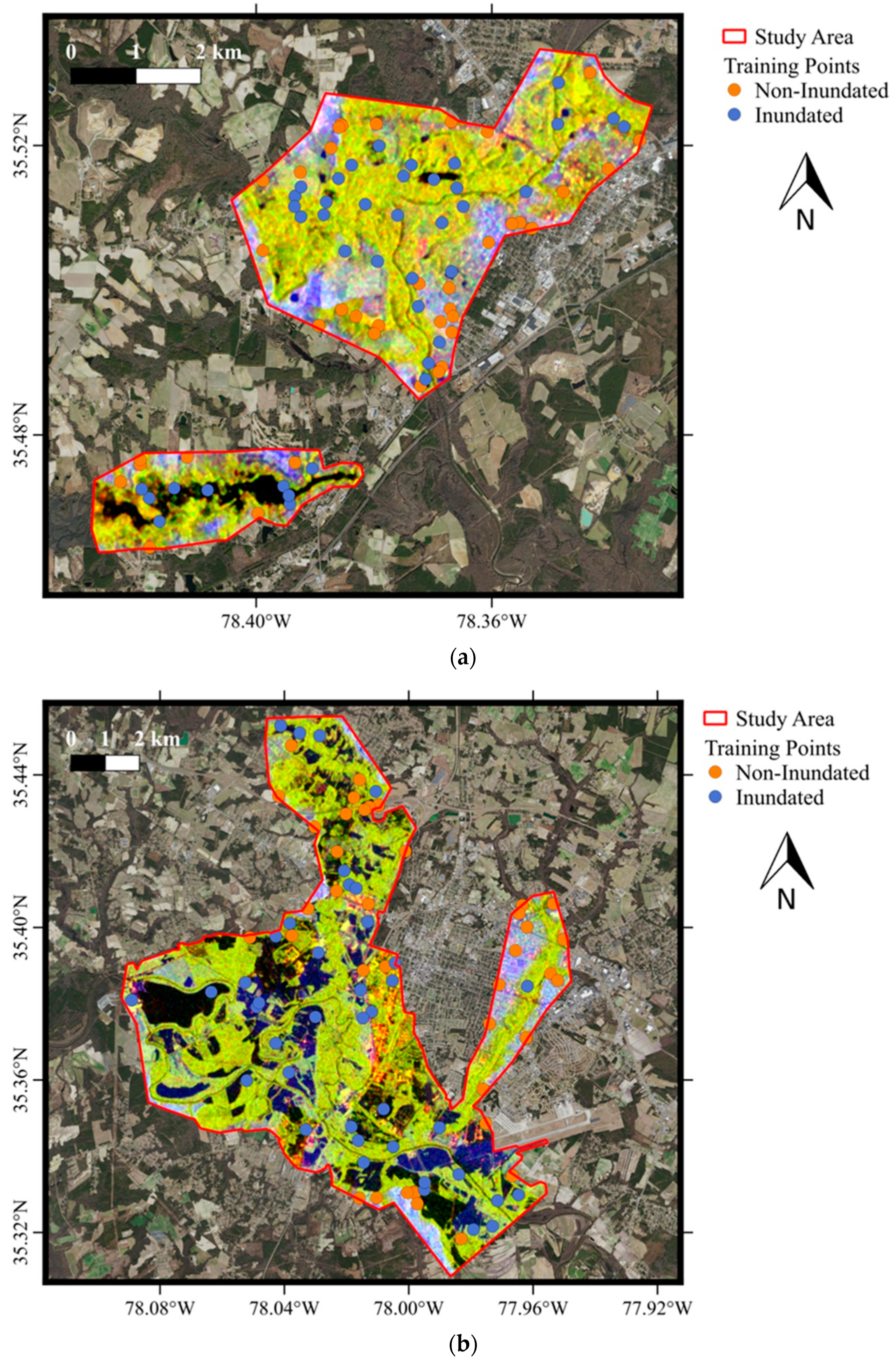
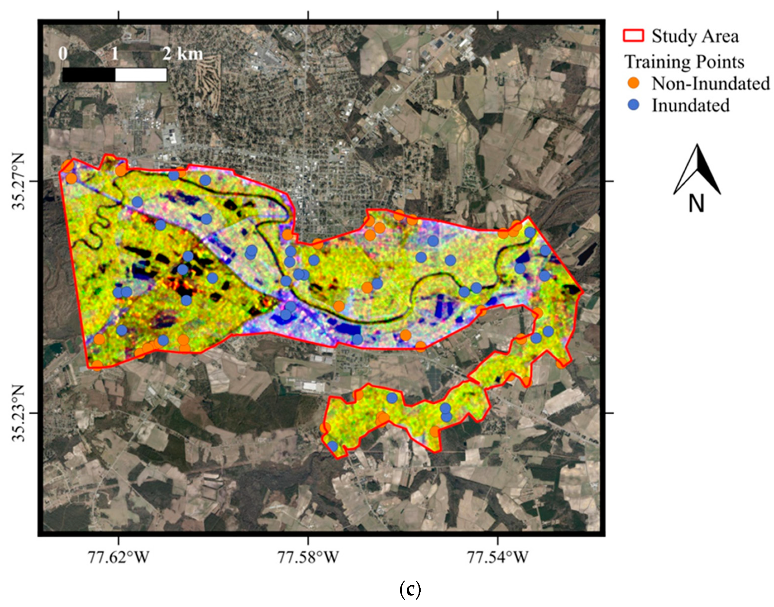
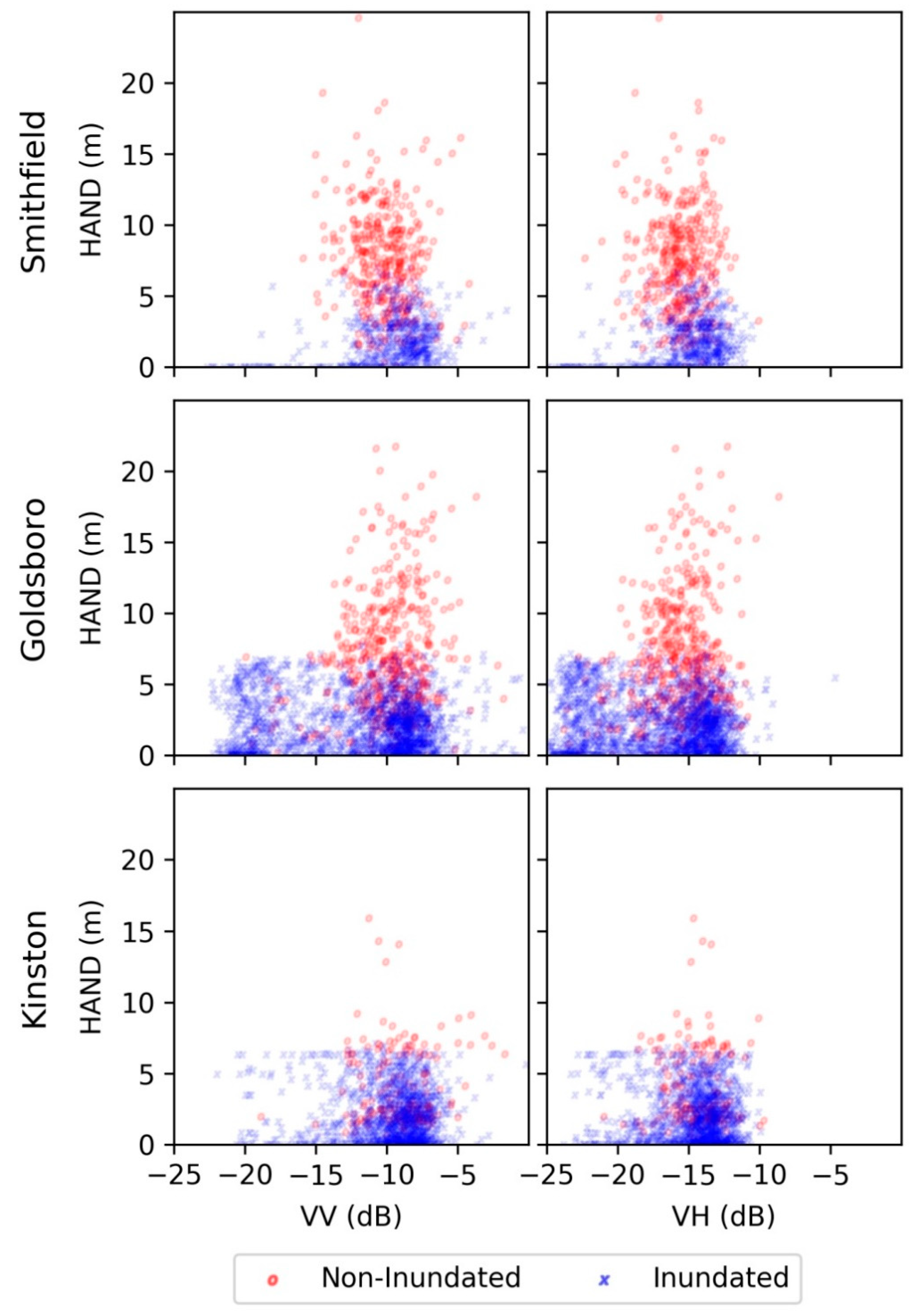
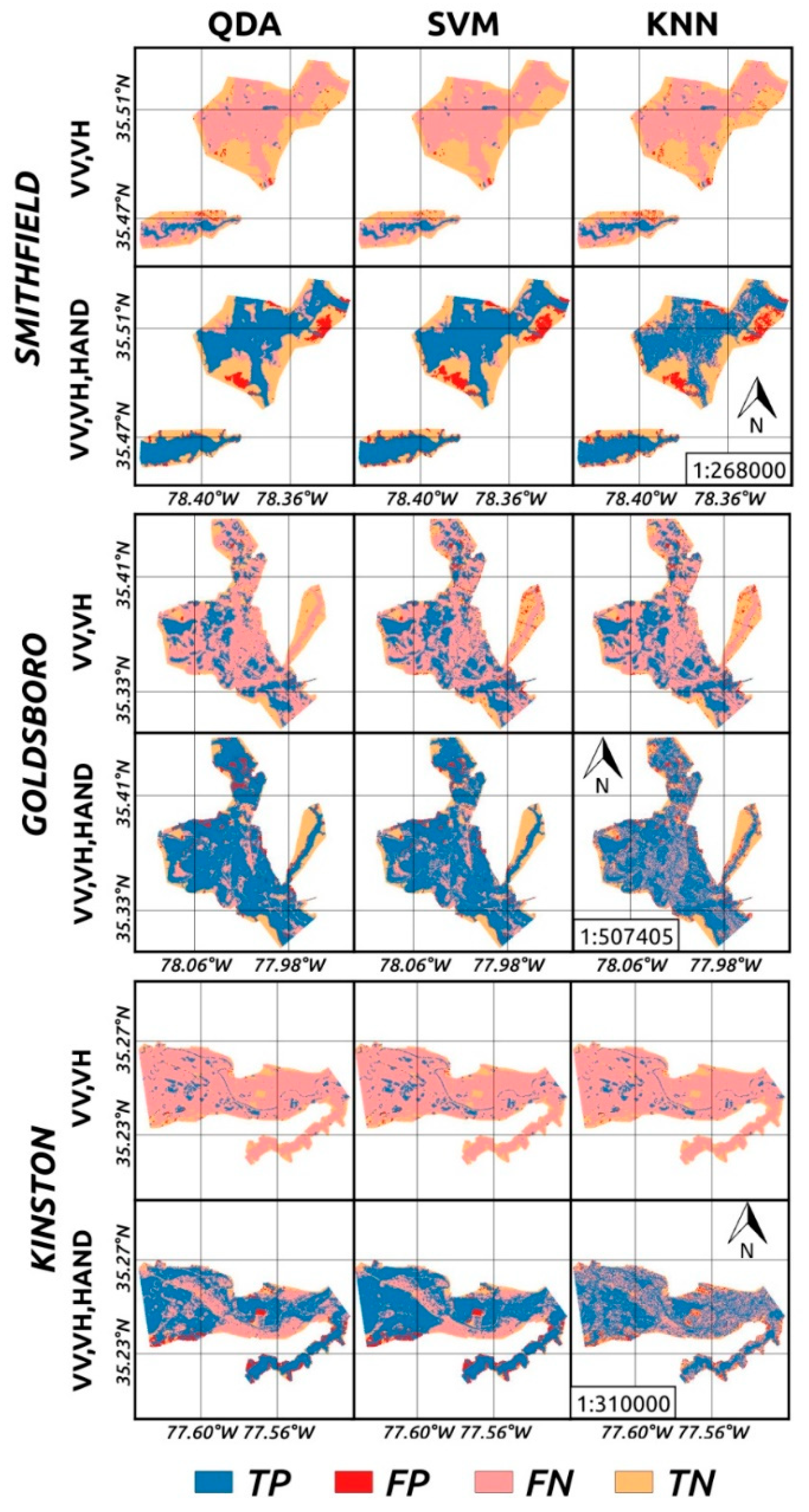
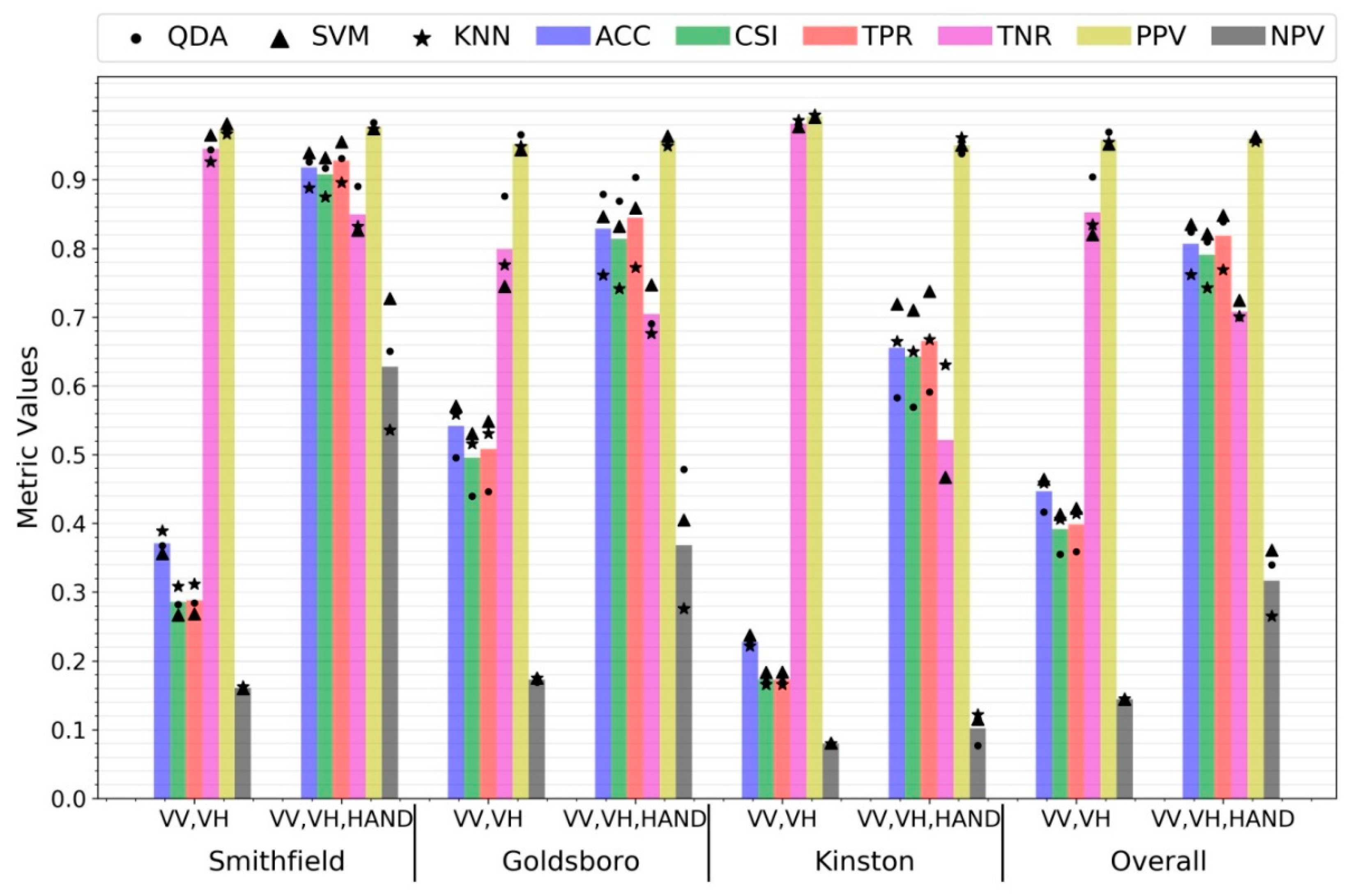
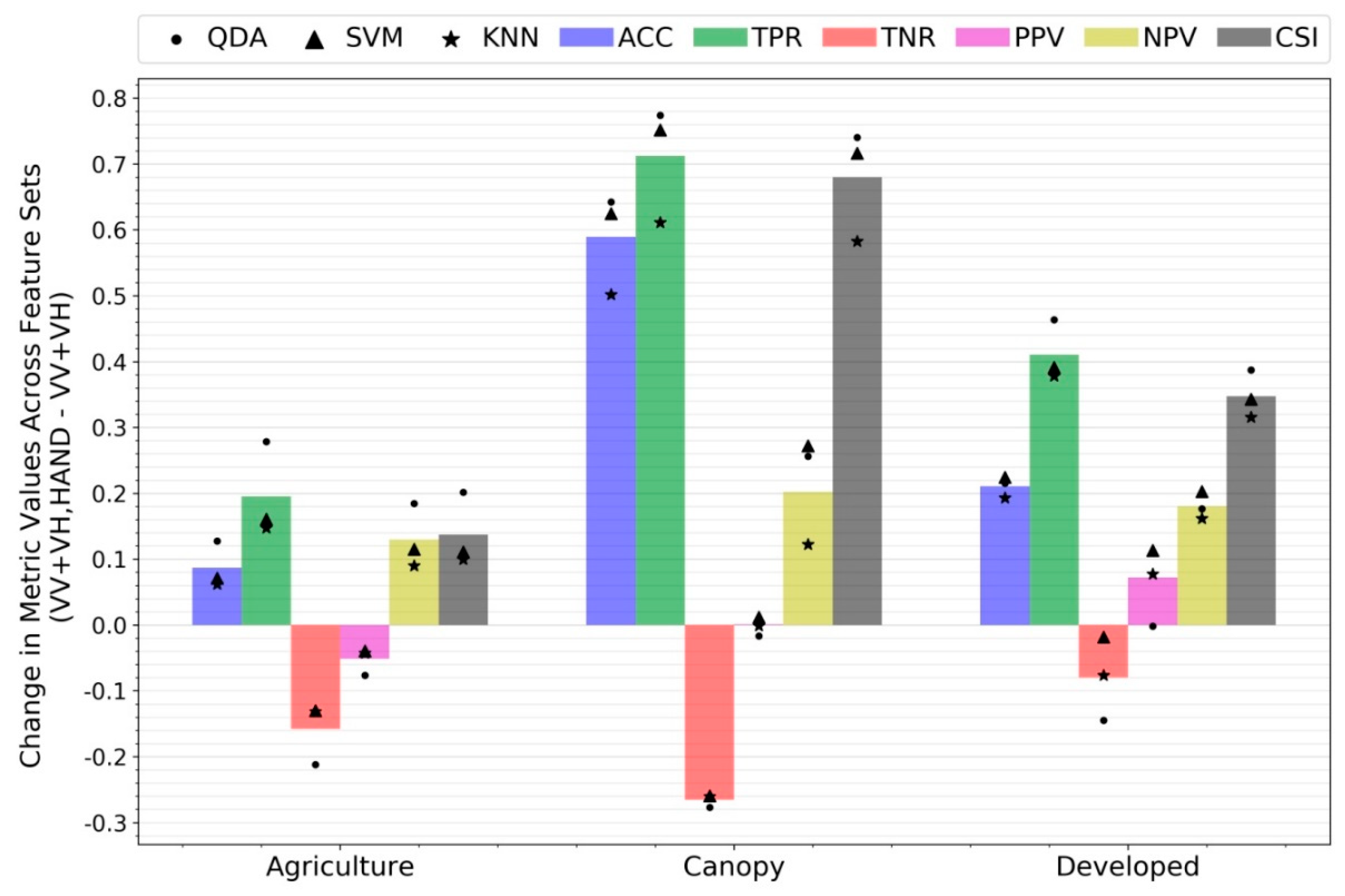
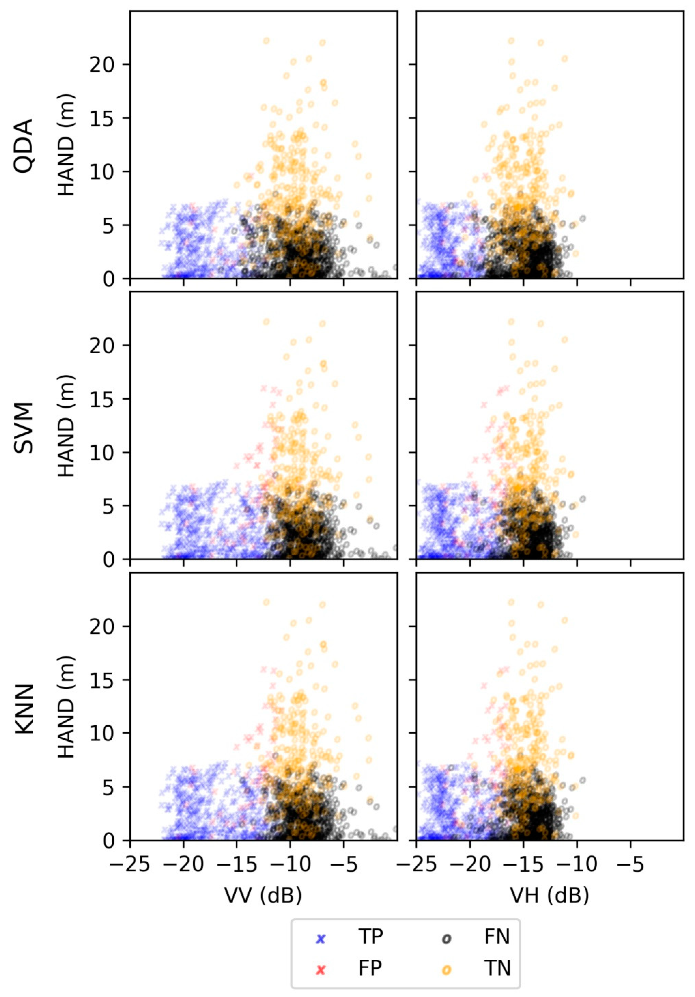
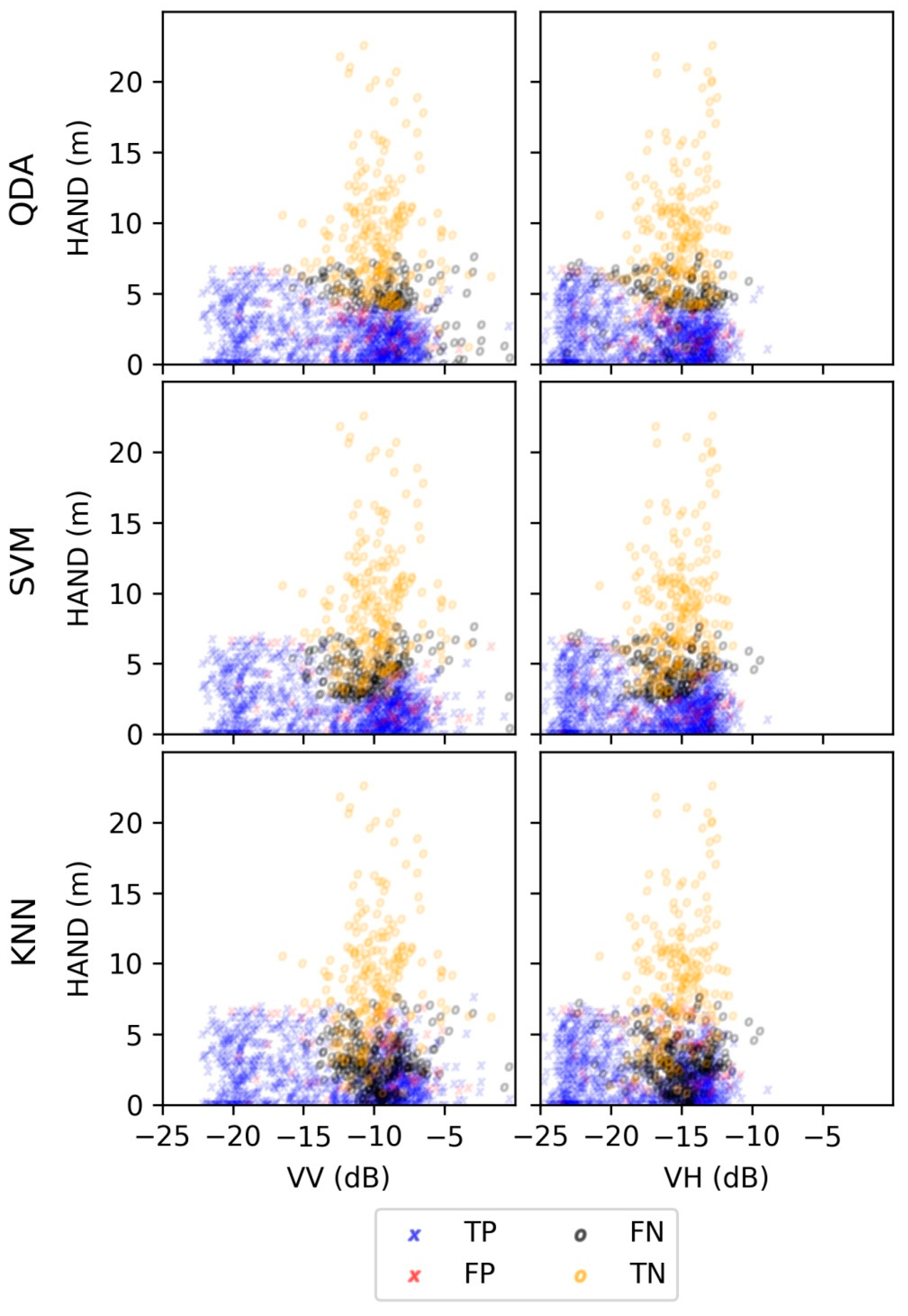
Floods are one of the most wide-spread, frequent, and devastating natural disasters that continue to increase in frequency and intensity. Remote sensing, specifically synthetic aperture radar (SAR), has been widely used to detect surface water inundation to provide retrospective and near-real time (NRT) information due to its high-spatial resolution, self-illumination, and low atmospheric attenuation. However, the efficacy of flood inundation mapping with SAR is susceptible to reflections and scattering from a variety of factors including dense vegetation and urban areas. In this study, the topographic dataset Height Above Nearest Drainage (HAND) was investigated as a potential supplement to Sentinel-1A C-Band SAR along with supervised machine learning to improve the detection of inundation in heterogeneous areas. Three machine learning classifiers were trained on two sets of features dual-polarized SAR only and dual-polarized SAR along with HAND to map inundated areas. Three study sites along the Neuse River in North Carolina, USA during the record flood of Hurricane Matthew in October 2016 were selected. The binary classification analysis (inundated as positive vs. non-inundated as negative) revealed significant improvements when incorporating HAND in several metrics including classification accuracy (ACC) (+36.0%), critical success index (CSI) (+39.95%), true positive rate (TPR) (+42.02%), and negative predictive value (NPV) (+17.26%). A marginal change of +0.15% was seen for positive predictive value (PPV), but true negative rate (TNR) fell −14.4%. By incorporating HAND, a significant number of areas with high SAR backscatter but low HAND values were detected as inundated which increased true positives. This in turn also increased the false positives detected but to a lesser extent as evident in the metrics. This study demonstrates that HAND could be considered a valuable feature to enhance SAR flood inundation mapping especially in areas with heterogeneous land covers with dense vegetation that interfere with SAR.
Keywords: supervised machine learning; flood inundation mapping; high-resolution; synthetic aperture radar; height above nearest drainage; Sentinel-1; inundated vegetation supervised machine learning; flood inundation mapping; high-resolution; synthetic aperture radar; height above nearest drainage; Sentinel-1; inundated vegetation
Graphical Abstract