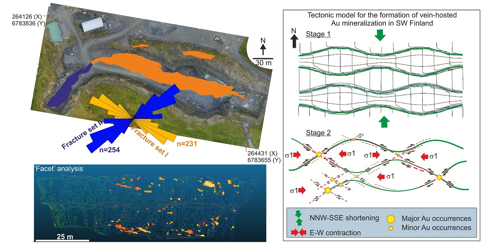
Virtual Structural Analysis of Jokisivu Open Pit Using ‘Structure-from-Motion’ Unmanned Aerial Vehicles (UAV) Photogrammetry: Implications for Structurally-Controlled Gold Deposits in Southwest Finland


Abstract
Share and Cite
Sayab, M.; Aerden, D.; Paananen, M.; Saarela, P. Virtual Structural Analysis of Jokisivu Open Pit Using ‘Structure-from-Motion’ Unmanned Aerial Vehicles (UAV) Photogrammetry: Implications for Structurally-Controlled Gold Deposits in Southwest Finland. Remote Sens. 2018, 10, 1296. https://doi.org/10.3390/rs10081296
Sayab M, Aerden D, Paananen M, Saarela P. Virtual Structural Analysis of Jokisivu Open Pit Using ‘Structure-from-Motion’ Unmanned Aerial Vehicles (UAV) Photogrammetry: Implications for Structurally-Controlled Gold Deposits in Southwest Finland. Remote Sensing. 2018; 10(8):1296. https://doi.org/10.3390/rs10081296
Chicago/Turabian StyleSayab, Mohammad, Domingo Aerden, Markku Paananen, and Petri Saarela. 2018. "Virtual Structural Analysis of Jokisivu Open Pit Using ‘Structure-from-Motion’ Unmanned Aerial Vehicles (UAV) Photogrammetry: Implications for Structurally-Controlled Gold Deposits in Southwest Finland" Remote Sensing 10, no. 8: 1296. https://doi.org/10.3390/rs10081296
APA StyleSayab, M., Aerden, D., Paananen, M., & Saarela, P. (2018). Virtual Structural Analysis of Jokisivu Open Pit Using ‘Structure-from-Motion’ Unmanned Aerial Vehicles (UAV) Photogrammetry: Implications for Structurally-Controlled Gold Deposits in Southwest Finland. Remote Sensing, 10(8), 1296. https://doi.org/10.3390/rs10081296