Abstract
As urbanization accelerates globally, preserving and developing historical cultural districts is increasingly critical, especially in areas with unique historical and cultural value. To understand the development of urban construction and the diachronic and spatial patterns of development, this paper focuses on Guiyang, a key transportation hub in Southwest China connected to Southeast Asia. It examines the historical districts from four representative periods: the early Ming Dynasty (1413–1420), the early Qing Dynasty (1616–1626), the Republican era (1912–1949), and the 1980s (1980–1990). Employing complex network analysis, the study investigates the changes in the connectivity characteristics of construction land and road networks. Key findings reveal: (1) Stability: The construction land networks stability decreased steadily from the early Ming period to the 1980s, whereas the road network density exhibited a wave-like decline. (2) Centrality: The construction land networks centrality decreased linearly, and the road network density exhibited a wave-like decrease. (3) Vulnerability: Both networks showed increased vulnerability, with fluctuations in the road network during the early Qing period, but generally reduced vulnerability. The analysis also indicates that changes in the connectivity of Guiyang’s historical district construction land and road networks are influenced by shifts in social structures, improvements in productivity, and the physical geography of the area. In mountainous cities with limited terrain, urban forms have transitioned from single-center aggregation to multi-center aggregation, and areas where administrative expansion is not feasible have adopted compact spatial development strategies. The application of complex network analysis has proven effective in urban spatial studies, revealing that changes in construction land and road networks reflect multifaceted internal transformations in society, politics, economy, military, and culture, significantly impacting the formation of a diverse yet unified national identity. Based on these findings, this paper offers recommendations for the planning and development of mountainous cities globally.
1. Introduction
In recent years, particularly in developing countries, how to balance urban modernization with the preservation of historical and cultural districts has become a major challenge in urban development. These districts not only preserve rich history and culture but also play a key role in urban development [1]. However, urban expansion and modernization often impact these areas. The expansion and modification of road networks have particularly profound impacts, not only altering the spatial structure and functionality of regions but also exerting significant effects on the economic and social environments of surrounding communities [2]. To understand why there has been an increasing focus on heritage preservation in these historic districts, it is essential to trace the historical context of the city and explore the historical significance of these districts as cultural heritage. Historical and cultural heritage not only represents the historical memory of a region but also serves as the core of local cultural identity. The historic districts of Guiyang are a key manifestation of this cultural heritage. China, as the most populous country in the world with vast territory, boasts a rich cultural heritage and diverse geographical environments. The challenge of effectively preserving historical and cultural districts while optimizing urban spatial planning during the rapid urbanization process has become an urgent issue to address. Since the Ming Dynasty, China’s overall strength has lagged behind the West, particularly during the late Qing period, with low productivity, and it remains a developing country today [3]. Over the past 600 years, China’s social, economic, and spatial structures have undergone profound changes [4], especially with urbanization reshaping urban spaces [5]. Guiyang, a major political, economic, and cultural center in southwest China, became a strategic location in the Ming and Qing periods, connecting inland China with Southeast Asia and fostering cultural exchange among various ethnic groups [6]. Over time, Guiyang developed into a multi-ethnic city with a unique local culture. However, rapid economic growth and urbanization have significantly changed construction land and road networks in its historic districts. These changes have altered the city’s landscape and impacted residents’ quality of life and cultural heritage preservation. Therefore, the preservation of the cultural heritage in these historic districts and ensuring its proper transmission during the process of modernization have become crucial issues in urban development. Furthermore, studying the changes in construction land and road network connectivity in Guiyang’s historic districts can offer insights into the relationship between urban development and cultural preservation, providing valuable lessons for other cities.
Current research on historic cultural districts mainly focuses on four areas: “preservation and renewal” [7,8,9], “landscape research and planning” [10,11,12], “historical resilience” [13,14], and “commerce and tourism” [15,16,17,18]. Research on historical districts in global mountain cities focuses on three primary aspects: (1) Examining the impact of unique topographical characteristics on historical landscapes and urban forms, as evidenced by studies such as Mohamed et al. on heritage conservation in Aman, a mountain city in the Arab region [19,20]; (2) Developing sustainable practices to minimize environmental impacts due to the ecological sensitivity of mountain areas, with Taherkhani et al. proposing a sustainable urban revitalization framework for historic districts in Iran [21,22]; (3) Exploring how historical districts can enhance local economies through tourism and the preservation of traditional crafts and industries [23,24]. In recent years, research on historical heritage conservation has increasingly emphasized the integration of spatial, social, economic, and environmental dimensions. For example, some studies argue that heritage conservation should not only focus on the buildings themselves but also consider the functional roles of historic districts in modern cities and their impact on social structures [25]. Additionally, heritage conservation is becoming more closely linked to sustainable urban development, with studies highlighting the symbiotic relationship between heritage preservation and modern urban growth and proposing models that balance conservation and development, such as cultural heritage tourism and community participation [26].
Concurrently, research on road space networks includes studying road centrality, optimizing road system efficiency [27,28], integrating road networks with public transportation systems [29], and further optimizing existing road infrastructures as demonstrated by Alec et al. in their study on the invariance of intermediacy centrality in planar network structures [30] and Fan et al., who examined changes in the centrality of Changsha’s road system [31]. Additionally, studies on construction land focus on the impact of institutional changes on land use [32,33]. Based on the above analysis, current studies on the morphological changes of historical district urban forms using spatial complex networks are relatively limited. Such research is instrumental in deepening the understanding of the city’s historical and cultural contexts, enabling urban planners to accurately capture the dynamic changes of the city. By analyzing the evolution and current state of historical districts, planners can more effectively formulate future development strategies, ensuring the continuity of urban development and the preservation of cultural heritage.
Building on this foundation, the current paper employs complex network analysis to investigate connectivity changes in construction land and road networks within historic districts of mountainous cities, using Guiyang as a case study since the Ming Dynasty. This study aims to provide novel insights into urban planning and heritage conservation through the following contributions: (1) Uncovering Connectivity Dynamics: By examining the evolution of construction land and road networks, this research highlights the transformation of urban spatial structures over time, offering a deeper understanding of connectivity patterns in historic districts. (2) Identifying Key Drivers: The study analyzes social, economic, and environmental factors that shape connectivity in Guiyang’s historic districts, pinpointing critical influences on urban development and change. (3) Policy Recommendations: Based on these findings, targeted strategies are proposed to balance the preservation of cultural heritage with modern urban needs, promoting sustainable development and effective conservation practices.
2. Research Subjects and Methods
2.1. Selection and Overview of the Research Area
Guiyang, located in central Guizhou Province (26°11′–26°55′ N, 106°07′–107°17′ E), is a city with over 700 years of history. It currently covers an area of 8043 km2, and belongs to the subtropical highland monsoon humid climate zone, with an average annual temperature of 16.2 °C, an annual rainfall of 1129.5 mm, and an average annual relative humidity of 77%. The city is characterized by well-developed karst topography, with exposed karst areas accounting for 85.03% of the total land area, dominated by mountainous and hilly terrain. As a crucial transportation hub connecting the five southwestern provinces of China to Southeast Asia, Guiyang serves as the economic, political, and cultural center of Guizhou Province. The city is home to 11 indigenous ethnic minorities, contributing to its multicultural coexistence. Compared with the plains and coastal regions, Guiyang’s socioeconomic development is relatively lagging, making it a representative case for studying urban spatial structure in southwestern mountainous cities (refer to Figure 1).
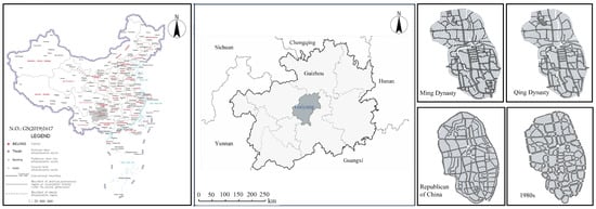
Figure 1.
Location Map of Guiyang City.
Since the establishment of Guizhou as a province, the provincial capital, Guiyang, has experienced four major waves of migration, shaping its multicultural coexistence. In the early Ming Dynasty, Guiyang was primarily inhabited by ethnic minorities. To pacify Yunnan, the central government initiated a large-scale migration of Han people from the Central Plains, which altered the city’s ethnic composition. In the early Qing Dynasty, the implementation of the land reform policy led to continued Han migration, along with the establishment of regional guild halls, introducing various provincial cultures. During the Second Sino-Japanese War, a large number of factories, businesses, schools, government agencies, and personnel relocated inland, further expanding Guiyang’s non-local population. In the 1980s, a significant influx of cadres, soldiers, and graduates from military and “Third Front” construction efforts migrated to Guiyang, further transforming the city’s population, economy, and society. These four waves of large-scale migration not only fostered Guiyang’s multiculturalism but also brought significant changes to its spatial structure (refer to Table 1).

Table 1.
The event of four periods.
2.2. Research Methods
2.2.1. Construction of the Spatial Network Model
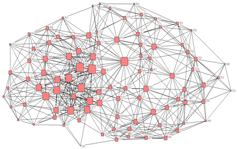
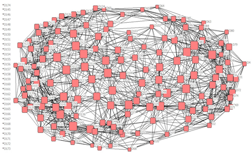
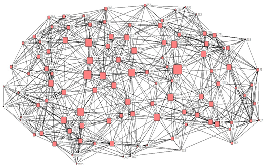
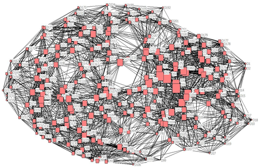
This study employs complex network analysis to construct the road and construction land networks across four different periods. Complex network analysis, primarily inspired by social network analysis, focuses on studying relationships between individual entities within a network. The principle is to represent each entity as a “node” and the connections between entities as “edges” to form a network model, allowing for a quantitative analysis of relationships within the network [34,35,36]. The construction of the quantitative model for Guiyang’s road and construction land networks during four periods includes the following three steps:
- Identifying Nodes and Connections for Four Historical Periods: In this study, the “nodes” in the network model refer to the spatial genes of roads and construction land. The “connections” are defined as the “edges” between the network nodes. A connection is recorded as an edge if a road and construction land are geographically connected or adjacent; this is recorded as 1, and otherwise, as 0. The road system serves as the “edges,” where a connection between nodes is recorded as 1 and no connection as 0.
- Collecting Basic Data for Nodes: Two-dimensional maps obtained from the Gazetteer of Guizhou are imported into ArcMap 10.6 to quantify the spatial outlines of roads and construction land. The spatial join tool in this software is used to identify.
- Relationships between roads and construction land, as well as between roads themselves. The data are then converted into a relational matrix using Matlab 2019 software.
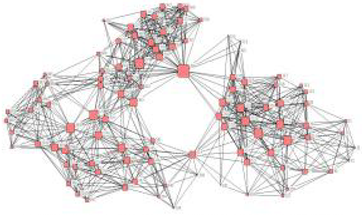
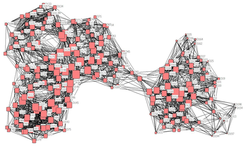
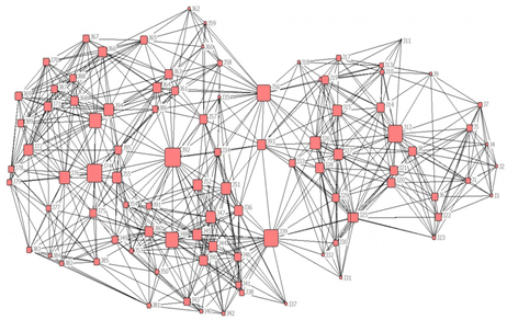
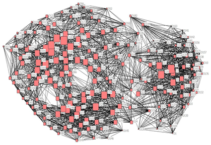
- Constructing the Spatial Network Model: The processed data are imported into Ucinet 6.0 to construct the overall spatial network for each period (i.e., construction land-construction land and road-road networks). Visualization images and relevant network indicators are generated for these two types of networks.
2.2.2. Selection of Spatial Network Model Indicators
The analysis of the network connectivity characteristics of Guiyang’s construction land and road networks across four periods will be conducted from three dimensions: network stability (K-core, network density), network Centrality (Degree Centrality, Betweenness Centrality), and network vulnerability (clustering coefficient, network efficiency). The specific definitions of these indicators are provided in Table 2.
Table 2.
Indicators of Construction Land and Road Networks in Guiyang Across Four Periods.
2.3. Data Processing
The primary data for this study are derived from historical maps, urban planning maps, and land use planning maps of Guiyang City from various periods. These materials are provided by the Guiyang City Archives and the public library resources of the Guizhou Provincial Library, originally in paper form. The data processing procedure is illustrated in Figure 2, with the following specific steps: (1) The collected maps were imported into ArcMap 10.6, where the spatial boundaries of roads and construction land were quantified into shapefile (shp) format (see Figure 1). Within ArcMap 10.6, researchers quantitatively analyze the spatial boundaries of roads and built-up areas and use the spatial join feature to extract the “line” relationships between construction land areas and roads and between roads themselves. (2) The data obtained from ArcMap is imported into MATLAB 2019. After that, a program specifically designed to transform the relational data into a matrix is used to convert the relationship data into a bipartite matrix. (3) The resulting matrix is then imported into Ucinet 6.0. First, the bipartite matrix obtained in the previous step is converted into two unipartite matrices: one for road-to-road relationships and the other for constructing land-to-construct land relationships. Next, using these unipartite matrices, network topology diagrams for the land-use spatial network and road spatial network are constructed in Ucinet 6.0, and selected indices are calculated using the software’s computational capabilities. (4) Finally, by comparing index data across different periods, the study analyzes the dynamic changes in the spatial network of Guiyang City’s historic districts.
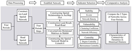
Figure 2.
Data Processing Flowchart.
3. Results and Analysis
3.1. Stability of Construction Land Spatial Network and Road Network in Historical Cultural Districts Across Four Periods
3.1.1. K-Core of Construction Land Spatial Network and Road Network
From Table 3, it can be seen that the K-core distribution trends of the construction land spatial network and road network are generally consistent over time, both showing a downward trend from the early Ming Dynasty to the Republic of China period, followed by an increase in the 1980s, returning to a distribution ratio similar to the early Qing Dynasty. However, the K-core values of the road network are higher than those of the construction land network, and the road network includes more components. For example, in the Republic of China period, the construction land network only has 10-core and 11-core, while the road network contains 10-core, 12-core, 13-core, and 16-core components. This indicates that the road network’s stability is higher than that of the construction land network, reflecting the prioritization of road network planning in urban construction, consistent with current strategies. The K-core components were fewest in the Republic of China period and most abundant in the early Ming Dynasty, indicating that the networks were least stable in the Republic of China period and most stable in the early Ming Dynasty. In Chinese history, the Ming and Republic of China periods both placed great importance on the southwestern region, where numerous ethnic minorities lived. Before the Yuan Dynasty, this region had various independent regimes, leading to social instability. The Ming Dynasty’s establishment of the Tusi system and governance measures promoted stability, ethnic integration, and economic prosperity, fostering the unity and diversity of the Chinese nation, which in turn stabilized urban networks. In contrast, during the Republic of China, wars and social unrest, especially during the Sino-Japanese War, destabilized urban networks. This demonstrates that the stability of construction land and road networks in urban construction reflects broader social, economic, and political factors.
Table 3.
K-Core in Construction Land Network Across Four Historical Periods in Historic Districts.
3.1.2. Density of Construction Land Spatial Network and Road Network
As shown in Figure 3, from the early Ming Dynasty to the 1980s, the density of the construction land spatial network displayed a linear declining trend, while the road network density showed a fluctuating decline. This indicates that the variability of the road network is higher than that of the construction land spatial network during urban development, reflecting the relative stability of construction land spaces and the flexibility of road usage, particularly influenced by changes in transportation modes with frequent adjustments. Over approximately 600 years, the density of the construction land spatial network gradually decreased from 0.737 in the early Ming Dynasty to 0.655 in the early Qing Dynasty, 0.607 during the Republic of China period, and 0.506 in the 1980s. This change demonstrates a slow evolution of urban spatial forms, where the spatial pattern of historical cultural districts has maintained historical continuity to a certain extent, showing significant stability. However, the connectivity of the spatial network in historical districts has also gradually declined. Based on this, the construction and management of current historical cultural districts should actively promote the enhancement of spatial network connectivity while preserving historical spatial forms, aiming to balance historical integrity with modern needs.
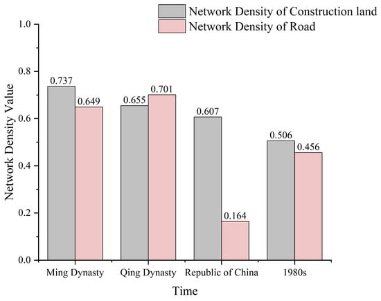
Figure 3.
Density Values Construction Land and Road Networks across Four Periods.
3.2. Balance of Construction Land Spatial Network and Road Network in Historical Cultural Districts Across Four Periods
3.2.1. Degree Centrality of Construction Land Spatial Networks and Road Networks
As shown in Table 4, with historical progression, the degree centrality trends of the construction land spatial network and road network are consistent, both showing a declining trend from the early Ming dynasty through the early Qing Dynasty to the Republic of China period, followed by a recovery in the 1980s, but still with a significant difference compared to the Ming and Qing periods. The two networks overall tend towards balance, indicating that the spatial form of historical cultural districts is evolving towards balanced development. In the same historical period, the degree centrality of the road network is lower than that of the construction land spatial network, indicating that the balance of the road network is higher than that of the construction land spatial network. During the Ming and Qing periods, the degree centrality of both networks was significantly higher than during the Republic of China and the 1980s. This phenomenon is inseparable from the traditional social system of China: The Ming and Qing Dynasties were in a typical feudal societal structure, centered around supreme monarchal power, strict hierarchical systems, and ritual systems as core ideologies. Therefore, the urban spatial form during this period was often strongly influenced by politics and rituals, displaying significant center-periphery relationships and hierarchically orderly spatial characteristics. The layout of construction land and roads at that time was more class-oriented and reflective of power projection, naturally resulting in poorer balance. With changes in political systems, societal forms, and economic conditions since modern times, the hierarchical nature of urban spatial layout has gradually weakened, and the balance of the network system has been enhanced. In summary, the innovation of political and social systems profoundly impacted the evolution of urban spatial forms, and this is clearly presented in the changes in balance within the construction land and road networks.
Table 4.
Degree Centrality of Historical Street Networks in Four Periods.
3.2.2. Betweenness Centrality of Construction Land Spatial Network and Road Network
As shown in Figure 4 and Table 5, the betweenness centrality of construction land nodes over the four periods can be divided into three levels based on the descending order of the line graph. The first level has high betweenness centrality values with large variations and a small proportion of nodes. The second level has more nodes, with betweenness centrality values lower than the first level and decreasing more gradually. The third level has low betweenness centrality values, with small and gradual decreases, and contains more nodes than the first level. Over time, the number of nodes in the first and second levels of the construction land spatial network increases, with the second level showing the largest increase, while the number of nodes in the third level decreases. The road network exhibits a similar pattern, indicating that both networks tend to develop more evenly over time. This phenomenon is closely linked to the evolution of social systems and economic structures. During the feudal era, political systems emphasized centralization and strict hierarchical order, causing urban spaces to exhibit a “pyramidal” center-grade structure, where a few key nodes possessed high centrality. With societal transitions and political reforms, especially since the reforms and opening up and the liberation of thought in modern times, society has advocated more for diversified and balanced development. Correspondingly, urban planning concepts have gradually shifted from a traditionally dominant single-center model to a modern urban spatial pattern with multiple centers and levels. This is reflected not only in the construction land spatial network but also in the road network structure.
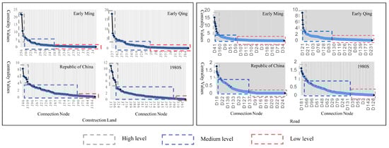
Figure 4.
Depicts the descending line chart of intermediary centrality for construction land spatial networks and road networks in four historical periods.
Table 5.
Centrality Values of Spatial Networks of Construction Land and Road.
3.3. Vulnerability of Construction Land Spatial Network in Historical Districts Across Four Periods
3.3.1. Efficiency of Construction Land Spatial Network and Road Network
Table 6 shows that overall, in each historical period, both the construction land spatial network and the road network demonstrate relatively high (0.7583–0.8771), indicating low vulnerability of these networks. Specifically, as history progresses, the efficiency of the construction land spatial network increases, suggesting that its vulnerability decreases over time. Conversely, the efficiency of the road network initially decreases and then increases, further reflecting that the road network’s variability is higher than that of the construction land spatial network. Taking the early Qing Dynasty as an example, compared to the early Ming Dynasty, productivity improved and the number of roads increased. However, the engineering and technological conditions at the time were not sufficient to completely overcome the constraints of the karst mountain terrain. Many new roads could not achieve direct interconnectivity, resulting in a generally low efficiency of the road network. In contrast, the construction land space, with locally adapted architectural forms (such as stilt houses), could more flexibly adjust to the rugged terrain, thereby significantly reducing the vulnerability of the construction land spatial network. This shows that the constraints of natural terrain on road network efficiency were more pronounced in specific historical periods, while the construction land network achieved more effective local adaptation through flexible architectural strategies. As history progressed to the 1980s, significant breakthroughs in social productivity and engineering technology enabled previously affected roads to be interconnected, thus significantly improving road network efficiency. This process clearly displays the high sensitivity of road networks to natural terrain conditions and their strong response to technological advancements. Thus, in the historical process of the Southwest region, the impact of the natural environment on the road network was more typical and significant compared to its impact on the construction land spatial network. Accordingly, as technological and economic conditions improved, urban infrastructure and spatial organization forms also continuously optimized, promoting balanced and efficient development of the overall spatial structure.
Table 6.
Displays the efficiency values for construction land spatial networks and road networks in four historical periods.
3.3.2. Clustering Coefficients of Spatial Networks of Construction Land and Road Networks
Table 7 shows that, overall, the clustering coefficients of the spatial networks of construction land and road networks across the four historical periods ranged from 2.2 to 3.6, with characteristic path lengths below 6. Therefore, in each historical period, both the spatial networks of construction land and road networks can be classified as small-world networks, indicating generally high network efficiency. This further reflects a relatively low vulnerability of the networks in each historical period. As history progressed, the clustering coefficients of both types of networks decreased overall, suggesting a decline in their vulnerability. Within the same historical period, the clustering coefficient of road networks was higher than that of the spatial networks of construction land, indicating that road networks were more vulnerable in comparison. Particularly during the Ming and Qing dynasties, the vulnerability of the road network was more pronounced. This phenomenon can be traced back to the typical feudal societal system and urban forms of the time: The ideology of centralized governance deeply permeated the city layout, causing the road system to exhibit clear hierarchical levels and a centralized dependency structure. If certain key sections were obstructed, it could impair the functionality of the entire transportation system. During the Republic of China period, the deep influence of the feudal hierarchical system on road layouts gradually faded, and the traces of road hierarchy diminished, reducing network vulnerability. During the Republic of China period, as the hierarchical system that defined road relationships dissolved, the vulnerability of the road network decreased. In the 1980s, although the number of roads increased during the early stages of China’s reform and opening up, the lack of scientific planning and construction management slightly reduced the effective connectivity between roads, leading to a minor rise in network vulnerability.
Table 7.
Clustering Coefficient Values of Construction Land Spatial Networks and Road Networks in Four Historical Periods.
4. Discussion
4.1. Characteristics of Connectivity Dynamics in Construction Land and Road Network Spatial Networks
This study indicates that, over time, the connectivity changes in construction land networks and road networks tend to align. As time progresses, both types of spatial networks generally exhibit increased stability, enhanced balance, and reduced vulnerability. Notably, construction land networks tend to change in a linear fashion, whereas road networks show wave-like fluctuations. This suggests that during urbanization, the planning and design principles of road networks precede those of construction land [40], which aligns with current urban development strategies that prioritize road network expansion.
In analyzing the transformation of construction land and road networks in the historical districts of Guiyang City, this study’s perspective partially aligns with the findings in Fan [31] concerning the changes in road connectivity in the historical urban areas of Changsha, attributing the main reasons for the evolution of urban spatial networks to national policy and planning changes, natural terrain, and shifts in urban centers. However, this study introduces a new viewpoint, suggesting that changes in social systems and productivity have a more pronounced impact on the evolution of construction land and road networks in Guiyang City. Specifically, during the Ming and Qing dynasties, which marked the feudal era of Chinese history, the road and construction land spatial networks were influenced by the social systems of the time, exhibiting poorer balance and higher vulnerability. This phenomenon bears similarities to the impact of Islamic feudal societies in the Middle East [41] and the caste system in India [42] on urban spatial layouts, indicating that social systems profoundly shape urban spatial networks to a significant extent.
Entering the Republic of China period, with the disintegration of the feudal hierarchy and the transformation of social systems, the road network in historical districts gradually broke free from strict hierarchical constraints, leading to significant changes in urban road connectivity and stability. Especially during the Second Sino-Japanese War, as the strategic hinterland of China, the Southwest region faced severe threats from the war, directly impacting the stability of the construction land spatial network and road network. However, despite the decline in stability, the disappearance of hierarchical relations significantly enhanced the balance of the urban spatial network. This phenomenon is somewhat similar to urban morphological changes during historical transitions in other regions, such as Hanoi, Vietnam [43], Japan after the Meiji Restoration [44], and Europe during the Industrial Revolution [45], where the transformation from feudal to modern societies generally resulted in various degrees of changes in urban spatial forms and structures. After entering the 1980s, with the advancement of urban modernization, the balance of the construction land and road networks in Guiyang’s historical districts further improved, and their vulnerability decreased. Moreover, Guiyang is a typical karst landform and mountainous city, where urban development is significantly constrained by topographical and geomorphological factors [46,47,48]. Consequently, the development of productivity is also a key factor influencing changes in the land-use network and road network of historic districts. As a mountainous city, Guiyang faces significant topographical challenges in urban expansion. Compared to the flat terrain of Changsha, Guiyang faces greater construction difficulties in urban expansion, prompting the city to focus more on inward development and productivity enhancement. Therefore, as productivity levels changed, there was a significant change in the connectivity of Guiyang’s construction land and road networks, a phenomenon rarely mentioned in previous research.
Further analysis shows that the spatial network of construction land and the centrality of the road network have evolved toward a more balanced structure over time. This trend is consistent with the spatial evolution of mountainous cities in southwestern China [49] and aligns with patterns observed in European cities [50,51] and Southeast [52] Asian cities, where limited outward expansion leads to a transition from a monocentric to a polycentric urban form. However, compared to European and Southeast Asian mountainous cities, Guiyang’s urban development is influenced by its unique history of multicultural migration and ethnic diversity. European mountainous cities were shaped by early industrialization and transnational migration [53,54], while Southeast Asian cases were influenced by distinct ethnic settlement patterns and trade networks [55,56]. In contrast, as a key immigration city in southwestern China since the Ming and Qing dynasties, Guiyang’s population movement has been regulated by national migration policies while also reflecting the characteristics of ethnic minority settlements, introducing additional complexity to the formation and evolution of the “polycentric aggregation” model. Therefore, topographical comparisons alone may be limited in explaining urban evolution across different mountainous regions. Future research should further examine the roles of cultural, population mobility, and socio-economic factors in shaping polycentric urban development.
In summary, the evolution of the construction land and road networks in Guiyang’s historical districts is influenced not only by social systems, historical context, and national policies but also by changes in geographical environment and productivity levels. These findings provide crucial theoretical support for understanding the spatial evolution characteristics of Guiyang’s historical districts and offer valuable experiences for future urban planning and preservation.
4.2. The Socio-Historical Value Implied in the Dynamics of Spatial Networks of Construction Land and Road Networks
The evolution of the construction land and road networks in the historical districts of Guiyang City not only represents the development of the city’s physical space but also reflects the interplay of social and historical backgrounds, cultural concepts, political systems, and economic activities. This study introduces complex network analysis into the research of construction land and road networks in historical cultural districts, revealing the social and historical values underlying these networks during different historical periods and demonstrating the profound impact of social systems, economic development, and cultural changes on urban spatial networks.
- Relationship Between Social Systems and Urban Spatial Networks: During the Ming and Qing dynasties, the relatively stable feudal society and centralized political system profoundly influenced the urban spatial layout of Guiyang City. Roads and construction land networks often adhered to strict hierarchical and centralized principles, closely related to the societal hierarchy and ruler-subject relationships prevalent at the time. Particularly during the Qing dynasty, the central government’s control over local governance and road and construction land through the dispatch of officials made the city’s spatial layout more tightly integrated into the hierarchical system. For instance, the spatial network of Guiyang’s historical districts displayed clear hierarchical structures, reflecting the feudal society’s strict social stratification. Similar phenomena have been validated in other regions as well, such as the Tusi site spatial connectivity study by Xiang [34], which illustrates how social class order under a centralized system influenced spatial organization and development. Research by Zhao et al. [57] on the culture of auspiciousness in Yunnan also found that architectural networks are closely related to local culture, further proving the shaping role of social systems on spatial networks.
- As the social systems of the Ming and Qing periods deepened, particularly in the ethnically diverse Southwest region, the central government maintained regional stability through the perfection of the Tusi system and other governance measures. In this process, the construction land and road networks in Guiyang’s historical districts was gradually improved, reflecting the central government’s significant role in promoting ethnic integration and economic prosperity. The evolution of these networks during this period not only revealed the impact of governance systems on urban spatial organization but also demonstrated how Guiyang facilitated ethnic integration and social stability through spatial planning. Historically, four major population migrations in Guiyang stimulated the blending of various ethnic cultures, shaping a multicultural and integrated social structure. This amalgamation of diverse cultures is also reflected in the urban spatial network, exhibiting a combination of diversity and coordination.
- Economic and Cultural Changes Shaping Urban Networks: The transformation of the construction land and road networks in Guiyang’s historical districts reflects the continual changes and development of the socio-economic environment. Particularly during the Republic of China period, with the disintegration of the feudal system and the progression of social reforms, Guiyang’s urban structure began to modernize gradually, and the connectivity and balance of its spatial networks improved. During times of social upheaval, especially in the Second Sino-Japanese War, the Southwest region, as China’s strategic depth and political center, underwent significant wartime impacts, causing a decline in the stability of Guiyang’s construction land and road networks. However, with the dissolution of the hierarchical system, the urban space’s balance was significantly enhanced, highlighting the profound impact of social system transformations on spatial networks. During this period, Guiyang’s roads and construction land networks gradually moved away from strict hierarchical relationships, starting to exhibit a more open and flexible spatial structure.
- Complex Network Analysis and Its Connection to Historical Social Structures: This study utilized complex network analysis to reveal the evolutionary patterns of the construction land and road networks in Guiyang’s historical districts. Complex network analysis not only quantifies the structural characteristics of urban spatial networks but also uncovers the hidden social structures and power distributions within the historical urban spaces. By comparing urban networks from different periods, the study found that Guiyang’s roads and construction land networks underwent several changes under varying social backgrounds, transitioning from a hierarchical structure in feudal society to a more balanced and open network during the Republic of China period, reflecting the profound impact of social systems, political, and economic factors on urban space. For example, complex network analysis can help identify key nodes and important connections within the spatial network of historical districts and assess their stability and vulnerability. Through quantitative analysis of historical data, researchers can more clearly see how social systems manifest themselves in urban space through spatial layouts. For instance, the influence of the centralized governance system during the Ming and Qing dynasties on urban space can be reflected in the connectivity, density, and clustering of nodes within the spatial network. This method of network analysis reveals the social and political structures within urban spaces of historical periods, serving as an effective tool for understanding the evolution of historical societies.
4.3. Urban Planning Implications Based on the Spatial Network Evolution of Mountainous Cities
This study demonstrates the unique advantages of complex network analysis in understanding urban spatial transformations, providing new perspectives and methodological support for future urban planning and historical cultural preservation. By analyzing the evolution of construction land and road networks in the historical districts of Guiyang, it uncovers the unique spatial structure and development patterns of mountainous cities. The findings offer valuable insights into Guiyang’s urban planning and innovative solutions for sustainable development in global mountainous cities facing climate change, rapid urbanization, and resource constraints.
- Spatial Development of Mountainous Cities: Polycentric Aggregation and Cultural Diversity: Guiyang’s urban expansion is constrained by its mountainous terrain, leading to a polycentric development pattern. Like other mountainous cities, natural barriers limit monocentric expansion, necessitating multiple development nodes. However, unlike European and Southeast Asian mountainous cities, Guiyang’s spatial evolution is also shaped by multicultural migration and ethnic integration. European cities formed secondary centers through industrialization, while Southeast Asian cities developed multifunctional structures influenced by trade networks. As a key migration hub in southwestern China, Guiyang’s polycentric model reflects distinct cultural stratification. Studies show that Guiyang’s high-impact areas are mainly in well-connected and economically developed regions. However, urban shifts and transport network reorganization have weakened some historical core areas, reducing their cultural and geographical influence. This suggests that Guiyang’s polycentric model results not only from topographical constraints but also from historical and cultural evolution, setting it apart from other mountainous cities. Future research should further examine cultural influences on polycentric urban development.
- Revitalizing the Historical and Cultural Functions of High-Impact Land Parcels: To address the unique spatial constraints of mountainous cities, urban planning should focus on revitalizing the historical and cultural functions of historical districts and high-impact land parcels. Scientific planning can transform these areas into multifunctional zones that integrate historical and cultural exhibitions with public services. The regeneration of historical and cultural land parcels not only enhances the historical value of these areas but also adds distinctive cultural landscapes to modern cities, thereby strengthening their cultural soft power. For instance, introducing cultural exhibitions, creative industries, and community activities into Guiyang’s historical cultural districts can transform these areas into new urban cores characterized by historical significance, cultural ambiance, and public services. This approach can boost citizens’ cultural identity and elevate the status of historical districts within the modern urban framework.
- Promoting Ecological Restoration and Expanding Green Spaces: The ecological environment of mountainous cities is often complex and fragile, necessitating the incorporation of ecological restoration and green space expansion into urban planning. For Guiyang’s high-impact land parcels, implementing a “construction-to-forest” strategy could involve removing unsuitable structures to restore ecological environments and expand urban green spaces. This approach not only helps improve the city’s ecological conditions and mitigate urban heat island effects but also provides residents with additional spaces for leisure and recreation, enhancing the city’s livability and sustainability. Simultaneously, restoring ecological landscapes and increasing urban greenery will offer healthier living environments, raise public environmental awareness, and strengthen the city’s disaster resilience.
- Optimizing the Spatial Form of Multi-Center Aggregation: Due to the geographical constraints of mountainous cities, Guiyang’s urban structure exhibits a distinct multi-center aggregation pattern. To adapt to these unique geographic conditions, urban planning should further optimize the spatial structure of multi-center aggregation. By rationally planning the layout of roads, public service facilities, and functional areas, the connectivity and coordination among centers can be enhanced, reducing over-reliance on a single center and alleviating congestion in core areas. Additionally, Guiyang’s mountainous advantages can be leveraged to plan multifunctional urban nodes and scenic corridors, fostering interaction and connections between different areas, improving the overall efficiency of urban space utilization, and avoiding excessively concentrated development patterns.
- Flexibly Adjusting the Functional Positioning of High-Impact Land Parcels: The development of mountainous cities is influenced not only by topography but also by changes in societal structures and productivity, which profoundly impact urban spatial structures. Guiyang’s historical districts and high-impact land parcels were once the core areas of the city, but their functions have evolved with the transformation of social forms and economic development. Urban planning should flexibly adjust the functional positioning of these land parcels in response to changes in societal structures and productivity, ensuring they meet the needs of modern urban life while preserving their historical and cultural value. For instance, with the economic transition of the city, traditional industrial or commercial zones may need to be transformed into cultural and creative parks, research institutes, or educational zones, ensuring that historical land parcels continue to play a significant role in modern urban development.
5. Conclusions
As history progresses, the changes in connectivity patterns of the construction land network and the road network show significant alignment. While specific values for the road network fluctuate slightly, the overall trends remain consistent. The road network typically exhibits wave-like fluctuations, while the spatial network of construction land shows more linear changes, indicating that road planning was prioritized over construction land in urban development. The findings are as follows: Stability: Construction land network density declined linearly over time, while road network density exhibited wave-like fluctuations. Centrality: Both networks showed a decline, followed by a rebound in the 1980s, suggesting a transition toward a more balanced urban structure. Vulnerability: Both networks exhibited increased efficiency and decreased vulnerability over time, despite fluctuations in the road network during the early Qing Dynasty. The analysis shows that the changes in the connectivity of construction land and road networks in Guiyang’s historical districts were influenced by societal structure changes, productivity shifts, and natural topography.
These results align with existing studies on urban development in mountainous cities, where topographical constraints lead to a shift from mono-centric to multi-centric spatial patterns. This shift is often accompanied by compact urban development, especially in areas where expansion is not feasible. Socio-economic and cultural factors have also played a key role in shaping these urban patterns, with historical changes in society, politics, and economy influencing spatial layouts. Further analysis suggests that applying complex network analysis to urban spatial studies is effective in understanding the interplay between physical geography and social structures. The findings of this study support the idea that construction land and road networks reflect broader social, political, and economic transformations, contributing to the unified structure of modern urban societies. Based on these insights, the study recommends (1.) Multi-center spatial development in mountainous cities. (2.) Revitalizing historical and cultural land parcels. (3.) Ecological restoration and green space expansion. (4.) Optimizing multi-center urban forms. (5.) Flexible adjustment of high-impact land parcels to align with evolving urban needs. These strategies can guide the sustainable development of mountainous cities while preserving their historical and cultural heritage.
Author Contributions
Conceptualization, Z.L., Z.H., H.X., Y.C. and J.Y.; Data curation, Z.L., Z.H., H.X., Y.C. and S.L.; Formal analysis, Z.L., Z.H., H.X. and J.Y.; Funding acquisition, Z.H.; Investigation, Z.L., Y.C. and S.L.; Methodology, Z.L., Z.H., H.X., Y.C., S.L. and J.Y.; Project administration, Z.H. and H.X.; Resources, Z.L., Z.H., H.X., S.L. and J.Y.; Software, Z.L., Z.H., H.X. and Y.C.; Supervision, Z.L. and Z.H.; Validation, Z.L., Z.H., S.L. and J.Y.; Visualization, Z.L. and Y.C.; Writing—original draft, Z.L. and Z.H.; Writing—review and editing, Z.L., Z.H. and H.X. All authors have read and agreed to the published version of the manuscript.
Funding
This work is supported by the National Natural Science Foundation of China, grant number 51978187.
Institutional Review Board Statement
Not applicable.
Informed Consent Statement
Not applicable.
Data Availability Statement
The datasets generated and analyzed during the current study are not publicly available due to the participation in projects that have not yet been completed but are available from the corresponding author upon reasonable request.
Conflicts of Interest
The authors declare that they have no known competing financial interests or personal relationships that could have appeared to influence the work reported in this paper. Shaowei Lu is employed by PowerChina Guiyang Engineering Co., Ltd.; his employer’s company was not involved in this study, and there is no relevance between this research and their company.
References
- Zhang, Y.; Chen, S.; Hoistad, M.A. Sustainable development strategy for historic neighborhood shrinkage: Taking Puhuiquan neighborhood in Yulin, China, as an example. Herit. Sci. 2024, 12, 67. [Google Scholar] [CrossRef]
- Duranton, G.; Turner, M.A. The Fundamental Law of Road Congestion: Evidence from US Cities. Am. Econ. Rev. 2011, 101, 2616–2652. [Google Scholar] [CrossRef]
- Salat, G. The Cambridge Illustrated History of China. Acta Orient. Acad. Sci. Hung. 2013, 66, 487–489. [Google Scholar]
- Wu, Q.; Cheng, J. A temporally cyclic growth model of urban spatial morphology in China: Evidence from Kunming Metropolis. Urban Stud. 2019, 56, 1533–1553. [Google Scholar] [CrossRef]
- Fan, Q.; Mei, X.; Zhang, C.; Wang, H. Urban spatial form analysis based on the architectural layout—Taking Zhengzhou City as an example. PLoS ONE 2022, 17, e0277169. [Google Scholar] [CrossRef]
- Zhang, J.; He, X.; Yuan, X.D. Research on the relationship between Urban economic development level and urban spatial structure—A case study of two Chinese cities. PLoS ONE 2020, 15, e0235858. [Google Scholar] [CrossRef] [PubMed]
- Zhang, W.; Xin, J. Green Spaces and the Spontaneous Renewal of Historic Neighborhoods: A Case Study of Beijing Dashilar Community. Sustainability 2023, 15, 16566. [Google Scholar] [CrossRef]
- Lin, H.; Huang, L.; Chen, Y.; Zheng, L.; Huang, M.; Chen, Y. Research on the Application of CGAN in the Design of Historic Building Facades in Urban Renewal—Taking Fujian Putian Historic Districts as an Example. Buildings 2023, 13, 1478. [Google Scholar] [CrossRef]
- Can, K.; Aminreza, I. Modelling and Assessing Sustainable Urban Regeneration for Historic Urban Quarters via Analytical Hierarchy Process. Land 2022, 12, 72. [Google Scholar] [CrossRef]
- Yang, X.; Shen, J. Landscape Sensitivity Assessment of Historic Districts Using a GIS-Based Method: A Case Study of Beishan Street in Hangzhou, China. ISPRS Int. J. Geo-Inf. 2023, 12, 462. [Google Scholar] [CrossRef]
- Chen, Z.; Liu, S.; Liao, W.; Zhang, J. Construction of Security Pattern for Historical Districts in Cultural Landscape Based on MCR Model: A Case Study of Chaozong Street, Changsha City. Sustainability 2023, 15, 10619. [Google Scholar] [CrossRef]
- Zhou, Z.; Zhong, T.; Liu, M.; Ye, Y. Evaluating building color harmoniousness in a historic district intelligently: An algorithm-driven approach using street-view images. Environ. Plan. B Urban Anal. City Sci. 2023, 50, 1838–1857. [Google Scholar] [CrossRef]
- Slocum, K. Historically Black: Imagining Community in a Black Historic District by Mieka Brand Polanco New York: New York University Press, 2014. 208 pp. Am. Anthropol. 2015, 117, 863–864. [Google Scholar] [CrossRef]
- Mohl, R.A. The Interstates and the Cities: The U.S. Department of Transportation and the Freeway Revolt, 1966–1973. J. Policy Hist. 2008, 20, 193–226. [Google Scholar] [CrossRef]
- Wang, D.; Tang, J.; Wang, M.; Zhao, M. Spatial evolution and influence mechanism of tourism in historic quarters from the postmodern consumption perspective: A case study of Pingjiang road and Shantang Street, Suzhou, China. Asia Pac. J. Tour. Res. 2022, 27, 1071–1094. [Google Scholar]
- Sousa, R.C.; Joana, A. A framework to analyse conflicts between residents and tourists: The case of a historic neighbourhood in Lisbon, Portugal. Land Use Policy 2022, 114, 105938. [Google Scholar]
- Zhu, H.; Liu, J.; Liu, H.; Wang, X.; Ma, Y. Recreational Business District boundary identifying and spatial structure influence in historic area development: A case study of Qianmen area, China. Habitat Int. 2017, 63, 11–20. [Google Scholar] [CrossRef]
- Basyar, M.R.; Mardiyanta, A.; Setijaningrum, E. Multi-Stakeholder Analysis in Building Tourism Resilience: Collaborative Governance Implementation in the Majapahit House Heritage Area, Indonesia. Tour. Hosp. 2025, 6, 5. [Google Scholar] [CrossRef]
- Xia, J.; Kang, J.; Xu, X. Global Research Trends and Future Directions in Urban Historical Heritage Area Conservation and Development: A 25-Year Bibliometric Analysis. Buildings 2024, 14, 3096. [Google Scholar] [CrossRef]
- Mohamed, S.A. Current Trends in Urban Heritage Conservation: Medieval Historic Arab City Centers. Sustainability 2022, 14, 607. [Google Scholar] [CrossRef]
- Shen, D.; Dong, S. Transition of Urban Morphology in the Mountainous Areas Since Early-Modern Times from the Perspective of Urban Historic Landscape—A GIS Tools and Historical Map Translation Approach. Sustainability 2022, 14, 12896. [Google Scholar] [CrossRef]
- Taherkhani, R.; Hashempour, N.; Lotfi, M. Sustainable-resilient urban revitalization framework: Residential buildings renovation in a historic district. J. Clean. Prod. 2020, 286, 124952. [Google Scholar] [CrossRef]
- Hao, L.; Youmei, Z. Conducting Heritage Tourism-Led Urban Renewal in Chinese Historical and Cultural Urban Spaces: A Case Study of Datong. Land 2022, 11, 2122. [Google Scholar] [CrossRef]
- Kerimbergenovich, A.A.; Kamilovich, S.S.; Tursinbaevich, A.R.; Jannazarovich, A.K.; Kazievich, S.J.; Maksetovich, O.H. Ecotourism Development in the Republic of Karakalpakstan: Historical Places and Protected Areas. J. Crit. Rev. 2020, 7, 1258–1262. [Google Scholar]
- Zhu, Y.; Martínez, P.G. Heritage, values and gentrification: The redevelopment of historic areas in China. Int. J. Herit. Stud. 2022, 28, 476–494. [Google Scholar] [CrossRef]
- Mubaideen, S.; Al Kurdi, N. Heritage conservation and urban development: A supporting management model for the effective incorporation of archaeological sites in the planning process. J. Cult. Herit. 2017, 28, 117–128. [Google Scholar] [CrossRef]
- David, L.; Yamir, M. Network Structure and City Size. PLoS ONE 2012, 7, e29721. [Google Scholar]
- Lämmer, S.; Helbing, D. Self-Control of Traffic Lights and Vehicle Flows in Urban Road Networks. J. Stat. Mech. Theory Exp. 2008, 2008, 4019. [Google Scholar] [CrossRef]
- Cats, O.; Larijani, A.N.; Koutsopoulos, H.N.; Burghout, W. Impacts of Holding Control Strategies on Transit Performance: Bus Simulation Model Analysis. Transp. Res. Rec. 2018, 2216, 51–58. [Google Scholar] [CrossRef]
- Kirkley, A.; Barbosa, H.; Barthelemy, M.; Ghoshal, G. From the betweenness centrality in street networks to structural invariants in random planar graphs. Am. Phys. Soc. 2019, 9, 2501. [Google Scholar] [CrossRef]
- Fan, J.; Zheng, B.; Tang, Q.; Zhang, B.; Liu, N. The Changsha Historic Urban Area: A Study on the Changing Accessibility of the Road Network. Appl. Sci. 2022, 12, 2796. [Google Scholar] [CrossRef]
- Keer, Z.; Handuo, D.; Fang, W.; Ye, Y. Reproduction of consumer spaces and historic district touristification in Old Beijing City. Tour. Geogr. 2023, 25, 508–531. [Google Scholar]
- Hu, Y.; Li, H. Planning Strategies for the Preservation and Utilization of Historical Districts: A Case Study of the Tanhualin Area in Wuchang, Wuhan. Planner 2004, 61–64. [Google Scholar]
- Xiang, H.; Xie, M.; Huang, Z.; Bao, Y. Study on spatial distribution and connectivity of Tusi sites based on quantitative analysis. Ain Shams Eng. J. 2023, 14, 101833. [Google Scholar] [CrossRef]
- Shi, Y.; Huang, Y.; Xiao, L. Spatial Structure and Layout Optimization of Mountain Parks Based on Social Network Analysis. Chin. Gard. 2020, 36, 91–96. [Google Scholar] [CrossRef]
- Huang, Y.; Xiao, L.; Hu, Y. Research on Urban Infrastructure Health Evaluation Based on Social Network Analysis: A Case Study of Power In-frastructure in Wanzhou District, Chongqing. Sci. China Technol. Sci. 2015, 45, 68–80. [Google Scholar]
- Newman, M.E.J. The structure and function of complex networks. SIAM Rev. 2003, 45, 167–256. [Google Scholar] [CrossRef]
- Liu, J.W. Network Approach: A Practical Guide to UCINET Software, 3rd ed.; Gezhi Publishing House: Shanghai, China, 2009; pp. 48–138. [Google Scholar]
- Newman, M.E.J.; Watts, D.J. Scaling and percolation in the small-world network model. Phys. Rev. E Statal Phys. Plasmas Fluids Relat. Interdiplinary Top. 1999, 60, 7332–7342. [Google Scholar] [CrossRef]
- Wahnschafft, R.; Wei, F. Urban China: Toward Efficient, Inclusive, and Sustainable Urbanization. Nat. Resour. Forum 2015, 39, 151–152. [Google Scholar] [CrossRef]
- Hakim, B.S. Urban form in traditional Islamic cultures: Further studies needed for formulating theory. Cities 1999, 16, 51–55. [Google Scholar] [CrossRef]
- Datta, A. The intimate city: Violence, gender and ordinary life in Delhi slums. Urban Geogr. 2016, 37, 323–342. [Google Scholar] [CrossRef]
- Aimini, M.; Giang, N.D.; Minh, D.B. The Last 150 Years of Urban Mutations in Hanoi: An Investigation About Form and Morphology of the Vietnam’s Capital City. Innov. Land Water Energy Vietnam. Sustain. Dev. 2020, 169–195. [Google Scholar]
- Hein, C. Shaping Tokyo: Land Development and Planning Practice in the Early Modern Japanese Metropolis. J. Urban Hist. 2010, 36, 447–484. [Google Scholar] [CrossRef]
- Clark, P. European Cities and Towns 400-2000; Oxford University Press: Oxford, UK, 2009. [Google Scholar]
- Huang, Q.; Zhang, H.; van Vliet, J.; Ren, Q.; Wang, R.Y.; Du, S.; Liu, Z.; He, C. Patterns and Distributions of Urban Expansion in Global Watersheds. Earth’s Future 2021, 9, e2021EF002062. [Google Scholar] [CrossRef]
- Bin, S.; Lu, Y.D. Study on Jinan urban construction planning based on the protection of karst landscape. J. Groundw. Sci. Eng. 2018, 6, 280–292. [Google Scholar]
- Gao, H.; Diao, C. A Discussion on the Impact of Karst Topography on Urban Development and Construction: A Case Study of Guiyang, a Karst Mountain City. Carsologica Sinica Chin. Karst 2010, 29, 81–86. [Google Scholar]
- Qian, Y.; Yang, Q.; Zheng, C. Study on the Spatial Morphological Evolution of Mountainous Urban Areas: A Case Study of the Main Urban Area of Chongqing. J. Yunnan Norm. Univ. (Philos. Soc. Sci. Ed.) 2012, 44, 54–59. [Google Scholar]
- Ana, P.; Sophie, H.; David, K. Cooperative planning under pro-development urban agenda? A collage of densification practices in Zurich, Switzerland. Habitat Int. 2023, 140, 102922. [Google Scholar]
- Lagarias, A.; Prastacos, P. Comparing the urban form of South European cities using fractal dimensions. Environ. Plan. B Urban Anal. City Sci. 2020, 47, 1149–1166. [Google Scholar] [CrossRef]
- Rimmer, P.J.; Dick, H.W. The City in Southeast Asia: Patterns, Processes and Policy; University of Hawaii Press: Honolulu, HI, USA, 2009. [Google Scholar]
- Perlik, M.; Membretti, A. Migration by Necessity and by Force to Mountain Areas: An Opportunity for Social Innovation. Mt. Res. Dev. 2018, 38, 250–264. [Google Scholar] [CrossRef]
- Hohenberg, P.M. The historical geography of European cities: An interpretive essay. Handb. Reg. Urban Econ. 2006, 4, 3021–3052. [Google Scholar]
- Wang, Y.; Zhang, H.; Huang, G.; Jin, L.; Lin, L. Characteristics and Driving Factors of Comprehensive Urbanization Levels in Southeast Asian Countries. Trop. Geogr. 2015, 35, 680–686. [Google Scholar] [CrossRef]
- Mcgee, T.G. The Southeast Asian City: A Social Geography of the Primate Cities of Southeast Asia; George Bell & Sons: London, UK, 1967. [Google Scholar]
- Zhao, H.; Huang, Z.; Deng, C.; Ren, Y. The Decorative Auspicious Elements of Traditional Bai Architecture in Shaxi Ancient Town, China. Sustainability 2023, 15, 1918. [Google Scholar] [CrossRef]
Disclaimer/Publisher’s Note: The statements, opinions and data contained in all publications are solely those of the individual author(s) and contributor(s) and not of MDPI and/or the editor(s). MDPI and/or the editor(s) disclaim responsibility for any injury to people or property resulting from any ideas, methods, instructions or products referred to in the content. |
© 2025 by the authors. Licensee MDPI, Basel, Switzerland. This article is an open access article distributed under the terms and conditions of the Creative Commons Attribution (CC BY) license (https://creativecommons.org/licenses/by/4.0/).