Article

Evolution of Ecological Patterns of Poyang Lake Wetland Landscape over the Last One Hundred Years Based on Historical Topographic Maps and Landsat Images


1
Department of History, Jinan University, Guangzhou 510632, China
2
School of Geography and Environmental Engineering, Gannan Normal University, Ganzhou 341000, China
*
Author to whom correspondence should be addressed.
Sustainability 2022, 14(13), 7868; https://doi.org/10.3390/su14137868
Submission received: 4 May 2022 / Revised: 21 June 2022 / Accepted: 22 June 2022 / Published: 28 June 2022
(This article belongs to the Special Issue Geomorphological Mapping for the Geoheritage Resources Sustainability)

Abstract

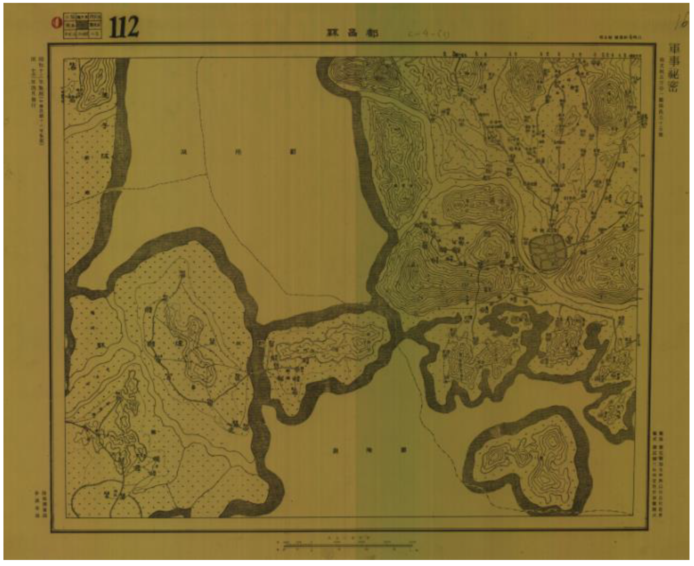
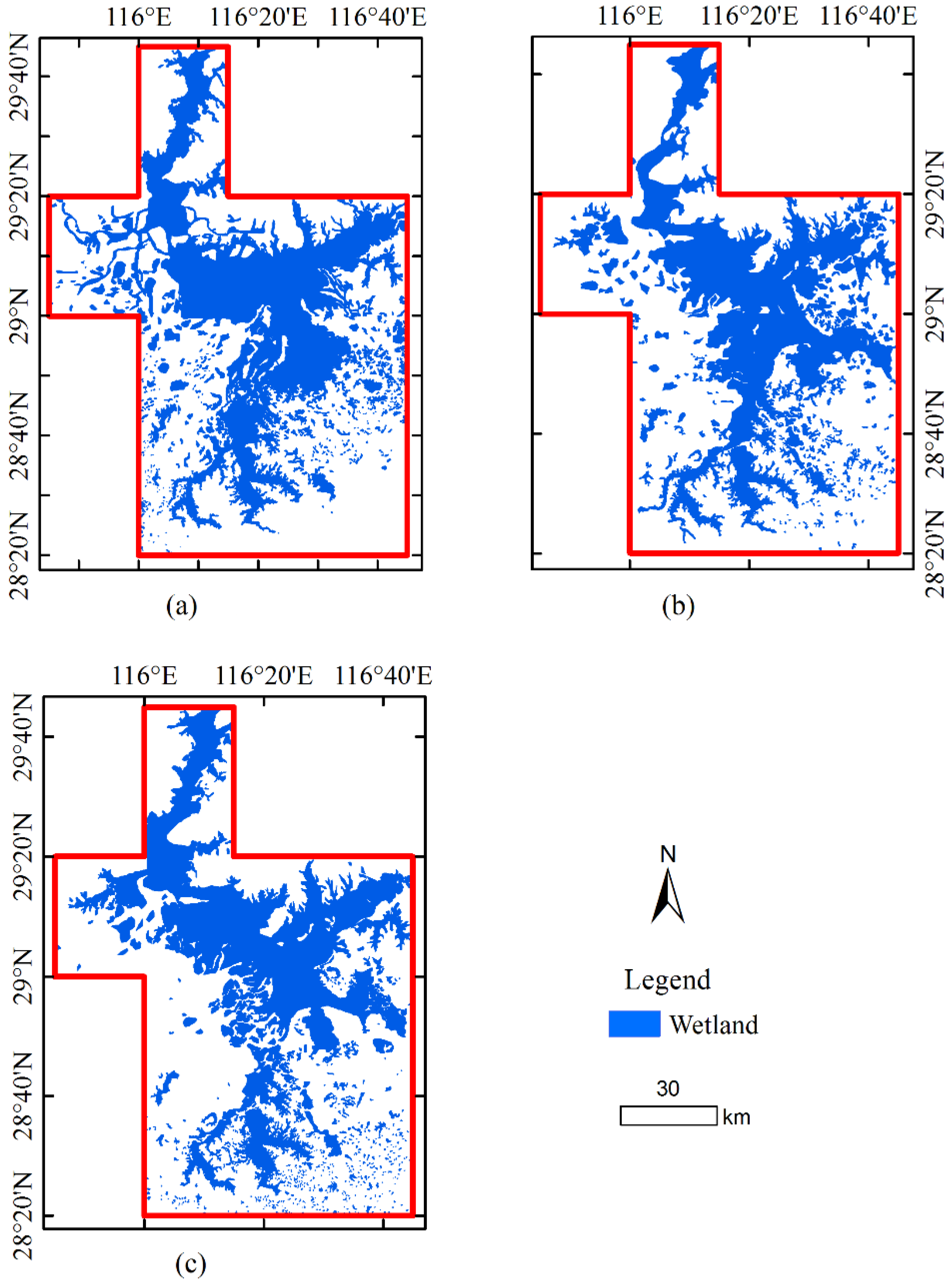
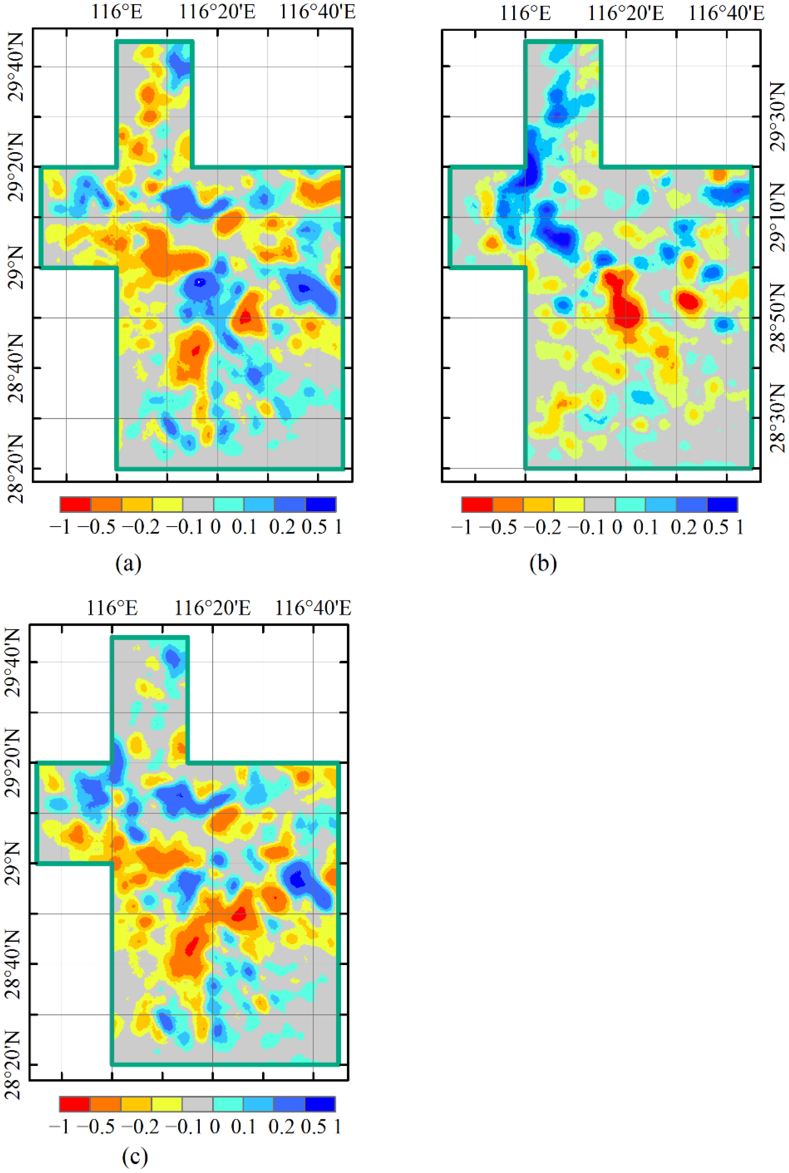
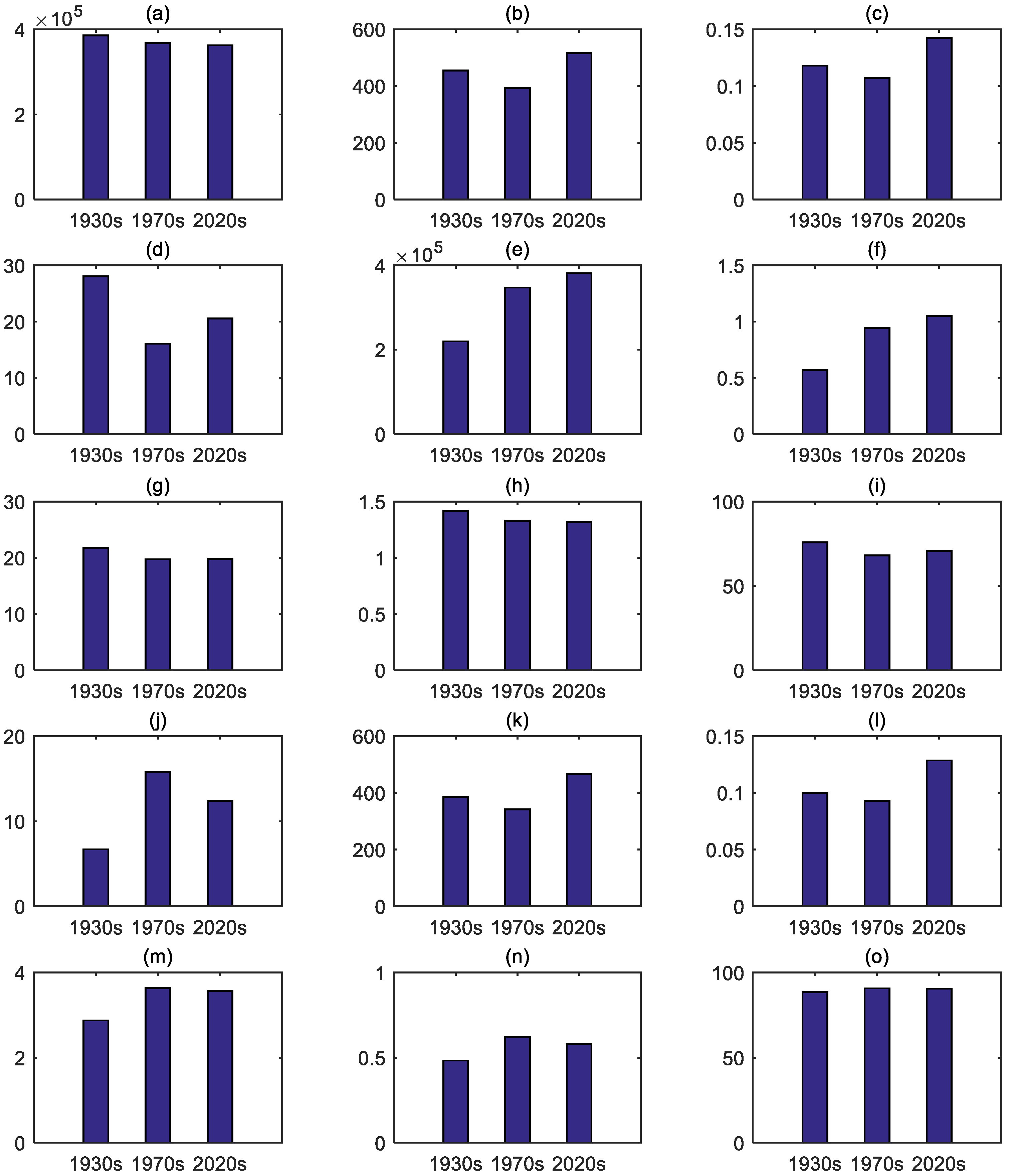
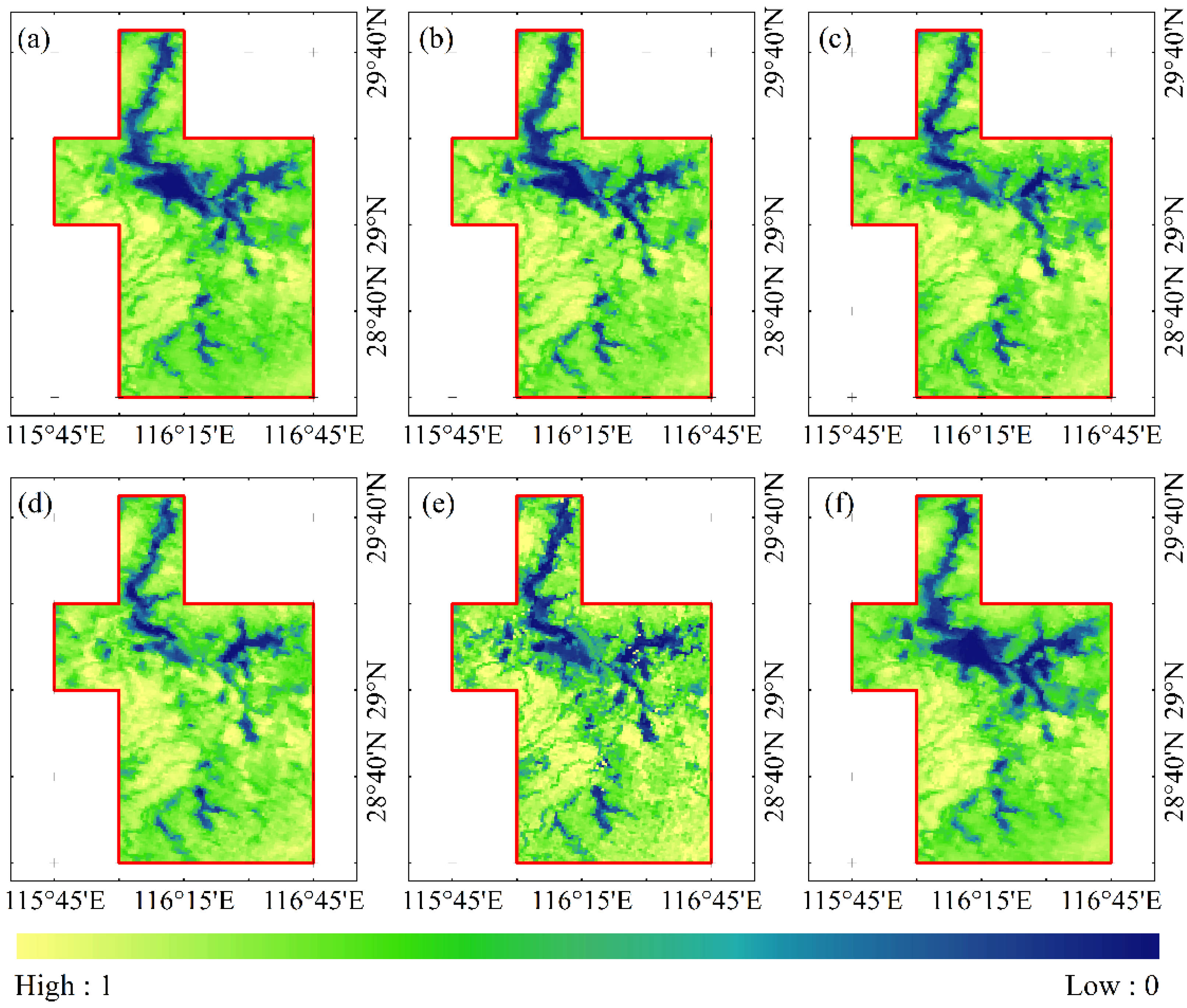
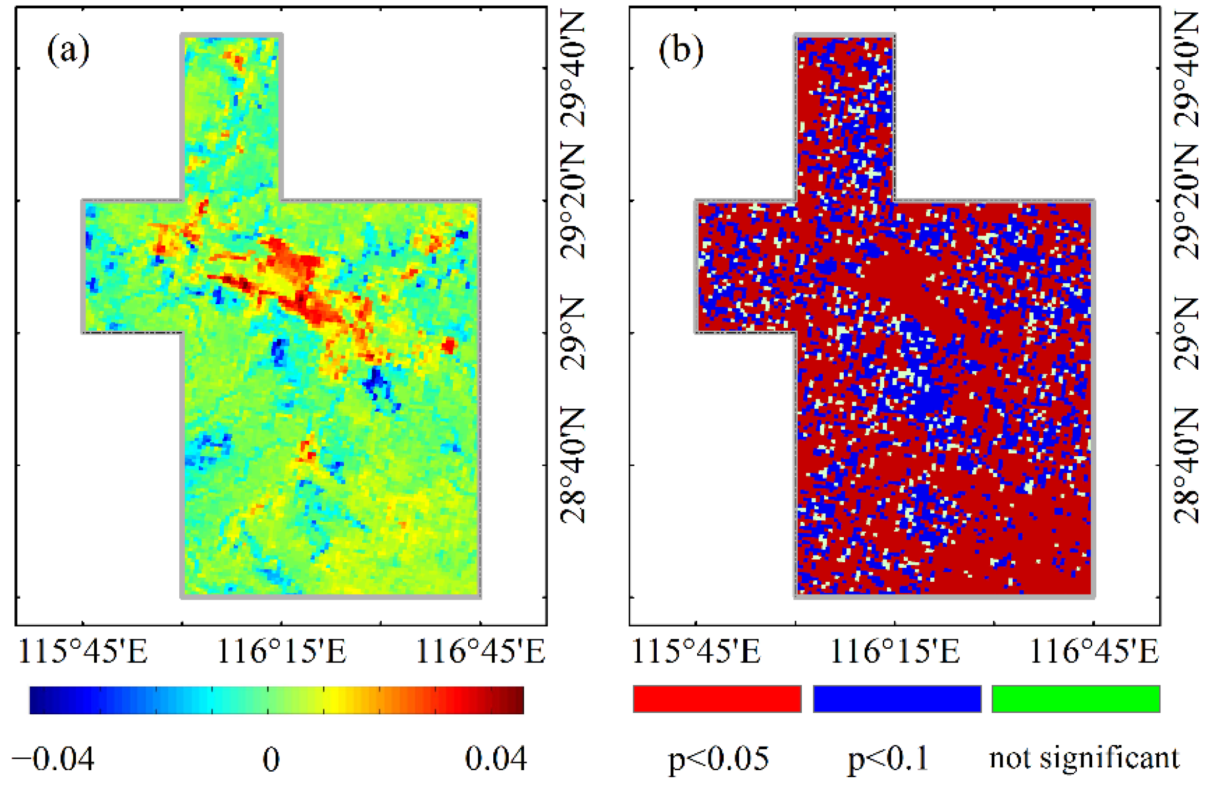
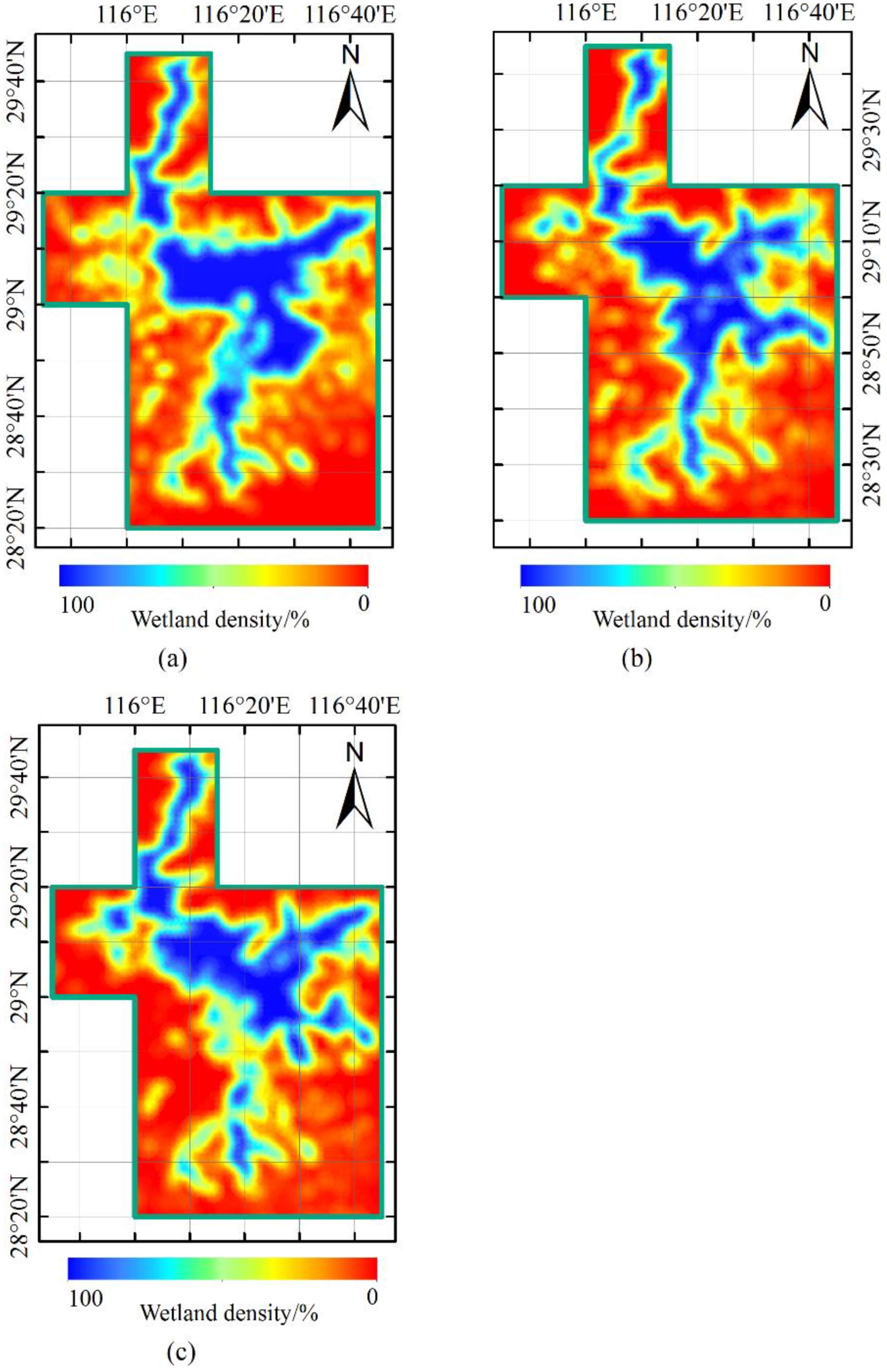
Ecological pattern evolution of Poyang Lake wetland, the largest freshwater lake in China, is critical for regional ecological protection and sustainable development of migratory bird habitats; however, this information is still not fully explored. In this study, we quantitatively reconstructed the spatial distribution and landscape ecological pattern of Poyang Lake wetlands in three periods in the past 100 years based on the military topographic map in the 1930s and the Landsat satellite remote sensing image data in 1979 and 2021. Further, use the Fragstats software to analyze the ecological pattern index of wetland reconstruction results. The results show that the wetland area in the Poyang Lake region has experienced a continuous reduction process over the past 100 years, and it decreased from 3857 km2 in the 1930s to 3673 km2 in the 1970s, and then to 3624 km2 in the 2020s. The current wetland area has decreased by about 6.04% compared with the 1930s. The general trend of changes in the spatial pattern of Poyang Lake wetlands is that the surface water decreases and the open land increases. Nevertheless, the trend has certain spatial differences as a large area of wetlands disappeared in the southwest and west of Poyang Lake and the areas with enlarged wetland density values mainly appeared in the northeastern and northern parts of the study area. The NP (number of patches) in the wetlands of Poyang Lake over the past 100 years showed a downward trend during the 1930s–1970s, and an increasing trend during the 1970s–2010s. Due to the increases of constructed wetlands, the number and density of patches also increased, and PD (patch density) reached a maximum value of 0.142 in 2020s. The LPI (largest patch index) has shown a gradual downward trend in the past 100 years. Compared with the 1930s, the wetlands in 2020s dropped by about 26.64%, and the wetlands further showed a trend of fragmentation. The AI index, which indicates the concentration of wetland patches, reached the maximum value in 2020s, but the LSI (landscape shape index) showed a downward trend in general, indicating that the shape of wetland patches has been simplified over the past 100 years. The research results can provide basic data and decision-making basis for Poyang Lake wetland protection, construction of migratory bird reserve and regional sustainable development.
Keywords: long-term scale; Poyang Lake; wetland; landscape ecological pattern; historical topographic map long-term scale; Poyang Lake; wetland; landscape ecological pattern; historical topographic map