Article

Statistical and Spatial Analysis of Hurricane-induced Roadway Closures and Power Outages


by
Mahyar Ghorbanzadeh
1,
Mohammadreza Koloushani
1,
Mehmet Baran Ulak
2,
Eren Erman Ozguven
1,* and
Reza Arghandeh Jouneghani
3
1
Department of Civil and Environmental Engineering, Florida Agricultural and Mechanical University-Florida State University College of Engineering, Florida State University, Tallahassee, FL 32310, USA
2
Department of Civil Engineering, College of Engineering and Applied Sciences, Stony Brook University, Stony Brook, NY 11794, USA
3
Department of Computing, Mathematics, and Physics, Faculty of Engineering and Science, Western Norway University of Applied Sciences, 5020 Bergen, Norway
*
Author to whom correspondence should be addressed.
Energies 2020, 13(5), 1098; https://doi.org/10.3390/en13051098
Submission received: 4 February 2020 / Revised: 22 February 2020 / Accepted: 28 February 2020 / Published: 2 March 2020

Abstract

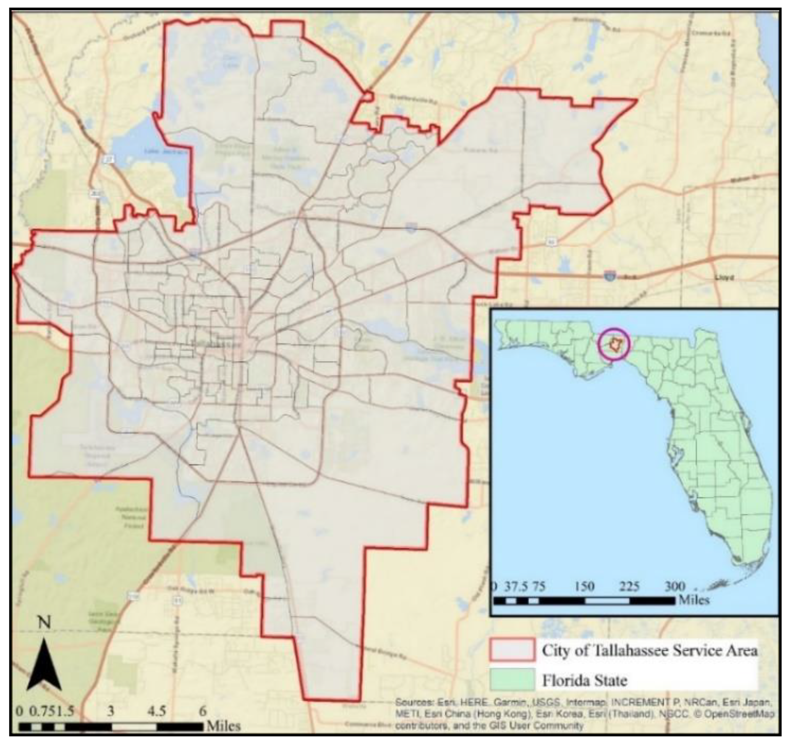
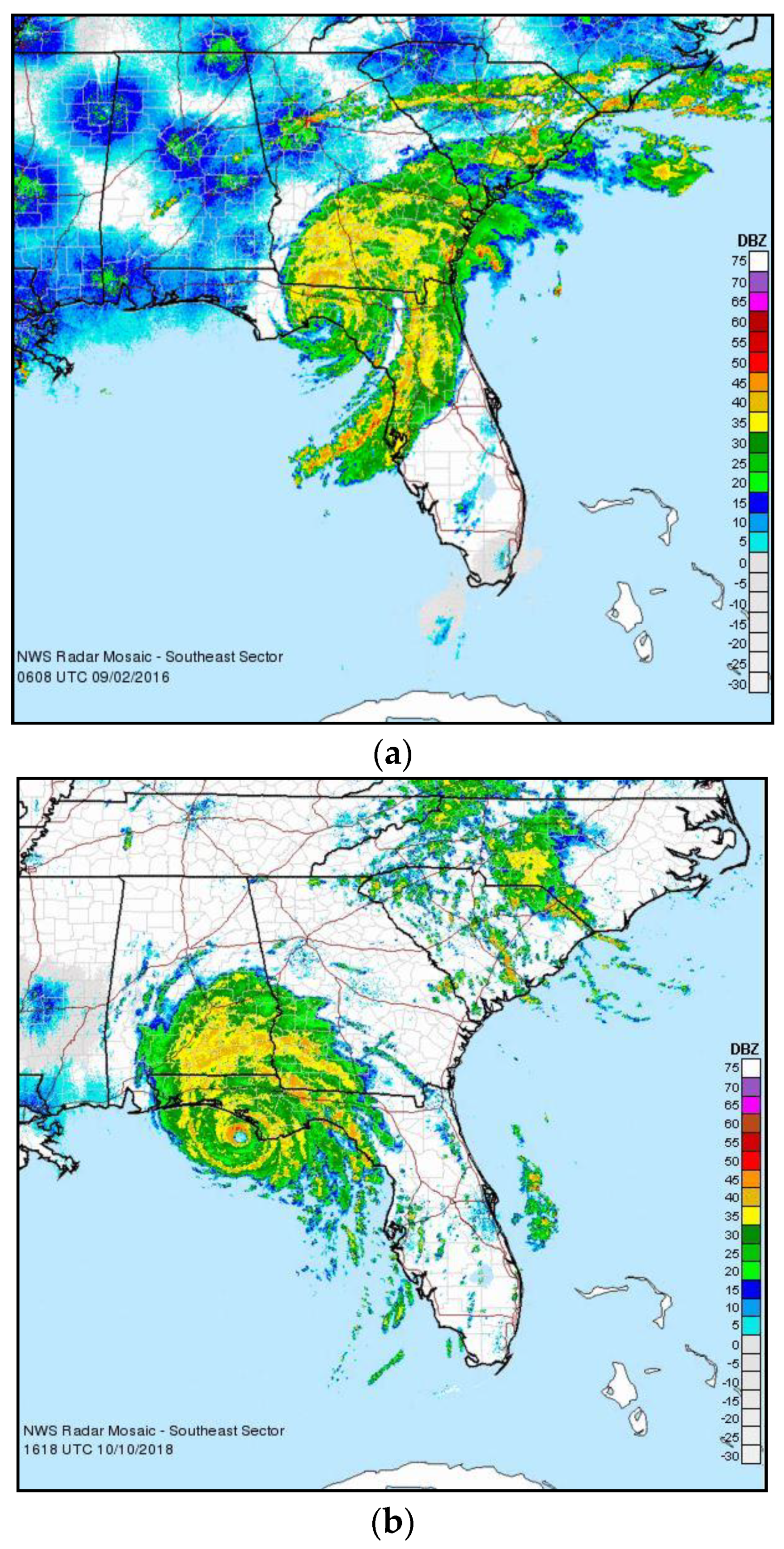
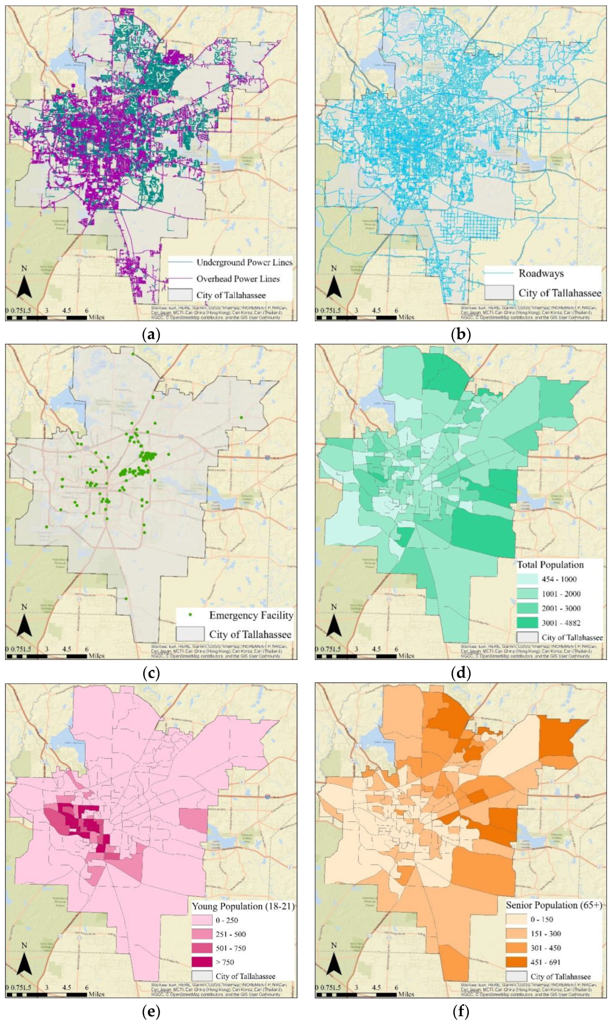
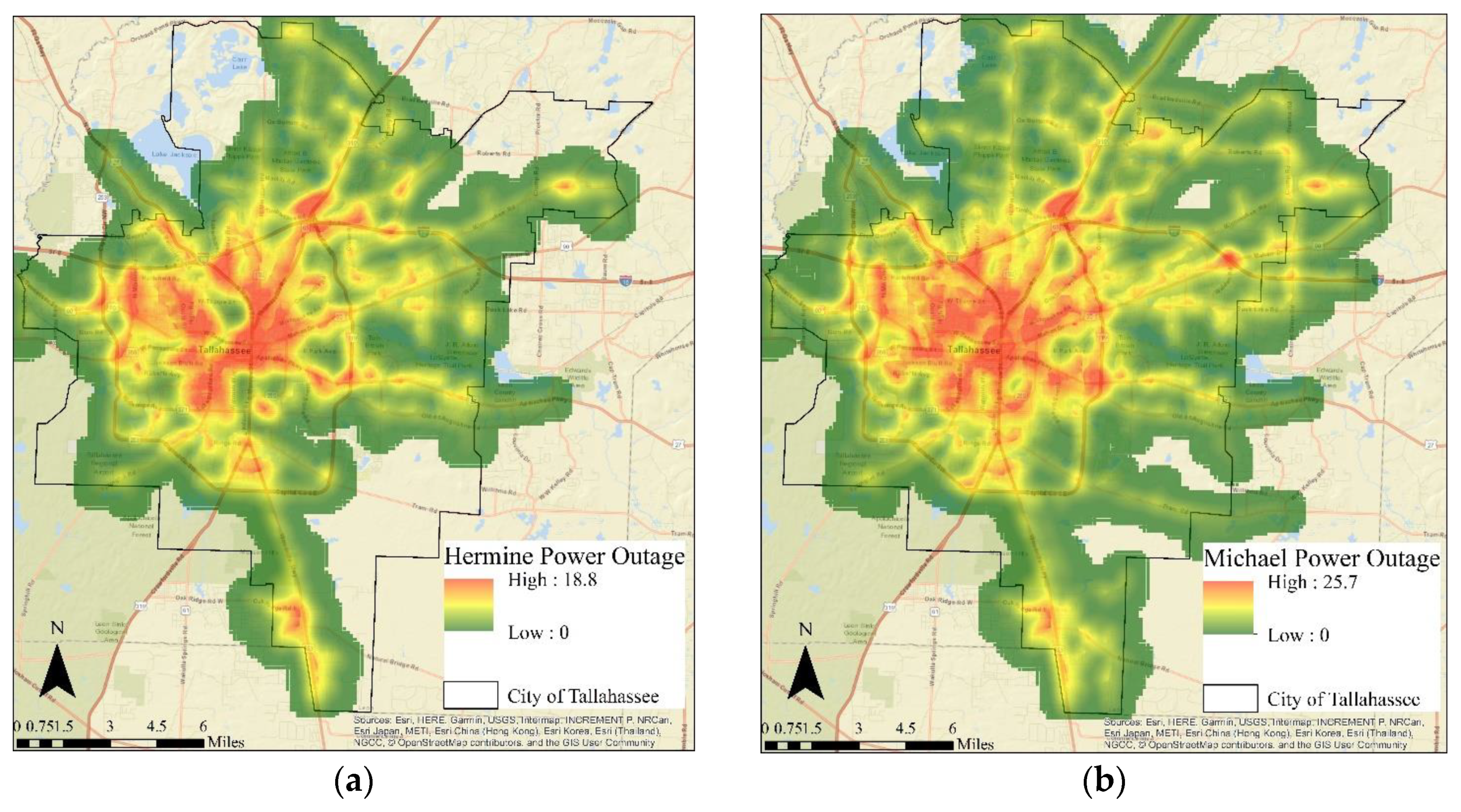
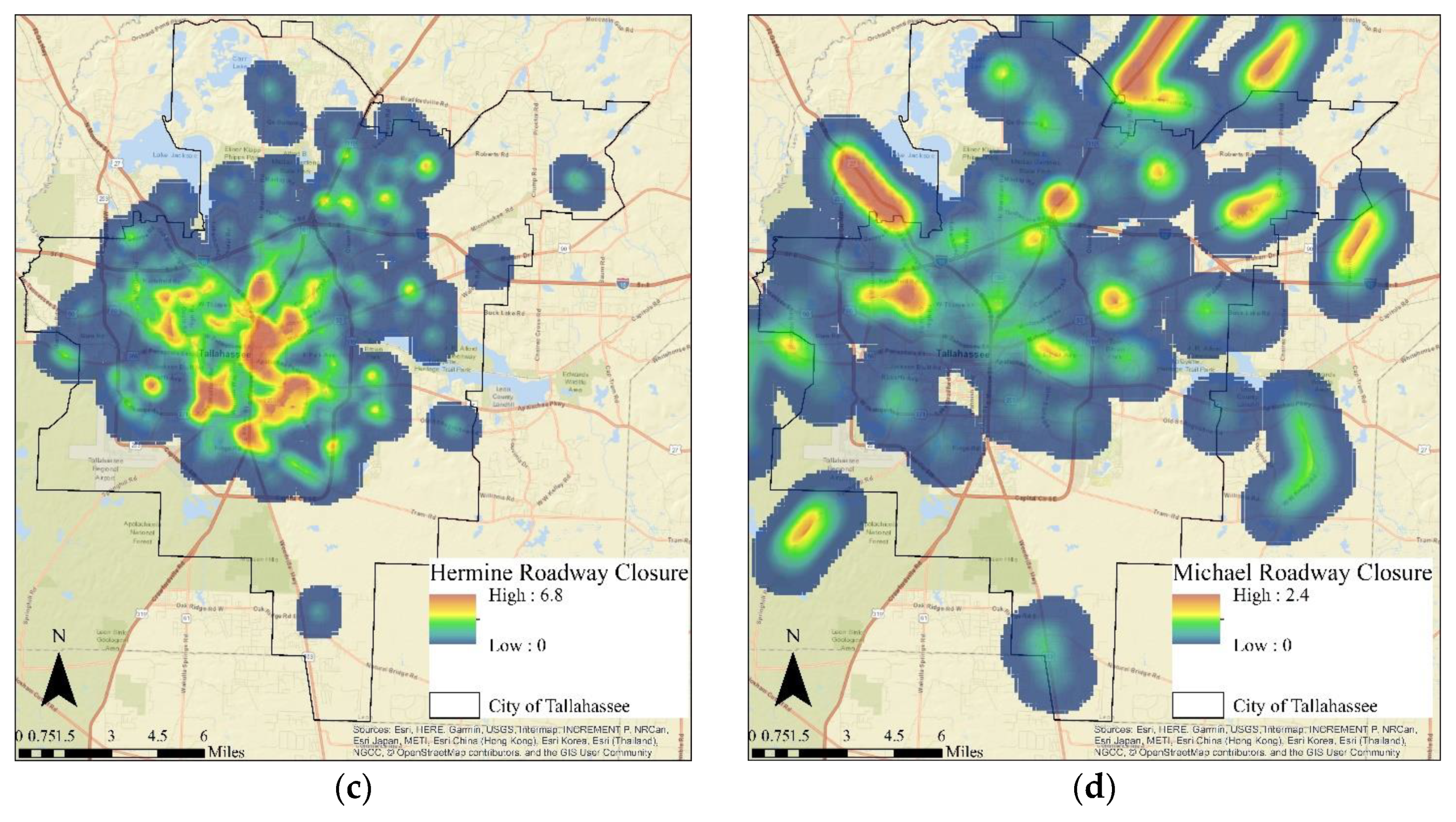
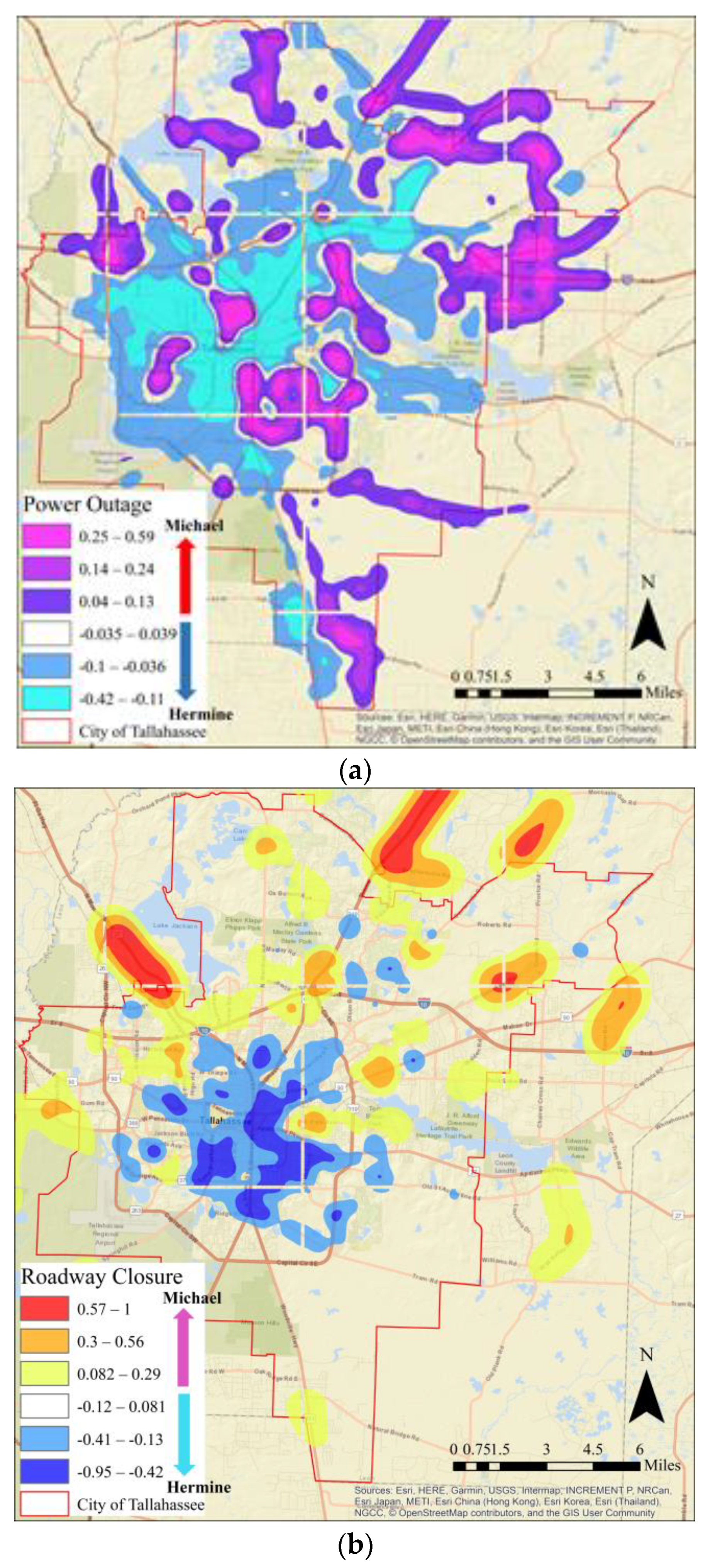
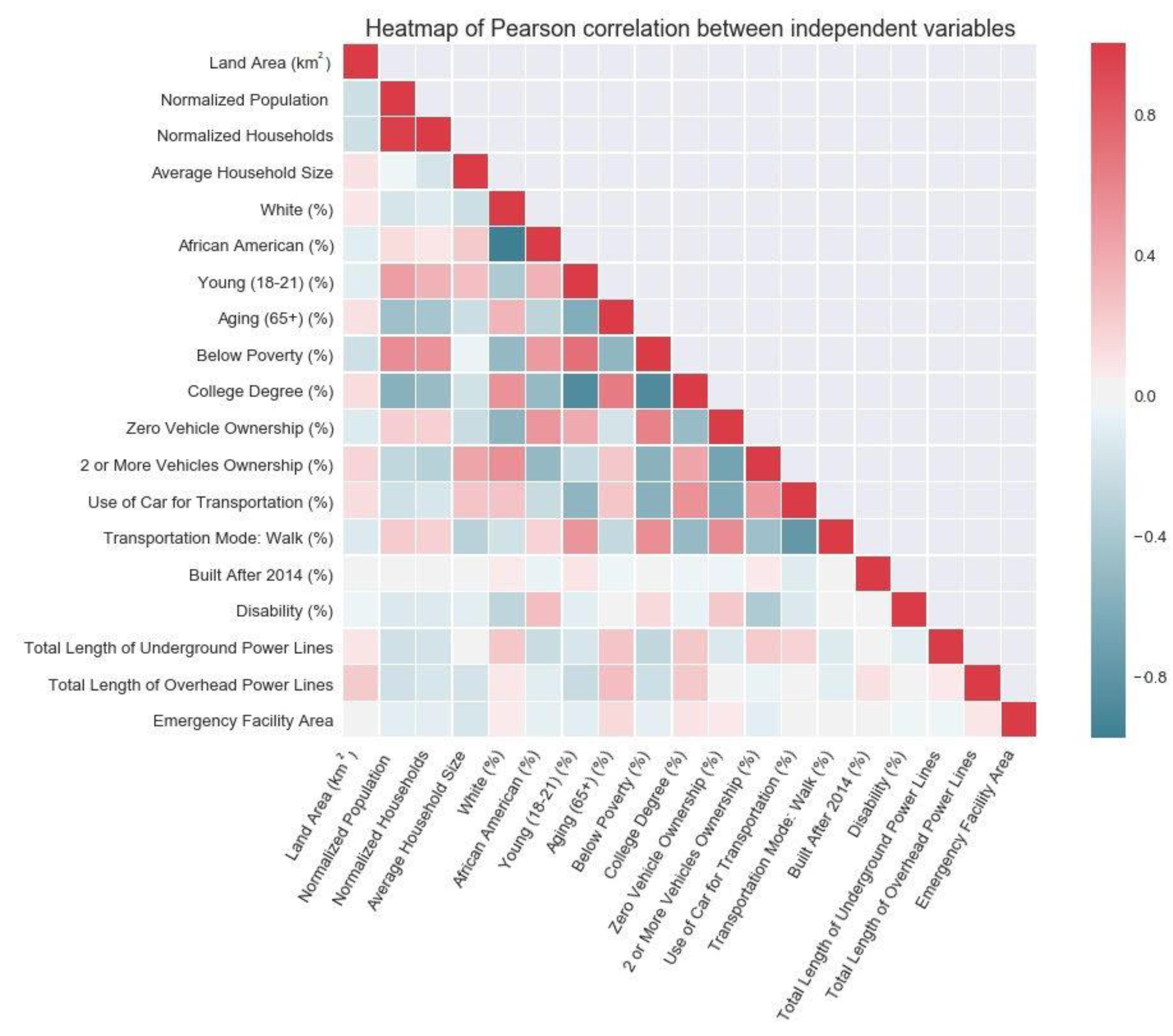
Hurricanes lead to substantial infrastructure system damages, such as roadway closures and power outages, in the US annually, especially in states like Florida. As such, this paper aimed to assess the impacts of Hurricane Hermine (2016) and Hurricane Michael (2018) on the City of Tallahassee, the capital of Florida, via exploratory spatial and statistical analyses on power outages and roadway closures. First, a geographical information systems (GIS)-based spatial analysis was conducted to explore the power outages and roadway closure patterns in the city including kernel density estimation (KDE) and density ratio difference (DRD) methods. In order to provide a more detailed assessment on which population segments were more affected, a second step included a statistical analysis to identify the relationships between demographic- and socioeconomic-related variables and the magnitude of power outages and roadway closures caused by these hurricanes. The results indicate that the high-risk locations for roadway closures showed different patterns, whereas power outages seemed to have similar spatial patterns for the hurricanes. The findings of this study can provide useful insights and information for city officials to identify the most vulnerable regions which are under the risk of disruption. This can lead to better infrastructure plans and policies.
Keywords: hurricane impact assessment; roadway closures; power outages; density ratio difference hurricane impact assessment; roadway closures; power outages; density ratio difference