Article

End-to-End Multi-Scale Adaptive Remote Sensing Image Dehazing Network

1
School of Computer Science, Northeast Electric Power University, Jilin 132012, China
2
State Key Laboratory of Applied Optics, Changchun Institute of Optics, Fine Mechanics and Physics, Chinese Academy of Sciences, Changchun 130033, China
*
Author to whom correspondence should be addressed.
Sensors 2025, 25(1), 218; https://doi.org/10.3390/s25010218
Submission received: 14 September 2024 / Revised: 5 November 2024 / Accepted: 12 December 2024 / Published: 2 January 2025
(This article belongs to the Section Sensing and Imaging)

Abstract

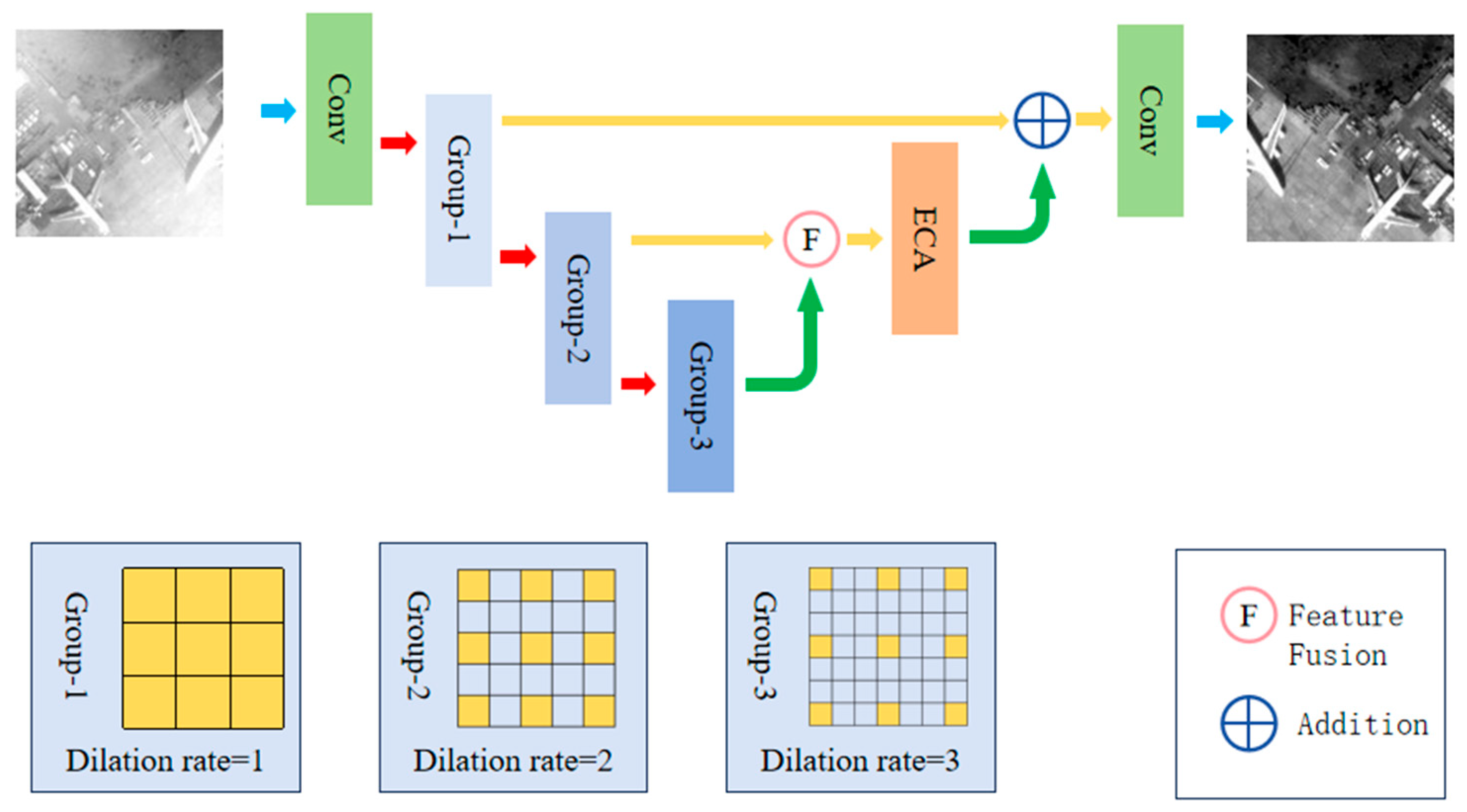
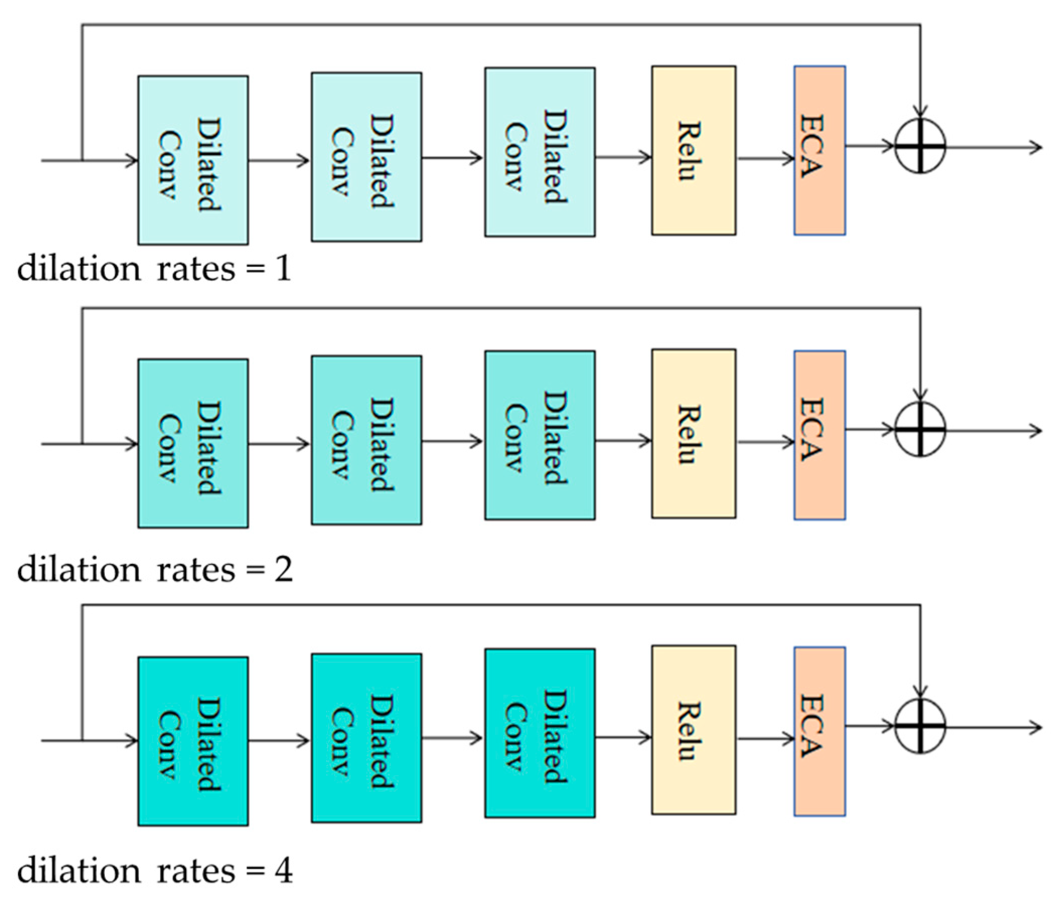
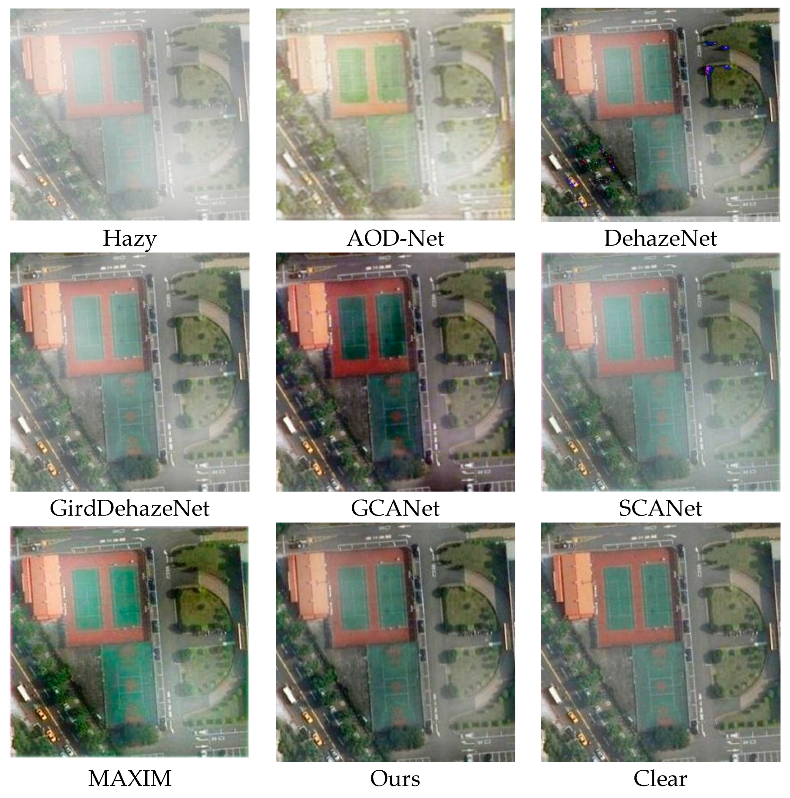
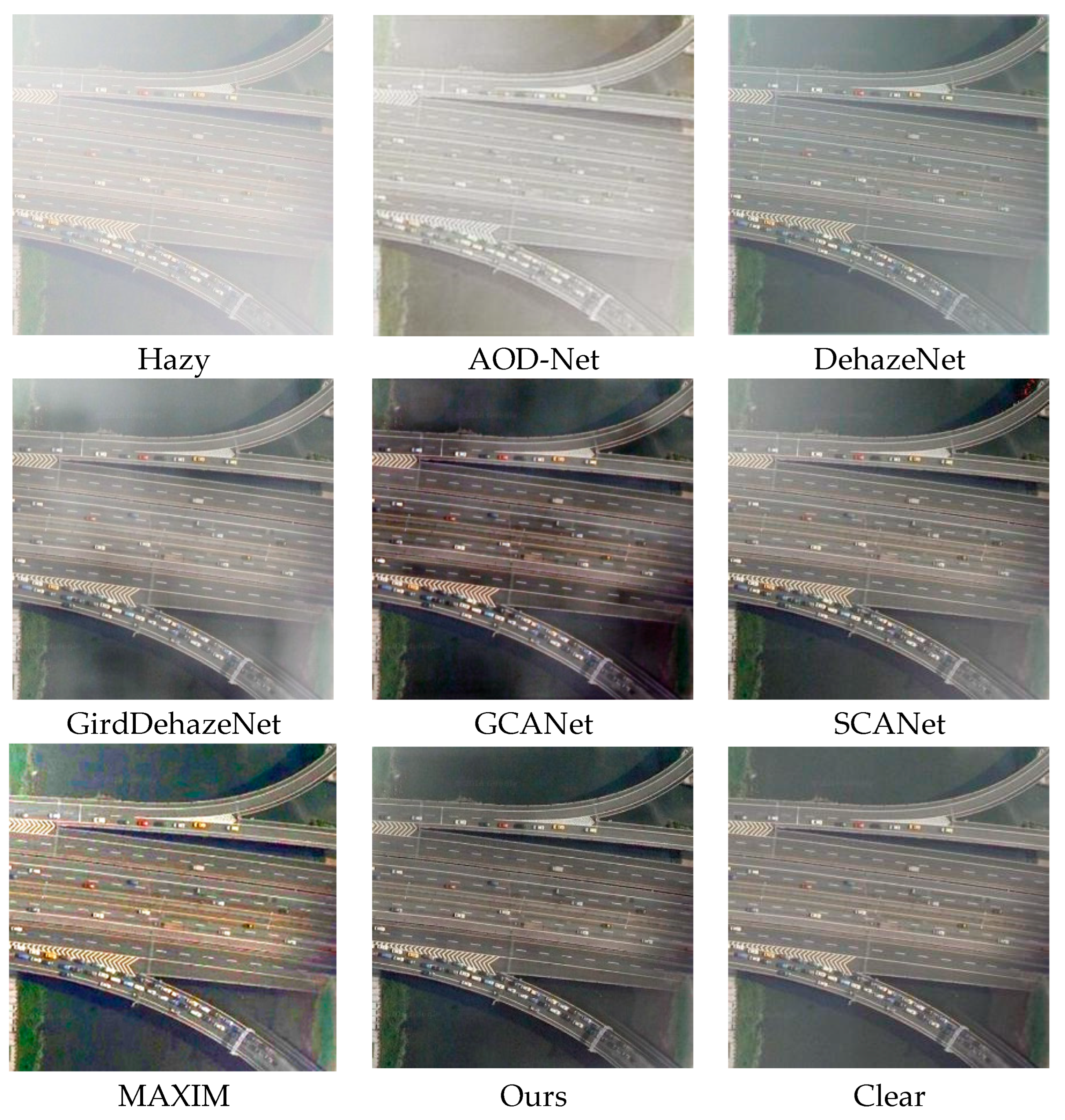
Satellites frequently encounter atmospheric haze during imaging, leading to the loss of detailed information in remote sensing images and significantly compromising image quality. This detailed information is crucial for applications such as Earth observation and environmental monitoring. In response to the above issues, this paper proposes an end-to-end multi-scale adaptive feature extraction method for remote sensing image dehazing (MSD-Net). In our network model, we introduce a dilated convolution adaptive module to extract global and local detail features of remote sensing images. The design of this module can extract important image features at different scales. By expanding convolution, the receptive field is expanded to capture broader contextual information, thereby obtaining a more global feature representation. At the same time, a self-adaptive attention mechanism is also used, allowing the module to automatically adjust the size of its receptive field based on image content. In this way, important features suitable for different scales can be flexibly extracted to better adapt to the changes in details in remote sensing images. To fully utilize the features at different scales, we also adopted feature fusion technology. By fusing features from different scales and integrating information from different scales, more accurate and rich feature representations can be obtained. This process aids in retrieving lost detailed information from remote sensing images, thereby enhancing the overall image quality. A large number of experiments were conducted on the HRRSD and RICE datasets, and the results showed that our proposed method can better restore the original details and texture information of remote sensing images in the field of dehazing and is superior to current state-of-the-art methods.
Keywords: remote sensing for defogging; dilated convolution; self-adaptive attention; multi-scale feature extraction remote sensing for defogging; dilated convolution; self-adaptive attention; multi-scale feature extraction