Article

A PAD-Based Unmanned Aerial Vehichle Route Planning Scheme for Remote Sensing in Huge Regions

1
College of Computer Science, Sichuan University, Chengdu 610065, China
2
School of Geographical Sciences, Southwest University, Chongqing 400715, China
*
Author to whom correspondence should be addressed.
Sensors 2023, 23(24), 9897; https://doi.org/10.3390/s23249897
Submission received: 20 November 2023 / Revised: 15 December 2023 / Accepted: 16 December 2023 / Published: 18 December 2023
(This article belongs to the Section Vehicular Sensing)

Abstract

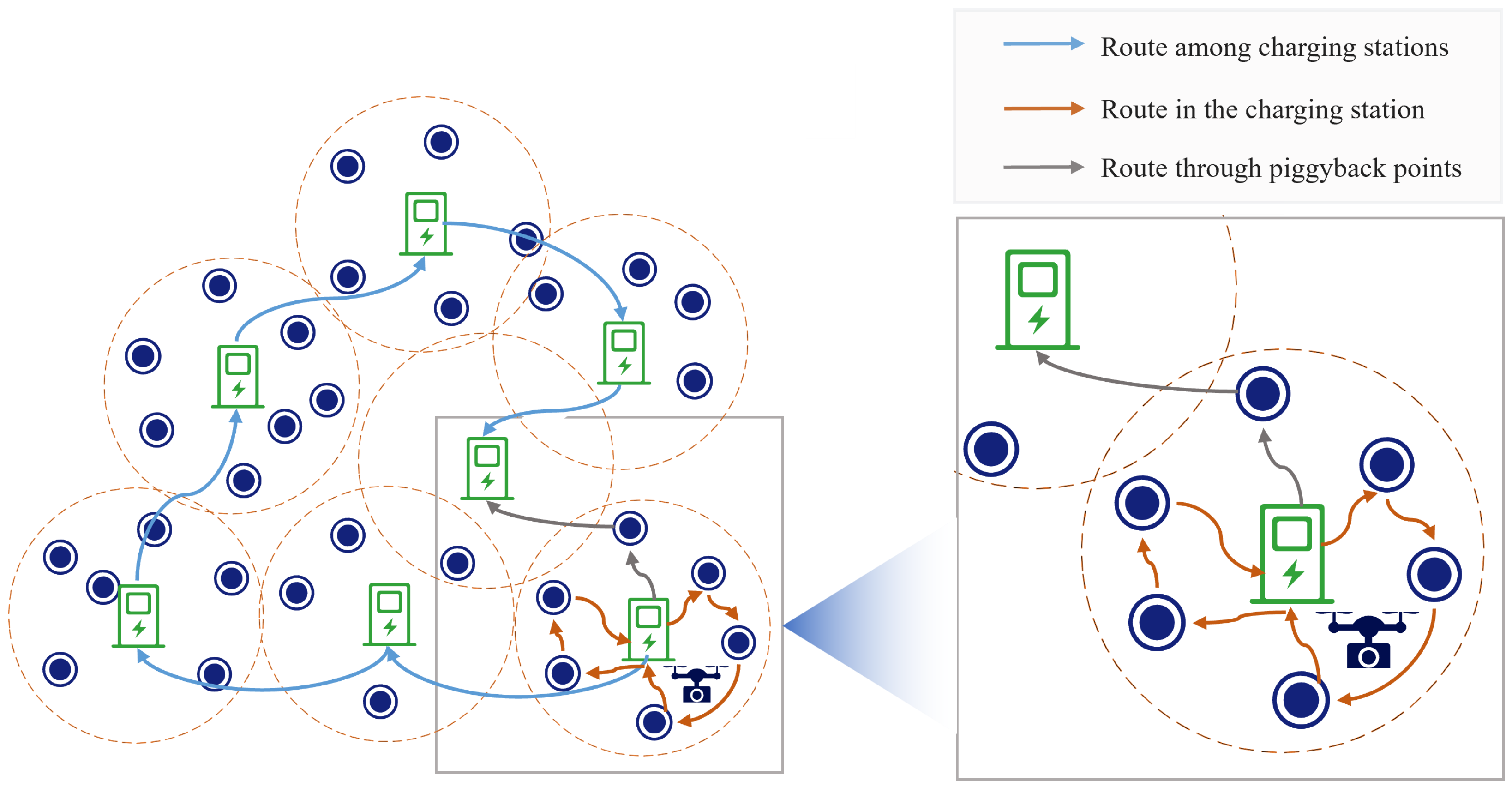
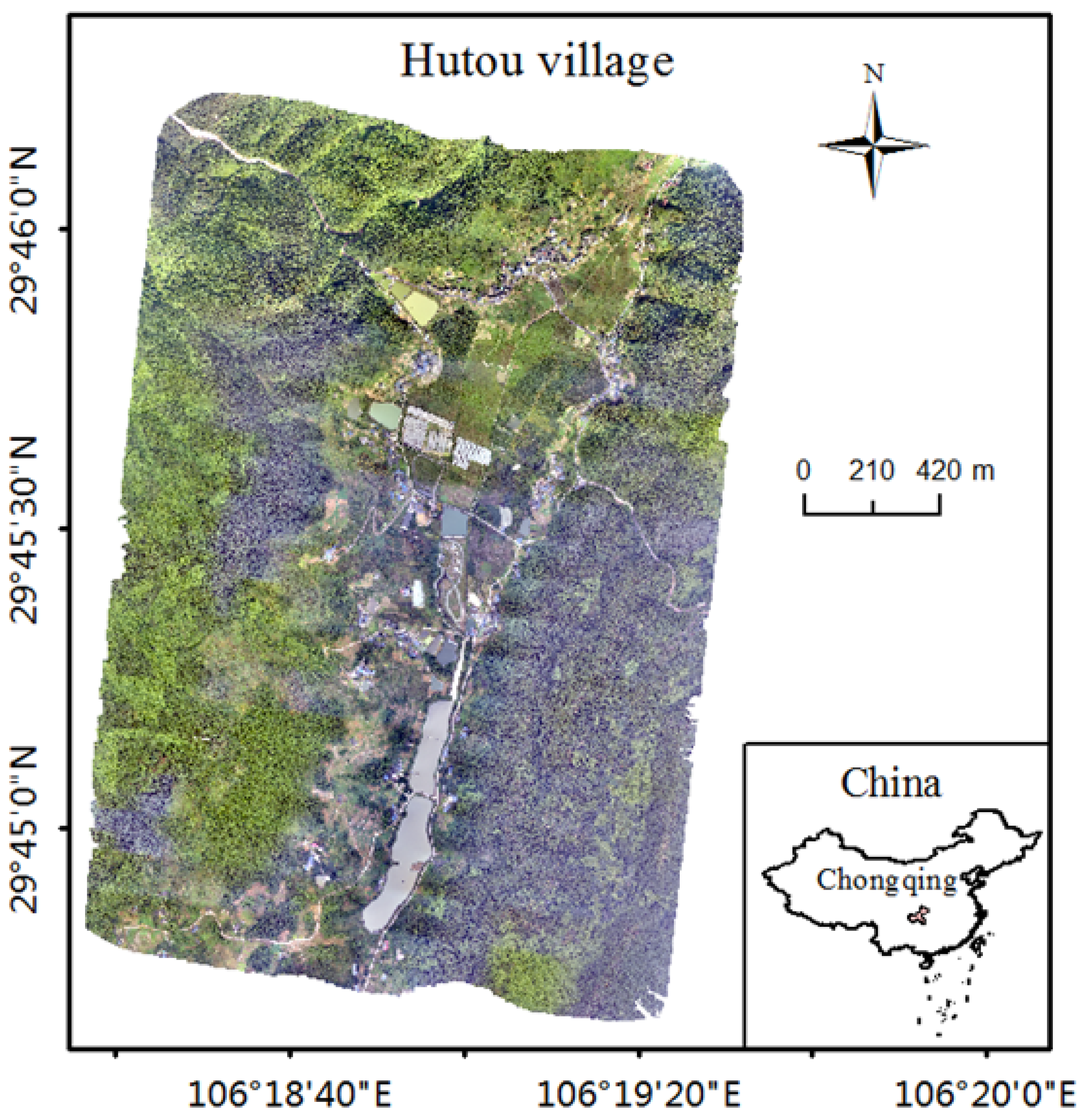
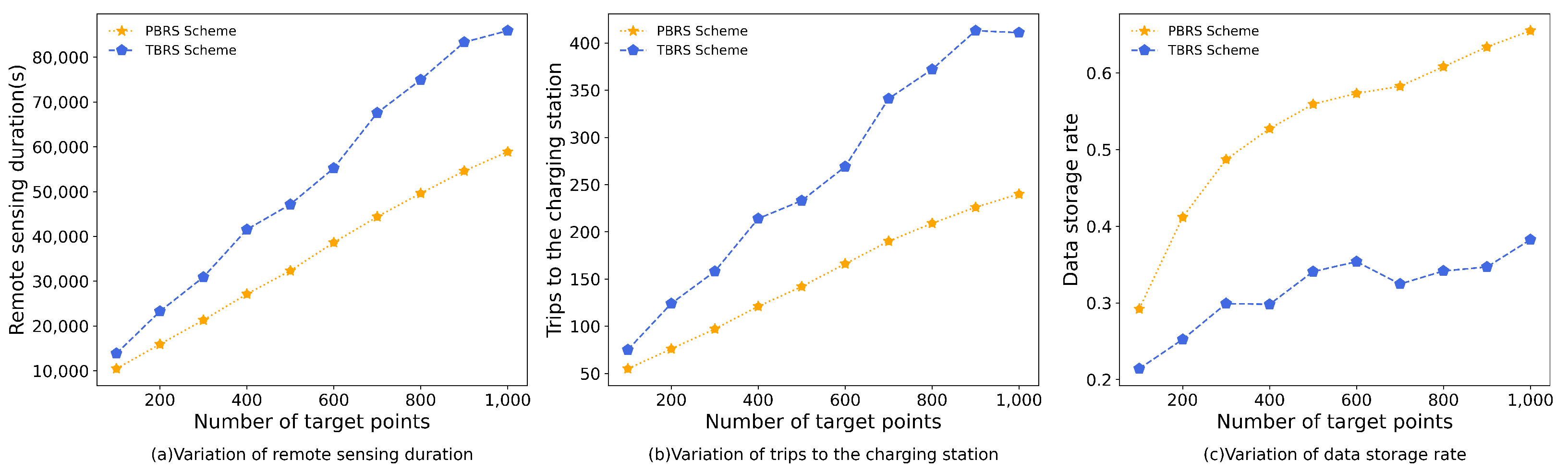
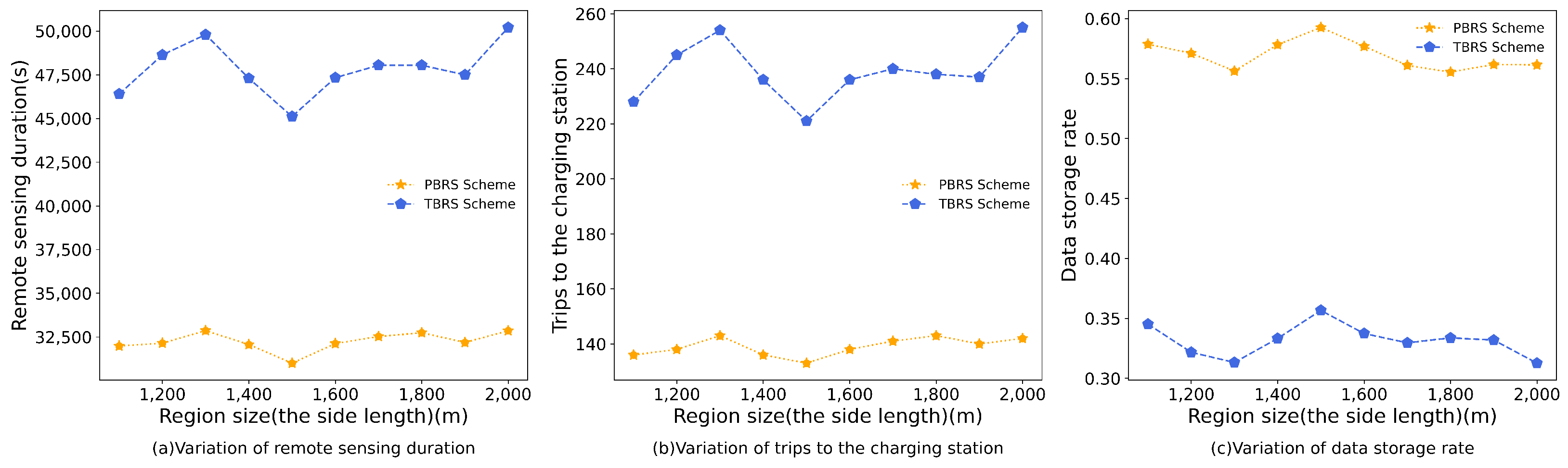
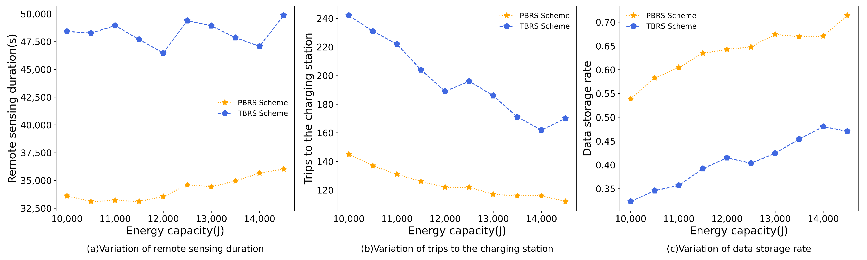
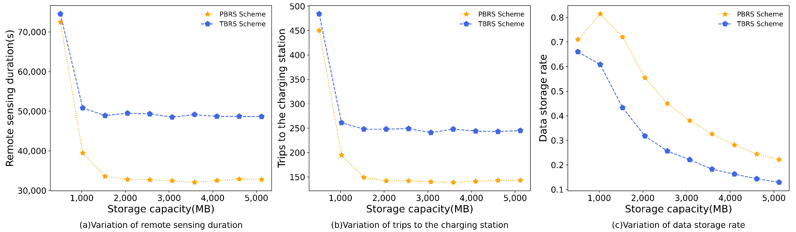
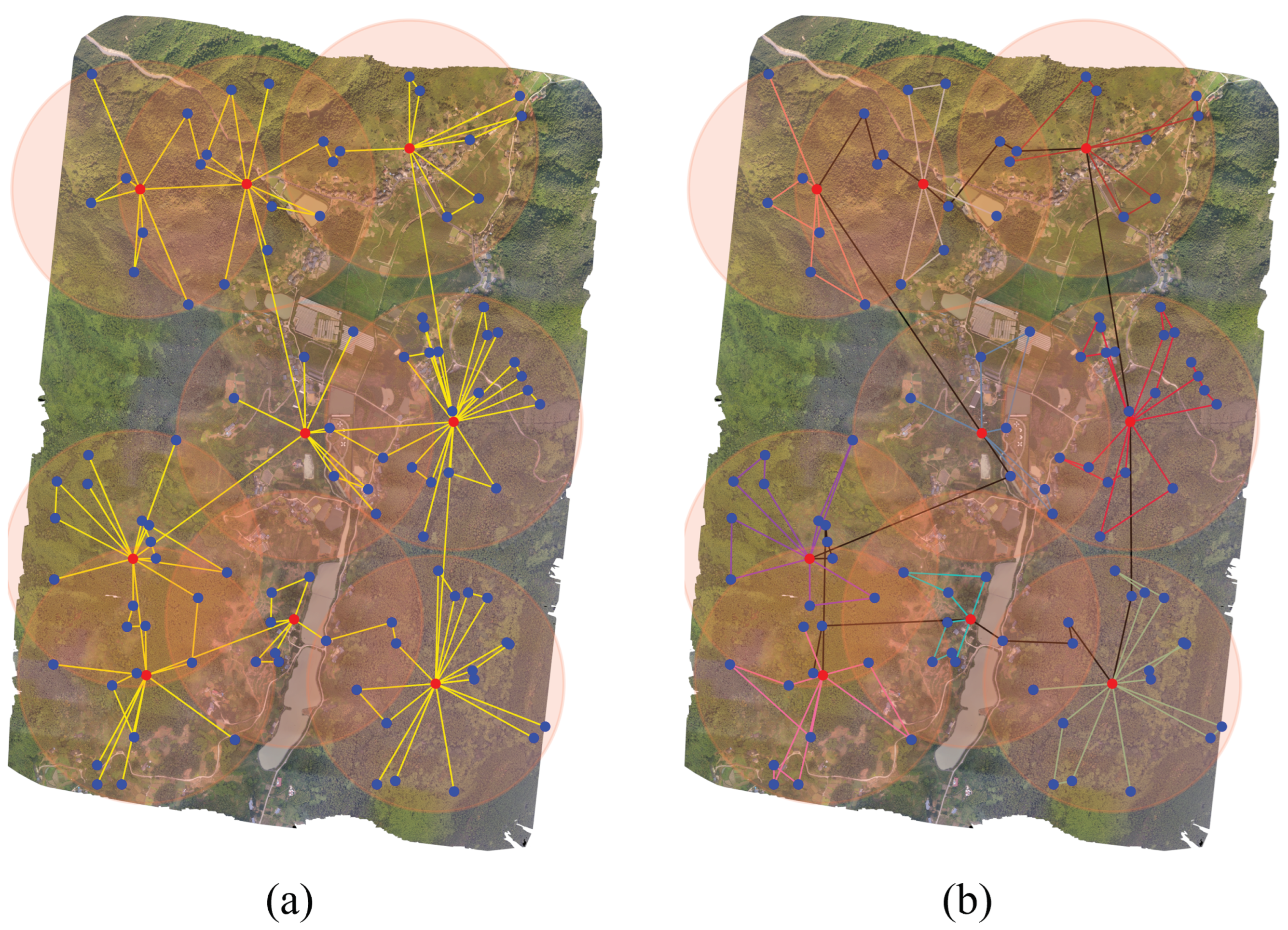
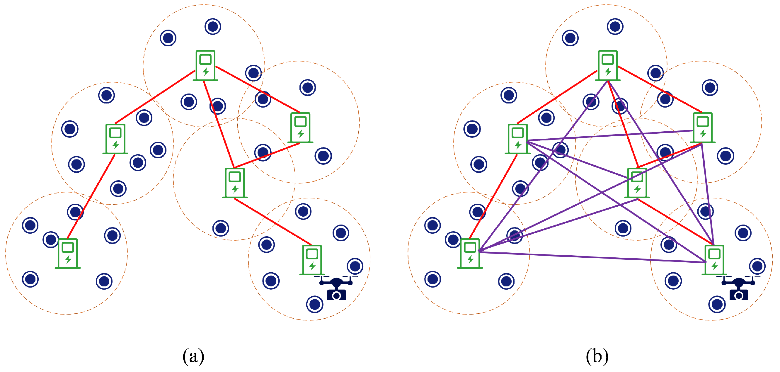
Unmanned aerial vehicles (UAVs) have been employed extensively for remote-sensing missions. However, due to their energy limitations, UAVs have a restricted flight operating time and spatial coverage, which makes remote sensing over huge regions that are out of UAV flight endurance and range challenging. PAD is an autonomous wireless charging station that might significantly increase the flying time of UAVs by recharging them in the air. In this work, we introduce PADs to simplify UAV-based remote sensing over a huge region, and then we explore the UAV route planning problem once PADs have been predeployed throughout a huge remote sensing region. A route planning scheme, named PAD-based remote sensing (PBRS), is proposed to solve the problem. The PBRS scheme first plans the UAV’s round-trip routes based on the location of the PADs and divides the whole target region into multiple PAD-based subregions. Between adjacent subregions, the UAV flight subroute is planned by determining piggyback points to minimize the total time for remote sensing. We demonstrate the effectiveness of the proposed scheme by conducting several sets of simulation experiments based on the digital orthophoto model of Hutou Village in Beibei District, Chongqing, China. The results show that the PBRS scheme can achieve excellent performance in three metrics of remote sensing duration, the number of trips to charging stations, and the data-storage rate in UAV remote-sensing missions over huge regions with predeployed PADs through effective planning of UAVs.
Keywords: remote sensing; PAD; path planning; UAV remote sensing; PAD; path planning; UAV