Article

Monitoring and Landscape Dynamic Analysis of Alpine Wetland Area Based on Multiple Algorithms: A Case Study of Zoige Plateau


1
State Key Laboratory of Grassland Agro-Ecosystems, College of Pastoral Agriculture Science and Technology, Lanzhou University, Lanzhou 730020, China
2
Key Laboratory of Grassland Livestock Industry Innovation, Ministry of Agriculture, Lanzhou University, Lanzhou 730020, China
3
Key Laboratory of Western China’s Environmental Systems (Ministry of Education), College of Earth and Environmental Sciences, Lanzhou University, Lanzhou 730020, China
*
Author to whom correspondence should be addressed.
Sensors 2020, 20(24), 7315; https://doi.org/10.3390/s20247315
Submission received: 12 November 2020 / Revised: 11 December 2020 / Accepted: 17 December 2020 / Published: 19 December 2020
(This article belongs to the Special Issue Remote Sensing Application for Monitoring Grassland)

Abstract

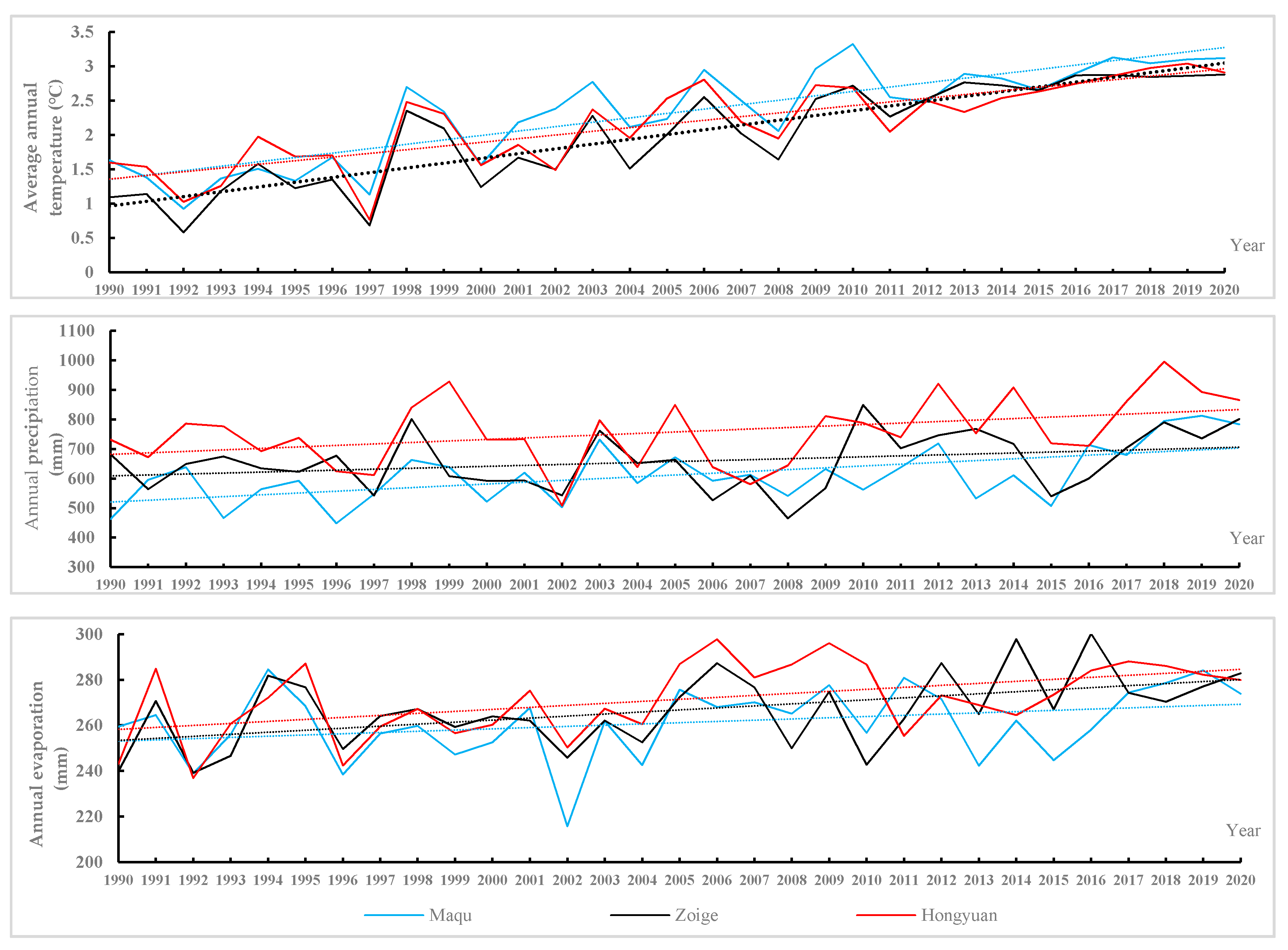
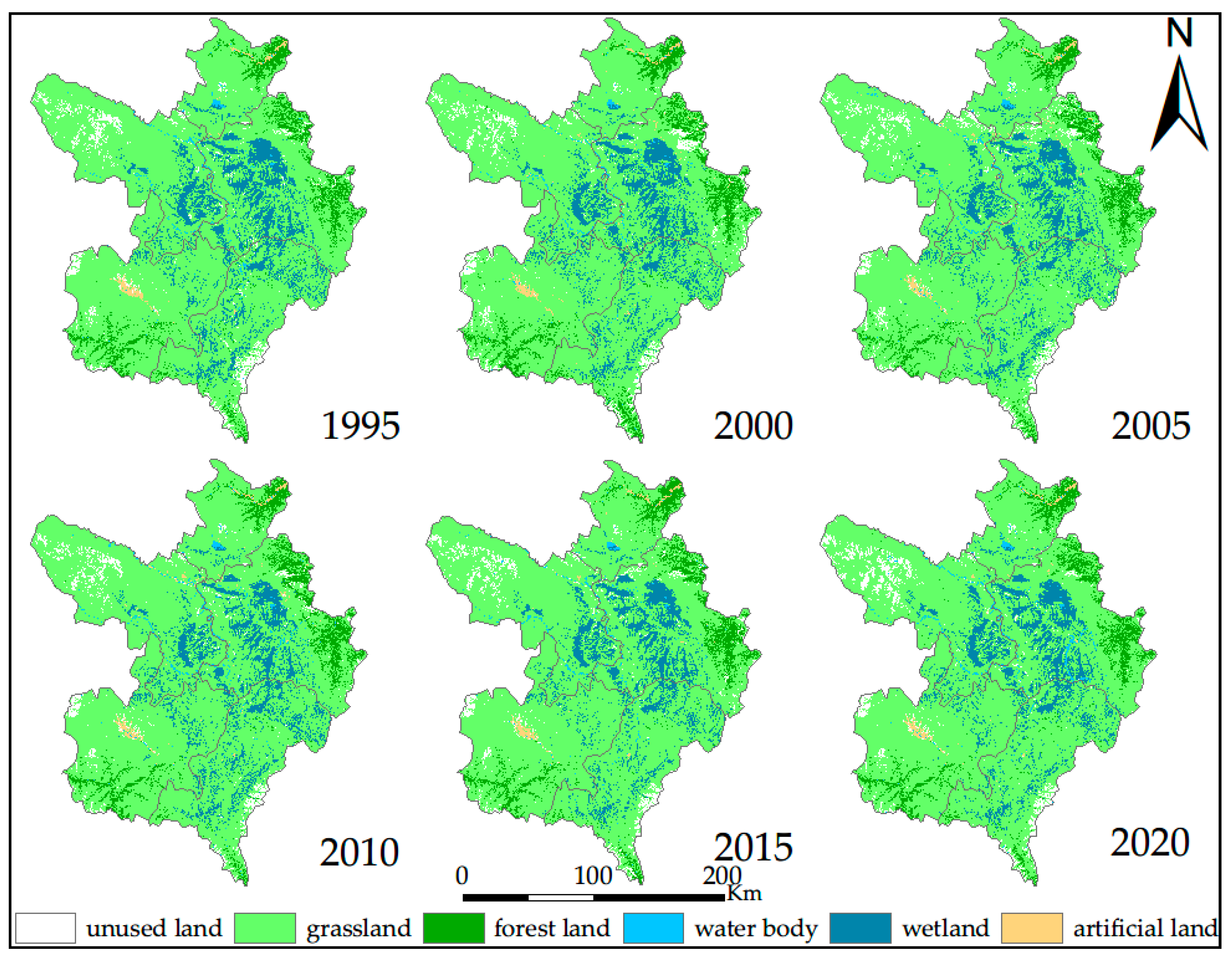
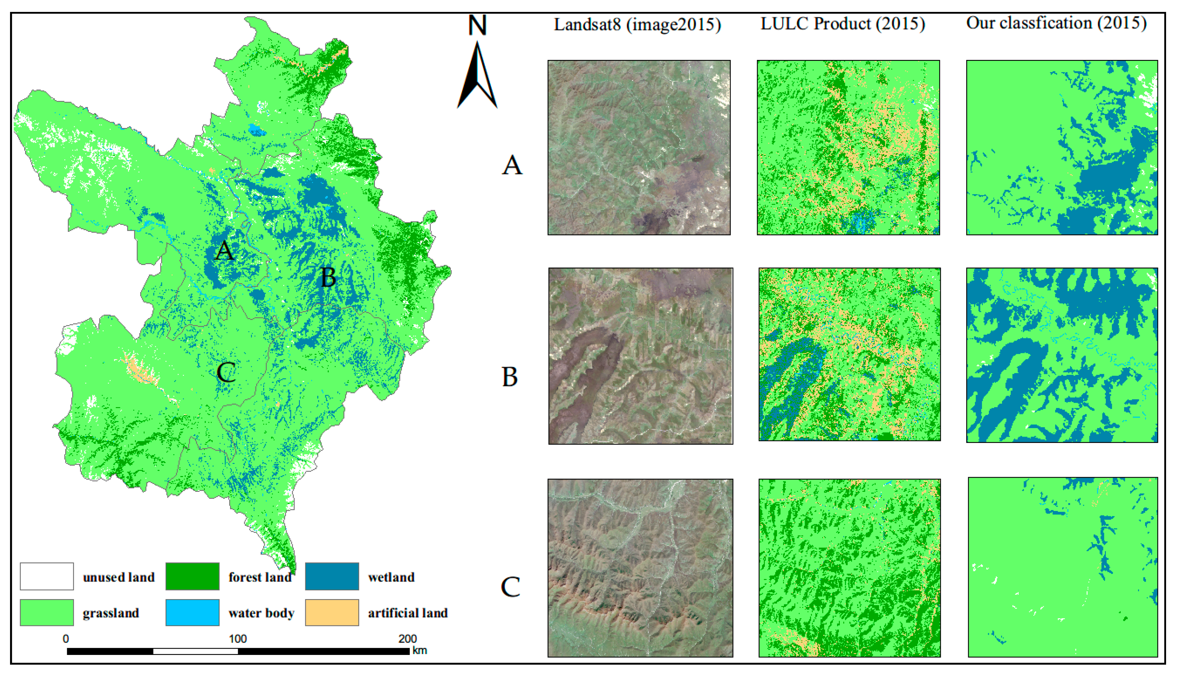
As an important part of the wetland ecosystem, alpine wetland is not only one of the most important ecological water conservation areas in the Qinghai–Tibet Plateau region, but is also an effective regulator of the local climate. In this study, using three machine learning algorithms to extract wetland, we employ the landscape ecological index to quantitatively analyze the evolution of landscape patterns and grey correlation to analyze the driving factors of Zoige wetland landscape pattern change from 1995 to 2020. The following results were obtained. (1) The random forest algorithm (RF) performs best when dealing with high-dimensional data, and the accuracy of the decision tree algorithm (DT) is better. The performance of the RF and DT is better than that of the support vector machine algorithm. (2) The alpine wetland in the study area was degraded from 1995 to 2015, whereas wetland area began to increase after 2015. (3) The results of landscape analysis show the decrease in wetland area from 1995 to 2005 was mainly due to the fragmentation of larger patches into many small patches and loss of the original small patches, while the 2005 to 2015 decrease was caused by the loss of many middle patches and the decrease in large patches from the edge to the middle. The 2015 to 2020 increase is due to an increase in the number of smaller patches and recovery of original wetland area. (4) The grey correlation degree further shows that precipitation and evaporation are the main factors leading to the change in the landscape pattern of Zoige alpine wetland. The results are of great significance to the long-term monitoring of the Zoige wetland ecosystem.
Keywords: wetland; random forest; Google Earth Engine (GEE); Zoige Plateau; landscape analysis wetland; random forest; Google Earth Engine (GEE); Zoige Plateau; landscape analysis