Article

Evaluation of Urban Heat Island (UHI) Using Satellite Images in Densely Populated Cities of South Asia

1
Department of Environmental Engineering, Kyoto University, Katsura, Nishikyo-ku 615-8510, Japan
2
Interdisciplinary Centre for River Basin Environment, University of Yamanashi, 4-3-11 Takeda, Kofu 400-8510, Japan
3
Smartphones For Water Nepal (S4W-Nepal), Lalitpur 44700, Nepal
4
Texas A&M AgriLife Research, Texas A&M University, El Paso, TX 79927, USA
5
Universal Engineering and Science College, Lalitpur 44700, Nepal
*
Author to whom correspondence should be addressed.
Earth 2021, 2(1), 86-110; https://doi.org/10.3390/earth2010006
Submission received: 8 December 2020 / Revised: 28 January 2021 / Accepted: 4 February 2021 / Published: 9 February 2021

Abstract

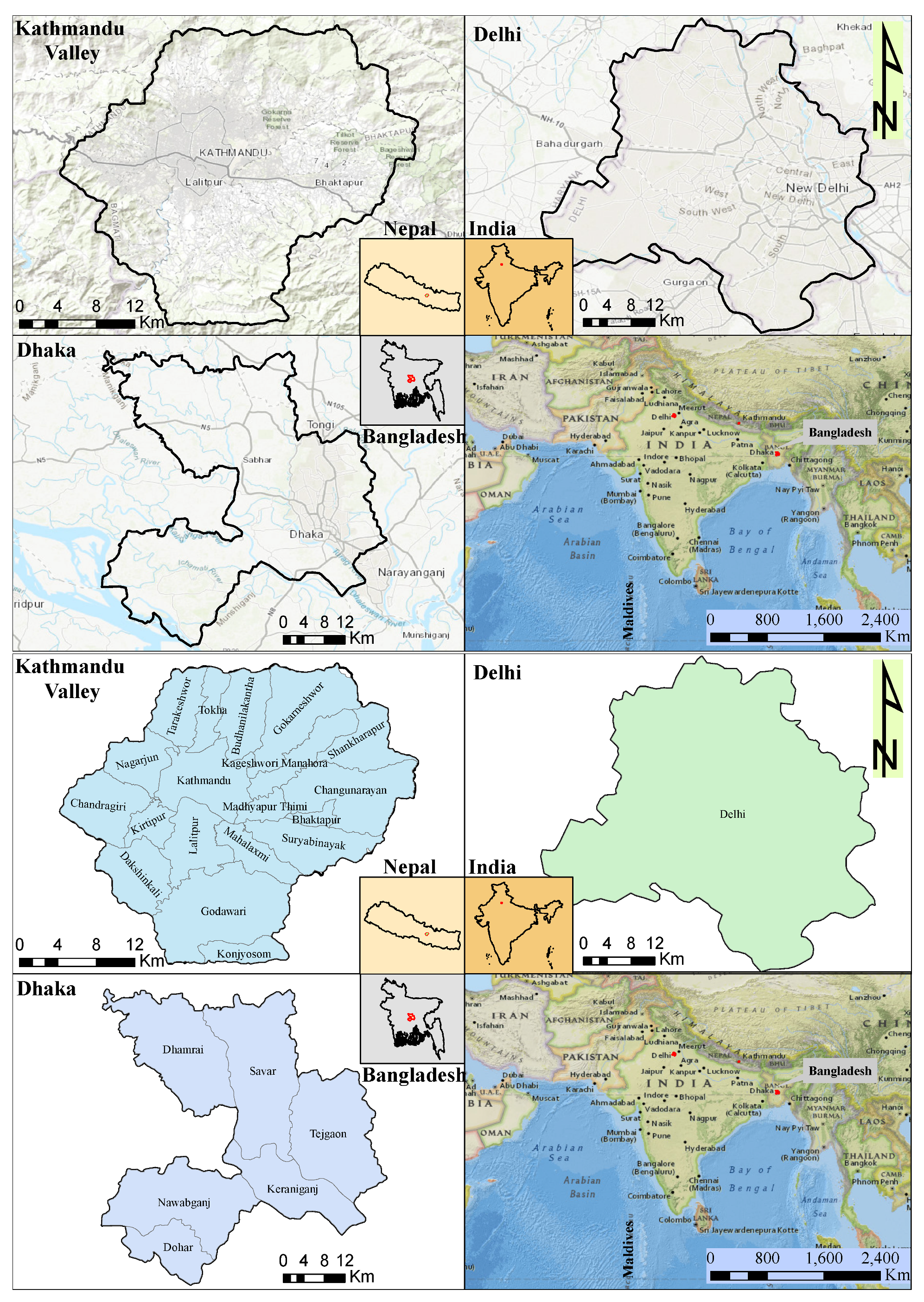
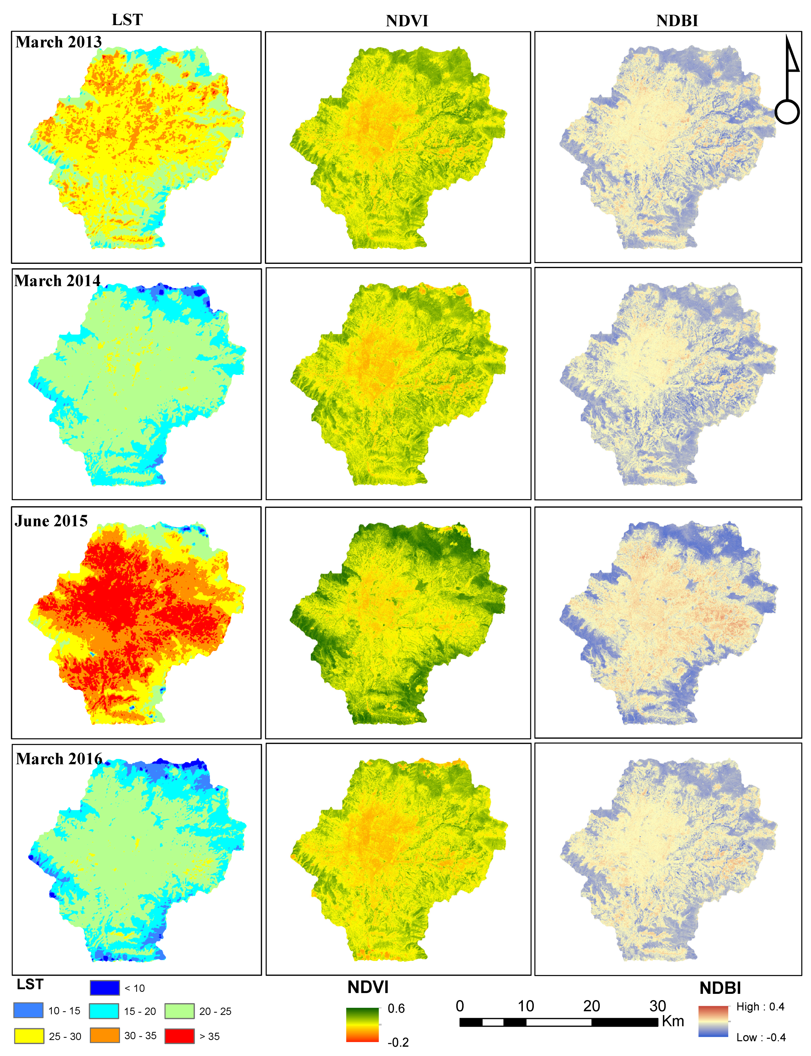
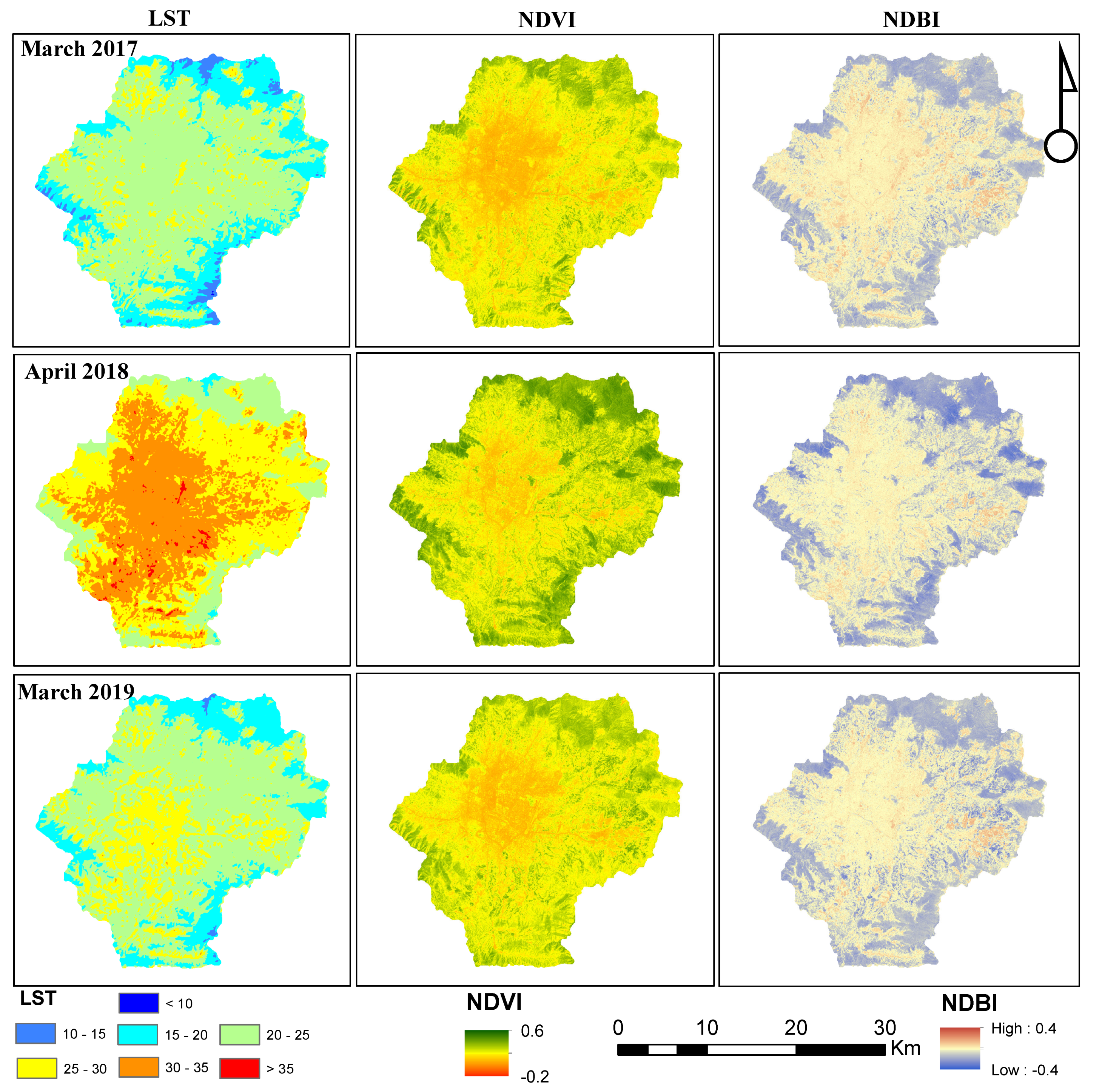
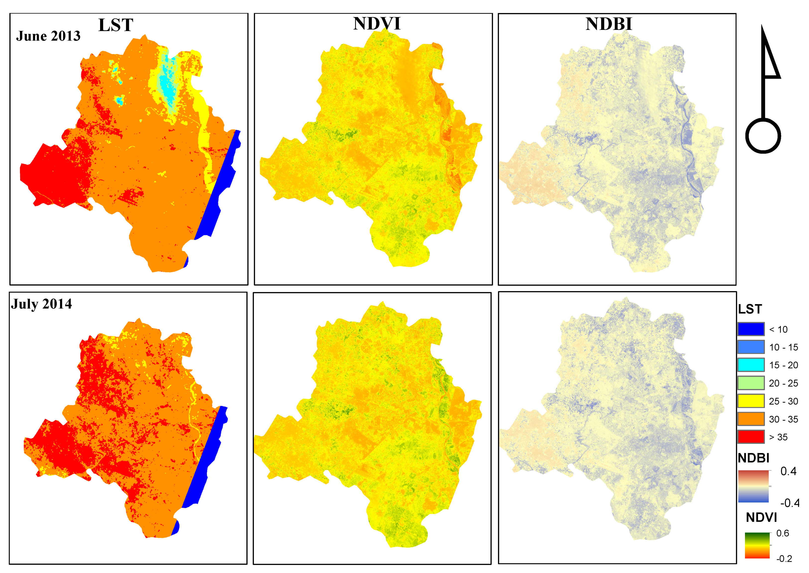
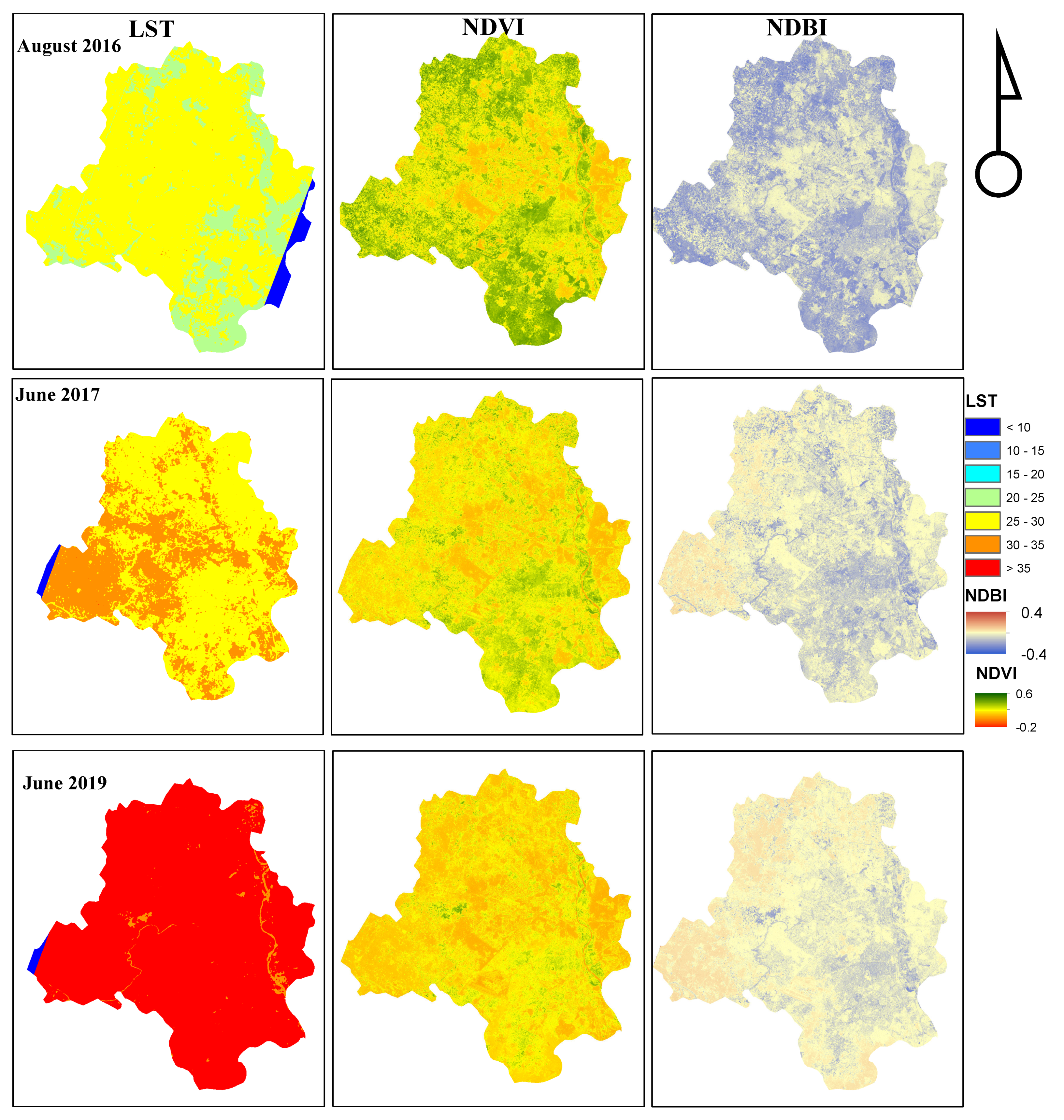
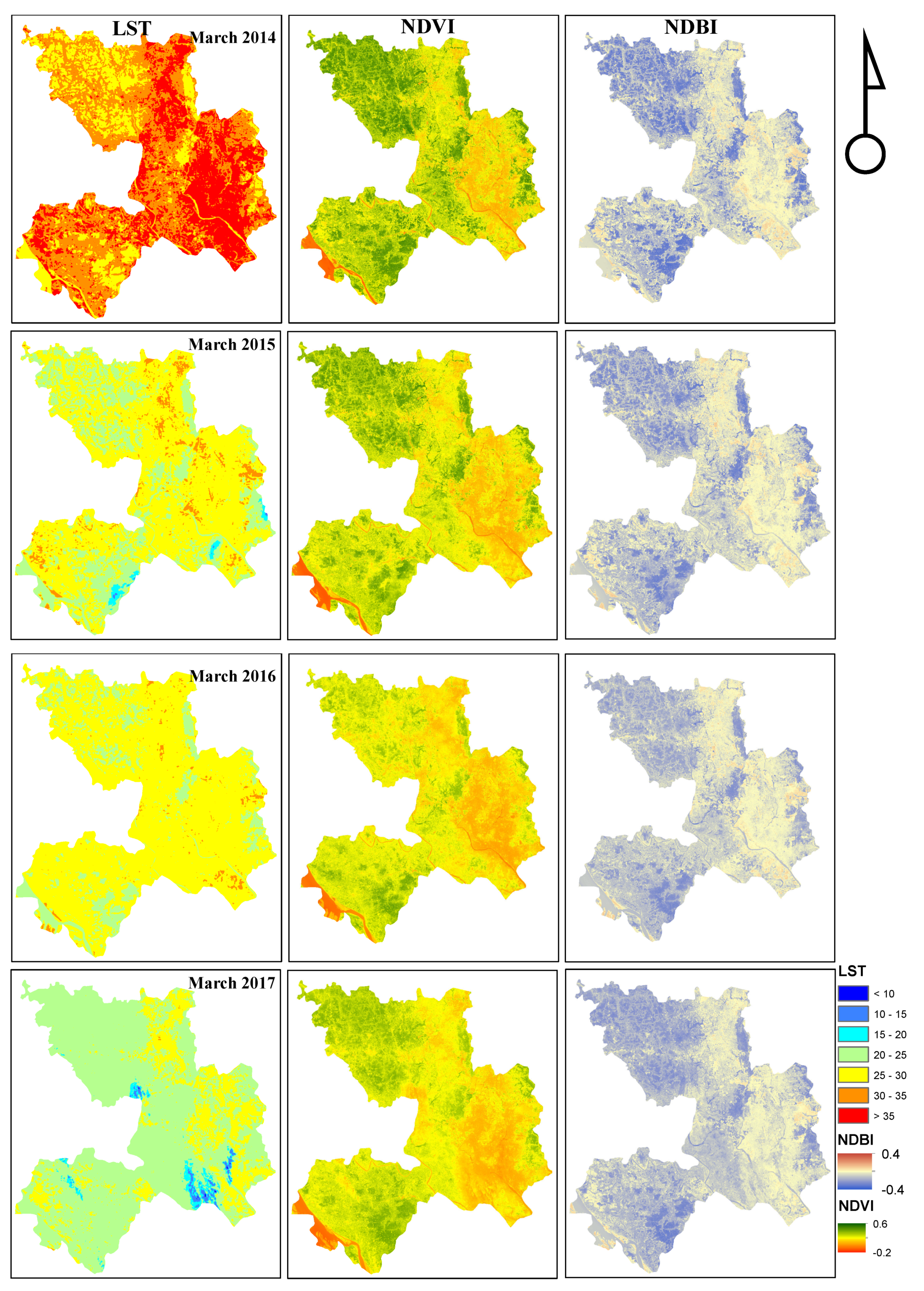
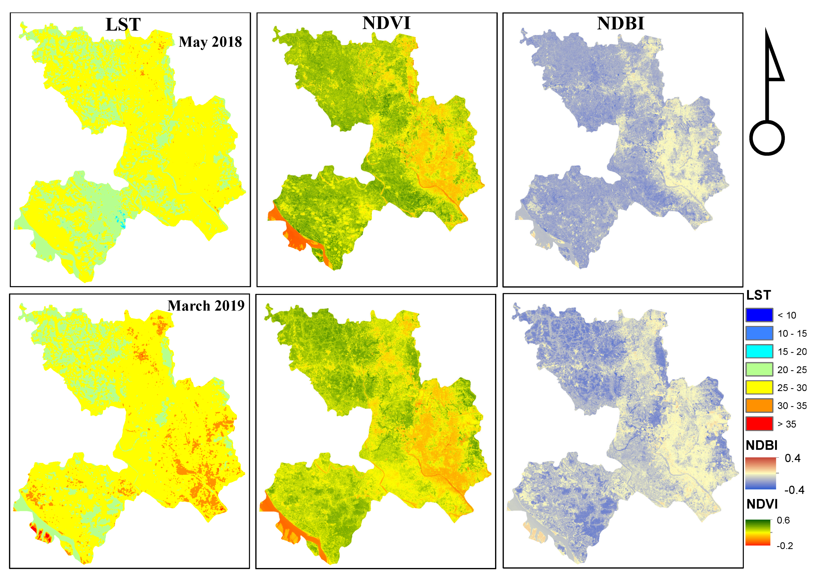
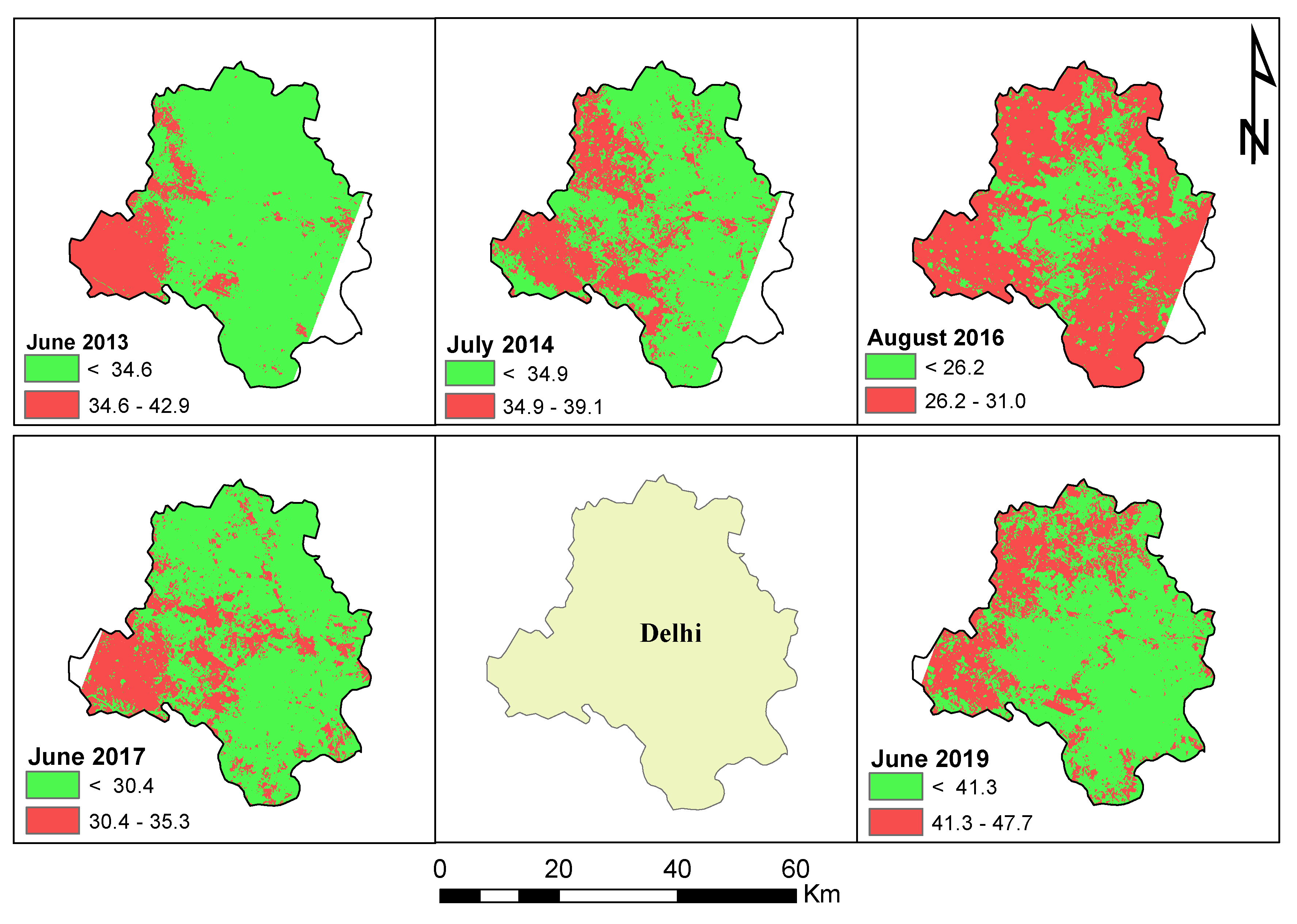
Rapid Urbanization, and other anthropogenic activities, have amplified the change in land-use transition from green space to heat emission in built-up areas globally. As a result, there has been an increase in the land surface temperature (LST) causing the Urban Heat Island (UHI) effect, particularly in large cities. The UHI effect poses a serious risk to human health and well-being, magnified in large developing cities with limited resources to cope with such issues. This study focuses on understanding the UHI effect in Kathmandu Valley (KV), Delhi, and Dhaka, three growing cities in South Asia. The UHI effect was evaluated by analyzing the UHI intensity of the city with respect to the surroundings. We found that the central urban area, of all three cities, experienced more heat zones compared to the peri-urban areas. The estimated average surface temperature ranged from 21.1 C in March 2014 to 32.0 C in June 2015 in KV, while Delhi and Dhaka experienced surface temperature variation from 29.7 C in June 2017 to 40.2 C in June 2019 and 23.6 C in March 2017 to 33.2 C in March 2014, respectively. Based on magnitude and variation of LST, highly built-up central KV showed heat island characteristics. In both Delhi and Dhaka, the western regions showed the UHI effect. Overall, this study finds that the UHI zones are more concentrated near the urban business centers with high population density. The results suggest that most areas in these cities have a rising LST trend and are on the verge of being UHI regions. Therefore, it is essential that further detailed assessment is conducted to understand and abate the impact of the temperature variations.
Keywords: land surface temperature; normalized difference vegetation index; normalized difference built-up index; South Asia; urban heat island land surface temperature; normalized difference vegetation index; normalized difference built-up index; South Asia; urban heat island