Article

Landslide Susceptibility Mapping in the Mount Elgon Districts of Eastern Uganda Using Google Earth Engine


by
Mohammed Mussa Abdulahi
1,
Pascal E. Egli
2,* and
Zinabu Bora
3
1
Africa Center of Excellence in Climate Smart Agriculture and Biodiversity Conservation, Haramaya University, Dire Dawa P.O. Box 138, Ethiopia
2
Department of Geography and Social Anthropology, Norwegian University of Science and Technology, NO-7049 Trondheim, Norway
3
National Engineering Technology Research Center for Desert-Oasis Ecological Construction, Xinjiang Institute of Ecology and Geography, Chinese Academy of Sciences, 818 South Beijing Road, Urumqi 830011, China
*
Author to whom correspondence should be addressed.
GeoHazards 2026, 7(2), 50; https://doi.org/10.3390/geohazards7020050

Submission received: 5 May 2025 / Revised: 26 July 2025 / Accepted: 7 August 2025 / Published: 30 April 2026

Abstract

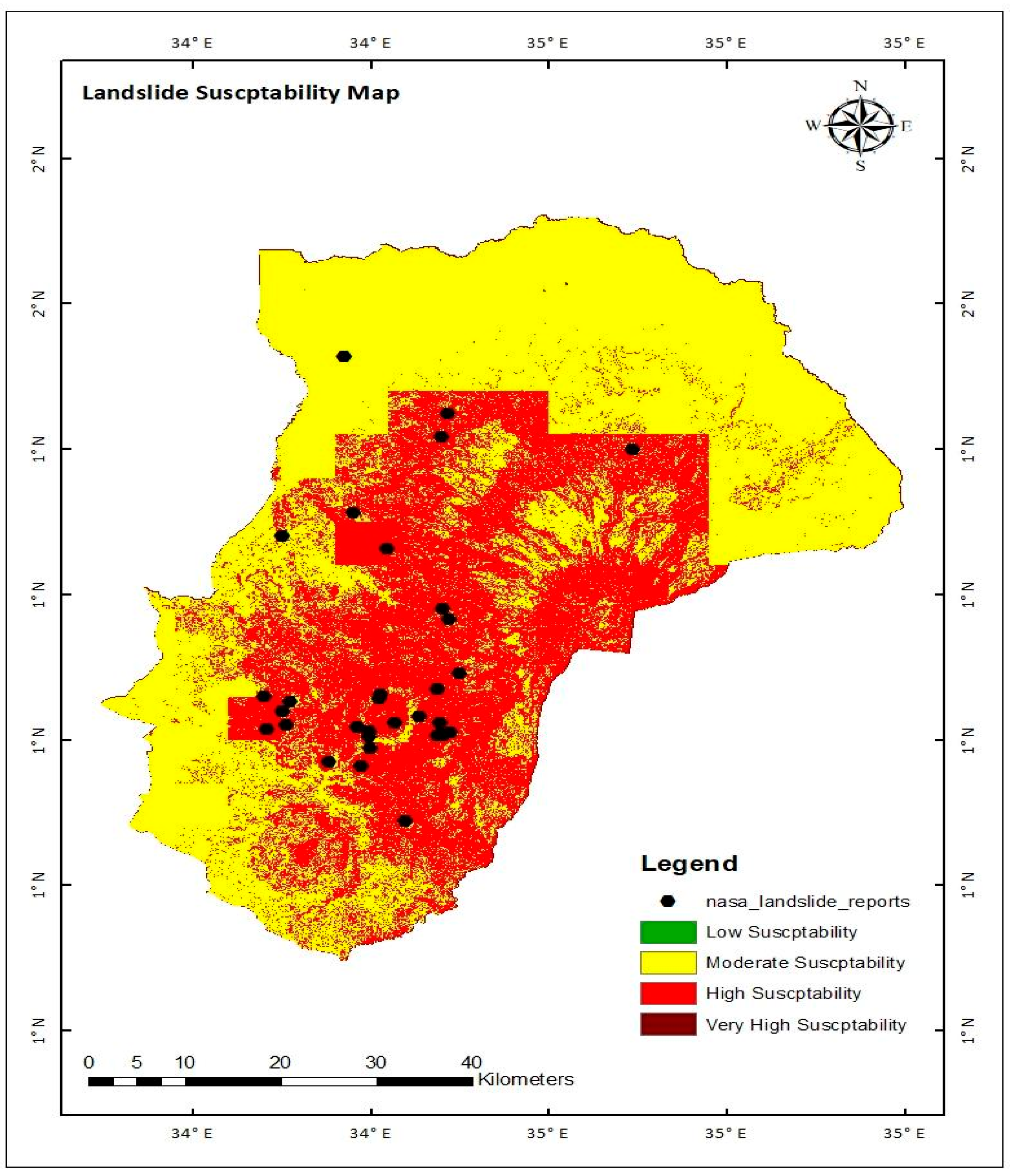
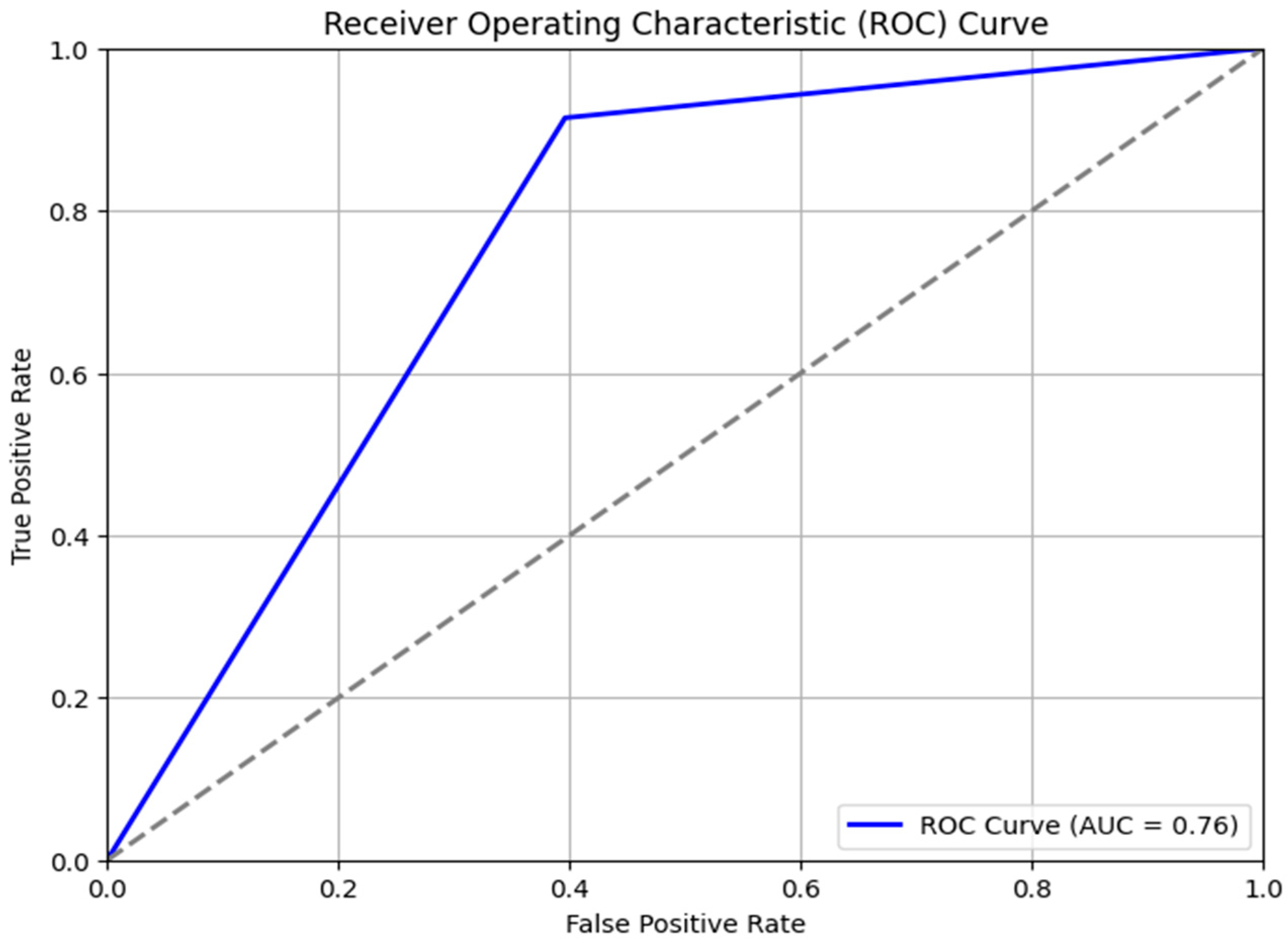
Landslides are a critical environmental hazard in mountainous regions like eastern Uganda, posing serious threats to lives, infrastructure, and ecosystems. While recent advances in geospatial technology have improved hazard assessment, existing research often lacks high-resolution, cloud-based analysis for dynamic landscapes such as the Mount Elgon region. This study addresses that gap by developing a landslide susceptibility map (LSM) using Google Earth Engine (GEE), which integrates remote sensing and geospatial data for scalable analysis. The main objective is to identify landslide-prone zones by analyzing eight conditioning factors, namely slope, elevation, vegetation cover, rainfall, land use land cover, soil type, soil moisture, and groundwater levels using the weighted overlay method (WOM). The methodology produced a classified LSM with zones of high (37.7%), moderate (58%), low (2%), and very low (2.3%) susceptibility, with validation via historical landslide data and ROC analysis yielding an AUC of 0.76, confirming strong predictive performance. The study underscores the value of GEE in hazard modeling and provides actionable insights for targeted risk mitigation, sustainable land use planning, and early warning system development in landslide-prone areas.
Keywords: Google Earth Engine; landslide susceptibility; Mount Elgon; Uganda; weighted overlay method Google Earth Engine; landslide susceptibility; Mount Elgon; Uganda; weighted overlay method