1. Introduction
In the context of the hydrographic studies of the territory of Comacchio Lagoon, there was a lack of non-invasive research in the water, carried out with remote-sensing technologies. Our work started this new study session of investigation; this was made possible as a result of the research permits received during a forensic archaeological project (co-ordinated by Project Recover Team, USA with the collaboration of who is writing) which allowed us to use the most advanced non-invasive techniques for understanding the lagoon bed and the local stratigraphy. The permits came from Soprintendenza Archeologia, Belle Arti e Paesaggio per la città metropolitana di Bologna e le province di Modena, Reggio Emilia e Ferrara—SABAP-BO—Archaeology sector, and from Parco del Delta (Research Authorization protocols below).
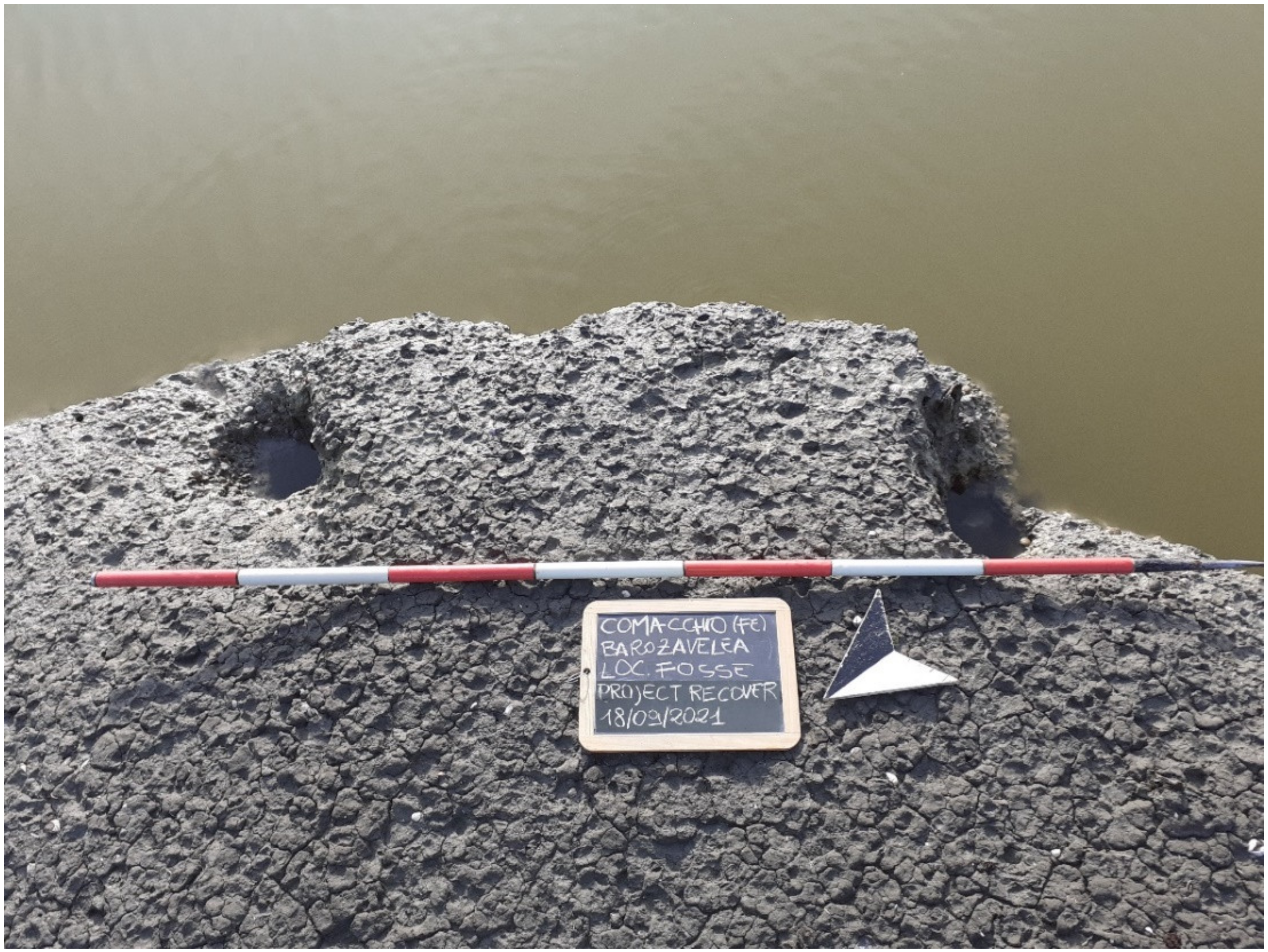
The northern sector of Valle Fossa di Porto, between the Fosse Canal and the structure called Casone Garibaldi, had not yet been the object of specific studies and archaeological investigations since now (unlike very nearby areas which have been excavated with extensive stratigraphic fields, since the 1970s) [
1,
2,
3,
4,
5,
6,
7,
8,
9] (see
Section 1.3 Archaeological Panorama). In addition, for this reason, the authorities in charge have welcomed the possibility of completing new non-invasive underwater geophysical investigations with coastal surveys, focusing our campaign on unexplored areas. The understandings of the territory, now covered by water, still not investigated, could give important results to relate the northern sites of Comacchio (especially Valle del Mezzano and Valle Pega) with the finds south of the Fosse canal, reaching a holistic vision of the cultural heritage related to the hydrography evolution.
From the point of view of research planning, considering a series of preliminary surveys and checks on the depth of the water, we have found that the most useful means for carrying out remote-sensing investigations would have been a shallow draft hydrographic drone. Among the various autonomous vehicles for non-invasive investigations capable of navigating even in 30 cm-deep water, we choose the
OpenSWAP—Shallow Water Autonomous Prospector [
10], a small catamaran on which several instruments could be mounted at the same time by concentrating the scan times (see
Section 2, Materials and Methods); this means that it is equipped with an echo-side-scan sonar, single-beam, and sub-bottom profiler, which would have allowed us to read the morphology and stratigraphy of the seabed, offering a diachronic complete approach.
This instrument belongs to the low-cost class of the ASV Autonomous Surface Vehicles for geophysical surveys in the shallow water environment. In the ambit of the archaeological hydrographic investigations in eastern Emilia Romagna, this kind of surface vehicle is not yet particularly widespread, despite the great versatility of this means. In this sense, the Italian National Superintendency for Underwater Cultural Heritage is developing new guidelines for preventive archeology which also include remote-sensing investigations with the combination of instruments that we have used (the work is in progress). Similar vehicles, equipped in the same way, completed some geophysical data acquisition in Emilia Romagna a few years ago: among the case studies, there was the Cavo Napoleonico artificial canal (connecting the Po and the Reno rivers), a sector of the Reno river, near Bologna, and the Comacchio Lagoon with the scope of a general morphobatimetrical overview, dedicated mainly to environmental data acquisition [
11], without going into the merits of the possibility of interpreting the historical data and the tools for understanding the submerged stratigraphy in relation to the cultural heritage. In addition, for this reason, our studies are innovative.
1.1. Topographical Context
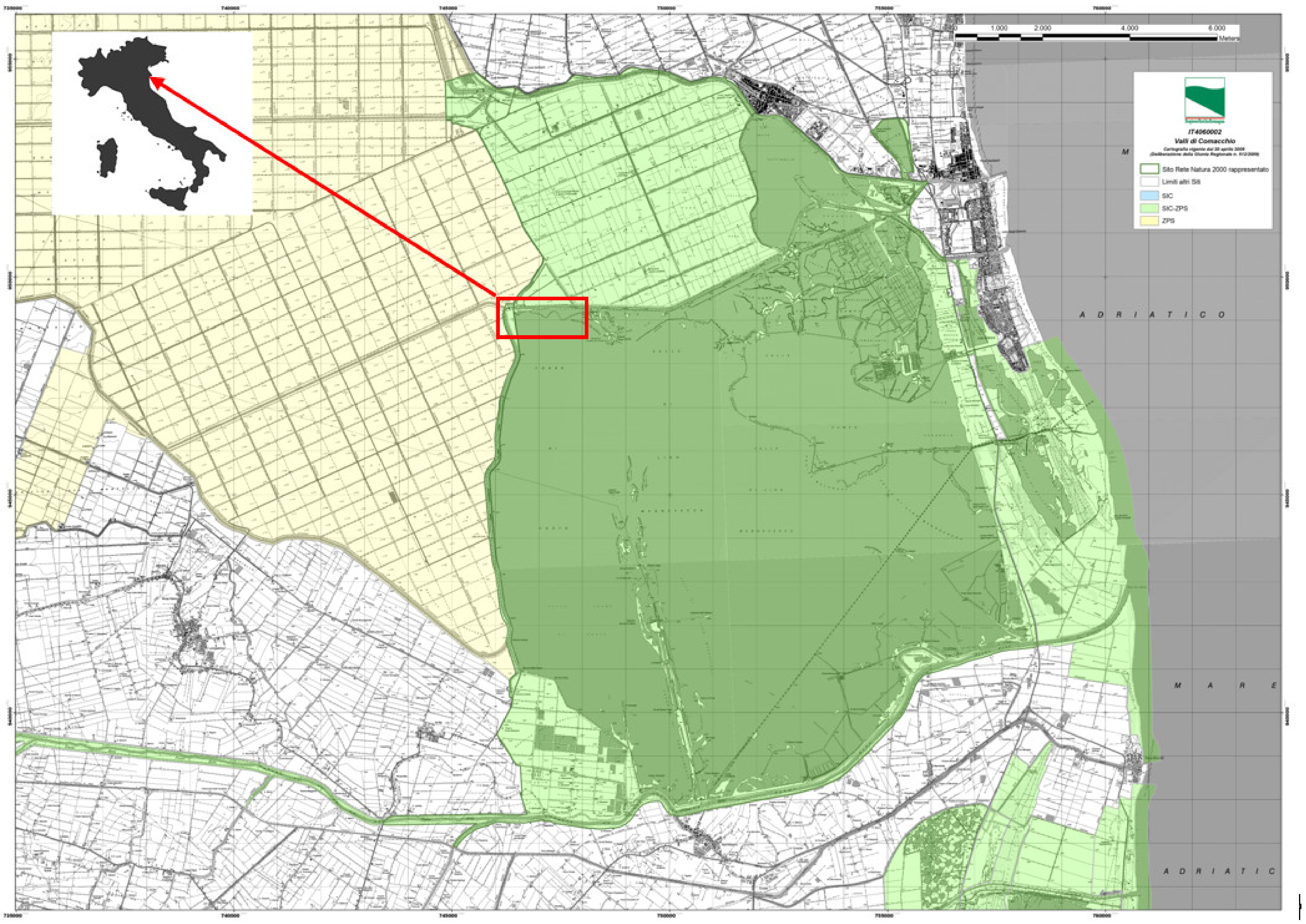
The Valle Fossa di Porto belongs to the southern sector of the Comacchio Lagoon (FE—Italy): to the north, it borders the Fosse Canal (south of Baro Zavelea Natural Oasis); to the west, the Provincial Road 72, called Argine Agosta—Via per Anita, extending to Via Valle Umana (where we find the Casone Garibaldi, a historic residence, bombed in the Second World War and rebuilt); and to the east, the Valle Fossa di Porto is partially separated from the extension of the peninsula of Boscoforte, a palaeo-dune running from north to south, dividing the Valle Fossa di Porto from the Valle Lido di Magnavacca (
Figure 1).
The site has undergone profound transformations, especially since the 1950s; the reclamation works partially erased or hid the ancient landscape and waterscape, first with the remodeling of banks and flooded areas, and subsequently with the construction of artificial canals and reclamation stations for the drainage of the surrounding area so that it could be cultivated. The arrangement of the provincial road SP 72 in an area that had already been bombed in the 1940s and the construction of a gas pipeline covered a sector of high archaeological interest (
Figure 2).
This territory by nature had already undergone several transformations: the level of the water has changed across the centuries and the big flow of the Delta covered natural and anthropogenic traces.
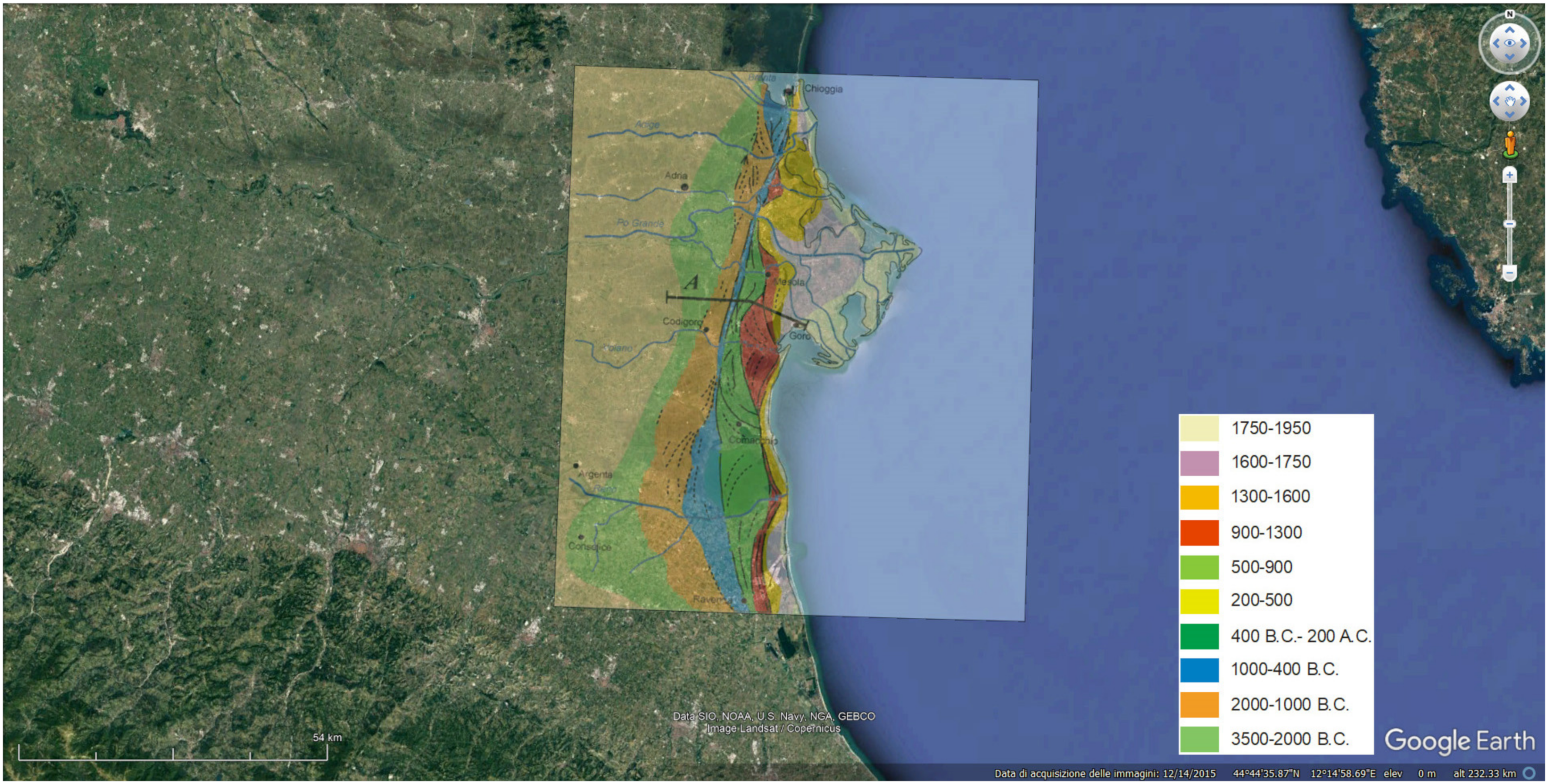
1.2. Geological Framework
The geological framework of the Valle Fossa di Porto fits into the context of the coastal dunes and the ancient coastline, with specific reference to the Etruscan, Roman, and Late Roman periods [
13,
14,
15,
16,
17] (
Figure 3).
The lithology testifies to the distributor channel deposits, such as silty clays, silts, and very fine sands organized in decimetric layers interspersed with peaty levels and partially decomposed organic matter. In the stratigraphy, there are mollusk shells and fine and very fine silty sand [
18].
There are coastal deposits (palaeo-shores), coastlines, and sand dunes of wind origin made of medium and fine sands with interspersed light levels of mollusk shells, with internal levels of sandy silts and a partially decomposed organic layer. The deposits of the brackish marsh are attested with silt, sands, and fine sands, levels of decomposed organic substance, mixed with fine sands and clayey silts [
14].
1.3. Archaeological Panorama
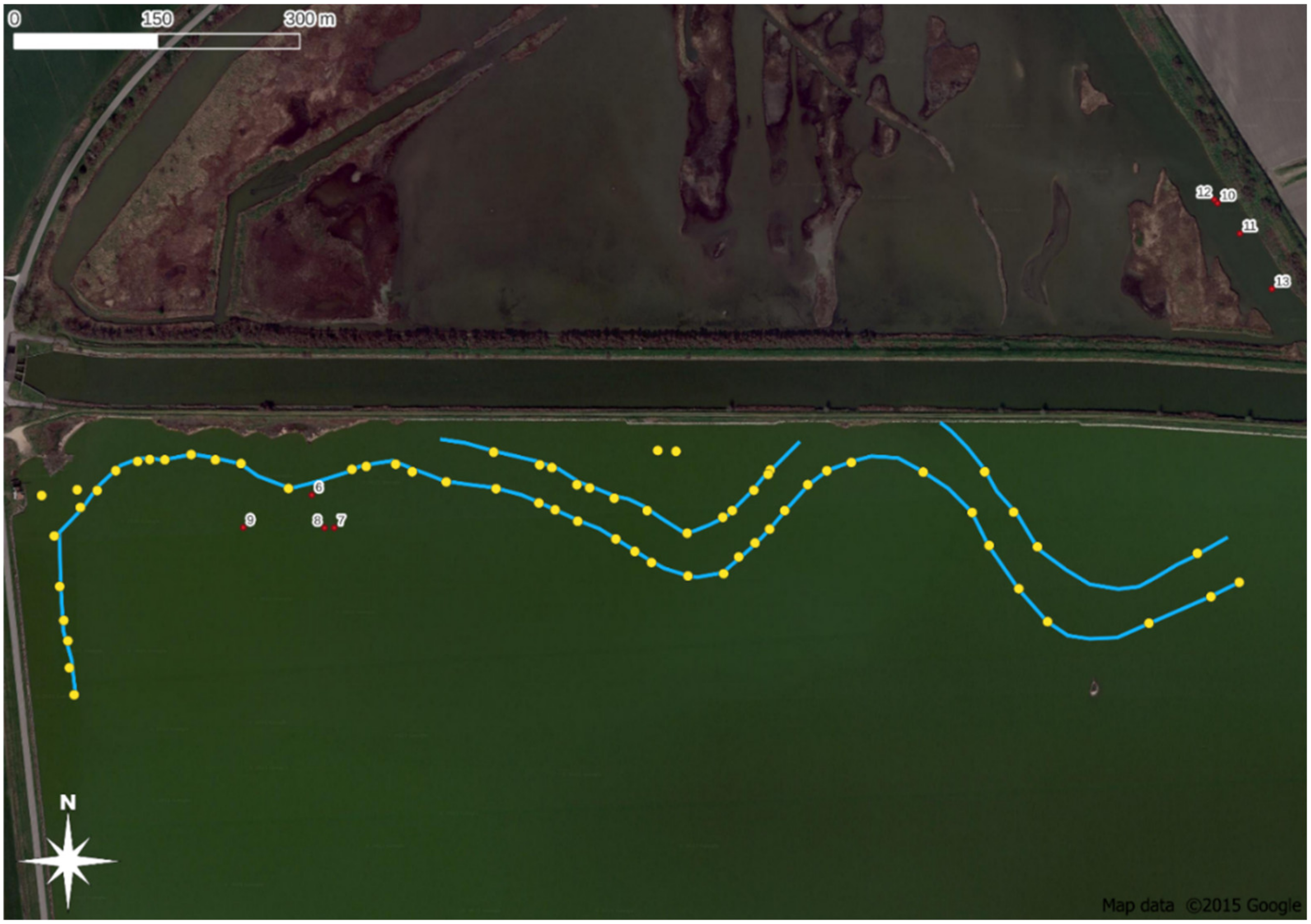
As mentioned, Valle Fossa di Porto is an area with diachronic archaeological evidence attributable to the Roman, Late Antique, Middle Ages, and Renaissance periods.
As reported in the archaeological studies since 1971 [
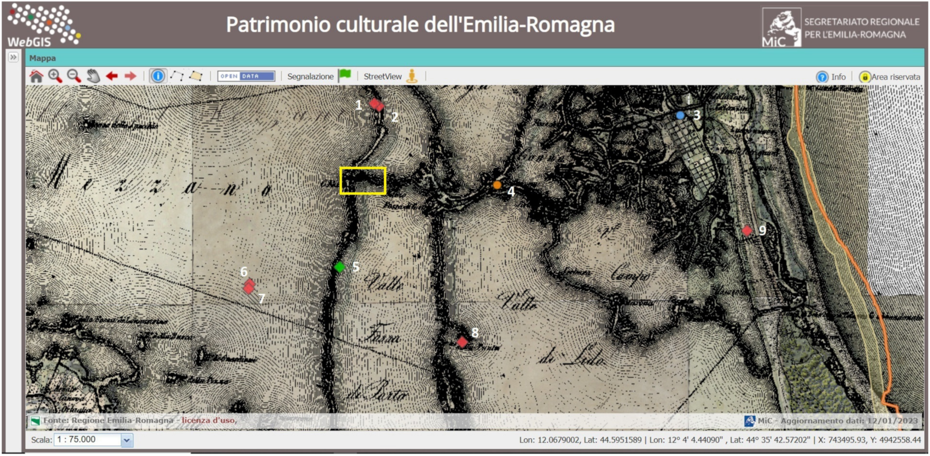
1], the area appeared to be scattered with fragments of tiles and floor hexagons from the Roman age and erratic materials. Excavations carried out since the 1970s brought to light a large structure, presumably identifiable as a Roman lighthouse, to the north of our investigation area (
Figure 4, site no.1): the tower should have had control and signaling functions at the entrance to the
Fossa Augusta, an artificial canal, in the direction of Ravenna. Imperial structural remains were identified, relating to several complexes: bricks, stone elements, fragments of plaster, mosaic tiles, architectural elements, fragments of opus sectile, and clay pipes [
2,
7]. Close to the big building, there are some remains of a Late Roman necropolis (
Figure 4, site no.2). In 2015, the ongoing excavations resumed on the brick base with a foundation on piles, preserved with almost 2 m in height, with a square shape (side 7.42 m), already studied in 1976 by G. Uggeri and S. Patitucci; in the same area, another brick platform was discovered, aligned with the first, perhaps the access to a tall building in wood and brick and covered in marble, partially collapsed, and stripped. A notable find is a well-preserved parallelepiped which bears decorations in bas-relief and friezes on three faces attributable to the Augustan era: bucrania surmounted by festoons, a paten, laurel leaves, and symbols of imperial propaganda, typical of the Julio-Claudian era (site no.1 area) [
19].
Northeast to our investigation site, we find the
Torre Rossa, a 15th cent. tower (
Figure 4, site no.3); to the east side, the Casone Donnabona, a post-Renaissance structure (
Figure 4, site no.4); to the South, there are traces of Roman settlement (
Figure 4, site no.5) on the way of the Agosta bank, very visible on the
Territorio Ferrarese 1814 Map (linking the sites nos. 1-2-5). To the southwest side, in the Valle del Mezzano, there are anthropogenic traces with settlements belonging to the Early Iron Age (
Figure 4, sites nos.6, 7).
South of our investigation area, we find the Dosso dei Sassi, a remnant of a coastal ridge running almost parallel, at approx. 3 km, to the inner Agosta bank (located along site no.5,
Figure 4); the site is known for the conspicuous finds of the Roman imperial age and a villa [
9]. Since 1949, repeated inspections have allowed the recovery of numerous materials, among which two fragments of marble relief stand out, one with a wild boar hunting scene and the other with a winged character. Marble frames and slabs of various and precious oriental marbles, large quantities of black and white mosaic tiles, sometimes connected to form geometric designs, hexagons bricks, including some tiles with a Solonas stamp, and fragments of window glass, indicating the relevance of this site to a residential complex of the imperial age [
7,
20]. Almost 10 km east of our study area, an Early Mediaeval wreck was found during Years Eighty (
Figure 4, site no.9).
Despite the numerous references, since today, there has been no archaeological investigation into the underwater sectors of Comacchio. This site, for sure, should have a role of strategic importance related to natural and artificial ancient waterways, as we can gather from the geoarchaeological studies begun during the 1970s (according to [
1,
2,
3,
4,
5,
6,
7,
8,
9,
10,
11,
12,
13,
14,
15,
16]).
2. Materials and Methods
For our underwater investigations, we opted for the use of a hydrographic drone; the deep knowledge of the geomorphological and hydrographic context determined the choice. We needed an autonomous instrument that could navigate even in very shallow waters with zero visibility, and can handle and is capable of being equipped with the main geophysical instruments for the investigations on a seabed with soft sediment.
Our underwater non-invasive investigations used a hydrographic drone, USV Unmanned Surface Vehicle called
OpenSWAP Shallow Water Autonomous Prospector [
10], a robotic vehicle (overall dimensions 120 × 120 cm), zero environmental impact instrument, low draft, controlled from a remote station by an operator who follows in real-time navigation and performance of parameters. The structure of the drone is developed as a catamaran with a central body, and it was equipped with a single-beam bathymetric sensor echo sounder (200 kHz), sub-bottom profiler (10–50 kHz), and side-scan sonar Tritech StarFish 990 F (900 kHz) (
Figure 5).
The vehicle can be driven completely automatically on pre-established routes or manually with direct operator assistance. During the survey, the vehicle is always remotely controlled by an operator who will follow the navigation and the progress of the operating parameters in real time, intervening manually in case of problems are found.
A small support boat was used for possible recovery or assistance to the autonomous vehicle.
The positioning data have been acquired with a system of on-board software that allows the combined management of such data and their registration simultaneously, using a GPS (the positioning was done with differential GPS with EGNOSS correction (2.5 m HDOP)).
The side-scan sonar StarFish 990 F was mounted in the vehicle and operated with a mini-independent PC integrated into the system, with software for setting parameters and data acquisition. This instrument is used for extreme image definition and target detection; it uses high-frequency 1 MHz acoustic ‘chirped’ pulses with a 0.3° horizontal beam width to produce the most defined and clear images; with a 35 m range capability on each channel (giving 70 m total swath coverage), this side-scan sonar is the ideal tool for high-resolution surveys in inland waters.
The high-frequency single-beam echosounder (50–200 kHz) performs profiles (two-dimensional sections) of the seabed, on the vertical of its navigation path. The system of acquisition can read the depth data with centimetric precision through an automatic bottom tracking algorithm, recording in SEGY format geo-referenced data.
From the post-processing of these profiles in SEG-Y format, it is possible to identify the exact location of the bottom water–sediment interface and obtain depth data in a timely manner, with centimeter accuracy also in very shallow water. The bathymetric data, once processed, are saved as geo-referenced seismic SEGY files, processed, and returned into profile images, with the dimensions of the backdrop provided automatically, with automatic bottom tracking, digitization, and identification of the lagoon bed. The data were saved in vector format (XYZ Asci text file, and DXF), with geographical co-ordinates.
The sub-bottom profiler (10–50 kHz) made profiles (two-dimensional sections) of the lagoon and canal beds, on the vertical of its navigation path. The system of acquisition can penetrate the lagoon bed and reach variable depths based on the lithological nature of the substrate. The data are recorded in geo-referenced SEGY format with a vertical resolution of 10 cm.
The procedure of data processing begins with quality control and filtering of depth data identified with automatic bottom tracking, processing of the acoustic profiles recorded in SEGY format (standard geophysical format) with dedicated software; detection of the bottom, and semi-automatic bottom picking where the bottom is missing tracking; elaboration of two-dimensional seismic profiles in image format (JPG); export in ASCII digital format XYZ file of the lagoon bed data; and the second quality control is dedicated to delivering of the thematic maps and stratigraphic profiles. After that, the phase of identification of targets and the creation of maps with remarkable anomalies, the final geo-referenced data are returned in the WGS84 datum, in geographic coordinates.
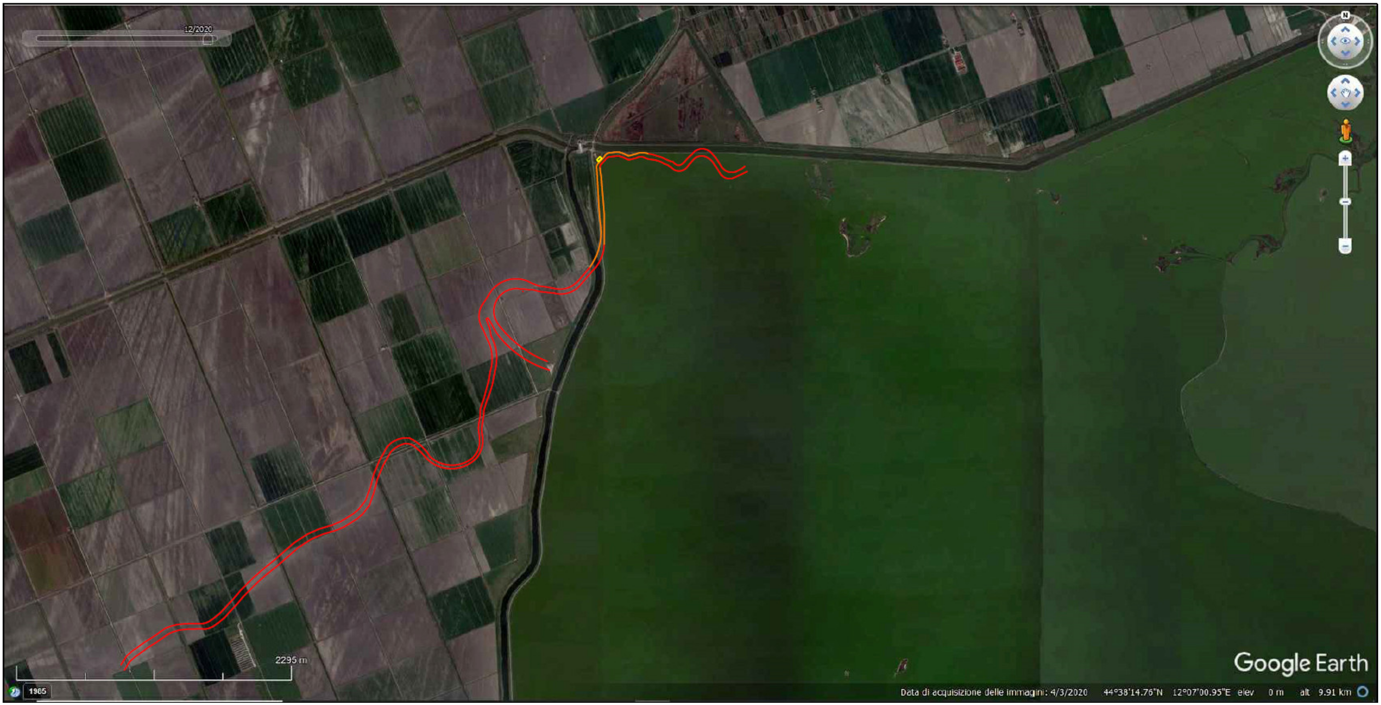
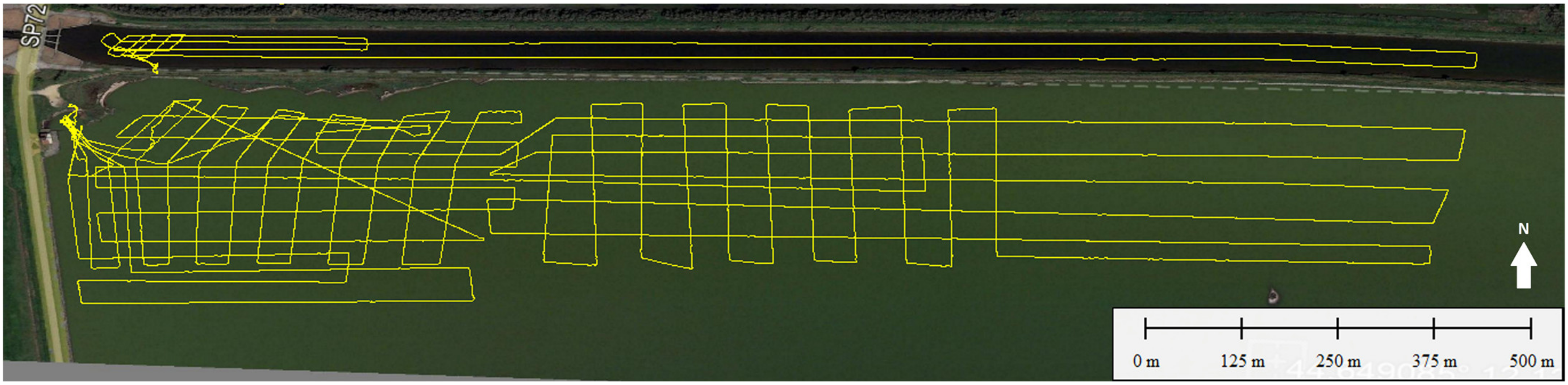
The remote-sensing surveys investigated a total of ~383.817 m
2 (2 sectors: Fosse Canal and Valle Fossa di Porto, northern area—
Figure 6 and
Figure 7)
All the scans were completed with geometry as rigorous as possible, based on parallel north–south swaths (
Figure 7) (about remote sensing for underwater research of palaeo-watercourses, see [
21]).
The maximum indirect depth of investigation reached 9 m depth, below the lagoon bed. The sub-bottom profiler was the tool that returned the greatest amount of data in terms of the utility of interpretation of the submerged archaeological context. The geophysicists’ work consisted not only of the scanning phase but also of post-processing the collected data, eliminating the multiple reflections that can occur in the lagoon environment that can obscure the signal reflected by the sedimentary layers and the anomalies. The first processing step was developed by de-chirping the signal to obtain a more defined reflection; and elaboration with a low-frequency pass filter at 10,000 Hz and high-frequency pass filter at 1000 Hz, combining the absolute value module (ABS) and the time-variant gain (TVG). The final post-processing phases are summarized with the following steps: semi-manual bottom detection, slant-range correction (to remove the central hole), de-striping, de-spiking, boundary delimitation (to remove lateral reflection), normalization and time-variant gain, and AGC automatic gain correction. As a result of this elaboration, the images became interpretable also from the archaeological point of view (see
Section 3. Results).
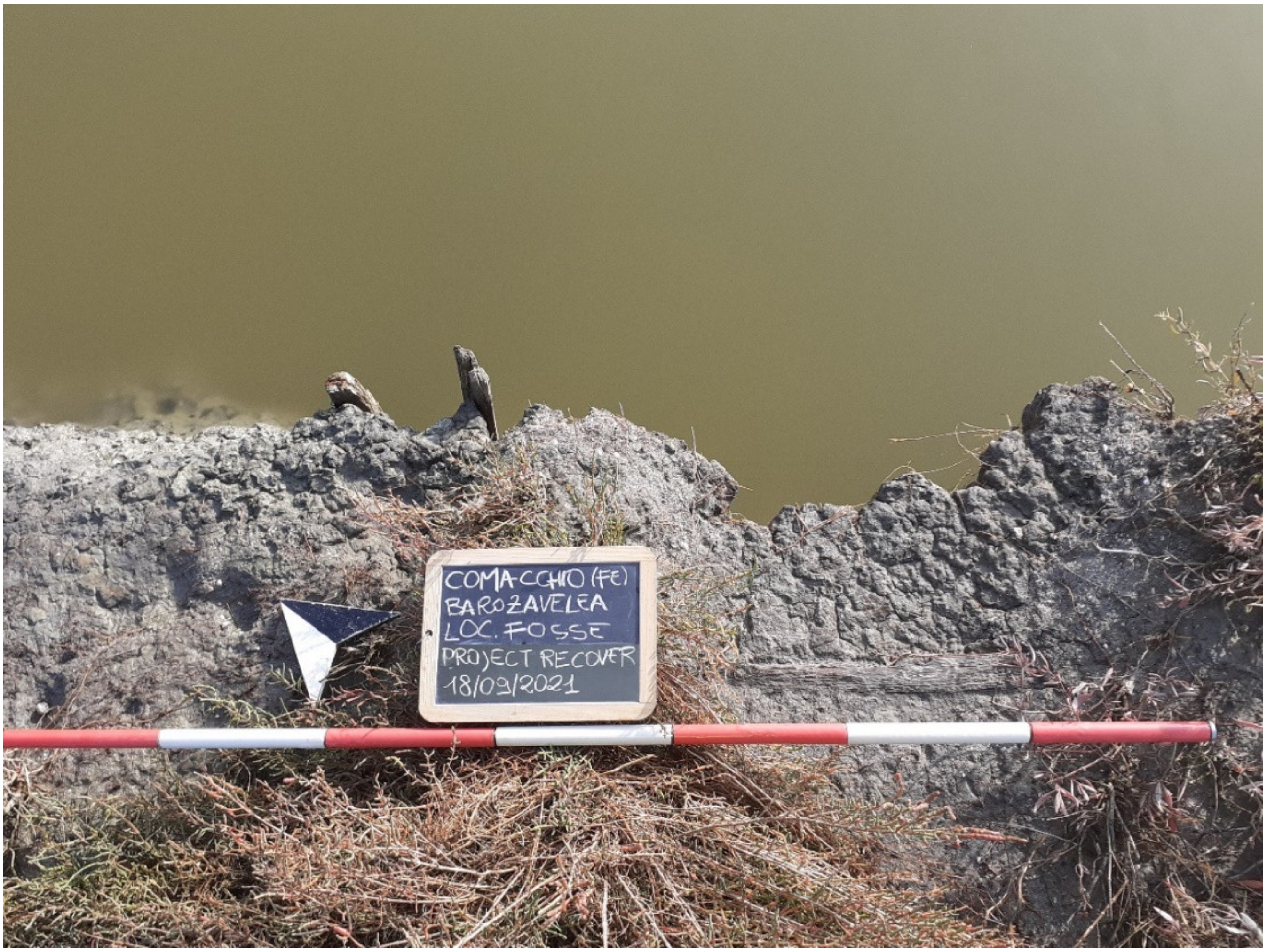
Visual surveys on the field were also completed, where the territory was accessible and walkable: the visual census on itinerary of length 7360 m. The reconnaissance on foot made it possible to document and collect some samples of archaeological finds which were classified and documented using digital photography and dedicated forms. Currently, the finds are preserved in the deposits of the Museo Delta Antico in Comacchio.
3. Results
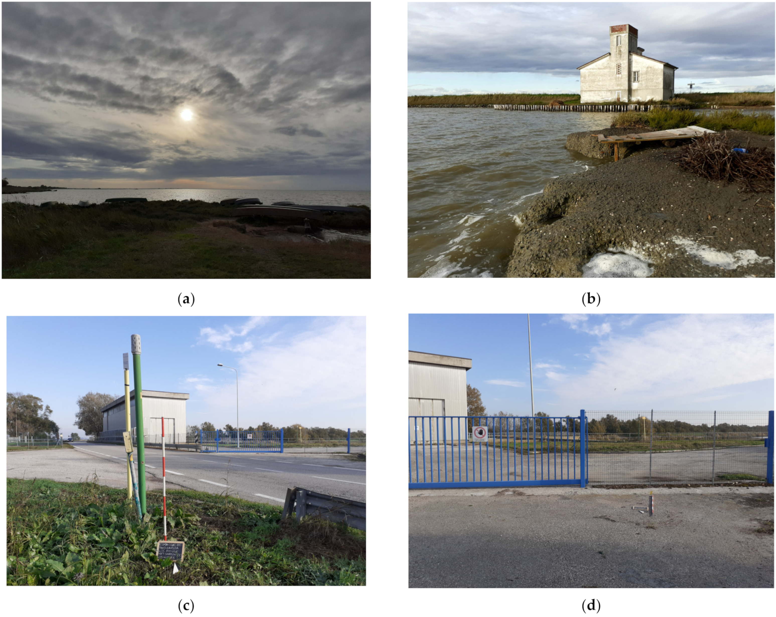
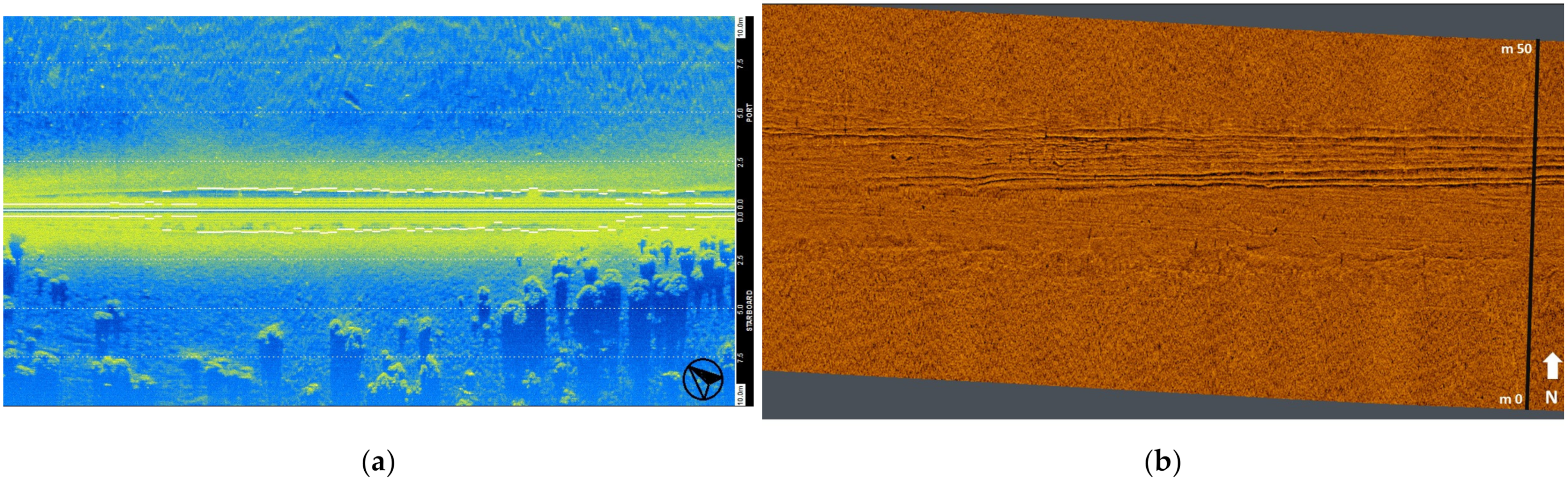
The geophysical investigations detected natural strata, geological elements, some possible scattered objects, and a great sequence of stratigraphical anomalies concerning an old river with its banks. The tool that allows us to receive more information from the point of view of the presence of the elements relating to the submerged cultural heritage has been, as mentioned, the sub-bottom profiler. In fact, the signals of the echo-side-scan sonar have been strongly compromised in very shallow water by the presence of limestone structures created by the polychaetes (
Figure 8a). Where the water was deep, as in the case of Fosse Canal, we detected that the bed of the waterway has been reworked (
Figure 8b).
The sub-bottom profiler detected a palaeo-soil at a depth of about 8.00 m, attributable, as suggested by the geologist F. Del Bianco, to the Last Glaciation [
22].
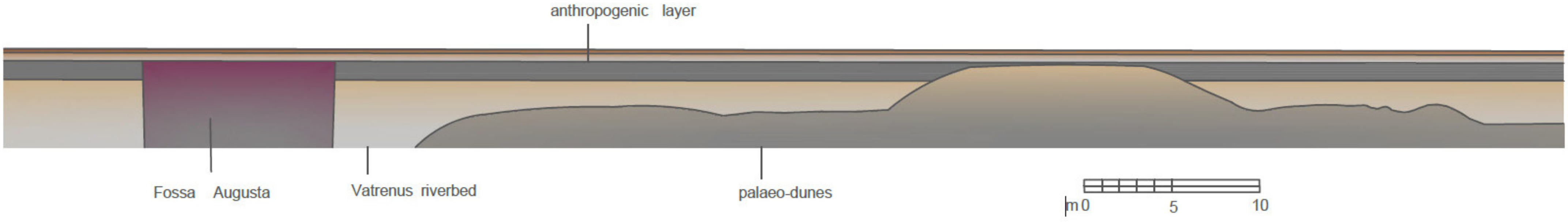
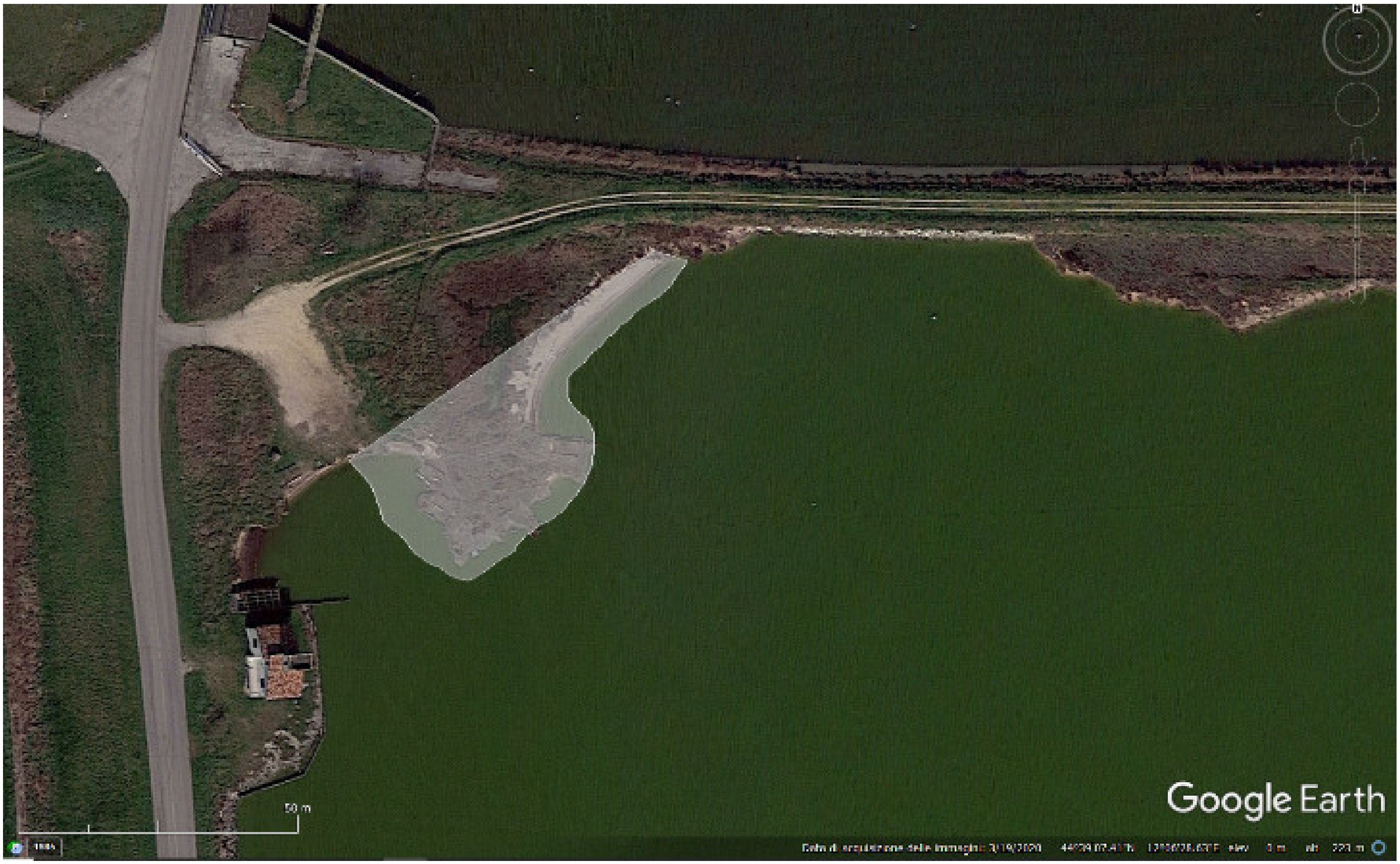
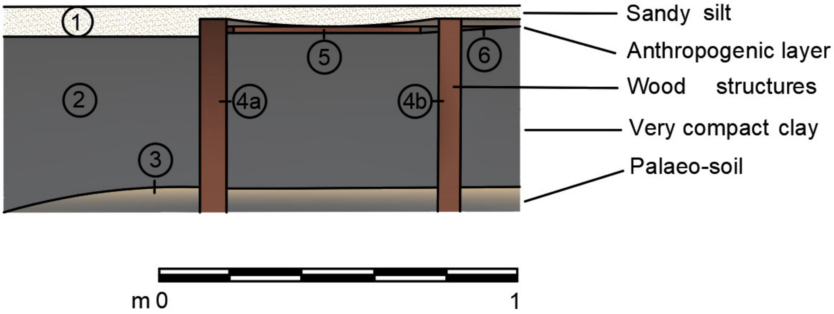
From the stratigraphic point of view, a powerful layer of gray clay (US2), covered by sandy silt (US1), emerges from the sand (US3) up to the water surface (thickness > 50 cm); on this stratum, there are postholes with a diameter of approximately 15 cm, residues of piles (US4a and 4b) fixed together with horizontal beams on the same chronological phase (US5). The fragments of the structure correspond to the shoreline, partially emerged, and are subject to deterioration due to the tides and the slight wave motion generated by local winds (Scirocco). Because of the low rainfall of the years 2020–2021 and the low tide, an anthropogenic layer became visible during our work (
Figure 9).
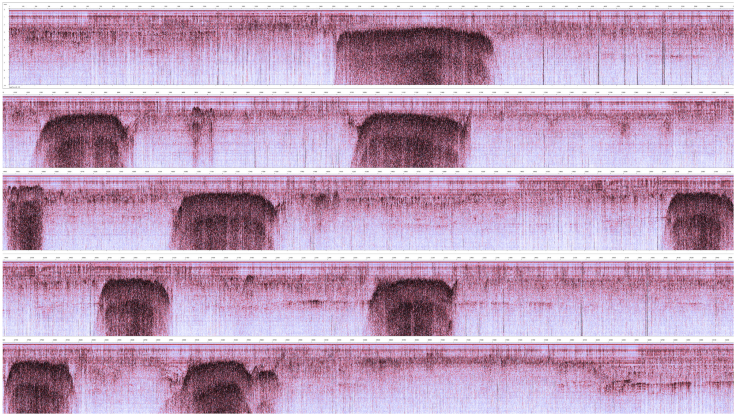
The scanning of the sub-bottom profiler provided important information on the presence of erosive surfaces and palaeo-channels, attesting palaeo-soils (highly reflective sedimentary layers), with buried sand dunes. The images from the sub-bottom profiler show how the palaeo-riverbed exceeds 8 m in depth.
The remote-sensing investigation detected the exact layout of the river
Vatrenus, identified in detail following the strong discrepancy between the homogeneous filling that characterizes it, probably linked to a large flood (
Figure 10 and
Figure 11).
The palaeo-watercourse, in the vicinity of the ancient mouth, denotes four meanders (see
Figure 9), to the south of which a para-fluvial ancient settlement attests wooden structures perhaps for fishing (see over Figures 14 and 15).
Elaborating on the seismo-stratigraphic data, we reconstructed a section representative of the west sector of the underwater investigations (
Figure 12).
The presence of the large compact clay plateau south of the elbow meander that veers from south to east documents the anthropization of the area between Late Antique and Renaissance, as we can gather from the finds of material culture (see
infra). The big stratum occupies an area of 450 m
2 ca. The anthropogenic traces are attested on 140 m
2 and they are visible mainly close to the water (
Figure 13).
A complex system of postholes, as mentioned, is connected by very worn horizontal beams: the postholes have a diameter of 15 cm; the distance between each other is 80 cm ca and they reach a depth of about 1 m (
Figure 14 and
Figure 15).
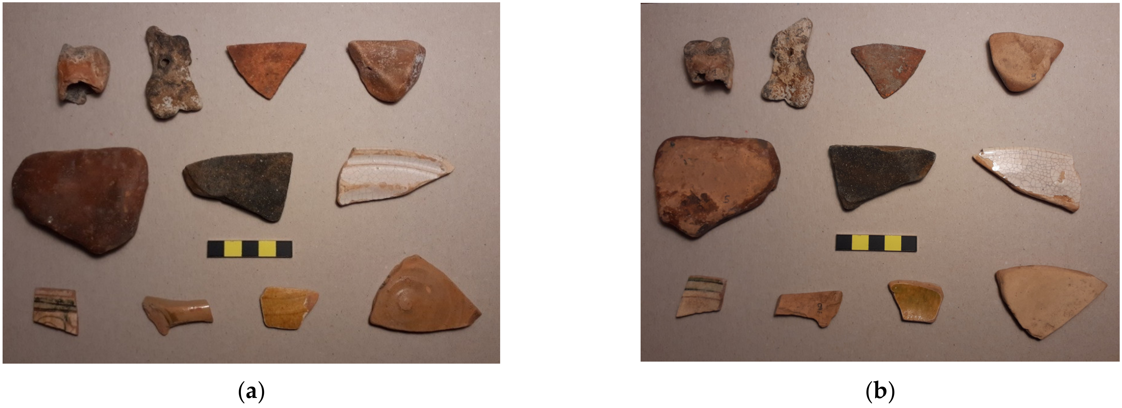
During our surveys, we found on the coast fragments of ancient bricks and tiles (also partially vitrified by burning), fragments of common and kitchen pottery, Roman/Late Roman, Renaissance, and post-Renaissance pottery fragments. Notable finds include a limestone fishing net weight, a rim with a portion of the wall of a Renaissance glass with phytomorphic motifs, and a flat bottom of a jug (
Figure 16).
The site can be traced back to scattered settlement systems with structured bank edges and reinforced with wooden docks [
23,
24], a typical landscape of the ancient Delta. To the north side of Comacchio, wooden Late Roman structures belonging to harbor banks and small houses are attested in the district of Villaggio San Francesco; those sites have been excavated by F. Berti, S. Gelichi, D. Calaon, E. Grandi, and who is writing, a few years ago, documenting methodologies and construction techniques typical of the Late Antiquity and the Early Middle Ages [
25,
26,
27,
28,
29].
The finds of the Renaissance period probably refer to local transit, related to hunting and fishing; the finds are found in the second layering, therefore in dispersion, simply attesting traces of 15th- and 16th-century life.
The data coming from the structures and the ancient hydrography are more interesting and they are particularly important for explaining the evolution of the local watercourses.
4. Discussion
From the investigations carried out, new archaeological data emerge concerning the territory’s diachronic evolution, particularly the hydrographic distribution of the fresh waters and the settlements of the Late Antique period, near the river courses and the lagoon.
The remains of material culture together with the wooden structures denote traces of daily life.
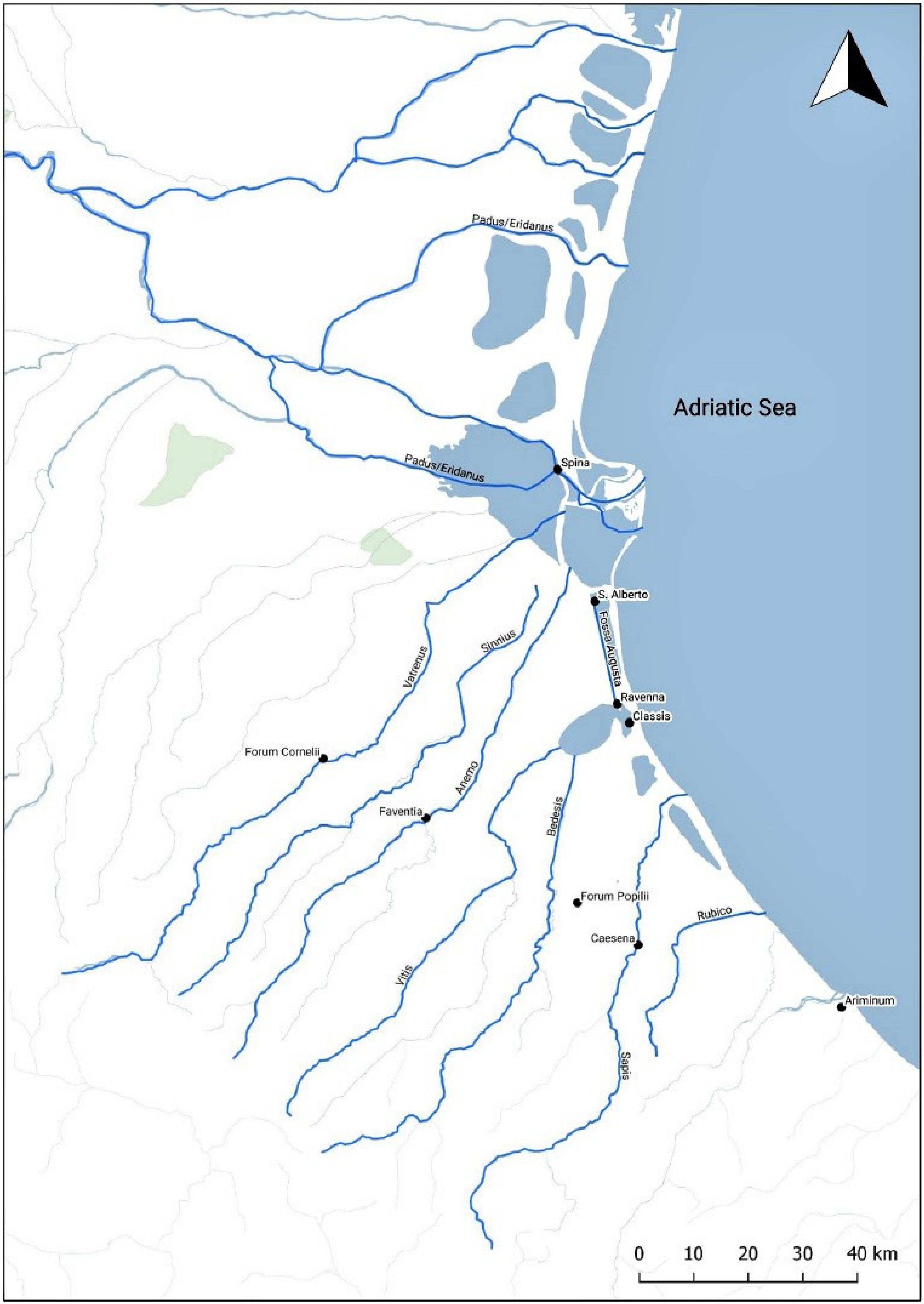
Data coming from the sub-bottom profiler have made it possible to reconstruct the course of the ancient riverbed
Vatrenus and a sector of an artificial canal, the
Fossa Augusta. The
Vatrenus was a river of
Gallia Cispadana, one of the southern tributaries of the
Padus. It had its sources in the Apennines, flowed under the walls of
Forum Cornelii (Imola), and joined the southern branch of the
Padus close to the
Spineticum Ostium. The place was maybe a harbor area at the confluence of the rivers. Plinius mentions the site and its rivers and canals (Plinius,
Naturalis historia III, 119–121—about the ancient literary sources of the river Po—
Padum and its tributaries [
29,
30]).
Linking the profiles to the anomalies detectable through satellite photography, we reconstructed the palaeo-watercourse of the
Vatrenus, approximately for a length of 5 km, confirming the first hypotheses formulated by Veggiani [
31,
32,
33,
34] who recognized the ancient
Vatrenus as a river diversion of the Santerno, running from south to north, close to the Agosta bank, corresponding actually to the provincial road SP72 (
Figure 17).
The studies of Balista, Bonfatti, and Calzolari [
30] underline how important the water supply of the
Vatrenus was for the river
Padus—
Padovetere; the progressive and rapid abandonment of the ancient river branch (
Vatrenus), blocked by the great floods of the Po, induced the ancient inhabitants of this site to prepare a more effective north–south traffic route to lead to the preparation of a navigable channel, located at the base of the river bump—the Fossa Augusta—to guarantee the navigation from Ravenna to the nearest active course of the
Padum (comparisons in [
33,
34,
35]). The scholars have formulated two hypotheses regarding the location of the Fossa Augusta: running along the Fossa di Porto bank or parallel to the
Fossa Augusta (
Figure 18).
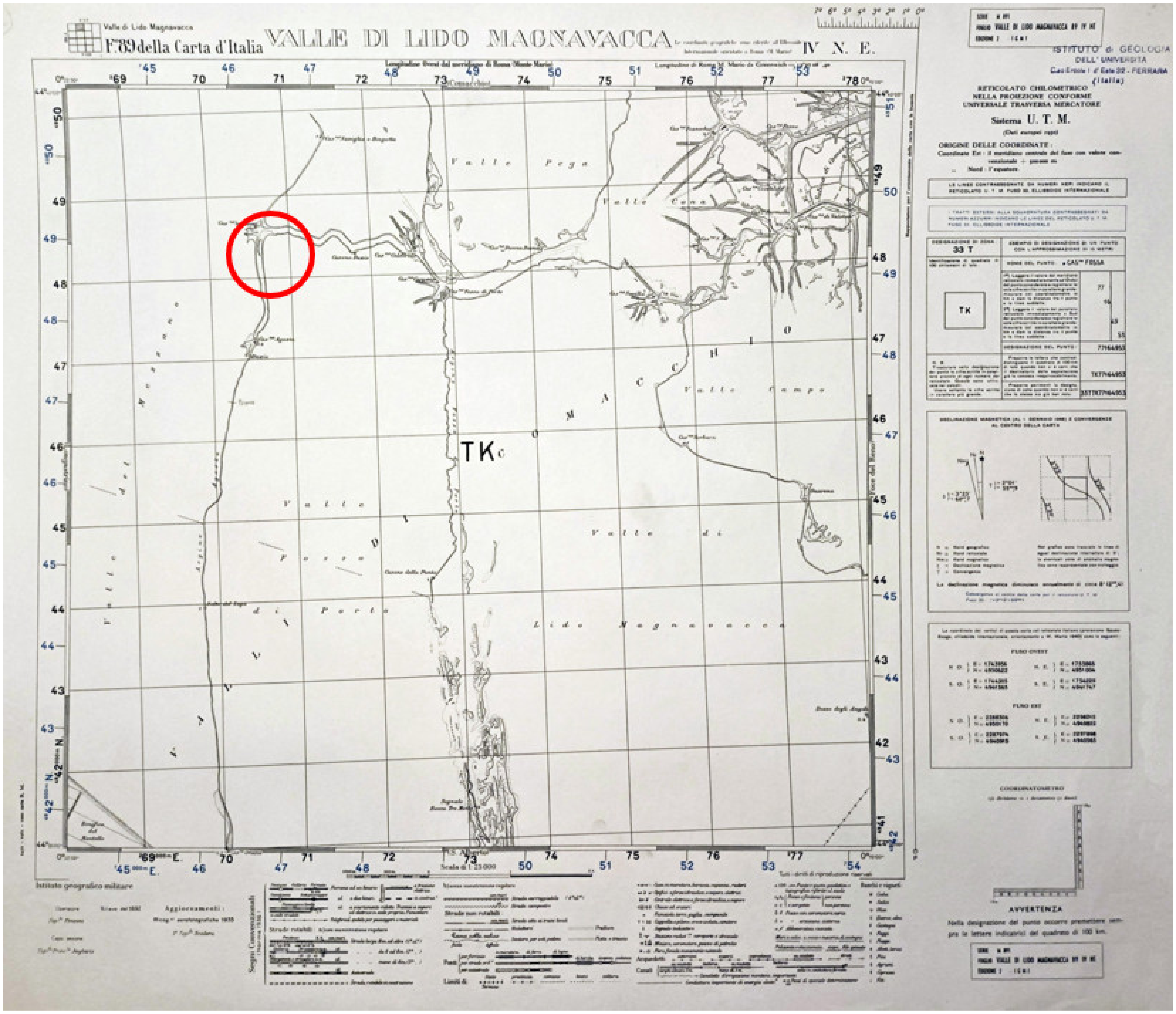
The 1949 IGM aerial photos, in particular the Frame: 52, Swipe: 11, Sheet: 77, Location: 1949, Date: 11 July 1949, Elevation: 3600, Scale: 18,000, and the Map IGM F89 IV NE, 1935, Valle Lido Magnavacca, document the morphology of the river in the first half of the last century, subsequently rectified west–east for the construction of the Fosse drainage complex: the residue of the river shows a meandering path in the direction of a mouth (
Figure 19).
5. Conclusions
The fusion of the precedent bibliography, the ancient literary sources studied by Calzolari, and our non-invasive investigation offer a new interpretation of the hydrographic system attested between the Imperial and Late Imperial Epoch.
Our investigations relocated the final fluvial sector of the river
Vatrenus and have confirmed the hypothesis of Uggeri [
6,
7] about the position of the
Fossa Augusta, parallel to the
Argine Agosta, running (now a day underwater) close to the actual provincial road SP 72.
Through the reconstructive section (
Figure 12), from west to east, we see the deep palaeo-riverbed with the typical alluvial traces of flooding, above the ancient dunes; the river has been excavated quite in the center, to construct the new waterway, the
Fossa Augusta, in the stretch of the river that flowed from south to north; the margins of the cut of the
Fossa are vertical and obviously artificial, giving an unequivocal interpretation of an anthropic artifact.
Summarizing the periodization of the studied stratigraphy, it is possible to recognize, above the dunes belonging to the Last Glaciation (Period 1), a pre-Roman palaeo-riverbed definitely active until the Augustan age (Period 2); when the river lost power because of the great floods and tended to silt up, the Fossa Augusta was dug to guarantee a navigable route to the north (Period 3, phase 1). The waterway remains in operation until the Early Middle Ages and probably during Late Antiquity; an arrangement of the banks and of the emerged lands was made in correspondence with the intersection between the ditch and the last stretch of the river; this work provided the reinforcement of bank margin and dock construction with the wooden structures documented in these latest investigations (Period 3, phase 2).
Remote-sensing geophysical investigations have been fundamental for the archaeological study of the submerged environment in Valle Fossa di Porto. The chance of reading the sections up to a depth of 6–9 m gave us the possibility to understand the diachronic evolution of the territory, offering us unprecedented results, relocating the river course and its anthropogenic features, including artificial waterways. The use of the hydrographic drone in this environment, characterized by zero visibility and very shallow water, has proven to be the winning choice for geo-archaeological detection.
The scientific synergy between archaeologists and geologists has shown how the collaboration leads to results proven by stratigraphic data through historical and geological sequences, documenting the cultural heritage across the different epochs.
The study relating to the transept investigated by us can be repeated not only over the whole area of the Valli di Comacchio, but also in all the sites with the same geological characteristics.


