1. Introduction
1.1. Glocalization
For Erik Swyngedouw [
1], glocalization “refers to the twin process whereby, firstly, institutional/regulatory arrangements shift from the national scale both upwards to supra-national or global scales and downwards to the scale of the individual body or to local, urban or regional configurations and, secondly, economic activities and inter-firm networks are becoming simultaneously more localised/regionalised and transnational”. In the context of this new organization and consolidation of scales (scalar gestalt), every scale has its significance in a quite unique way. Swyngedouw concludes that there is no privileged scale of the exercise of power. In particular, he stresses that attention should be paid to the political and economic dynamics of this geographical recast, as well as its impact. The scales of economic networks and institutional arrangements are reformulated in ways that could change the geometry of social forces. He also clearly asserts that glocalization succeeds the globalization process. As a result of glocalization and the redeployment of political and economic scales, he proposes three modes of action: (a) the transition from national forms to units of different (upper or lower) scales; (b) the switch from parties to (ecological, climate change, and justice) movements that act simultaneously at a local, regional, national, and global level; and (c) the move from social classes to new alliances and points of intervention reflecting the concept of “commons” [
1].
1.2. The Network Paradigm
The concept of the “network” has emerged in recent years, mainly due to the development of information technologies, and offers an important conceptual framework for the design, the construction and the operation of space. Dimitris Papalexopoulos, Athina Stavridou and Eleni Kalafati [
2] note: “The ascertainment that the network paradigm is hegemonic in the present state of things refers to the transition from the linear and clearly defined organization of the production of tangible and intangible goods to the gradual prevalence and acceptance of organization through distributed networks with vague boundaries and identities. The network paradigm delineates our thinking (knowledge structures) and defines what is normal and acceptable, and what is not”. The network has become the key example of the representation and understanding of today’s global culture. In this regard, there are several texts by leading scholars, including, among others, Manuel Castells [
3], Jan van Dijk [
4], Lawrence Lessig [
5], Saskia Sassien [
6], Michael Hardt and Antonio Negri [
7], which focus on the changing of production relationships in the global economy, networking and work patterns. They analyze a number of relevant phenomena such as the new relations of power and experience arising from the nation-state destabilization, the emergence of networked forms of power, and the crisis of representative democracy. Especially for Castells [
3], the information age introduces two major trends: (a) the globalization of the economy, technology and communication; and (b) the need to confirm the identity of each individual.
1.3. Interdisciplinarity
Georgios Angelopoulos [
8] argues that the need to adopt interdisciplinarity is widely recognized by international organizations, funding bodies, universities and research units to address complex social problems that cannot be solved by a single science. Interdisciplinarity exploits the different perspectives and practices that each science offers in order to achieve innovative solutions to current problems that concern societies. This kind of “epistemological pluralism”, which legitimizes, through deployment, other ways of knowing, shows that there is no single methodology for a successful realization of interdisciplinarity but rather different interdisciplinary “styles” that cross over boundaries between traditional academic fields of study. In addition, Tanya Augsburg [
9] draws systematic attention not only to the development of diverse skills or utilization of forms but also to the self-reflective, metacognitive appraisal of why this happens and, more importantly, how this helps both our knowledge and experience.
1.4. Historic Urban Landscapes
The term “historic urban landscapes” appears in 1976 in an official UNESCO proclamation which refers to the protection and the contemporary role of historic urban areas, defined as a set of buildings, structures and open spaces, including archaeological sites, embedded in the natural and ecological environment [
10]. UNESCO emphasizes the unique value of these historical landscapes, which formulate modern society by embracing its memories, shaping present life and indicating our future. In these historic urban areas, as stated in the newer text of the Vienna Memorandum in 2005 [
11], current and past social expressions and developments, ideas, memories, symbolic meanings, and other intangible values arising from the notion of “place” are integrated. The Vienna Memorandum argues that both tangible and intangible components of culture and nature frame the qualities of a landscape (topography, soil, spatial organization, land use, visual relations, buildings, vegetation, water element, technical infrastructure, urban equipment, as well as an extensive range of social cultural, economic and ecological factors). The concept of “urban landscapes” was later elaborated by Jeremy W. R. Whitehand [
12] and applied by others [
13,
14,
15].
2. The Glocal Participatory System for the Recording, Documentation and Promotion of Cultural Heritage
2.1. General Description of the System
The proposed system consists of three fundamental levels of conception and infrastructure which are associated with the related processes: (a) Level A, which covers basic research and recording; (b) Level B, which includes documentation, evaluation and management; and (c) Level C, which incorporates presentation and promotion. Starting with scientific research, a circular mechanism is created that allows the exploitation of open joint research results by developing innovative and creative activities in many areas related to the tangible and intangible cultural heritage of a historic urban landscape. This mechanism gains more value if open data is interconnected with a digital network to produce several multi-faceted results.
2.2. Basic Operation Scenario with a Greek Case-Study
In order to sketch the performance of the system, we have to understand that there are many factors which could be combined in complex ways and affect its operation. Although some of these dynamics are difficult to formalize, the expected value of this apparatus is explicated in the following scenario (see
Section 2.2.1,
Section 2.2.2 and
Section 2.2.3) that outlines a typical use case of the system in a historic urban landscape context.
2.2.1. Level A: Research and Recording
An interdisciplinary research group of scientists settles down in the area for an appropriate period of time to record and inscribe tangible and intangible cultural data. The team consists of historians, folklorists, ethnomusicologists and architects. The combined recording and assemblage of historical evidence, human life-stories, music and dance traditions, building and land surveys is central in this process. Small-scale constructions are placed near the research area during the group’s expedition. These structures include all the appropriate equipment to support field recordings and inscriptions, while being “spatial event-catalysts”. They function as the meeting point of local communities with the research team to work together in a collective process. These are small, public laboratories (open micro-labs) that can be easily transported to different places. The most important feature of this level still remains the interactive involvement of local communities in the research and recording of their cultural heritage.
2.2.2. Level B: Documentation, Evaluation and Management
Continuing at the next level, information that has been recorded and digitized in open micro-labs is compiled into a collaborative digital platform for scientific documentation, assessment and editing. At this point, the team joins forces with specific academic centers and institutes that have the primary responsibility for data management. These bodies imply interdisciplinary scientific methodologies in controlling, organizing and analyzing the collected accounts. The results of the above process lead to particular outputs aiming, on the one hand, at the academic specialists and, on the other, at the general public through an online application and/or within the open micro-labs.
2.2.3. Level C: Presentation and Promotion
As was previously mentioned, the edited information is displayed either via the internet in the form of a virtual tour of the landscape or by the equipment provided inside the open micro-labs. Online presentation is ensured according to the combined rationale of “Google Street View” [
16] and “Google Art Project” [
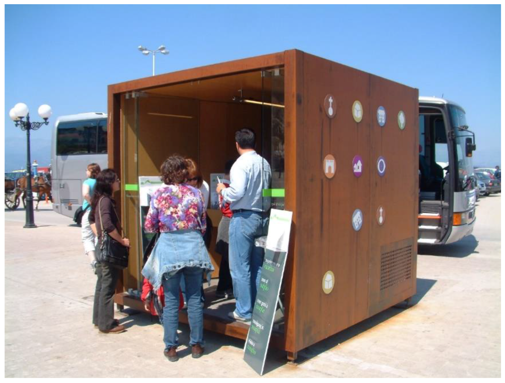
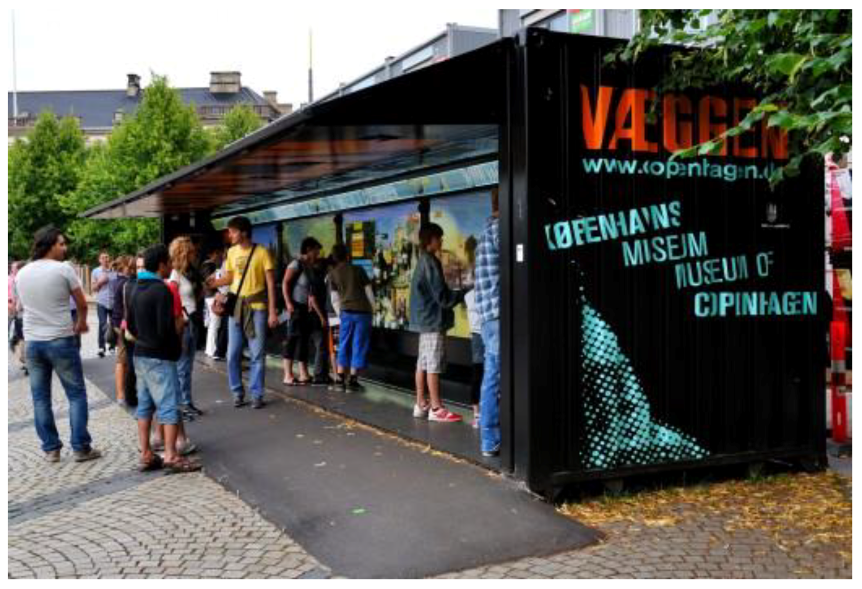
17]. Google Street View shows panoramic visions of an array of consecutive locations along a pathway, while Google Art Project allows virtual tourists to visit the interior of museums and watch artworks and exhibits. The proposed system allows visitors to navigate within the landscape with the aid of specific key points of a pathway, through which they will be able to gather information about the buildings of the area, hear narratives and personal stories from the community’s residents, listen to local music as well as watch music and dance performances from traditional festivals. At the same time, all these will also be presented on a web-based application through a “virtual open-workshop platform”. The main constructions of the system are used both as recording stations and micro-museums that demonstrate local tangible and intangible cultural heritage. Indicative case studies of related practices could be traced back in earlier systems such as the creation of the “digital guide” project at the Municipality of Nafplion, Greece (
Figure 1) [
18], the “wall project” carried out by the Copenhagen Museum (
Figure 2) [
19] and the renewed “Theatre in a Caravan”, a project of Athens Epidaurus Festival [
20].
2.3. Spatial Constructions, Recording Stations and Open Micro-Labs.
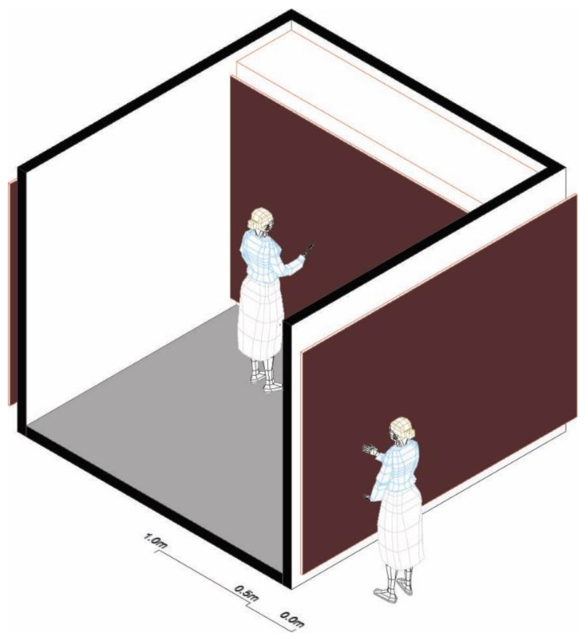
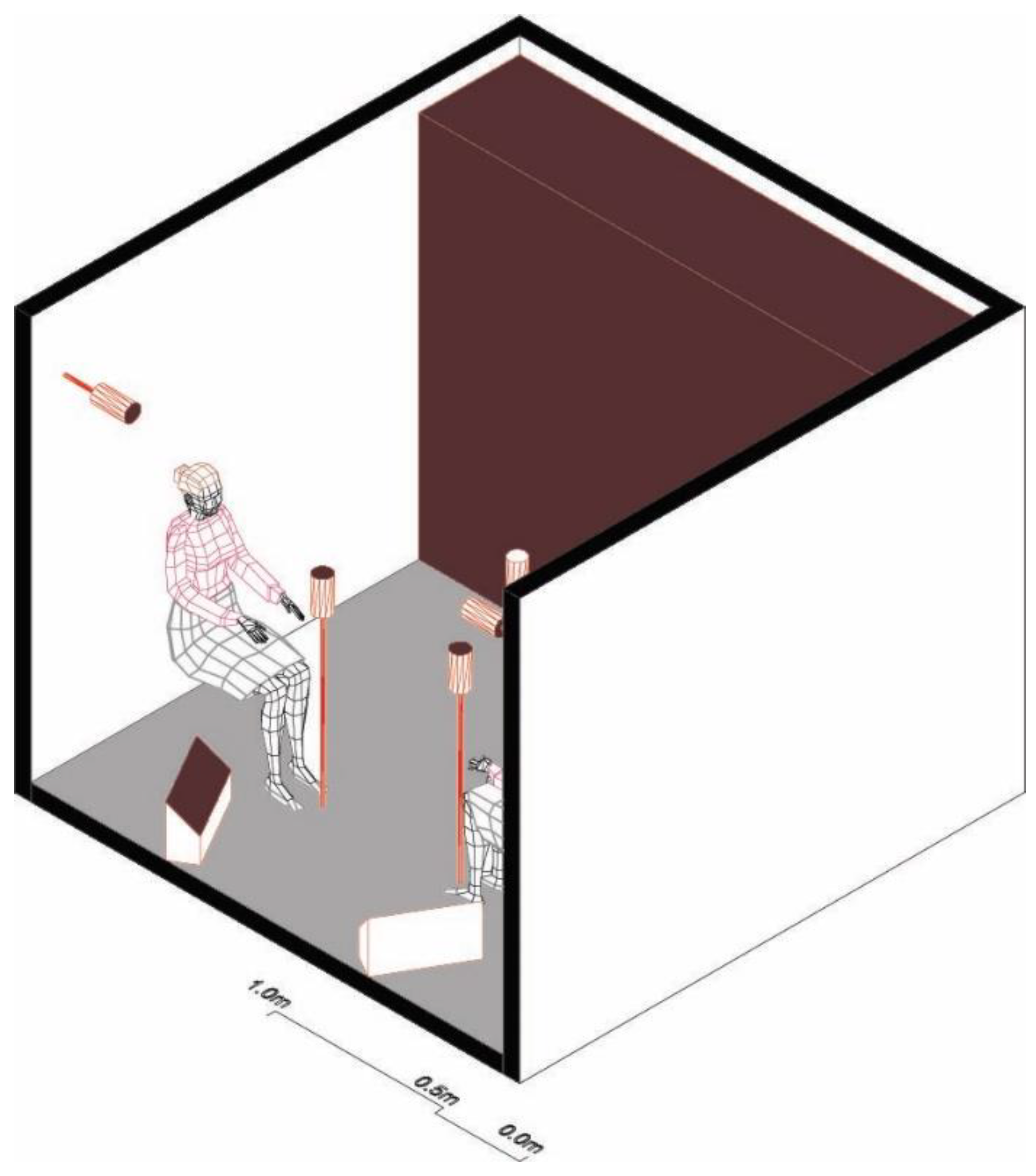
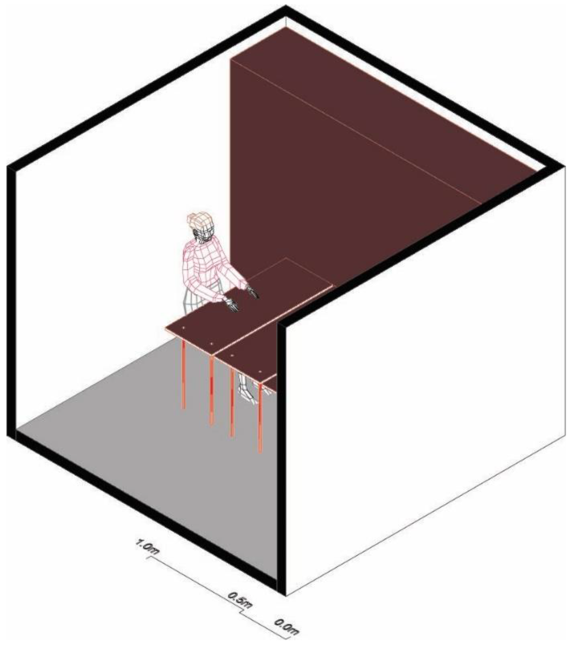
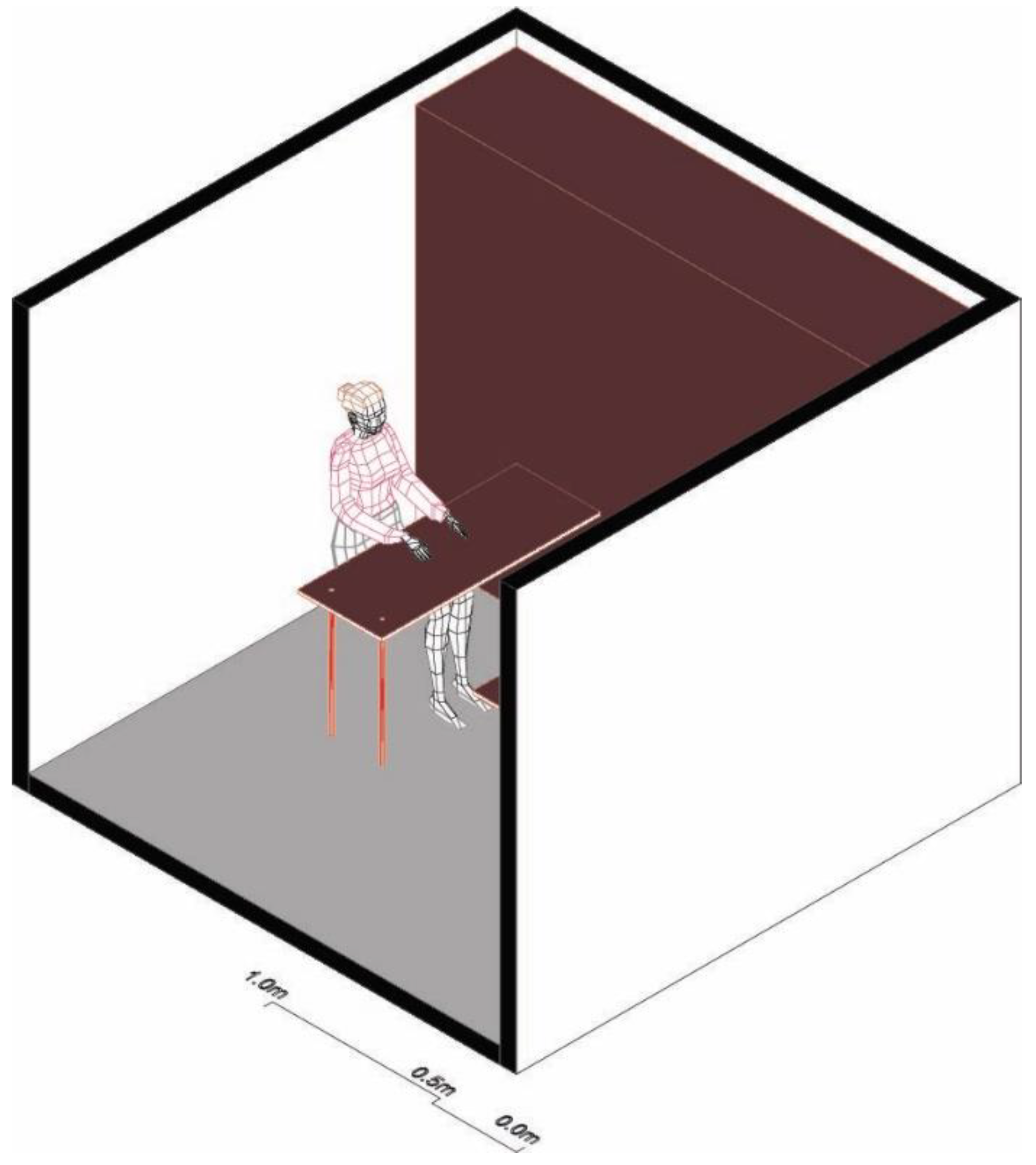
Open micro-labs are lightweight, small-scale, easy-to-carry minimal structures. As recording and documenting stations, they enclose all necessary equipment for inscribing texts, recordings, videos, photographs and 3D scans from small-scale objects to building imprints (
Figure 3,
Figure 4,
Figure 5,
Figure 6,
Figure 7 and
Figure 8). Each one can function as an office for 3–4 people, as a studio for small music bands’ performances or for interviewing local residents, and/or as a photograph and 3D scanning workspace, providing additional support for documenting open-air cultural events. At the same time, the construction is equipped with a variety of HD projection screens/walls and audiovisual and sound installations for supporting and displaying local digital content. The outward appearance of these constructions fits precise requirements concerning the entire landscape wherein it will be installed. Moreover, they have the appropriate features and means for safely storing the equipment, preventing its damage and creating a small-scale sheltered terrace.
2.4. Research Centers and Participatory Scientific Platforms
Research centers and academic institutions belonging to advanced scientific bodies are fundamental to the system’s feasibility. Within these centers, the evaluation, documentation and editing of data resulting from the recording phase are carried out by distance management. Simultaneous interdisciplinary study of the tangible and intangible cultural heritage of a historic urban landscape is a central requirement. The participatory platform for storing the information gathered is based on Geographic Information Systems (GIS) and consists of five principal modules, namely the basic geospatial data module and another four information processing units related to the history, the architecture, the folklore and the performing arts framework (music, dance and singing) of the specific location (
Figure 9 and
Figure 10). Some relevant examples of applications that focus only on similar scientific specialties are the “cradle” project for the historical center of the city of Nafplion [
21] and the Digitization Program of the 5A Interdepartmental Course applied within the School of Architecture Engineers at the National Technical University of Athens [
22].
2.5. Technologies and Methodologies of Recording, Documentation and Promotion
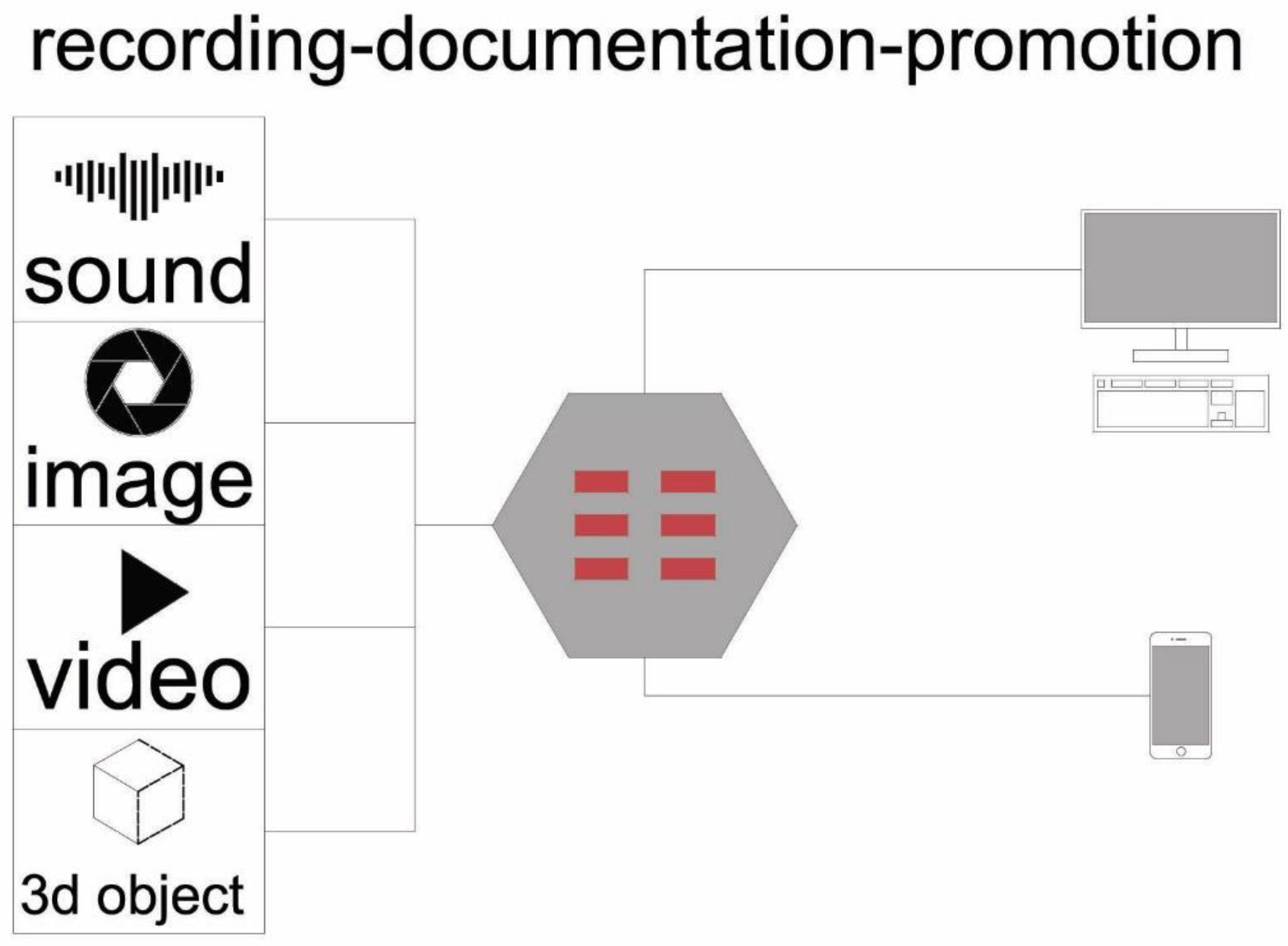
System technologies can be divided into four types, i.e., recording technologies by specialized and non-specialized users as well as projection technologies by specialized and non-specialized users. Bearing in mind the project’s sustainability and adaptability, it is important that Level C of the proposed system will be constructed according to contemporary digital technologies for non-specialized users. In this context, the applications should focus on mobile technology for capturing still images, sounds, audiovisual material, object and space geometries (
Figure 11 and
Figure 12). One could find analogous methodologies in the Google Street View [
16] and Google Art Project [
17] platforms for online site tours and the Terracotta Warriors Wikitude of augmented reality for Android and iOS developed by the Franklin Institute [
23]. Along with the aforementioned mobile technologies, a wide range of methodological tools for specialized users will be integrated into the system as spatial structures supported by special scientific personnel.
3. Discussion
The emergence of the network paradigm, the prevalence of intangible artworks and the advent of glocal qualities in every part of human activity have, without a doubt, influenced the design, the organization and the setup of cultural structures. In this context, cultural operators, which are the hallmarks of social and individual actions, are required to respond to the new facts in this context. Today, our focus is more about cultural environments or environments of common cultural goods than museums or exhibitions. This distinction is based on the theoretical dipole “building-machine vs. building-node” of glocal networks.
Besides this, quite a few efforts have been made to create mechanisms and systems to manage with the desirable dissemination of culture. It should also be noted that modern design emphasizes both physical infrastructure and cultural control appliances. Cultural institutions are thus transformed into cultural service providers. It is a matter of particular importance that the local knowledge is filtered and diffused through the networks on a glocal scale—to a certain extent, the same as earlier libraries have done. A traditional museum is transformed from a place of accumulation of knowledge into a place of knowledge production at a glocal node where data is evaluated and then diffused into the web network. Digital technologies are gradually entering existing structures (exhibitions, warehouses, workshops etc.) as facilitators of these alterations and have begun changing their current operating framework.
Nowadays, free open access is the core objective, established through open workspaces and collective features, but away from mediators. Emphasis is placed on interactive efforts, the strengthening and co-operation of local collectives as well as knowledge sharing through glocal “flow paths”. Hybrid platforms are developed to maximize participation, engagement and reflexivity so that the emerging museum model is directly linked to cultural content. New spaces are invited to host and support these fresh forms of creativity. Respectively, one could cite the free culture movement, the interactive arts, the new participatory platforms for creators and the digitization of intangible cultural heritage as examples of this. As all these require an original spatial framework, the latest cultural environments imply the political concept of the “openness of the knowledge society”. The development of glocal network systems for the interdisciplinary recording, documentation and promotion of tangible and intangible cultural heritage is precisely in this direction.
4. Conclusions
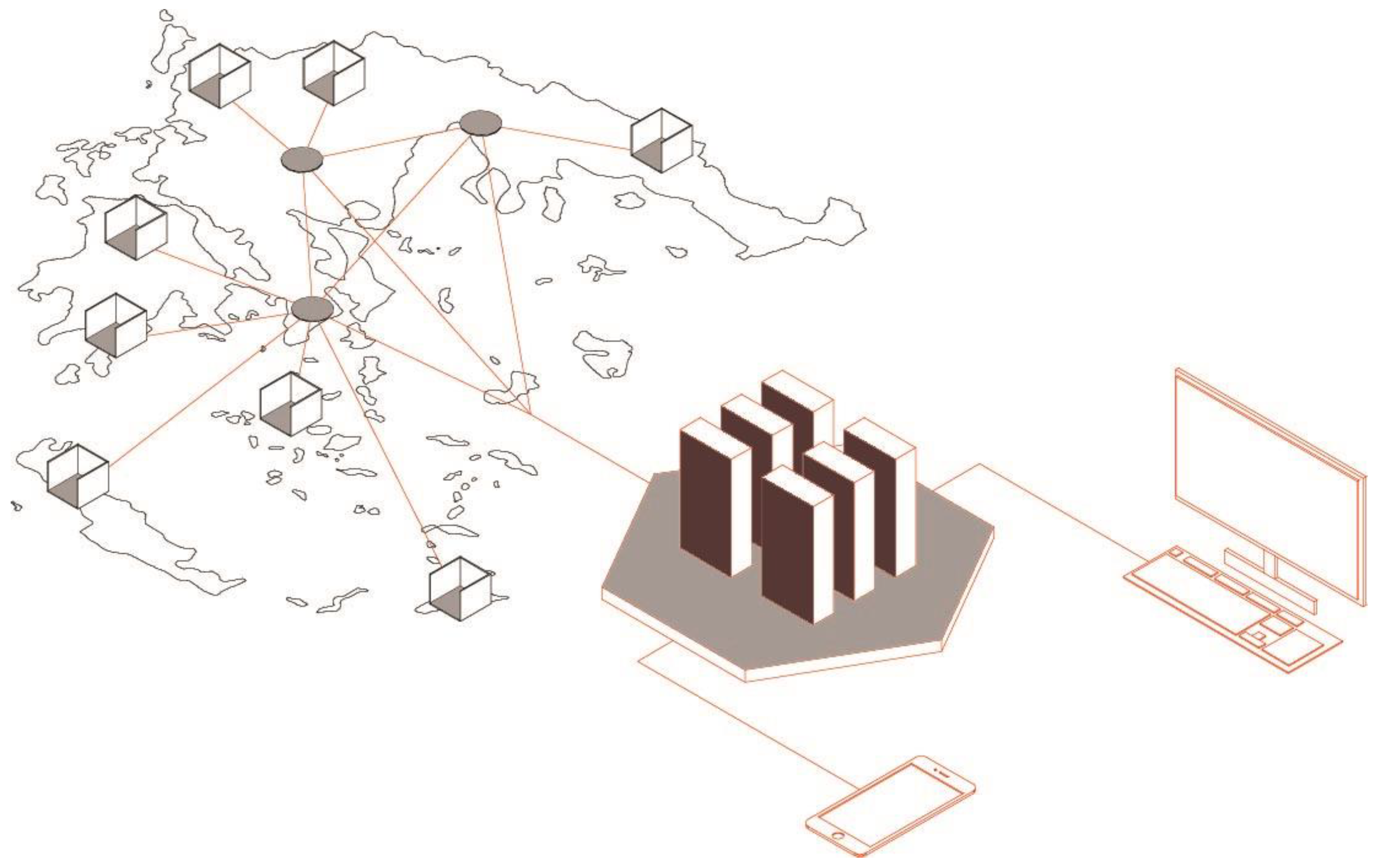
This article strives for the creation of a network of physical and virtual sites consisting of research centers, recording stations, collaborative platforms and mobile presentation applications (
Figure 13). A basic scenario, concerning the pilot operation of the proposed system, is shaped as follows: inside the area of a historic urban landscape (such as a traditional settlement or a historic center) “open micro-labs” are deployed. These documentation stations become the midpoint where an interdisciplinary group of researchers systematically records (through a participatory process) the tangible and intangible local cultural heritage. This is an interactive research method in view of the fact that it requires the involvement of the local community and the participation of various scientific specialties. It also incorporates data gathering as well as an evaluation and elaboration of the recorded information through an open digital collaborative platform.
Finally, the results of this action return back to the open micro-labs as physical presentations with digital exhibits or/and as virtual tours—augmented reality experiences via mobile device applications. This creates a system of mutually produced (yet scientifically valid) cultural information. At the same time, the local population is activated since it is called upon to participate in a substantial way both in the recording and the promotion procedures related to its cultural heritage. Moreover, the design and the construction of this system perfectly meet the requirements of the present-day digital world in such a way that this project has no territorial boundaries and, therefore, could be adapted and seek synergies all over the world to map the distinctive cultural identity of a place [
24].
Author Contributions
D.P. and N.P. conceived the project; D.P. designed the proposed system and performed its analysis and interpretation; D.P. and N.P. wrote the draft of the article; N.P. made a critical revision of the article; D.P. and N.P. approved the final version of the article to be published.
Funding
This research received no external funding.
Acknowledgments
The authors are grateful to Giannis Ladas, Maria Kechrinioti, and Rena Stolidou for their technical assistance in preparing this article.
Conflicts of Interest
The authors declare no conflict of interest.
References
- Swyngedouw, E. Globalisation or “Glocalisation”? Networks, Territories and Rescaling. Camb. Rev. Int. Affairs 2004, 17, 25–48. [Google Scholar] [CrossRef]
- Papalexopoulos, D.; Stavridou, A.; Kalafati, E. Network Paradigm and (Common) Space; National Technical University of Athens, School of Architecture Engineers: Athens, Greece, 2011; Available online: http://archtech.arch.ntua.gr/post-2011/smaR.htm (accessed on 1 February 2018).
- Castells, M. The Rise of the Network Society; Blackwell Publishers: Oxford, UK, 1996. [Google Scholar]
- Van Dijk, J. The Network Society; Sage Publications: London, UK, 1999. [Google Scholar]
- Lessig, L. The Future of Ideas; Vintage Books: New York, NY, USA, 2002. [Google Scholar]
- Sassien, S. (Ed.) Global Networks, Linked Cities; Routledge: New York, NY, USA; London, UK, 2002. [Google Scholar]
- Hardt, M.; Negri, A. Multitude: War and Democracy in the Age of Empire; Penguin Press: New York, NY, USA, 2005. [Google Scholar]
- Aggelopoulos, G. Policies for Promoting Interdisciplinarity: Toward a Typology of Interdisciplinarity at Post Graduate Level in Greek Universities. Ph.D. Thesis, University of Patras, Department of Educational Sciences and Early Childhood Education, Patras, Greece, 2014. Available online: https://www.didaktorika.gr/eadd/handle/10442/31614 (accessed on 1 February 2018).
- Augsburg, Τ. Becoming Interdisciplinary: An Introduction to Interdisciplinary Studies; Kendall Hunt Publishing: Dubuque, IA, USA, 2005. [Google Scholar]
- UNESCO. Recommendation Concerning the Safeguarding and Contemporary Role of Historic Areas. Nairobi, Kenya, 1976. Available online: http://unesdoc.unesco.org/images/0011/001140/114038e.pdf (accessed on 1 February 2018).
- UNESCO. Vienna Memorandum on “World Heritage and Contemporary Architecture: Managing the Historic Urban Landscape”. Paris, France, 2005. Available online: http://whc.unesco.org/archive/2005/whc05-15ga-inf7e.pdf (accessed on 1 February 2018).
- Whitehand, J.W.R. The Structure of Urban Landscapes: Strengthening Research and Practice. Urban Morphol. 2009, 13, 5–27. [Google Scholar]
- Maistrou, H. Analysis of Urban Patterns in Historic Settlements, as Basis for their Conservation and Planning. In European Research on Cultural Heritage: State of the Art Studies; Drdácký, M., Ed.; Institute of Theoretical and Applied Mechanics Academy of Sciences of the Czech Republic: Prague, Czech Republic, 2006; Volume 4, pp. 233–237. [Google Scholar]
- Maistrou, H. Rehabilitation of Historical Cities: Searching for a Creative Approach and Innovative Ways of Management through the Concept of the Creative and Sustainable City. In The Role of the Integrated Conservation of Cultural Heritage for a Creative, Resilient and Sustainable City; Colletta, T., Ed.; FrancoAngeli Edizioni: Milano, Italy, 2013; pp. 46–57. [Google Scholar]
- Bandarin, F.; van Oers, R. The Historic Urban Landscape: Managing Heritage in an Urban Century; Wiley Blackwell: Oxford, UK, 2012. [Google Scholar]
- Google Street View. Available online: https://en.wikipedia.org/wiki/Google_Street_View (accessed on 1 February 2018).
- Google Art Project. Available online: https://en.wikipedia.org/wiki/Google_Art_Project (accessed on 1 February 2018).
- Psychogyios, D.; Kechrinioti, M.; Stolidou, R. Design of Information Environments for the Promotion of Historic Cities Using New Technologies: The Example of the “Digital Guide” Project in Nafplio. In Appropriate Interventions for Safeguarding Monuments and Historical Buildings: New Trends in Design; Dousi, M., Nikiforidis, P., Eds.; Ianos Publications: Athens, Greece, 2009; pp. 564–570. [Google Scholar]
- Sandahl, J.; Ingemann Parby, J.; Smith, A.; Thorbek, J.; Kryger Broe, L. Taking the Museum to the Streets. In Museums and the Web 2011: Selected Papers from an International Conference; Trant, J., Bearman, D., Eds.; Archives and Museum Informatics: Toronto, ON, Canada, 2011; pp. 81–100. [Google Scholar]
- Athens Epidaurus Festival, Theatre in a Caravan. Available online: http://greekfestival.gr/en/events/view/theatre-in-a-caravan-2007 (accessed on 1 February 2018).
- Maistrou, H.; Psychogyios, D. Presentation of an Integrated System for the Recording and Documentation of the Cultural Heritage of a Historic City: Digital Registry for the Historic Centre of Nafplion. In The E-Volution of Information Communication Technology in Cultural Heritage, Where Hi-Tech Touches the Past: Risks and Challenges for the 21st Century; Ioannides, M., Amrnold, D., Niccolucci, F., Mania, K., Eds.; Archaeolingua and Epoch: Budapest, Hungary, 2006; pp. 114–118. [Google Scholar]
- Maistrou, H.; Karageorgi, C.-I.; Papakonstantinou, T.H.; Paterakis, M. Architectural Analysis of Traditional Buildings and Settings: Digitization Program of the 5A Interdepartmental Course; National Technical University of Athens, School of Architecture Engineers: Athens, Greece, 2011; Available online: http://5a.arch.ntua.gr (accessed on 1 February 2018).
- The Franklin Institute, Augmented Reality. Available online: https://www.fi.edu/augmented-reality (accessed on 1 February 2018).
- Sepe, M. Planning and Place in the City: Mapping Place Identity; Routledge: New York, NY, USA; London, UK, 2013. [Google Scholar]
© 2018 by the authors. Licensee MDPI, Basel, Switzerland. This article is an open access article distributed under the terms and conditions of the Creative Commons Attribution (CC BY) license (http://creativecommons.org/licenses/by/4.0/).
