Article

Optimizing Deep Learning Models for Fire Detection, Classification, and Segmentation Using Satellite Images

Electrical and Computer Engineering (ECE), Engineering Technical, Altinbas University, 34217 Istanbul, Turkey
*
Author to whom correspondence should be addressed.
Submission received: 6 November 2024 / Revised: 1 December 2024 / Accepted: 1 January 2025 / Published: 21 January 2025

Abstract

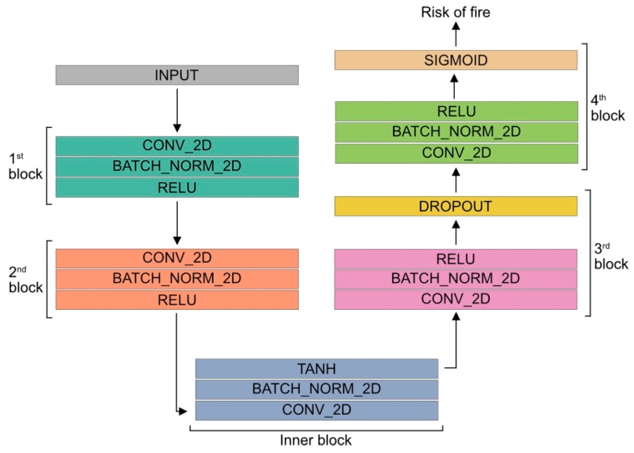
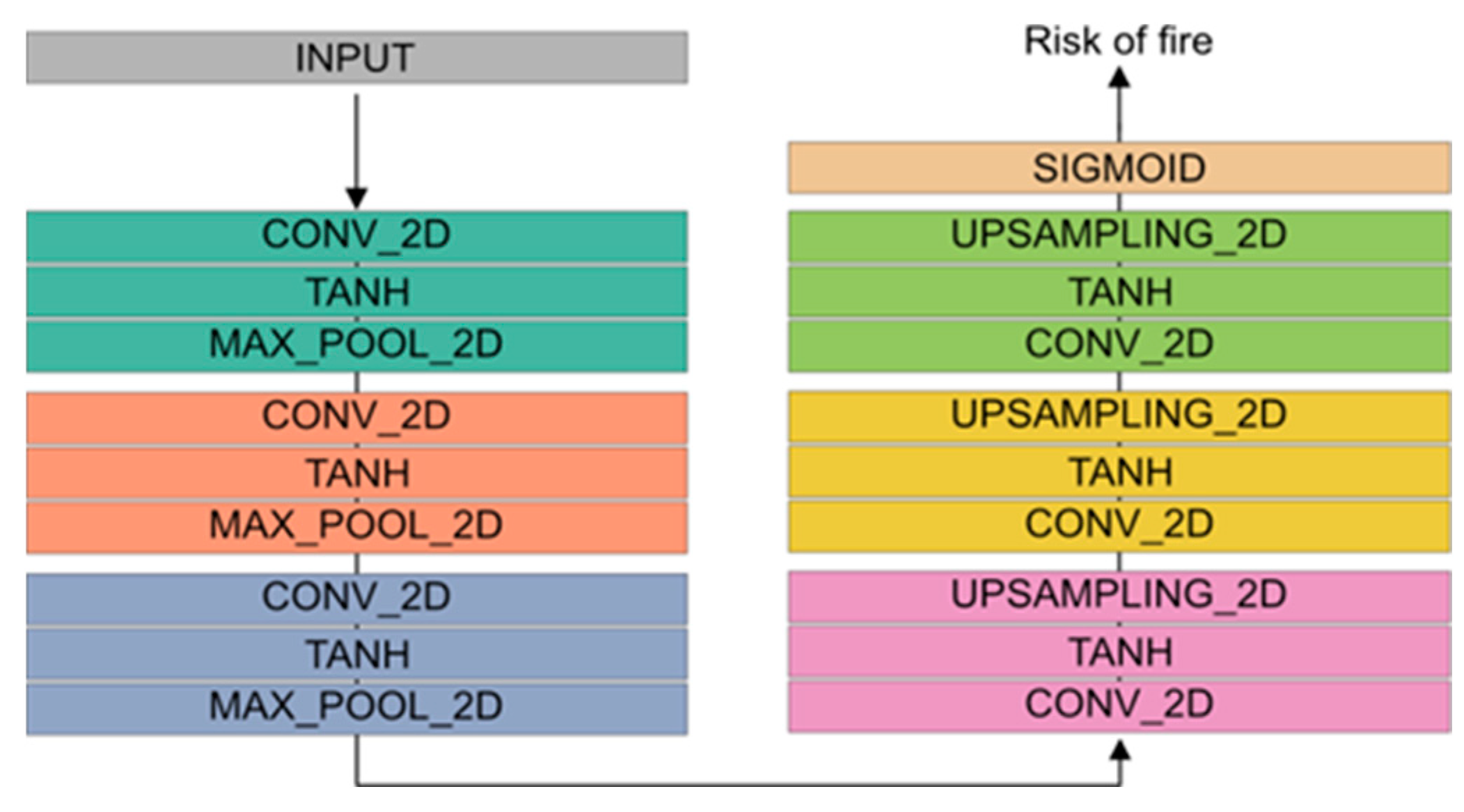
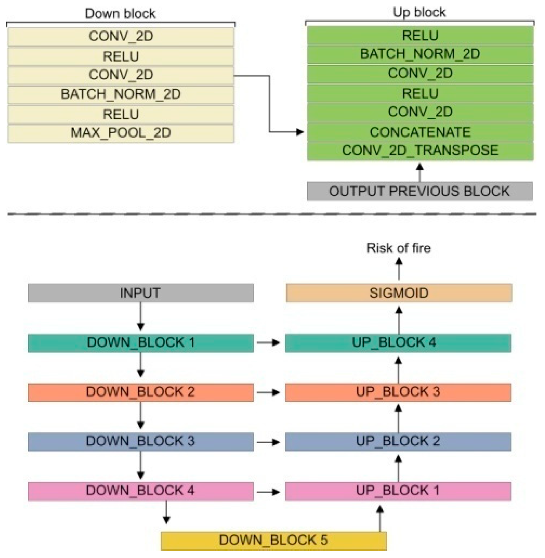
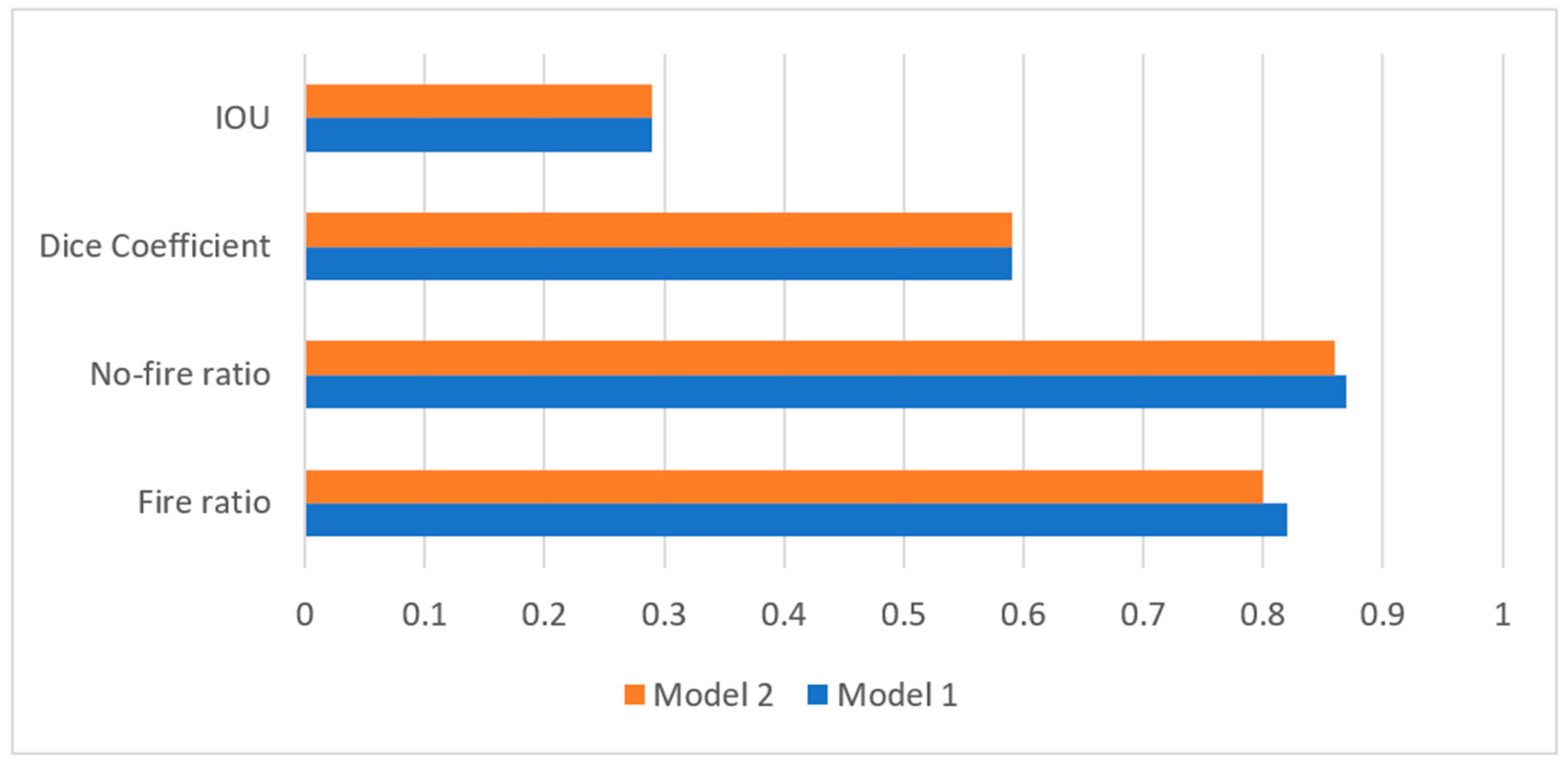
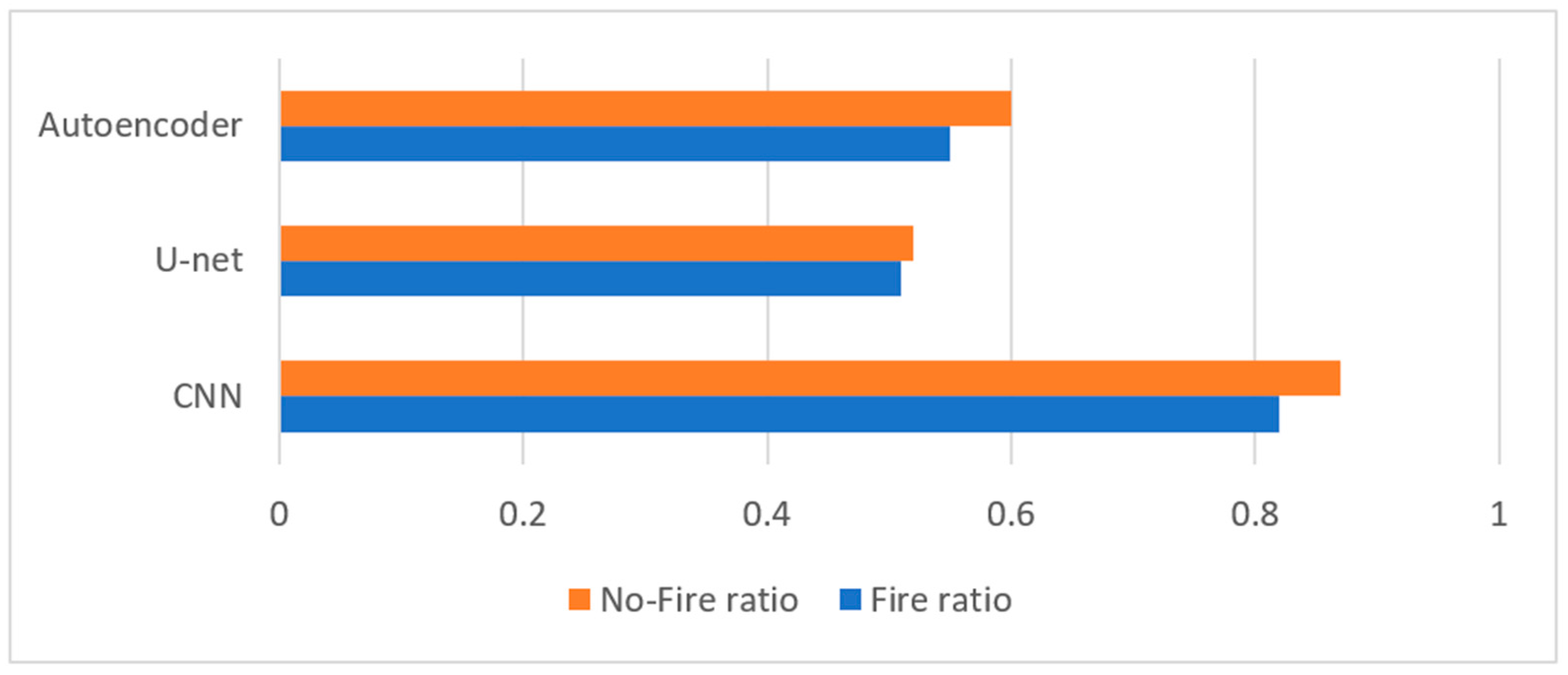
Earth observation (EO) satellites offer significant potential in wildfire detection and assessment due to their ability to provide fine spatial, temporal, and spectral resolutions. Over the past decade, satellite data have been systematically utilized to monitor wildfire dynamics and evaluate their impacts, leading to substantial advancements in wildfire management strategies. The present study contributes to this field by enhancing the frequency and accuracy of wildfire detection through advanced techniques for detecting, classifying, and segmenting wildfires using satellite imagery. Publicly available multi-sensor satellite data, such as Landsat, Sentinel-1, and Sentinel-2, from 2018 to 2020 were employed, providing temporal observation frequencies of up to five days, which represents a 25% increase compared to traditional monitoring approaches. Sophisticated algorithms were developed and implemented to improve the accuracy of fire detection while minimizing false alarms. The study evaluated the performance of three distinct models: an autoencoder, a U-Net, and a convolutional neural network (CNN), comparing their effectiveness in predicting wildfire occurrences. The results indicated that the CNN model demonstrated superior performance, achieving a fire detection accuracy of 82%, which is approximately 10% higher than the best-performing model in similar studies. This accuracy, coupled with the model’s ability to balance various performance metrics and learnable weights, positions it as a promising tool for real-time wildfire detection. The findings underscore the significant potential of optimized machine learning approaches in predicting extreme events, such as wildfires, and improving fire management strategies. Achieving 82% detection accuracy in real-world applications could drastically reduce response times, minimize the damage caused by wildfires, and enhance resource allocation for firefighting efforts, emphasizing the importance of continued research in this domain.
Keywords: wildfire; active fire detection; deep learning; semantic segmentation wildfire; active fire detection; deep learning; semantic segmentation