Inventory and Enhancement of Geological Heritage in the Ouzoud Syncline (M’Goun UNESCO Geopark, Central High Atlas, Morocco): First Step for Promoting Geotourism and Sustainable Development †
Abstract
:1. Introduction
2. Geographical and Geological Setting
3. Materials and Methods
4. Results
4.1. Presentation of the Selected Geosites
4.2. Assessment of the Scientific and Additional Values of Selected Geosites
4.3. Use and Management Characteristics
5. Conclusions and Discussion
Supplementary Materials
Author Contributions
Funding
Institutional Review Board Statement
Data Availability Statement
Acknowledgments
Conflicts of Interest
References
- Panizza, M.; Piacente, S. Geomorphosites: A bridge between scientific research, cultural integration and artistic suggestion. Il Quat. 2005, 18, 3–10. [Google Scholar]
- Newsome, D.; Dowling, R. Geoheritage and geotourism. In Geoheritage; Elsevier: Amsterdam, The Netherlands, 2018; pp. 305–321. [Google Scholar] [CrossRef]
- Bruschi, V.M.; Cendrero, A. Geosite evaluation: Can we measure intangible values. Il Quat. 2005, 18, 293–306. [Google Scholar]
- Pralong, J.P. Géotourisme et Utilisation de Sites Naturels D’intérêt Pour les Sciences de la Terre: Les Régions de Crans-Montana-Sierre (Valais, Alpes Suisses) et Chamonix-Mont-Blanc (Haute-Savoie, Alpes Françaises); Univ. de Lausanne, Faculté des Lettres, Inst. de Géographie: Lausanne, Switzerland, 2006. [Google Scholar]
- Pereira, P.; Pereira, D. Methodological guidelines for geomorphosite assessment. Géomorphologie Relief Process. Environ. 2010, 16, 215–222. [Google Scholar] [CrossRef]
- Brilha, J.B. Mining and Geoconservation; Springer: Berlin/Heidelberg, Germany, 2014. [Google Scholar] [CrossRef]
- Reynard, E.; Perret, A.; Bussard, J.; Grangier, L.; Martin, S. Integrated approach for the inventory and management of geomorphological heritage at the regional scale. Geoheritage 2016, 8, 43–60. [Google Scholar] [CrossRef]
- Kubalíková, L.; Kirchner, K. Geosite and geomorphosite assessment as a tool for geoconservation and geotourism purposes: A case study from Vizovická vrchovina Highland (eastern part of the Czech Republic). Geoheritage 2016, 8, 5–14. [Google Scholar] [CrossRef]
- Enniouar, A.; Errami, E.; Lagnaoui, A.; Bouaala, O. The Geoheritage of the Doukkala-Abda Region (Morocco): An Opportunity for Local Socio-Economic Sustainable Development. In From Geoheritage to Geoparks. Geoheritage, Geoparks and Geotourism; Errami, E., Brocx, M., Semeniuk, V., Eds.; Springer: Cham, Switzerland, 2015. [Google Scholar] [CrossRef]
- Berred, S.; Fadli, D.; El Wartiti, M.; Zahraoui, M.; Berred, K.; Sadki, R. Geomorphosites of the Semi-arid Tata Region: Valorization of an Unknown Geoheritage for Geotourism Sustainable Development (Anti-Atlas, South Morocco). Geoheritage 2019, 11, 1989–2004. [Google Scholar] [CrossRef]
- Beraaouz, M.; Macadam, J.; Bouchaou, L.; Ikenne, M.; Ernst, R.; Tagma, T.; Masrour, M. An Inventory of Geoheritage Sites in the Draa Valley (Morocco): A Contribution to Promotion of Geotourism and Sustainable Development. Geoheritage 2019, 11, 241–255. [Google Scholar] [CrossRef]
- Rais, J.; Barakat, A.; Louz, E.; Barka, A.A. Geological heritage in the M’Goun geopark: A proposal of geo-itineraries around the Bine El Ouidane dam (Central High Atlas, Morocco). Int. J. Geoheritage Park. 2021, 9, 242–263. [Google Scholar] [CrossRef]
- Arrad, T.Y.; Errami, E.; Ennih, N.; Ouajhain, B.; Bouaouda, M.S. From geoheritage inventory to geoeducation and geotourism implications: Insight from Jbel Amsittene (Essaouira province, Morocco). J. Afr. Earth Sci. 2020, 161, 103656. [Google Scholar] [CrossRef]
- Louz, E.; Rais, J.; Ait Barka, A.; Nadem, S.; Barakat, A. Geological heritage of the Taguelft syncline (M’Goun Geopark): Inventory, assessment, and promotion for geotourism development (Central High Atlas, Morocco). Int. J. Geoheritage Park. 2022, 10, 218–239. [Google Scholar] [CrossRef]
- Lahmidi, S.; Lagnaoui, A.; Bahaj, T.; El Adnani, A.; Fadli, D. First inventory and assessment of the Geoheritage of Zagora province from the project Bani Geopark (South-Eastern Morocco). Proc. Geol. Assoc. 2020, 131, 511–527. [Google Scholar] [CrossRef]
- Barka, A.A.; Rais, J.; Barakat, A.; Louz, E.; Nadem, S. The Karst Landscapes of Beni Mellal Atlas (Central Morocco): Identification for Promoting Geoconservation and Tourism. Quaest. Geogr. 2022, 41, 87–109. [Google Scholar] [CrossRef]
- Moufti, M.R.; Németh, K. Volcanic Geoheritage of Other Harrats of Kingdom of Saudi Arabia. In Geoheritage of Volcanic Harrats in Saudi Arabia. Geoheritage, Geoparks and Geotourism; Springer: Cham, Switzerland, 2016. [Google Scholar] [CrossRef]
- Charrière, A.; Ibouh, H.; Haddoumi, H. Le Haut Atlas central de Beni Mellal à Imilchil. Nouv. Guides Géologiques Et Min. Du Maroc 2011, 4, 109–164. [Google Scholar]
- El Wartiti, M.; Malaki, A.; Zahraoui, M.; Di Gregorio, F.; De Waele, J. Geosites and Touristic Development of the Northwestern Tabular Middle Atlas of Morocco Desertification and Risk Analysis Using High and Medium Resolution Satellite Data; Springer: Dordrecht, The Netherlands, 2009; pp. 143–156. [Google Scholar] [CrossRef]
- Martínez-Graña, A.; Legoinha, P.; Goy, J.L.; González-Delgado, J.A.; Armenteros, I.; Dabrio, C.; Zazo, C. Geological-Geomorphological and Paleontological Heritage in the Algarve (Portugal) Applied to Geotourism and Geoeducation. Land 2021, 10, 918. [Google Scholar] [CrossRef]
- Ouchouia, I.; Chaouki, A. De la Variabilité Climatique au Changement du Régime Hydrologique dans le Bassin de l’oued Ouzoud/Haut Atlas Central/Maroc. 2022. Available online: https://hal.science/hal-03581861/document (accessed on 23 March 2022).
- Bouzekraoui, H.; El Khalki, Y.; Mouaddine, A.; Lhissou, R.; El Youssi, M.; Barakat, A. Characterization and dynamics of agroforestry landscape using geospatial techniques and field survey: A case study in central High-Atlas (Morocco). Agrofor. Syst. 2016, 90, 965–978. [Google Scholar] [CrossRef]
- Monbaron, M. Précisions sur la chronologie de la tectogenèse atlasique: Exemple du domaine atlasique mésogéen du Maroc. Comptes Rendus Académie Sci. 1982, 294, 883–886, Series II. [Google Scholar]
- Guezal, J.; El Baghdadi, M.; Barakat, A. Les basaltes de l’Atlas de Béni-Mellal (Haut Atlas Central, Maroc): Un volcanisme transitionnel intraplaque associé aux stades de l’évolution géodynamique du domaine atlasique. Anuário Inst. Geociências 2013, 36, 70–85. [Google Scholar] [CrossRef]
- Grandgirard, V. L’évaluation des geotopes. Geol. Insubrica 2010, 4, 59–66. [Google Scholar]
- Brilha, J. Inventory and Quantitative Assessment of Geosites and Geodiversity Sites: A Review. Geoheritage 2016, 8, 119–134. [Google Scholar] [CrossRef]
- Bensalah, M.K.; Youbi, N.; Mata, J.; Madeira, J.; Martins, L.; El Hachimi, H.; Bertrand, H.; Marzoli, A.; Bellieni, G.; Doblas, M.; et al. The Jurassic–Cretaceous basaltic magmatism of the Oued El-Abid syncline (High Atlas, Morocco): Physical volcanology, geochemistry and geodynamic implications. J. Afr. Earth Sci. 2013, 81, 60–81. [Google Scholar] [CrossRef]
- Rolley, J.P. Etude géologique de l’Atlas d’Afourer-Haut-Atlas central-Maroc. Stratigraphie. Doctoral Dissertation, Université de Grenoble, Saint-Martin-d’Hères, France, 1973; p. 100. [Google Scholar]
- Arfib, B.; Gilli, E. Karst Côtier et Sources Sous-Marines- Fonctionnement et Exploitation. P. Audra, Association Française de Karstologie. Grottes et Karsts de France, 2010, pp. 128–129, Karstologia Mémoires 19, 978-2-9504222-5-5. ffhal-01458718f. Available online: https://hal.science/hal-01458718/document (accessed on 23 March 2021).
- Gordon, J.E. Geoconservation principles and protected area management. Int. J. Geoheritage Park. 2019, 7, 199–210. [Google Scholar] [CrossRef]
- Brilha, J. Geoheritage: Inventories and Evaluation Geoheritage; Elsevier: Amsterdam, The Netherlands, 2018; pp. 69–85. [Google Scholar]
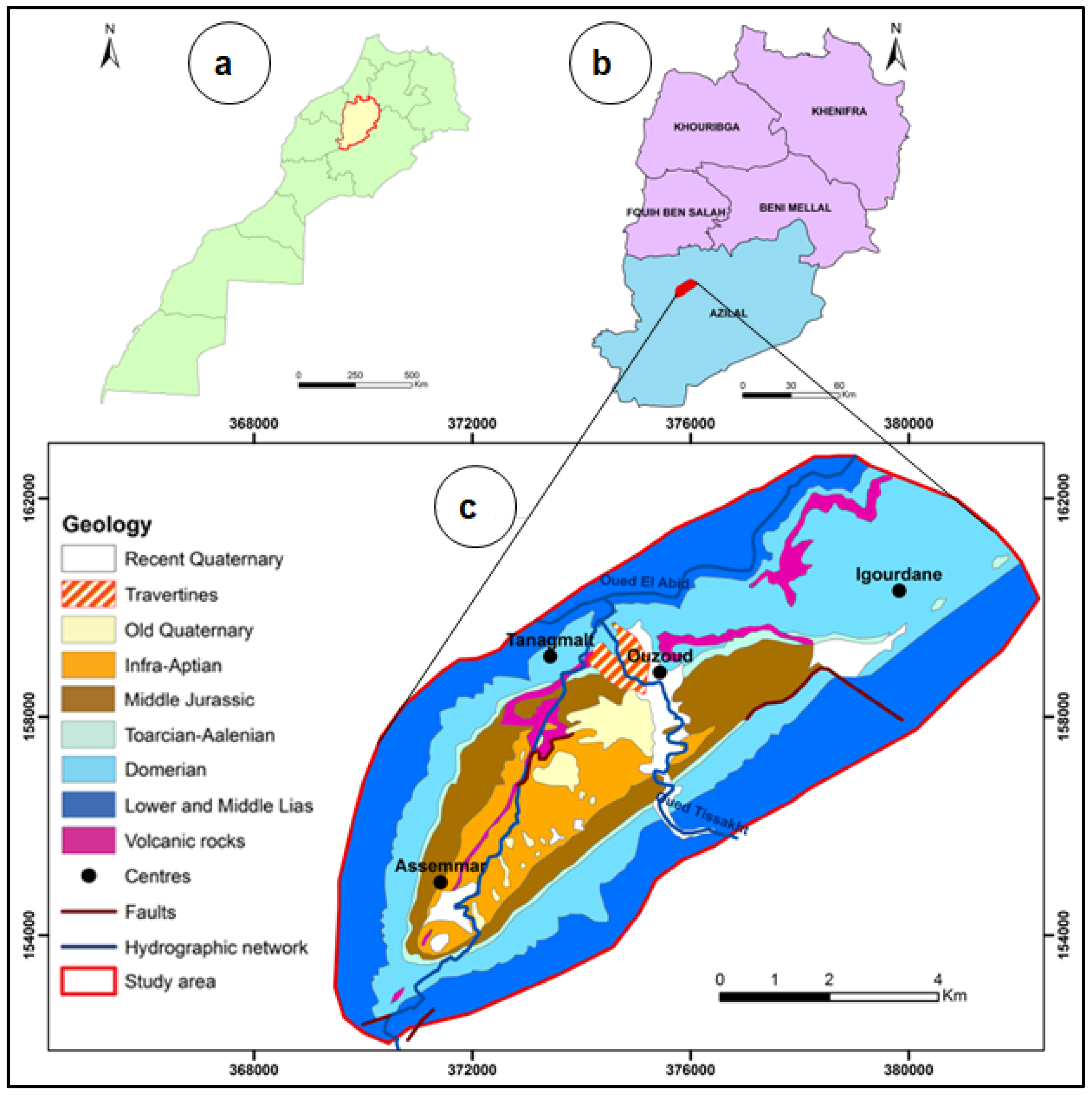
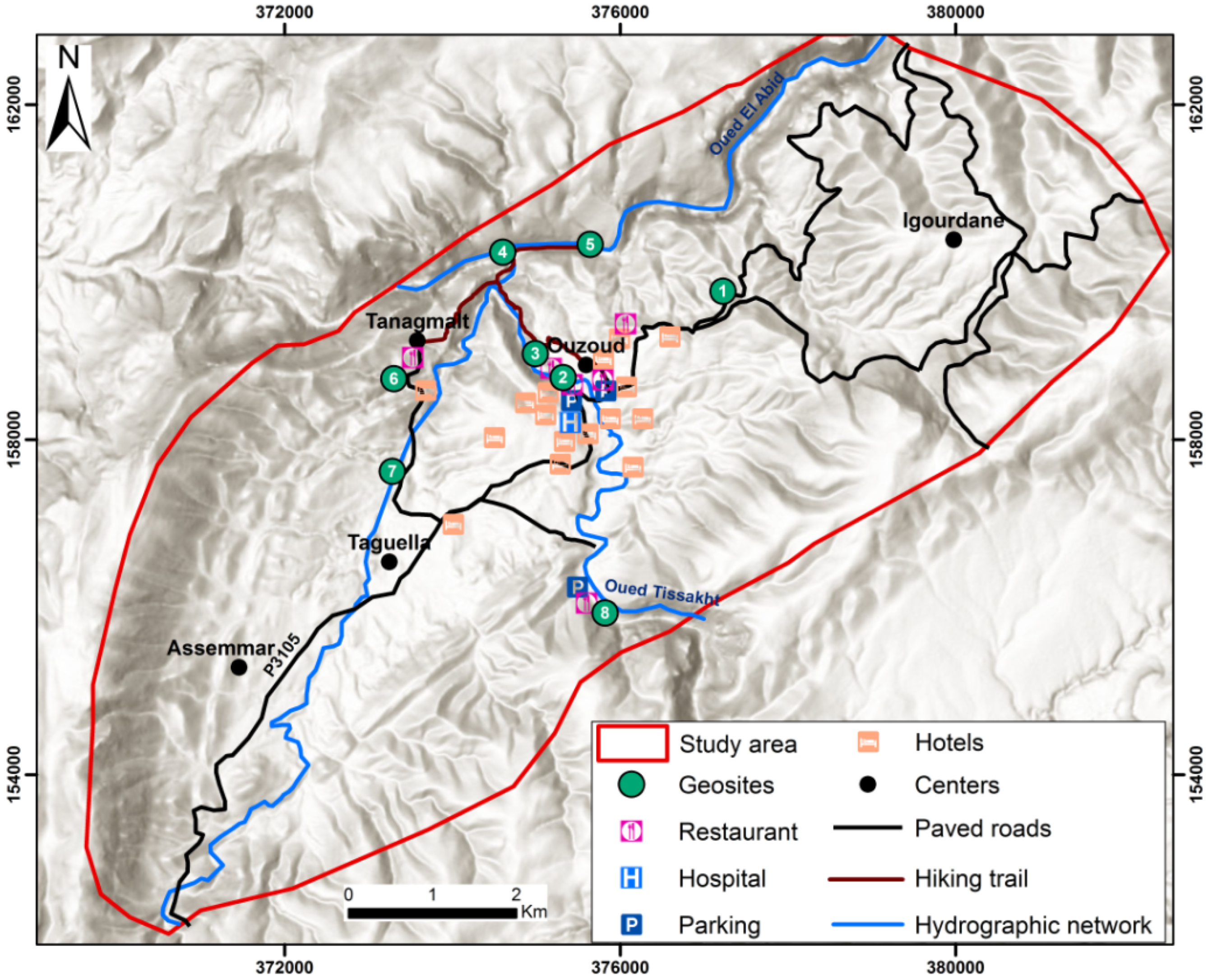
| Name (Code) | Main Features | Photos |
|---|---|---|
| The dolerite sill of Ouzoud (OUZmag001) | The Ouzoud sill is in the North-East, 3 km from the center of Ouzoud. It is a greenish dolerite layer of Lower Cretaceous age [27] which intrudes the massifs limestones of the Dogger. It extends over 3.5 km and has a texture that tends to be microlithic with phenocrysts of olivine and pyroxene [28]. The same sill intersects the chocolate marls of the Aalenian-Toarcian and the last benches of the Domerian towards the west [28]. This site constitutes an educational station that can be used to teach the magmatism process and stratigraphic principles. |  |
| Ouzoud waterfalls (OUZhyd002) | The Ouzoud waterfalls are falls that occur when the Oued Tissakht crosses the Bajocian limestone cliffs, the most spectacular fall is about 110 m high at the bottom of a chasm covered with beautiful travertine concretions. This picturesque landscape constitutes an internationally known tourist attraction; it is one of the geosites of the M’Goun UNESCO geopark and a SEBI. At the top of the waterfalls, tourists can visit small grain mills that rotate by exploiting the speed of the waterfalls. In some places, the speed of the river current has carved Giant’s kettle in the limestone bedrock, forming basins that overflow into each other. | 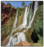 |
| The Ouzoud travertines (OUZKar003) | Important travertine stripping on the limestone cliffs dominates the Ouzoud waterfalls and along the Oued Tissakht. These concretions result from the precipitation of calcium carbonates dissolved in the river water following the degassing of CO2 in the open air [29]. These changes in the physicochemical parameters of water are closely related to hydrogeological, morphological, bioclimatic, and anthropogenic conditions. The Ouzoud travertines, particularly the oldest ones, have yielded beautiful leaf, root, and twig imprints of various sizes that can characterize the Plio-quaternary ecological, climatic, and hydrological paleoenvironment of the study area. | 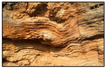 |
| The Estuary of Oued Tissakht (OUZflu004) | The estuary of the Oued Tissakht is located only 3 km from the Ouzoud waterfalls. This Tissakht watercourse descends quickly among the limestone cliffs about 15 m high, covered with travertine. The rapid flow between these structures forms a turbulent eddy that joins the Oued El Abid, thus digging beautiful cavities of different sizes, known locally as the Ouzoud caves. These structures give this site an undeniable aesthetic interest. | 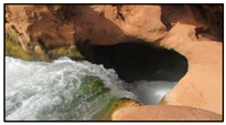 |
| The Oued El Abid Gorges (OUZGeo005) | The Oued El Abid Gorges, located 7 km NNW of the Ouzoud waterfalls, are exceptional geomorphological forms carved out of the massive Lias limestone by the Oued El Abid, forming a very deep valley that exceeds 100 m. This river has succeeded over centuries of erosive events to shape a stratigraphic column from the Domerian to the Upper Jurassic. The caves lining the gorge provide a habitat for monkeys, birds, and bats. This site attracts hundreds of hikers annually to enjoy unique and admirable landscapes. | 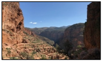 |
| Azilal formation intruded by the Tanaghmelt sill (OUZmag006) | About 800 m west of Tanaghmelt, we find a particular geological structure; it is a doleritic sill that cuts the reddish-brown marls of the Azilal Fm, leaving traces of contact metamorphism [24,28]. The Azilal Fm is underlain by Domerian marine limestone; this transition from carbonate to terrigenous sedimentation is considered a good benchmark of marine regression. In addition to this geological wealth, the site contains an ancient religious building called the Zaouïa of Tanaghmelt that accumulated an impressive religious heritage dating back to the 7th century. |  |
| The basaltic flows of Ouzoud (OUZmag007) | The basaltic flows of Ouzoud are located west of the syncline; they are associated with the upper part of the Iouaridene Fm, which corresponds to the second magmatic outpouring B2 of the Lower Cretaceous [24]. These flows, of 10 m thickness, present reddish grey facies, with vacuolated surfaces of prismatic structure at the top. Unfortunately, these magmatic rocks are being excessively exploited as building materials, which risks destroying this magmatic heritage. | 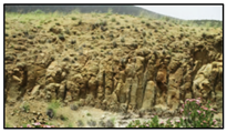 |
| Ouzoud springs (OUZkar008) | Ouzoud springs are karstic resurgences; there are 22 of them, which gush out through a complex karstic system formed by carbonates of the Lias. Underground waters from these springs feed the Oued Tissakht and give rise to a favorable environment for developing diversified freshwater fauna (fish, gastropods, crabs, and insects). This geosite has constituted for a long time a favorite tourist destination to practice bivouac and camping within a picturesque, soft, and calm landscape. | 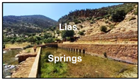 |
| Geosites | Scientific Value | Additional Value | ||||||||
|---|---|---|---|---|---|---|---|---|---|---|
| Code | Name | Int | Rep | Rar | Pal | Sci Val | Eco Val | Aes Val | Cul Val | Add Val |
| OUZmag001 | Doleritic sill of Ouzoud | 0.75 | 0.75 | 0.5 | 1 | 0.75 | 0.62 | 0.87 | 0.25 | 0.58 |
| OUZhyd002 | Ouzoud waterfalls | 1 | 1 | 1 | 1 | 1 | 0.87 | 1 | 1 | 0.96 |
| OUZkar003 | Ouzoud travertines | 1 | 1 | 0.5 | 1 | 0.87 | 0.87 | 1 | 0.75 | 0.87 |
| OUZflu004 | Estuary of Oued Tissakht (Ouzoud caves) | 1 | 1 | 0.75 | 0.75 | 0.87 | 0.5 | 1 | 0.5 | 0.66 |
| OUZgem005 | Oued El Abid Gorges | 1 | 1 | 0.75 | 0.5 | 0.81 | 0.5 | 1 | 0.5 | 0.66 |
| OUZmag006 | Chocolate marl intruded by Tanaghmelt sill | 1 | 1 | 0.75 | 0.75 | 0.87 | 0.5 | 0.75 | 1 | 0.75 |
| OUZmag007 | Basaltic flows of Ouzoud | 0.5 | 1 | 0.5 | 0.75 | 0.69 | 0.5 | 0.5 | 0.25 | 0.42 |
| OUZkar008 | Karstic spring of Ouzoud | 0.75 | 1 | 0.75 | 0.5 | 0.75 | 0.87 | 0.75 | 0.75 | 0.79 |
| Geosites | Use and Management Values | |||||
|---|---|---|---|---|---|---|
| Protection Status | Eventual Threats | Touristic Infrastructure | Conditions of Visit | Access Road | Enhancement Installation | |
| Doleritic sill of Ouzoud | ** | *** | ** | **** | **** | Absent |
| Ouzoud waterfalls | **** | *** | **** | **** | **** | Present |
| Ouzoud travertines | *** | ** | **** | *** | *** | Absent |
| Estuary of Oued Tissakht (Ouzoud caves) | *** | ** | ** | ** | ** | Absent |
| Oued El Abid Gorges | ** | ** | ** | ** | ** | Absent |
| Chocolate marl intruded by Tanaghmelt sill | ** | ** | ** | *** | *** | Absent |
| Basaltic flows of Ouzoud | ** | **** | ** | *** | *** | Absent |
| Karstic spring of Ouzoud | *** | *** | *** | *** | *** | Present |
Disclaimer/Publisher’s Note: The statements, opinions and data contained in all publications are solely those of the individual author(s) and contributor(s) and not of MDPI and/or the editor(s). MDPI and/or the editor(s) disclaim responsibility for any injury to people or property resulting from any ideas, methods, instructions or products referred to in the content. |
© 2022 by the authors. Licensee MDPI, Basel, Switzerland. This article is an open access article distributed under the terms and conditions of the Creative Commons Attribution (CC BY) license (https://creativecommons.org/licenses/by/4.0/).
Share and Cite
Louz, E.; Rais, J.; Barakat, A.; Barka, A.A.; Nadem, S. Inventory and Enhancement of Geological Heritage in the Ouzoud Syncline (M’Goun UNESCO Geopark, Central High Atlas, Morocco): First Step for Promoting Geotourism and Sustainable Development. Proceedings 2023, 87, 12. https://doi.org/10.3390/IECG2022-13878
Louz E, Rais J, Barakat A, Barka AA, Nadem S. Inventory and Enhancement of Geological Heritage in the Ouzoud Syncline (M’Goun UNESCO Geopark, Central High Atlas, Morocco): First Step for Promoting Geotourism and Sustainable Development. Proceedings. 2023; 87(1):12. https://doi.org/10.3390/IECG2022-13878
Chicago/Turabian StyleLouz, Elhassan, Jamila Rais, Ahmed Barakat, Abdellah Ait Barka, and Samir Nadem. 2023. "Inventory and Enhancement of Geological Heritage in the Ouzoud Syncline (M’Goun UNESCO Geopark, Central High Atlas, Morocco): First Step for Promoting Geotourism and Sustainable Development" Proceedings 87, no. 1: 12. https://doi.org/10.3390/IECG2022-13878
APA StyleLouz, E., Rais, J., Barakat, A., Barka, A. A., & Nadem, S. (2023). Inventory and Enhancement of Geological Heritage in the Ouzoud Syncline (M’Goun UNESCO Geopark, Central High Atlas, Morocco): First Step for Promoting Geotourism and Sustainable Development. Proceedings, 87(1), 12. https://doi.org/10.3390/IECG2022-13878


