1. Introduction
Extended reality (XR) encompasses immersive technologies such as virtual reality (VR), augmented reality (AR), and mixed reality (MR), all of which aim to enhance or transform the user’s perception of the physical environment. VR provides a fully immersive digital environment, whereas AR overlays digital elements onto the real world, and MR goes a step further by enabling real and virtual elements to interact dynamically in real time. In the field of XR, 360 tours represent a more accessible and lightweight form of immersive experience, based on 360 images. A 360 image, commonly referred to as a 360° image, is characterized by capturing a complete view of the scene, allowing viewers to look in any direction. These images provide a comprehensive representation of a location, enabling users to engage visually with their surroundings as if they were physically present in that environment [
1]. The 360 images can be interconnected, forming a 360 tour, often accompanied by audio or textual information, and can be enhanced with immersion technologies such as VR [
2,
3].
Creating 360 images typically involves the use of specialized cameras or software capable of stitching multiple photographs into a single immersive experience. The development of 360 tours has evolved from early forms of panoramic photography to advanced immersive digital experiences. Initially, the concept relied on simple still images to create panoramic views, providing static representations of locations. Over the years, technological innovations, such as image stitching techniques and advancements in camera technology, have enhanced the creation of highly detailed 360 tours [
4,
5]. Software for creating 360 tours has advanced significantly in recent years, as have the cameras and image processing techniques. Concurrently, the rise of accessible software and hardware has enabled a broader range of users to create 360 tour content [
6,
7,
8].
In recent years, 360 tours have gained significant traction in various fields [
9]. A well-known case is Google Street View, which uses 360 images to create routes of our everyday surroundings. In the real estate field, it is commonly used to show properties that are for sale or rent. In the scientific field, the use of 360 technology has become particularly impactful in several fields such as culture, tourism education, and so on. 360 tours are very useful for promoting cultural heritage [
10], enhancing visitor engagement and serving vital roles in educational contexts, where virtual tours can supplement physical visits by providing contextualized information conveniently [
11,
12]. In the educational sector, 360 tours have become an essential resource [
13,
14]. The integration of immersive visuals is crucial as it allows for an experiential learning process, bridging the gap between theoretical knowledge and practical understanding [
8]. In the tourism sector, hotels and tourism operators have recognized the potential of these tours to provide prospective guests with a realistic preview of facilities and experiences, thus influencing their purchasing decisions. The importance of such immersive technology in promoting tourism cannot be overstated; it serves as a key element in modern marketing strategies aimed at capturing the attention of contemporary consumers who increasingly seek personalized and engaging experiences [
15,
16]. Several studies indicate that using 360 tours positively influences users’ behavioural intentions to visit sites physically, thereby serving as effective tools for tourism marketing [
17,
18]. These tours not only create opportunities for exploration but also provide essential information that enhances the understanding of the respective locations, fostering a sense of presence and connection even from a distance [
19].
The present work focuses on the maritime sector. The implementation of 360 tours provides significant advantages, particularly for crew members who may be unfamiliar with their work environment until they are onboard. This familiarity is crucial for safety and operational efficiency, especially in emergencies where rapid evacuation can be life-saving. During instances such as fire, shipwreck, or other emergencies, crew members must quickly understand their surroundings, identify emergency exits, locate firefighting equipment, and navigate through potentially hazardous conditions, including smoke, noise, and blocked routes [
20]. A core benefit of 360 tours in this context is their ability to create an immersive experience that allows crew members to familiarize themselves with the ship’s layout and emergency protocols before stepping aboard. Training and orientation programmes that incorporate 360 tours not only prepare crew members for the physical layout but also enhance their ability to react appropriately under stress, thereby significantly mitigating risks associated with human error [
21,
22]. There are some studies on VR in the naval sector, especially in the firefighting sector [
23]. To this purpose, game engines such as Unity 3D [
23,
24,
25,
26,
27,
28] or Unreal [
29] were mainly used. Pitana et al. [
30] developed a VR application and Tao et al. [
31] developed a training simulator with physics-based smoke. Nevertheless, to the author’s knowledge, the present work is the first to design, implement, and experimentally validate a 360 virtual-tour-based system for maritime evacuation familiarization. Although 360 tours do not reach the full level of immersion or interactivity of VR or MR, they offer significant advantages in terms of ease of development, cost, and deployment, making them particularly suitable for applications such as education, training, and pre-familiarization tasks. Compared to traditional methods, each approach offers distinct advantages and limitations. Simulator-based training provides highly immersive and interactive scenarios, including dynamic emergency evolution, but it requires significant infrastructure, cost, and scheduled access, making it less suitable for rapid or large-scale pre-boarding familiarization. Traditional e-learning and paper maps, on the other hand, are widely accessible but lack spatial immersion and often fail to convey the complexity of real onboard environments. In contrast, 360 virtual tours offer a balanced solution, combining realistic visual representation (based on real environments) with relatively low technological and economic requirements, enabling users to explore spaces remotely and asynchronously.
Unfortunately, most companies are paying little attention to the importance of familiarizing themselves with the working environment beforehand. Accordingly, a 360 tour model was created using a real merchant vessel. The model includes all the information on and the location of emergency exits and fire-fighting devices, as well as elements that facilitate orientation within the engine room. The aim of this study is to improve the safety and preparedness of newly embarking crew members by enabling them to become familiar with the layout of a ship’s engine room and its emergency routes before boarding. With respect to the target group, the proposed tool is primarily intended for new crew members or inexperienced seafarers who have not yet been physically onboard the vessel. This includes cadets, newly hired personnel, or crew assigned to unfamiliar ships. The experimental design (participants with no prior ship experience) reflects this target population. Nevertheless, the tool could also serve as a refresher resource for experienced crew members when transferring between vessels with different layouts.
2. Materials and Methods
2.1. Development of the 360 Tour
As indicated above, a 360 image captures a full view of a scene. This means that the user can look in any direction—up, down, left, right—and see the entire environment as if standing in the middle of it.
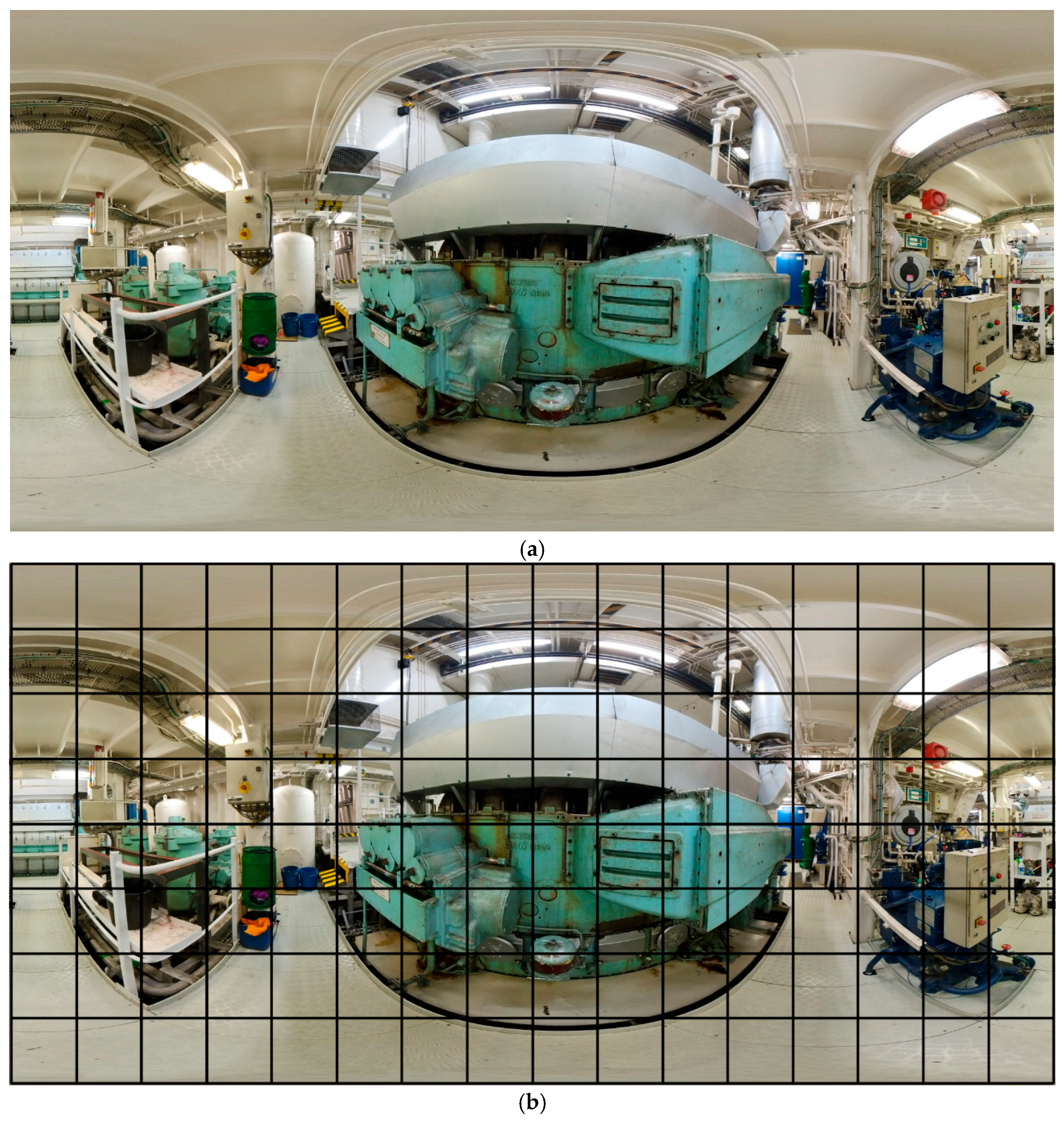
Figure 1a shows an example of a 360 image viewed in equirectangular projection, i.e., with the image as unfolded from a sphere into a rectangle. For ease of understanding, a grid has been provided (
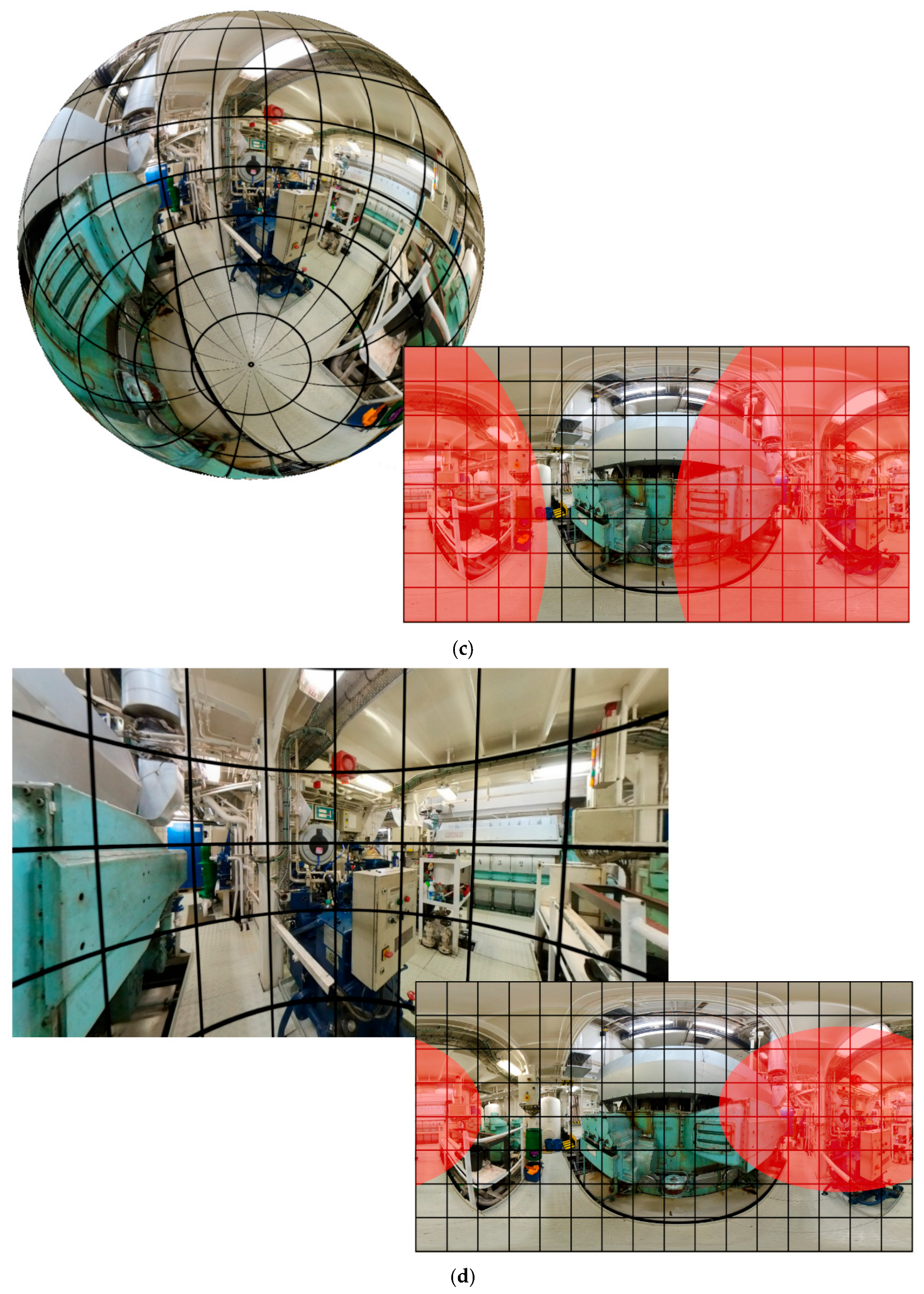
Figure 1b). This image can perfectly be projected onto a sphere, as shown in
Figure 1c. This figure shows where the camera was placed and highlights in red the area of the photograph shown on the sphere. In practice, displays are used that show the image, as shown in
Figure 1d. In this image, the part of the photograph shown is also shown in red. The user can go up, down, right and left and see all around them.
Either a 360 camera or mobile devices such as smartphones or tablets can be used for creating 360 images. Regarding smartphones and tablets, there are numerous applications, both free and paid. Essentially, these applications convert a set of ordinary photos into a single 360 image. The main drawback is that the stitching between images is usually not perfect. 360 cameras overcome this advantage as they are equipped with two or more wide-angle lenses that capture images from all directions and perfectly stitch the images together into a seamless 360 image. In the present work, the Insta360 One X2 camera (Arashi Vision Inc., Shenzhen, China) was used. This is a dual-lens 360 camera featuring 5.7 K video recording and 18 MP photos. It can be operated by touchscreen or remotely by another device via Wifi and Bluetooth connection. It is a very light and compact camera with sufficient performance to capture places such as machine rooms, which are not always as well-lit as one would like them to be.
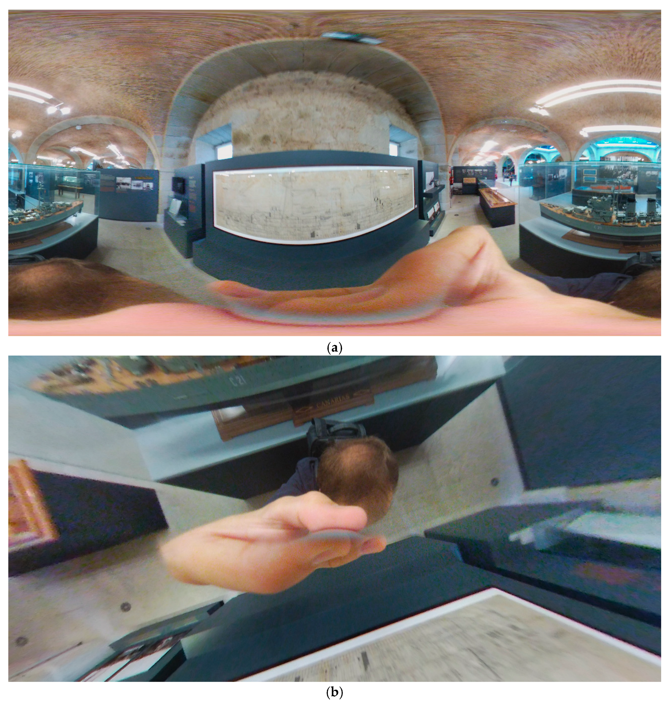
A common issue in 360 images is that the photographer may appear in the frame, as in
Figure 2. To avoid this, a tripod and the camera’s remote control utility were used. Specifically, Insta’s own “invisible” extendable tripod stand was used. The camera is able to hide it in the image stitching. A tripod stand was chosen because, in combination with the camera’s Wi-Fi trigger control, it allowed the scenes to be shot without appearing in them. In addition, a more human-like point of view is achieved by standing upright. It is worth mentioning that on a smartphone, using a tripod to take 360 images would be unfeasible because many ordinary photos are needed for a single 360 image, and these must be done by hand by moving the device.
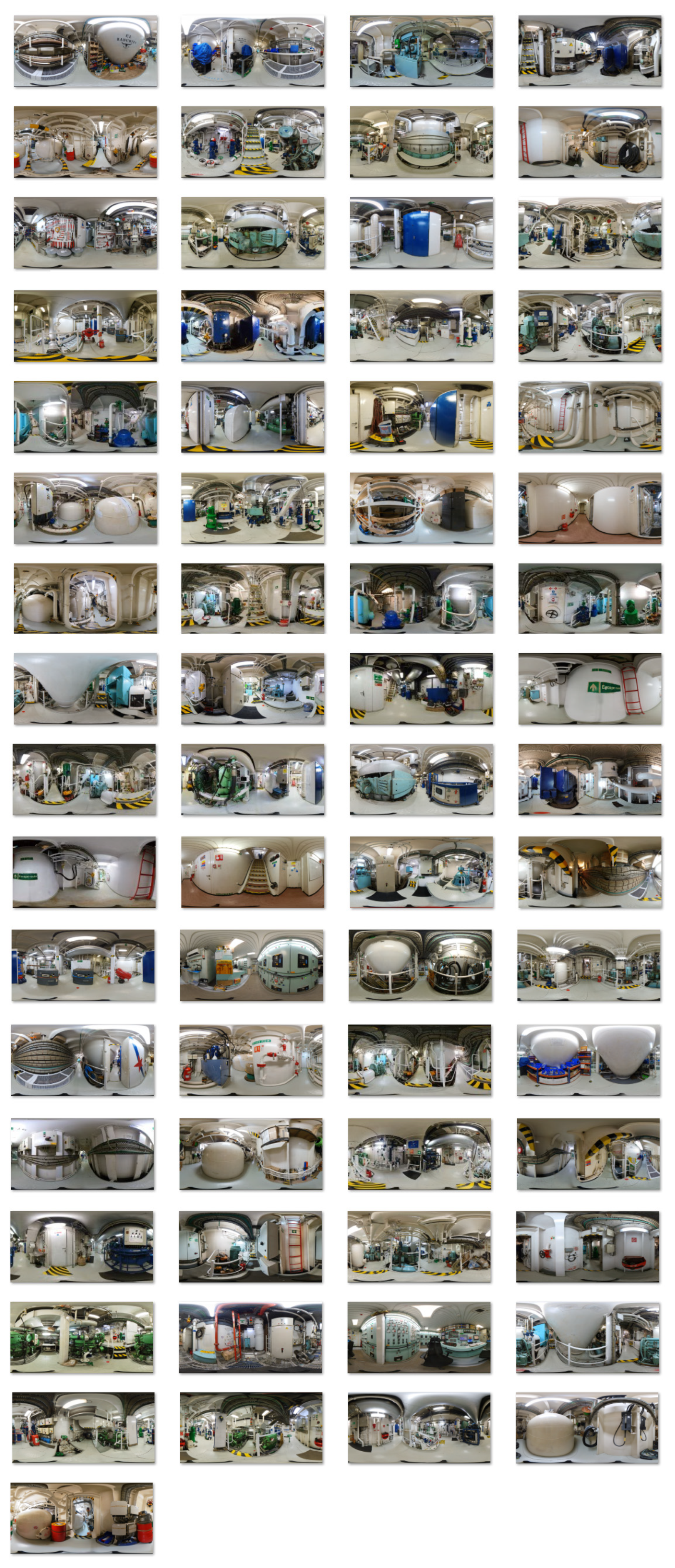
In total, 65 photographs were used for this work. These are shown in
Appendix A. The selected images show a clear path through the whole ship. Special attention was paid to emergency exits, fire-fighting elements (fire extinguishers, alarm buttons, equipped fire hydrants and pumps) and elements that could facilitate orientation (arrows to where one moves within the ship).
Once the 360 images are created, the next step is to use them to develop the 360 tour. Creating effective 360 tours increasingly relies on specialized software that allows users to stitch together 360 images and develop interactive experiences. Over the years, various software options have emerged, each with unique features suitable for different contexts. Some notable software options are Matterport [
10,
32]; 3DVista [
4,
11]; Cloudpano [
22,
32]; Kuula [
33]; Pano2VR [
34]; Ricoh Theta [
35]; Panotour [
16], etc. In this study, the Virtual Tour (360) was selected. This interactive content type, provided by H5P, enables users to craft immersive 360 tours. H5P is an open-source platform designed for creating, sharing, and reusing interactive HTML5 content. Virtual Tour (360) offers a variety of multimedia options to enrich the tour experience, including the ability to add audio, video, and other interactive elements to hotspots. The intention is not to imply that other software solutions lack capability, but rather that the selected platform (H5P Virtual Tour 360) was chosen due to its accessibility, ease of deployment, and compatibility with web-based environments. Other platforms may provide additional features (e.g., higher graphical fidelity or advanced interaction), but they may also require greater technical expertise or resources.
2.2. Experimental Design and Procedure
To evaluate the effectiveness of the proposed 360 virtual tour as a familiarization tool, an experimental study was conducted involving ten participants. The participants were familiarized with the ship using the 360 tour. These people had no technical knowledge of ships. This was considered of particular interest since young seafarers may not have much previous experience in this field.
The experiment consisted of two sequential phases: (i) a familiarization phase using the 360 virtual tour, and (ii) a real-world evacuation test conducted onboard the vessel.
In the familiarization phase, participants individually explored the virtual tour using a desktop computer. They were allowed to navigate freely through the different scenes and interact with the available hotspots (e.g., directional arrows, safety equipment indicators, and emergency exits). No time limit was imposed, and no external guidance was provided, in order to simulate autonomous pre-boarding familiarization.
Following this phase, participants were taken to the real ship, where the evacuation test was conducted. Each participant started from the Engine Control Room and was instructed to reach a predefined emergency exit located in the gear space using the most direct route possible. The decision to centre the evacuation simulation on the engine room is justified by the critical role this compartment plays in ship safety, risk exposure, and crew operations. The engine room is one of the most complex, densely equipped, and hazard-prone areas on board a vessel. It contains high-temperature machinery, pressurized systems, fuel lines, and rotating equipment, all of which contribute to an elevated likelihood of fire, mechanical failure, or other emergency situations, as widely acknowledged in maritime safety literature. Due to these characteristics, emergency scenarios originating in or affecting the engine room typically present increased evacuation difficulty, reduced visibility, and a heightened need for rapid decision-making.
The evaluator accompanied each participant at all times to time their evacuation and monitor their chosen route options. The evacuation time was measured manually using a stopwatch, starting from the initial position. Additionally, the evaluator recorded qualitative observations regarding route selection, hesitation, and deviations from the optimal path.
3. Results and Discussion
The Virtual Tour (360) v1.0.12 software allows the tour to be created in HTML5 format, which can be implemented on a web page or viewed locally without the need for an internet connection. In this particular case the tour has been published on a website in both English (
https://app.Lumi.education/run/yDhZ3f, accessed on 26 June 2026) and Spanish (
https://app.Lumi.education/run/qaKnyD, accessed on 26 June 2026). It is important to mention that the quality of each image had to be reduced from 18 Mp to 2 Mp in these online tours. In this case, one point in its favour is that the higher the quality of the camera and the images, the better the results and the better the sensation of using the model; however, better images represent, in most cases, a more voluminous file weight, which can be detrimental both when uploading them to the platforms where these models can be mounted and when downloading them. To address this trade-off, optimization strategies such as adaptive resolution delivery, efficient image compression, and progressive loading can be implemented. Additionally, hybrid approaches combining high-quality local versions with optimized web-based deployments can support scalable and practical implementation across diverse user environments. In the present work, the size of each image was reduced to 18 Mp.
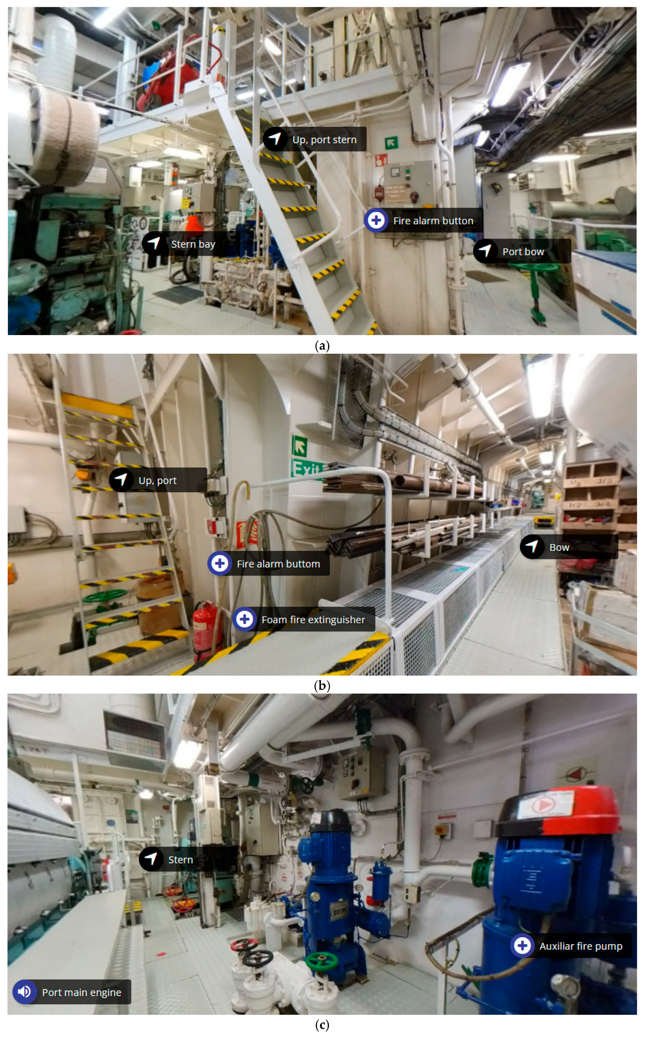
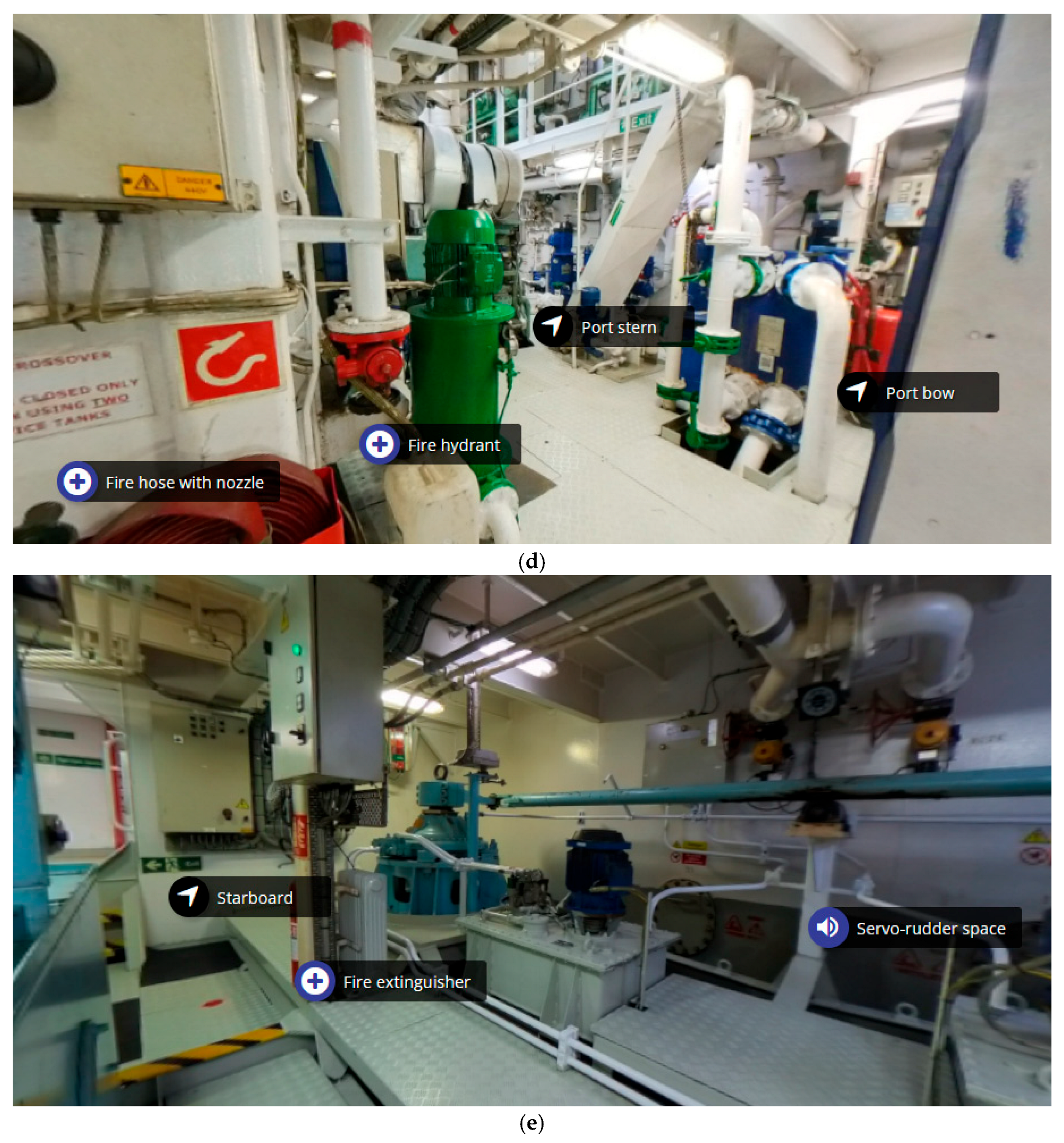
Figure 3 shows several images of the tour. In particular,
Figure 3a shows a scene with three arrows pointing to three other scenes, as well as the indication of a fire button that activates the alarm. These interactive elements are called hotspots. Hotspots enhance interactivity by allowing to navigate between scenes (move from one scene to another) and display information such as text, images, videos, audio, and so on.
Figure 3b shows two labels, one for a fire extinguisher and one for a fire button, along with two arrows to change the scene.
Figure 3c shows the port side of the port main engine. In addition, the bilge and auxiliary fire pumps, which could also serve as a bilge pump, are shown to the right of the image, providing some redundancy. The following labels can be seen:
- –
On the left there is a loudspeaker icon; when pressed, it allows users to listen to the sound of the port main engine in sailing conditions.
- –
In the centre there is an image with an arrow icon, the button that takes users to the aft scene of the current scene.
- –
On the right there is a plus icon; this button expands to show information about the item in view or whatever is desired.
In
Figure 3d, on the left of the image, several pieces of firefighting equipment together with their lance can be seen. In the centre, an arrow moves users to the scene of that position. This scene would take place on the port main engine bow. Just to the right of this arrow, the plate exchanger in charge of cooling the main engine fresh water with sea water can be seen, and to the right of this another arrow that allows users to move directly to the port side of the current scene position can be seen.
Finally,
Figure 3e shows one of the emergency exits from the ship’s machinery spaces, the starboard aft one, on the left-hand side. Next to it, there is an arrow that allows users to change the scene to the position where the icon is located approximately. At the bottom right of this icon is an icon indicating a fire extinguisher; on this occasion, it was decided to simplify the label and specify the type once the icon is selected. To the right, there is again an icon of a loudspeaker which allows you to listen to the noise of this space.
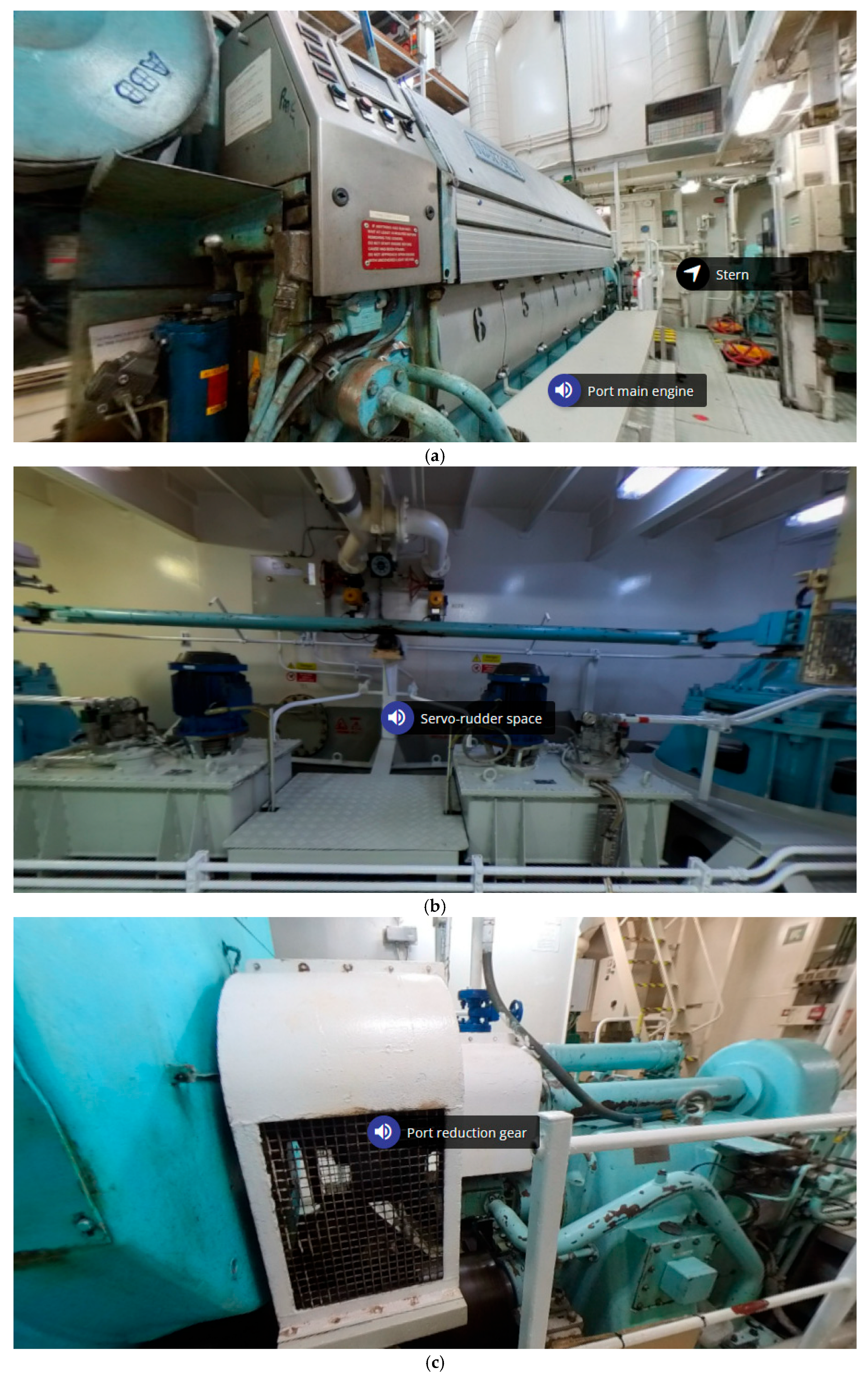
The most representative sounds of each piece of equipment were included in the tour. These are port main engine, port gearbox and servo rudder space, as shown in
Figure 4a, b and c, respectively. The part related to sounds was added to show that it is possible for a person to know where they are just by the noise. It is worth mentioning that the problem with this is that most noises change depending on the state of the ship, whether it is underway, at anchor, etc.; thus, this could be confusing or not as useful in practice as everything else. In real-life environments, these variations may mislead inexperienced crew members or reduce the transferability of the experience to actual emergency conditions. While sound can enrich the user experience and support spatial familiarization in certain contexts, it should be framed primarily as an enhancement that complements—rather than underpins—the core pedagogical objectives of the tour.
As previously indicated, a group of ten people was asked to experiment with the model separately. The test consisted of seeing if they were able to get from the engine control to the port emergency exit of the gear space with the fewest number of steps. This test was timed and the directness of their route there was also observed. This was an indication of how well they had memorized or interpreted the shape of the model ship’s engine room. The evacuation time results are shown in
Table 1. As can be seen, the mean completion time was 59.2 s, with a standard deviation of 20.0 s, indicating moderate variability among participants. The fastest recorded time was 35 s, while the slowest reached 91 s. Half of the participants completed the task in under one minute. The remaining participants required longer times, generally due to route selection uncertainties and minor detours. This is an excellent result considering that the time taken by someone going straight in and knowing the place perfectly well is around 30 s, while if somebody does not the place it could take several minutes.
In the test, most participants were direct and did not become lost, except for participants 1, 4 and 8, who hesitated when determining which route was the most direct. In these cases, time was lost by taking a detour through a non-optimal route (not the most direct evacuation path possible). Although it is true that their route took them where they were aiming to arrive, the fact that they had to take a longer route made a difference. The biggest difference between participants was that some decided to use the emergency exit from the gear space from the port side of the lower deck, while others went up the starboard side and arrived on the upper deck at the port side exit from the gear space.
It should be noted that the experiment was conducted under controlled, low-stress conditions to isolate the effect of spatial familiarization. This situation differs significantly from real emergency situations. Stress is known to negatively affect decision-making and may increase evacuation times even among individuals familiar with the environment. Therefore, the improvements observed in this study should be interpreted as reflecting enhanced spatial understanding rather than fully realistic emergency performance. What is most remarkable is that, although they had never been to the workplace, they already had an idea of what the workplace was like when they arrived. This was also verified by asking people to go to various places on the ship. The accuracy they showed rivalled that of having been to the site previously, so it can be stated that these tours are a didactic, immersive and efficient method for teaching an unknown environment with sufficient accuracy to be transferable and observable results to the real world.
Although the participants had no prior physical exposure to the ship, they were able to complete the evacuation task with relatively low times and limited disorientation. This suggests that the virtual tour effectively supported the development of a mental representation of the environment, which is a key factor in emergency response performance. From a practical perspective, the proposed approach offers a low-cost, accessible, and easily deployable solution for pre-boarding familiarization of crew members. Unlike simulator-based training, it does not require specialized infrastructure and can be completed remotely and asynchronously, making it particularly suitable for large-scale implementation in the maritime sector.
4. Conclusions
This study presents a 360 tour-based method of showing crew members where they will be boarding for work before they are on board. Although the timed evacuation test focused specifically on reaching a designated emergency exit, the virtual tour was intentionally designed to teach participants not only the layout of escape routes but also the locations of fire-fighting and safety equipment throughout the machinery spaces.
A total of 65,360 images were used to create the tour. In view of the results obtained, it can be concluded that the proposed method is appropriate for teaching an unknown environment with sufficient accuracy to be translatable and observable in the real world. The tour provided notions of what the place is like without having been there before, and they were even able to guide themselves around the boat with an accuracy that rivalled that of having been to the site previously.
As for limitations of the model, it is worth mentioning that the analysis is based on static 360 images and lacks dynamic simulation or real-time interaction. In future work, this limitation could be addressed through 3D modelling or AI-guided decision pathways. In addition, dynamic emergency conditions, such as fire propagation, route obstruction, or changing environmental conditions, could explore the integration of dynamic simulation elements in future works.
Another limitation is that the experiment involved ten participants with limited demographic diversity. Future trials with a broader sample are proposed to be carried out as well as a statistical analysis. In particular, it would be useful to conduct studies including comparison groups familiarized using traditional methods (e.g., ship plans, briefings, e-learning material or no prior training) to assess the impact of 360 tours. Additionally, the incorporation of structured questionnaires is also envisaged to evaluate user experience, perceived usefulness, and subjective perceptions. In addition, while evacuation time provides a useful initial measure of training effectiveness, incorporating complementary performance indicators, such as route selection accuracy, navigation errors, spatial knowledge retention, workload, and user confidence, would provide a more comprehensive assessment of learning outcomes.
Another limitation of the model relies on the fact that the experimental evaluation was conducted under controlled conditions, which may differ from the complexity of real emergency situations. In future works, incorporating simulated factors such as time pressure, alarm sounds, smoke, or reduced visibility in future studies could provide additional insights into the effectiveness of the training method under more realistic operational scenarios.





 ,
,