Article

Quantification of Gas Flaring from Satellite Imagery: A Comparison of Two Methods for SLSTR and BIROS Imagery


by
Alexandre Caseiro
1,* and
Agnieszka Soszyńska
2,3
1
Research Institute for Sustainability–Helmholtz Centre Potsdam, 14467 Potsdam, Germany
2
School of Physics and Astronomy, University of Leicester, Leicester LE1 7RH, UK
3
Faculty Geo-Information Science and Earth Observation (ITC), University of Twente, 7500 AE Enschede, The Netherlands
*
Author to whom correspondence should be addressed.
J. Imaging 2023, 9(8), 152; https://doi.org/10.3390/jimaging9080152

Submission received: 5 May 2023 / Revised: 18 July 2023 / Accepted: 24 July 2023 / Published: 27 July 2023
(This article belongs to the Section Color, Multi-spectral, and Hyperspectral Imaging)

Abstract

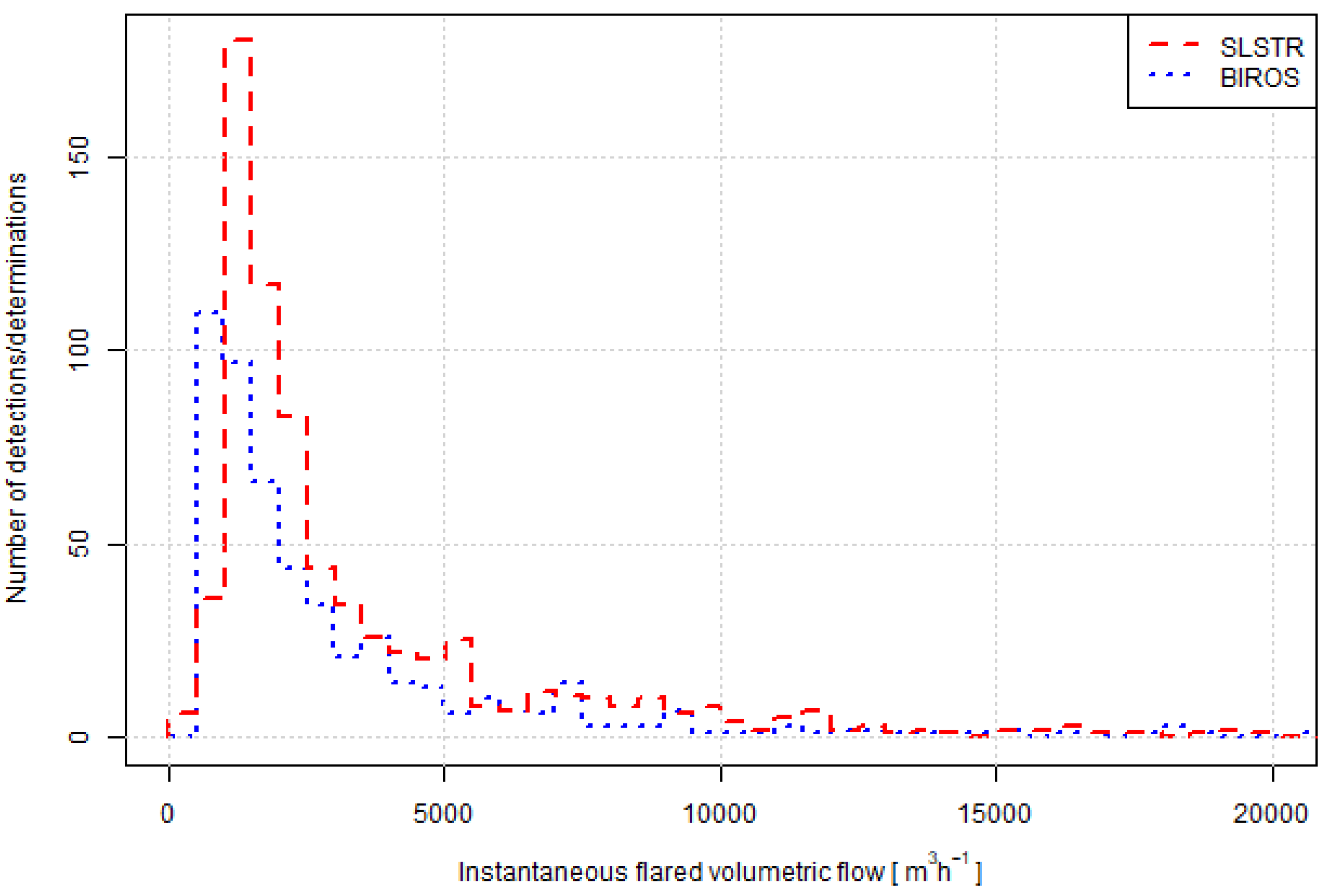
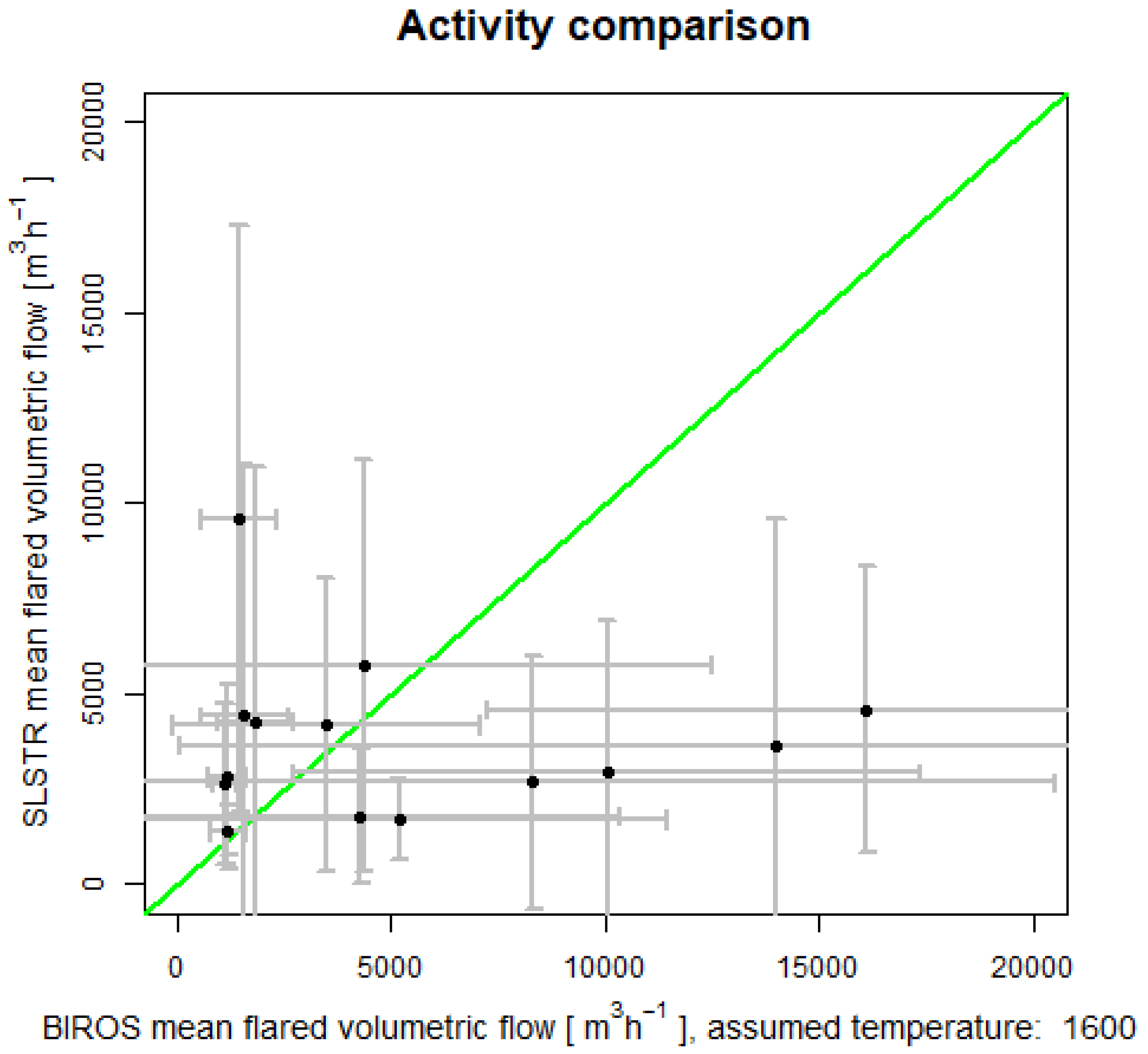
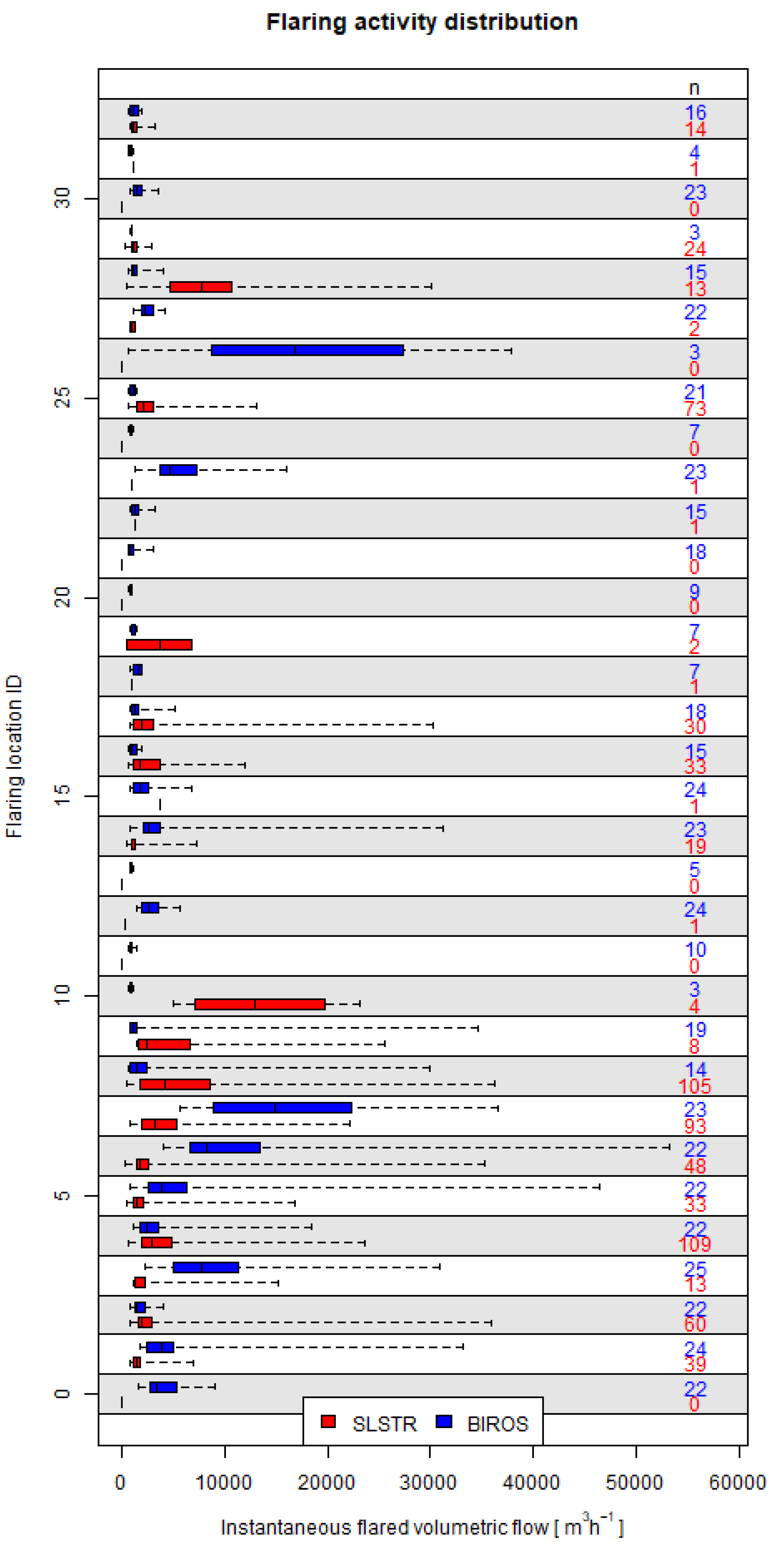
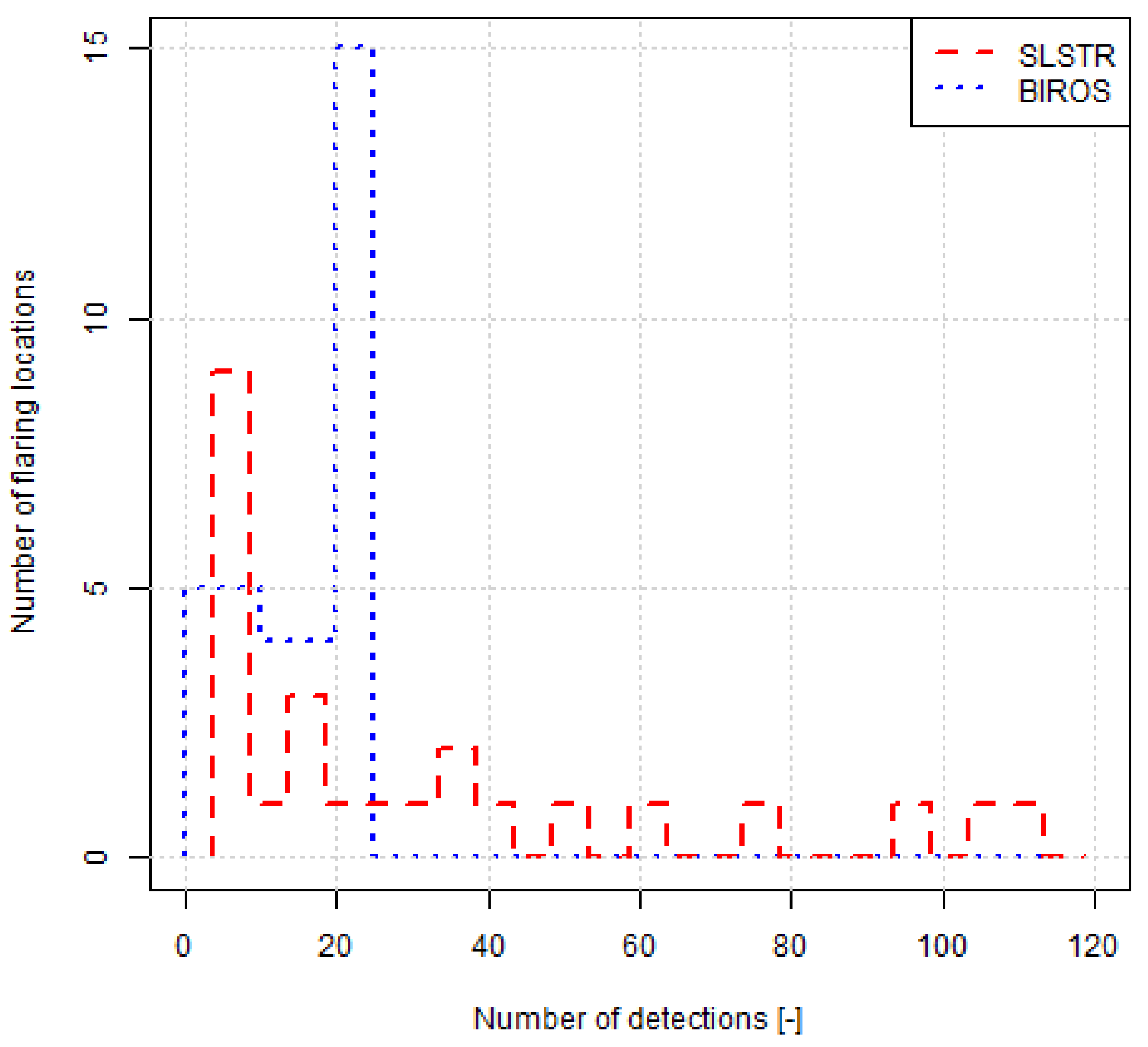
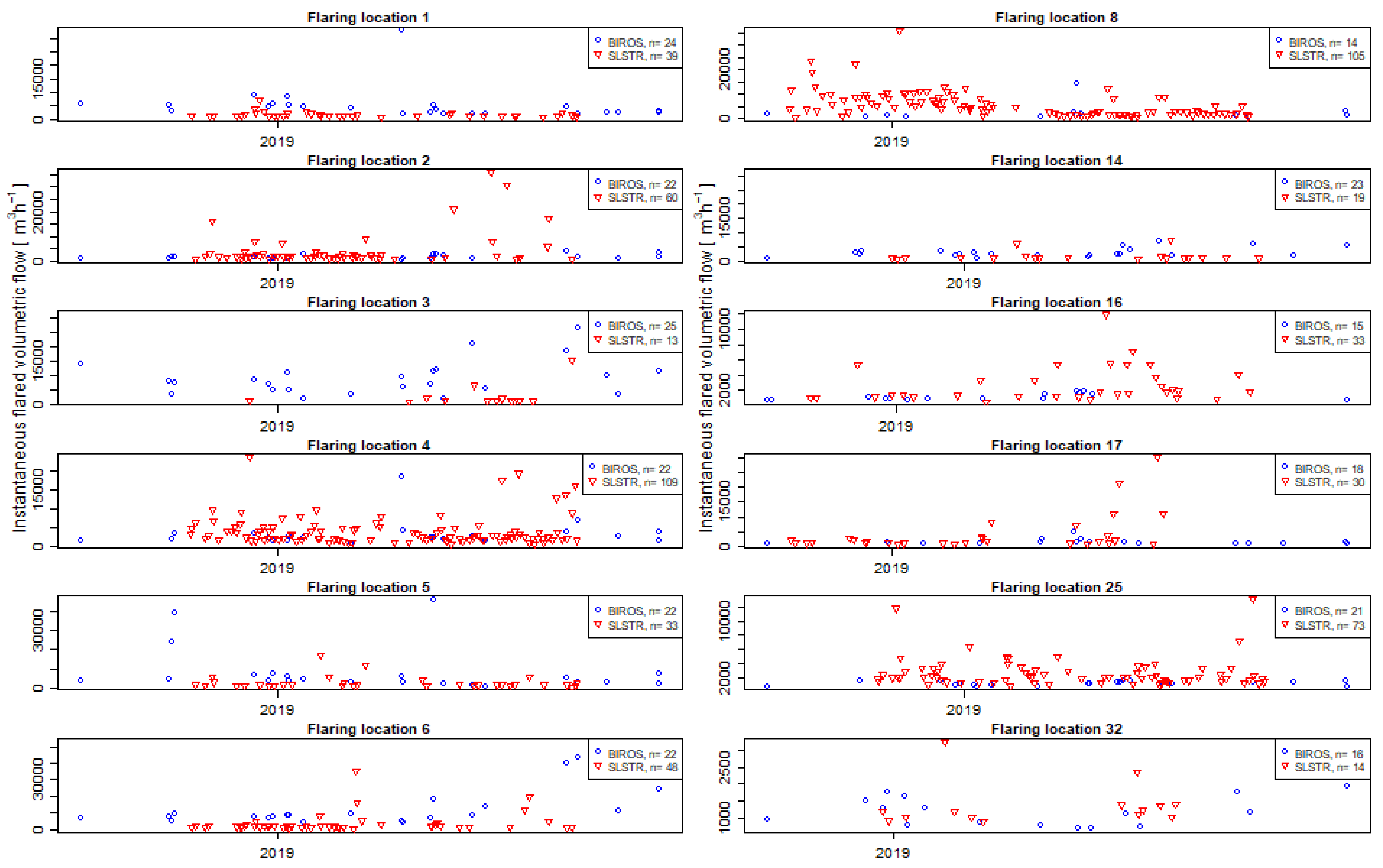
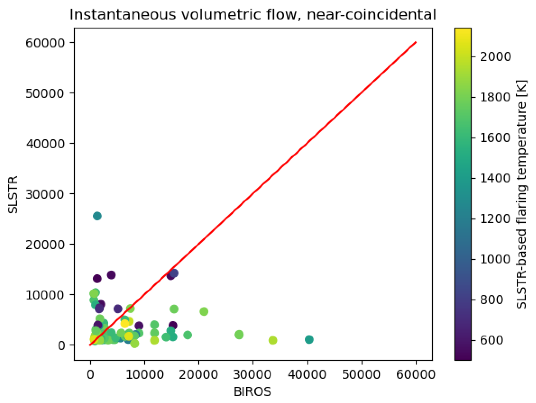
Gas flaring is an environmental problem of local, regional and global concerns. Gas flares emit pollutants and greenhouse gases, yet knowledge about the source strength is limited due to disparate reporting approaches in different geographies, whenever and wherever those are considered. Remote sensing has bridged the gap but uncertainties remain. There are numerous sensors which provide measurements over flaring-active regions in wavelengths that are suitable for the observation of gas flares and the retrieval of flaring activity. However, their use for operational monitoring has been limited. Besides several potential sensors, there are also different approaches to conduct the retrievals. In the current paper, we compare two retrieval approaches over an offshore flaring area during an extended period of time. Our results show that retrieved activities are consistent between methods although discrepancies may originate for individual flares at the highly temporal scale, which are traced back to the variable nature of flaring. The presented results are helpful for the estimation of flaring activity from different sources and will be useful in a future integration of diverse sensors and methodologies into a single monitoring scheme.
Keywords: gas flaring; SLSTR; BIROS gas flaring; SLSTR; BIROS