
Article

Comparative Analysis of Automated Cloud-Based Mapping and Manual 3D Modeling for AR-Based Indoor Navigation


by
Evianita Dewi Fajrianti
1,*,
Amma Liesvarastranta Haz
1,*,
Yuita Arum Sari
2,
Sritrusta Sukaridhoto
1,
Zacky Maulana Achmad
1 and
Rizqi Putri Nourma Budiarti
3
1
Human Centric Multimedia Research Laboratory, Department of Informatic and Computer Engineering, Politeknik Elektronika Negeri Surabaya, Surabaya 60111, Indonesia
2
Faculty of Computer Science, Brawijaya University, Malang 65145, Indonesia
3
Department of Information Systems, Faculty of Business Economics and Digital Technology, Universitas Nahdlatul Ulama Surabaya, Surabaya 60237, Indonesia
*
Authors to whom correspondence should be addressed.
J. Imaging 2026, 12(9), 452; https://doi.org/10.3390/jimaging12090452 (registering DOI)

Submission received: 16 July 2026 / Revised: 6 September 2026 / Accepted: 14 September 2026 / Published: 18 September 2026

Abstract

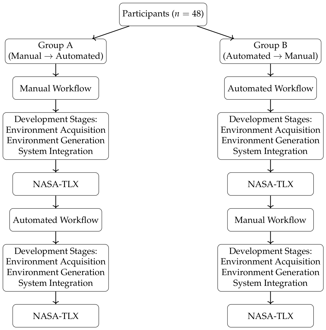
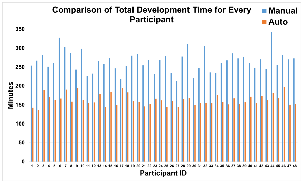
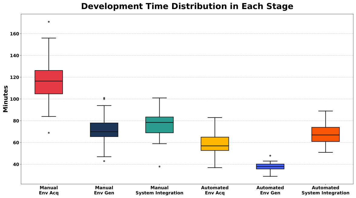
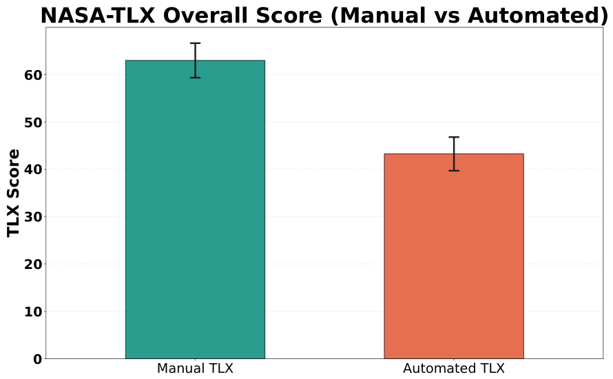
Modern building infrastructures are becoming increasingly complex, creating a need for intuitive indoor navigation systems that can assist users in unfamiliar environments. Augmented Reality (AR) has emerged as a promising solution by providing spatially contextual guidance directly within the user’s field of view. However, many AR indoor navigation systems rely on manually constructed 3D environments, a development process that is time-consuming and prone to spatial inconsistencies with the real-world environment. This study presents a comparative evaluation of two environment creation workflows for AR indoor navigation development: a traditional manual 3D modeling approach and an automated cloud-based spatial mapping workflow using the Immersal SDK. A counterbalanced within-subject experiment was conducted with 48 participants, each of whom completed equivalent indoor navigation development tasks using both workflows in a real-world campus building environment. The development process was divided into three stages: environment acquisition, environment generation, and system integration. Development efficiency was evaluated using stage-based development time measurements, while perceived workload was assessed using the NASA Task Load Index (NASA-TLX). Statistical analysis was performed using repeated-measures analysis to compare workflow performance across development stages. Results show that the automated workflow significantly reduced overall development time by approximately 38% compared to the manual modeling approach, with the most substantial time reductions occurring during the environment acquisition and environment generation stages. NASA-TLX results indicate an approximately 31% reduction in overall perceived workload. Descriptively, the automated workflow had lower mental-demand and effort scores but a higher physical-demand score. A separate researcher-conducted spatial validation of one implementation per workflow showed a higher mean three-dimensional positional error for the automated implementation (22.47 cm) than for the manual implementation (19.14 cm), with a mean paired difference of 3.33 cm across 13 anchor locations. These findings indicate that automated spatial mapping can substantially improve development efficiency and reduce overall perceived workload, while introducing trade-offs in physical demand and spatial alignment accuracy relative to manual environment reconstruction.
Keywords: Augmented Reality; indoor navigation; automated mapping; perceived workload; NASA-TLX Augmented Reality; indoor navigation; automated mapping; perceived workload; NASA-TLX