Article

Analysis of the Characteristics and Cause Analysis of Soil Salt Space Based on the Basin Scale

1
School of Geology and Mining Engineering, Xinjiang University, Urumqi 830046, China
2
Jiangsu Zhongwu Environmental Protection Industry Development Co., Ltd., Changzhou 213000, China
*
Author to whom correspondence should be addressed.
Appl. Sci. 2022, 12(18), 9022; https://doi.org/10.3390/app12189022
Submission received: 10 August 2022 / Revised: 30 August 2022 / Accepted: 5 September 2022 / Published: 8 September 2022
(This article belongs to the Section Environmental Sciences)

Abstract

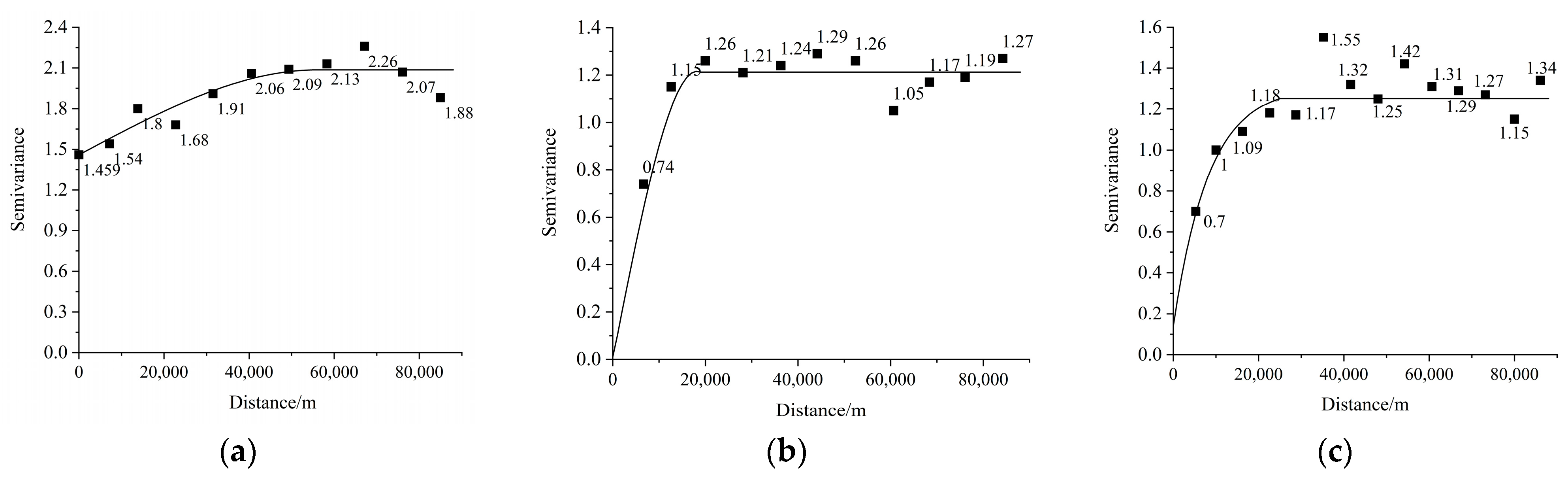
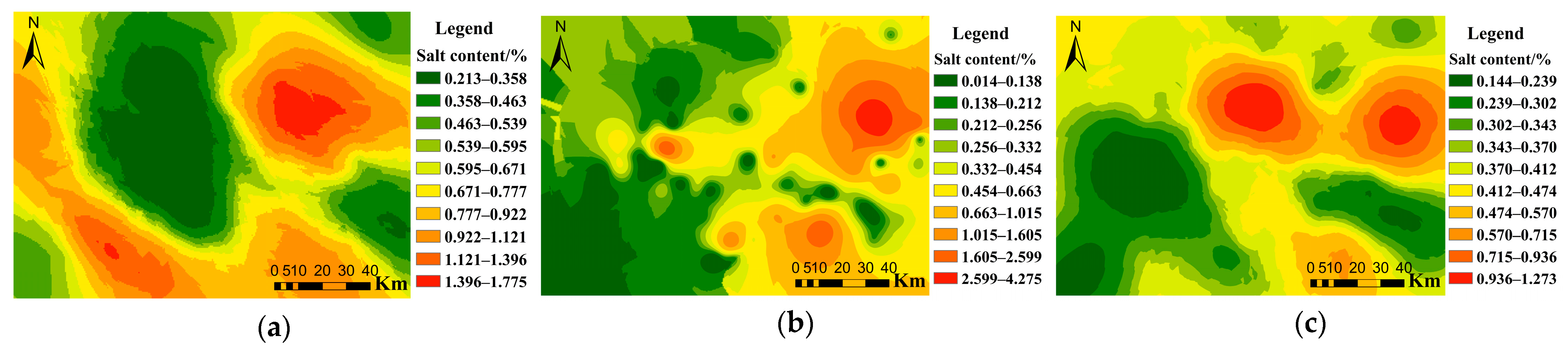
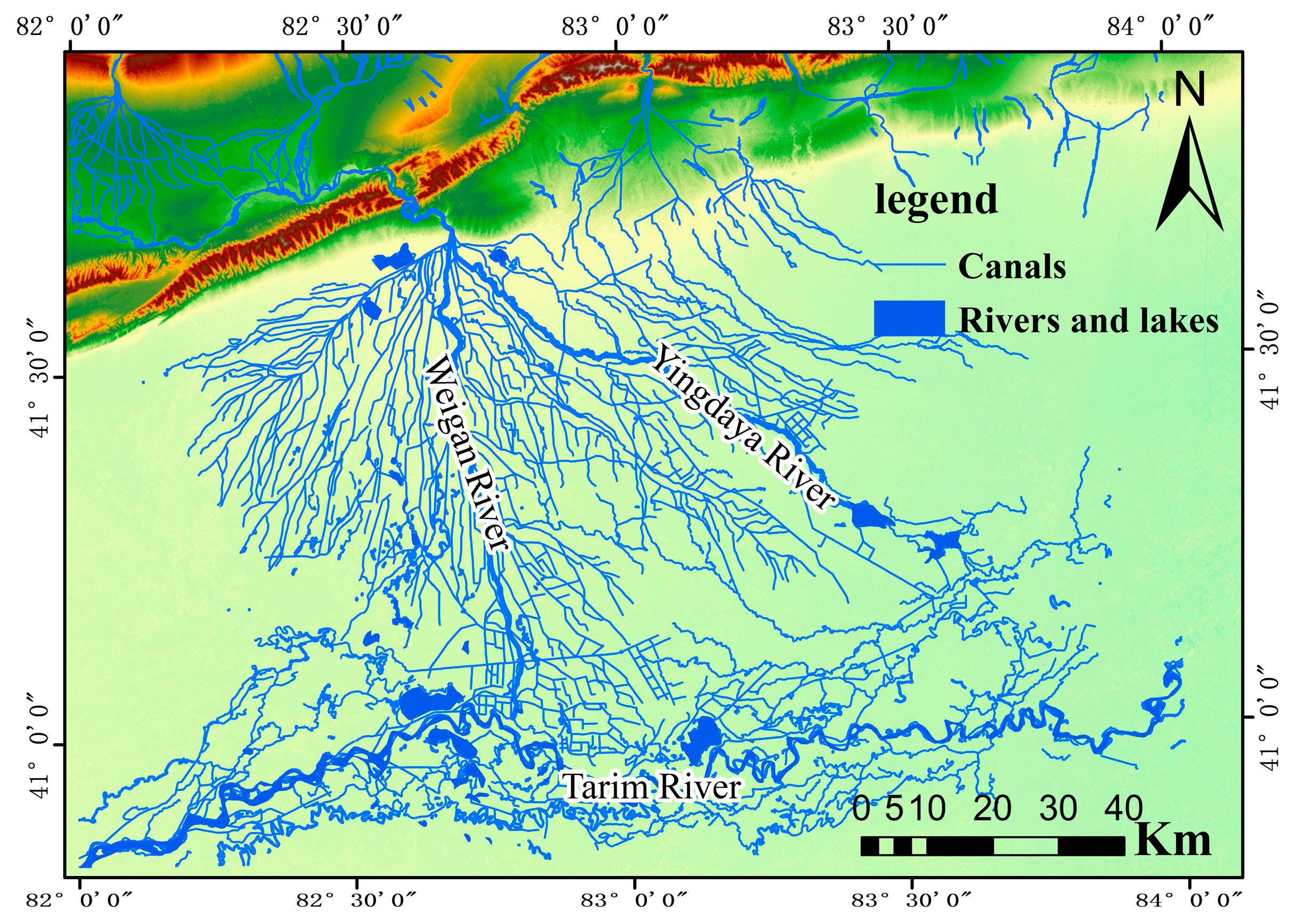
The analysis of water-soluble salts in the soil is an important basic work for the development and research of the salinity monitoring and salinization control of saline soils, aiming at the complexity of the development of soil salinization in oases in arid and semi-arid areas. Based on the regionalization theory, GPS positioning technology was adopted in this paper to conduct fixed point sampling of the Weigan River Basin oasis from April to May 2020. Soil sampling levels were between 0 m and 0.25 m, between 1 m and 2 m, and between 2 m and 3 m, respectively, and soil physical and chemical properties were analyzed and tested from May to June 2022. The spatial variability of soil salinity at different depths in the Weigan River Basin oasis was quantitatively studied by GIS and geostatistics, and the results show that: (1) the soil salinity of each layer in the Weigan River Basin oasis was generally high, with an average value of 1.27%, 0.87%, and 0.79%, respectively, and a variation coefficient between 1.023 and 1.265, showing strong variability. (2) A reasonable number of soil sampling should be based on the 95% confidence level and 20% relative error. Therefore, the number of soil samples in the corresponding layers should not be less than 89, 70, and 91. (3) Optimal fitting models of soil salinity at the layers between 0 m and 0.25 m and between 1 m and 2 m were both spherical models, while the optimal fitting model of soil salinity at the layer between 2 m and 3 m was an exponential model. Soil salinity at different depths is affected by random factors and structural factors. Soil salinity at the layer between 0 m and 0.25 m showed moderate spatial correlation, while soil salinity at the layers between 1 m and 2 m and between 2 m and 3 m showed strong spatial correlation. (4) Three layers of soil salinity had obvious anisotropy, and the maximum variation direction was northwest–southeast. The nested model can overcome the influence of directionality on the fitting of soil salinity variation function in the layer between 0 m and 0.25 m and improve the spatial interpolation accuracy. (5) In terms of spatial pattern, the area of high soil salinity was located along the Tarim River and at the edge of oasis (i.e., desert–oasis ecotone). On the whole, the salinity shows a gradual increasing trend from the inner part of the oasis (i.e., cultivation area) to the edge of the oasis, and from the northwest to the southeast. (6) The spatial distribution pattern of soil salinity in the study area was mainly affected by the differences in topography, groundwater level, and water quality, while agricultural activities intensified the formation of the distribution pattern, reflecting the complexity of the development of soil physical and chemical properties in arid and semi-arid areas. This study provided a reference for the improvement, management, and rational utilization of saline soil in the Weigan River Basin oasis.
Keywords: spatial variability; geostatistics; Kriging interpolation; nested model; Weigan River Basin oasis spatial variability; geostatistics; Kriging interpolation; nested model; Weigan River Basin oasis