Editorial

40 Years Later: New Perspectives on the 23 November 1980, Ms 6.9, Irpinia-Lucania Earthquake

by
Sabina Porfido
1,2,
Giuliana Alessio
2,
Germana Gaudiosi
2,
Rosa Nappi
2,* and
Alessandro Maria Michetti
2,3
1
Consiglio Nazionale delle Ricerche-ISA, Via Roma 64, 80100 Avellino, Italy
2
Istituto Nazionale di Geofisica e Vulcanologia, Sezione di Napoli Osservatorio Vesuviano, Via Diocleziano 328, 80124 Napoli, Italy
3
Dipartimento di Scienza e Alta Tecnologia, Università degli Studi dell’Insubria, Via Valleggio 11, 22100 Como, Italy
*
Author to whom correspondence should be addressed.
Geosciences 2022, 12(4), 173; https://doi.org/10.3390/geosciences12040173
Submission received: 9 March 2022 / Accepted: 31 March 2022 / Published: 15 April 2022
After more than forty years since the 1980 Irpinia-Lucania earthquake, with this Special Issue “The 23 November 1980 Irpinia-Lucania, Southern Italy Earthquake: Insights and Reviews 40 Years Later” we revisit this milestone geological and seismological event, bringing together the latest views and news on this earthquake, with the aim of improving the dissemination of wide-ranging information on this remarkable case history.
This earthquake struck Irpinia-Lucania region (Lucania is also called Basilicata; Southern Italy) on 23 November 1980 (Ms 6.9, Io X MCS) [1,2], and it is remembered in Italy not only for being the strongest earthquake recorded in the last 100 years causing devastation of entire regions and severe loss of human life, but also for the destruction of the cultural heritage in the epicentral area.
It was felt throughout Italy, from Sicily in the South, to Emilia Romagna and Liguria in the North (Figure 1) causing damage in over 800 localities spread in the regions of Campania and Basilicata with a total of 75,000 houses destroyed and 275,000 seriously damaged. The number of victims was about 3000, with 10,000 injured people [1,2,3,4,5,6,7,8].
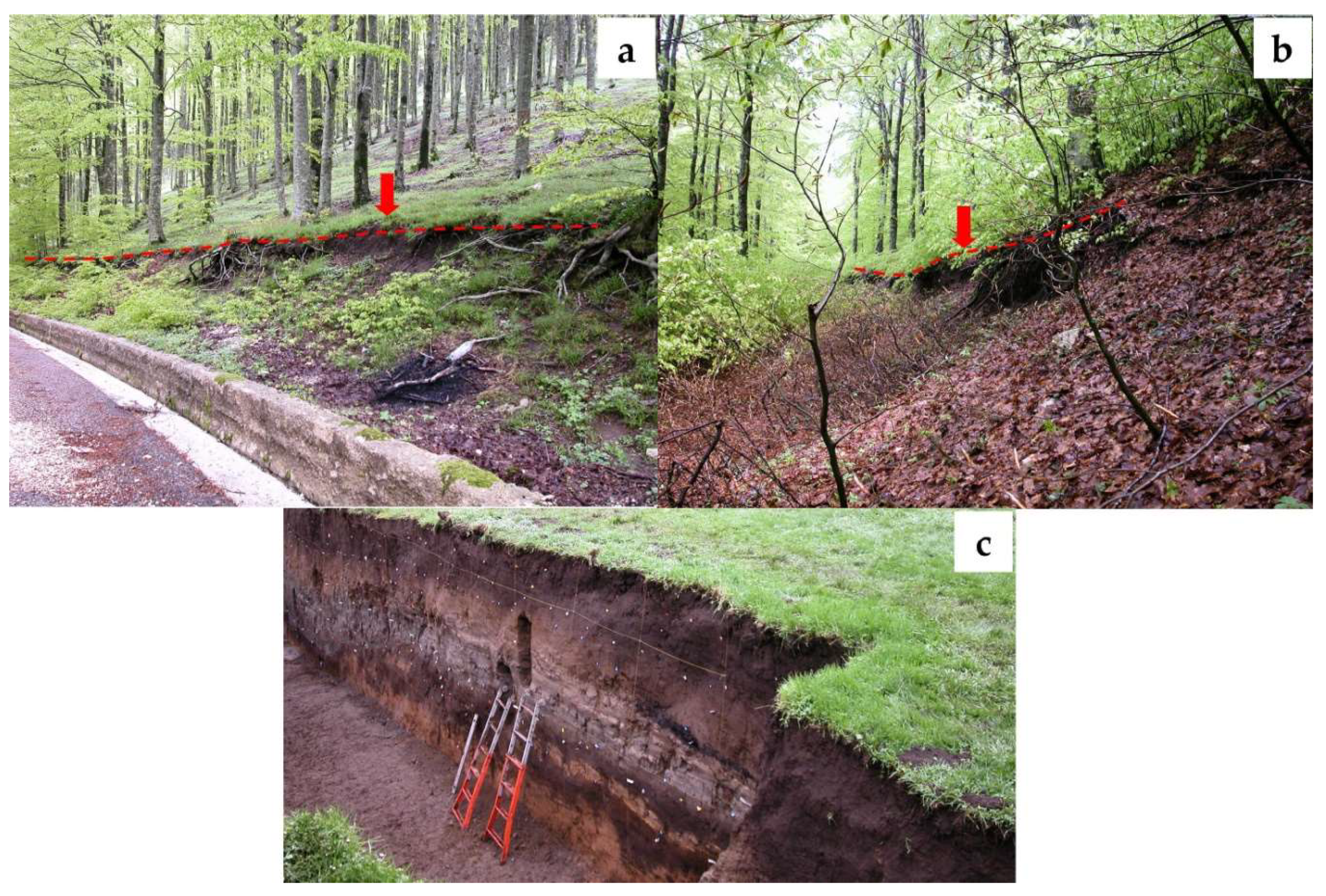
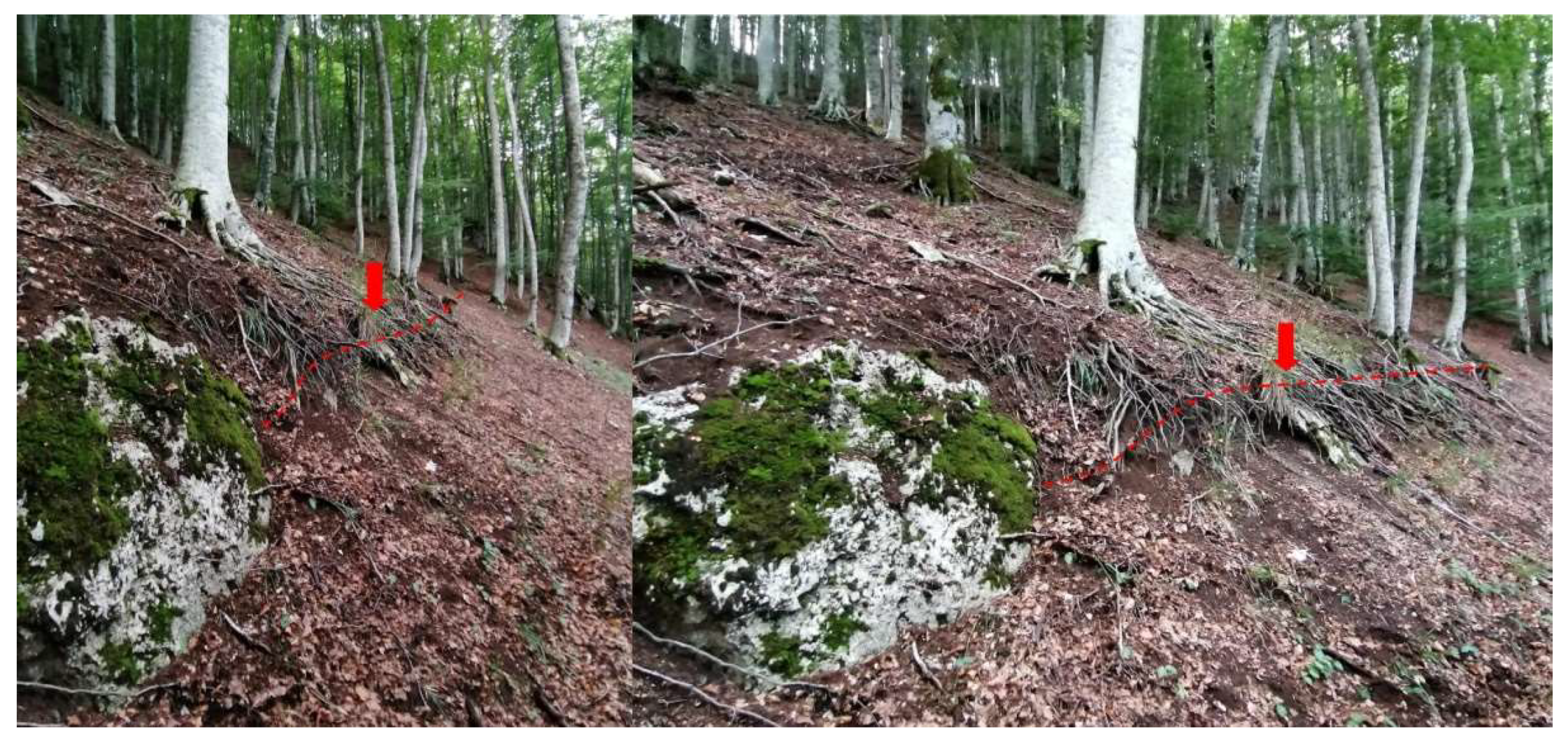
The earthquake also caused several striking effects on the natural environment, including extensive coseismic surface faulting which is still visible today (Figure 2 and Figure 3), and was mapped in the following years for a total length of about 40 km [9,10,11,12,13,14,15,16,17,18,19].
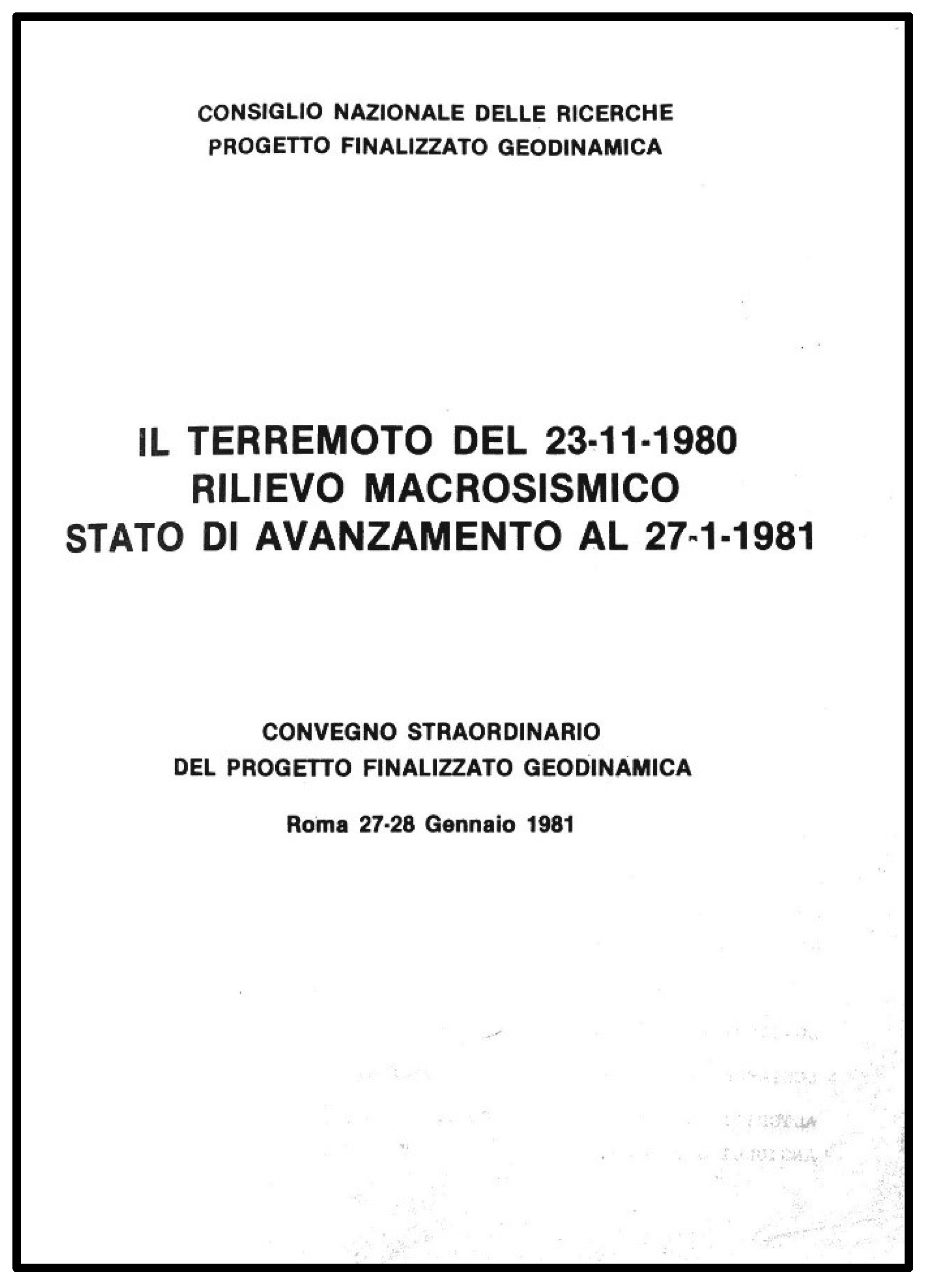
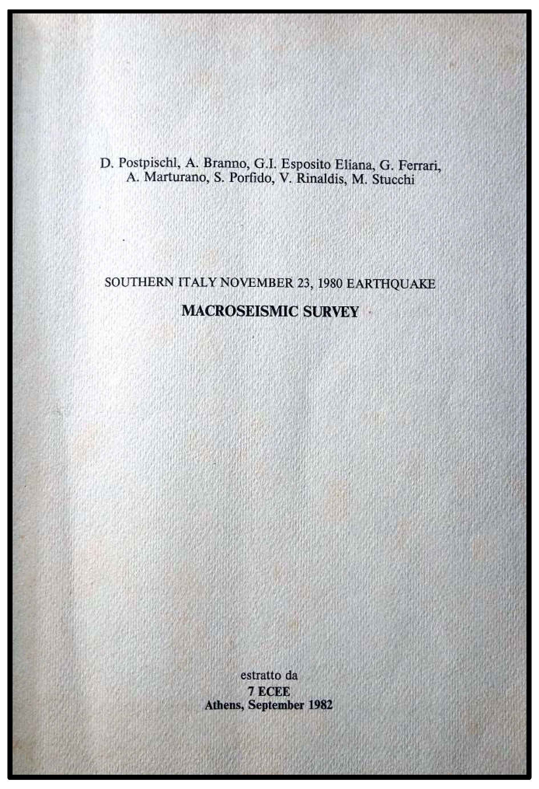
Moreover, over 200 landslides occurred [20,21,22,23,24]; also, widespread soil fracturing was observed, and minor liquefaction effects [25,26]. Wide changes in water flow rate in some regional karst springs [27,28] were reported. In that extremely dramatic context for Italy, the national scientific community played an important role, through the Geodynamic Finalized Project of the National Research Council (“Progetto Finalizzato Geodinamica”, PFG-CNR), that involved in the field many researchers, from different universities and research institutes, contributing to collect instrumental data, macroseismic surveys (Figure 4 and Figure 5), geological fieldwork and mapping (Figure 6 and Figure 7), and seismic engineering analyses, indispensable for the knowledge of the 1980 earthquake and for implementing a proper risk mitigation strategy [1,28,29,30,31,32,33,34,35,36].
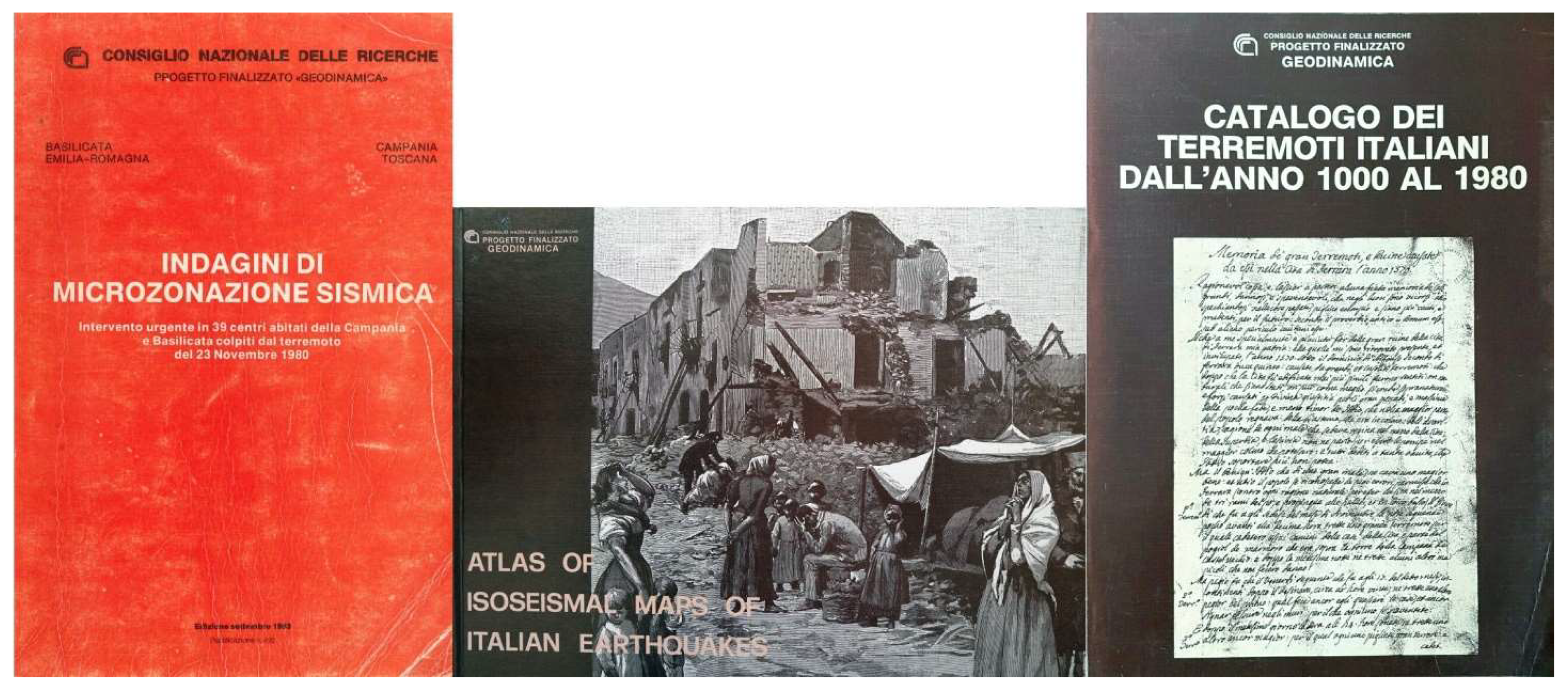
In particular, during the emergency activity for urban reconstruction, preliminary seismic microzonation studies were carried out in collaboration with the Tuscany and Emilia-Romagna regions, involving 39 towns in the epicentral area of Campania and Basilicata, with the objective of providing technical maps, on a scale of 1:5000, with indications of areas with different geological characteristics and the most suitable areas for reconstruction [35]. Other two important publications edited by the CNR- PFG in the field of seismology were certainly the Atlas of Isoseismal maps of Italian Earthquakes, and the first modern Italian Seismic Catalogue (Figure 8) [1,36].
The Irpinia-Lucania 1980 earthquake is still considered a crucial seismic event for the study of seismicity in Italy and abroad, and for the development of modern seismology, Quaternary geology and active tectonic studies, also including the emerging methodology of paleoseismology in Europe (Figure 2).
The recognition of the primary surface faulting due to the 1980 seismic event, and of its extent, was not obvious at all, for the limited technological tools, difficult environmental conditions and doubts of the scientific community; it required several months of field work by various researchers, and was firstly properly interpreted in 1984 by Rob Westaway and James Jackson [12] near Piano di Pecore, where a ca. 1 m high fault scarp was observed and mapped [11], then detected in the following months and in the neighbouring areas for over 40 km [12,13,14,15,16,17].
Paleoseismological studies, based on the excavation of trenches across the coseismic fault scarps detected on the surface, began in Italy only ten years later [15]. Thanks to these studies it has been possible to reconstruct the seismic history of the 1980 seismogenic fault, through the recognition of past earthquakes (historic and prehistoric) detectable by the faulted geological strata and the relative dating.
Forty years after the earthquake and with the introduction of modern scientific knowledge, it becomes important and fundamental to reconsider the many relevant and still open research lines that have been triggered by the Irpinia-Lucania earthquake.
The Special Issue “The 23 November 1980 Irpinia-Lucania, Southern Italy Earthquake: Insights and Reviews 40 Years Later” contains 13 articles proposed by 44 researchers with different expertise, with a multidisciplinary approach that highlights the most important aspects of the earthquake from a seismological and geological point of view, without neglecting the reconstruction of cultural heritage, the resilience of the population, and the socioeconomic development of the internal areas of the Southern Apennines after the earthquake. No doubt, lessons learned from the Irpinia-Lucania event are relevant at the local level, for the whole Mediterranean region, and in similar seismotectonic and cultural environments around the world.
The volume is organised in five virtual sections in which the authors deal different features about the 1980 Irpinia earthquake: the historical-scientific framework, the geological and seismotectonic setting, the seismological framework, examples of applied geophysics, post-earthquake and resilience aspects.
The historical-scientific framework is represented by the papers of Lombardi [38] and Gizzi and Potenza [8]. The first paper introduces the “earthquake” topic by highlighting the far-reaching significance of this calamitous event not only in the social history of our country, but also and above all in the context of the various disciplines, from the scientific to the humanistic ones, giving a critical review of the academic debate that still exists today. According to the Author, this socio-historical vision can also support the demand for knowledge and risk mitigation coming from citizens and communities living in seismic areas, focusing on attention to social memory and awareness of seismic risk and natural risks.
The second paper by Gizzi and Potenza [8] can be rightly considered a milestone on the topic because it analyses about 640 papers with a tailored methodological approach, international and national (Italian) studies initiated and advanced since the earthquake occurred. They built and analyzed statistically two bibliographic databanks regarding the earthquake studies: (a) the international version of Irpinia Bibliographic database (IR_BASE_ENG), selecting and standardizing the pertinent scientific documents extracted from Scopus, Web of Science, and other databases and (b) the national version of the database (IR_BASE_IT) using the Google Scholar search engine to search for the most relevant papers in Italian. The review provides a rich and useful bibliography (123 papers) that includes studies on seismic source, environmental effects, seismic damage, seismic microzonation, disaster response and recovery, disaster epidemiology, ground motion estimates, and other research. The results of their research confirm that the 1980 Irpinia-Lucania earthquake was a significant occasion for the scientific community to expand the knowledge on the seismic phenomena, as well as to learn lessons in view of setting up preventive actions to mitigate the seismic risk.
The section about geological and seismotectonic setting includes papers by Ascione et al. [39], Matano et al. [19], and Galli [18]. Three papers that provide a broad overview of new insights not only into the detailed geology and geomorphology of the area but also into the seismotectonic interpretation and post seismic deformation of the epicentral area through different methodologies: the analysis of PS-InSAR data, new stratigraphic, petrographic, structural data, paleoseismological and archaeoseismological evidence. In detail, Ascione et al. [39], analyzed eighteen years of PS-InSAR data after the earthquake, showing that in the past decades soil deformation has affected the 1980 earthquake epicentral area. The analysis showed that cumulative deformation is consistent with coseismic deformation inferred from both seismological data (rupture mechanisms of the three main shocks which occurred in a 40 s timespan), levelling data and coseismic surface faulting. It is also consistent with evidence of Late Quaternary active faults at the surface. The Authors identify continuing uplift of the footwall and subsidence of the hanging wall blocks of the two major faults activated by the 23 November earthquake; they also show that the region in the mid part between the main seismic structures is currently affected by slow uplift. Moreover, the results of PS-InSAR data show that postseismic deformation is still occurring 30 years after the earthquake.
Matano et al. [19] collected geological data from the studies for the excavation works of the Pavoncelli bis hydraulic tunnel, developing between Caposele and Conza della Campania, highly damaged during the 1980 earthquake and described the geology of the epicentral area of the 1980 earthquake with new stratigraphic, petrographic and structural data. Through a multi-disciplinary and updated datasets the Authors have achieved (1) new insights on the tectono-stratigraphic evolution and stratigraphic architecture of the southern Apennines foreland and basin system, as well as on the structural and stratigraphic relations of Apennines tectonic units (2) the timing of their kinematic evolution, (3) a better understanding of the relationships between internal and external basin units within the Apennine thrust belt and its tectonic evolution.
Galli [18] in his paper deals with both paleoseismological clues from the Monte Marzano Fault System (the structure responsible for the catastrophic, Ms 6.9, 1980 earthquake) and archaeoseismological evidence of settlements founded in its surroundings, in order to cast light on two poorly known earthquakes that occurred at the onset and at the end of the first millennium CE, likely in 62 and in 989 CE. The Author tried to demonstrate that both earthquakes should share the same seismogenic structure and the same power as the 1980 seismic event.
With regard to the seismological section, the papers presented by Festa et al. [40] and Piombino et al. [41] starting from the 1980 event, give precise information on the current seismicity. Festa et al. [40], provided detailed location and characterization of events of the 3–7 July 2020 Irpinia sequence (southern Italy) that occurred at the northern tip of the main segment that ruptured during the 1980 Irpinia earthquake. Using an autocorrelation technique, they detected more than 340 events within the sequence, with local magnitude ranging between 0.5 and 3.0. The Authors provided double difference locations, source parameter estimation, and focal mechanisms determination for the best quality events and found that the sequence ruptured an asperity with a size of about 800 m, along a fault structure having a strike compatible with one of the main segments of the 1980 Irpinia earthquake fault system, and a dip of 50–55 at depth of 10.5–12 km and 60–65 at shallower depths (7.5–9 km).
Piombino et al. [41] merged historical records of seismicity with new satellite techniques to allow for the precise determination of ground movements, and then derived physical dimensions, such as strain rate. In this way, the Authors verified that in Irpinia, the occurrence of new strong shocks forty years after the 1980 event (one of the strongest known seismic events in the district) with Mw 6.8 is still a realistic possibility. They hypothesized that the reason for this is due to the fact that, since 1990, only areas characterized by high rates of deformation have hosted significant earthquakes, also confirmed by analyzing the historical catalog of events with seismic completeness for magnitude M 6 over the last four centuries. Moreover, they show that strong seismic events with magnitude M 6 generally occurred at a relatively short time distance between one another, with a period of 200 years without strong earthquakes between the years 1732 and 1930.
Nardone et al. [42], Forcellini [43] and Mina and Forcellini [44] provide a useful overview of applied geophysics investigating some specific cases, both real and theoretical on the seismic assessment, the site effects, the soil–structure interactions, the response of the cultural heritage, applying various numerical simulations. Nardone et al. [42], analyze the ground response in the Avellino town (Campania, Southern Italy) and its correlation with the effects caused by the 23 November 1980 Irpinia earthquake on the historical buildings with the aim to get some clues about the earthquake damage and the cause-effect relationship. They use the seismic hazard disaggregation for estimating the ground motion response for Avellino, where strong motion recordings are not available. For assessing the seismic ground motion, the authors use borehole data to build the lithological model. The results indicate that the complex subsoil layers influence the ground motion, particularly in the lowest period (0.1–0.5 s). Moreover, the comparison with the observed damage of the selected historical buildings and the maximum acceleration expected indicates that the damage distribution cannot be explained by the surface geology effects alone.
Forcellini [43] deals with the role of the water level, closely related to changes in the degree of soil saturation, in the assessment of seismic vulnerability for the 1980 Irpinia–Basilicata earthquake, performing several 3D numerical finite element modeling in order to consider the effects of soil–structure interaction (SSI) on a representative benchmark structure. The results show the importance of considering the water level for buildings on shallow foundations in terms of settlements, base shear forces and floor displacements.
Mina and Forcellini [44] present a systematic study of the effects caused by the strong earthquake that struck southern Italy on 23 November 1980 (Ms = 6.9) and affected the Campania and Basilicata regions. In detail the Authors study the response site effects by considering several soil free-field conditions and the assessment of the role of the soil–structure interaction (SSI) on a representative benchmark structure through the numerical simulations performed with the advanced platform Open Sees, which can consider non-linear models for both the structure and the soil. The results show the importance of considering the SSI in the seismic assessment of soil amplifications and its consequences on the structural performance.
Last, but certainly not least, are the papers in the section relating generically to post-earthquake, but including papers on seismic risk and resilience of heavily earthquake-damaged villages. The paper of Wyss and Rosset [45], using the computer code QLARM, calculates the number of dead and injured in near-real time taking into account data from the 1980 earthquake. The results show that the number of casualties and injuries in large and major earthquakes in Italy can be estimated correctly within less than an hour by using QLARM, very important for definition of the seismic risk and for the civil protection actions to be prepared.
The paper by Moscaritolo [46] approaches the post-1980 earthquake reconstruction problem as a complex social process in which cultural backgrounds, expectations, and ideas of the future come into play, without neglecting geological, historical, legislative, economic, and political factors. Combining oral historical sources and archival records, the article shows the paths taken by two small towns among the most affected by the 1980 earthquake.
The last paper by Porfido et al. [7], aims to present, through a photographic reportage, the current state of rebuilding of the most devastated villages by the 1980 earthquake. Forty years after the seismic event, the photographs show villages almost completely rebuilt with modern techniques where reinforced concrete prevails. Only in few instances, the reconstruction was carried out trying to recover the pre-existing building heritage, without changing the original urban planning, or modifying it. Even more than this, documenting the rebuilding process in a large epicentral area reveals the human legacy to the natural landscape, and our ability, or failure, to properly interpret the environmental fate of a site.
This volume, far from being exhaustive, is nevertheless intended to be an important point of reference for the new generations, who will be able to have a historical as well as a multidisciplinary vision a seismic event that some of the researchers involved in the drafting of the volume have experienced personally [7,47,48,49,50,51,52,53,54,55]. An event that, due to its catastrophic consequences, not only modified and conditioned the lives of many people, but whose effects are still felt today.

Supplementary Materials

The following are available online at https://www.mdpi.com/article/10.3390/geosciences12040173/s1, File S1: Supplementary_material_Editorial_Porfido et al_2022.

Author Contributions

For this editorial all authors have contributed to the work reported. All authors have read and agreed to the published version of the manuscript.

Funding

This research received no external funding.

Acknowledgments

The Guest Editors thank all the Authors, the “Geosciences” Editors, and the reviewers for their appreciable contributions and commitment to this Special Issue. Many thanks go “Geosciences” Assistant Editors, for their dedication to this project and their valuable collaboration in the setup, promotion, and management of the Special Issue. Special thanks to Paolo Scandone (1939–2016) who made available the topographic maps with the seismic-induced effects survey carried out immediately after the earthquake. We would like to take this opportunity to thank once again all the researchers who, despite the many difficulties of the moment, took part in the post-earthquake investigations organised by the PFG of the CNR.

Conflicts of Interest

The authors declare no conflict of interest.

References

  1. Postpischl, D.; Branno, A.; Esposito, E.; Ferrari, G.; Marturano, A.; Porfido, S.; Rinaldis, V.; Stucchi, M. The Irpinia earthquake of November 23, 1980. In Atlas of Isoseismal Maps of Italian Earthquakes; CNR-PFG: Bologna, Italy, 1985; Volume 114, pp. 152–157. [Google Scholar]
  2. Rovida, A.; Locati, M.; Camassi, R.; Lolli, B.; Gasperini, P. CPTI15, the 2015 Version of the Parametric Catalogue of Italian Earthquakes; Istituto Nazionale di Geofisica e Vulcanologia (INGV): Roma, Italy, 2016. [Google Scholar] [CrossRef]
  3. Postpischl, D.; Branno, A.; Esposito, E.; Ferrari, G.; Marturano, A.; Porfido, S.; Rinaldis, V.; Stucchi, M. Southern Italy November 23, 1980 earthquake: Macroseismic Survey. In Proceedings of the Seventh European Conference on Earthquake Engineering, Athens, Greece, 20–25 September 1982. [Google Scholar]
  4. Commissione Parlamentare d’Inchiesta Sulla Attuazione Degli Interventi per la Ricostruzione e lo Sviluppo dei Territori della Basilicata e Della Campania Colpiti dai Terremoti del Novembre 1980 e Febbraio 1981. Relazione Conclusiva e Propositiva. 1991, Volume I. Available online: https://storia.camera.it/lavori/sedute/27-novembre-1990-bf-10-19901127-00-01 (accessed on 24 December 2020).
  5. Proietti, G. Dopo la Polvere: Rilevazione Degli Interventi di Recupero Post-Sismico del Patrimonio Archeologico, Architettonico ed Artistico delle Regioni Campania e Basilicata Danneggiato dal Terremoto del 23 Novembre 1980 e del 14 Febbraio 1981; Ministero per i Beni Culturali e Ambientali: Rome, Italy, 1994; Volume 5. [Google Scholar]
  6. Mazzoleni, D.; Sepe, M. (Eds.) Rischio Sismico, Paesaggio, Architettura: L’Irpinia Contributi per un Progetto; CRdC, AMRA: Naples, Italy, 2005. [Google Scholar]
  7. Porfido, S.; Alessio, G.; Gaudiosi, G.; Nappi, R.; Michetti, A.M.; Spiga, E. Photographic Reportage on the Rebuilding after the Irpinia-Basilicata 1980 Earthquake (Southern Italy). Geosciences 2021, 11, 6. [Google Scholar] [CrossRef]
  8. Gizzi, F.T.; Potenza, M.R. The Scientific Landscape of November 23rd, 1980 Irpinia-Basilicata Earthquake: Taking Stock of (Almost) 40 Years of Studies. Geosciences 2020, 10, 482. [Google Scholar] [CrossRef]
  9. Bollettinari, G.; Panizza, M. Una faglia di superficie presso San Gregorio Magno in occasione del sisma del 23/11/1980 in Irpinia. Rend. Soc. Geol. Ital. 1981, 4, 135–136. [Google Scholar]
  10. Cinque, A.; Lambiase, S.; Sgrosso, I. Su due faglie nell’alta valle del Sele legate al terremoto del 23.11.1980. Rend. Soc. Geol. Ital. 1981, 4, 127–129. [Google Scholar]
  11. Carmignani, L.; Cello, G.; Cerrina Feroni, A.; Funiciello, R.; Klin, O.; Meccheri, M.; Patacca, E.; Pertusati, P.; Plesi, G.; Salvini, F.; et al. Analisi del campo di fratturazione superficiale indotto dal terremoto Campano-Lucano del 23/11/1980. Rend. Soc. Geol. Ital. 1981, 4, 451–465. [Google Scholar]
  12. Westaway, R.; Jackson, J. Surface faulting in the southern Italian Campania-Basilicata earthquake of 23 November 1980. Nature 1984, 312, 436–438. [Google Scholar] [CrossRef]
  13. Cotecchia, V. Ground deformations and slope instability produced by the earthquake of 23 November 1980 in Campania and Basilicata. Geol. Appl. Idrogeol. 1986, 21, 31–100. [Google Scholar]
  14. Bernard, P.; Zollo, A. The Irpinia (Italy) 1980 earthquake: Detailed analysis of a complex normal faulting. J. Geophys. Res. 1989, 94, 1631–1648. [Google Scholar] [CrossRef]
  15. Pantosti, D.; Valensise, G. Faulting mechanism and complexity of the November 23, 1980, Campania-Lucania earthquake, inferred from surface observations. J. Geophys. Res. 1990, 95, 319–341. [Google Scholar] [CrossRef]
  16. Blumetti, A.M.; Esposito, E.; Ferreli, L.; Michetti, A.M.; Porfido, S.; Serva, L.; Vittori, E. Ground effects of the 1980 Irpinia earthquake revisited: Evidence for surface faulting near Muro Lucano. In Large-Scale Vertical Movements and Related Gravitational Processes; Dramis, F., Farabollini, P., Molin, P., Eds.; Studi Geol. Camerti: Camerino, Italy, 2002; pp. 19–27. [Google Scholar]
  17. Ascione, A.; Mazzoli, S.; Petrosino, P.; Valente, E. A decoupled kinematic model for active normal faults: Insights from the 1980, MS = 6.9 Irpinia earthquake, southern Italy. Geol. Soc. Am. Bull. 2013, 125, 1239–1259. [Google Scholar] [CrossRef]
  18. Galli, P. Roman to Middle Age Earthquakes Sourced by the 1980 Irpinia Fault: Historical, Archaeoseismological, and Paleoseismological Hints. Geosciences 2020, 10, 286. [Google Scholar] [CrossRef]
  19. Matano, F.; Di Nocera, S.; Criniti, S.; Critelli, S. Geology of the Epicentral Area of the November 23, 1980 Earthquake (Irpinia, Italy): New Stratigraphical, Structural and Petrological Constrains. Geosciences 2020, 10, 247. [Google Scholar] [CrossRef]
  20. Del Prete, M.; Trisorio Liuzzi, G. Risultati dello studio preliminare della frana di Calitri (AV) mobilitata dal terremoto del 23/11/1980. Geol. Appl. Idrogeol. 1981, 16, 153–165. [Google Scholar]
  21. Esposito, E.; Gargiulo, A.; Iaccarino, G.M.; Porfido, S. Distribuzione dei fenomeni franosi riattivati dai terremoti dell’Appennino meridionale. Censimento delle frane del terremoto del 1980. In Proceeding Internal Convention on Prevention of Hydrogeological Hazards; CNR(IRPI): Torino, Italy, 1998; pp. 409–429. [Google Scholar]
  22. Porfido, S.; Esposito, E.; Michetti, A.M.; Blumetti, A.M.; Vittori, E.; Tranfaglia, G.; Guerrieri, L.; Ferreli, L.; Serva, L. Areal distribution of ground effects induced by strong earthquakes in the Southern Apennines (Italy). Surv. Geophys. 2002, 23, 529–562. [Google Scholar] [CrossRef]
  23. Porfido, S.; Esposito, E.; Guerrieri, L.; Vittori, E.; Tranfaglia, G.; Pece, R. Seismically induced ground effects of the 1805, 1930 and 1980 earthquakes in the Southern Apennines. Boll. Soc. Geol. Ital. 2007, 126, 333–346. [Google Scholar]
  24. Wasowski, J.; Pierri, V.; Pierri, P.; Capolongo, D. Factors controlling seismic susceptibility of the Sele valley slopes: The Case of the 1980 Irpinia Earthquake Re-examined. Surv. Geophys. 2002, 23, 563–593. [Google Scholar] [CrossRef]
  25. Carulli, G.B.; Migliacci, A.; Onofri, R.; Porfido, S. Indagini geologiche ed in prospettiva sismica a S. Michele di Serino. Rend. Soc. Geol. Ital. 1981, 161–164. [Google Scholar]
  26. Galli, P. New empirical relationships between magnitude and distance for liquefaction. Tectonophysics 2000, 324, 169–187. [Google Scholar] [CrossRef]
  27. Cotecchia, V.; Salvemini, A. Correlation between seismic events and discharge variations at Caposele and Cassano Irpino springs, with particular reference to the 23 November 1980 earthquake. [Correlazione fra eventi sismici e variazione di portata alle sorgenti di Caposele e Cassano Irpino, con particolare riferimento al sisma del 23 novembre 1980]. Geol. Appl. Idrogeol. 1981, 16, 167–192. [Google Scholar]
  28. Esposito, E.; Pece, R.; Porfido, S.; Tranfaglia, G. Hydrological anomalies connected to earthquakes in Southern Apennines, Italy. Nat. Hazards Earth Syst. Sci. EGS 2001, 1, 137–144. [Google Scholar] [CrossRef] [Green Version]
  29. Postpischl, D.; Mercu, G.; Pergalani, F.; Puglielli, C.; Signanini, P.; La Bagnara, R.; Bonardi, G.; Carannante, G.; Ortolani, F.; Orsi, G.; et al. Il terremoto del 23-11-1980. Rilievo Macrosismico Stato di Avanzamento al 27-1-1981. In Proceedings of the Convegno straordinario del progetto Finalizzato Geodinamica, Roma, Italy, 27–28 January 1981. [Google Scholar]
  30. Berardi, R.; Berenzi, A.; Capozza, F. Terremoto Campano-Lucano del 23 Novembre 1980. Registrazioni Accelerometriche Della Scossa Principale e Loro Elaborazioni; Tech. Rept.; CNEN-ENEL: Rome, Italy, 1981. [Google Scholar]
  31. Braga, F.; Dolce, M.; Liberatore, D. A statistical study on damaged buildings and an ensuing review of the MSK-76 scale. In Proceedings of the Seventh European Conference on Earthquake Engineering, Athens, Greece, 20–25 September 1982; pp. 65–84. [Google Scholar]
  32. Del Pezzo, E.; Iannaccone, G.; Martini, M.; Scarpa, R. The 23 November 1980 Southern Italy earthquake. Bull. Seism. Soc. Am. 1983, 73, 187–200. [Google Scholar] [CrossRef]
  33. Faccioli, E. Engineering Seismology Aspects of the M-6.5, Southern Italy Earthquake of November 23, 1980: A Preliminary Review, 1981. In Proceedings of the International Conferences on Recent Advances in Geotechnical Earthquake Engineering and Soil Dynamics, Bengaluru, India, 13–16 July 2020; pp. 1215–1222. [Google Scholar]
  34. Gruppo di Lavoro Sismometria terremoto del 23.11.1980. Il terremoto campano-lucano del 23.11.1980: Elaborazione dei dati sismometrici. Rend. Soc. Geol. Ital. 1981, 4, 427–450. [Google Scholar]
  35. Siro, L.; Bigi, G.; Testoni, P.; Luongo, G. Indagini di microzonazione sismica. In Intervento Urgente in 39 Comuni Della Campania e Della Basilicata Colpiti dal Terremoto del 23 Novembre, 1980; Pubbl. n. 492; CNR-PFG: Bologna, Italy, 1983; 221p. [Google Scholar]
  36. Postpischl, D. Atlas of Isoseismal Maps of Italian Earthquakes; CNR-PFG: Bologna, Italy, 1985; p. 114. [Google Scholar]
  37. Postpischl, D. Catalogo dei Terremoti Italiani Dall’anno 1000 al 1980; Consiglio Nazionale Delle Ricerche, Progetto Finalizzato Geodinamica, Sottoprogetto Rischio Sismico e Ingegneria Sismica: Bologna, Italy, 1985. [Google Scholar]
  38. Lombardi, G. Irpinia Earthquake and History: A Nexus as a Problem. Geosciences 2021, 11, 50. [Google Scholar] [CrossRef]
  39. Ascione, A.; Nardò, S.; Mazzoli, S. The MS 6.9, 1980 Irpinia Earthquake from the Basement to the Surface: A Review of Tectonic Geomorphology and Geophysical Constraints, and New Data on Postseismic Deformation. Geosciences 2020, 10, 493. [Google Scholar] [CrossRef]
  40. Festa, G.; Adinolfi, G.M.; Caruso, A.; Colombelli, S.; De Landro, G.; Elia, L.; Emolo, A.; Picozzi, M.; Scala, A.; Carotenuto, F.; et al. Insights into Mechanical Properties of the 1980 Irpinia Fault System from the Analysis of a Seismic Sequence. Geosciences 2021, 11, 28. [Google Scholar] [CrossRef]
  41. Piombino, A.; Bernardini, F.; Farolfi, G. Assessing Current Seismic Hazards in Irpinia Forty Years after the 1980 Earthquake: Merging Historical Seismicity and Satellite Data about Recent Ground Movements. Geosciences 2021, 11, 168. [Google Scholar] [CrossRef]
  42. Nardone, L.; Gizzi, F.T.; Maresca, R. Ground Response and Historical Buildings in Avellino (Campania, Southern Italy): Clues from a Retrospective View Concerning the 1980 Irpinia-Basilicata Earthquake. Geosciences 2020, 10, 503. [Google Scholar] [CrossRef]
  43. Forcellini, D. The Role of the Water Level in the Assessment of Seismic Vulnerability for the 23 November 1980 Irpinia–Basilicata Earthquake. Geosciences 2020, 10, 229. [Google Scholar] [CrossRef]
  44. Mina, D.; Forcellini, D. Soil–Structure Interaction Assessment of the 23 November 1980 Irpinia-Basilicata Earthquake. Geosciences 2020, 10, 152. [Google Scholar] [CrossRef] [Green Version]
  45. Wyss, M.; Rosset, P. Near-Real-Time Loss Estimates for Future Italian Earthquakes Based on the M6.9 Irpinia Example. Geosciences 2020, 10, 165. [Google Scholar] [CrossRef]
  46. Moscaritolo, G.I. Reconstruction as a Long-Term Process. Memory, Experiences and Cultural Heritage in the Irpinia Post-Earthquake (November 23, 1980). Geosciences 2020, 10, 316. [Google Scholar] [CrossRef]
  47. Le macerie invisibili. In Rapporto 2010 Osservatorio Permanente sul Doposisma; MidA (Ed.) 2010; ISBN 97890-51-48-1488. Available online: http://www.osservatoriosuldoposisma.com/ricerche/ricerche/le-macerie-invisibili-il-rapporto-2010 (accessed on 1 January 2022).
  48. Picone, G. Paesaggio Con Rovine; Ed. Mondadori: Milano, Italy, 2020; p. 226. ISBN 978-88-04-72480-3. [Google Scholar]
  49. Festa, G.; Iuliano, G.; Saggese, P. Irpinia-1980–2020; Delta 3Edizioni; p. 312. ISBN 978-88-6436-860-3.
  50. Porfido, S. Temporary Housing in San Potito Ultra; Blurb: San Francisco, CA, USA, 2020; ISBN 978-1-71-476363-4. [Google Scholar]
  51. Porfido, S.; Spiga, E. Ricostruzione 1980–2020 Ed; Blurb: San Francisco, CA, USA, 2020; Volume I, ISBN 978-1-71-571504-5. [Google Scholar]
  52. Porfido, S.; Spiga, E. Ricostruzione 1980–2020 Ed; Blurb: San Francisco, CA, USA, 2020; Volume II, ISBN 978-1-71-572142-8. [Google Scholar]
  53. Spiga, E.; Porfido, S. Bisaccia Piano di Zona Ed; Blurb: San Francisco, CA, USA, 2020; ISBN 978-1-71-555296-1. [Google Scholar]
  54. Available online: https://ingvterremoti.com/category/terremoti_storia/terremoti-del-900/terremoto80/ (accessed on 1 January 2022).
  55. Available online: https://www.facebook.com/groups/83021542900/?multi_permalinks=10158673022082901&notif_id=1643320398042162&notif_t=group_highlights&ref=notif (accessed on 1 January 2022).
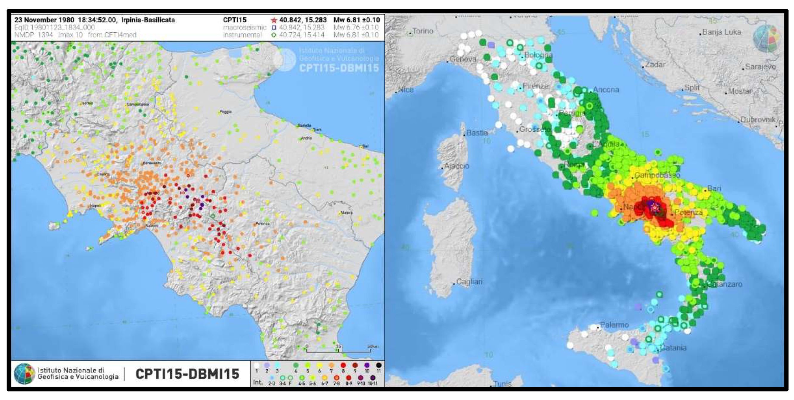
Figure 1. Intensity felt reports of the Irpinia-Basilicata 23 November 1980 earthquake (modified by CPTI15 [2]).
Geosciences 12 00173 g001
Figure 2. The photos (a,b), taken in 2004, show the coseismic 1980 fault scarps along M.te Carpineta; the photo (c) shows a paleoseismological trench wall along the Piano di Pecore plain (Photos by Rosa Nappi).
Geosciences 12 00173 g002
Figure 3. The coseismic 1980 fault scarp along M.te Carpineta, 40 years later (Photos by Giuliana Alessio, October 2020).
Geosciences 12 00173 g003
Figure 4. First macroseismic study published about two months after the 23 November 1980, earthquake (January 1981), showing preliminary intensity assessment by PFG researchers [29].
Geosciences 12 00173 g004
Figure 5. Macroseismic survey of the 23 November 1980 earthquake presented at the 7ECEE conference in Athens in 1982 [3].
Geosciences 12 00173 g005
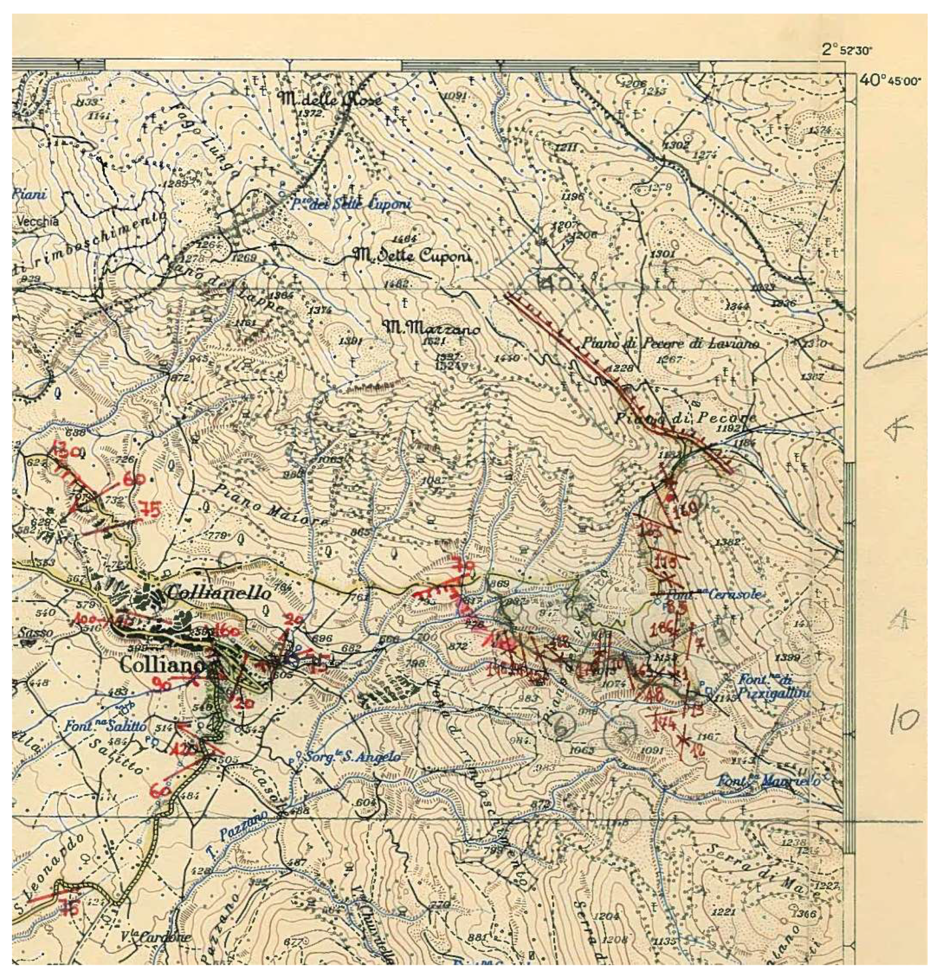
Figure 6. Detail of the original 1:25,000 scale topographical map with the most important geological effects surveyed by Italian geologists immediately after the earthquake of 23 November 1980 (fractures, landslides, faults by Carmignani et al., 1981 [11], see also Supplementary Materials S1) right top corner, trace of the most relevant primary earthquake ruptures located at Piano di Pecore on Monte Marzano (see also Figure 2c; courtesy of Paolo Scandone, PFG).
Geosciences 12 00173 g006
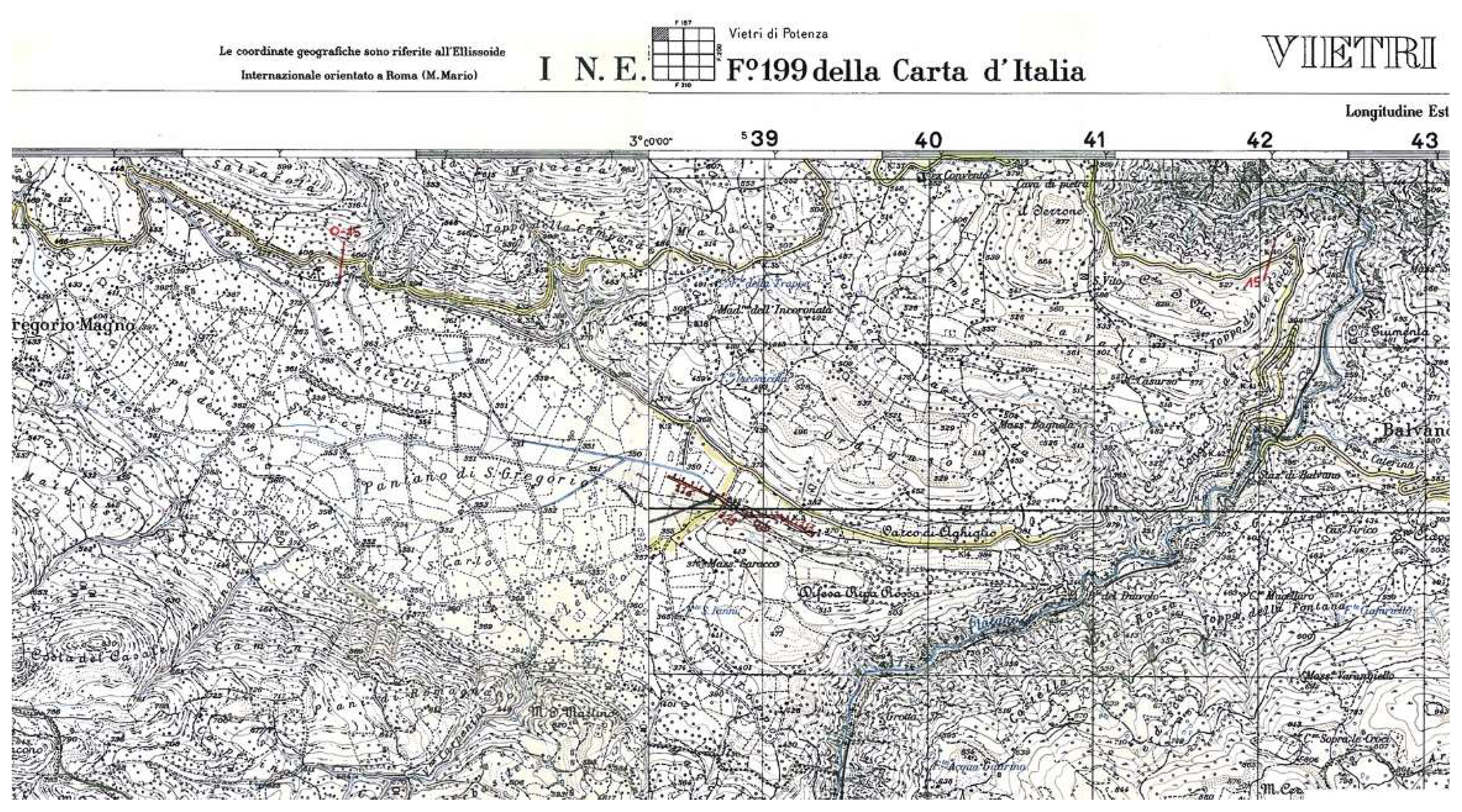
Figure 7. Detail of the original 1:25,000 scale topographical map with the most important geological effects surveyed by Italian geologists immediately after the earthquake of 23 November 1980 (fractures, landslides, faults by Carmignani et al., 1981 [11], see also Supplementary Materials S1); note the trace of the most relevant primary earthquake ruptures located at Pantano di San Gregorio (courtesy of Paolo Scandone, PFG).
Geosciences 12 00173 g007
Figure 8. Some of the most important CNR-PFG publications; left, the volume of preliminary seismic microzonation studies for 39 locations severely affected by the 1980 earthquake [35]; center, the atlas collecting the isoseismal maps of the most important Italian earthquakes (1985, [36]); right, the catalogue of Italian earthquake from 1000 to 1980 of the CNR-PFG [37].
Geosciences 12 00173 g008
Publisher’s Note: MDPI stays neutral with regard to jurisdictional claims in published maps and institutional affiliations.