
Celestial Light Marker: An Engineered Calendar in a Topographically Spectacular Geoscape


Abstract
1. Introduction
- Celestial specialists, including sky watchers (or the term astronomers) and light-marking engineers, were needed to produce this complex light marker and associated ceremonial areas.
- Both celestial lights during both the day and night could have been marked.
- Different celestial light sources, such as stars, patterns of celestial objects, planets, our moon, and our sun, were probably involved.
- The documented purpose of marking and keeping track of celestial lights over time, according to tribal representatives, involved knowing the time of the season and coordinating ceremonies needed to balance the world and help it sustain life. Time was a critical marker of life events.
2. Ethnographic Background Studies
2.1. Case One: Solar Calendar in Utah
2.2. Case Two: Arches National Park, Utah
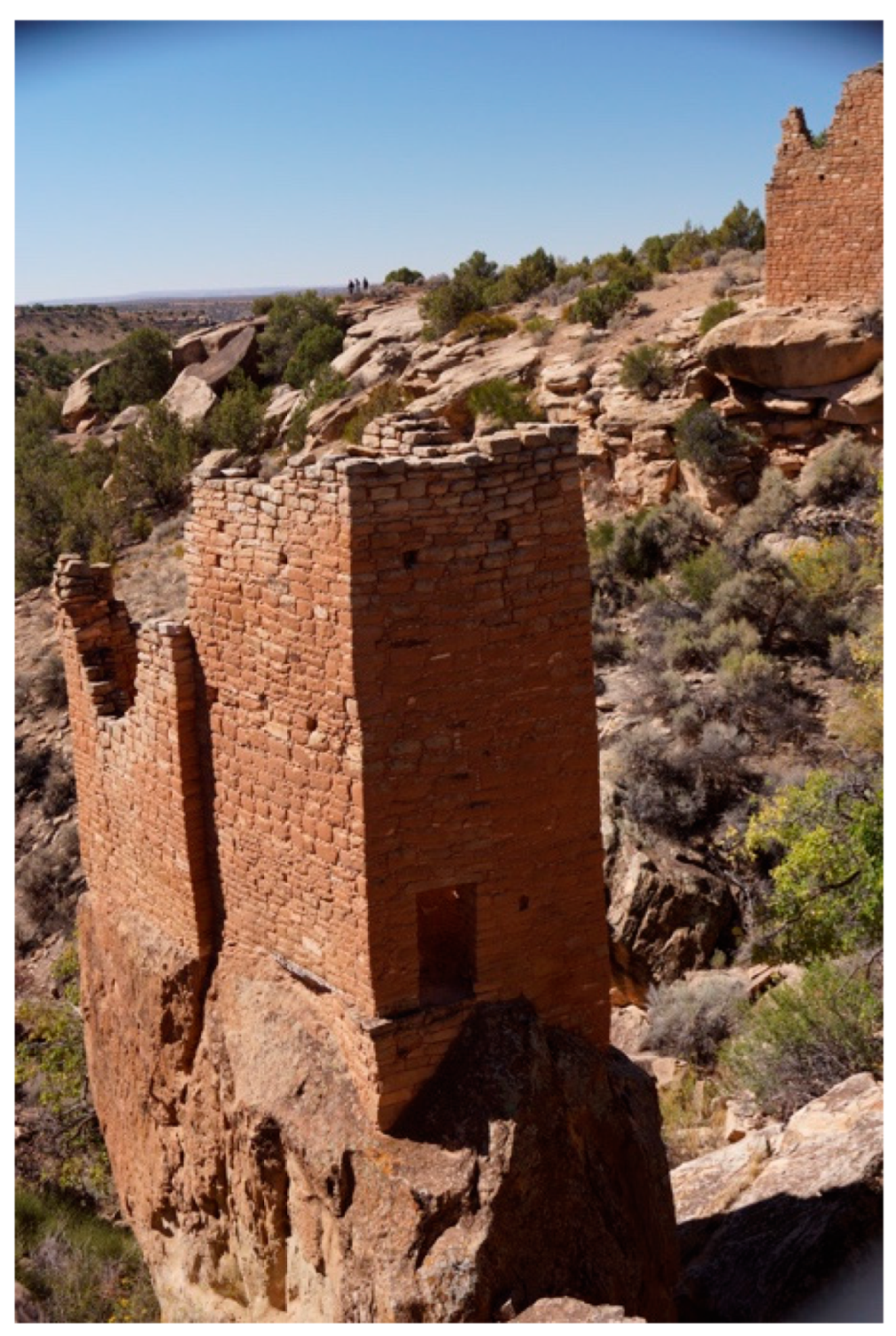
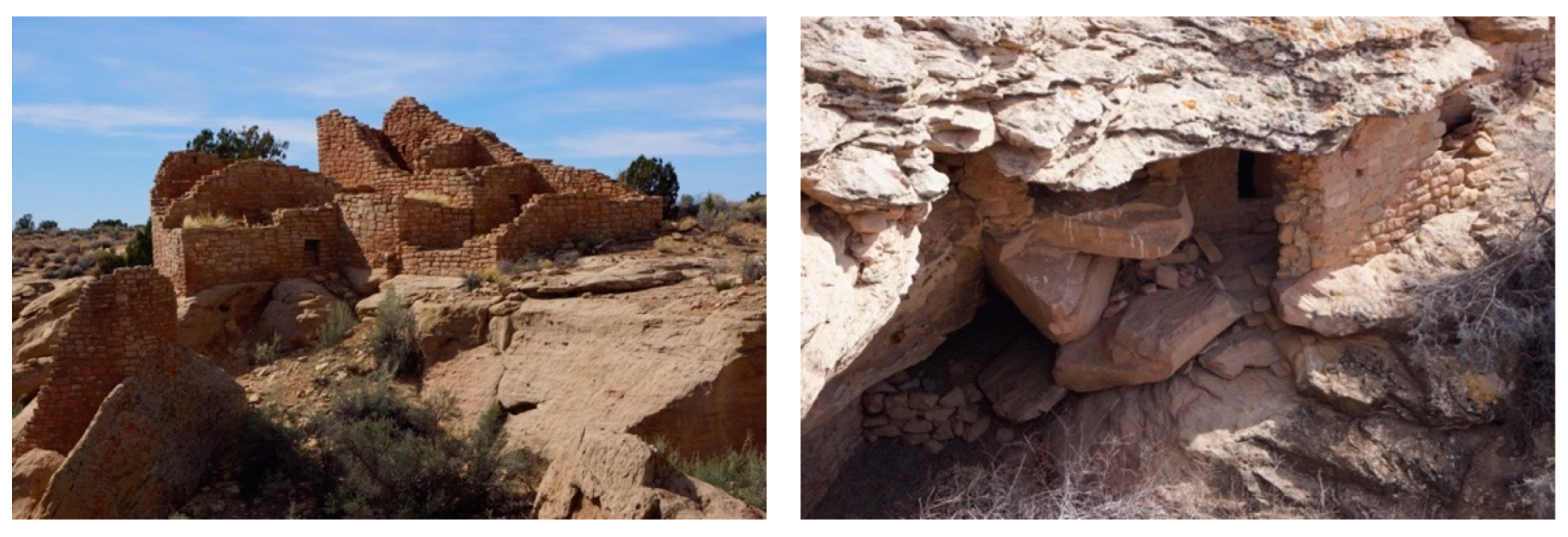
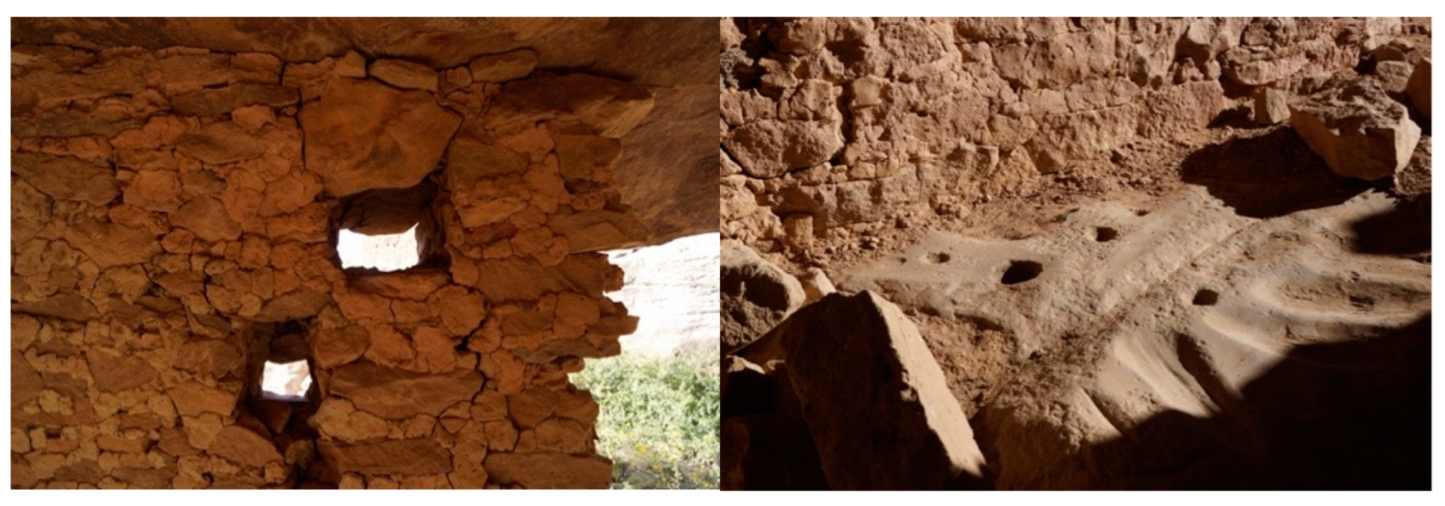
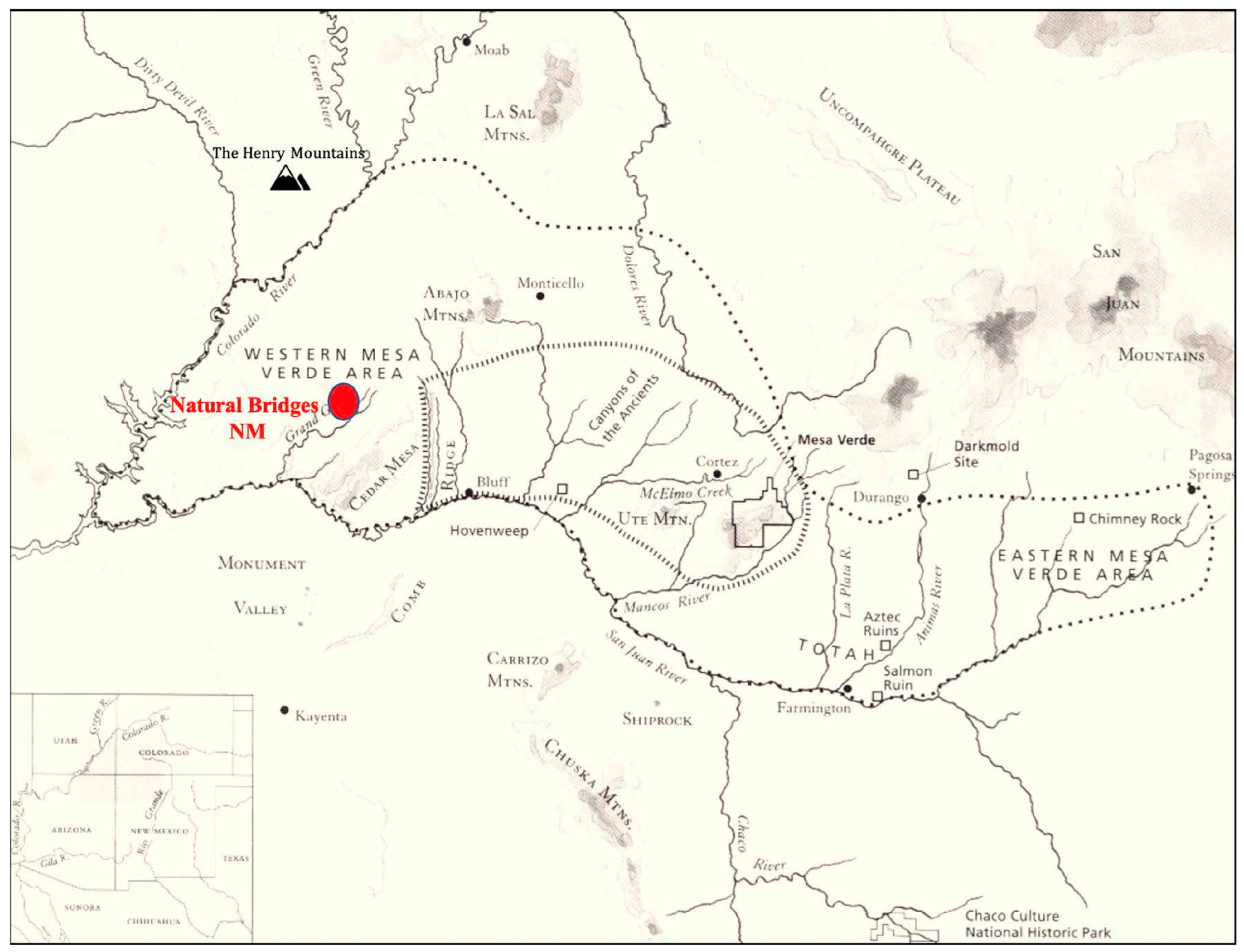
2.3. Case 3: Hovenweep National Monument, Utah and Colorado
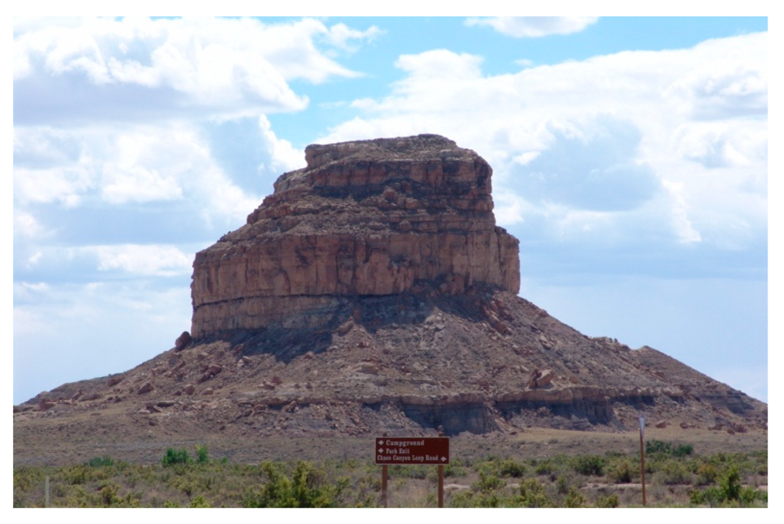
2.4. Case Four: Fajada Butte, Chaco Culture National Historic Park, New Mexico
- 1.
- Prayer shrine on top of Fajada Butte;
- 2.
- Contemporary ceremonial area on top, now used by the Native American Church;
- 3.
- Eagle’s Nest edge, rim of the Butte, and falling feathers;
- 4.
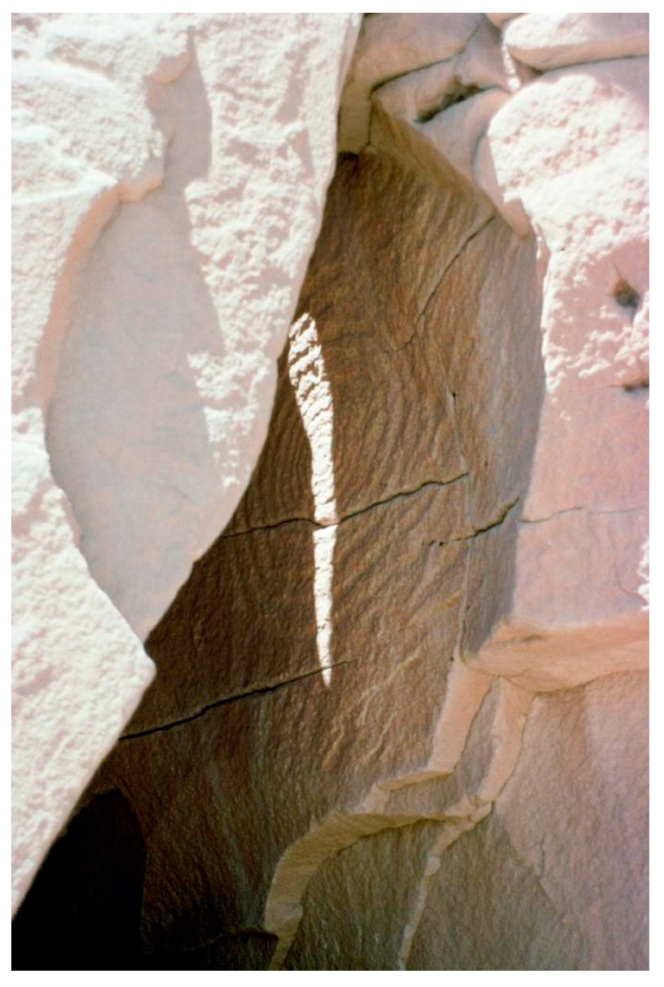
- Sun Dagger just below the top of the Butte;
- 5.
- Rooms where astronomers lived along the edge of the upper side;
- 6.
- Calendars and symbols near the roofs of astronomers’ rooms;
- 7.
- Minerals, mostly on top;
- 8.
- Hogan on the lower flank of Fajada Butte;
- 9.
- Petroglyph panel away from the base of Fajada Butte;
- 10.
- Support for family living and cooking quarters—north and south of Fajada Butte;
- 11.
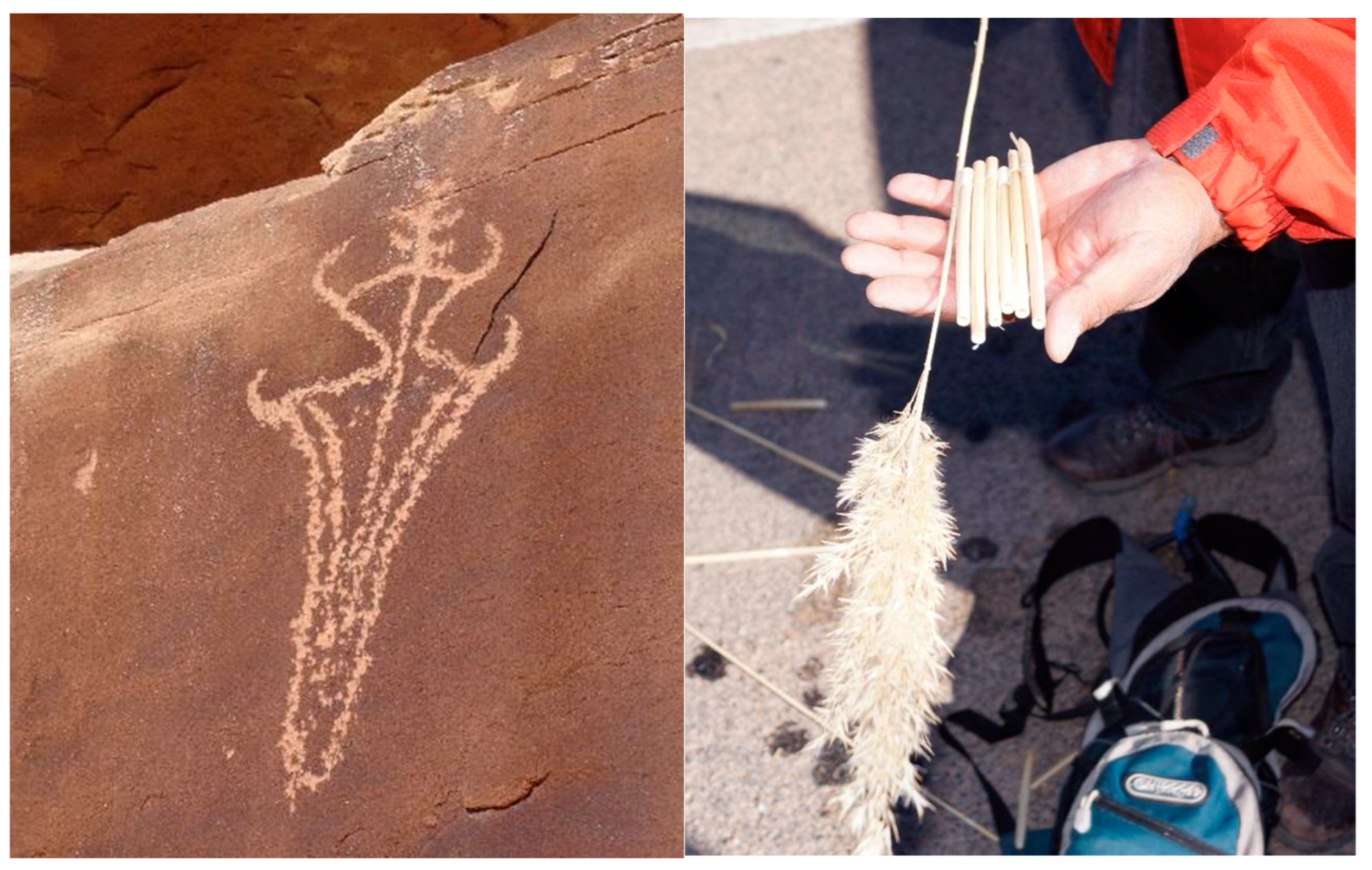
- Plants used by American Indians are widely distributed around the base of the Butte.
3. Tsa’aktuyga (A Hopi Perspective)
Ta’a, pay nu’ yev tuyqat tungway’a, hal owi, pan itam aw wuuwaya kye i’ pamhimu papiq oovi piw tu’awi’ytaqw pam himu taawa haqe’ qalawmaqwtsa’lawngwu; himu tiingaviwngwu. Pam songa put aw awiwaniqw paniqw payoovi itam panwat tungwayani, Tsa’aktuyga. Papiq pam ang tuvoyla’at pe jryunggwhaqe’ taawa pakye’, haqe’ galawmagw put pant hapi tsa’lawngwu so’onge yaapiqooveqa. Pay yan itam son it qa aw oovi panayani, Hopivewat tsa’aktuyga.Tsa’akmongwit hapi i’ tiingappi’ata, tsa’lawpi’at piiwu.(Translated by Hopi Scholar Emory Sekaquaptewa)
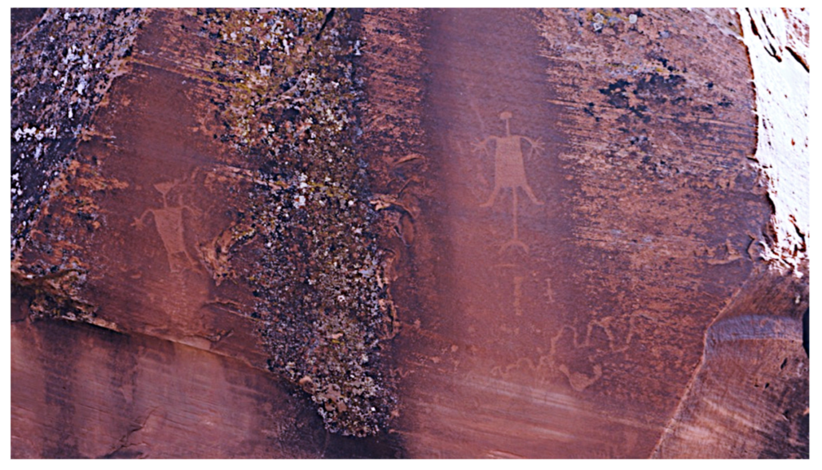
Verily, I have given a name to the rock point here, that is to say, we have concluded that this is something that represents the place from which someone [appropriate] makes his announcements giving the positions of the sun [from season to season]; so that preordination of life- giving activities [i.e., ceremonies, planting, harvesting, etc.] can be given. It is undoubtedly used for that purpose, that is the reason we have given it the name, Tsa’aktuyqa. There are line drawings [on the rock] up there for marking sunsets [on the horizon], telling the positions of the sun that he must announce from up there. This is the way we are going to enter it [in the report], that according to Hopi practice this is the announcing point. The Crier Chief uses this as his place of declaring preordinations, his announcements. (Figure 10)
4. A Western Scientific Perspective
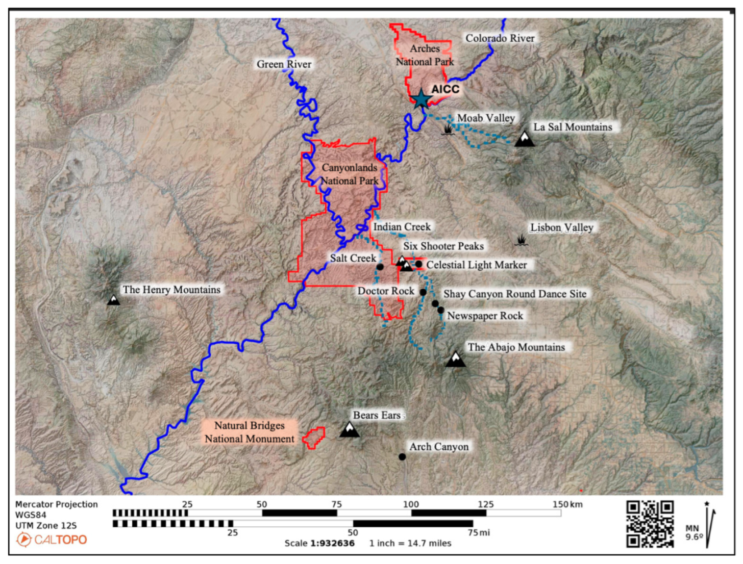
5. The Study Area
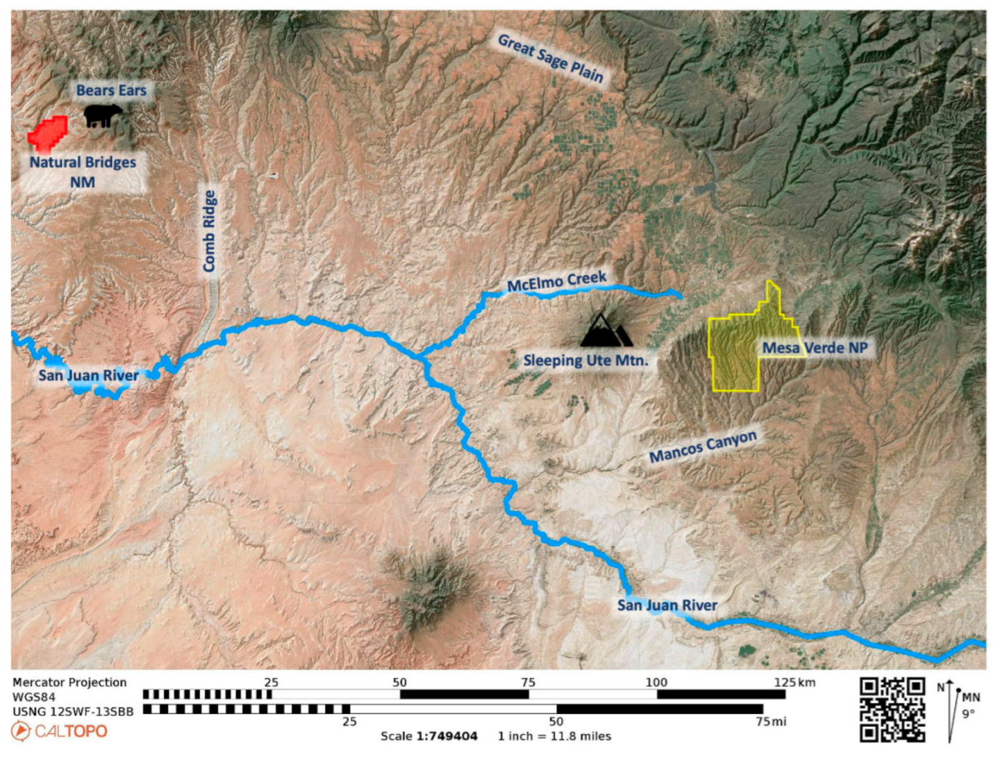
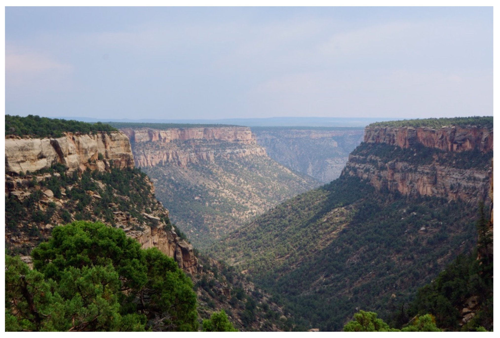
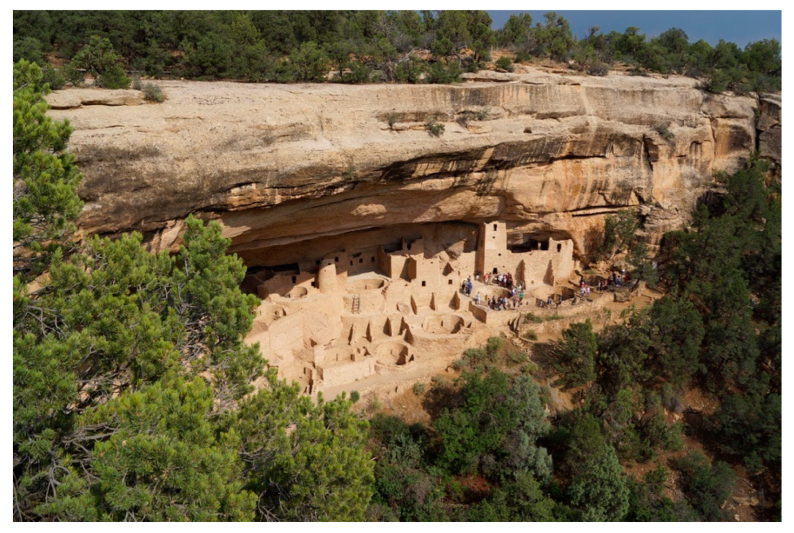
The Mesa Verde World
6. Methods
6.1. Canyonlands National Park EOA
6.2. BLM Utah Monticello Field Office Ethnographic Information Partnership
6.3. Issues of Ethnographic Analysis
6.4. Group Interpretation Agreement
6.5. Tribally Specific Interpretations
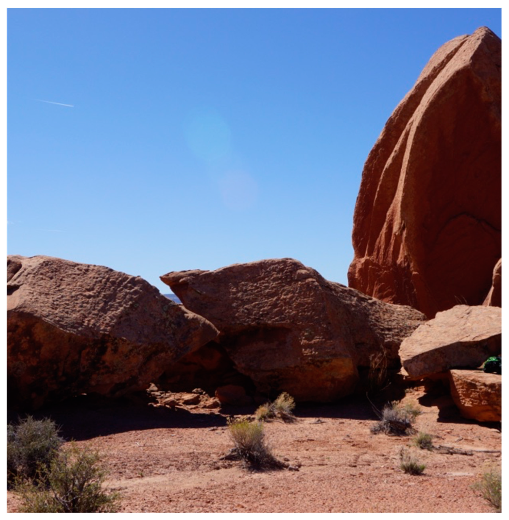
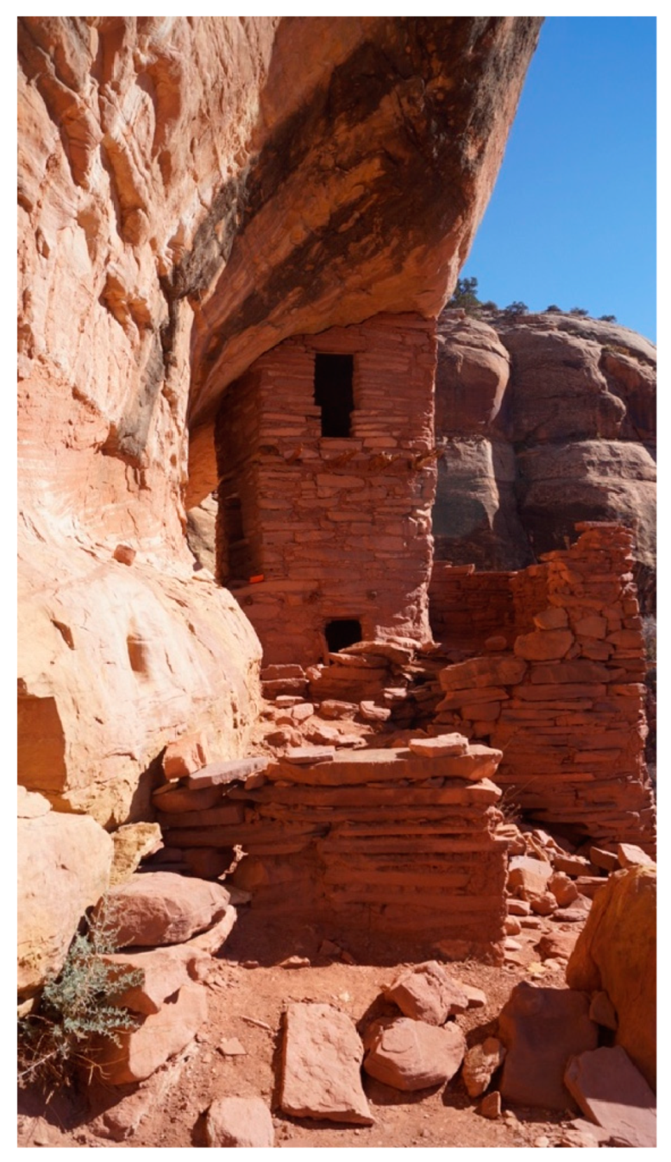
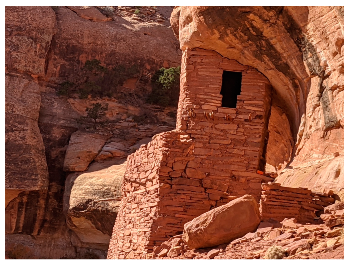
7. The Celestial Light Marker
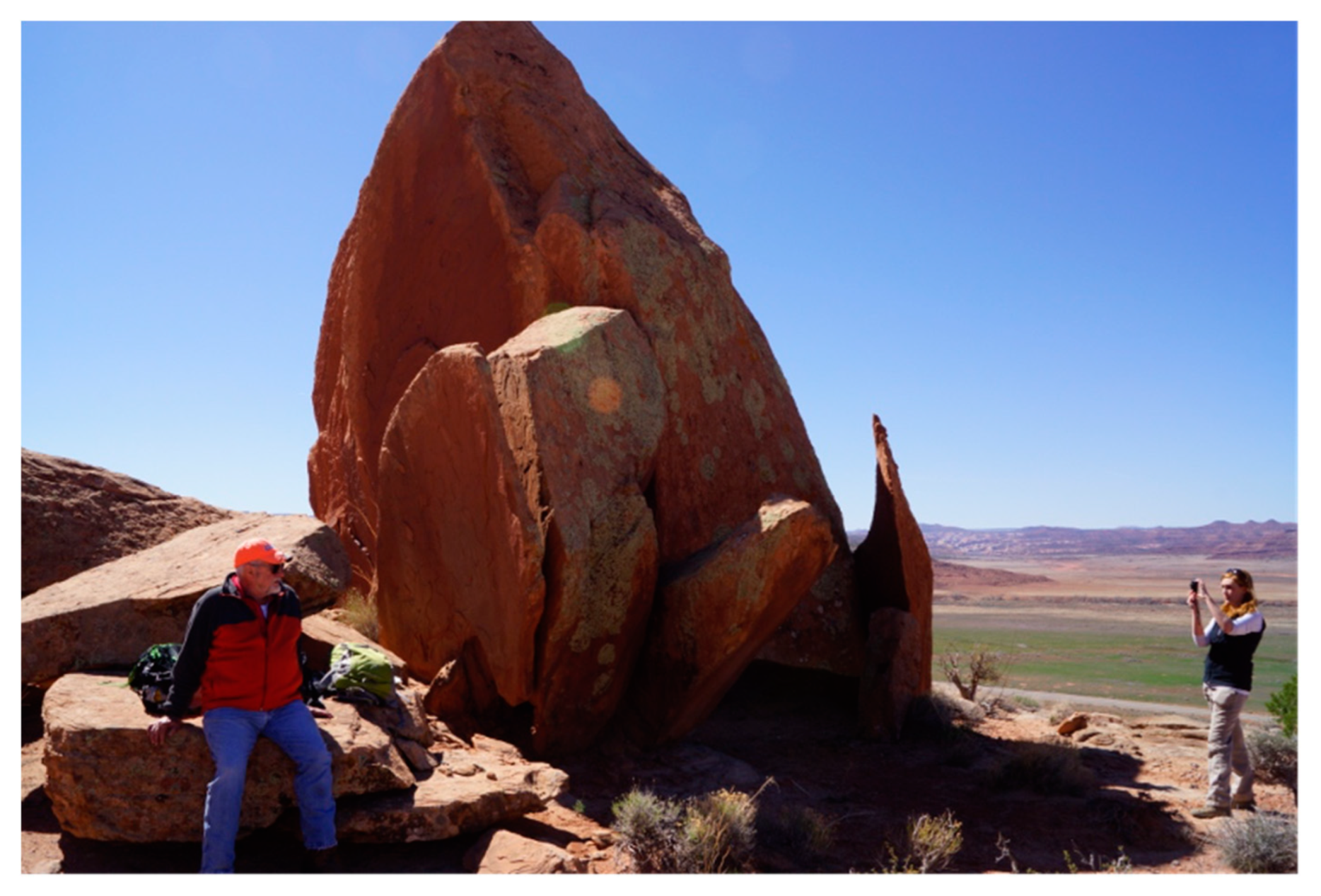
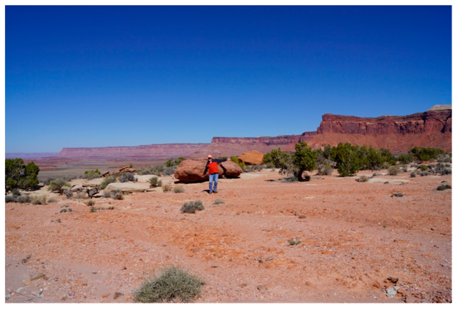
7.1. Fallen Mesa Remnant
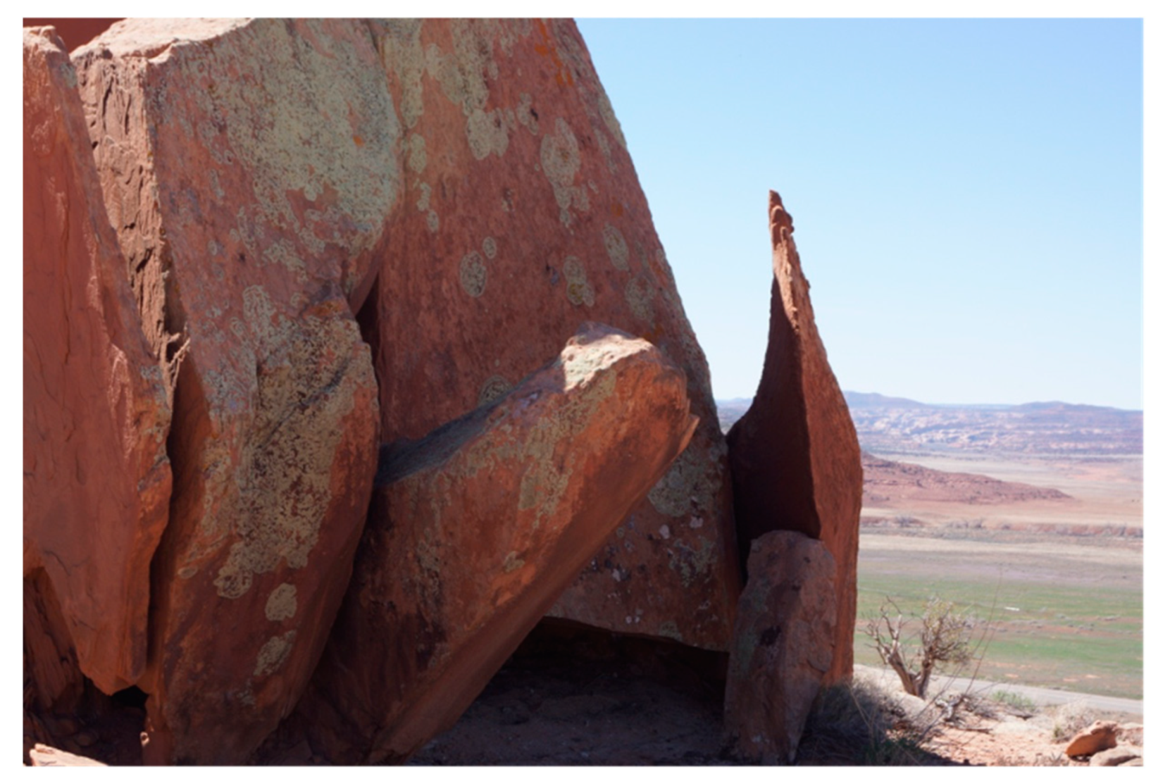
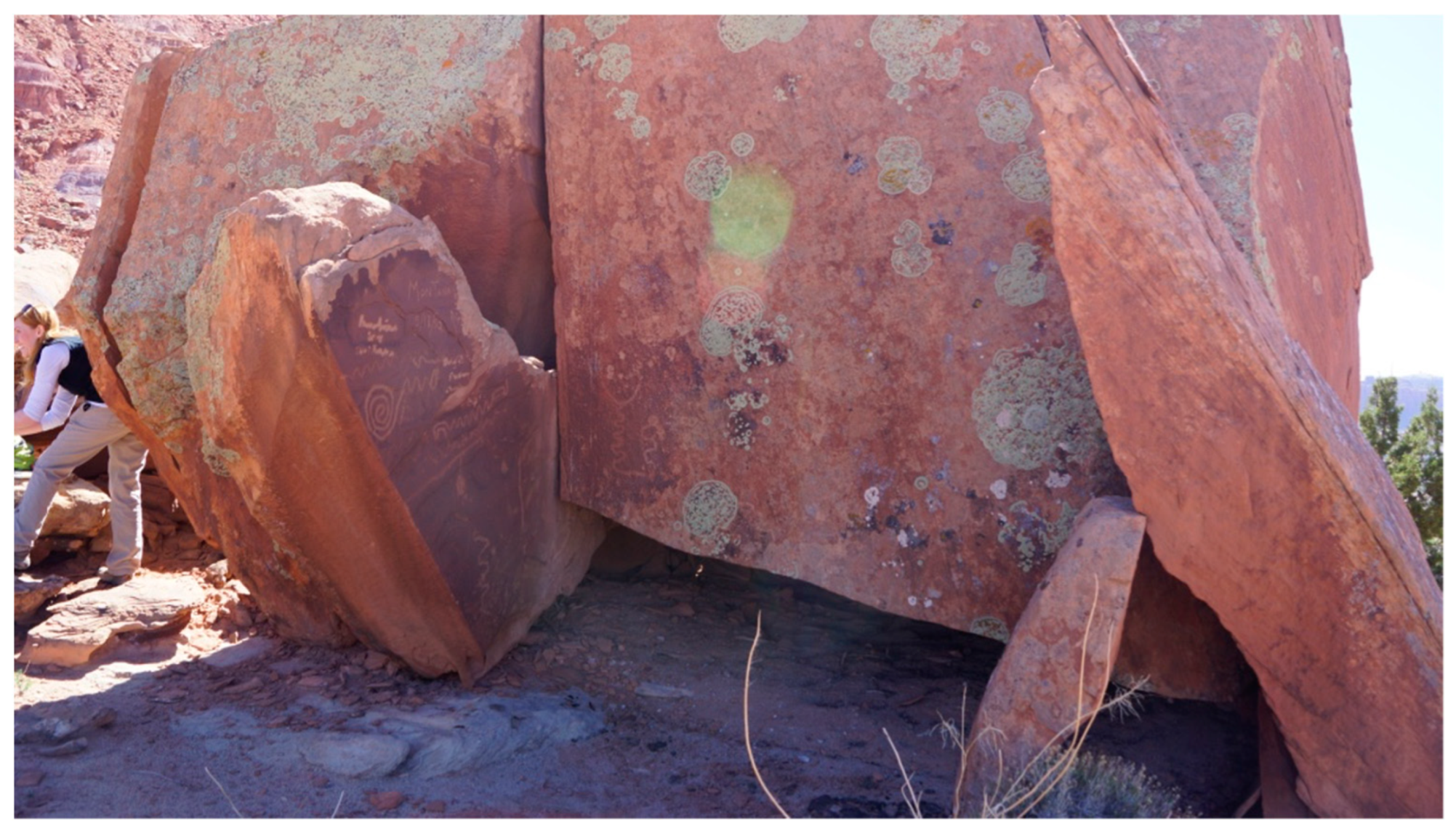
7.2. Upturned and Supported Stone Slab
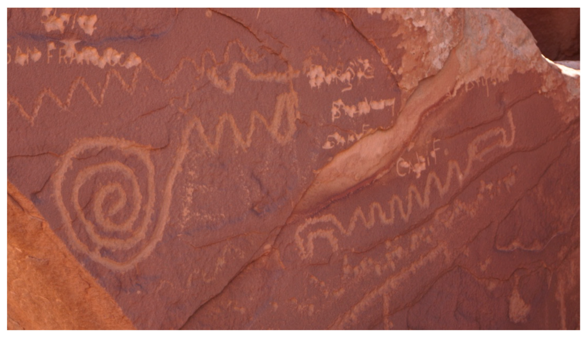
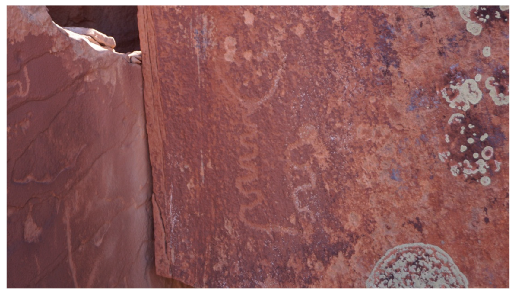
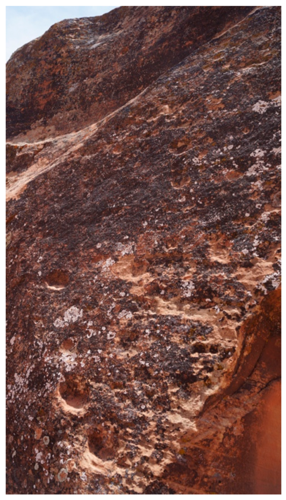
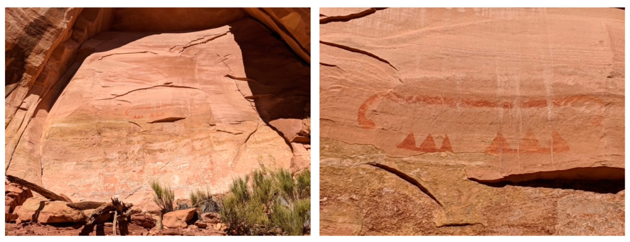
7.3. Celestial-Light-Marking Peckings
7.4. The Dance Grounds
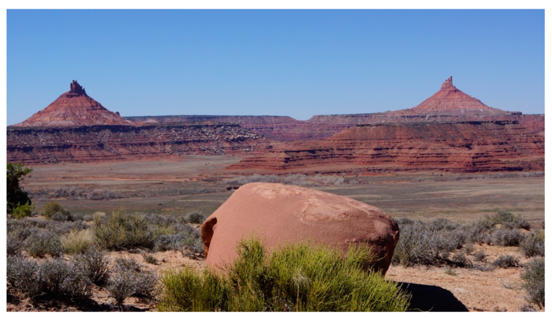
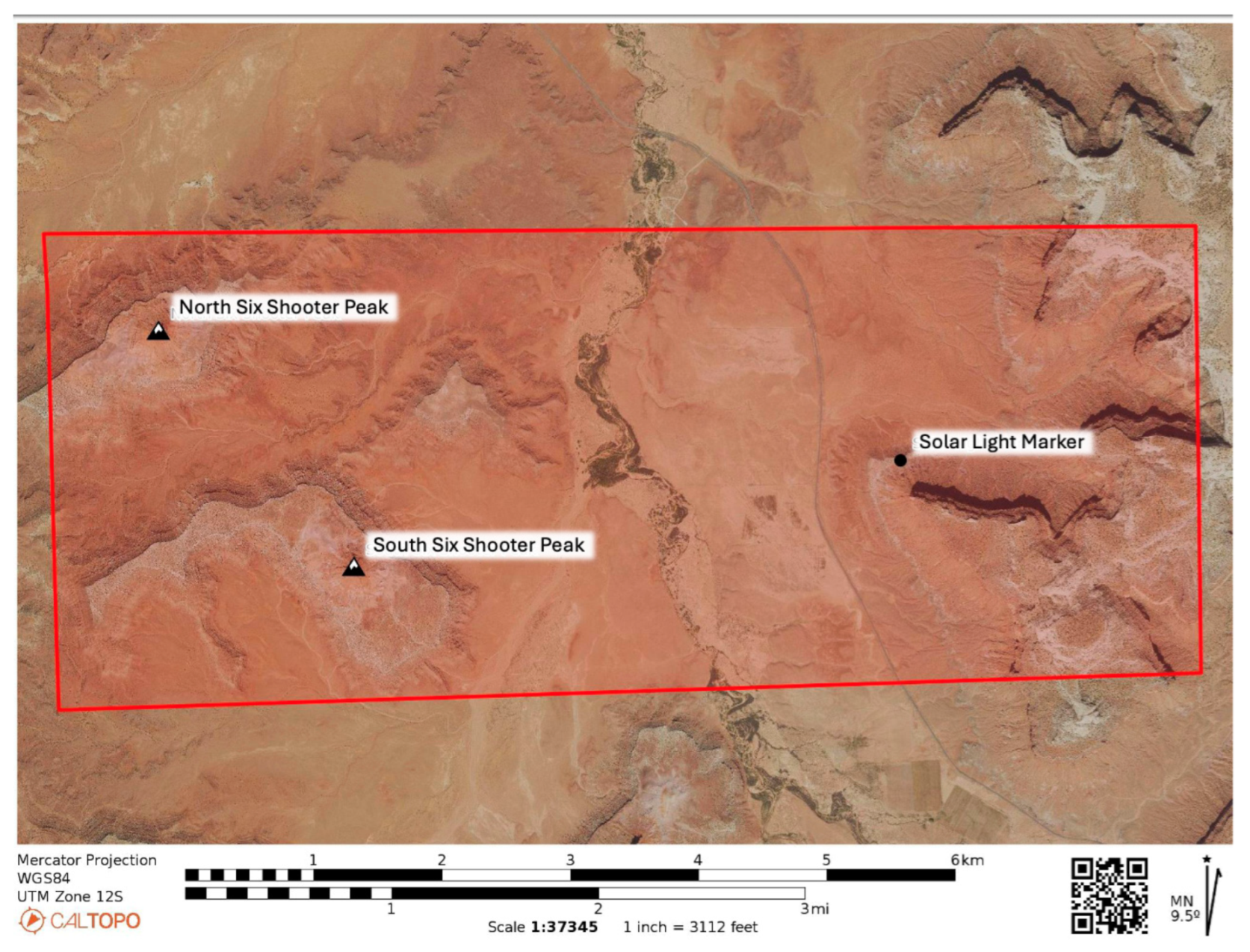
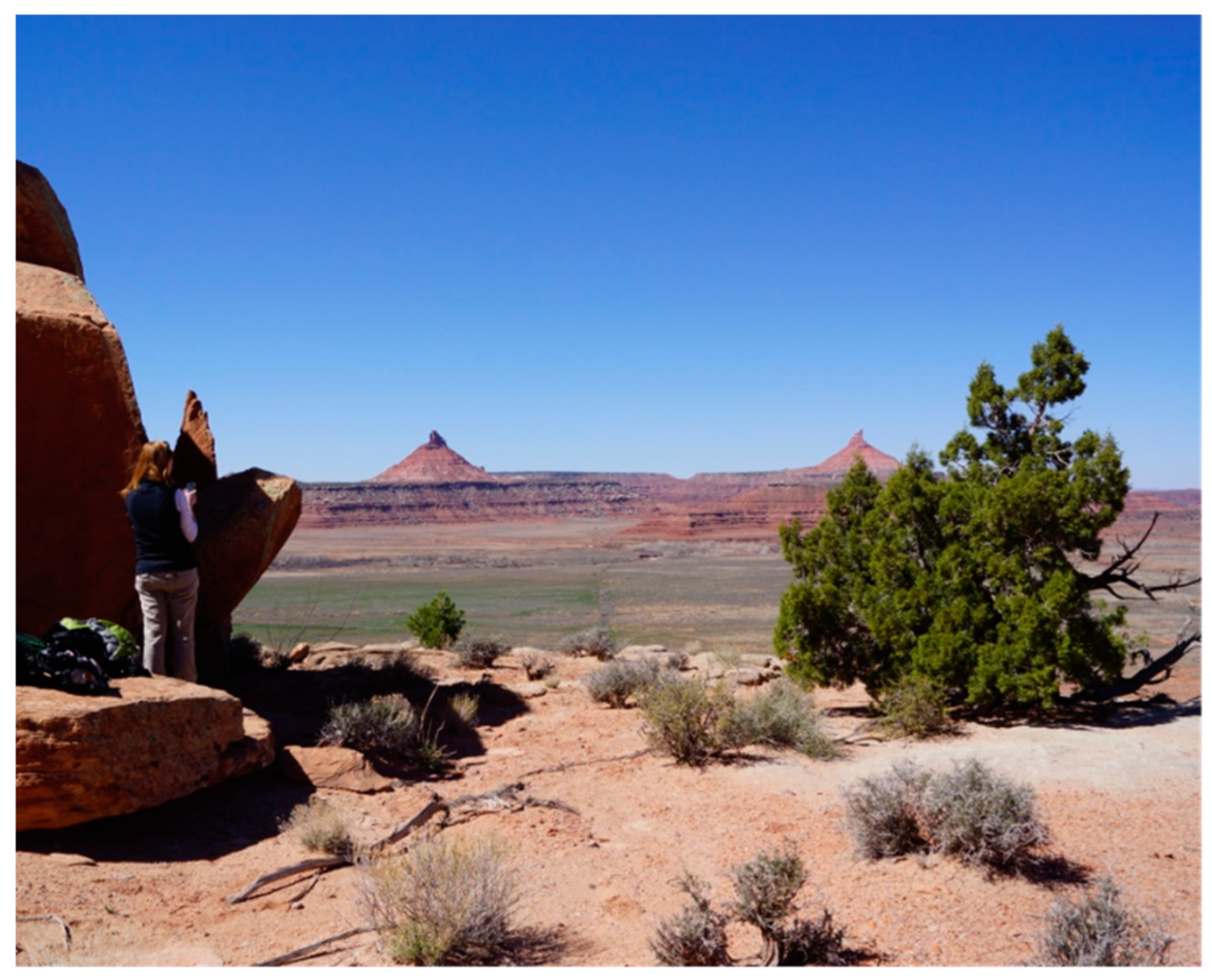
7.5. The Bracketing Peaks
I am just speculating but, of these two points [Six-Shooter Peaks], I am sure there is something there, a site or something that uses these two as a calendar. Maybe the sun goes far to the left during the summer solstice and comes back during the winter solstice, in between the two. I am sure that it is very significant in some way during that time of the year. There may be something to the west of this area.
So that [solar panel] is the observation point. When you have something like that, there is probably something like the mounds [in Indian Creek] you guys just passed. When you get to that point, you look west and east. There is going to be something prominent, either a structure or something there, or a shrine that they used in ceremonies. So that would tell them the times of year. When it reaches its point, then certain ceremonies or things would happen.
8. Analysis Summary: Eleven Key Features
- It is located in a spectacular geological landscape or geoscape.
- It involves views of distant sacred Sky Islands, which are snowcapped mountains.
- It spans Indian Creek, which is a spiritual area that (a) derives from the Abajo Mountains, a Sky Island, (b) contains miles of continuous rock peckings and paintings, and (c) is a tributary of the sacred Colorado River.
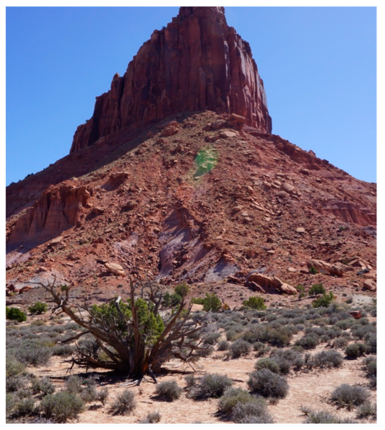
- It is visually bracketed to the west by the tall and narrow sandstone Six-Shooter Peaks.
- It receives celestial light that comes from between the peaks and especially a U-shaped dip between the peaks.
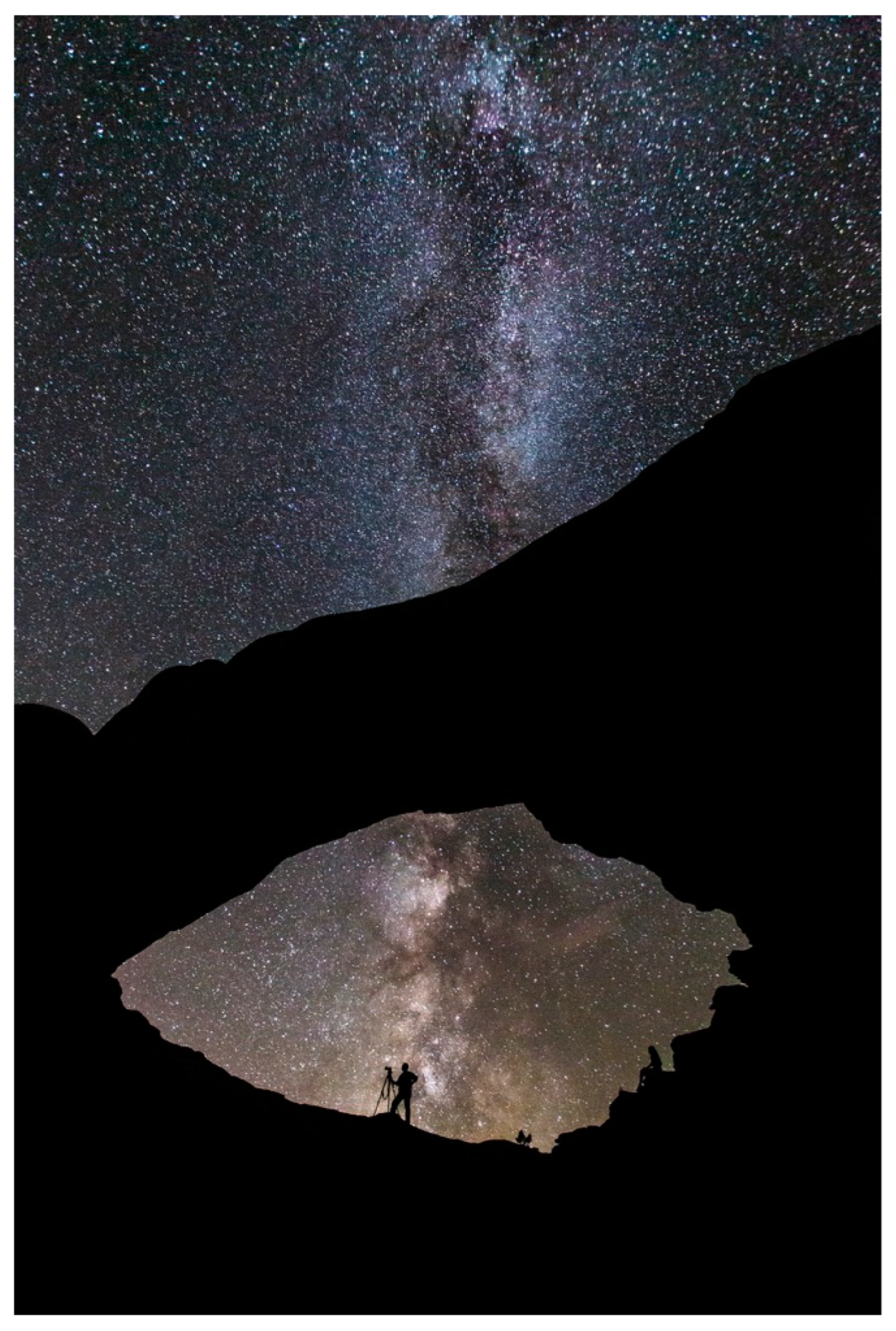
- Celestial lights rise and set as planets, stars, patterns of lights, and the Milky Way.
- It is built from a fallen remnant of a 6601-foot mesa but persists as a geosite isolated on a narrow, high ledge above Indian Creek.
- It is associated with a large flat dance and ceremonial area covered with offerings.
- It is near populous ancient Native American irrigated farming communities.
- It is within the viewscape of lands managed by the Bureau of Land Management and the National Park Service.
- It is touched and valued by millions of national and international tourists, including hikers, ecologists, archaeologists, and technical rock climbers.
9. Indian Creek Geoscape
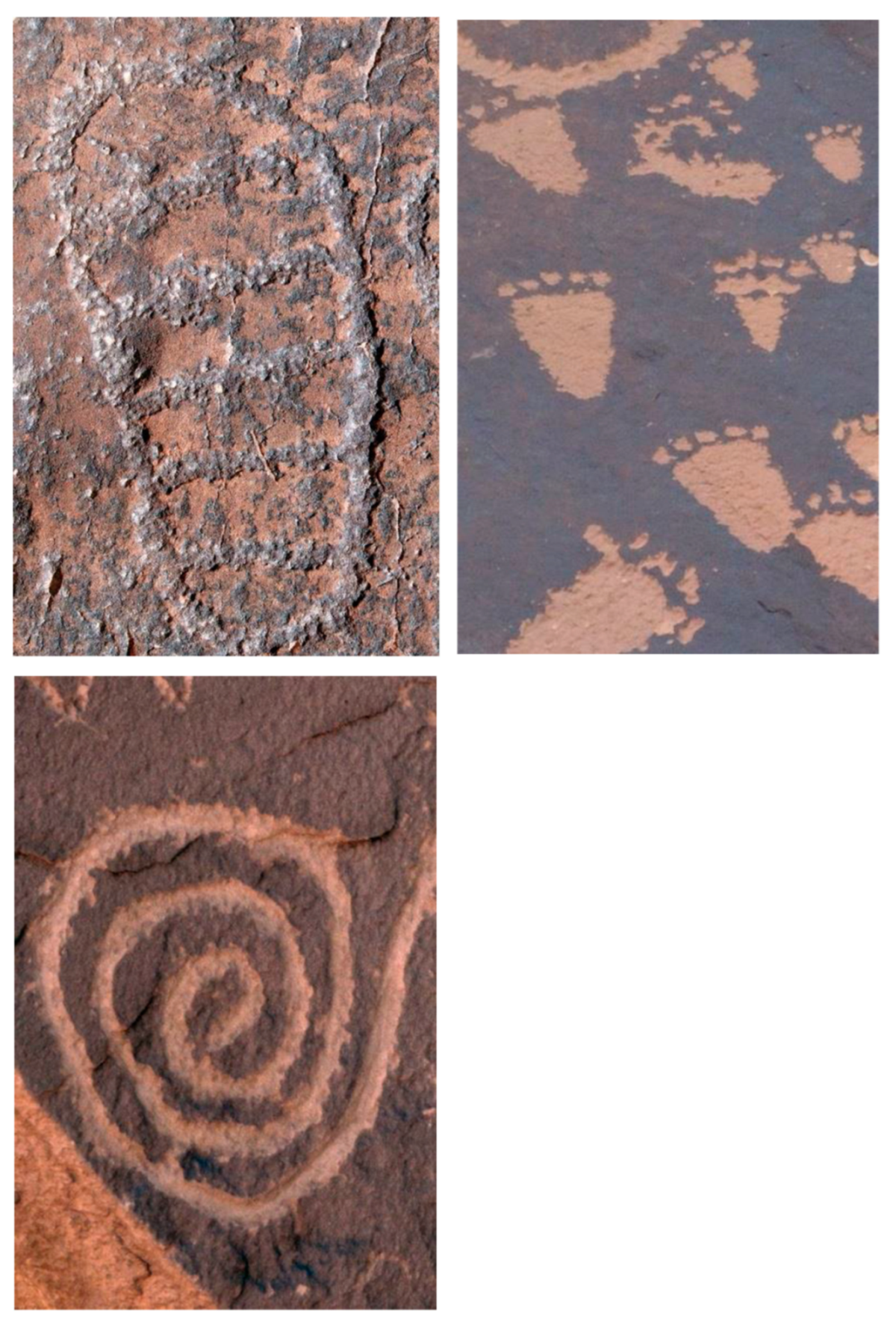
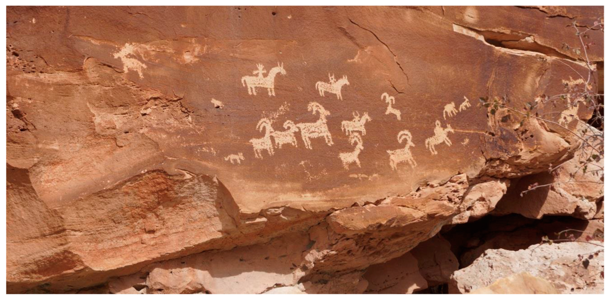
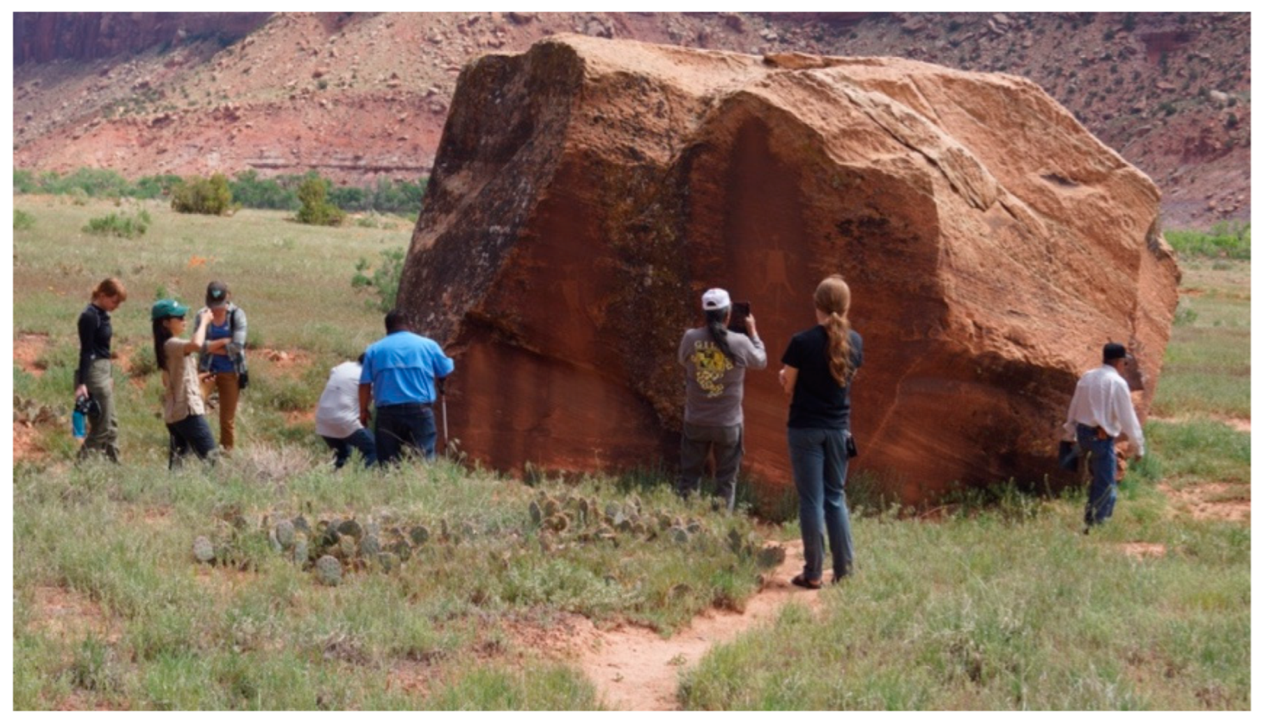
9.1. Geosite One: Newspaper Rock
The other ones, the circles with asterisks inside of it, some of those represent all edible flowers before they bear fruits. See that is why there is abundance here. And when you see all these associated, next to the baby footprints, it is telling us there is abundance. Especially the left handprint, see that left handprint there? Left hand is a feminine symbol. It means prosperity, it means longevity everything good is a left symbol. A right-hand symbol is completely the opposite. That means challenges. It is masculine. It also means strength or power. The left hand is everything good. Especially if you see baby footprints or handprints next to that. It is really a good story written on this side.
[Newspaper Rock] is saying a lot. A lot of activity going on, like hunting buffalo, deer, and bighorn sheep. A lot of it is drawn over old inscriptions. See the dark ones are underneath and the light ones are on top? See the man on the horse? I believe the most recent ones are Ute.
It is a good name, newspaper, but we call them libraries of our history. Our ancestors left this information behind so that in the future, when their children, us, come back, we can identify what they left behind. I am really thankful that our ancestors had the foresight to look into their future and leave information like this behind.
The footprints and then the handprints, especially the left handprint is a very good symbol. And then baby footprints are a really good sign. There are certain styles of footprints that are modern versus ancient. The one on the left is ancient. This one I think is relatively old. See those baby foots? It symbolizes something, a very good life that they had at that time. A lot of children were born, really good crops and plenty of game, stuffs like that.
9.2. Geosite Two: Medicine Area and Doctor Rock
9.3. Geosite Three: Cliff Complex
10. Heritage of Indian Creek
11. Discussion
The World According to Pimm and Tribal Elders
Supplementary Materials
Author Contributions
Funding
Data Availability Statement
Conflicts of Interest
References
- Angelbeck, Bill, Chris Springer, Johnny Jones/Yaqalatqa, Glyn Williams-Jones, and Michael C. Wilson. 2024. Líĺwat Climbers Could See the Ocean from the Peak of Qẃelqẃelústen: Evaluating Oral Traditions with Viewshed Analyses from the Mount Meager Volcanic Complex Prior to Its 2360 BP Eruption. American Antiquity 89: 378–98. [Google Scholar] [CrossRef]
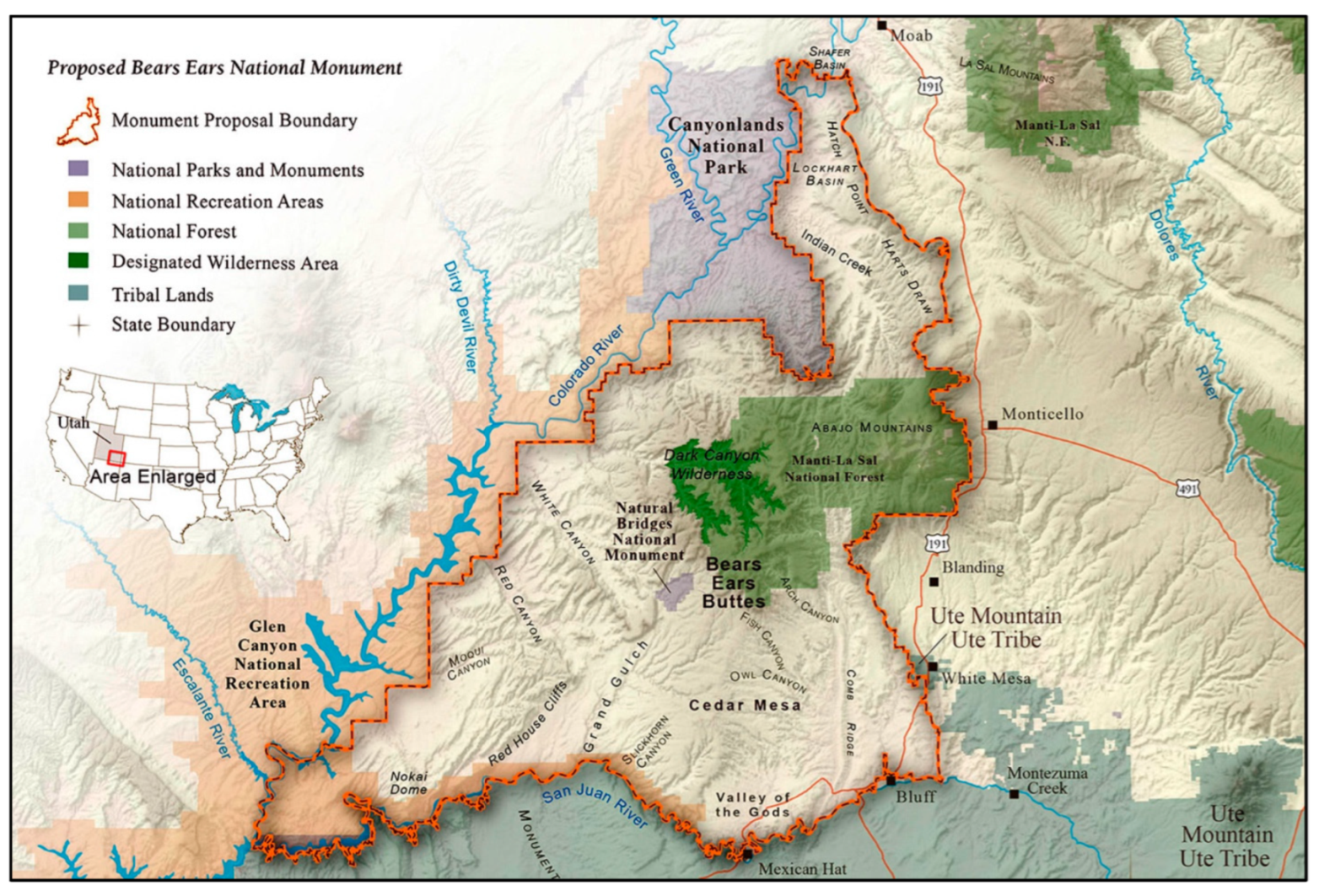
- Bears Ears Intertribal Coalition. 2025. Bears Ears National Monument Map. Available online: https://www.bearsearscoalition.org/wp-content/uploads/2017/01/uw_BearsEars_Proclamation_8.5x11.pdf (accessed on 11 February 2025).
- Bennett, Matthew R., David Bustos, Jeffrey S. Pigati, Kathleen B. Springer, Thomas M. Urban, Vance T. Holliday, Sally C. Reynolds, Marcin Budka, Jeffrey S. Honke, Adam M. Hudson, and et al. 2021. Evidence of humans in North America during the Last Glacial Maximum. Science 373: 1528–31. [Google Scholar] [CrossRef] [PubMed]
- Brocx, Margaret, and Vic Semeniuk. 2017. Towards a Convention on Geological Heritage (CGH) for the Protection of Geological Heritage. Geophysical Research Abstracts 19: EGU2017-11284. [Google Scholar]
- Brocx, Margaret, and Vic Semeniuk. 2022. Geoparks, Geotrails, and Geotourism—Linking Geology, Geoheritage, and Geoeducation. Available online: https://www.mdpi.com/journal/land/special_issues/geoparks_geotrails_geotourism (accessed on 20 February 2025).
- Canyons of the Ancients. 2024. Canyons of the Ancients National Monument; Cortez Colorado: Bureau of Land Management. Available online: https://www.blm.gov/programs/national-conservation-lands/colorado/canyons-of-the-ancients (accessed on 20 February 2025).
- Grayson, Donald K. 1993. The Desert’s Past: A Natural Prehistory of the Great Basin. Washington, DC: Smithsonian Institution Press. [Google Scholar]
- International Union for Conservation of Nature. 2024. World Commission on Protected IUCN 2024. International Union for Conservation of Nature. World Commission on Protected Areas 2021–2025. Available online: https://iucn.org/our-union/commissions/iucn-world-commission-protected-areas-2021-2025 (accessed on 20 February 2025).
- IUGS. 2024. IUGS: International Commission on Geoheritage. Available online: https://iugs-geoheritage.org/ (accessed on 16 December 2024).
- Johnson, Edward A., and Susan M. Aldridge, eds. 2024. Natural Science and Indigenous Knowledge: The Americas Experience. Cambridge: Cambridge University Press. [Google Scholar] [CrossRef]
- Kohler, Timothy A., Mark D. Varien, Aaron M. Wright, and Kristin A. Kuckelman. 2012. Mesa Verde Migrations: New Archaeological Research and Computer Simulation Suggest Why Ancestral Puebloans Deserted the Northern Southwest United States. American Scientist 96: 146–53. [Google Scholar] [CrossRef]
- Loubser, Johannes H. N., and Scott Ashcraft. 2020. Gates Between Worlds: Ethnographically Informed Management and Conservation of Boulders in the Blue Ridge Mountains. In Cognitive Archaeology: Mind, Ethnography, and the Past in South African and Beyond. Edited by David Whitley, Johannes Loubser and Gavin Whitelaw. London: Routledge, Taylor Francis Group, pp. 247–69. [Google Scholar]
- Muzambiq, Said, Robert Sibarani, Zaid Perdana Nasution, and Gustanto Gustanto. 2024. Geoheritage and Cultural Heritage Overview of the Toba Caldera Geosite, North Sumatra, Indonesia. Smart Tourism 5: 2517. [Google Scholar] [CrossRef]
- National Park Service. 2024. Fajada Butte: Chaco Culture National Historical Park. Available online: https://www.nps.gov/places/fajada-butte-overlook.htm (accessed on 16 December 2024).
- National Park Service, and Jacob W. Frank. 2024. North Window and Milky Way. Available online: https://www.nps.gov/media/photo/gallery-item.htm?id=264B17EA-155D-451F-67A77ACA100D7BD2&gid=275B0E39-155D-451F-6752DA81D6E6018D (accessed on 16 December 2024).
- Noble, David Grant. 2006. The Mesa Verde World: Explorations in Ancestral Pueblo Archaeology. Santa Fe: School of American Research Press. [Google Scholar]
- NRC. 2001. Marine Protected Area: Tools for Sustaining Ocean Ecosystems. National Research Council. Washington, DC: National Academies Press. [Google Scholar] [CrossRef]
- Pigati, Jeffrey S., Kathleen B. Springer, Jeffrey S. Honke, David Wahl, Marie R. Champagne, Susan R. H. Zimmerman, Harrison J. Gray, Vincent L. Santucci, Daniel Odess, David Bustos, and et al. 2023. Independent age estimates resolve the controversy of ancient human footprints at White Sands. Science 382: 73–75. [Google Scholar] [CrossRef] [PubMed]
- Pimm, Stuart L. 1991. The Balance of Nature?: Ecological Issues in the Conservation of Species and Communities. Chicago: University of Chicago Press. [Google Scholar]
- Pimm, Stuart L. 2001. The World According to Pimm: A Scientist Audits the Earth. New York: McGraw-Hill. [Google Scholar]
- Rowe, Timothy B., Thomas W. Stafford, Jr., Daniel C. Fisher, Jan J. Enghild, J. Michael Quigg, Richard A. Ketcham, J. Chris Sagebiel, Romy Hanna, and Matthew W. Colbert. 2022. Human Occupation of the North American Colorado Plateau 37,000 Years Ago. Frontiers in Ecology and Evolution 10: 903795. [Google Scholar] [CrossRef]
- Ruuska, Alex K. 2025. When the Earth Was New Memory, Materiality, and the Numic Ritual Life Cycle. Ogdon: University of Utah Press. [Google Scholar]
- Sjolander-Lindqvist, Annelie, Ivan Murin, and Michael E. Dove. 2022. Anthropological Perspectives on Environmental Communication. Palgrave Studies in Anthropology of Sustainability. Cham: Springer Nature Macmillan. ISBN 9783030780401/3030780406. [Google Scholar]
- Sofaer, Anna, Volker Zinser, and Rolf M. Sinclair. 1979. A Unique Solar Making Construct. Science 206: 283–91. [Google Scholar] [CrossRef] [PubMed]
- Sofaer, Anna P., and Rolf M. Sinclair. 1982. Astronomical Marking Sites on Fajada Butte. Nageezi: Chaco Canyon Center, NPS, Department of the Interior. [Google Scholar]
- Stoffle, Richard, Christopher Sittler, Mariah Albertie, Heather Lim, Christopher Johnson, Cameron Kays, Grace Penry, Daniel Velasco, and Noah Pleshet. 2019. Hovenweep National Monument Ethnographic Overview and Assessment. Tucson: University of Arizona. [Google Scholar]
- Stoffle, Richard, Evely Pickering, Christopher Sittler, Heather Lim, Katherine Brooks, Kathleen Van Vlack, Chelsea Forer, and Mariah Albertie. 2017. Ethnographic Overview and Assessment for Canyonlands National Park. Tucson: University of Arizona. [Google Scholar]
- Stoffle, Richard, Evelyn Pickering, Katherine Brooks, Christopher Sittler, and Kathleen Van Vlack. 2016. Ethnographic Overview and Assessment for Arches National Park. Tucson: Bureau of Applied Research in Anthropology, School of Anthropology. [Google Scholar]
- Stoffle, Richard, Glen Rogers, Ferman Grayman, Gloria Bulletts Benson, Kathleen Van Vlack, and Jessica Medwied-Savage. 2008. Timescapes in Conflict: Cumulative Impacts on a Solar Calendar. Impact Assessment and Project Appraisal 26: 209–18. [Google Scholar] [CrossRef]
- Stoffle, Richard, Octavius Seowtewa, Cameron Kays, and Kathleen Van Vlack. 2020. Sustainable Heritage Tourism: Native American Preservation Recommendations at Arches, Canyonlands, and Hovenweep National Parks. Sustainability 12: 9846. [Google Scholar] [CrossRef]
- Stoffle, Richard W., Lawrence Loendorf, Diane E. Austin, David B. Halmo, and Angelita Bulletts. 2000. Ghost Dancing the Grand Canyon: Southern Paiute Rock Art, Ceremony, and Cultural Landscapes. Current Anthropology 41: 1–38. [Google Scholar] [CrossRef]
- Stoffle, Richard W., Michael J. Evans, M. Nieves Zedeno, Brent W. Stoffle, and Cindy J. Kesel. 1994. American Indians and Fajada Butte: Ethnographic Overview and Assessment for Fajada Butte and Traditional (Ethnobotanical) Use Study for Chaco Culture National Historical Park, New Mexico. Tucson: University of Arizona. [Google Scholar]
- Stoffle, Richard W., Noah Pleshet, Kathleen Van Vlack, Christopher Sittler, Heather H. Lim, Mariah Albertie, Cameron R. Kays, Christopher M. Johnson, Grace K. Penry, Daniel E. Velasco, and et al. 2022. Natural Bridges National Monument Ethnographic Overview and Assessment. Tucson: University of Arizona. [Google Scholar]
- Stoffle, Richard W., Richard Arnold, and Kathleen Van Vlack. 2024. Native American Science in a Living Universe: A Paiute Perspective. In Natural Science and Indigenous Knowledge: The Americas Experience. Edited by Edward A. Johnson and Susan M. Arlidge. Cambridge: Cambridge University Press. [Google Scholar]
- Tilley, Christopher. 1997. A Phenomenology of Landscape Places, Paths and Monuments. London: Berg Publishers. [Google Scholar]
- Tilley, Christopher. 2004. The Materiality of Stone: Explorations in Landscape. London: Routledge. [Google Scholar] [CrossRef]
- UCAR. 2024. Sun Dagger. Available online: https://www2.hao.ucar.edu/education/prehistoric-southwest/sun-dagger (accessed on 20 February 2025).
- U.S. Congress. 2025. Antiquities Act of 1906. S. Rept. 106–250. Available online: https://www.congress.gov/congressional-report/106th-congress/senate-report/250 (accessed on 20 February 2025).
- Van Vlack, K., J. Yaquinto, and S. Kelley. 2025b. Tribal Ethnohistories of the Greater Cedar Mesa and Bears Ears Region. Prepared for the Bureau of Land Management, Monticello Field Office. Cortez: Heritage Lands Collective. [Google Scholar]
- Van Vlack, Kathleen, Heather Lim, Jessica Yaquinto, and Joseph Gazing Wolf. 2025a. Monticello BLM Ethnographic Partnership: Ethnographic Overview and Assessment of the Cedar Mesa and Bears Ears Region Preliminary Draft. Prepared for the Bureau of Land Management, Monticello Field Office Cortez. Cortez: Heritage Lands Collective. [Google Scholar]
- Van Vlack, Kathleen, Jessica Yaquinto, Heather Lim, Sean Gantt, and Joanie Finch. 2023. Moab Ethnographic Study: Southern Paiute and Ute Perspectives. Cortez: Living Heritage Research Council. [Google Scholar]
- Van Vlack, Kathleen A., Bianca Eguino Uribe, Richard W. Stoffle, Heather H. Lim, Landon Yarrington, and Alannah Bell. 2024. Landscapes of Origin: Geoparks and Pilgrimage. Geology, Earth Marine Science 6: 1–18. [Google Scholar] [CrossRef]
- Varien, Mark D. 1999. Sedentism and Mobility in a Social Landscape: Mesa Verde and Beyond. Tucson: University of Arizona Press. [Google Scholar]
- Villanueva, Guadalupe Romero, Marcela Sepúlveda, José Cárcamo-Vega, Alexander Cherkinsky, María Eugenia de Porras, and Ramiro Barberena. 2024. Earliest directly dated rock art from Patagonia reveals socioecological resilience to mid- Holocene climate. Science Advances 10: eadk4415. [Google Scholar] [CrossRef] [PubMed]
- Whitley, David S. 1998. Finding Rain in the Desert: Landscape, Gender, and Far Western North American Rock-Art. In The Archaeology of Rock-Art. Edited by Paul S. C. Tacon and Christopher Chippindale. Cambridge: Cambridge University Press, pp. 11–29. [Google Scholar]
- Whitley, David S. 2013. Rock Art Dating and the Peopling of the Americas: A Revies. Journal of Archaeology 2013: 713159. [Google Scholar] [CrossRef]
- Whitley, David S., Johannes H. N. Loubser, and Gavin Whitelaw. 2020. The Benefits of an Ethnographically Informed Cognitive Archaeology. In Cognitive Archaeology: Mind, Ethnography, and the Past in South African and Beyond. Edited by David S. Whitley, Johannes H. N. Loubser and Gavin Whitelaw. London: Routledge, Taylor Francis Group, pp. 1–19. [Google Scholar]
- Wilshusen, Richard H., and Donna Glowacki. 2017. An Archaeological History of the Mesa Verde Region. In The Oxford Handbook of Southwest Archaeology. Edited by Barbara Mills and Severin Fowles. New York: Oxford University Press, pp. 307–22. [Google Scholar]


Disclaimer/Publisher’s Note: The statements, opinions and data contained in all publications are solely those of the individual author(s) and contributor(s) and not of MDPI and/or the editor(s). MDPI and/or the editor(s) disclaim responsibility for any injury to people or property resulting from any ideas, methods, instructions or products referred to in the content. |
© 2025 by the authors. Licensee MDPI, Basel, Switzerland. This article is an open access article distributed under the terms and conditions of the Creative Commons Attribution (CC BY) license (https://creativecommons.org/licenses/by/4.0/).
Share and Cite
Stoffle, R.; Van Vlack, K.; Lim, H. Celestial Light Marker: An Engineered Calendar in a Topographically Spectacular Geoscape. Arts 2025, 14, 25. https://doi.org/10.3390/arts14020025
Stoffle R, Van Vlack K, Lim H. Celestial Light Marker: An Engineered Calendar in a Topographically Spectacular Geoscape. Arts. 2025; 14(2):25. https://doi.org/10.3390/arts14020025
Chicago/Turabian StyleStoffle, Richard, Kathleen Van Vlack, and Heather Lim. 2025. "Celestial Light Marker: An Engineered Calendar in a Topographically Spectacular Geoscape" Arts 14, no. 2: 25. https://doi.org/10.3390/arts14020025
APA StyleStoffle, R., Van Vlack, K., & Lim, H. (2025). Celestial Light Marker: An Engineered Calendar in a Topographically Spectacular Geoscape. Arts, 14(2), 25. https://doi.org/10.3390/arts14020025