Article

Using New York City’s Geographic Data in an Innovative Application of Generative Adversarial Networks (GANs) to Produce Cooling Comparisons of Urban Design


1
Centre for Climate-Resilient and Low-Carbon Cities, College of Architecture and Urban Planning, Key Laboratory of New Technology for Construction of Cities in Mountain Area, Ministry of Education, Chongqing University, Chongqing 400045, China
2
College of Art, Northeastern University, Shenyang 110819, China
3
Institute for Smart City of Chongqing University in Liyang, Chongqing University, Liyang 213300, China
4
College of Art, Xi’an University of Architecture and Technology, Xi’an 710311, China
5
Architectural Intelligence Group, Department of Architecture and Civil Engineering, City University of Hong Kong, Tat Chee Avenue Kowloon, Hong Kong, China
*
Author to whom correspondence should be addressed.
Land 2025, 14(7), 1393; https://doi.org/10.3390/land14071393
Submission received: 15 June 2025 / Revised: 29 June 2025 / Accepted: 30 June 2025 / Published: 2 July 2025

Abstract

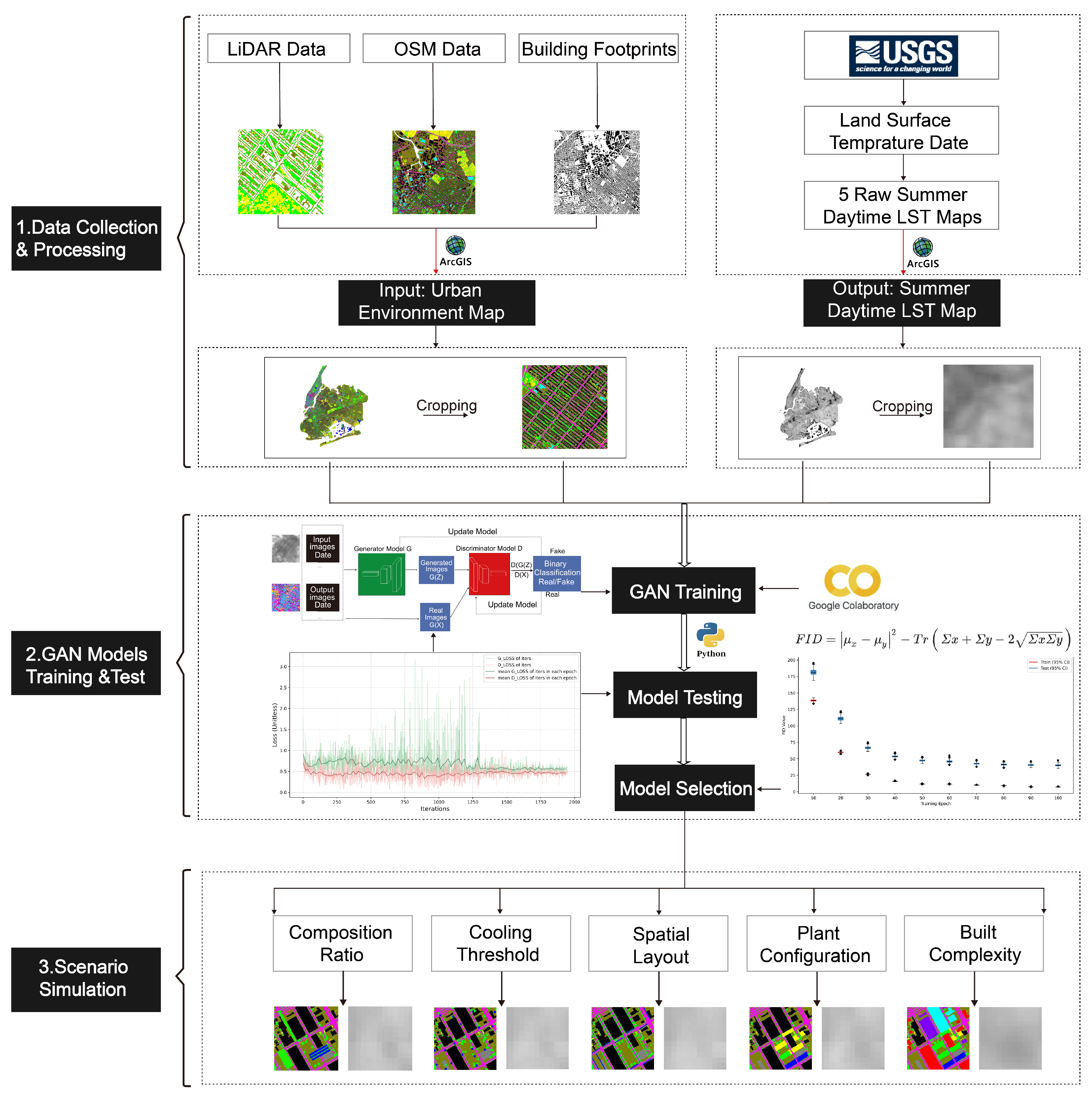
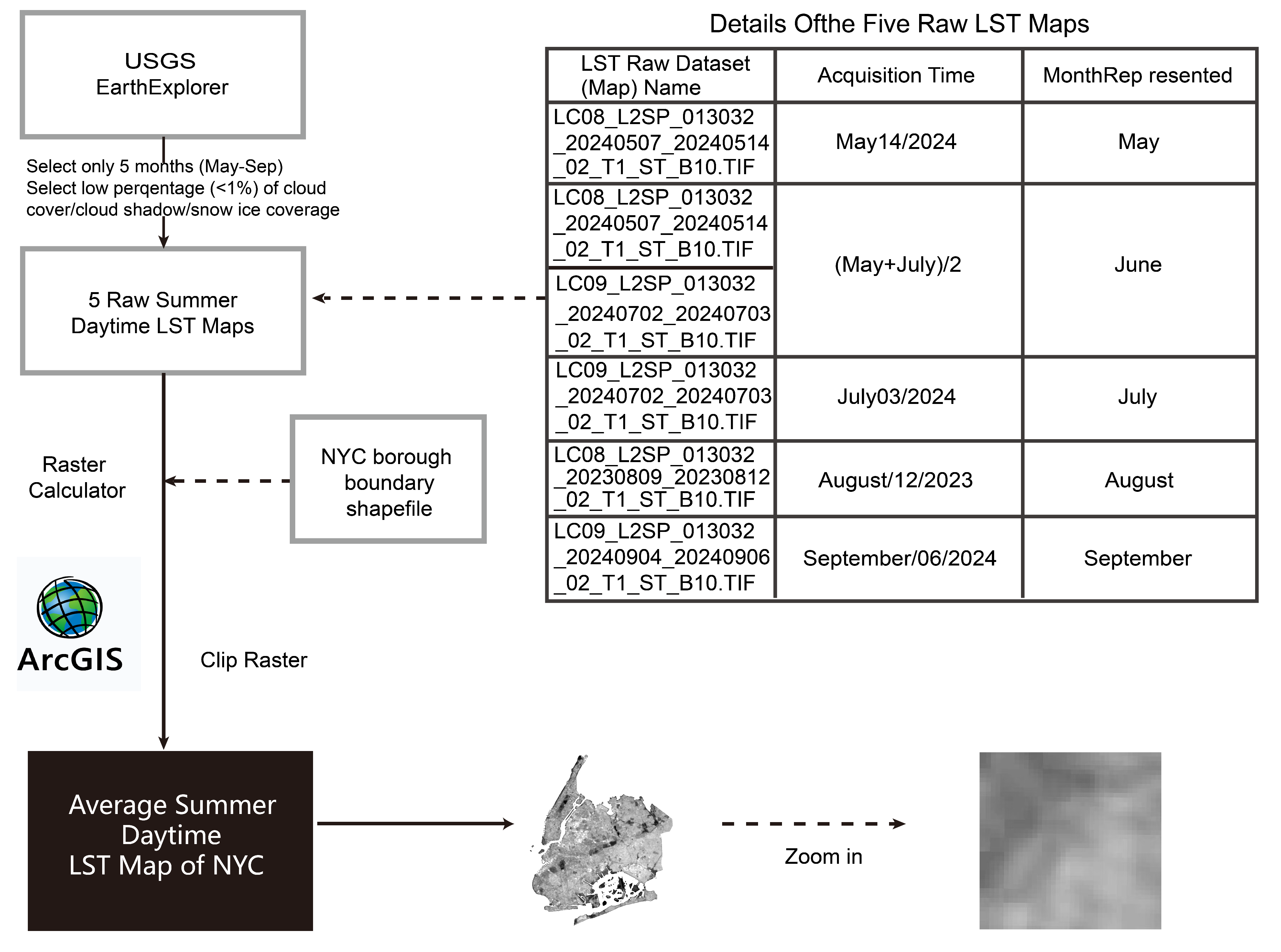
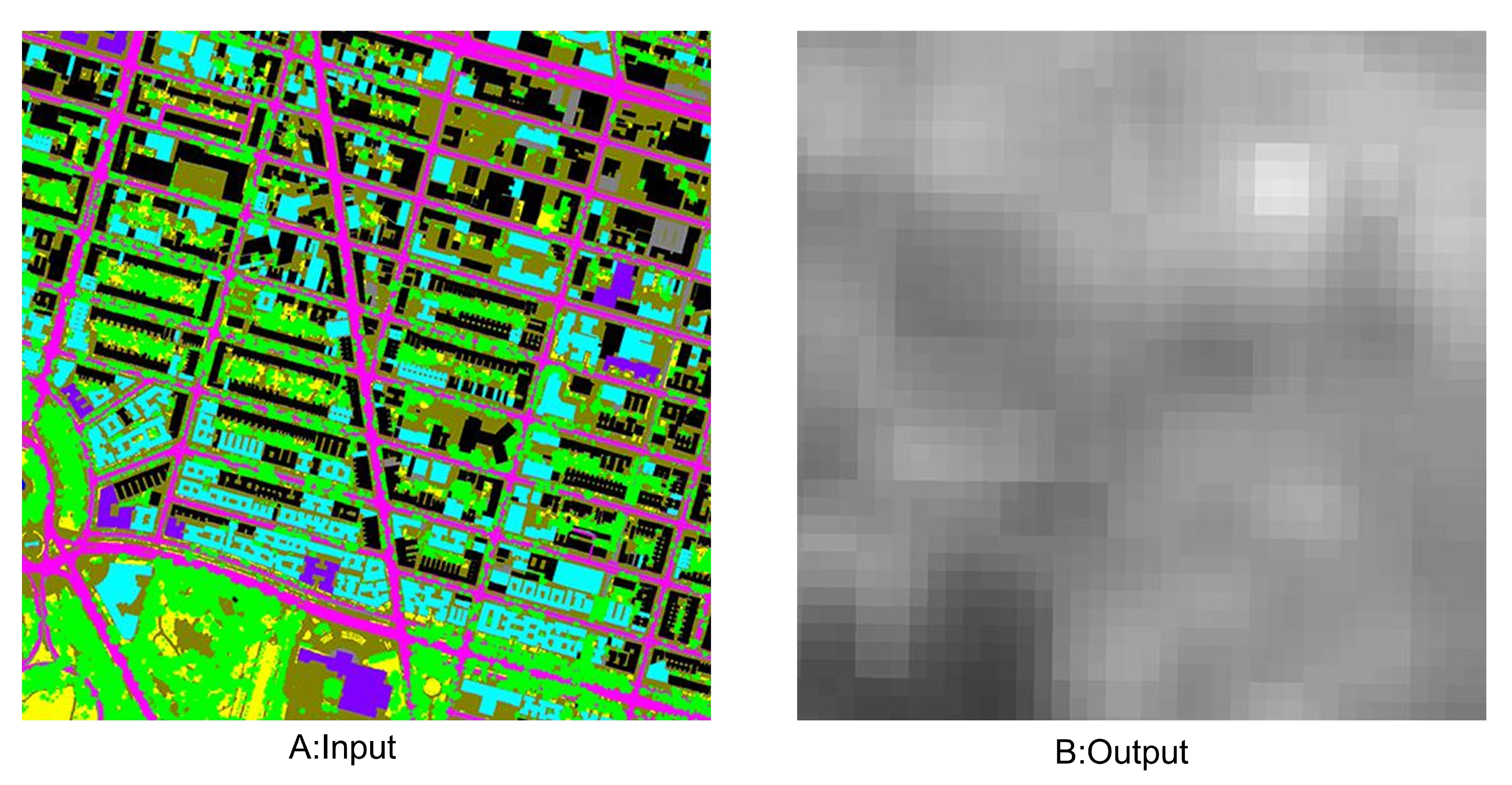
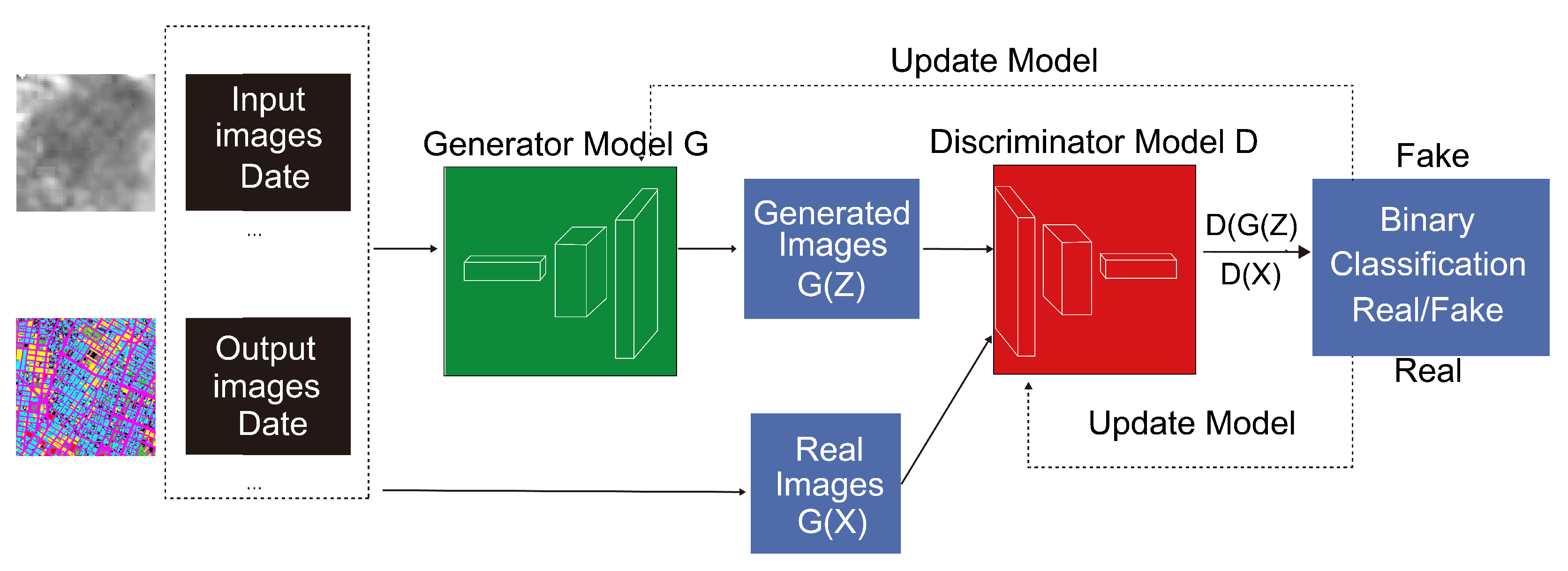
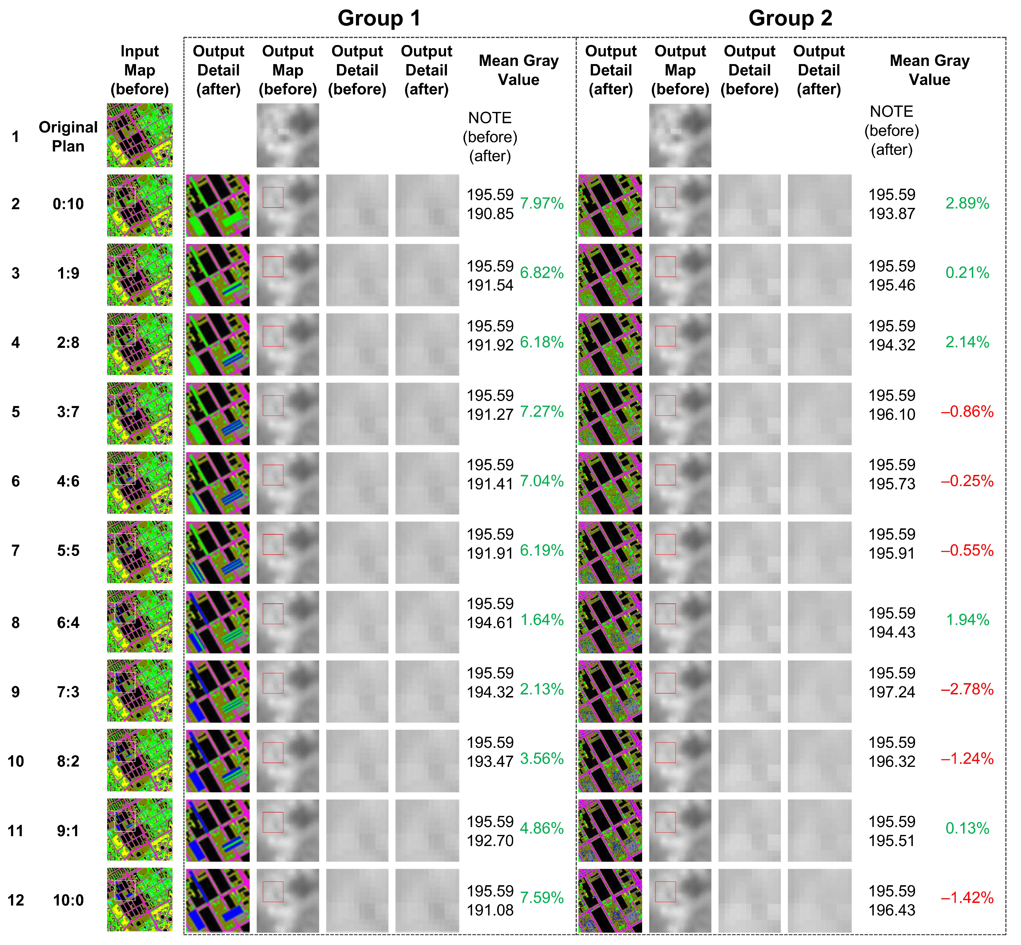
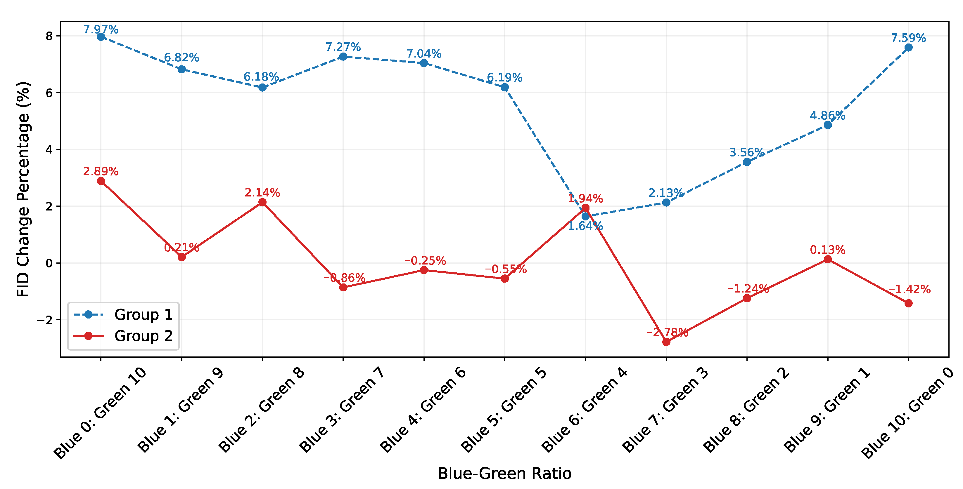
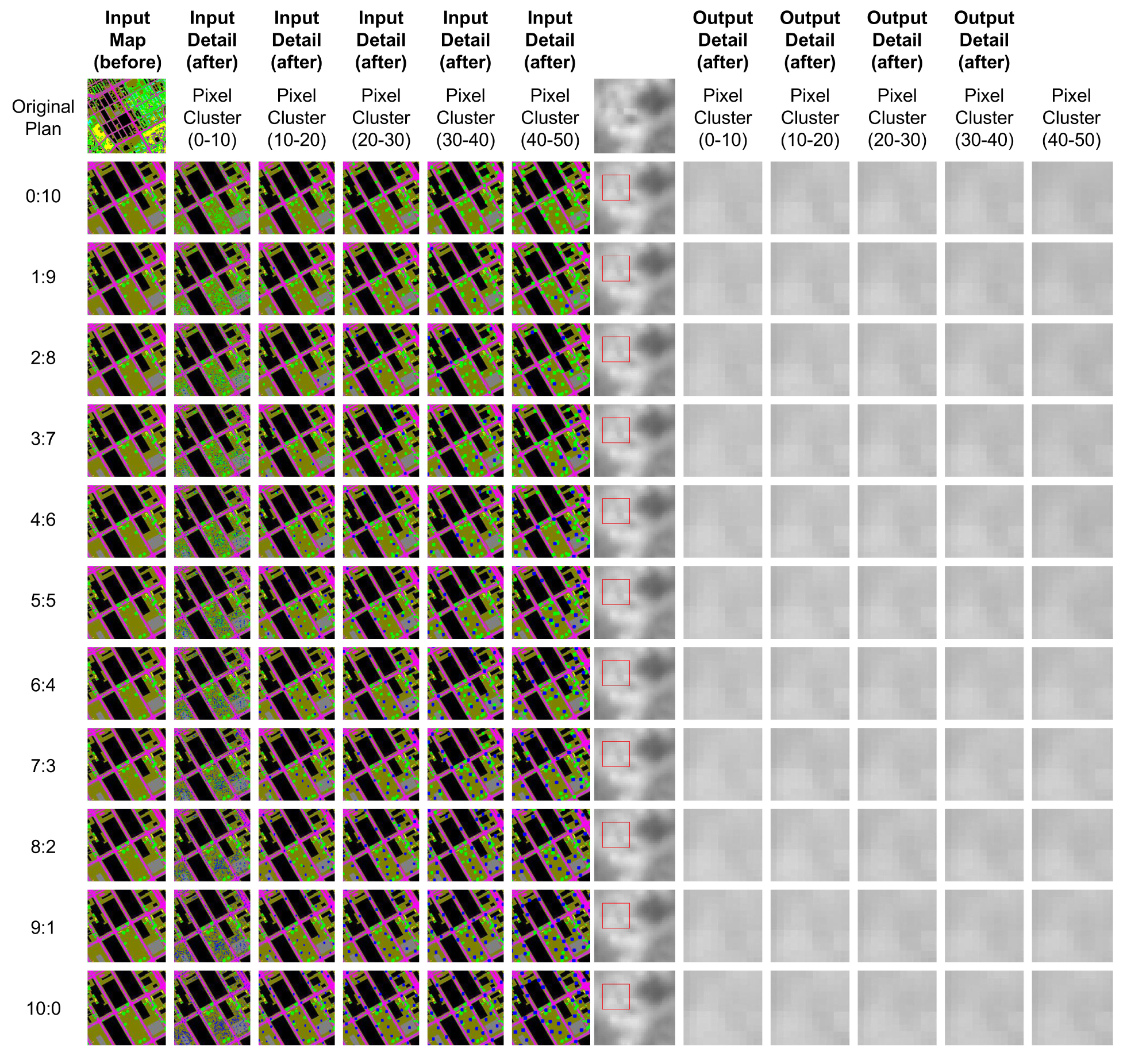
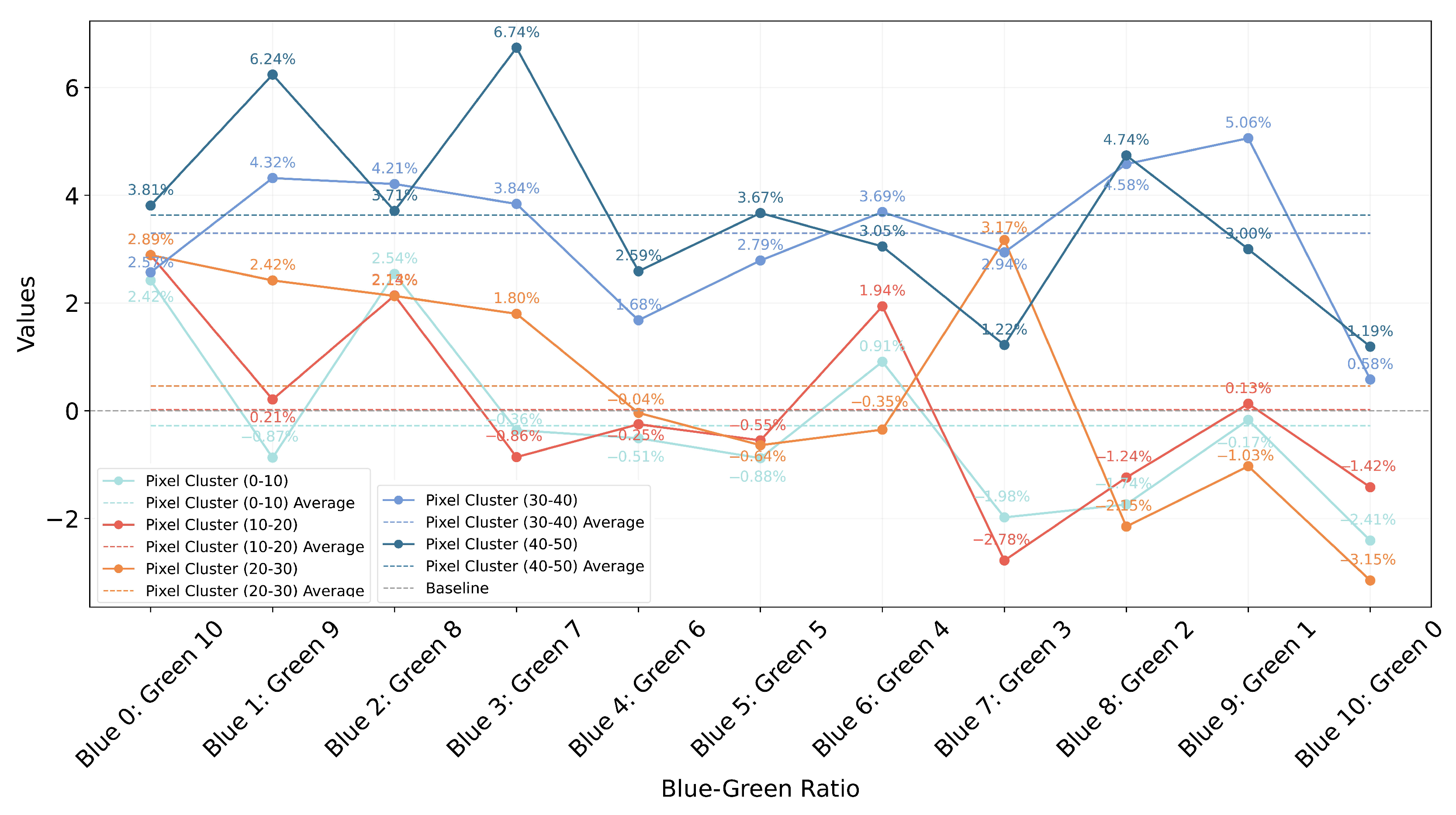
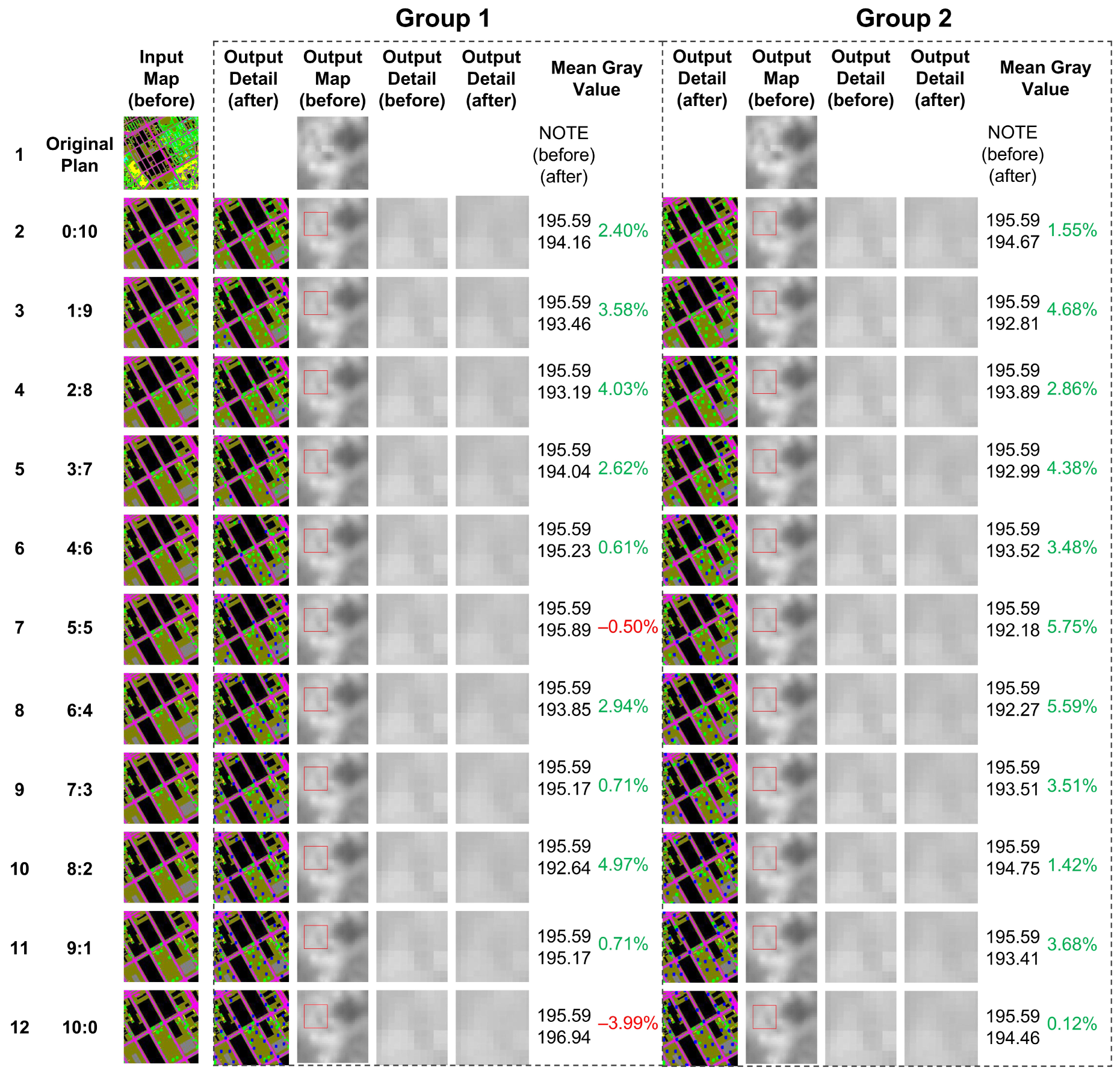
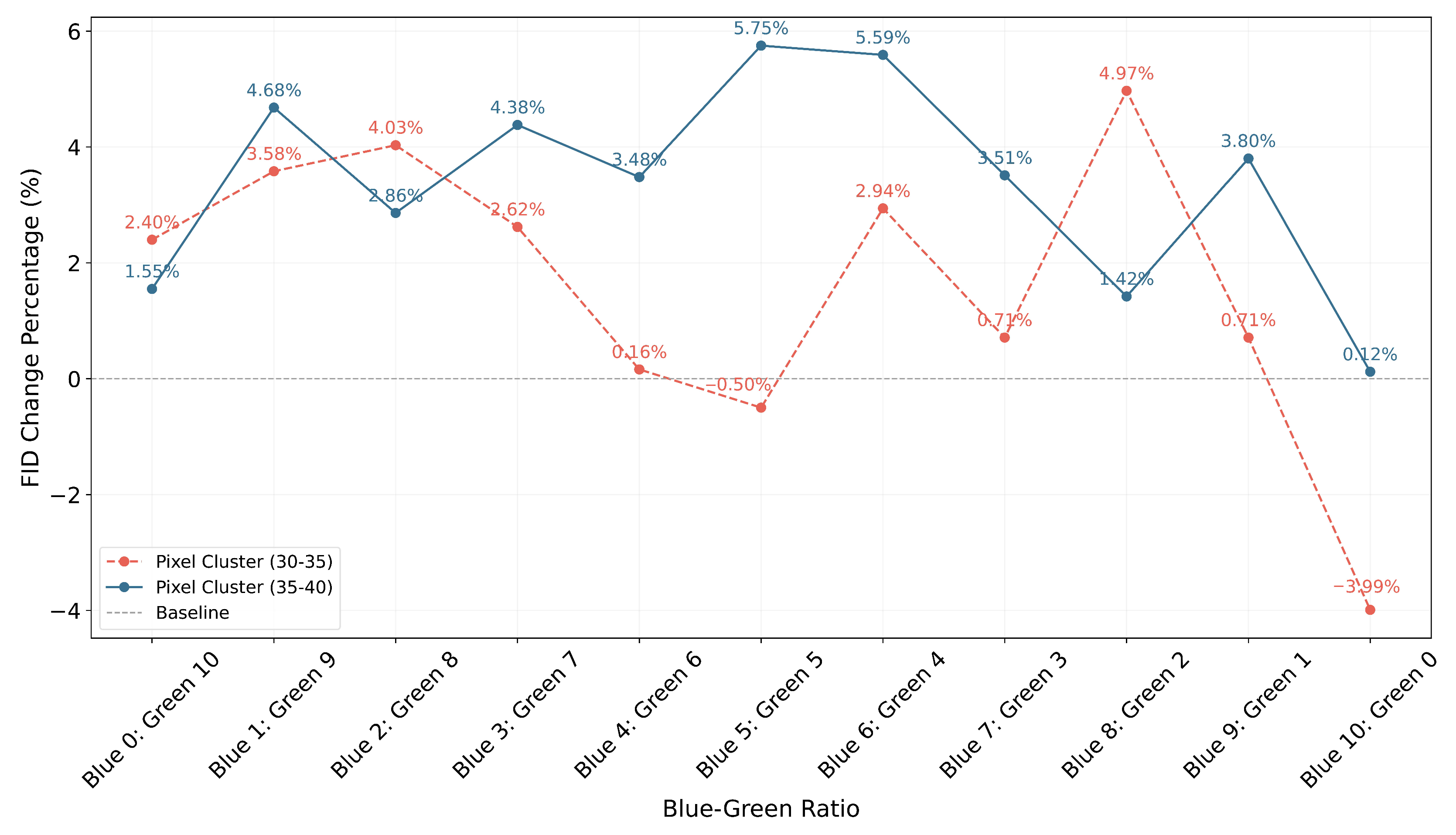
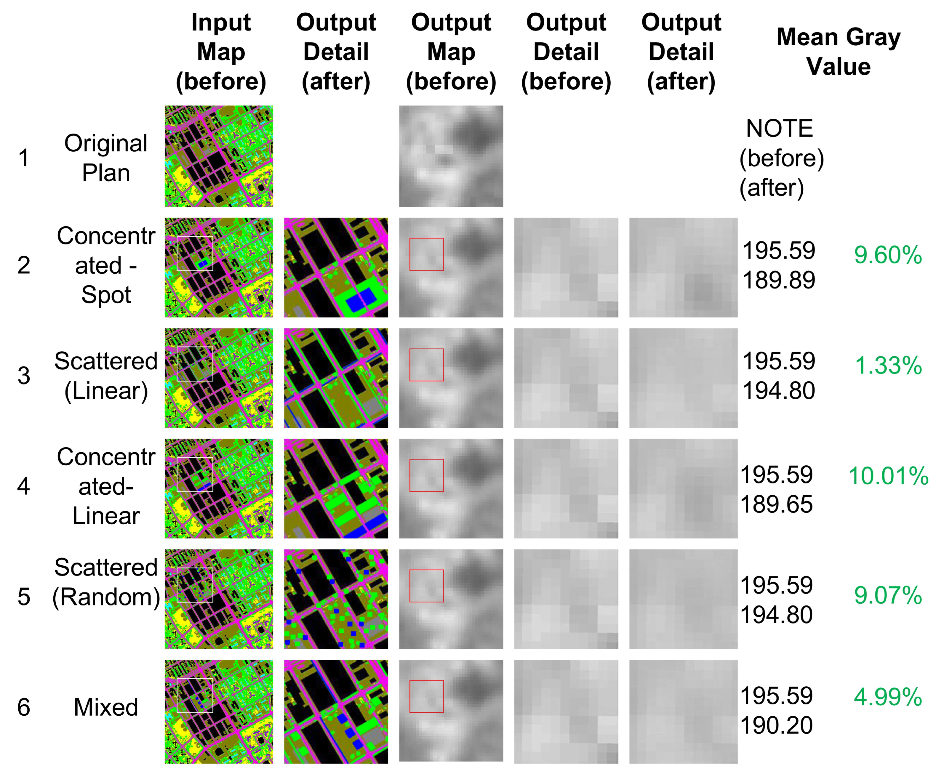
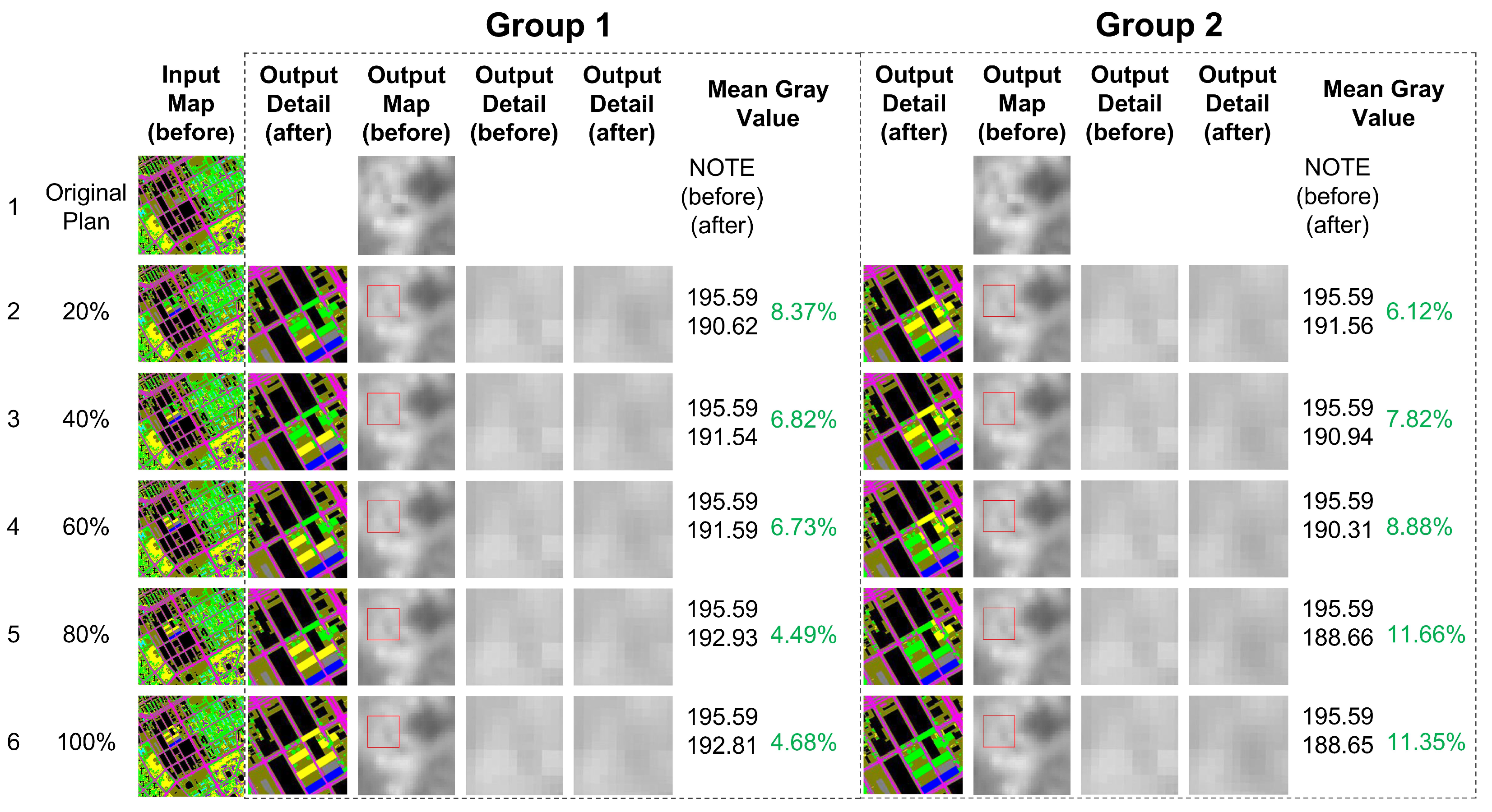
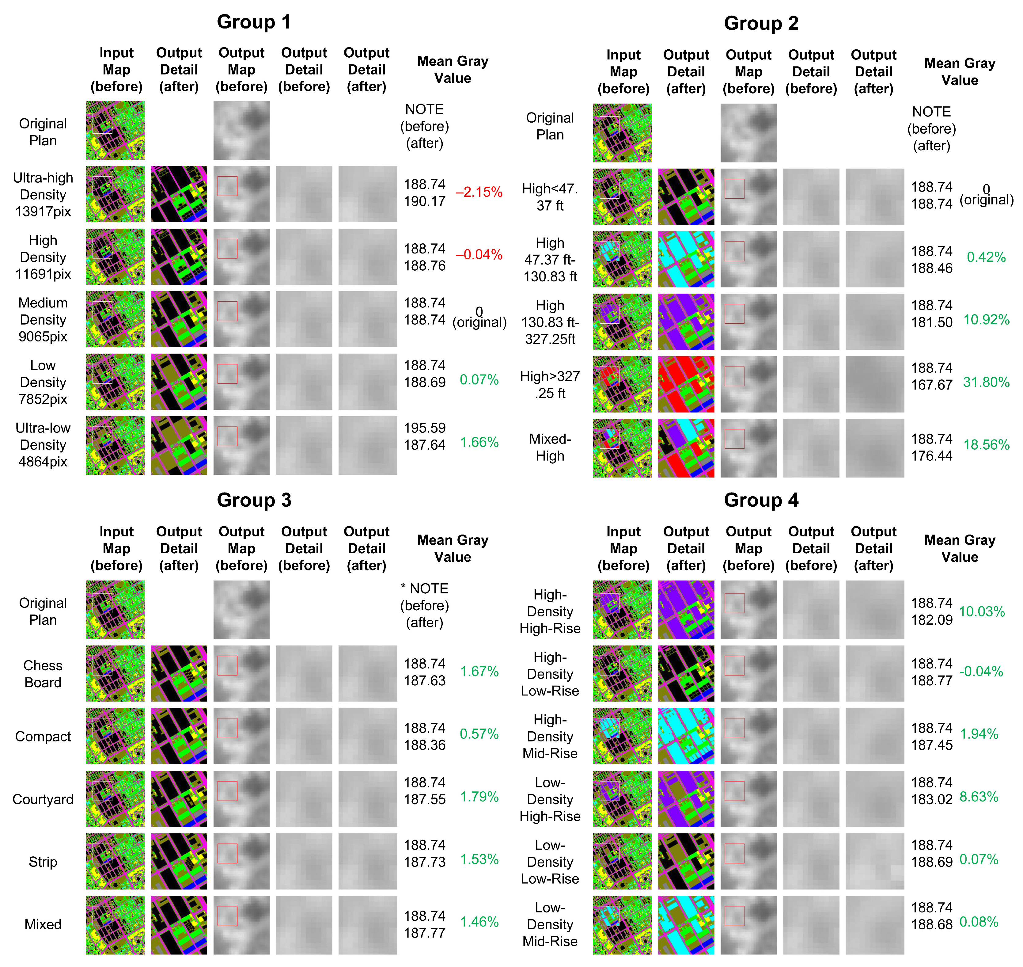
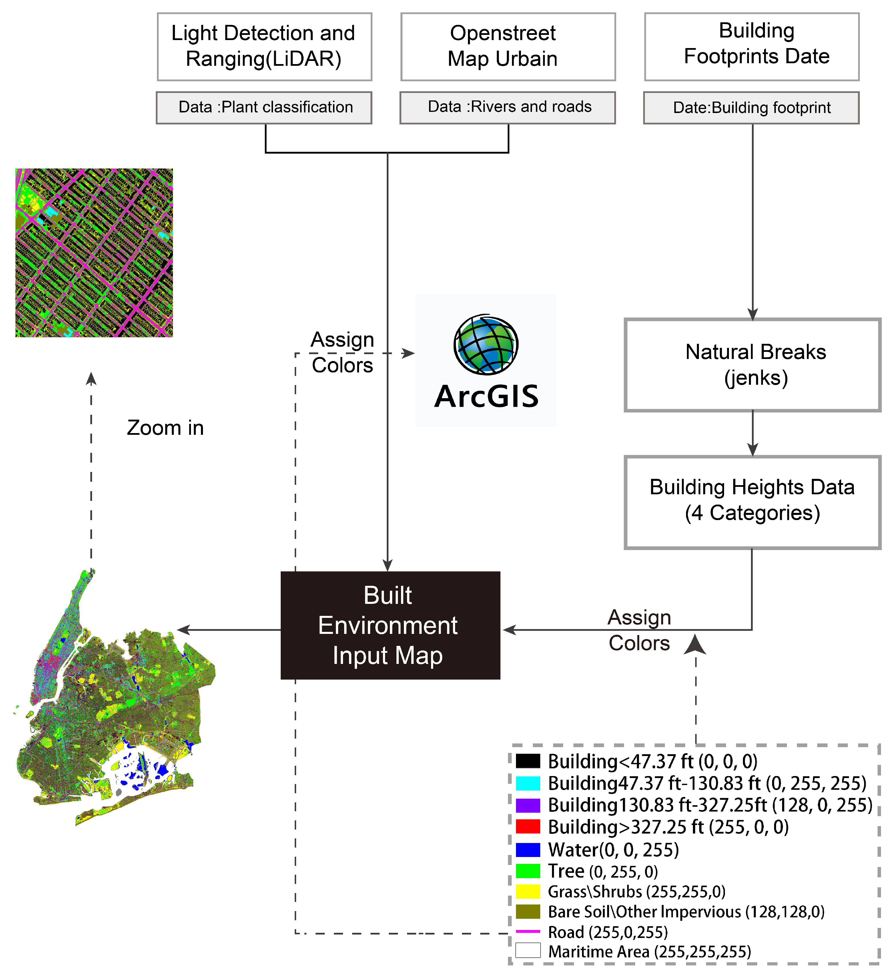
Urban blue–green space (UBGS) plays a critical role in mitigating the urban heat island (UHI) effect and reducing land surface temperatures (LSTs). However, existing research has not sufficiently explored the optimization of UBGS spatial configurations or their interactions with urban morphology. This study takes New York City as a case and systematically investigates small-scale urban cooling strategies by integrating multiple factors, including adjustments to the blue–green ratio, spatial layouts, vegetation composition, building density, building height, and layout typologies. We utilize multi-source geographic data, including LiDAR derived land cover, OpenStreetMap data, and building footprint data, together with LST data retrieved from Landsat imagery, to develop a prediction model based on generative adversarial networks (GANs). This model can rapidly generate visual LST predictions under various configuration scenarios. This study employs a combination of qualitative and quantitative metrics to evaluate the performance of different model stages, selecting the most accurate model as the final experimental framework. Furthermore, the experimental design strictly controls the study area and pixel allocation, combining manual and automated methods to ensure the comparability of different ratio configurations. The main findings indicate that a blue–green ratio of 3:7 maximizes cooling efficiency; a shrub-to-tree coverage ratio of 2:8 performs best, with tree-dominated configurations outperforming shrub-dominated ones; concentrated linear layouts achieve up to a 10.01% cooling effect; and taller buildings exhibit significantly stronger UBGS cooling performance, with super-tall areas achieving cooling effects approximately 31 percentage points higher than low-rise areas. Courtyard layouts enhance airflow and synergistic cooling effects, whereas compact designs limit the cooling potential of UBGS. This study proposes an innovative application of GANs to address a key research gap in the quantitative optimization of UBGS configurations and provides a methodological reference for sustainable microclimate planning at the neighborhood scale.
Keywords: blue–green space optimization; land surface temperature; generative adversarial networks; urban cooling strategies blue–green space optimization; land surface temperature; generative adversarial networks; urban cooling strategies