Advancing Multi-Scale Geographic Environmental Monitoring: A Synthesis of Cutting-Edge Research and Scalable Solutions


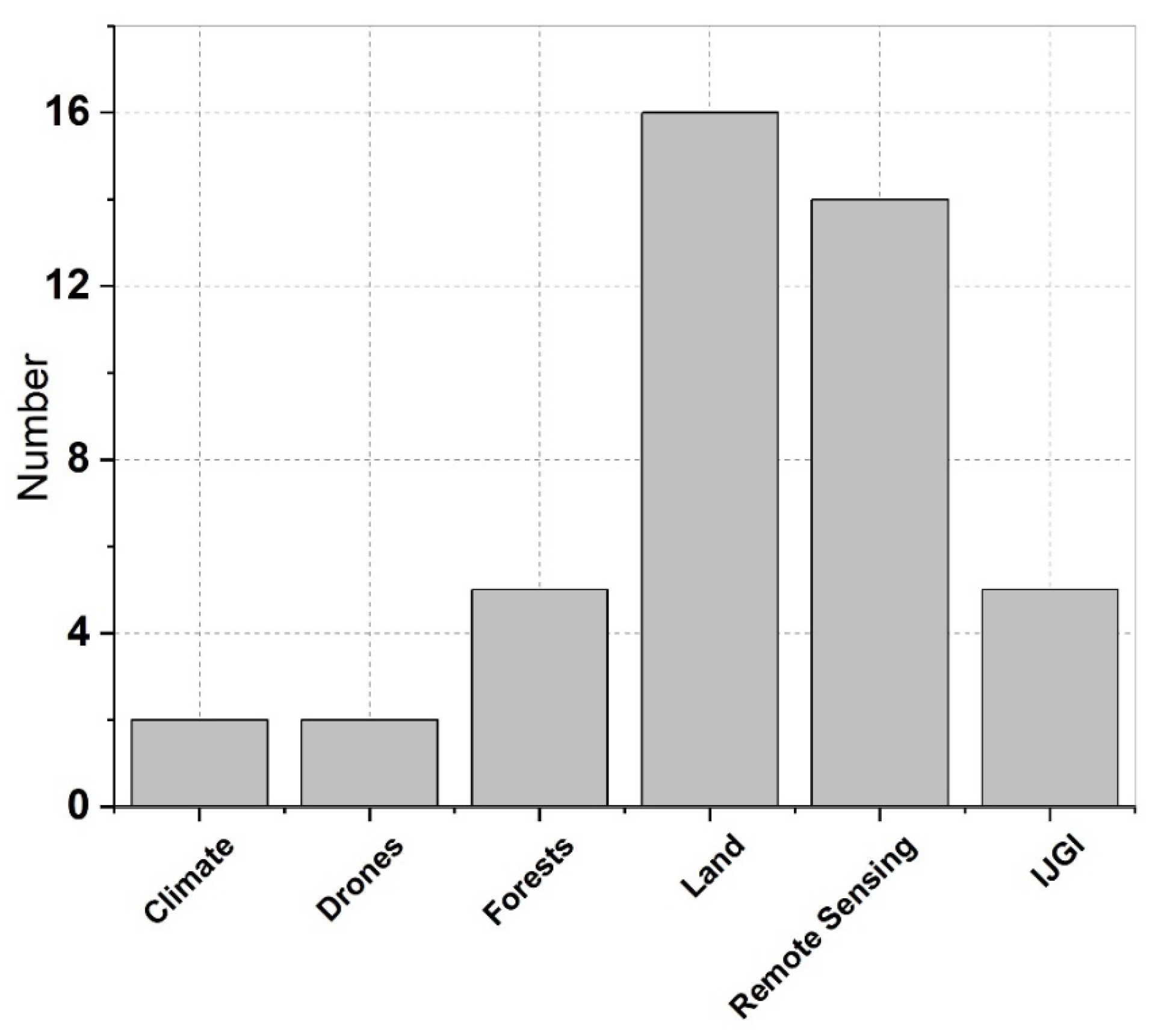
1. Introduction
2. Overviews of Topic Papers
3. Future Perspectives: Scalable Solutions
3.1. Advancing Multi-Scale Theoretical Frameworks and Dynamic Modeling
3.2. Intelligent Collaborative Monitoring Technology Systems
3.3. Precision Decision-Making and Sustainable Governance
3.4. Mitigating Uncertainties and Enhancing Data Credibility
3.5. Cross-Disciplinary Innovation Ecosystems
Author Contributions
Funding
Data Availability Statement
Acknowledgments
Conflicts of Interest
References
- Vitousek, P.M.; Mooney, H.A.; Lubchenco, J.; Melillo, J.M. Human Domination of Earth’s Ecosystems. Science 1997, 277, 494–499. [Google Scholar] [CrossRef]
- Golledge, R.G. The Nature of Geographic Knowledge. Ann. Assoc. Am. Geogr. 2002, 92, 1–14. [Google Scholar] [CrossRef]
- Ge, J.; Hu, Y. The Yellow River Civilization and Other River Civilizations of the World. In A Historical Survey of the Yellow River and the River Civilizations; Ge, J., Hu, Y., Eds.; Springer Singapore: Singapore, 2021; pp. 85–112. [Google Scholar]
- Kunstler, J.H. The Long Emergency: Surviving the End of Oil, Climate Change, and Other Converging Catastrophes of the Twenty-First Century; Grove Press: New York, NY, USA, 2007. [Google Scholar]
- LeMenager, S.; Shewry, T.; Hiltner, K. Environmental Criticism for the Twenty-First Century; Routledge: New York, NY, USA, 2011. [Google Scholar]
- Goudie, A.S. Human Impact on the Natural Environment: Past, Present and Future; John Wiley & Sons: Hoboken, NJ, USA, 2018. [Google Scholar]
- Fu, B. Promoting Geography for Sustainability. Geogr. Sustain. 2020, 1, 1–7. [Google Scholar] [CrossRef]
- Fu, B.; Li, Y. Bidirectional coupling between the Earth and human systems is essential for modeling sustainability. Natl. Sci. Rev. 2016, 3, 397–398. [Google Scholar] [CrossRef]
- Wang, J.; Ding, J.; Ge, X.; Peng, J.; Hu, Z. Monitoring soil salinization on the basis of remote sensing and proximal soil sensing: Progress and perspective. Natl. Remote Sens. Bull. 2024, 28, 2187–2208. (In Chinese) [Google Scholar]
- Wang, J.; Zhen, J.; Hu, W.; Chen, S.; Lizaga, I.; Zeraatpisheh, M.; Yang, X. Remote sensing of soil degradation: Progress and perspective. Int. Soil Water Conserv. Res. 2023, 11, 429–454. [Google Scholar] [CrossRef]
- Montillet, J.P.; Kermarrec, G.; Forootan, E.; Haberreiter, M.; He, X.; Finsterle, W.; Fernandes, R.; Shum, C.K. How Big Data Can Help to Monitor the Environment and to Mitigate Risks due to Climate Change: A review. IEEE Geosci. Remote Sens. Mag. 2024, 12, 67–89. [Google Scholar] [CrossRef]
- Ghamisi, P.; Rasti, B.; Yokoya, N.; Wang, Q.; Hofle, B.; Bruzzone, L.; Bovolo, F.; Chi, M.; Anders, K.; Gloaguen, R.; et al. Multisource and Multitemporal Data Fusion in Remote Sensing: A Comprehensive Review of the State of the Art. IEEE Geosci. Remote Sens. Mag. 2019, 7, 6–39. [Google Scholar] [CrossRef]
- Hu, Z.; Chu, Y.; Zhang, Y.; Zheng, X.; Wang, J.; Xu, W.; Wang, J.; Wu, G. Scale matters: How spatial resolution impacts remote sensing based urban green space mapping? Int. J. Appl. Earth Obs. Geoinf. 2024, 134, 104178. [Google Scholar] [CrossRef]
- Wang, J.; Zhang, S.; Lizaga, I.; Zhang, Y.; Ge, X.; Zhang, Z.; Zhang, W.; Huang, Q.; Hu, Z. UAS-based remote sensing for agricultural Monitoring: Current status and perspectives. Comput. Electron. Agric. 2024, 227, 109501. [Google Scholar] [CrossRef]
- Fei, S.; Guo, Q.; Potter, K. Macrosystems ecology: Novel methods and new understanding of multi-scale patterns and processes. Landsc. Ecol. 2016, 31, 1–6. [Google Scholar] [CrossRef]
- Zhang, Z.; Ding, J.; Wang, J.; Ge, X. Prediction of soil organic matter in northwestern China using fractional-order derivative spectroscopy and modified normalized difference indices. Catena 2020, 185, 104257. [Google Scholar] [CrossRef]
- Dritsas, E.; Trigka, M. Remote Sensing and Geospatial Analysis in the Big Data Era: A Survey. Remote Sens. 2025, 17, 550. [Google Scholar] [CrossRef]
- Li, Y.; Lai, Y.; Lin, Y. The Role of Diversified Geo-Information Technologies in Urban Governance: A Literature Review. Land 2024, 13, 1408. [Google Scholar] [CrossRef]
- Bennett, E.M.; Peterson, G.D.; Gordon, L.J. Understanding relationships among multiple ecosystem services. Ecol. Lett. 2009, 12, 1394–1404. [Google Scholar] [CrossRef]
- Pei, T.; Xu, J.; Liu, Y.; Huang, X.; Zhang, L.; Dong, W.; Qin, C.; Song, C.; Gong, J.; Zhou, C. GIScience and remote sensing in natural resource and environmental research: Status quo and future perspectives. Geogr. Sustain. 2021, 2, 207–215. [Google Scholar] [CrossRef]
- Sheffield, J.; Wood, E.F.; Pan, M.; Beck, H.; Coccia, G.; Serrat-Capdevila, A.; Verbist, K. Satellite Remote Sensing for Water Resources Management: Potential for Supporting Sustainable Development in Data-Poor Regions. Water Resour. Res. 2018, 54, 9724–9758. [Google Scholar] [CrossRef]
- Yang, J.; Gong, P.; Fu, R.; Zhang, M.; Chen, J.; Liang, S.; Xu, B.; Shi, J.; Dickinson, R. The role of satellite remote sensing in climate change studies. Nat. Clim. Change 2013, 3, 875–883. [Google Scholar] [CrossRef]
- Im, J.; Park, H.; Takeuchi, W. Advances in Remote Sensing-Based Disaster Monitoring and Assessment. Remote Sens. 2019, 11, 2181. [Google Scholar] [CrossRef]
- Li, J.; Pei, Y.; Zhao, S.; Xiao, R.; Sang, X.; Zhang, C. A Review of Remote Sensing for Environmental Monitoring in China. Remote Sens. 2020, 12, 1130. [Google Scholar] [CrossRef]
- Pricope, N.G.; Mapes, K.L.; Woodward, K.D. Remote Sensing of Human–Environment Interactions in Global Change Research: A Review of Advances, Challenges and Future Directions. Remote Sens. 2019, 11, 2783. [Google Scholar] [CrossRef]
- Fu, B.; Liu, Y.; Li, Y.; Wang, C.; Li, C.; Jiang, W.; Hua, T.; Zhao, W. The research priorities of Resources and Environmental Sciences. Geogr. Sustain. 2021, 2, 87–94. [Google Scholar] [CrossRef]
- Liu, Y.; Du, J.; Wang, Y.; Cui, X.; Dong, J.; Gu, P.; Hao, Y.; Xue, K.; Duan, H.; Xia, A.; et al. Overlooked uneven progress across sustainable development goals at the global scale: Challenges and opportunities. Innov. 2024, 5, 100573. [Google Scholar] [CrossRef]
- Zhu, C.; Li, Y.; Ding, J.; Rao, J.; Xiang, Y.; Ge, X.; Wang, J.; Wang, J.; Chen, X.; Zhang, Z. Spatiotemporal analysis of AGB and BGB in China: Responses to climate change under SSP scenarios. Geosci. Front. 2025, 16, 102038. [Google Scholar] [CrossRef]
- Chen, H.; Wu, J.; Xu, C. Monitoring Soil Salinity Classes through Remote Sensing-Based Ensemble Learning Concept: Considering Scale Effects. Remote Sens. 2024, 16, 642. [Google Scholar] [CrossRef]
- Qin, S.; Zhang, Y.; Ding, J.; Wang, J.; Han, L.; Zhao, S.; Zhu, C. The Link between Surface Visible Light Spectral Features and Water–Salt Transfer in Saline Soils—Investigation Based on Soil Column Laboratory Experiments. Remote Sens. 2024, 16, 3421. [Google Scholar] [CrossRef]
- Cheng, W.; Ma, C.; Li, T.; Liu, Y. Construction of Ecological Security Patterns and Evaluation of Ecological Network Stability under Multi-Scenario Simulation: A Case Study in Desert–Oasis Area of the Yellow River Basin, China. Land 2024, 13, 1037. [Google Scholar] [CrossRef]
- Liu, B.; Yang, X.; Wang, Z.; Ding, Y.; Zhang, J.; Meng, D. A Comparison of Six Forest Mapping Products in Southeast Asia, Aided by Field Validation Data. Remote Sens. 2023, 15, 4584. [Google Scholar] [CrossRef]
- Papadopoulou, E.E.; Papakonstantinou, A. Combining Drone LiDAR and Virtual Reality Geovisualizations towards a Cartographic Approach to Visualize Flooding Scenarios. Drones 2024, 8, 398. [Google Scholar] [CrossRef]
- Tiškus, E.; Bučas, M.; Vaičiūtė, D.; Gintauskas, J.; Babrauskienė, I. An Evaluation of Sun-Glint Correction Methods for UAV-Derived Secchi Depth Estimations in Inland Water Bodies. Drones 2023, 7, 546. [Google Scholar] [CrossRef]
- Chen, J.; Wang, Y.; Wang, J.; Zhang, Y.; Xu, Y.; Yang, O.; Zhang, R.; Wang, J.; Wang, Z.; Lu, F.; et al. The Performance of Landsat-8 and Landsat-9 Data for Water Body Extraction Based on Various Water Indices: A Comparative Analysis. Remote Sens. 2024, 16, 1984. [Google Scholar] [CrossRef]
- Bu, Z.; Fu, J.; Jiang, D.; Lin, G. Production–Living–Ecological Spatial Function Identification and Pattern Analysis Based on Multi-Source Geographic Data and Machine Learning. Land 2023, 12, 2029. [Google Scholar] [CrossRef]
- Tian, H.; Lu, C.; Pan, S.; Yang, J.; Miao, R.; Ren, W.; Yu, Q.; Fu, B.; Jin, F.-F.; Lu, Y.; et al. Optimizing resource use efficiencies in the food–energy–water nexus for sustainable agriculture: From conceptual model to decision support system. Curr. Opin. Environ. Sustain. 2018, 33, 104–113. [Google Scholar] [CrossRef]
- Gaillard, M.-J.; Sugita, S.; Mazier, F.; Trondman, A.-K.; Broström, A.; Hickler, T.; Kaplan, J.O.; Kjellström, E.; Kokfelt, U.; Kuneš, P. Holocene land-cover reconstructions for studies on land cover-climate feedbacks. Clim. Past 2010, 6, 483–499. [Google Scholar] [CrossRef]
- Chakraborty, T.C.; Venter, Z.S.; Demuzere, M.; Zhan, W.; Gao, J.; Zhao, L.; Qian, Y. Large disagreements in estimates of urban land across scales and their implications. Nat. Commun. 2024, 15, 9165. [Google Scholar] [CrossRef]
- Lenton, T.M.; Abrams, J.F.; Bartsch, A.; Bathiany, S.; Boulton, C.A.; Buxton, J.E.; Conversi, A.; Cunliffe, A.M.; Hebden, S.; Lavergne, T. Remotely sensing potential climate change tipping points across scales. Nat. Commun. 2024, 15, 343. [Google Scholar] [CrossRef]
- Yu, L.; Du, Z.; Li, X.; Zheng, J.; Zhao, Q.; Wu, H.; Weise, D.; Yang, Y.; Zhang, Q.; Li, X.; et al. Enhancing global agricultural monitoring system for climate-smart agriculture. Clim. Smart Agric. 2025, 2, 100037. [Google Scholar] [CrossRef]
- Alvarez-Vanhard, E.; Corpetti, T.; Houet, T. UAV & satellite synergies for optical remote sensing applications: A literature review. Sci. Remote Sens. 2021, 3, 100019. [Google Scholar] [CrossRef]
- Mohammed, M.A.; Lakhan, A.; Abdulkareem, K.H.; Almujally, N.A.; Al-Attar, B.B.S.M.T.; Memon, S.; Marhoon, H.A.; Martinek, R. Edge-Cloud Remote Sensing Data-Based Plant Disease Detection Using Deep Neural Networks With Transfer Learning. IEEE J. Sel. Top. Appl. Earth Obs. Remote Sens. 2024, 17, 11219–11229. [Google Scholar] [CrossRef]
- Al-Shafi, M.; Massarweh, O.; Abushaikha, A.S.; Bicer, Y. A review on underground gas storage systems: Natural gas, hydrogen and carbon sequestration. Energy Rep. 2023, 9, 6251–6266. [Google Scholar] [CrossRef]
- Yabe, T.; Jones, N.K.W.; Rao, P.S.C.; Gonzalez, M.C.; Ukkusuri, S.V. Mobile phone location data for disasters: A review from natural hazards and epidemics. Comput. Environ. Urban Syst. 2022, 94, 101777. [Google Scholar] [CrossRef]
- Yuan, F.; Fan, C.; Farahmand, H.; Coleman, N.; Esmalian, A.; Lee, C.-C.; Patrascu, F.I.; Zhang, C.; Dong, S.; Mostafavi, A. Smart flood resilience: Harnessing community-scale big data for predictive flood risk monitoring, rapid impact assessment, and situational awareness. Environ. Res. Infrastruct. Sustain. 2022, 2, 025006. [Google Scholar] [CrossRef]
- Priyadarshana, T.S.; Martin, E.A.; Sirami, C.; Woodcock, B.A.; Goodale, E.; Martínez-Núñez, C.; Lee, M.B.; Pagani-Núñez, E.; Raderschall, C.A.; Brotons, L. Crop and landscape heterogeneity increase biodiversity in agricultural landscapes: A global review and meta-analysis. Ecol. Lett. 2024, 27, e14412. [Google Scholar] [CrossRef]
- Khan, J.A.; Khan, M.A.; Al-Khalidi, M.; AlHammadi, D.A.; Alasiry, A.; Marzougui, M.; Zhang, Y.; Khan, F. Design of Super Resolution and Fuzzy Deep Learning Architecture for the Classification of Land Cover and Landsliding Using Aerial Remote Sensing Data. IEEE J. Sel. Top. Appl. Earth Obs. Remote Sens. 2025, 18, 337–351. [Google Scholar] [CrossRef]
- Zeng, Y.; Hao, D.; Huete, A.; Dechant, B.; Berry, J.; Chen, J.M.; Joiner, J.; Frankenberg, C.; Bond-Lamberty, B.; Ryu, Y.; et al. Optical vegetation indices for monitoring terrestrial ecosystems globally. Nat. Rev. Earth Environ. 2022, 3, 477–493. [Google Scholar] [CrossRef]
- Li, X.; Feng, M.; Ran, Y.; Su, Y.; Liu, F.; Huang, C.; Shen, H.; Xiao, Q.; Su, J.; Yuan, S.; et al. Big Data in Earth system science and progress towards a digital twin. Nat. Rev. Earth Environ. 2023, 4, 319–332. [Google Scholar] [CrossRef]
- Webster, A.J.; Lin, Y.C.; Scruggs, C.E.; Bixby, R.J.; Crossey, L.J.; Huang, K.; Johnson, A.; de Lancer Julnes, P.; Kremer, C.A.; Morgan, M.; et al. Facilitating convergence research on water resource management with a collaborative, adaptive, and multi-scale systems thinking framework. Ecol. Soc. 2025, 30, 23. [Google Scholar] [CrossRef]
- See, L. A Review of Citizen Science and Crowdsourcing in Applications of Pluvial Flooding. Front. Earth Sci. 2019, 7, 44. [Google Scholar] [CrossRef]
Disclaimer/Publisher’s Note: The statements, opinions and data contained in all publications are solely those of the individual author(s) and contributor(s) and not of MDPI and/or the editor(s). MDPI and/or the editor(s) disclaim responsibility for any injury to people or property resulting from any ideas, methods, instructions or products referred to in the content. |
© 2025 by the authors. Licensee MDPI, Basel, Switzerland. This article is an open access article distributed under the terms and conditions of the Creative Commons Attribution (CC BY) license (https://creativecommons.org/licenses/by/4.0/).
Share and Cite
Wang, J.; Wu, Y.; Zhang, Y.; Lizaga, I.; Zhang, Z. Advancing Multi-Scale Geographic Environmental Monitoring: A Synthesis of Cutting-Edge Research and Scalable Solutions. Land 2025, 14, 1059. https://doi.org/10.3390/land14051059
Wang J, Wu Y, Zhang Y, Lizaga I, Zhang Z. Advancing Multi-Scale Geographic Environmental Monitoring: A Synthesis of Cutting-Edge Research and Scalable Solutions. Land. 2025; 14(5):1059. https://doi.org/10.3390/land14051059
Chicago/Turabian StyleWang, Jingzhe, Yangyi Wu, Yinghui Zhang, Ivan Lizaga, and Zipeng Zhang. 2025. "Advancing Multi-Scale Geographic Environmental Monitoring: A Synthesis of Cutting-Edge Research and Scalable Solutions" Land 14, no. 5: 1059. https://doi.org/10.3390/land14051059
APA StyleWang, J., Wu, Y., Zhang, Y., Lizaga, I., & Zhang, Z. (2025). Advancing Multi-Scale Geographic Environmental Monitoring: A Synthesis of Cutting-Edge Research and Scalable Solutions. Land, 14(5), 1059. https://doi.org/10.3390/land14051059