Article

Possibilities and Limitations of a Geospatial Approach to Refine Habitat Mapping for Greater Gliders (Petauroides spp.)

by
Jess E. Evans
1,*,
Elizabeth A. Brunton
1,
Javier X. Leon
1,
Teresa J. Eyre
2 and
Romane H. Cristescu
1
1
School of Science, Technology and Engineering, University of the Sunshine Coast, Maroochydore, QLD 4558, Australia
2
Queensland Herbarium and Biodiversity Science, Queensland Department of Environment and Science, Mt Coot-tha Road, Brisbane, QLD 4066, Australia
*
Author to whom correspondence should be addressed.
Land 2025, 14(4), 784; https://doi.org/10.3390/land14040784
Submission received: 21 February 2025 / Revised: 21 March 2025 / Accepted: 2 April 2025 / Published: 5 April 2025

Abstract

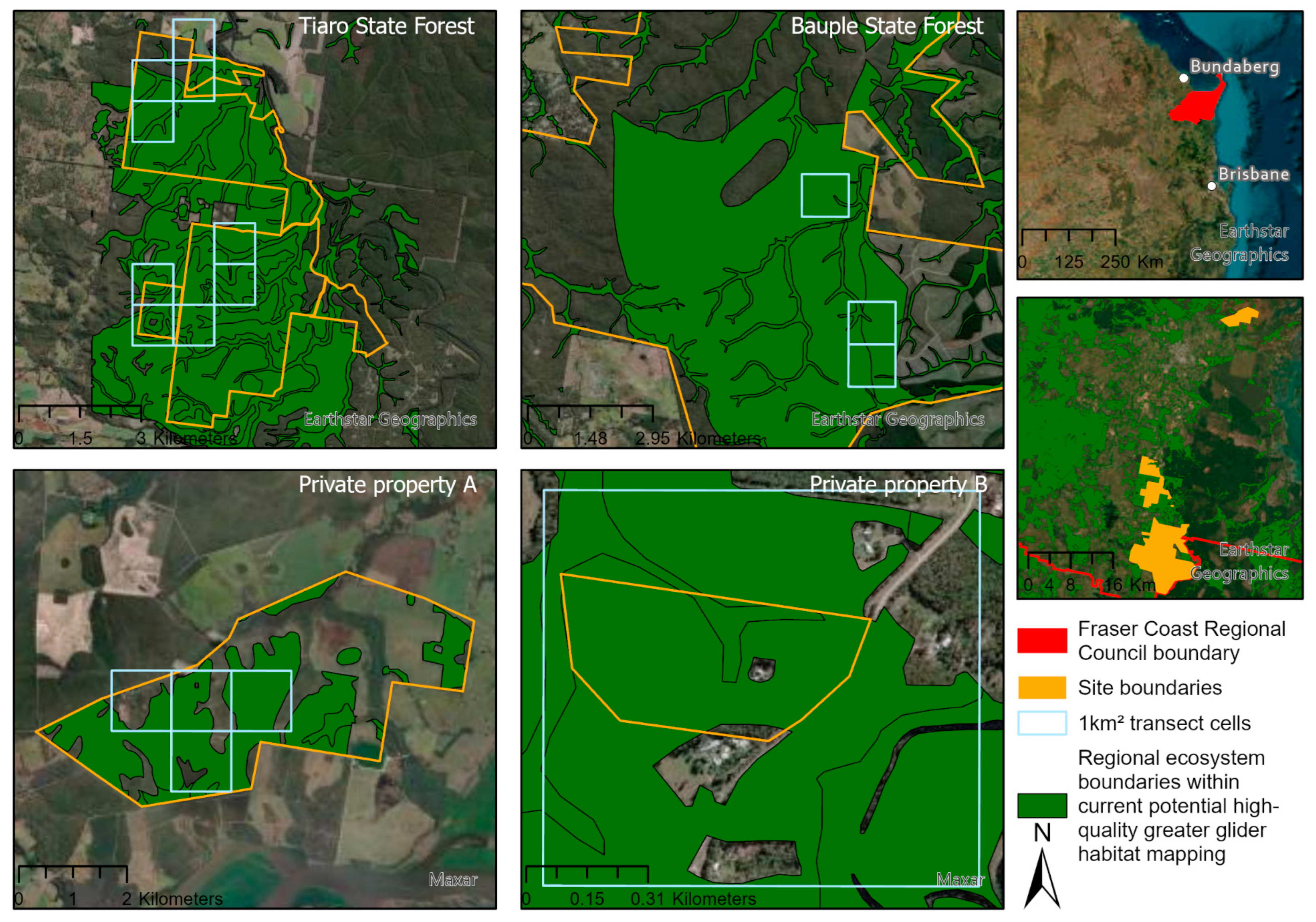
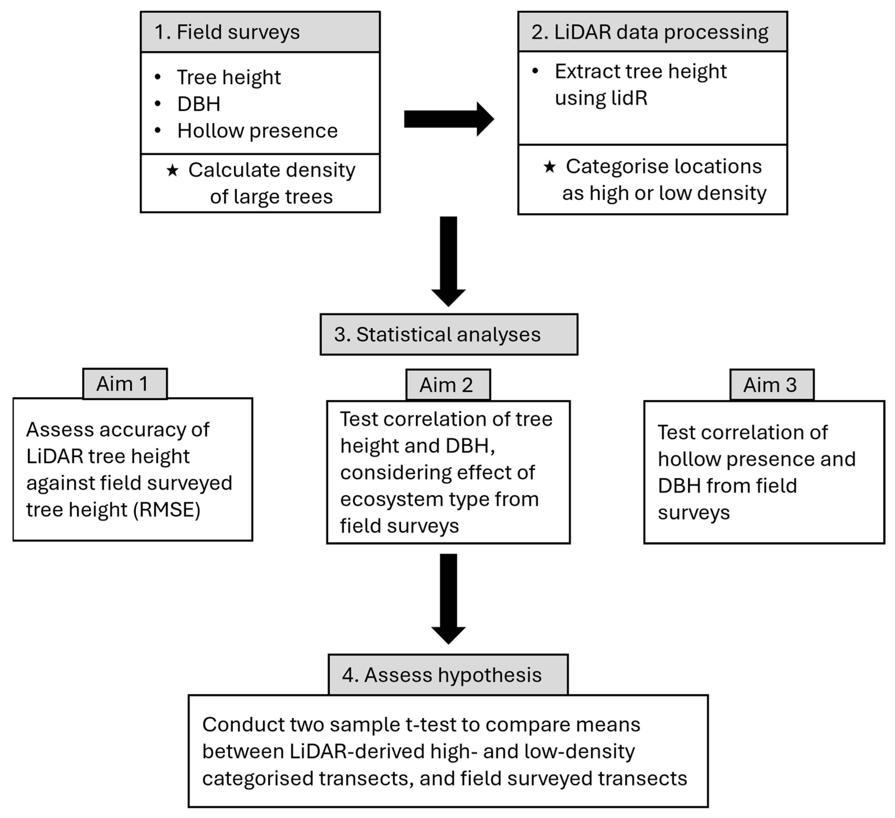
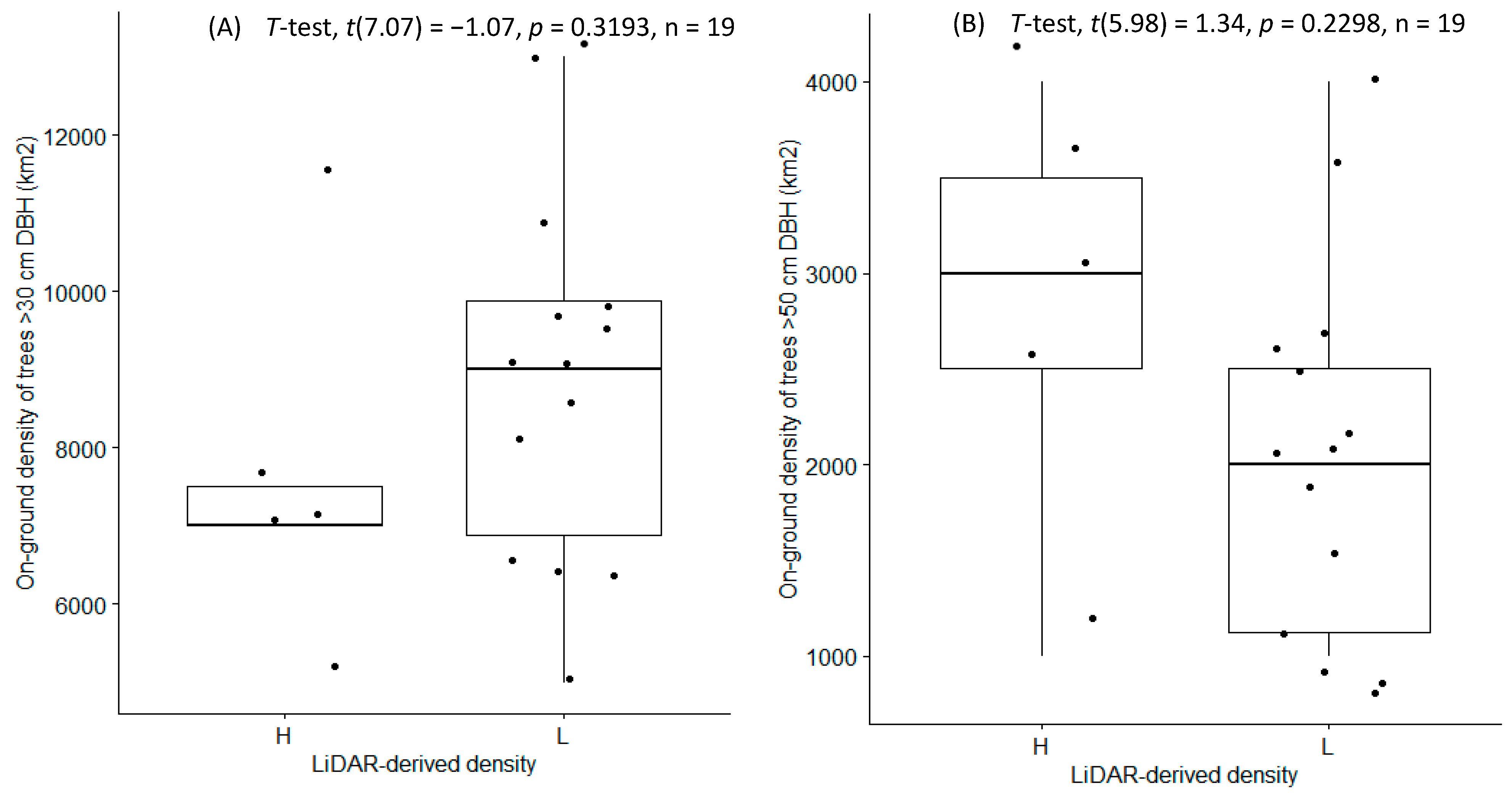
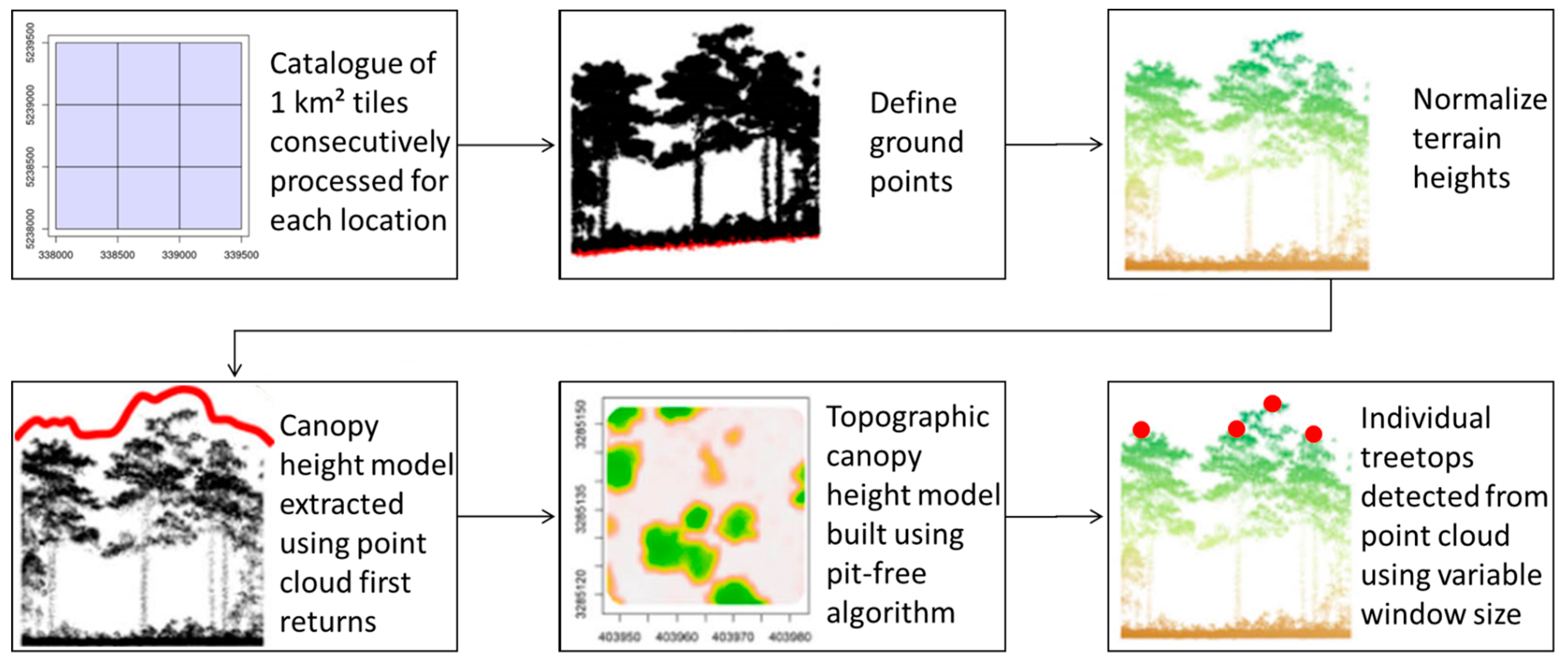
Hollow-dependent wildlife has been declining globally due to the removal of hollow-bearing trees, yet these trees are often unaccounted for in habitat mapping. As on-ground field surveys are costly and time-consuming, we aimed to develop a simple, accessible and transferrable geospatial approach using freely accessible LiDAR to refine habitat mapping by identifying high densities of potential hollow-bearing trees. We assessed if LiDAR from 2009 could be accurately used to detect tree heights, which would correlate to tree diameter at breast height (DBH), which in turn would identify trees that are more likely to be hollow-bearing. Here, we use habitat mapping of greater gliders (Petauroides spp.) in the Fraser Coast region of Australia as a case study. Across four sites, field surveys were conducted in 2023 to assess the tree height and density of large trees (>50 cm DBH per 1 km2) at 19 transects (n = 91). This was compared to outputs from individual tree detection derived from unsupervised classification using a local maximal filter and variable window size to identify treetops in freely available LiDAR. Tree height was measured with an accuracy of RMSE 5.75 m, and we were able to identify transects with large trees (>50 cm DBH), which were more likely hollow bearing. However, there was no statistical evidence to suggest that transects with a high density of large trees could be accurately identified based on LiDAR alone (>50 cm DBH p 0.2298). Despite this, we have demonstrated that freely accessible LiDAR and unsupervised machine learning techniques can be utilised to identify large, potentially hollow-bearing trees on a broad scale to refine habitat mapping for hollow-dependent species. It is important to develop geospatial analysis methods that are more accessible to land managers, as deep machine learning methods and current LiDAR can be computationally intensive and expensive. We propose a workflow using free and accessible geospatial analysis methods to identify large, potentially hollow-bearing trees and determine how to address some limitations in this geospatial approach.
Keywords: hollow-bearing tree; geospatial analysis; hollow-dependent; greater glider; lidR hollow-bearing tree; geospatial analysis; hollow-dependent; greater glider; lidR