1. Introduction
Air transport plays a pivotal role in shaping contemporary territorial configurations, particularly within metropolitan systems where international connectivity functions as a strategic asset for economic integration, demographic mobility, and territorial competitiveness [
1,
2,
3,
4]. This growing centrality is amplified by globalization processes that increase the circulation of people, capital, and information, positioning airports not only as logistical and economic hubs, but also as symbolic nodes within the world urban system [
5,
6,
7]. Regions equipped with accessible, intermodal, and strategically located airport infrastructure tend to rise in international urban hierarchies, attracting foreign investment, quality tourism, and knowledge-intensive activities [
8,
9].
This paradigmatic shift, from conceiving infrastructure as an isolated technical facility to understanding it as a spatial and political agent, has profoundly altered how airports are planned and evaluated. They are now seen as structuring elements of metropolitan space, shaping land-use patterns and regional development [
7]. In this light, airports increasingly serve as instruments of territorial planning, embedded in broader logics of spatial governance, land transformation, and socio-environmental negotiation [
10,
11].
Reflecting this evolution, several conceptual models have emerged to capture the multifaceted role of airports in landscape and regional dynamics, such as the Aerotropolis [
5], Airport City [
12], Airport Corridor [
13], Aviopolis [
14], Airea [
15], and AeroSCAPE [
16]. Despite their differences, these models converge in reimagining airports as engines of metropolitan reconfiguration [
17].
In relation to this, the present study asks where and how a new airport in the Madrid region could be optimally located, integrating functional, environmental, and territorial criteria.
In parallel, research has increasingly acknowledged that infrastructure location cannot be guided solely by demand forecasts or engineering feasibility. Instead, it must incorporate criteria such as landscape integrity, spatial justice, environmental resilience, and governance capacity [
3,
18,
19]. Airport location, therefore, becomes fundamentally a question of territorial governance, requiring the integration of functional, environmental, social, and spatial criteria into strategic territorial planning [
20]. Recent literature has emphasized the need to deconcentrate strategic nodes to enhance resilience against disruptions [
21], reduce negative externalities, and ensure better territorial integration of infrastructure, particularly in densely urbanized regions like Madrid, where functional expansion has surpassed administrative limits, generating new centralities in neighboring areas [
22,
23,
24].
Building on these governance-driven imperatives, recent research has shifted from traditional unidimensional approaches, focused solely on land availability or proximity to city centers, toward multicriteria models that integrate functional, environmental, symbolic, and spatial variables into more realistic and operational comparative frameworks [
25,
26,
27]. Numerous studies have applied such methods, integrating territorial analysis and spatial evaluation. Gago and Serrano [
22] were among the first to advocate for combining functional and territorial dimensions. Subsequent research by Fuerst and Gross [
27] and Rodrigue [
7] demonstrated the value of including environmental, social, and symbolic criteria aligned with contemporary demands for sustainability and infrastructure resilience [
28]. Case studies from the UK, Germany, Taiwan, and Turkey illustrate how spatial analysis tools have supported location decisions by anticipating impacts and optimizing resource use [
3,
4,
25,
29,
30]. Although the literature in Spain remains limited, recent contributions underscore the need to diversify the network, decentralize functions, and improve the territorial articulation of the airport system [
17,
31,
32].
Recent methodological advances have promoted the use of Geographic Information Systems (GISs) and multicriteria evaluation (MCE) techniques as tools for identifying optimal infrastructure locations through transparent, participatory, and evidence-based processes [
4,
33,
34]. These tools integrate ecological, functional, and socio-political factors into spatial decision-making [
35,
36,
37].
In the Spanish context, the limitations of the current airport system are epitomized by Adolfo Suárez Madrid–Barajas Airport, the country’s main aviation hub and a key intercontinental gateway. With over 66 million passengers in 2024 [
38], it concentrates nearly all international long-haul traffic and a significant share of domestic connections, serving as Iberia’s central hub and a strategic node in Southern Europe. However, this excessive functional centrality has led to operational saturation, environmental stress, and a structural lack of resilience, making Barajas a paradigmatic case of territorial vulnerability in times of disruption or crisis [
1,
24,
39]. Despite successive expansions, physical constraints and environmental impacts have rendered further enlargement unfeasible, while the absence of complementary infrastructure in the regional system limits the redistribution of flows and compromises long-term sustainability.
Against this backdrop, debates over the need for a second airport in Madrid have re-emerged, recently amplified by proposals reported in national media and promoted by private-sector actors. Several national newspapers and economic outlets, such as
20 Minutos [
40],
El Debate [
41], and
El Español [
42], have covered renewed interest in projects like the reactivation of Casarrubios del Monte or the identification of alternative sites in Castilla–La Mancha. These developments show the growing public visibility of airport planning as a matter of governance and territorial vision. They expose tensions between centralized models and emerging logics of polycentrism [
21]. In our view, this visibility reinforces the urgency of adopting strategic, evidence-based approaches capable of navigating complex spatial trade-offs. The present study aims to respond to this challenge by offering a GIS-based methodology with direct implications for regional development and spatial governance.
Accordingly, this paper hypothesizes that several underutilized or low-density areas in the metropolitan periphery of Madrid, particularly in the bordering provinces of Toledo, Guadalajara, and Cuenca, may offer favorable conditions for hosting a new international-scale airport. Rather than questioning whether a new infrastructure is needed, the research focuses on how and where it should be located to enhance spatial justice, intermodal integration, and the sustainability of the regional airport system.
To address this challenge, we develop a GIS-based multicriteria model that evaluates land suitability for airport location based on three analytical dimensions: (i) territorial functionality, prioritizing accessibility and regional integration; (ii) environmental compatibility, avoiding sensitive or protected landscapes; and (iii) socioeconomic rationale, emphasizing development potential, distributive fairness, and infrastructural efficiency. The specific objectives of the study are:
To select and classify spatial variables relevant to strategic airport planning.
To distinguish exclusionary constraints from weighted suitability criteria.
To construct a synthetic suitability model using Weighted Linear Combination (WLC); and
To validate results by comparing model outputs with real locations and proposals under debate.
Ultimately, the goal is to contribute to the design of integrated and evidence-based strategies for metropolitan infrastructure planning, bridging geospatial modeling with territorial governance, spatial sustainability, and land-use planning in complex urban–rural systems. This research is situated within a tradition of critical geographic inquiry that understands infrastructure not only as a technical response, but as a political and territorial project with the potential to reshape land systems, rebalance spatial accessibility, and enhance resilience across regional scales [
43,
44,
45].
2. Materials and Methods
2.1. Methodological Framework and Multicriteria Approach
To identify the optimal location for a new airport infrastructure in the central Iberian Peninsula, a spatial analysis methodology based on a GIS-implemented multicriteria approach was developed. This model not only provides a technical diagnosis but also integrates territorial, environmental, and functional considerations into strategic decision-making, as proposed in previous studies such as Erkan and Elsharida [
3], Ballis [
18], and Fawaz et al. [
4].
Unlike previous works, this research explicitly combines exclusionary constraints with weighted suitability criteria in a single GIS-based workflow, incorporates territorial intelligence and spatial justice principles, and applies the model to a congested metropolitan region where infrastructural overconcentration is a pressing challenge. The potential infrastructure is conceived with a mixed passenger–freight orientation; therefore, no re-evaluation of the variables was necessary, since the selected criteria adequately capture the requirements of both passengers and cargo operations.
The choice of a multicriteria model responds to the need for a flexible, replicable tool based on updated geospatial data. This approach enables the ranking of potential locations according to their territorial suitability by incorporating both absolute constraints and relative suitability gradients. The analysis was conducted using QGIS 3.40 “Bratislava” at a resolution compatible with a 1:50,000 scale, with raster cells of 25 m derived from the digital elevation model (DEM), suitable for capturing territorial detail without compromising layer operability. The study area covers the Community of Madrid and the bordering provinces of Toledo, Guadalajara, and Cuenca, located in the center of the Iberian Peninsula. Together they extend over approximately 50,000 km2 and include a variety of landscapes ranging from the metropolitan core of Madrid to peri-urban belts and rural hinterlands. The area is traversed by major road and rail corridors that radiate from Madrid and connect with the rest of Spain, as well as by secondary networks that link provincial capitals and intermediate towns. With more than 7 million inhabitants, it represents one of the most densely populated and highly urbanized regions of the country, while also encompassing extensive agricultural areas, river valleys, and open plateaus suitable for spatial analysis. This combination of urban concentration and peripheral open land provides a heterogeneous territorial framework for assessing potential locations for large-scale infrastructure.
Taken together, these methodological premises, integrating exclusionary and weighted criteria, applying a mixed orientation, and situating the analysis within a metropolitan region of over seven million inhabitants, establish the logical framework of the study. This framework provides the basis for the sequential phases of the research, which are detailed in the following section.
2.2. Methodological Phases
The methodology is structured into six sequential phases, summarized in
Table 1: data collection, preprocessing, raster conversion, reclassification and normalization, weighting, final integration using a Weighted Linear Combination (WLC), and model validation. All stages followed spatial harmonization logic, ensuring consistency in projection, resolution, and spatial extent.
2.2.1. Data Collection
This phase involved the acquisition of 22 vector and raster layers (
Table 2) from authoritative and reliable sources, including the National Geographic Information Center (Centro Nacional de Información Geográfica, CNIG) [
46], the Geological and Mining Institute of Spain (Instituto Geológico y Minero de España, IGME) [
47], the European Environment Agency (EEA) [
48], the National Geographic Institute (Instituto Geográfico Nacional, IGN) [
49], the State Meteorological Agency (Agencia Estatal de Meteorología, AEMET) [
50], and the Global Wind Atlas [
51]. Functionally, the variables were grouped into five thematic blocks: (1) environmental and territorial; (2) urban and land-use; (3) accessibility and infrastructure; (4) climatic and physical conditions; and (5) operational factors.
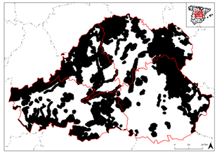
Methodologically, all layers were classified as either absolute exclusion factors (binary) or relative suitability criteria (continuous, to be reclassified and normalized).
For the absolute exclusion layers, eight key constraints were incorporated:
Protected natural areas (including Natura 2000), with a 2 km buffer
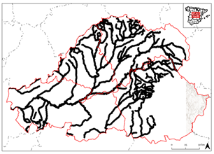
Main hydrographic network, with a 2 km buffer
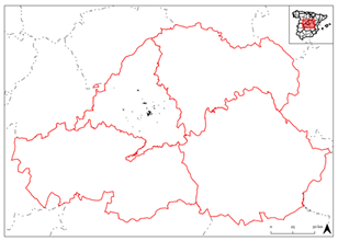
Dense urban areas, identified through CLC 2018 and population thresholds
Settlements with more than 10,000 inhabitants
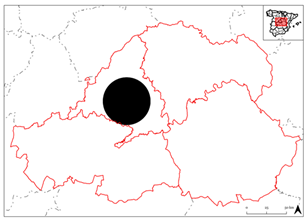
Proximity to Madrid (less than 30 km)
Areas with high annual precipitation
Planned urban expansion zones
Slopes greater than 3%, with optimal thresholds below 1.25% in line with ICAO recommendations
The identification of the eight exclusionary constraints is grounded in both normative and technical considerations. From a regulatory perspective, the protection of Natura 2000 sites and hydrographic networks reflects European and Spanish limitations on development in sensitive ecosystems and water protection zones. In functional terms, the incompatibility of airports with dense urban fabrics or medium-sized settlements responds to possible conflicts related to noise exposure, safety risks, and land-use competition. Similarly, the exclusion of areas located within 30 km of Madrid acknowledges the operational restrictions associated with overlapping air corridors and airspace management criteria. Climatic factors, such as zones with high annual precipitation, were also considered unsuitable due to their implications for operational reliability and long-term infrastructure resilience. Finally, the rejection of planned urban expansion areas and sites with slopes exceeding 3% follows, respectively, the need to ensure consistency with officially designated growth patterns and compliance with ICAO’s technical recommendations, which establish optimal thresholds below 1.25% for runway construction. Collectively, these criteria reflect a precautionary logic that combines international standards, legal regulations, and widely accepted planning practices to minimize territorial conflicts and ensure the long-term feasibility of airport infrastructure.
For the relative suitability layers, 14 thematic variables were included, such as
High-value agricultural land (penalized)
Altitude (penalized above 550 m)
Road and rail accessibility (including AVE and conventional lines)
Proximity to reservoirs
Lithology (favoring stable soils)
Travel time to Madrid
Wind speed (preferably low)
Air quality indicators (PM2.5, PM10, NO2)
Urban pressure gradients
Proximity to high-voltage power lines
This dual classification ensures both regulatory compliance (via exclusion) and spatial differentiation (via suitability scoring), forming the foundation for the subsequent modeling phases.
2.2.2. Preprocessing
This stage included topological correction, format harmonization, overlap resolution, and projection unification. These steps were conducted in QGIS using geometry-cleaning and topological validation tools to ensure interoperability and spatial accuracy.
2.2.3. Raster Conversion
Vector layers were rasterized at uniform resolution to enable matrix-based operations in subsequent stages. Each raster cell encodes a single attribute value, compatible with WLC analysis.
2.2.4. Reclassification and Normalization
All layers were spatially harmonized: Vector layers were cleaned, reclassified, and rasterized; raster layers were reprojected to ETRS89 and rescaled. Variables were converted to comparable 0–1 or 0–4 scales based on their data nature and variability. For instance, higher altitudes (>550 m), strong winds (>15 km/h), and greater distances from key infrastructures were penalized. Other variables such as air quality or urban pressure were derived using synthetic indices or buffer gradients. Unnormalized rasters were scaled by their maximum values to ensure arithmetic compatibility
2.2.5. Weighting
Each variable was assigned a weight reflecting its thematic relevance (environmental, operational, or territorial), using a simplified application of the Analytic Hierarchy Process (AHP), informed by literature, functional analysis, and reasoned judgment (
Table 3) [
52,
53,
54]. For instance, road access, travel time to Madrid, and proximity to rail networks received high weights. Others, such as lithology or air quality, were moderately weighted.
This simplified weighting procedure was deliberately adopted to streamline the analytical process and maintain methodological transparency, ensuring that the model remains easily replicable and adaptable for future studies in similar metropolitan contexts.
2.2.6. Weighted Linear Combination
The final suitability map was obtained through a two-stage Weighted Linear Combination (WLC) model:
Exclusion phase: First, all exclusion layers were multiplied to eliminate areas unsuitable for airport development. This resulted in a binary raster where excluded cells were assigned a value of zero. The exclusion layers included
Protected Natural Areas
Main Hydrographic Network
Dense Urban Areas
Critical Distance to Madrid (threshold-based)
High Precipitation Zones
Urban Expansion Areas
Populated Areas
Slope (penalized as Slope × 0.5)
Suitability phase: Over the remaining territory, a weighted additive model was applied to compute a composite suitability score. Each criterion was normalized and weighed according to its relative importance:
where the weighted sum was defined as
(Air Quality × 0.07) +
(Access to High-Capacity Roads × 0.09 × 0.5) +
(High-Value Agricultural Land × 0.03) +
(Air Density × 0.05 × 0.25) +
(Distance to Primary Road Network × 0.10 × 0.5) +
(Proximity to AVE Stations × 0.09 × 0.33) +
(General Distance to Madrid × 0.10 × 0.25) +
(Proximity to Conventional Rail Network × 0.07) +
(Access to Strategic Water Resources × 0.03) +
(Lithology × 0.05) +
(Proximity to Power Grid × 0.05) +
(Road Travel Time to Madrid × 0.11 × 0.25) +
(Average Wind Speed × 0.07) +
(Urban Pressure Gradient × 0.09 × 0.33)
The resulting raster expresses, for each cell, the relative suitability for the location of a large-scale airport based on the integrated territorial, functional, environmental, and socioeconomic criteria. The model thus functions as a robust spatial decision-support tool for land-use planning and infrastructure governance.
In addition, once the Weighted Linear Combination results were obtained, model validation also required establishing a minimum area threshold to guarantee the spatial feasibility of potential sites. While primary hubs such as Madrid–Barajas (≈4000 ha), Paris-Charles de Gaulle (≈3000 ha), or London–Heathrow (≈1500 ha) extend over very large surfaces, the objective of this study is not to replicate infrastructures of that magnitude but rather to explore complementary facilities within the metropolitan system. In this regard, European airports such as London–Gatwick (≈600 ha), London–Stansted (≈650 ha), and Paris–Beauvais (≈300 ha) illustrate the viability of more compact platforms. On this basis, a threshold of 500 hectares of contiguous land was adopted as the minimum requirement, ensuring sufficient space for runways, terminals, ancillary facilities, and possible future expansions. This criterion strengthens the robustness of the model by aligning it with the functional role intended for a secondary airport in the Madrid region and by preventing the study of undersized or fragmented areas.
2.2.7. Model Validation
To assess the robustness and operational validity of the proposed model, a comparative spatial validation was conducted using two real-world reference cases:
Adolfo Suárez Madrid–Barajas Airport, currently the main aviation hub in Spain and the core node in the metropolitan airport system.
Casarrubios del Monte, a site recently promoted by private-sector actors and widely discussed in the media as a potential location for a second airport.
Both sites were evaluated against the model’s final output to verify its coherence, spatial discriminatory capacity, and alignment with actual or proposed infrastructures. Their respective locations and scores were used to confirm that the model not only identifies technically and territorially coherent areas but also differentiates between viable and less suitable alternatives across the region.
2.3. Layers Visualization and Map Output (Appendix A)
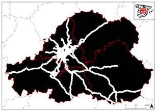
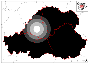
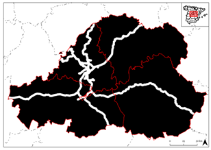
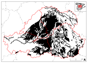
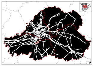
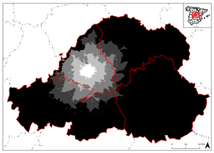
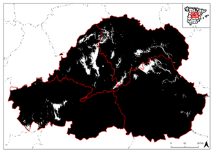
To enhance the interpretability and transparency of the model, a visual annex (
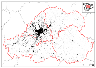
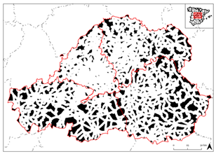
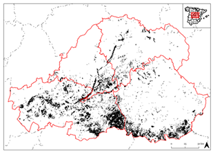
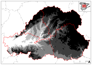
Appendix A) was created featuring the most representative layers used in the WLC process. All raster layers were normalized and reclassified according to relative suitability:
This visualization strategy facilitates intuitive spatial interpretation, allowing users to identify territorial patterns and visualize key constraints and opportunities. It aligns with emerging research priorities in land system science, territorial intelligence, spatial governance, metropolitan infrastructure planning, and evidence-based spatial planning.
The resulting cartographic outputs not only support analytical rigor but also enhance the transparency, communication, and replicability of the spatial decision-making process. Moreover, the visual framework can be readily adapted to other metropolitan contexts facing similar challenges related to infrastructural saturation, land-use conflicts, or regional imbalance.
3. Results
3.1. Territorial Suitability and Regional Opportunity Structure
The GIS-based multicriteria model generated a synthetic land suitability index that integrates technical, environmental, infrastructural, and territorial variables to assess the optimal location of a new airport in the Madrid metropolitan region. Each cell in the raster grid was assigned a normalized value ranging from zero (null suitability) to one (maximum suitability), resulting in a continuous cartographic surface that spatializes potential across the extended urban–rural interface.
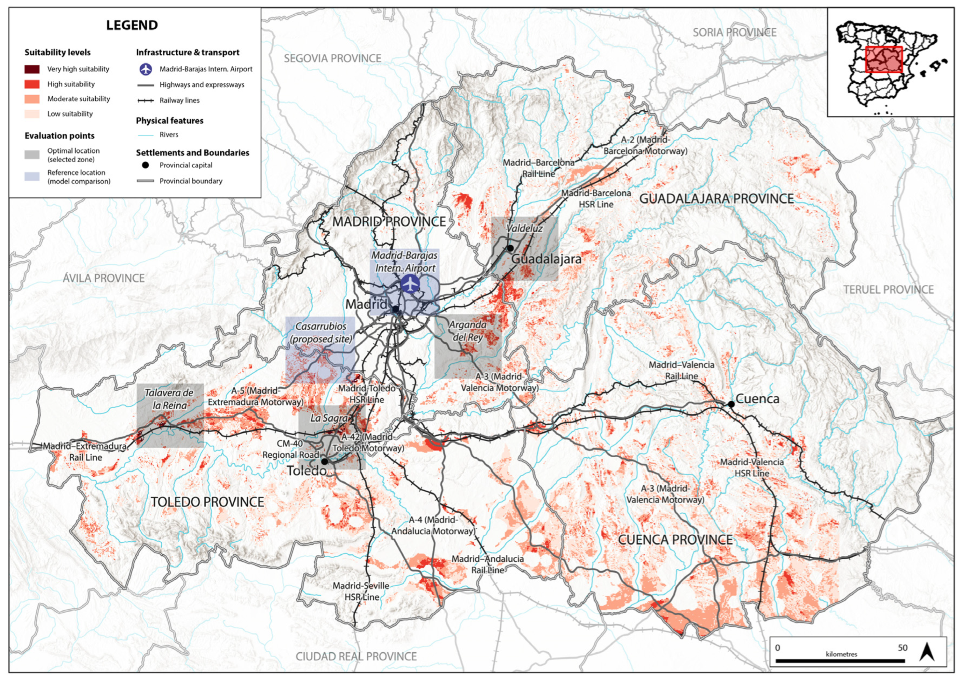
The suitability map (
Figure 1) reflects a dual spatial logic: on one hand, areas of strong constraint were excluded (e.g., Natura 2000 protected zones, flood-prone areas, steep slopes, consolidated urban fabric); on the other, a combination of enabling factors, morphological favorability, road and rail accessibility, limited anthropogenic pressure, and land continuity, shaped the emergence of opportunity corridors.
Four major clusters of high territorial suitability were identified, mostly aligned along the boundary between the Community of Madrid and the provinces of Toledo and Guadalajara in Castilla–La Mancha (namely, La Sagra, Talavera de la Reina, Valdeluz, and Arganda). This configuration highlights an evolving metropolitan geography, where decentralization processes, infrastructural expansion, and land availability reshape the spatial logic of strategic infrastructure planning at a supraprovincial scale.
3.2. Reference Sites and Institutional Discourse: Madrid–Barajas Airport and Casarrubios del Monte
To validate the robustness of the model and evaluate its capacity to inform strategic decision-making, two reference locations were assessed:
Madrid–Barajas Airport, the existing infrastructural hub.
Casarrubios del Monte, recently proposed in political and media discourse as a candidate site for a second airport.
Barajas scored zero in the model, reflecting severe territorial incompatibilities due to high urban density, topographic constraints, airspace congestion, and environmental protections. Although central to Spain’s air transport system, it lacks the spatial flexibility required for major expansion.
Casarrubios del Monte obtained a medium suitability score. Although it benefits from proximity to the highway network and a strategic position near the Madrid–Toledo boundary, its candidacy is constrained by a fragmented peri-urban morphology, lack of high-speed rail (AVE) connectivity, and a relatively limited area of contiguous developable land. The renewed attention it has received in recent months in Spanish mass media [
40,
41,
42] highlights the potential misalignment between politically promoted proposals and spatially grounded evidence
This comparison underscores the model’s value not only for site selection, but also for informing public debate with spatial intelligence, land-use planning principles, and evidence-based criteria.
3.3. Strategic Evaluation of High-Suitability Zones
Beyond the reference sites, the model identifies four areas with high composite suitability scores: La Sagra, Talavera de la Reina, Valdeluz, and Arganda. While all meet the essential technical thresholds, their territorial configurations, levels of accessibility, and integration into the regional system vary considerably. When analyzing the suitability as a whole, it also becomes evident that other areas, such as the corridor between Toledo and Talavera de la Reina or the eastern sector around Ocaña, display relatively high potential. However, these zones were not retained in the final selection, since the analysis prioritized clusters of very high suitability over those classified only as high suitability. Moreover, once potential sites of more than 500 hectares with very high suitability values were identified, areas that only reached the high category were discarded. This double condition explains why certain zones visible on the map were excluded, while La Sagra (2200 ha), Talavera de la Reina (700 ha), Valdeluz (500 ha), and Arganda (500 ha) emerged as the most consistent opportunities in terms of both locational quality and spatial feasibility.
Table 4 summarizes the key attributes of the selected areas.
La Sagra, located in the province of Toledo, exemplifies the technical, spatial, and functional conditions required to host a major airport infrastructure. It emerges as the most consistent option from both an operational and territorial perspective. Its excellent connectivity to road and rail networks, low urban pressure, and extensive availability of developable land offer strategic advantages for long-term infrastructure planning. Given the low settlement density in its surroundings, no significant relocation of population or activities would be expected, reinforcing its high territorial compatibility.
Talavera de la Reina, situated in western Toledo and adjacent to the A-5 motorway, occupies a strategic position within the central Iberian Peninsula. In contrast to areas closer to the capital, Talavera combines land availability, functional connectivity, low territorial pressure, and future AVE integration, enhancing its operational viability and highlighting its potential as a strategic hub for regional rebalancing. The medium–low urban pressure recorded for this area indicates limited exposure of nearby population centers, minimizing the likelihood of relocations or social conflicts.
Valdeluz, though more limited in surface area, benefits from immediate access to high-speed rail through the Guadalajara–Yebes AVE station and direct road linkage via the A-2 Madrid–Barcelona motorway. Its southeastern location within the province of Guadalajara contributes to the polycentric structure of the expanded metropolitan region. With low urban pressure, Valdeluz presents minimal risks of displacement, although its smaller land availability constrains long-term scalability. Together, these three selected areas illustrate the viability of Castilla–La Mancha as a strategic alternative for decentralizing Madrid’s airport system.
Arganda del Rey, the only viable option located within the Community of Madrid, lies along a key logistical axis at the interface between consolidated urban development and semi-rural agricultural zones. This dual character enhances its territorial potential by combining operational proximity with physical availability for future functional transformation. However, the medium–high urban pressure surrounding Arganda suggests higher potential impacts on existing population centers, possibly requiring relocation of certain activities or generating land-use conflicts, which would need to be carefully addressed in future planning stages.
3.4. Spatial Prioritization and Planning Implications
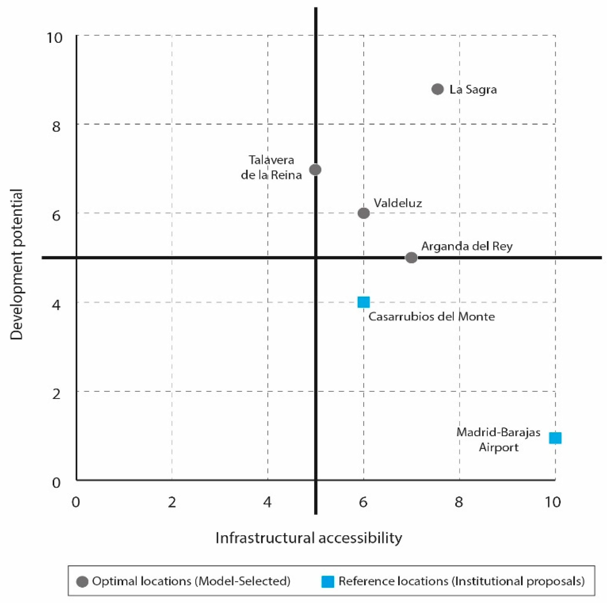
To facilitate the comparative evaluation of alternative sites, a two-dimensional classification diagram (
Figure 2) was developed. This figure locates the four model-selected zones, La Sagra, Talavera de la Reina, Valdeluz, and Arganda del Rey, alongside two reference sites: Madrid–Barajas Airport and Casarrubios del Monte. The positioning is based on two analytical dimensions: infrastructural accessibility (horizontal axis), which includes proximity to high-capacity road networks, conventional railway lines, and AVE stations; and development potential (vertical axis), interpreted through indicators such as land availability, spatial continuity, and levels of anthropogenic pressure. This spatial typology enables a strategic reading of each site’s relative suitability for accommodating new large-scale infrastructure.
The distribution of sites across this diagram reveals that La Sagra and Talavera de la Reina occupy the most favorable quadrant, combining high accessibility with strong development potential, thus consolidating their role as robust polycentric nodes in the regional structure. Valdeluz and Arganda del Rey, while maintaining reasonable levels of accessibility, exhibit more limited capacity for long-term expansion due to environmental and urban constraints. By contrast, the inclusion of Madrid–Barajas Airport and Casarrubios del Monte as reference locations underscores the disconnect between institutional preferences and spatial evidence. Both sites are positioned in zones that reflect either saturation (in the case of Madrid–Barajas Airport) or weak territorial integration (in the case of Casarrubios del Monte), challenging their strategic viability.
Overall, this typological classification reinforces the value of integrated territorial evaluation in metropolitan infrastructure planning. By offering a visual and analytical synthesis of accessibility and development capacity, the model supports more informed decision-making processes and encourages a transition toward spatially balanced, context-sensitive airport location strategies.
4. Discussion
4.1. Territorial Drivers of Site Selection
The results obtained through the GIS-based multicriteria model provide a robust analytical foundation for evaluating the territorial feasibility and strategic potential of new airport development across the Madrid region. Crucially, the model reveals that there is no single “optimal” site, but rather a group of high-suitability zones whose relative importance depends on planning priorities, such as relieving congestion at Madrid–Barajas, enhancing multimodal integration, rebalancing regional development, or minimizing land-use conflicts. All variables incorporated into the Weighted Linear Combination, ranging from lithology and air quality to distance to Madrid, proximity to high-speed rail stations, and accessibility to motorways, contributed to the construction of the composite suitability index. Once this index was generated, the final selection of candidate areas was restricted to clusters classified as very high suitability and exceeding the minimum contiguous threshold of 500 hectares. This double condition explains why La Sagra, Talavera de la Reina, Valdeluz, and Arganda emerged as consistent options, while other zones with only high suitability—such as Ocaña or the Toledo–Talavera corridor, were excluded from the final shortlist.
4.2. Institutional Preferences and Strategic Tensions
From a territorial standpoint, the findings directly challenge current institutional preferences. The expansion of Madrid–Barajas, approved in recent years, responds to short-term traffic forecasts but suffers from mounting structural constraints: limited physical space, dense surrounding urbanization, and increasing environmental stress [
24]. These factors hinder its long-term scalability and reinforce the need to consider sustainable alternatives. Similarly, the renewed political and media interest in Casarrubios del Monte, reported by 20 Minutos [
40], El Debate [
41], and El Español [
42], has not been supported by robust spatial diagnostics. In fact, the model assigns Casarrubios only a moderate score, citing poor connectivity, fragmented peri-urban land, and weak territorial integration. This misalignment between institutional discourse and spatial evidence illustrates the political inertia that often favors continuity over territorial rebalancing. By contrast, the emergence of high-suitability zones such as La Sagra, Talavera, Arganda and Valdeluz signals a reconfiguration of Madrid’s metropolitan spatial logic, reflecting a shift toward a diffuse, interdependent, and functionally polycentric urban system that transcends traditional administrative boundaries.
4.3. Practical Obstacles and Governance Challenges
While the spatial evidence identifies feasible locations, translating them into practice would encounter significant obstacles. Interregional coordination between the Community of Madrid and Castilla–La Mancha would be indispensable, as the most suitable zones lie outside Madrid’s administrative boundaries. Divergent regional strategies, funding responsibilities, and planning authorizations could hinder implementation. Political visibility, moreover, continues to concentrate on Barajas and Casarrubios, raising the risk that technically superior alternatives may be sidelined. Land-use conflicts also represent a potential constraint, particularly in Arganda, where medium–high urban pressure suggests that new infrastructure could generate tensions with nearby urban and semi-rural communities. These obstacles underscore the need for governance frameworks capable of reconciling functional, environmental, and social objectives at a supraprovincial scale.
4.4. Implications for Future Airport Planning
The findings offer valuable insights for the future of airport location planning in Madrid and comparable metropolitan regions. First, they highlight that secondary airports can play a complementary role in relieving congestion at primary hubs, provided that they meet minimum spatial and accessibility requirements. Second, they demonstrate the importance of integrating territorial intelligence, land availability, connectivity, and urban pressure into decision-making processes, moving beyond approaches based solely on demand forecasts or political expediency. Third, the model underscores how geospatial diagnostics can serve as a counterweight to media-driven debates, offering analytical guidance for more coherent and resilient planning strategies. These implications resonate with international approaches to polycentric airport development [
5,
7,
19] and with planning paradigms oriented toward sustainable land management, regional cohesion, and landscape-sensitive territorial governance [
43,
44,
45]. Beyond the Madrid case, the methodological framework presented here may inform other European and Latin American metropolitan regions where infrastructural saturation, territorial inequalities, and institutional fragmentation converge.
4.5. Limitations of the Study
Although this study offers a robust and replicable framework, certain limitations must be acknowledged. The model does not incorporate elements such as transport demand forecasts, detailed environmental impact assessments, or cost–benefit analyses, which would complement its territorial approach but lie beyond the scope of this exploratory work. Similarly, political feasibility and participatory dimensions were not integrated, even though they are crucial for ensuring legitimacy and long-term implementation. The analysis also relies on current datasets that require periodic updating to reflect evolving land uses, mobility networks, and regulatory frameworks.
In addition, some methodological simplifications should be noted. The adoption of a 500-hectare minimum threshold, while grounded in comparison with European secondary airports, remains a general criterion and could be refined through more detailed demand-based studies. Similarly, although the infrastructure is conceived with a mixed passenger–freight orientation, future research could adjust the weighting of variables (e.g., rail accessibility or logistics land requirements) under more specific scenarios. The exclusion of zones with only “high” suitability in favor of “very high” clusters over 500 hectares, while consistent with the study’s objectives, also introduces a level of arbitrariness that could be revisited in subsequent analyses. Moreover, while the potential impacts on existing population centers were qualitatively considered through the variable of urban pressure, further research could explore in detail the social implications of potential relocations or land-use transformations.
Rather than diminishing the validity of the findings, these aspects highlight avenues for further refinement. Future research could combine the present geospatial multicriteria framework with strategic environmental assessment, stakeholder engagement, and scenario planning, thereby enhancing its value as an integrative tool. The methodological structure demonstrated here nonetheless provides a strong foundation with potential applications in other metropolitan contexts, particularly in Europe and Latin America, where infrastructural saturation and territorial imbalances converge.
4.6. Toward a Place-Sensitive Infrastructure Planning Paradigm
In the Spanish context, this research represents both a conceptual and methodological shift. Rather than treating airport location as a purely technical or administrative task, it frames infrastructure as a spatial and political project capable of reshaping accessibility, promoting equity, and reinforcing resilience [
55]. By embedding geospatial modeling within broader governance debates, the study helps bridge the gap between analytical rigor and institutional practice, contributing to a new generation of place-sensitive, evidence-based planning approaches. Ultimately, the findings highlight the need to plan strategic infrastructures not only in terms of efficiency and capacity, but also through the lenses of spatial justice, sustainability, and territorial intelligence. Especially in contexts where political urgency and media discourse risk outpacing spatial analysis, models such as the one proposed here offer critical guidance for more coherent, equitable, and resilient metropolitan development.
5. Conclusions
This study advocates for a renewed approach to airport planning, one that treats infrastructure not merely as a response to operational demands, but as a strategic lever to reshape metropolitan structure, enhance territorial resilience, and foster sustainable development. In a spatially saturated and fragmented urban context such as Madrid, decisions about new airport locations must transcend short-term optimization and adopt a broader territorial governance perspective, in line with key debates in land system science, urban–rural planning, and spatial sustainability.
The GIS-based multicriteria model developed herein demonstrates the potential of territorial intelligence frameworks to inform infrastructure decisions in complex metropolitan regions. By integrating environmental constraints, technical criteria, and multimodal accessibility indicators into a transparent and replicable structure, this research identifies a set of high-suitability zones, notably La Sagra, Talavera de la Reina, Arganda, and Valdeluz, each with distinct territorial profiles and strategic value.
Rather than prescribing a single solution, the analysis highlights a spectrum of opportunities that emerge when infrastructure planning is grounded in regional logic and geospatial evidence. This plurality reinforces the role of the model as a decision-support system, adaptable to diverse institutional priorities such as relieving pressure on Madrid–Barajas, enhancing rail–air integration, fostering territorial balance, or mitigating land-use conflicts.
In this light, the growing political momentum behind the Casarrubios del Monte proposal deserves critical scrutiny. While the site may offer certain institutional advantages, the model underscores its spatial limitations, fragmented land structure, absence of AVE connectivity, and low territorial integration. This illustrates the broader risk of privileging short-term visibility over long-term strategic coherence in infrastructure governance. Conversely, areas such as La Sagra exemplify how well-situated nodes can align technical feasibility with spatial opportunity, reflecting a deeper shift toward resilient, polycentric, and regionally integrated planning logics.
Beyond the Madrid case, the methodological approach developed here holds value for other metropolitan contexts, national and international, facing similar tensions between infrastructural needs, governance fragmentation, and spatial asymmetries. By anchoring geospatial modeling within a normative and strategic planning framework, this research contributes to global debates on infrastructure siting, territorial governance, spatial justice, and sustainable land-use transitions.
Ultimately, the challenge is not only to decide where to build infrastructure, but also how, for what purpose, and under what principles. Embedding airport planning within coherent territorial strategies is essential to ensure efficiency, spatial equity, environmental awareness, and long-term resilience. As airport infrastructure becomes increasingly central to mobility, competitiveness, and regional cohesion, planning models must evolve to be land-sensitive, evidence-based, and grounded in the public interest.
