1. Introduction
Climate change is a global issue that is important to everyone. The large industrial areas and smaller towns are facing new challenges.
The research question was: What can we do to mitigate climate change in case of the cultural heritage of post-industrial origin located in the town’s center to promote the health and well-being of the local community?
The revitalization of a historic post-industrial old village on the banks of Zagórska Struga in the town of Rumia in the vicinities of Tri-City in Poland can serve as a case study. The neglected post-industrial site underwent an urban renewal process to become a favorite recreational site for the city’s inhabitants. A public park created around historical monuments and reconstructed water pond became popular among all age groups. The historical building of the “Manor under the linden trees” was reconstructed and today is a local cultural center. The new open-air theatre serves to organize social events and festivals.
A new public park brought cultural and social benefits regarding place identity and place attachment. The local community actively participated in park development. Nivea company funded the new playground because of local citizens’ involvement.
The space of the new park with all amenities is an example of a well-developed public space. This study focused on assessing the new park’s therapeutic qualities and mapping the users’ activity.
The construction of a new urban public park and reconstruction of historic water ponds and waterworks was significant because of local culture and cultural identity, and helped moderate the local climate.
2. Climate Change Risks
Climate change can affect cultural heritage in at least two ways: direct physical effects on the site, building, or structure and the effects on social structures. It may impact communities changing the way they live, work, worship, and socialize in buildings, sites, and landscapes. What can be anticipated is abandonment with the eventual loss of cultural memory [
1].
According to UNESCO Report temperature increases (‘global warming’), changes in precipitation patterns, and increased frequencies of extreme weather events, i.e., intensity and seasonality of droughts, is exerting considerable impacts on our environment and biodiversity [
1,
2,
3,
4].
The biodiversity loss is a risk. The growing season of plants is lengthening, and the threat of invasive alien species increasingly impact indigenous species. The small and isolated areas are especially at risk when the grid of green infrastructure connections is broken. Wetlands are especially vulnerable to climate change and have limited adaptive capacity.
The physical substance of cultural heritage buildings is also exposed to threats, like changes in temperature, precipitation and atmospheric moisture, and wind intensity. Historic buildings were designed for a specific local climate. They have a different relation with the ground than modern ones, as they are more porous. Changes in water-table levels and changes in soil chemistry are responsible for destruction of original historic tissue [
1]. There is a plethora of research on climate change and its impact on cultural heritage [
1,
2,
3,
4,
5]. Among those which might affect the case study location in Central and Northern Europe are the following risks:
Cultural heritage assets such as historical buildings are a legacy that lend a sense of place and identity to local populations. In Rumia, the historic building of the “Manor under the linden trees” is one of only a few historic monuments. It is important to preserve it not only for cultural reasons, but also to promote the sense of place attachment and place identity. The decision to revitalize the historic waterworks and create the urban park helped to preserve the biodiversity and local microclimate.
2.1. Possible Interventions or Adaptive Responses to Counteract Climate Change Threats
UNESCO proposes a specific approach to natural World Heritage sites at risk [
1]. A two-pronged approach is required: first, the site’s vulnerability should be assessed, and specific site-level mitigation and adaptation strategies should be designed and implemented in partnership with relevant stakeholders. Second, site managers need to look beyond the individual site level and develop and implement regional and transboundary mitigation and adaptation strategies that reduce the site vulnerability in a larger landscape context. That approach may be applied to any cultural heritage site.
The critical question is why the cultural heritage site is sensitive and vulnerable to the pressures of climate change and what could be done to remedy the current situation. Responses in the case of World Heritage sites may include monitoring, maintaining, and managing [
1]. In the case of cultural heritage, it might also include urban renewal and adaptation to new functions, if possible, without causing any damage to the original tissue.
When the social and cultural aspects are considered, informing the public about these issues is the most critical strategy. It is vital to emphasize satisfying the public interest and ensuring the participation of the individuals, authorities, and site managers. It is crucial to promote educational activities to raise public awareness [
3]. In the case of urban renewal strategies concerning the cultural heritage sites is the entitlement of any given generation to these assets and their right to adapt them to meet contemporary needs with the consent of the larger public [
4].
Today, the landscapes are fragmented and subject to human pressures. However, the Kyoto Protocol identifies significant opportunities for mitigating climate change and adapting to climate change while enhancing the conservation of biodiversity. The ecosystem approach is essential [
1].
The urban renewal of the historic forge in Rumia was a community-led effort. Numerous uproot initiatives, satisfying the public interest, and ensuring the participation of the individuals, authorities, and site managers was the driving force behind creating this landscape park.
2.2. Climate Change and Human Well-Being. Urban Parks and Therapeutic Landscapes
Some researchers stipulate establishing recreational facilities on poor lands unsuitable for agricultural purposes [
3]. The construction of a new urban park can result in the provision and use of new green infrastructure, promoting active forms of travel, thus reducing exposure to air, water, and soil pollutants—climate change impacts in the long run [
6]. Public parks offer numerous possibilities of physical and mental restoration, physical activities, and social contacts [
7].
Parks, forests, and waterways can be spaces of refuge from brutal and chaotic urbanization. Moreover, public open green spaces offer symbolic ownership of a place to local community members and democratization of access to land, which is crucial to prevent social exclusion, spatial deprivation, and environmental injustice [
6]. Engaging residents in the management of urban parks boosts their participation and willingness to use them [
5].
Today, we need more complex socio-environmental systems to improve the quality of life in a socially friendly and climate-neutral build environment maintaining achievements of previous generations and cultural heritage [
8]. The story of the urban renewal of the public park in Rumia is an excellent example of such an approach.
2.3. Case Study. Park Starowiejski in Rumia, Poland
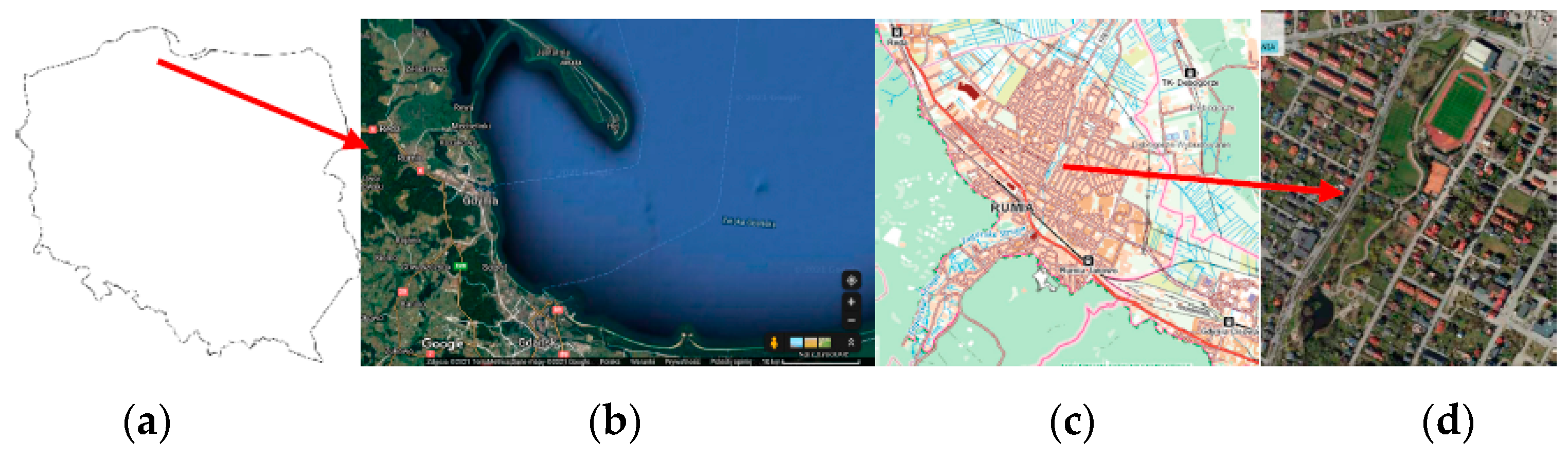
Rumia (54°34′14″ N 18°23′16″ E) is a city in the Eastern Pomerania region of northwestern Poland in the Kashubian region (
Figure 1). The altitude is 7–169.4 m in height above sea level. The area of the city is 30.10 km
2, and the urban density is 1600/km
2. The city has almost fifty thousand inhabitants, but eventually is a prolongation of a linear conurbation of the Tricity—Gdańsk, Gdynia, and Sopot, which has over one million inhabitants. The proximity to the urban center (metro area) is 130,000. The time zone is UTC+1 (CET).
Rumia’s climate is classified as Cfb by the Köppen—Geiger system. The average annual temperature in Rumia is 8.7 °C. The average annual rainfall is 550–792 mm, with heavy rain present in all seasons [
9].
Figure 1.
Case study location—Park Starowiejski in Rumia, Poland (
a) Map of Poland, source: [
10], (
b) Map of Gdańsk Bay, source [
11], (
c) Map of Rumia, source [
12], (
d) map of Park Starowiejski in Rumia, source [
12].
Figure 1.
Case study location—Park Starowiejski in Rumia, Poland (
a) Map of Poland, source: [
10], (
b) Map of Gdańsk Bay, source [
11], (
c) Map of Rumia, source [
12], (
d) map of Park Starowiejski in Rumia, source [
12].
Park Starowiejski is located in the center of Rumia along the banks of Zagórska Struga—a river which flows out of Marchowo Lake, located at an altitude of 154 m above sea level in the Szemud municipality. It then crosses the Kashubian Lake District upland and continues to the valley surrounded by forests of the Tri-City Landscape Park (TPK), to the alluvial fan forming the city of Rumia and the Łyski Canal, and finally enters the Baltic Sea in the Puck Bay. The length of the river is almost 29 km, and the average longitudinal slope is 5.6 ‰ [
13].
The streets Starowiejska, Adama Mickiewicza, Dębogórska, and Józefa Wybickiego are marking the borders of the park (
Figure 1 and
Figure 2).
3. The Story of Water Forge—The Most Important Industrial Plant in Rumia
The village of Rumia dates back to ancient times. In 1950 and 1960 in the case study area—Starowiejska and Mickiewicza streets, on both sides of the Zagórska Struga River (
Figure 1), over 300 graves were discovered from the ancient time of early Roman influence on the Pomeranian culture [
14]. Old stoves for iron ore smelting were found there [
15]. The oldest documents mentioning the industrial water facilities in the old village of Rumia date back to the second half of the 16th century. The natural water fault creating a small waterfall was used to move the water wheel of the forge. It is believed that the first water smithy belonged to Cistercian Monks from Oliwa.
The water smithy was the largest industrial plant in Rumia, of great economic importance until the 19th century [
15]. (
Figure 3)
At the beginning of the 19th century, the Napoleonic wars and the continental blockade disrupted the activity of the forge. It was closed in 1887 and replaced by a woodworking plant that produced thin veneers of wood to make matchboxes. After installing a water turbine to produce electricity, it was powered by electricity [
16,
17].
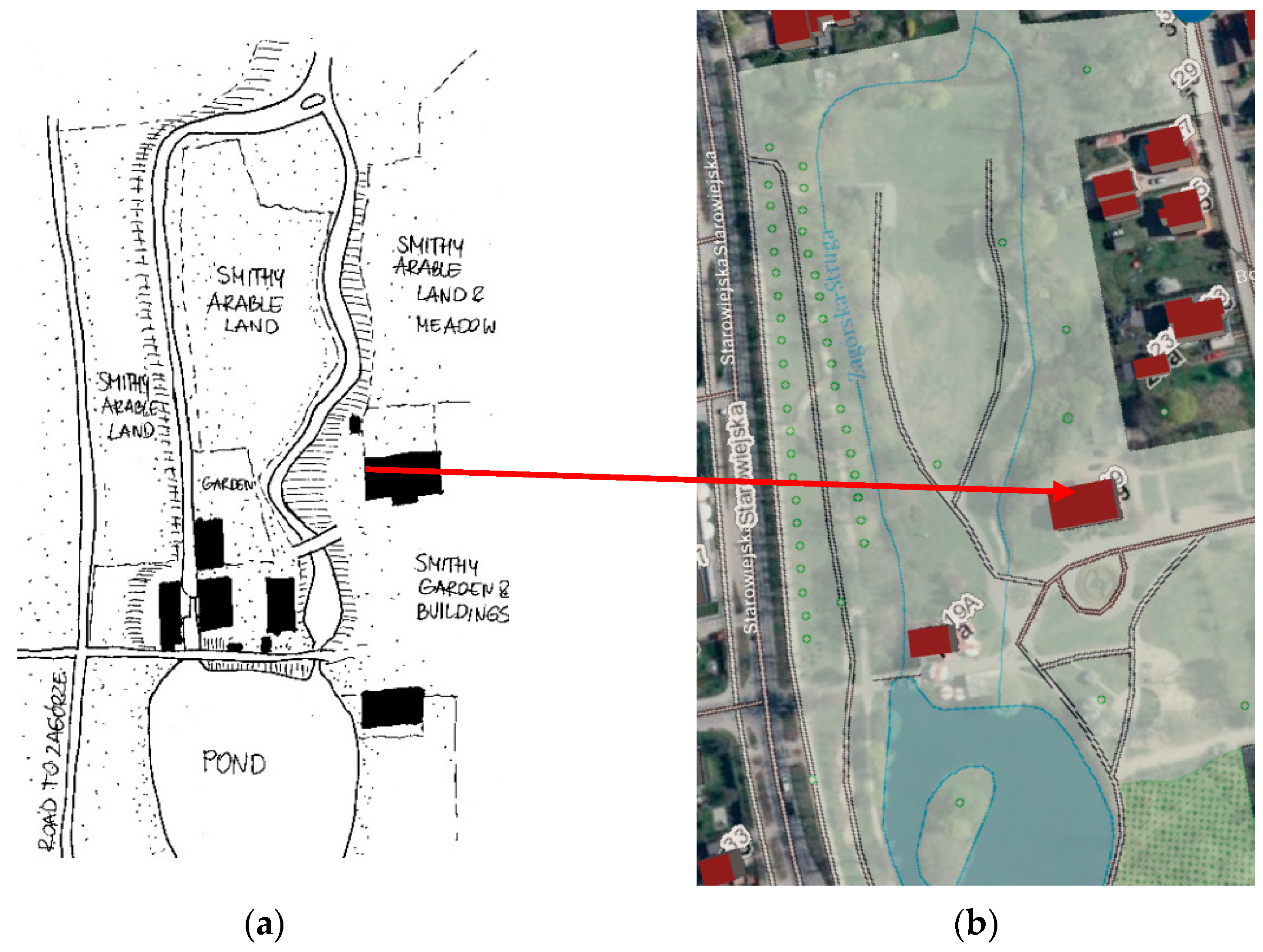
Figure 3.
The case study area: (
a) in the XIX century—a manor house from the second half of the 18th century, a residential house from the first half of the 19th century (demolished in the 1970s), a granary, a barn, a pigsty, and a stable next to Mickiewicza Street, and further away—a factory building, a factory office, an oven, a farmhouse, and a pond designated as “public water” Source: author drawing, according to A. Sadłowski [
15] and historic map from 1829/66/664—Königl. Domänenrentamta in Brück zu Zoppot, Wojewodzkie Archiwum Państwowe w Gdańsku; (
b) today—there is only one building remaining from that period—the manor house and a new building constructed next to the pond, designed to resemble historic watermills, orthophoto map, source: [
18].
During World War II, material to make parachutes was produced in the hall erected on the granary site. This facility was demolished in 1995 due to poor technical conditions. After WWII, the site was owned by PSS Społem and served as a place to store metals and fuel. In the mid-1950s, a butcher’s shop in the rebuilt facilities of the plant was organized [
17].
4. Creation of New Identity—Municipal Centre of Culture and Public Park
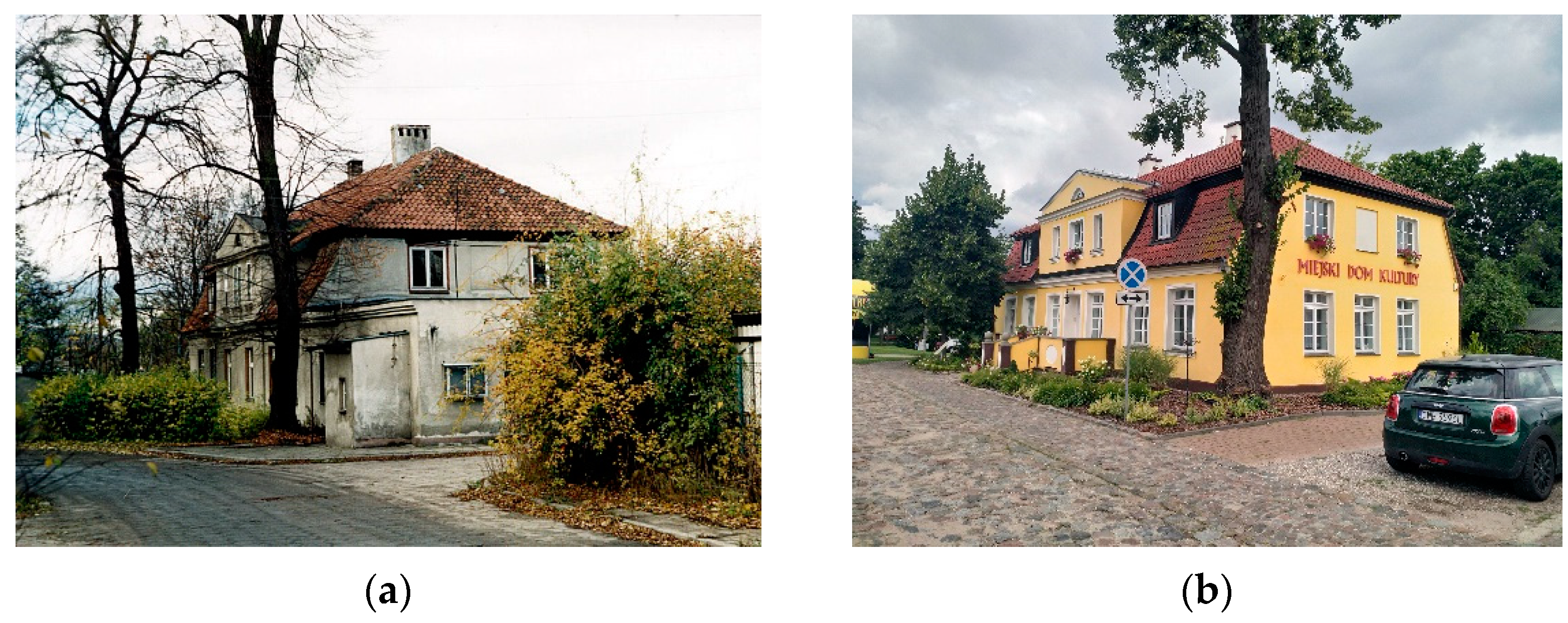
In the second part of the XVIII century, a residential house was built, later referred to by the local community as a manor house “under the linden trees.” After the cease of industrial use in the 1950s, the poorly maintained manor house slowly fell into disrepair until the municipality took it over (
Figure 4).
The reconstruction of the manor house started in 1995. Some additions were demolished to restore the original functional plan changed to accommodate the offices on the first floor and apartments on the second floor. Only the foundation, basement walls, exterior walls, and some of the interior partitions were preserved. All the floors, stairs, and roof construction needed to be removed and replaced. New foundations under the new construction walls and a chimney were added. The original walls needed to be cleaned, and the destroyed bricks were replaced.
The monument bears visible traces of arches and vaults preserved in its walls. The arched slab over the basement was renovated. Locally, a layer of reinforced concrete was added from above in inevitable places. The stairs and the slab of the first floor were reconstructed using reinforced concrete. The steel beams support the slab. The second floor and the roof were carefully reconstructed using wood. It is a hipped Mansard roof with a collar-and-purlin wooden structure with a ridge purlin in the axis of the building. The new lintels are made of reinforced concrete or steel. The exterior walls were insulated with mineral wool—7 cm.
The windows were reconstructed with triple glazing. The interior decoration was preserved, renovated, or reconstructed if necessary [
19].
The local law protects the manor as cultural heritage. It is inscribed into the communal register of monuments (Gminna ewidencja zabytków -Zarzadzenie Nr 1716/95/2018 z dnia 12 marca 2018 roku) together with the park [
20].
In 1996, the manor became the new seat of Municipal Cultural Centre—MDK.
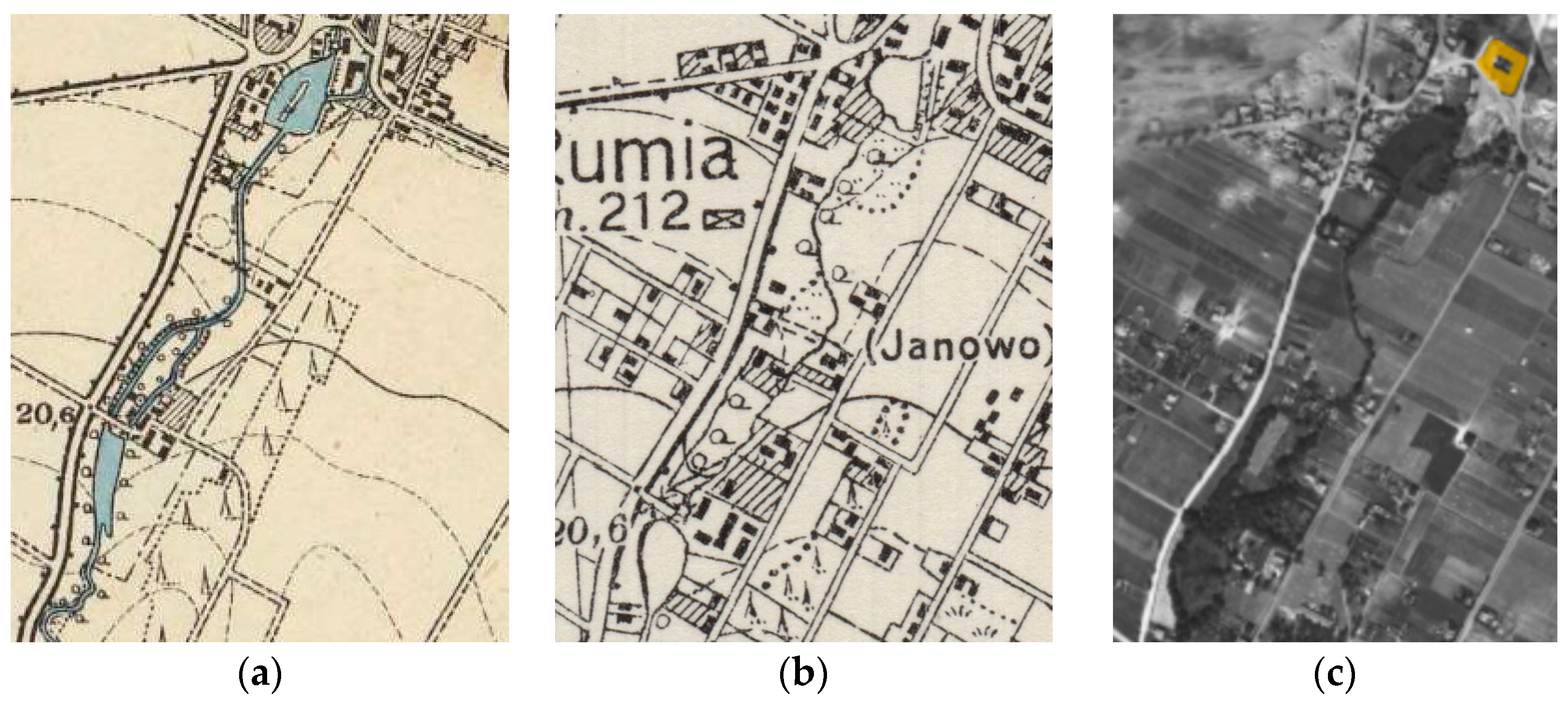
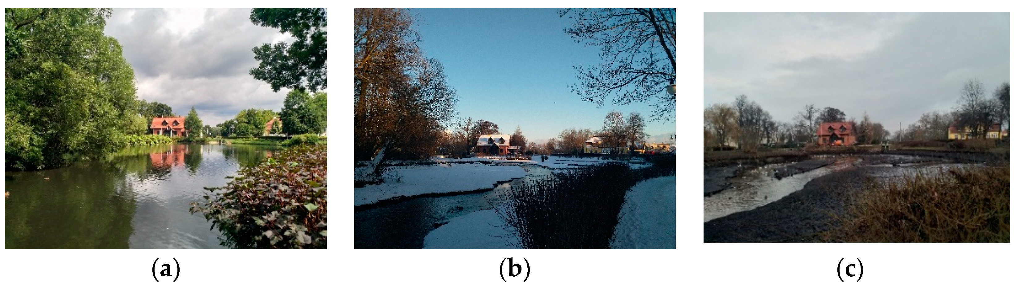
The area between the streets Starowiejska, Adama Mickiewicza, Dębogórska, and Józefa Wybickiego gradually become a public park. The schematic design was prepared by Autorska Pracownia Projektowa “Kwadrat”. In 1998, the pond of the former forge and its weir were reconstructed. The historical maps evidence the pond’s changes in location and size (
Figure 5). Its size and shape vary on different maps, however. That may result from the changes in water level due to seasonal droughts or man-induced enlargement and deepening (
Figure 6).
The historic airplane photographs from the WWII period show that the pond was dried. It was more of an open green area until the 90s.
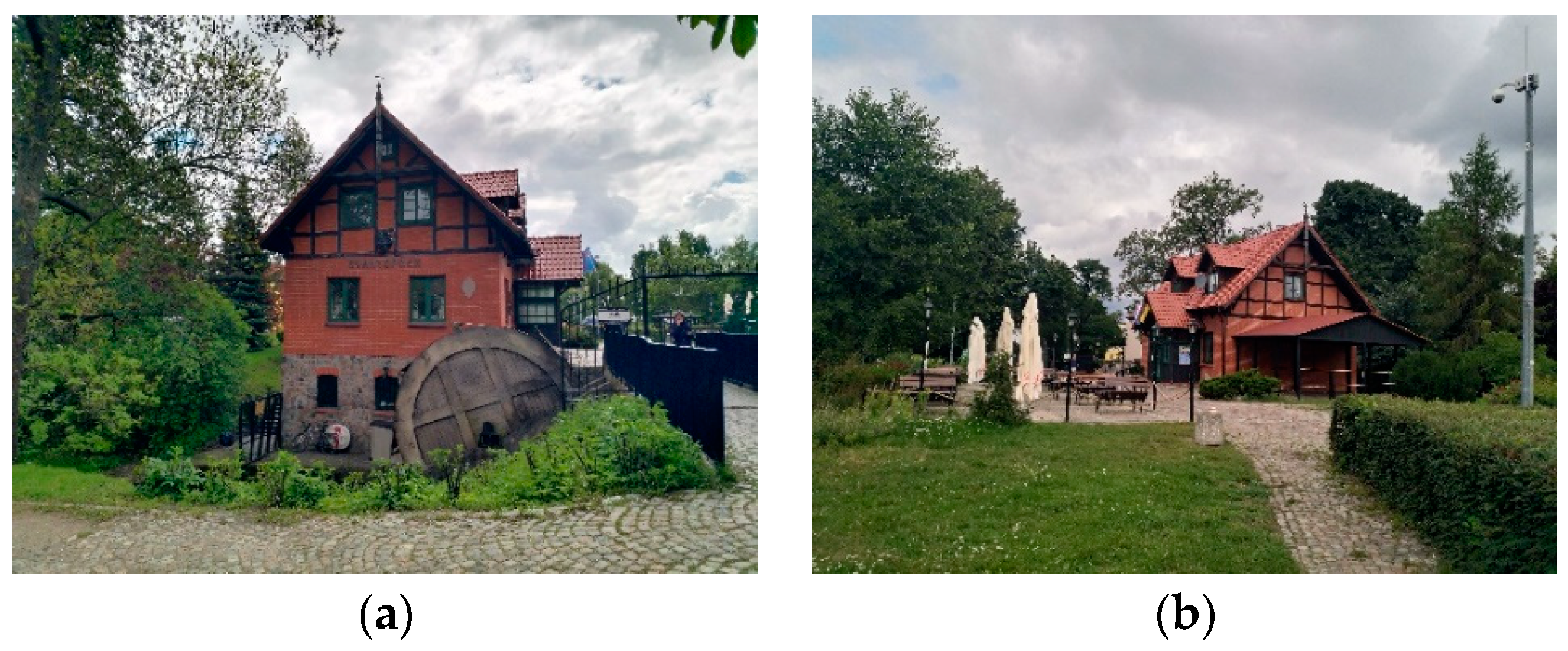
In the place of the historic forge, in 2002, a water mill was built—today, the seat of the Kashubian-Pomeranian Association (Stowarzyszenie Kaszubsko-Pomorskie) and a restaurant with a name in the Kashubian language “Svantopołk” (
Figure 7). Protection of Kashubian cultural heritage is vital. Next to the mill, the grinding wheel was reconstructed. The park became the place for education about the local history and heritage.
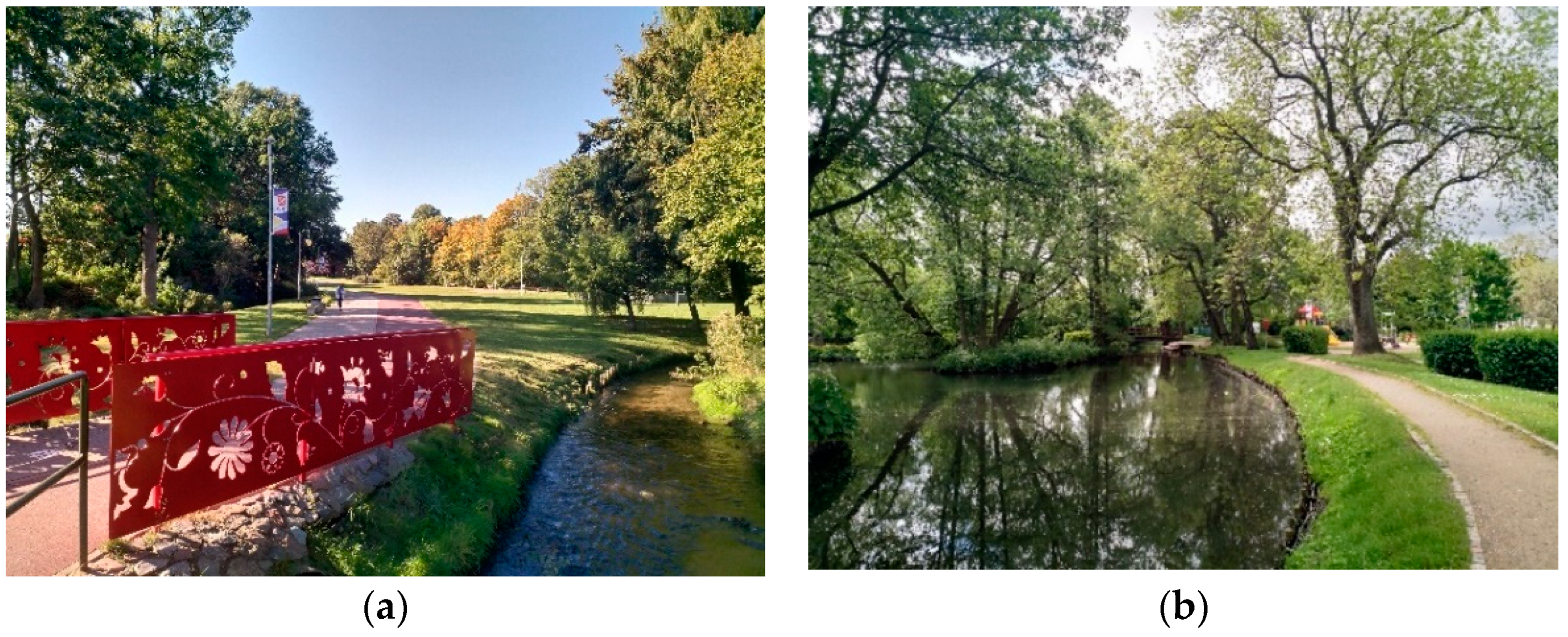
Gradually the park was developed to become one of the favorite places of local inhabitants. It resembles the XIX century picturesque landscape parks created next to village mansions. The renewal ideology was to restore the references to the past and add new elements. Therefore, new visual connections were added. In 2017, along the Zagórska Struga, from the park to Dębogórska Street, a walking and cycling path was led, which became another attraction of Rumia. It was designated to take part in the competition for the best revitalization project in 2017 [
24].
5. Community Engagement
As the park was developed gradually, it became a place for education about local culture, history, and ecological issues—the importance of biodiversity and local insect and bird species. A park is also where children can discover nature and learn using the talent playground.
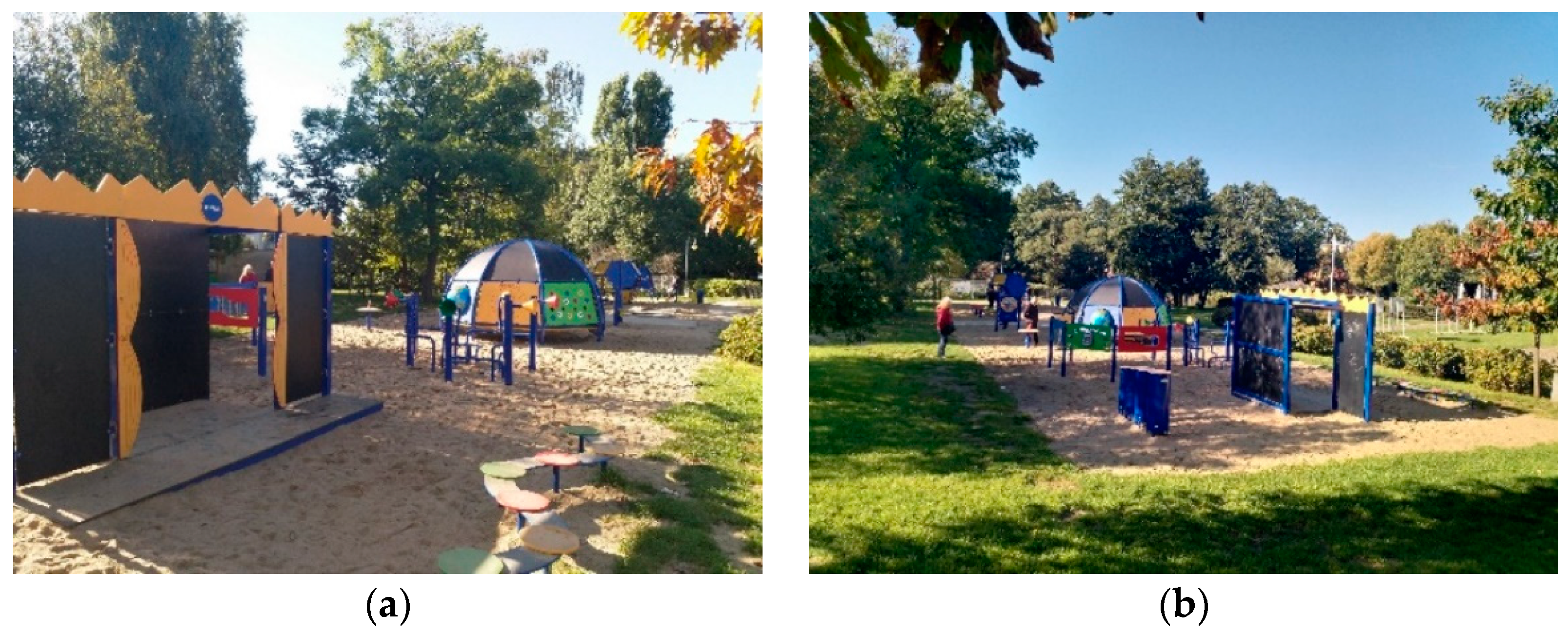
5.1. A Talent Playground
Over forty-two thousand Rumia inhabitants voted to build a talent playground in the park. They voted for Rumia in a championship organized by the Nivea company, which promised to install a playground called “podwórko Nivea”, worth 250,000 PLN in town, which obtained the largest number of votes. It is a fascinating example of social participation and proof of inhabitants’ place attachment. The playground has three zones: sports, science, and art. The recreational infrastructure aims to bridge the intergenerational gap and develop various skills [
25,
26,
27] (
Figure 8).
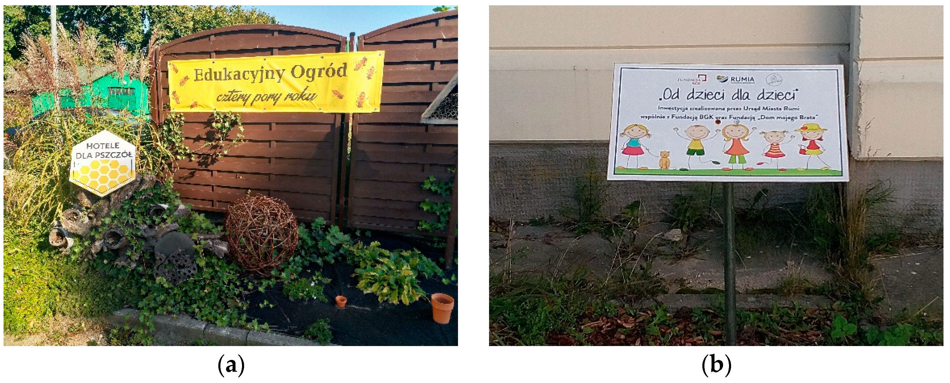
5.2. Educational Gardens
Two educational gardens were installed in the park, a popular place among schoolchildren. One, themed on biodiversity protection, is placed next to fencing and a small parking lot adjacent to the manor house—today MDK (a). It has an insect hotel with educational tables teaching children and adults about the importance of pollinators. The other, themed “from children to children”, is placed against the sports hall wall, next to recreational infrastructure and pedestrian path meandering along the banks of Zagórska Struga—local river and the fenced area of a local team soccer field. It offers a flower bed and educational tables (
Figure 9).
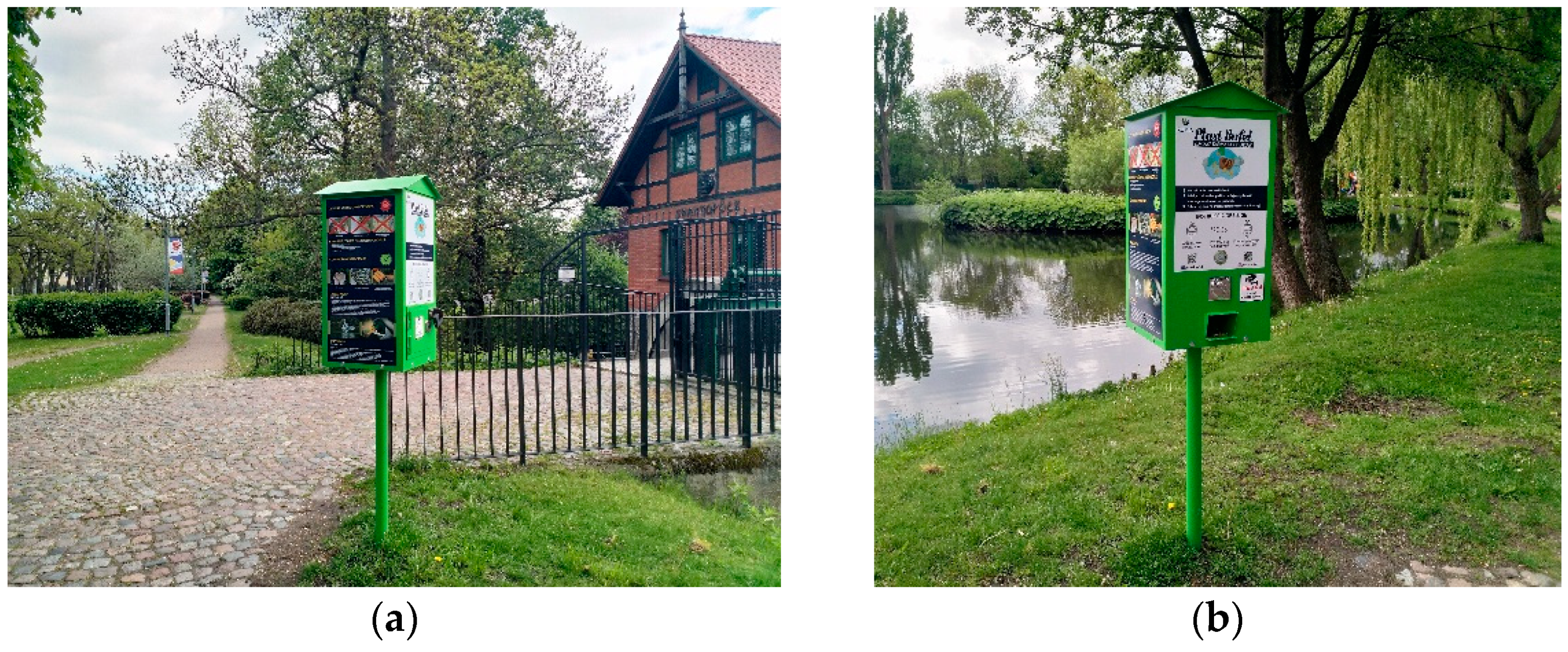
5.3. Educational Tables—How to Feed the Birds
The reconstruction of historic ponds created a bird-friendly environment. However, the birds’ stomachs are not prepared to digest bread and cakes. Therefore, special vending machines with birds’ food were placed strategically where bird feeders usually gather. They are instructions explaining which grains can be given to feed the birds. They are selling a handful of mixed grains for a small amount of money (
Figure 10).
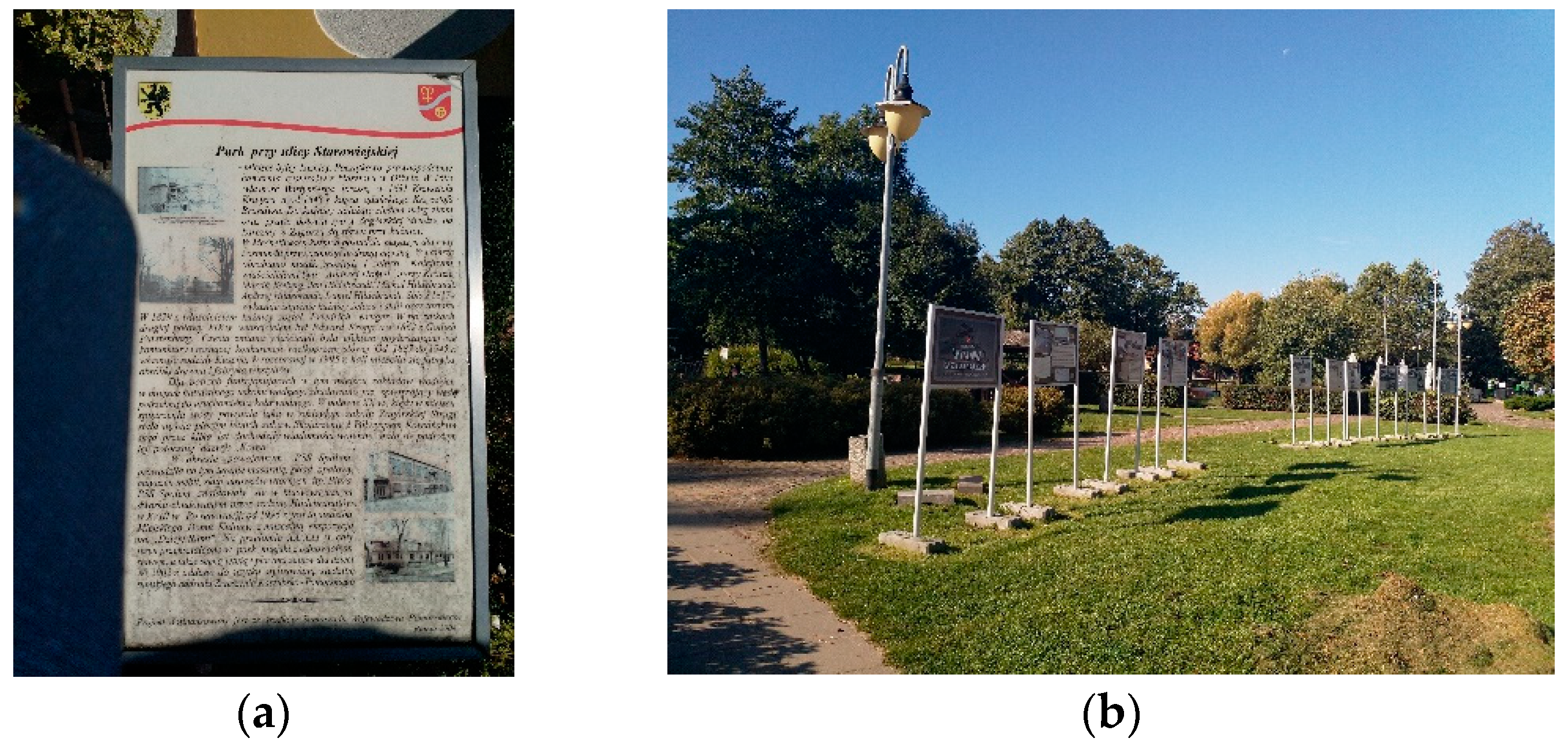
5.4. Educational Tables—Local History
In front of the manor house, next to the main entrance, is a permanent table with a short description of the park’s history and a few historical images. The lawn in front of the manor serves temporary exhibitions dedicated to local history (
Figure 11).
6. Methods. Assessment of the Park Therapeutic and Recreational Qualities
Two different methods of assessment were used—the Universal Standard for Health-Promoting Places (
Table 1) [
28,
29] and Community Park Audit Tool (CPAT) [
30]. The author—a professional researcher with a degree in architecture and urban design—performed the evaluation during numerous visits to the park at least once a week on various hours and days (weekdays and weekends) over two years in 2020 and 2021. Site observation, mapping the presence of users, and unstructured anonymous interviews were used to evaluate the therapeutic qualities of the park.
6.1. Assessment of the Therapeutic Qualities of the Public Park Using the Universal Standard for Health Promoting Places
The first assessment was performed using the Universal Standard for Health-Promoting Places [
28,
29,
31]. It is a set of criteria connected to health promotion. The tool was developed after a long-term study of over 100 public parks and gardens in Europe and the United States triangulated with literature research [
29]. The criteria are divided into five categories: 1. Sustainability, 2. Accessibility, 3. Amenities, 4. Design, and 5. Placemaking. For better clarity, the five categories were split into five separate tables (
Table 1,
Table 2,
Table 3,
Table 4 and
Table 5) with columns for individual assessment remarks. The detailed assessment required a written explanation of why the researcher thought the attribute was present [
28,
29,
31]. The assessment results were inscribed into the five tables representing five sections of the universal standard. (
Table 1,
Table 2,
Table 3,
Table 4 and
Table 5).
Both a thick binary and a detailed assessment were performed when applicable.
The thick binary assessment has two categories (0, 1):
No, not observed—0
Yes satisfactory—1
Data n/a stands for data not available.
There are some criteria where the points count is not applicable.
An additional column was added to five tables representing five sections of the universal standard to accommodate the binary assessment. The points were added to represent the score and facilitate comparison with maximal values (
Table 1,
Table 2,
Table 3,
Table 4 and
Table 5).
Table 1.
Assessment of Public Park in Rumia—part 1, source: author.
Table 1.
Assessment of Public Park in Rumia—part 1, source: author.
| Public Park in Rumia—part 1 | POINTS |
| 1. SUSTAINABILITY | 12/12 |
| 1.1 Place | Not applicable |
| Area | Approx. 10 ha (counted with adjacent private gardens) | Not applicable |
| Location | Rumia is a small town located in the north of Poland, near the cost of the Baltic Sea in the Kashubian Region. The park is located centrally in the oldest part of the town, called old village or old Rumia.
The average temperature in January on the coast is −1 °C, the average temperature in July is +18 °C. In addition, there are long transitional periods between summer and winter and clearly cooler spring than autumn. Annual precipitation amounts to about 550–792 mm. The average altitude is approx. 20 m over the sea level [9,32]. | Not applicable |
| Surrounding urban pattern | Low density residential urban tissue with small-scale retail and services | Not applicable |
| 1.2 Environmental characteristics | 6/6 |
| Soil quality | Sufficient for recreational use [32]. | 1 |
| Water quality | The river—Zagórska Struga has qualities similar to mountain creeks with many meanders and cascades. The quality of water is sufficient for recreational use, but no bathing or swimming in the ponds is allowed. | 1 |
| Air quality | Good, Measured on 5 October 2021:
PM 10; 21.2 µg/m3 / PM 2.5; 19.7 µg/m3 Source: [33] | 1 |
| Noise level | Low to moderate noise level in areas close to traffic routes [3]. | 1 |
| Forms of natural protection | National heritage registers—manor house, Old monumental trees protected by local law. | 1 |
| Green and Blue Infrastructure | Important part of the green and blue infrastructure, especially the corridor along the river—Zagórska Struga. | 1 |
| 1.3 Biodiversity protection | 3/3 |
| Parts of open green space not available to visitors | Artificial island on the pond. | 1 |
| Native plants | Planting is a combination of native and non-native species, a couple of patches of invasive plant (Reynoutria japonica) were noted. | 1 |
| Native animals | Both native and foreign species were observed. | 1 |
| Natural maintenance methods | Data n/a | Data n/a |
| 1.4 Sustainable water management | 1/1 |
| Rainwater infiltration | Porous, permeable surfaces. | 1 |
| Irrigation with non-potable water | Data n/a | Data n/a |
| 1.5 Parks of Second (New) Generation | 1/1 |
| | The park has no boundaries, it spreads to join the green infrastructure and it can be regarded as park of new generation. | 1 |
| 1.6 Urban metabolism | 1/1 |
| | Receptacles for waste segregation and collection are located in the park. | 1 |
| 1.7 Ecological energy sources | Data n/a |
| | Data n/a | Data n/a |
The park was evaluated as sustainable open green and blue area. The result was 12 out of 12 available points, because there was no evidence about natural maintenance methods, irrigation with non-potable water, or ecological energy sources. However, those issues can be resolved by local authorities and park management.
Table 2.
Assessment of Public Park in Rumia, Poland—part 2, source: author.
Table 2.
Assessment of Public Park in Rumia, Poland—part 2, source: author.
| Public Park in Rumia, Poland—part 2 | POINTS |
| 2. ACCESSIBILITY—assessment of walkways to park | 24/26 |
| 2.1 Distance to park | 1/1 |
| | It was observed that most of users either walk or cycle to the park. There are few parking spaces. Bus stops are located next to the park. | 1 |
| 2.2 Sidewalk Infrastructure- | 5/5 |
| Width of sidewalk | Sufficient | 1 |
| Evenness of surface | Good | 1 |
| Lack of obstructions | Majority of terrain is accessible. Private gardens are fenced. | 1 |
| Slope | Flat, no significant slope | 1 |
| Sufficient drainage | Sufficient drainage | 1 |
| 2.3 General conditions of walkways | 6/8 |
| Maintenance | The park is well-maintained. No visible traces of litter. | 1 |
| Overall aesthetics | Good | 1 |
| Street art | None | 0/1 |
| Sufficient seating | Some benches along the walking path. | 1 |
| Perceived safety | Walkways are perceived as a safe and well-maintained. | 1 |
| Buffering from traffic | The planting is providing buffering from the traffic, creating enclosed green interiors. | 1 |
| Street activities | Yes, e.g., seasonal decorations | 1 |
| Vacant lots | No | 1 |
| 2.4 Traffic | 5/5 |
| Speed | Slow to moderate | 1 |
| Volume | Low to moderate | 1 |
| Number and safety of crossings | Numerous possibilities for safe crossing of the street. | 1 |
| Stop signs | Yes | 1 |
| On-street parking | Yes | 1 |
| 2.5 User Experience | 5/5 |
| Air quality | Good | 1 |
| Noise level | Low to moderate in places close to traffic lines | 1 |
| Sufficient lighting | Sufficient lighting along the walking routes | 1 |
| Sunshine and shade | Yes, adequate number of trees providing shade (Figure 3 and Figure 4) | 1 |
| Visibility of nearby buildings | Part of area has good visibility of nearby buildings, but there are parts of the green space buffered from the street. | 1 |
| 2.6 Public transports stops | 1/1 |
| | Bus stops next to the park | 1 |
| 2.7 Sufficient Parking | 1/1 |
| | Yes, there are few parking spots and on-street parking. | 1 |
The park was assessed as universally accessible to people in every age and special needs 25/26. The only point which was missing was street art.
Table 3.
Assessment of Public Park in Rumia, Poland—part 3, source: author.
Table 3.
Assessment of Public Park in Rumia, Poland—part 3, source: author.
| Public Park in Rumia, Poland—part 3 | POINTS |
| 3. AMENITIES | 14/15 |
| 3.1. Psychological and physical rejuvenation | 5/5 |
| Natural Landscapes | Combination of planting around open green spaces give an impression of a natural landscape. | 1 |
| Green open space | Numerous extensive grass-covered grounds (Figure 3 and Figure 4). | 1 |
| Presence of water | Zagórska Struga river, artificial ponds (Figure 4). | 1 |
| Places to rest in the sun and shade | Multiple places including picnic and play areas. | 1 |
| Places to rest in quiet and solitude | Multiple places to rest in quiet and solitude. | 1 |
| 3.2. Physical Activity Promotion | 4/4 |
| Sports infrastructure | Bicycle paths, cross-fit stations, sport field (soccer field of local team) | 1 |
| Recreational infrastructure | Recreational infrastructure for all age groups | 1 |
| Community gardens | Yes, educational gardens | 1 |
| Addressing the needs of people with disabilities | Pathways are wide and even, majority of the park area is accessible (there is small cobbled area). | 1 |
| 3.3. Catering for basic needs | 5/6 |
| Safety and security (presence of guards, cleanliness, maintenance, etc.) | Assessed as a safe place during daytime. | 1 |
| Places to sit and rest | Benches in the most popular areas, tables and seats in the restaurant garden, garden pavilions. | 1 |
| Shelter | Visitors may find shelter under tree canopies, garden pavilions, or inside buildings, e.g., manor house, reconstructed watermill—restaurant, etc. Provisional temporary structures provide shelter during organized events. | 1 |
| Restrooms | Provisional restrooms are placed during organized events. | 1 |
| Drinking water | No | 0 |
| Food (possibility to buy food in the park or close vicinity) | There is restaurant in the reconstructed watermill. | 1 |
The recreational infrastructure was assessed as satisfactory except for the drinking water fountain. Almost all the possible points were present on 14/15.
Table 4.
Assessment of Public Park in Rumia, Poland—part 4, source: author.
Table 4.
Assessment of Public Park in Rumia, Poland—part 4, source: author.
| Public Park in Rumia, Poland—part 4 | POINTS |
| 4. DESIGN | 19/20 |
| 4.1. Architectural design | 9/9 |
| Human scale | Park is designed to fit human scale. | 1 |
| Focal points and landmarks | Recognizable landmarks—historic manor, monumental trees, field exhibitions. | 1 |
| Structure of interior connections | A clear structure of interior connections | 1 |
| Framed views | Natural frames are created by mature trees and meandering pathways. | 1 |
| Long vistas (Extent) | Park offers numerous extensive vistas. | 1 |
| Pathways with views | Many paths offer interesting views. | 1 |
| Invisible parts of the scenery (Vistas which engage the imagination) | Numerous designed vistas which engage the imagination. | 1 |
| Possibility to observe other people | Yes, events organised on the stage, festivals, etc. | 1 |
| Possibility to observe animals | Plenty of places to see wildlife from a distance. Possibility of bird feeding. | 1 |
| 4.2. Salutogenic design | 5/5 |
| Optimal levels of complexity | Yes, park offers optimal levels of complexity. | 1 |
| Engaging features | Multiple elements attract attention: planting, animals, insects, and bridges with colorful handrails. The presence of monuments, temporary exhibitions, colorful playground infrastructure draw the attention of users (Figure 12). | 1 |
| Controlled Risk | Several elements offer a subjective feeling of overcoming controlled risk, e.g., bridges. | 1 |
| Mystery/Fascination | There are elements of the scenery which are hidden and revealed only when approached, e.g., meandering river views. It provides soft fascination. | 1 |
| Movement | Zagórska Struga river, choice of planting which gives impression of movement in the wind. | 1 |
| 4.3. Sensory stimuli design | 5/6 |
| Sensory stimuli: Sight | Colorful leaves in the autumn, flowering trees in the spring | 1 |
| Sensory stimuli: Hearing | Sound of meandering river, cascades | 1 |
| Sensory stimuli: Smell | Flowering trees in the spring | 1 |
| Sensory stimuli: Touch | Trees, water | 1 |
| Sensory stimuli: Taste | Restaurant in the reconstructed mill | 1 |
| Sensory path | No | 0/1 |
The results of the DESIGN section are excellent 19/20 points.
Only one point was missing—a sensory path, which could enhance the sensory experience.
Table 5.
Assessment of Public Park in Rumia, Poland—part 5, source: author.
Table 5.
Assessment of Public Park in Rumia, Poland—part 5, source: author.
| Public Park in Rumia, Poland– part 5 | POINTS |
| 5. PLACEMAKING | 14/14 |
| 5.1 Social Contact Enhancement | 2/2 |
| Organization of events | Multiple events, cultural festivals, sport events, soccer championships, etc. | 1 |
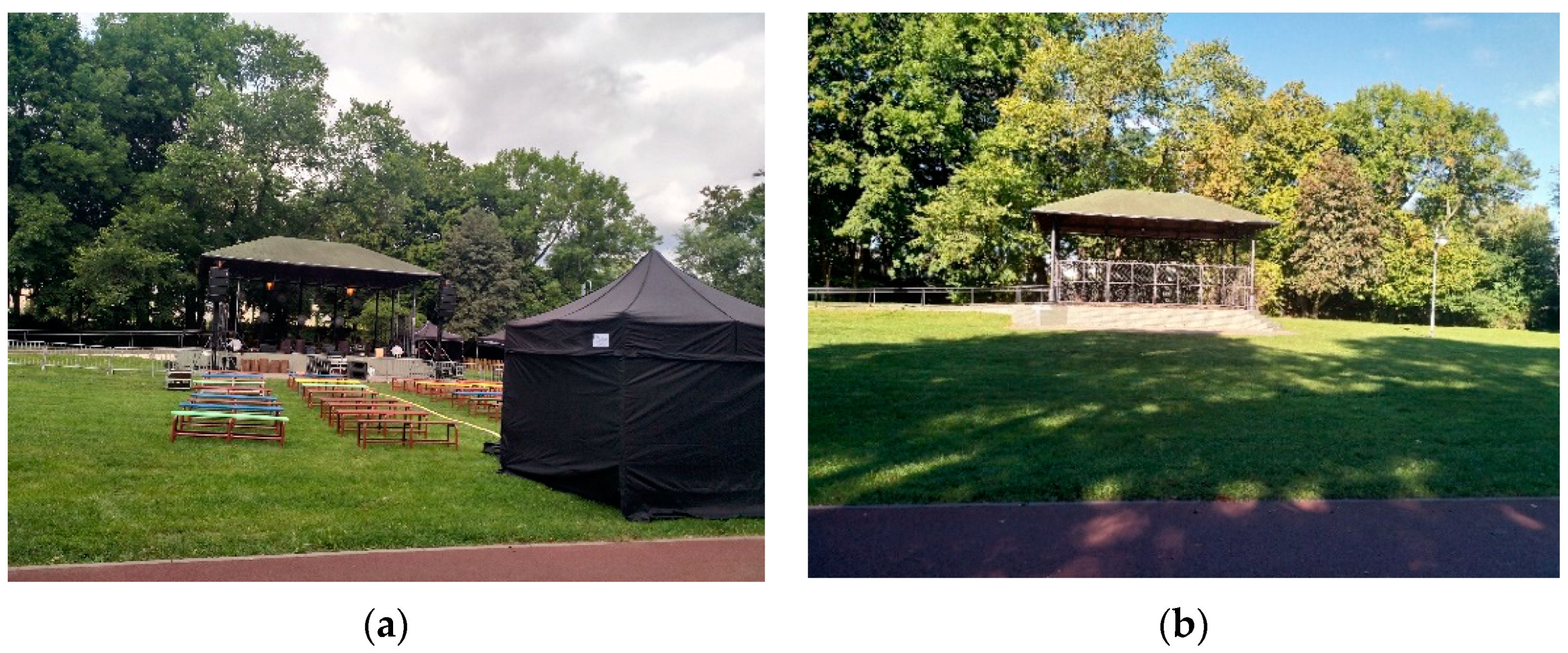
| Meeting places for groups | There are multiple places for group meetings—benches, restaurant garden, Cultural Center, garden pavilions. The open-air scene is used by teenagers as a place for gathering (Figure 13). | 1 |
| 5.2 Human perception—spiritual & symbolic | 6/6 |
| Sacred places | Nearby churches | 1 |
| Works of Art | | 1 |
| Monuments | Historic manor (Figure 6) | 1 |
| Culture and connections to the past | Reconstruction of water mill in the place of historic forge, temporary open-air exhibitions. | 1 |
| Thematic gardens | Yes, educational gardens dedicated to biodiversity. | 1 |
| Personalization | Yes, the users can personalize and directly take part in creating the park’s landscape. Good examples are educational gardens. | 1 |
| 5.3 Community Engagement | 6/6 |
| Personalising the architectural process | Yes, the names of people responsible for the park design and maintenance are publicly known, e.g., persons who organized the competition for talent playground. | 1 |
| Participation of all stakeholders, including inhabitants and users | Yes, e.g., the competition for talent playground. | 1 |
| Determining the rules of conduct and self-management | Yes, the rules of conduct are determined, written, and put on public display. There are tables in the park with rules of conduct. | 1 |
| Space for social contact | Yes, numerous places with equipment can facilitate social contacts (friendly engagement between strangers), e.g., gazebos, playgrounds, benches. | 1 |
| -third places | Some places can become the third most important place after home and work, e.g., MDK Municipal Cultural Centre, Restaurant, and park. | 1 |
| -fourth places | Park is being used as a fourth place—to spend time in between other engagements, e.g., open green space, seating places. | 1 |
The aspect of placemaking is very important. The maximum of 14 out of 14 points were awarded.
6.2. Assessment with Community Park Audit Tool (CPAT)
The Community Park Audit Tool (CPAT) is a user-friendly tool for evaluating the ability of parks to promote youth physical activity that would enable diverse community stakeholders to audit local parks. The CPAT is a comprehensive yet user-friendly instrument that is six pages long and contains four sections: park information, access and the surrounding neighborhood, park activity areas, and park quality and safety. It has demonstrated a high degree of inter-rater reliability with percent agreement for the vast majority of the items in the tool between 80–90% [
26].
The park was evaluated using the CPAT tool and scored in all categories, except for the off-leash dog park and skate park. The swimming pool and tennis courts are within walking distance from the park [
26]. Therefore, it may be presumed that the park Starowiejski in Rumia is a place that promotes youth physical activity.
6.3. Mappig the Users Activity
The users’ activity was observed over summer 2021 by one researcher during numerous visits conducted during various times of day on weekdays and weekends. Main gathering points identified included:
pedestrian path along the stream,
sports field,
benches along the pedestrian path,
open-air stage,
talent playground,
tot lot.
Among the other most popular gathering spots, the open-air stage was a favorite gathering spot for teenagers on weekdays when it was not used for events (
Figure 13).
7. Results and Discussion
These study results are highly satisfactory. When assessed with Universal Standard for Health-Promoting Places, the park scored 84 of 87 points. There were only a few missing points, such as a sensory path and street art, which the local community could add if needed.
The assessment with CPAT demonstrated a well-functioning and well-equipped public park which may promote youth physical activity. The park scored in all categories, except for the off-leash dog and skate parks, which are possible to construct if the local community wishes to.
The mapping of user activity demonstrated that activity pockets were aligned with the recreational infrastructure. Main gathering points were: the well-frequented pedestrian path along the stream, sports field of a local soccer team which gathered spectators and players on assigned days, wooden benches along the pedestrian path, open-air stage used for organized events, as well as by local teenagers during weekdays as a favorite gathering point, talent playground used by the children and their parents, tot lot frequented by the youngsters with their babysitters.
7.1. Preventing the Nocive Effects of Climate Change and Urban Heat Islands
The revitalization of the post-industrial site brought back and revived the historic pond, which is a valuable asset to mitigate heat waves. The green cover of open green areas and the green canopy of mature trees are helping to prevent the detrimental effects of climate change. Existing trees are well-maintained, and new ones are added. People choose to stroll along the stream or cycle to do their everyday errands, and some of them opt to do so and not to use their cars. Creating the public park was an important step to improve the local microclimate. People can reach this area to escape the heat urban island effect.
7.2. Promotion of Social Life
The revitalization of the former industrial site brought additional benefits. The engagement of the local community was manifested during the voting for the talent playground. Place identity is enhanced by events organized in the park and open-air exhibitions. A park is also a place for ecological education. Numerous events which promote social contacts are held in the park. It is a favorite public open green space.
8. Conclusions
The case study of the park in Rumia constructed on the post-industrial site is an example of good practices. On a previously neglected industrial lot, a public park provides joy to the people. A necessary revitalization process was done, with excellent results, providing green space with adequate infrastructure and maintenance for people’s enjoyment. The difference between the previous and the current situation lies in how people can now safely and meaningfully enjoy the park [
34].
The revitalization of the old manor house, which was turned into the local cultural center, was essential for success. The old monument houses a new function and therefore is well-maintained as it has a new owner.
The assessment of therapeutic qualities and using the CPAT tool demonstrated that the post-industrial cultural heritage site could be turned into a health-promoting urban place. Mapping the users’ activity confirmed that a park is a popular place. The presence of people was noted all day long, and the pockets of activity were formed in places with recreational infrastructure.
Additional benefits of creating a well-functioning public park were attachment and identity enhancement demonstrated during voting for the talent playground. The public park in an old village in Rumia demonstrates that it is possible to create a health-promoting place in place of a post-industrial site, revitalize the cultural heritage, and mitigate climate change at the same time.


