1. Introduction
Benin, officially the Republic of Benin (French: République du Bénin) is a former colony of France which gained independence in 1960. Benin became in 1991 a democratic republic, in which the President of Benin is both head of state and head of government, within a multi-party system.
Benin is a relatively small West African country, elongated in latitude, and covers an area of 114,763 km
2. It is bordered to the south by the Atlantic Ocean, to the west by Togo, to the north by Burkina Faso and Niger and to the east by Nigeria. Benin’s relief does not present great differences in altitude. The average altitude is 200 m [
1] (p. 9). According to the results of the Fourth General Census of Population and Housing of May 2013, Benin has 10 million inhabitants (almost 12 million according to the 2019 projection). The country has a predominantly rural population, with 5.5 million inhabitants in rural areas and 4.5 million in urban areas and a crude birth rate equal to 36%, of which 32% is in urban areas against 39% in rural areas. Life expectancy at birth in Benin is 63.84 years [
1] (p. 78). The capital of Benin is Porto-Novo, but the seat of government is in Cotonou, the economic capital). Benin is a developing French speaking country. In terms of the Human Development Index 2020, its position is 158 of the 189 [
2].
The legal foundation under the land administration in Benin is the 2013 Land Administration Law [
3] that together with the 2017 addendum [
4] replaced different previous land laws. The execution of the land administration in Benin is assigned to the National Land Registry and Agency, l’Agence Nationale du Domaine et du Foncier (abbreviated as ANDF), founded in 2016 (
Figure 1). ANDF is also responsible for the national cadaster.
With the introduction of the 2013 Land Administration Law and the establishment of ANDF, Benin has decided upon a centralized land administration, with the objective of recording the entire national territory in one digital central land administration system (“le cadastre national numérique”). Benin has also opted for a very high level of legal certainty, a Torrens-based system [
5], with the provision of land titles (titres fonciers) that grant a practically indisputable property right to the natural person or legal entity stated on the title. This property right is guaranteed by the state and can only be lost through the expropriation procedure described in the 2013 Land Administration Law [
3] (art. 210). The property right established by a land title remains even intact if it turns out later that the land title had been acquired fraudulently. In that case, damage compensation will be paid to the victim [
4] (art. 147 nouveau). Each transfer of the property right, for example, upon purchase or inheritance, is only legally valid when the parcel concerned has a land title [
3] (art. 17) and when the transaction is confirmed by means of a notarial deed registered in the national land administration [
3] (art.157). The Land Administration Law also establishes the basic structure of the work process for the application for and issuance of a title, the establishment of additional rights and restrictions and the registration of transactions. This is subject to legal time periods. For example, ANDF is required to issue a title within 120 days after an accepted application, provided no formal objections have been submitted against the title application. If this happens, ANDF is no longer bound by the 120 days deadline (the deadline is then undefined) [
6].
With the introduction of a state guaranteed property right and a legally established, uniform, issuance and maintenance process, the Benin government wants to end the prevailing uncertainty regarding real estate transactions that arose due to a wide variety of unclear procedures that were susceptible to official randomness and fraudulent practices, such as multiple sales of the same parcel and sales by parties other than the legal owner [
7]. To facilitate the transition to the land title system, the Land Administration Act established a transition period. This period originally ran from 2013 through 2018, but the 2017 addendum of the Land Administration Law extended this period to 2023 [
4] (art. 516 nouveau).
2. The Land Administration Problem
By setting a legal framework and establishing a centralized government body, Benin has decided upon a formal legal approach in order to realize a uniform land administration system that covers the entire country. Except for the legal transition period, no further specific measures have been taken to ease the transition to the legally prescribed title system. The following assumptions implicitly provide the support that this approach will deliver the envisioned legal certainty to Benin:
That the Land Administration Act compels all landowners, of their own accord, to apply for a land title within a foreseeable period;
That these title applications and resulting transactions generate a stream of revenue such that ANDF can provide its services in each municipality of Benin.
Seven years after the introduction of the Land Law in 2013, it appears these implicit assumptions will not be satisfied. The legal certainty has increased, but its effect is limited, since the transition to titles is progressing slower than expected. In April 2017, there were about 40,000 land titles issued [
8]. By January 2021, this number had risen to about 60,000 [
9]. This is only a very small part of the total number of Benin parcels to be registered, which ANDF estimates at about 5 million. It is obvious that this process will not succeed in registering land rights for a substantial portion of the Benin territory by 2023, the end of the transition period. The majority of the estimated 5 million parcels will then still be without title.
The reason for the slow increase in the number of titles is associated with the costs. The reference point for the determination of the price for the new land title was the situation before the introduction of the 2013 Land Law, when it cost a lot of time and money to obtain an official confirmation of landownership. The application process could take many years, where it was uncertain for the applicant all that time whether the desired certainty would be obtained [
10] (pp. 8–10). With the introduction of the guaranteed lead time of 120 days and a fixed price of 100,000 West African CFA franc (180 US dollars) for the application of a land title at ANDF, the government of Benin provided a significant improvement. This improvement, however, is not enough. In addition to this amount, there are also the costs of the (municipal) documents to be obtained before the application and the mandatory use of a certified private surveyor. These costs vary and depend among other things on the parcel size, but ANDF estimates, on the basis of internal calculations, the total cost for obtaining a land title for a parcel of 500 m
2 at 300,000 CFA (540 US dollars). With a national headcount poverty rate estimated at 40.1% in 2015 based on the international poverty threshold set at
$1.90 per person per day in purchasing power parity [
11], the price for a land title is still far too high for most of the Benin population.
The lag in the volume of titles can lead to a negative spiral. Before the introduction of the Land Law, it was possible to formalize real estate transactions at municipal level by recording them in municipal property registers. This decentralized system was inefficient and susceptible to fraud and corruption, but it was often cheaper for the landowners and provided a stable source of income to the municipalities involved [
10] (p. 41). In order to give them the opportunity to adapt, the 2013 Land Law provides in art. 516 a five-year transition period. This period was extended until 2023 by the 2017 adaptation of art. 516. Because the vulnerable groups that have the most interest in the legal certainty of the new titles cannot afford them and municipalities benefit from the continuation of the old method (and they are also allowed to do so during the transition period), there are, in practice, few incentives to comply with the new law. Parties are also not yet convinced of the enforceability of the title system. Benin has a history of unsuccessful land reforms [
10] (p. 2) and a large informal economy of almost 60% of Gross Domestic Product [
12] because rules are often not enforced. These past experiences lead to a wait and see attitude. The fact that the transition period has already been extended once and a new extension appears necessary, feeds the sepsis.
The lagging title flow has the negative effect that less money is coming in than expected. This leads to delays in the plans to open an ANDF office in each municipality. As a result, ANDF is less visible and increases the distance to the potential users, which reinforces the negative spiral and increases the likelihood that the increase in the necessary legal certainty envisioned by the legislator will not be achieved.
3. Addressing the Problem
3.1. Hypothesis
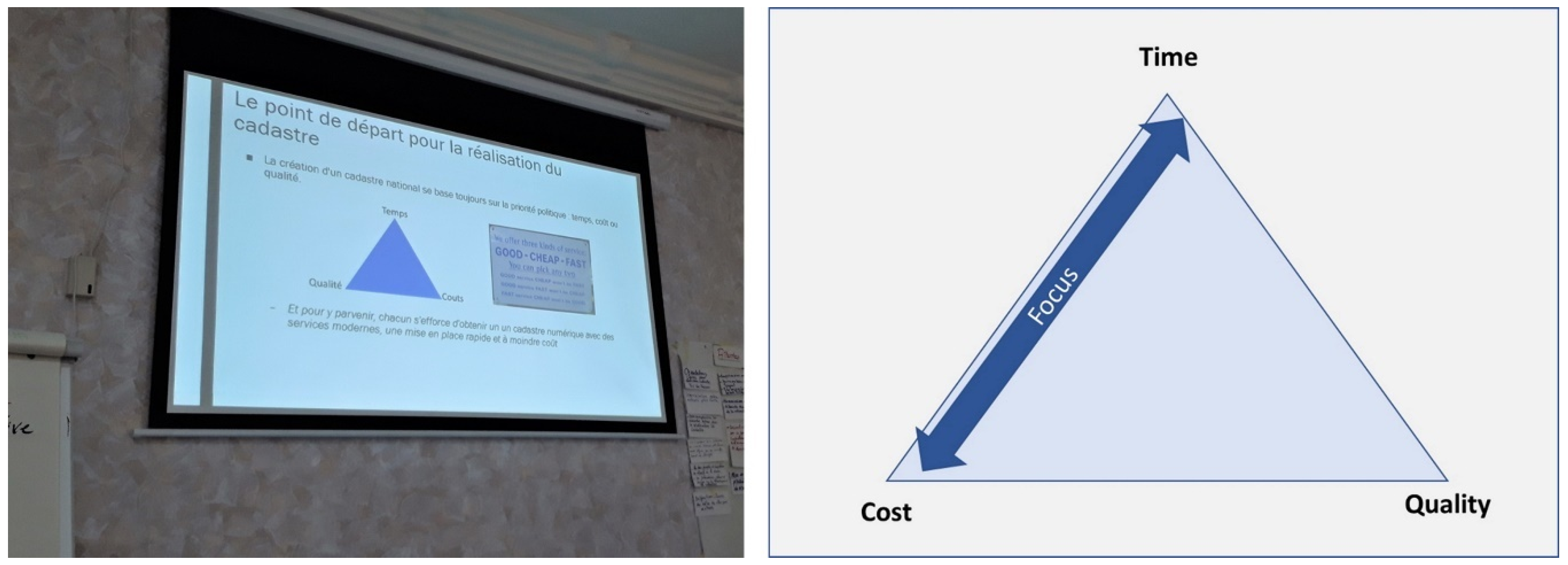
To support the Benin government, the Netherlands Embassy in Benin has funded a four-year project: le Projet de Modernisation de l’Administration Foncière (abbreviated as PMAF). In this project, staff from ANDF and Benin and Dutch land administration experts are working together in order to speed up the introduction of a sustainable national land administration.
The approach of the PMAF project is based on a closer analysis of the existing practice of land administration that assumes state-guaranteed property rights, with a land title (titre foncier) as tangible evidence. The major benefits of this system are the high degree of legal certainty and a sound recording through the mandatory registration of notarial deeds. The Benin government has also prepared well for the implementation of this system. The procedures and methods for issuing titles and the registration of transactions have been legally secured and translated into implementation rules and work procedures. The ANDF personnel has been trained to apply the instructions and an Information Technology system (Système d’Information Foncière) has been developed that supports the work process. ANDF and PMAF both considered this to be a solid foundation, provided that it would succeed in increasing the number of titles by lowering the threshold for obtaining the first title. The system could then maintain itself because each buyer understands that he/she runs too great risk if he/she does not have the title put in his/her name by AND, and there are also fewer financial thresholds, since there is no unit price for settling most transactions, but a rate based on the value of the parcel (currently this is usually 0.3% of the current market value). In this context, there is a need for an approach that is cost and time efficient for the initial establishment of the land administration. Such an approach was developed in the so-called Fit-For-Purpose Land Administration. This approach entails a land administration that has been designed to achieve tenure security for all within a relatively short time, with relatively low costs and applied within the legal, spatial, and institutional framework. Fit-For-Purpose Land Administration was jointly developed by the Fédération Internationale des Géomètres and the World Bank. The concepts and guidelines were first published in 2014 [
13] and 2015 [
14].
The analysis of the PMAF project led to the following hypothesis to have the envisioned system operate:
that a Fit-For-Purpose Land Administration approach
makes it possible to provide a land title (Titre Foncier) to all of the parcels
in a village or neighbourhood in a limited time for little money.
This opens up the possibility for each landowner to acquire a first land title affordably, or possibly even free of charge, if this approach is adopted in a National Program paid for by the Benin government or donors.
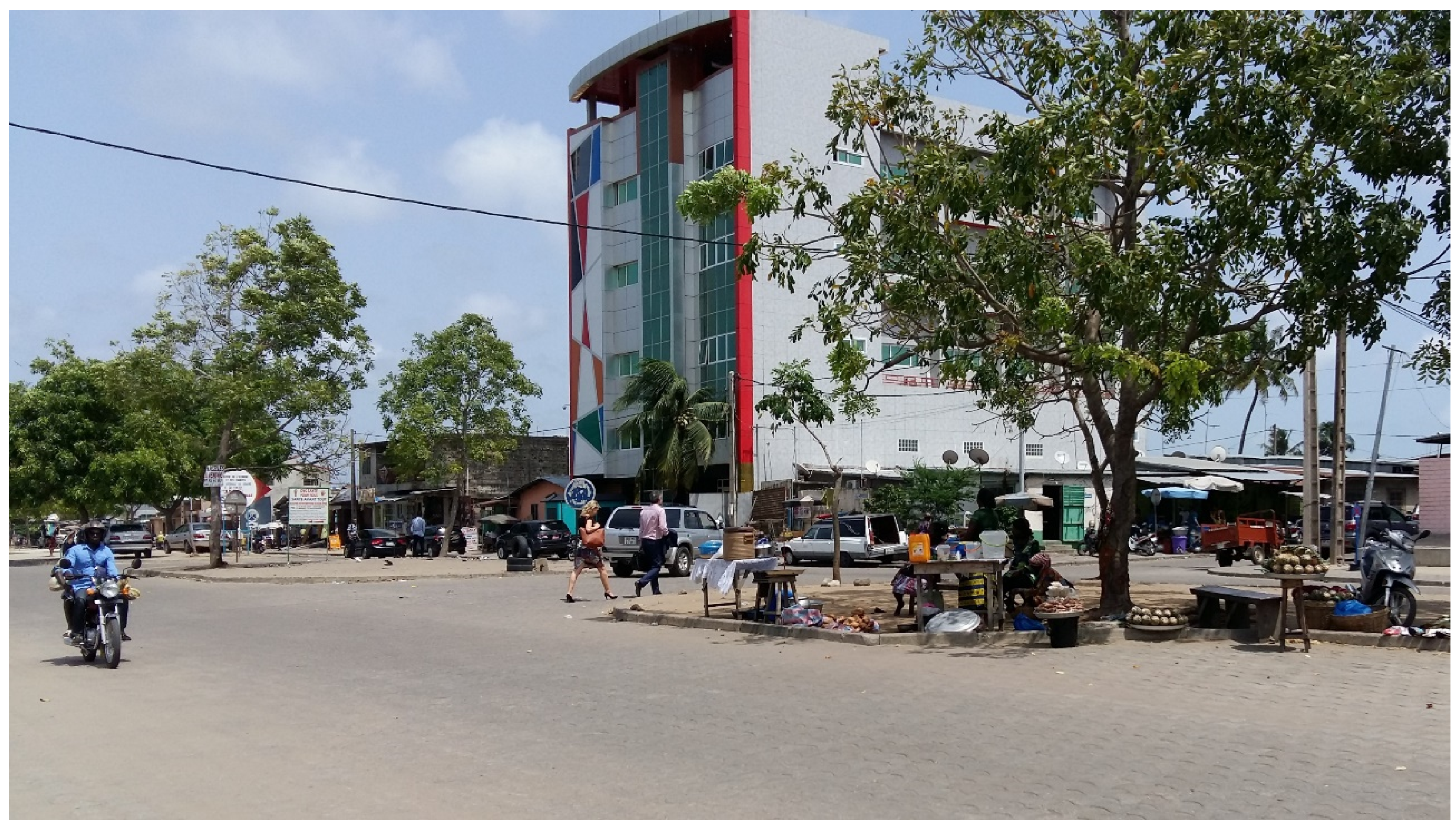
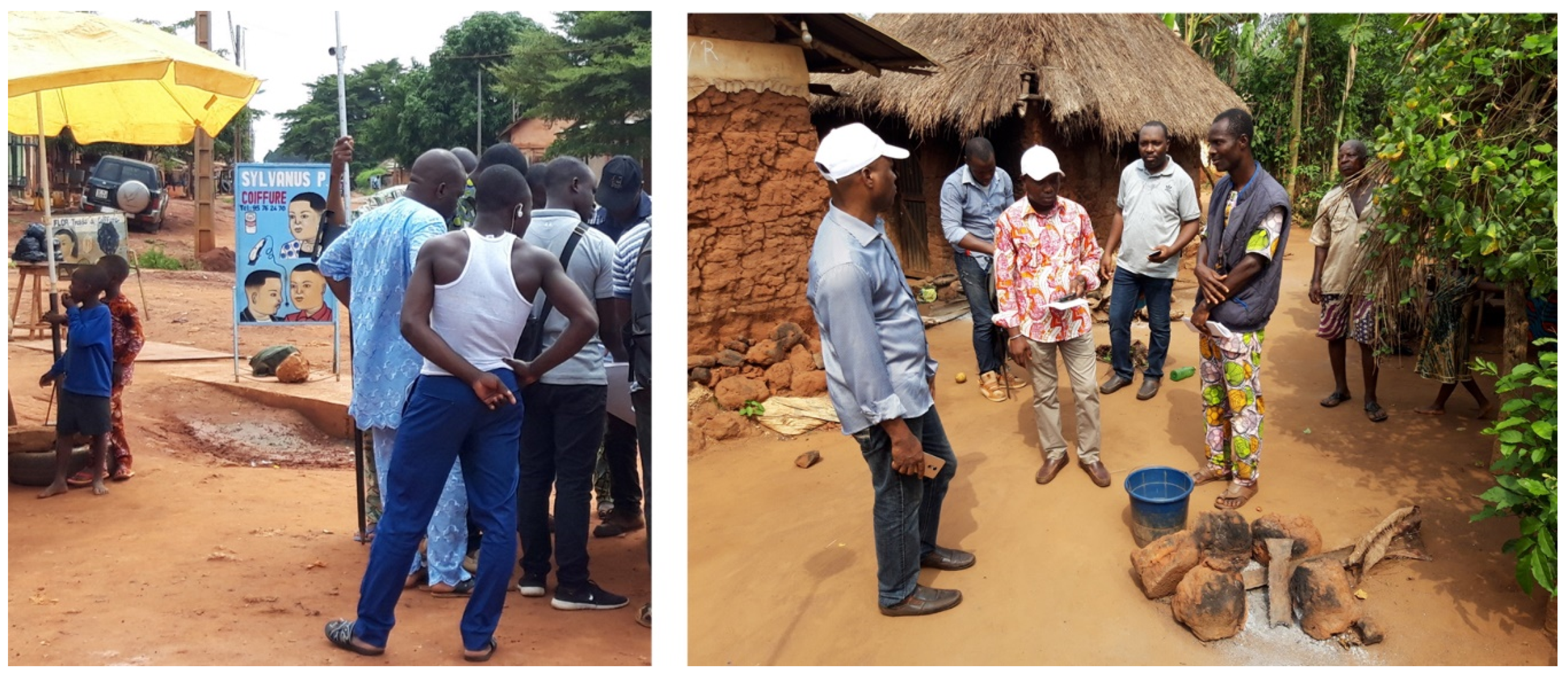
To validate the hypothesis, the PMAF project planned a field test. For this purpose, four geographically dispersed municipalities (Bohicon, Tori Bossito, Sakété, and N’Dali) were selected, consisting of urban, rural, and mixed areas.
Figure 2 gives an impression of the differences between the urban and rural test sites.
This mix was chosen to gain insight into potential cultural and area-specific issues in elaborating a fit-for-purpose approach in the Benin context. The tested approach included using para surveyors from the area with knowledge of the local language and using the local land committees (Section Villageoise/Urbaine de Gestion Foncière) to inform the residents. Over the course of the test, this approach was improved by accepting testimony for claiming property rights, using members of the local land committees as mediators for problem solving and accepting a relatively low accuracy for surveying parcel boundaries.
3.2. Conceptual Framework
For the elaboration of the proposed approach two widely accepted frameworks have been used:
The earlier introduced Fit-For-Purpose Land Administration (FFP LA) approach combined with a field test for verifying if FFP LA will be a solution for the Benin challenges.
The Land Administration Domain Model (LADM) [
15] as solution for using the results of the Fit-For-Purpose land administration approach in a future proof land information system [
16,
17].
3.3. Result of the Field Test of the Fit-For-Purpose Land Administration Approach
In the three months of the test period, spatial and administrative data for a total of 2349 parcels with a total surface area of 3500 hectares were collected in the four selected municipalities. The test proved that a fit-for-purpose approach can achieve fast production at low cost. The field teams produced data for an average of 11 parcels per working day with an average cost of 18 US dollars per parcel. This amount includes all costs directly related to data collection (the labor costs of the field teams, the cost of the collection equipment, the cost of the boundary stones, the cost of guidance and mediation by the local land committees, the cost of communication and publication and the cost of post-processing and quality control). One-off costs such as the development of methodologies and procedures and the construction of the central land administration information system (the digital cadaster) are not included in the costs per parcel. These are covered from the PMAF project budget.
However, the test also showed that the fast production and low price are only feasible if the original hypothesis of a title as end result is relinquished and a lower level of legal certainty is tolerated where the ownership is not established as absolute right but as a verified presumption of ownership.
In contrast to the property right documented by a title, this presumed ownership is not absolute but can be disputed. It is applicable until a legal procedure decides otherwise. The introduction of the possibility for later correction provides space for a less formal, faster, and cheaper approach that better aligns with the political goal of quickly achieving a land registration that covers the entire country. This modified assumption made it possible to apply cost-reducing and speed-increasing measures as part of replacing the existing way of registering land rights by a fit-for-purpose approach tailored to the Benin context. These measures were partly derived from the method for building a communal cadaster in rural areas of Benin, the creation of a Plan Foncier Rural [
18], and consisted of:
- (1)
Allowing testimonies as a basis for establishing the presumed ownership that will be confirmed by means of a one-time inspection open to the public in the village. This is a break with the current practice where owners must always present a document when applying for a title in order to demonstrate their presumed ownership. Working with testimonies is efficient but could lead to institutionalized land grabbing in specific cases, such as with unresolved estates. This risk is manageable because any victims can still rectify it later in court. This rectification is not possible with a title;
- (2)
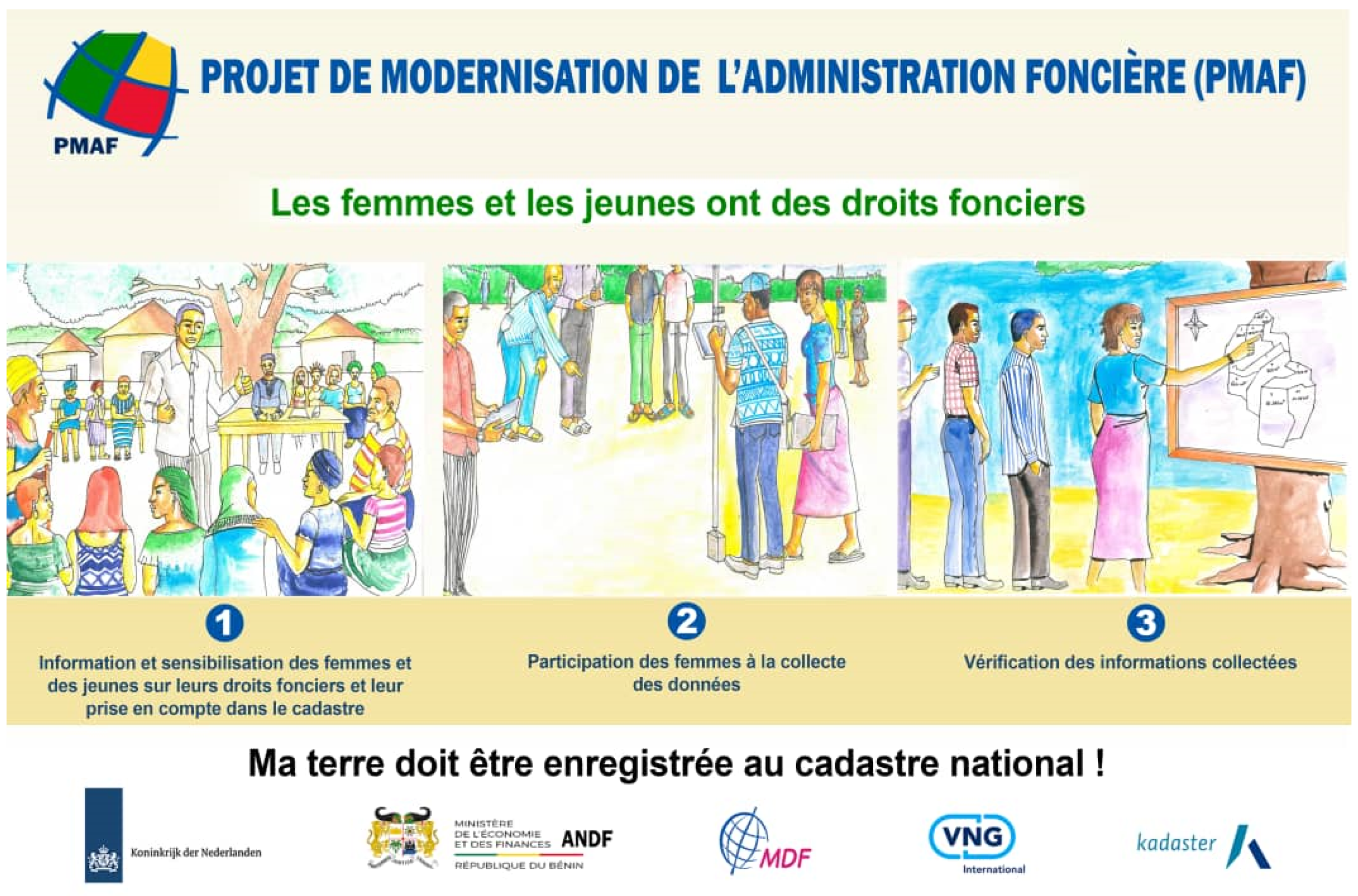
Engaging members of the local land administration committees to resolve disputes through mediation. The Land law in Benin regulates that each village and each municipality must have a land administration committee, une Section Villageoise de Gestion Foncière [
3] (art. 428). This committee consists of residents with authority who have been elected by the population to represent a particular interest group (such as women and young people). The land administration committee members are familiar with the local situation and can therefore mediate when there are conflicts regarding ownership or the parcel borders. To fulfil this task, the committee members must be trained and receive remuneration for their effort, but this is cheaper than hiring external mediators or legal experts. This grass roots mediation is not possible in the title process, where conflicts are directed straight to the court and a title parcel is recorded in the registration only when the court has passed judgment. In the alternative approach a parcel is registered as a conflict parcel when the mediation was unsuccessful, and a court ruling proves necessary. This does not delay the registration process and allows potential buyers and other parties with an interest in a parcel to see that there is a conflict as long as the case is still in court;
- (3)
Accelerating the measurement process by allowing the landowners to play a more active role. This additional participatory step allows the involved landowners themselves marking the parcel boundaries using locally produced boundary stones;
- (4)
Accepting a lower measurement accuracy of one meter for all cadastral parcels (urban and rural), rather than aiming for precision in terms of centimeters. This lower accuracy allows the use of simple measurement equipment and software that can be operated after limited training. As a result, relatively expensive certified land surveyors are only needed for specialized tasks like supervision and quality control. When issuing a title, such inaccuracy would be unacceptable because the stated surface area of the parcel has a legal meaning and therefore cannot change later on. That is why, with a title, the highest surveying standards must be satisfied immediately.
In the methods section, the last two changes are explained in more detail.
3.4. LADM-Based IT Architecture
After the field test, ANDF and PMAF agreed that adding the registration of presumed ownership is necessary in order to meet the goals of the Benin government. To realize this, not only the legal framework and the processes and procedures need to be adapted, but also the IT architecture. Important architectural challenges were to make the legal status of registered parcels as soon as possible visible to the public and to show both the parcels collected with the existing title process and the “fit-for-purpose” collected parcels. For this IT innovation, ANDF wanted to benefit from the knowledge and experience of PMAF.
A specific point of attention in the ANDF-PMAF partnership in terms of data and innovation was the development of a land administration information system based on international standards and best practices. The most important innovation was the introduction of a data-centric architecture (
Figure 3), where data and processes are decoupled [
19]. This decoupling enables the database to feed the central information data store, the digital cadaster, from different sources. The use of the LADM as an overarching standard, with a profile tailored to Benin’s needs [
20], ensures that parcel data from these different sources and with different levels of quality can be linked so that the user can always understand which level of legal certainty is provided for the cadastral parcel he or she is interested in.
The following figure shows how this architecture is constructed.
The green flow consists of owner data and parcel boundaries that are collected by field project teams. This parcel data is, at the village level, consolidated by the providers responsible for a particular work area (the software components used for this process are explained in more detail in
Section 4.3.1). The provider creates an input file from this bundled data and sends it electronically to the central IT system for validation and further processing under the control of the national land administration agency (ANDF). The central IT system then provides the services required for public viewing of the collected and consolidated parcel data (such as a draft cadastral map of the village) and the other process steps required to give the field data legal status as authentic cadastral data. This dataflow regards parcels collected in accordance with the agreed upon Fit-For-Purpose approach, hence with a presumed ownership based on a participatory approach that includes room for testimonial-based ownership claims. This flow is a new arrangement, enabling the imposition of procedural and technical standards on the parties that are contracted for the field data collection. Of these, the most important requirement is that the data collection software they use must provide data that is compliant with the Benin LADM profile. This means that the delivered data does not have to be converted but only checked before it can be incorporated in the central database. As the input data is standardized, these checks can also be largely automated.
The red flow regards data from the current titling process. For this purpose, an information system with its own data model already exists. A conversion module allows the core data from this system to be converted and duplicated automatically into a LADM-compliant data so that it can also be incorporated into the central database of the national digital cadaster. In doing so, the existing IT system does not need to be adjusted. Thus, the investment made continues to pay off and it relieves the ANDF organization because the current work method for processing title applications and linking rights and restrictions to titles can continue. Furthermore, the decoupling also ensures that any delay in the construction of the digital cadaster does not adversely affect the realization of the legal time periods for issuing the titles. After all, the IT system required for this purpose functions autonomously.
The orange flow regards the reading in of cadastral data from external parties. This is mainly data from existing municipal cadastral administrations. These data are very diverse, which sets specific requirements for the conversion and control. For example, it may require that paper plans and registers can be provided, which must first be digitized before they can be processed. It may also be necessary to adjust them geometrically again because, for example, they were collected in a local coordinate system. Because this conversion can cost a lot of time and money, an intake is always done first to determine whether the conversion of an external data source is worth the effort. In certain cases, it is more efficient not to use the data source and to collect the data once again in the relevant area (to use the green input flow). In the future, this input stream may also be used to record usage rights, as registered by the municipalities, in the national land register.
The update process has also been decoupled. A “Fit-For-Purpose” update process (the blue “updating” block in
Figure 4) is being developed to keep track of parcels of land with assumed ownership, allowing frequent transactions such as sales and heritage to be carried out more easily and with less costs. An important element in this new update process is the use of forms from the cadastral database instead of the mandatory use of notarial deeds. In line with the Fit-For-Purpose approach, this means that the maintenance process for parcels with a presumed ownership is limited to common transactions such as sales and inheritance. Relatively rare transactions requiring a high degree of legal certainty, such as the provision of a mortgage, will not be supported. However, the existing title information system does support this kind of transaction and by means of the “red” stream they can also be processed in the cadastral database. In this case also, the use of the LADM profile ensures that these different maintenance transaction flows are displayed in a coherent manner.
Another important element in the “Fit-For-Purpose” maintenance process and the Benin LADM profile is that mutation transactions are based on consulting the current parcel status in the national digital cadaster. The linking of persons to assumed property rights as registered there is considered to be “the truth”. Owners therefore do not need to submit paper documents to prove their ownership rights in the case of property transactions. After processing a transaction, the (new) owner does receive a printed notification, so that he can check whether the transaction was processed correctly, but this document plays no formal role in subsequent transactions. This digital working is in line with the Benin government’s aspiration to become a smart government [
21] (p. 38).
5. Discussion
The case study demonstrates how a traditional high-quality land administration system can be combined with another, fit-for-purpose, land administration system in order to speed up the implementation of parcellation with nation-wide coverage. However, this promise is based on a limited test and has not yet been validated at larger scale. Whether it will become a reality depends on several assumptions that need to be further investigated. Part of that research will be carried out by the PMAF project when, in the period 2021–2023, data for approximately 200,000 parcels of land have been collected with the presented Fit-For-Purpose approach will be made accessible in the newly created digital cadaster.
The assumptions that will be further investigated are listed below, including a short description of the measures that will be taken by the PMAF project to fulfil the expectations or to limit the damage when that is not possible:
- (1)
A legal basis is realized in a timely manner.
The current law considers a digital cadaster, and this is positioned as an essential guarantee for certainty about the ownership of land. The legislator has given this digital national cadaster a broader scope than just the disclosure of titles, where the exact content can be arranged by decree. The ANDF legal experts expect that the creation of this decree can introduce the alternative of a “presumption of ownership”, by registering it as such in “the cadaster”. This expectation is based on an interpretation of chapter 5 of the Benin land law which outlines the organization and functions of the cadaster. Because a decree can be established relatively easily in Benin, it is possible to quickly give a legal basis to the collected fit for purpose parcel data. Because this is such an important assumption, the project is providing funds for external specialists to carry out a legal analysis to independently determine what is needed to legally anchor the use of the Fit-For-Purpose procedures for the construction and maintenance of the national digital cadaster. By giving this priority, ANDF and PMAF will know what else needs to occur in the legal area and whether there is sufficient time available to arrange it. With this knowledge, additional resources can be organized, if necessary, to adjust the legal framework or in the worst case, the data collection can be delayed until there is an adequate legal basis for use and maintenance;
- (2)
The people of Benin have confidence in the national digital cadaster and its “Fit-For-Purpose” construction and maintenance.
The approach described creates a new legal, institutional, and technical ecosystem for the registration and mutation of property rights. This system will only produce the intended effects if users understand its importance and have confidence in its proper functioning. ANDF and the PMAF project are aware of the importance of creating trust and this is also included in the outcomes the project must achieve. These outcomes are operationalized by actively involving representatives of chain partners and population groups, and by basing the development of procedures and products on the interests and needs of both the population (the demand side) and the agencies involved (the supply side). However, much will depend on the way the Benin government is going to apply the system. If the latter uses the cadaster mainly to levy taxes and not as a tool for a fairer and better use of land, the population will avoid the land register and fall back on the current informal practices. The same will happen if there is no sustained investment in the knowledge and capacity of the actors involved. In that case, bureaucracy will return, and vulnerable groups will continue to face impregnable barriers. By having important guiding principles embedded in strategic government plans and by developing customer oriented sustainable business models, PMAF is trying to mitigate these risks (see also the discussion points below), but whether this is adequate will have to be seen in the years following the project’s completion;
- (3)
A pricing model is introduced that offers affordable legal certainty for everyone.
In order to not exclude any parties, the price for transactions on parcels with presumed property must be adjusted to the ability of the Benin population to pay and be in proportion to the value of the cadastral parcel involved in the transaction. Various solutions are available for this purpose, such as a rate based on the sale price or sliding scales based on the location and the surface area of the cadastral parcel. It is mainly the role of PMAF to provide alternative business models and to show with good communication to the partners in the chain that a low rate combined with a large volume will benefit everyone.
- (4)
Property transactions can be carried out easily.
In addition to making transactions affordable, the users must also be able to perform them easily. This regards very practical things such as taking illiteracy into account and preventing long travel times because motorized transport is scarce and relatively expensive in rural areas. An important task here for the project is to provide efficient and simple maintenance procedures and to ensure that no process steps are added that make it unnecessarily more complicated for the users. In addition, ANDF must mobilize the political support that is needed to move parties, which have not yet embraced thinking from the user standpoint, in the right direction;
- (5)
Certified surveyors can be used without driving up the cost.
Currently, the intention is to grant the first tranche of the field data collection to established surveyor agencies. This well-organized professional group of certified surveyors views the project with much interest and obviously sees this as an opportunity to increase its revenue. Because the surveyor agencies have a lot of knowledge and experience and can mobilize a lot of “opposing force” if they should be passed over, it has been decided to first outsource the collection of data to them. The proposal request will provide the tested work method and the corresponding cost as a framework to stimulate sharp pricing. As the collection of data is marketed in different tranches, other parties may also be involved at a later stage, if subcontracting to certified surveyors’ agencies proves too expensive;
- (6)
A separate GNSS antenna is required to register parcel boundaries.
The choice made in Benin to base the registration of all cadastral parcels on an accuracy of at least 1 m may makes it possible to register parcel boundaries with the help of a smart phone’s internal GNSS antenna. Currently, smart phones that can reliably deliver this precision are not yet common, but it is possible that they will be by the end of 2022, when the PMAF project ends. PMAF will follow developments in this area as the use of standard smart phones in combination with user-friendly collection applications may save significant costs compared to the current situation where professional surveying equipment is used.
- (7)
The tenure security of women and other vulnerable groups is reinforced.
When recording property rights, it is important that this occurs with specific attention to vulnerable groups, including women and young people. This approach has been evaluated and developed further using the gender evaluation criteria for large-scale land tools [
26]. The approach registers the ownership of men as well as women. In many cases, a usage right is granted for women’s access to land. To accelerate the data collection, the decision has been made to only record the property right and refrain from registering secondary usage rights. This issue was one of the difficult considerations between speed and quality. This choice was determined to be acceptable based on the assumption that when arranging the property right, landowners are more willing to grant long-term usage right because they then no longer run the risk that a claim on the land can be placed through this use. This would still indirectly reinforce the legal certainty of women and young people, with the added effect that they are more willing to invest more in working the land, which will increase the food security in time. Moreover, the LADM profile and the system architecture of the national digital land registry are designed to allow for the later addition of secondary usage rights, for example by granting specific updating rights to municipalities, so that they can populate the cadastral database on the basis of agreements drawn up at local level that define specific land use agreements.
- (8)
The entire population of Benin will benefit from the project results.
As explained earlier, Benin has a long history of failed land reform and, at the moment, land rights are still mainly something for the rich. However, the PMAF project’s motto is “Sécurité foncière pour tous” (land rights for all), and ANDF and PMAF truly believe that by applying “Fit-For-Purpose the Benin way”, it will be different this time. Because food security and inclusiveness are key policy priorities of the Dutch embassy (the formal sponsor of the project), it is important that it can be proven that the faith in the benefits of introducing a national “Fit-For-Purpose” digital cadaster is justified and that the position of vulnerable groups actually improves. Performance indicators have been established and a monitoring system has been set up to verify this.
To verify that the presented benefits are realized in a sustainable manner, it may be useful to repeat this case study when the PMAF project is completed.
6. Conclusions
The Benin case shows that the hypothesis that a Fit-For-Purpose approach could speed up the realization of a nationwide land administration is valid and that it is possible and advantageous to combine this with maintaining existing, more traditional, land administration systems.
The Benin example also shows that combining two different approaches for registering land rights with the development of a Fit-For-Purpose information system based on a situation-specific LADM profile, offers the possibility to include both in the information provision. By doing so, stakeholders can easily see what level of legal certainty applies to a cadastral parcel and thus what procedure they need to follow to carry out transactions. The the IT architecture presented also shows how existing information systems can be exploited so that no complex migration process is required, and existing IT investments continue to pay off.
The case demonstrates that there are several ways of applying a Fit-For-Purpose approach in land administration and that it can be necessary to adapt it to better match the context of the country in which it is applied. After all, the political officials of a country are the ones who determine the “purpose” in a fit for purpose land administration approach. This is a reality that a project must be able to handle. The responsible parties, ANDF and PMAF, believe that a “Fit-For-Purpose approach in the Benin way” will be up to the challenge. Whether that is actually the case will have to be proven in the remaining lifetime of the project.


