1. Introduction
Adaptation was defined by the Intergovernmental Panel on Climate Change (IPCC) as “the process of adjustment to actual or expected climate and its effects, in order to moderate harm or exploit beneficial opportunities” [
1]. Beneficial opportunities might include a longer growing season or expanded crop range. Effective adaptation to climate change requires both information on expected changes to adapt to and the technical and financial resources to identify and implement appropriate adaptation measures [
2,
3].
The amount of information available on climate change has grown exponentially over time. In 2021, an average of 135.2 papers referring to climate change or global warming were published every day versus 0.01 per day before 1990 [
4], and there are additionally numerous dedicated books and internet sites on the subject. Much of the climate change literature was written by the academic community for audiences of their peers rather than to the lay public. Decision makers responsible for adaptation planning face the daunting task of somehow sorting through this voluminous technical literature and extracting information on climate changes that will or may occur in their economic sector and geographic area and then developing appropriate adaptative responses. Decision makers require concise information that is in a format that they can access and understand and provides reliable guidance on the changes expected over their various planning periods.
The projected impacts of climate change increase with time at an accelerating rate and will likely be extreme in many areas over the next one to two centuries. However, infrastructure investment decisions are typically made over shorter planning periods that may be regulatorily prescribed and related to the time frame of potential changes that are anticipated to impact the adequacy of current resources and the time required to construct new or upgrade existing infrastructure. Key issues for adaptation planning are the rate, magnitude, and direction of climate changes over planning horizons, the impacts of other (non-climate-change-related) concurrent factors on the systems in question, and the operational lives of infrastructure elements.
In many parts of the world, groundwater is the primary or a major source of water for both public utilities, industry, agriculture, and household supply. In the United States in 2015, groundwater provided approximately 39% of the municipal water supply, 48% of irrigation use, and 98% of the self-supplied drinking water [
5]. In the state of Florida, 87.3% of the public water supply in 2015 was obtained from groundwater [
6]. Climate change may impact groundwater supplies through temperature-induced increases in evapotranspiration (and thus water demands), changes in precipitation and associated aquifer recharge, and changes in groundwater levels and salinity caused by sea level rise. Sea level rise will also cause groundwater levels in low-lying areas to rise close to or above land surface, potentially impacting a larger area and causing greater economic damage than direct inundation by seawater [
7].
Florida, being highly dependent on groundwater, provides an excellent case study to examine the important questions of how water supply adaptation decisions are actually made, the role of government, and the amount and quality of information that is available and accessible to decision makers to guide their planning. This study is based on a documentary analysis of institutional frameworks and local water supply plans in Florida and a review of the most recent climate change literature and data on the potential directions and magnitudes of potential impacts to Florida’s water supplies over the usual planning periods in the state. Climate change adaptation, with respect to groundwater, is examined from an applied perspective.
2. Methods
This study relied upon the author’s over 30 years of personal experience in the design and permitting of groundwater supply systems in Florida, ranging in scale from large municipal systems to small commercial projects. Government activities, with respect to climate change and groundwater, were evaluated through a review of the most recent water management district regional water supply plans and the Florida Department of Environmental Protection reports. Climate change and sea level rise projections were obtained from the most recent Intergovernmental Panel on Climate Change Sixth Assessment Reports, online tools based on the Coupled Model Intercomparison Project Phase 6 modeling results, and an internet search for more recent governmental and academic technical papers. Utility staff were questioned about their climate change resilience activities, but a systematic survey was not performed.
3. Climate Change Decision Making Process
3.1. Decision Makers
Adaptations to climate change can be made by individuals (either acting alone or collectively) and businesses for their own benefit or they can be made by governments and other public bodies to protect their citizens [
8]. Governments can either perform or contract adaptation measures or mandate their implementation.
A distinction exists between policymakers and decision makers. The former are usually elected or nonelected members of the government who promulgate laws, set standards, and direct the flow of public funding. Decision makers, on the contrary, are the individuals who are tasked with finding and implementing project-level solutions and operate within existing regulatory and economic frameworks.
Water users from large utilities and regional suppliers to households supplied by a domestic well are typically responsible for obtaining their own water supplies and thus reacting to how climate change and a myriad of other factors might impact their supplies and demands.
From the author’s personal experiences in Florida, public utility water supply plans that consider projected future water demands and the various options to meet those needs are developed by in-house technical staff (engineers and hydrogeologists) and their consultants. A series of water supply options are identified and evaluated (ranked) for technical and regulatory feasibility, environmental and other concerns, and relative costs. The water supply plans are subject to review, input, and approval by upper management (e.g., the utility director). Expenditures for capital improvements (i.e., implementation of plans) are voted on by local county commissioners, city council members, or other elected boards. Under Florida Sunshine Law, all meetings of state, county, or municipal boards or commissions must be open to the public. The public has a limited opportunity to express their opinions at county commission and city council meetings; commonly, each attending member of the public is allowed only three minutes to speak. In practice, there has been limited public engagement on technical issues such as water supply, and the few public speakers at meetings rarely affect the outcomes of votes.
Although climate change may have broad societal impacts on water supplies and demands, the subset of society tasked with evaluating climate change data and projections and making and implementing adaptation decisions is very small. The technical nature of infrastructure decisions limits stakeholder engagement, the utility staff-level decision making process is generally not open to the public, and members of the public have limited opportunity to express their opinions at meetings where water supply plans are voted on.
3.2. Governmental Involvement
Climate change has become highly politicized in the United States and Florida, and thus there is now a paucity of top-down guidance or mandates on the issue, particularly with respect to mitigation. Cities and counties in Florida that are most vulnerable to climate change, such as Monroe County, which includes the low-lying Florida Keys islands, and Miami-Dade County, are actively addressing climate change on the local level. High-level federal and state governmental involvement in climate change adaptation is primarily through data collection and dissemination, and technical and financial support. Florida state governmental policy is currently to recognize, for example, sea level rise and to plan and financially support implement measures to increase resiliency, but not to acknowledge a primary anthropogenic cause and require mitigation actions [
9].
Surface water and groundwater use in Florida is regulated by five regional water management districts through a permitting process. Water management districts in Florida also perform water level and quality monitoring, provide technical and financial support for alternative water supply projects, perform regional water supply planning, and promote conservation. The districts have the authority to mandate reductions in water use in response to dry conditions (e.g., limit residential landscaping irrigation to one or two days a week or curtail it entirely).
With some exceptions (e.g., household wells), water users are required to obtain consumptive use permits which have limits on the amount of water that can be abstracted and specify allowed sources. New permits will cease to be issued for areas when the cumulative modeled drawdowns from existing permitted withdrawals and proposed additional withdrawals are determined to result in unacceptable adverse impacts to the environment (e.g., dehydration of wetlands and lowering of lake levels) or to the resource. In some areas of Florida, new fresh groundwater abstractions are no longer permittable as aquifers are believed to have reached their sustainable limit of abstractions. Pumping additional fresh groundwater is thus not a viable adaptation option to drier climate conditions.
The water management districts are required by law to prepare regional water supply plans (RWSPs) for a minimum 20-year planning period. The RWSPs, which are updated every five years, provide estimates of future water demands and a determination if existing sources of water are adequate to supply all existing and future reasonable–beneficial uses and to sustain the water resources and associated natural systems over the planning period. The RWSPs include a list of traditional and alternative water sources judged to be technically and financially feasible, from which various water providers may choose for their water supply or the providers may propose alternatives.
Recent RWSPs discussed actions being taken to evaluate the impacts of climate change on water resources. The South Florida Water Management 2022 Lower West Coast Water Supply Plan Update (2022 LWC Plan Update), for example, notes that “Several ongoing research studies are focusing on the implications of future temperature changes on evapotranspiration losses. The District has conducted and commissioned studies on the predictive skills of climate models and has evaluated available downscaled datasets for application specific to Florida. Efforts to improve climate prediction models are under way, and the District will incorporate the improved models and future estimates into planning and operations, as appropriate” [
10]. Other RWSPs recognize general potential impacts of climate change and sea level rise and include planned evaluation measures (e.g., continued and expanded monitoring and modeling to evaluate saline water intrusion).
3.3. Planning Horizons
Local governments are required to prepare comprehensive plans, which include a water supply element that is required to identify water sources for meeting current and projected industrial, agricultural, and potable water needs and sources for at least a ten-year period. RWSPs have 20-year planning horizons. Consumptive use permits (CUPs) usually also have a duration of 20 years. However, CUPs for alternative water supply projects with large capital costs may have durations of up to 50 years.
The typical planning horizon for water supply in Florida is usually between twenty and fifty years into the future. Planning horizons also depend on project-specific circumstances. For example, the design and location of major nearshore infrastructure would overlook critical climate risks if the impacts of projected sea level rise over operational lifetimes are not adequately considered.
4. Future Climate and Water Resources’ Impacts Data
Future climate conditions are evaluated using three-dimensional models of the entire planet that simulate the major atmospheric, oceanic, and land processes that impact the climate. These highly complex models, called general circulation models (GCMs, also global climate models) and more recently atmosphere–ocean general circulation models (AOGCMs), have been developed and progressively refined by multiple international modeling groups.
One limitation of GCMs is a coarse spatial horizontal resolution that limits their ability to predict local climate changes. The horizontal resolution of GCMs has been improving over time. The recent standard horizontal resolution is approximately 100 km in the atmosphere and 50 km in the ocean. High-resolution projections have a horizontal resolution of about 25 km or less in the atmosphere and 10 km or less in the ocean [
11]. GCM data are downscaled by the creation of smaller grid regional climate models (RCMs) nested in GCMs or using statistical methods.
A common misunderstanding of the general public is that GCMs forecast most likely future conditions. In reality, each model run will predict future conditions under a selected future greenhouse gas (GHG) emissions scenario, the primary model variable input. Individual GCMs differ to varying degrees in their predictions of future conditions for given future GHG scenarios.
Climate change predictions are subject to a cascade of uncertainties, starting with future greenhouse gas (GHG) concentrations (which are unknown), and then on to the modeling of the impacts of changes in GHG concentrations on climate, downscaling the GCM results to a finer local geographic scale, and next modeling the effects of local climate changes on water resources [
12].
4.1. GHG Emission Scenarios
The greatest uncertainty in climate change modeling is future GHG concentrations because they will be determined by human actions taken in the present and future. The Coupled Model Intercomparison Project (CMIP) of the World Climate Research Programme (WCRP) is a global collaborative effort involving numerous climate modeling groups to examine uncertainties in GCM projections. A standard set of model simulations were run using the same set of GHG emissions and development scenarios to evaluate how accurate the models are in simulating the recent past and to understand some of the factors responsible for differences in projections between models [
13]. The CMIP results informed the Intergovernmental Panel on Climate Change (IPCC) and other international and national climate assessments.
CMIP5 used four Representative Concentration Pathways (RCPs; RCP2.6, RCP4.5, RCP6, and RCP8.5), which range from a high-mitigation, low emissions scenario (RCP2.6) to a high emissions scenario (RCP8.5), with the numbers referring to expected net change in year 2100 radiative forcing (net change in downward versus upward radiative flux though the atmosphere) in units of Watts per square meter [
14]. For each RCP, the CMIP5 modelers generated an ensemble of future climate projections that define an envelope or cone of uncertainty. The IPCC Fifth Assessment Report (AR5) relied heavily on the CMIP5 results.
Instead of the RCPs, CMIP6 and the IPCC Sixth Assessment Report (AR6) used five shared Socioeconomic Pathways (SSPs), which are storylines of projected socioeconomic global changes up to 2100. The five SSPs, SSP1 through SSP5, range from a sustainable future (SSP1) to a continued high economic growth and fossil fuel-intensive future (SSP5). SSPs names are often combined with the year 2100 level of radiative forcing (1.9 to 8.5 W/m
2), which allows for a comparison with earlier modeling results using the RCPs [
15].
The IPCC did not assign probabilities to the RCPs and SSPs. RCP8.5 and SSP5 have been frequently taken as the business-as-usual (minimal mitigation) scenarios and are most consistent with recent GHG concentration trends.
The selection of an emissions scenario is important in the adaptation decision making process. The model results based on a low emissions scenario can underestimate future climate change, whereas higher emissions scenarios may exaggerate future climate change and result in either over investment or defeatism [
16]. Hausfather and Peters observed that the RCP8.5 and SSP5 8.5 scenarios are extreme and that intermediate scenarios (SSP2-4.5, SSP4-6.0, and SSP3-7.0) may be more likely [
16]. The former scenarios were recommended to be labeled as unlikely worse cases. Significant divergences in climate change predictions between the scenarios do not occur until the middle of the century and thus are not important for predictions over a 20-year planning horizon [
17].
Although higher GHG scenarios result in greater modeled climate change, there is overlap. The multi-model median predicted climate changes from the high emissions RCP 8.5/SSP5-8.5 scenarios are within the upper range of values for the intermediate GHG scenarios.
4.2. GCM and RCM Simulations
Running and processing the results of GCMs is a very specialized discipline, and most users of climate change data rely on the results of modeling performed by others. Published climate change studies have either utilized the output of one or several GCMs or RCMs run for one or multiple emission scenarios or relied on the results from the numerous runs compiled by the CMIP. IPCC reports commonly provided for temperature, precipitation, global sea level rise, and other variables model median (50 percentile) values and percentile range values to illustrate uncertainty.
The GCM model outputs are available from the CMIP website, but the very large model output files are not in a format that is accessible by casual (non-expert) users—typical decision makers. Various online viewer applications have been developed that provide non-technical experts with more ready access to climate change predictions, some of which (e.g., Climate Wizard) have ceased to be updated and have been discontinued.
A noteworthy program for the United States is the USGS National Climate Change Viewer (NCCV), which provides access to CMIP5 and CMIP6 outputs statistically downscaled to a finer, county-scale spatial resolution [
18]. The NCCV web application provides individual GCM outputs and the CMIP5 and CMIP6 multi-model median and 10th and 90th percentile range. The Copernicus Interactive Climate Atlas is a viewer that provides climate change projections from CMIP5 and CMIP6 and some individual models for Europe and the rest of the world [
19]. Understanding the outputs of the NCCV and Copernicus Interactive Climate Atlas requires some knowledge of climate change basics, such as the GHC emission scenarios, GCMs, and CMIP.
4.3. Modeling the Impacts of Climate Change on Groundwater
Numerical groundwater modeling is the standard tool for evaluating the impacts of groundwater use on aquifer water levels and water quality and is also used to evaluate the potential effects of climate change. Groundwater models have varying degrees of sophistication, with selection based on project needs and budgets and data availability. Most sophisticated are integrated surface–water–groundwater models that are calibrated to project area historical data.
Once such a model is developed, simulations of the effects of climate change involve adjusting input parameters for future climate scenarios. The effects of changes in climate and SLR can be simulated by changes in model boundary conditions, such as precipitation, evapotranspiration, recharge, and sea level. The major technical challenge for modeling the impacts of climate change on groundwater is quantifying changes in future aquifer recharge rates from simulated changes in the amount, intensity, and seasonality of precipitation and potential evapotranspiration rates. Various statistical techniques are available to generate daily time-series of future precipitation data to be used as model inputs from historical data and projected future changes in the amount and seasonality of precipitation [
20,
21].
Density-dependent solute transport of saline water intrusion allows for the evaluation of potential rates of saline water intrusion. Such modeling has been conducted on the county or regional scale in Florida by or for the water management districts and the U.S. Geological Survey [
22,
23,
24].
Modeling of the impacts of climate change on groundwater requires high levels of expertise and is time consuming and thus expensive. Because of the high uncertainties associated with modeling climate change impacts to groundwater [
24], such models have typically not been developed by or for individual water users in Florida. The benefits usually do not justify the costs in terms of specific information that can guide planning.
5. Predicted Florida Climate Changes
The state of Florida has a particularly high vulnerability to climate change (described as “ground zero” by the Union of Concern Scientists) [
25]. However, actionable information on the specific impacts of climate change on Florida’s groundwater remains scarce. The primary information available to water supply decision makers in Florida is published reports and web sites such as the NCCV. Organizations have been established over the past two decades, including the Florida Water and Climate Alliance (FloridaWCA) and Southeast Florida Regional Climate Change Compact, that focus on fostering partnerships and sharing climate change science information between communities and utilities, regulatory agencies, and academic researchers [
26,
27].
Florida-focused reports addressing the impacts of climate change on water supplies [
24,
28,
29,
30,
31,
32,
33,
34] provide useful broad general predictions, but a low specificity and regional spatial resolution limit their value for planning purposes. The following is a summary of recent climate change projections for Florida.
5.1. Local Sea Level Rise
The historic rate of sea level rise in Florida has been close to the global average [
35]. Global mean sea level has risen by 111 mm since satellite observations of sea surface height began in 1993 through the end of 2023, with the rate of rise increasing from ~2.1 mm/year in 1993 to ~4.5 mm/year in 2023 [
36]. The reported rate for 2024 was 5.9 mm/year, which was greater than the predicted rate of 4.3 mm/year [
37].
Extrapolating the rate forward indicates an additional increase of approximately 107 mm between 2025 and 2045 [
31]. The CMIP6 modeling results presented by the IPCC (median; medium confidence) indicate SLRs from 2025 to 2055 of 168 and 196 mm for SSP3-4.5 and SSP5-8.5, respectively, and to 2075 of 285 mm and 386 mm for SSP3-4.5 and SSP5-8.5, respectively [
38]. The extreme SSP5-8.5 low confidence 95th percentile sea level rise from 2025 to 2075 is approximately 1.15 m [
38], which would have extreme impacts such as the permanent and frequent temporary inundation of low-lying coastal communities and ecosystems.
5.2. Temperature, Precipitation, and Evaporation Deficit
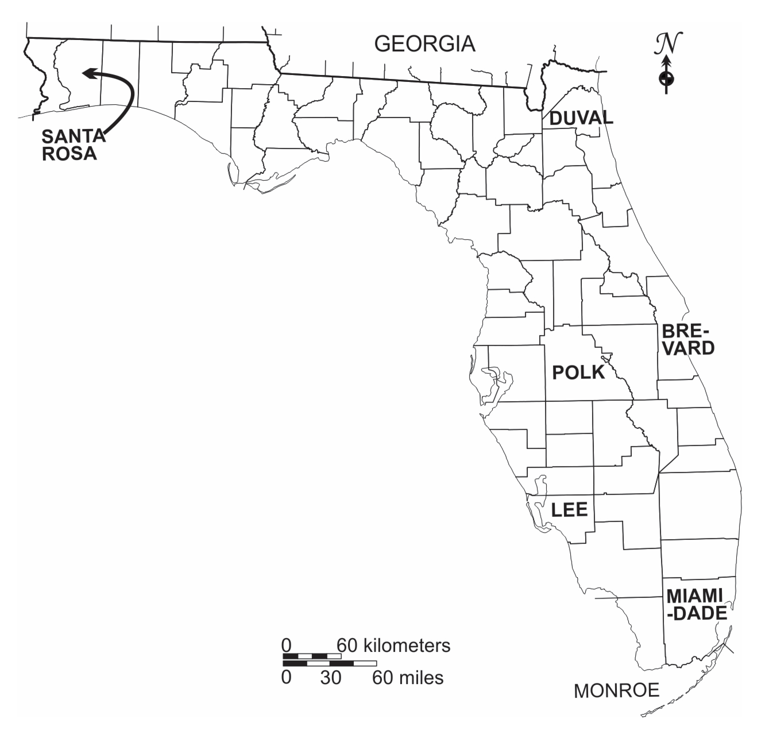
The CMIP6 data compiled and downscaled in the NCCV for six counties representing different areas of the state (
Figure 1) were processed to obtain the change in the multi-model mean annual temperature, precipitation, and evaporation deficit for the years 2045 and 2075 relative to 2025 for the SSP5-8.5 scenario (
Table 1).
The modeling results indicate a 0.8 to 1.0 °C increase in temperature over the next 20 years and a 1.6 to 2.5 °C increase over the next 50 years. The IPCC AR6 concludes that projections indicate that it is “very likely” in all regions of North America that the intensity and frequency of warm days and nights and heatwaves will increase and cold days and nights will decrease [
39]. The number of extreme heat days, defined as days at or above 95°F (35° C), is projected to increase in Florida [
40].
Annual precipitation is modeled to change to only a modest degree with increases in the north and decreases in the south. The modeled changes in precipitation are small relative to the statewide annual average of 1.37 m and less than the historical inter-year variation. Over the remainder of the century, the multi-model median for the SSP5-8.5 scenario projects a statewide mild tendency for greater precipitation in the spring, winter, and fall dry season and a stronger tendency for drier conditions in the summer wet season [
41]. Throughout North America, the CMIP6 models predict a robust increase in the intensity and frequency of extreme precipitation events [
39].
The net effect of an intensification and modification of the seasonality of rainfall on Florida ground-water is unclear; it can either result in greater recharge if more water escapes ET in the upper vadose zone or accumulates in areas favorable for recharge or lesser recharge if a larger fraction of the rainfall runs off and is lost to tide.
Evaporation deficit is the difference between actual and potential evapotranspiration and thus provides a measure of dryness and plant water stress, and, in turn, irrigation requirements. The modeling results indicate overall drier conditions throughout Florida, with the effects of higher temperatures being partially offset by increased precipitation in northern Florida.
5.3. Extreme Events
A general climate change prediction is that extreme weather events will become more common and severe. As average temperature rises, the risk of extreme and record-breaking temperatures increases [
42]. It is uncertain whether the number of Atlantic hurricanes (tropical cyclones) will increase, but it is likely that hurricanes that form may become more intense. Category 4 and 5 storms will very likely become more frequent and rain rates will increase with increasing global warming [
39]. Sea level rise will very likely result in higher storm level inundations [
42].
6. Actionable Information
Climate change modeling cannot provide water decision makers with accurate and reliable specific predictions of future conditions due to the high uncertainties inherent in each step of the process [
24]. However, climate change modeling is still of great importance in informing adaptive planning. Consideration of the results from multiple GCMs using conservative GHG emission scenarios (RCP 8.5 and SSP5-8.5) can provide decision makers with a range or envelope of plausible future conditions and allow them to be put in the context of historical experiences. The divergence from recent conditions and historical trends will increase over time.
Florida will almost certainly become warmer. The climate change modeling results suggest that changes in annual average precipitation in Florida will likely be small (within ±5 to 10%) over the next 50 years, and well within the historical variation. Increased precipitation in the dry season may be offset to some degree by increased ET caused by temperature increases. Drought conditions may tend to be more frequent and severe.
Thus, over a 20- to 50-year planning horizon, Florida will likely experience overall drier conditions and more frequent periods that are drier than the historic norm, but the magnitude of changes may not be out of the range of historical experiences. Drier conditions would increase irrigation water demands and likely decrease groundwater recharge. Water use permits in Florida have various conditions to require efficient water use, such as the implementation of conservation measures and allocations based on irrigated areas and local crop water requirements to avoid over irrigation. In response to future droughts, water use restrictions may be imposed more often and be deeper.
The challenges decision makers in Florida will face dealing with the effects of climate change on water supplies and demands over the next 50 years will likely be dwarfed by increases in water demand from population growth. The latest projection suggest that Florida’s population will increase from approximately 22.6 million in 2023 to between roughly 24.7 and 31.4 million in 2050 [
43].
Sea level rise will be an increasing threat to coastal communities. Sea level rise can cause the salinization of coastal aquifer through temporary and permanent inundation and horizontal saline water intrusion. A modeling investigation of the impacts of sea level rise in Pompano Beach, Broward County, Florida, a community particularly vulnerable to saline water intrusion, predicted apparent lateral intrusion rates of 15 to 21 m/yr for rates of sea level rise of 2.4 to 8.8 mm/yr [
22]. The results of the modeling of Miami-Dade County show that a sea level rise of 0.222 m (0.73 ft) over 30 years (7.4 mm/yr) would have minor impacts on the position of the freshwater–saline water interface, with a landward shift occurring mainly seaward of canal salinity structures and in the low-lying southern part of the study area where increased flooding would occur [
23].
Horizontal saline water intrusion is a relatively slow process and thus poses a threat mainly to wells located close to the coast and the current saline water interface. In response to historic saline water intrusion caused by groundwater pumping and tidal canal construction, communities in Florida have already abandoned near-coastal municipal supply wells and constructed new wells further inland or developed alternative water sources, such as brackish groundwater desalination [
44].
Over the next 20 to 50 years, the main impacts of sea level rise are expected to be increased coastal erosion, greater tidal and storm flooding, inland migration of saline water in rivers, and rising water tables, which can cause the inundation of a low lying area and impact underground infrastructure. The threat of more intense hurricanes, depending upon circumstances, may necessitate that water supply infrastructure be further hardened against stronger winds and, near the coast, larger storm surges.
7. Discussion
Decision makers in Florida, with respect to groundwater use, face a similar challenge as those in other geographic areas and societal sectors. Despite voluminous technical literature on climate change, there are limited actionable data that can guide their adaptation planning. Additionally, a survey conducted during a FloridaWCA workshop identified “trust in data” as by far the greatest barrier to decision making, followed by the “absence of standardized regulation and policy concerning the application of climate projections” [
45].
Climate change is insidious because on an annual basis, the changes have not been noticeable by casual observation. The slow and cumulative nature of climate changes can make their effects difficult to detect without systematic monitoring and in water resources planning can lead to the attitude that immediate action is not required. For example, the current sea level rise of 5.9 mm/yr would not be readily detected without monitoring, and projected local precipitation changes in Florida are within the natural variation. Average temperature has been progressively increasing, with most of the warmest years since 1895 occurring in the last decade [
46]. Addressing future climate change impacts on groundwater is not now a high priority as there are usually more pressing issues requiring attention. However, increasing rates of temperature and sea level rise may force an end to complacency.
Other groundwater-dependent areas face similar challenges to Florida with respect to their groundwater supplies. The median of the climate modeling results may suggest a direction of change in precipitation and aquifer recharge amounts, but there is still large uncertainty. For example, projections of future recharge for the High Plains Aquifer of the mid-continent of the United States encompass both increases and decreases in recharge, requiring that management responses be flexible enough to account for the uncertainty [
47]. Water users may hope for wetter conditions but should have plans to adapt to detrimental drier conditions should they arrive.
Various frameworks have been proposed to assess the vulnerability of water and other infrastructure to climate change, such as the United States Environmental Protection Agency “Adaptation strategies guide for water utilities” [
48]. The frameworks follow a basic sequence of first assessing the vulnerabilities of the different components of a system to climate changes, followed by the evaluation of the likelihood, magnitude, and timing of the impacts, and then consideration of the potential adaptation options. It is recognized that financial resources are limited and thus adaptation investments will need to be ranked, with priority given to actions that will bring the greatest net value [
49].
Rather than focusing on specific model predictions based on selected GHG scenarios, a more practical approach is to explore vulnerabilities and responses to various hypothetical changes, such as a 0.3 m sea level rise or a 20% decrease in aquifer recharge or increase in water demand caused by hotter and drier conditions. If a serious vulnerability is identified, then the climate change modeling may be explored to evaluate the probability and/or likely timing of the adverse change within the planning period. This “bottom-up” approach [
45,
50,
51,
52] can lead to the development of more robust water supply systems that can cope with a wide range of eventualities. The bottom-up approach is particularly useful to Florida because of its numerous vulnerabilities to climate change and uncertain future conditions.
The most challenging scenarios for decision makers to plan for are very high uncertainty, low-probability catastrophic-outcome climate changes, which include greatly accelerated sea level rise and temperature increases and changes in precipitation (e.g., much more intense and longer-duration droughts) [
42]. The upper boundaries of the CMIP6 ensemble for SSP5-8.5 provide some guidance on possible severe future conditions. However, feedback loops that amplify climate changes may exist that are not adequately accounted for (underestimated) in GCMs [
53]. It is not feasible to invest in adaptations to possible but unlikely events unless there are considerable ancillary benefits.
Restrictions on additional fresh groundwater withdrawals in Florida are forcing utilities to develop alternative water supplies, such as brackish groundwater desalination and reclaimed water reuse (both non-potable and potable). The alternative water supplies are less climate-sensitive and thus contribute toward making water supplies more climate-resilient. Greater water use efficiency, reductions in and relocation of pumping, managed aquifer recharge, and other measures to protect freshwater aquifers from saline water intrusions can contribute toward more sustainable groundwater use [
31,
54].
8. Conclusions
The state of Florida illustrates the quandary of adaptive planning for climate change in the water sector. Despite being a relatively wealthy region that is particularly vulnerable to climate change, there is still limited actionable information to guide decision makers. Historical trends and modeling results provide some general projections that temperatures will increase and that associated increases in evapotranspiration and a modest change in annual rainfall will increase irrigation demands and may decrease aquifer recharge. Droughts may become more frequent and be of longer durations but may not be of a severity outside of the historical record. The climate change projections suggest that the impacts of climate change on groundwater-dependent water suppliers will likely be modest over the current 20- to 50-year planning periods in the state and will also likely be less than the challenges posed by continued population growth. Current restrictions on additional fresh groundwater withdrawals are forcing water suppliers to develop alternative water sources, which are also increasing their resilience to climate change. The greatest vulnerability of water supplies is low-probability extreme events (accelerated climate changes) of a magnitude at the upper end of the range or beyond those simulated in climate models. For example, current climate change models may not simulate extreme feedback loops. It is necessary to plan under conditions of uncertainty whereby local vulnerabilities are identified and associated contingency plans are developed. Monitoring is important to identify and allow time to respond to climate change impacts before they reach a crisis stage.


