Article

Spatial Estimation of Soil Loss and Planning of Suitable Soil and Water Conservation Interventions for Environmental Sustainability in Northern Karnataka in India Using Geospatial Techniques


by
Raghavan Rejani
1,
Kondru Venkateswara Rao
1,
Maheshwar Shivashankar Shirahatti
2,
Kotha Sammi Reddy
1,*,
Gajjala Ravindra Chary
1,
Kodigal A. Gopinath
1,
Mohammed Osman
1,
Mathyam Prabhakar
1 and
Vinod Kumar Singh
1
1
ICAR-Central Research Institute for Dryland Agriculture, Hyderabad 500059, India
2
AICRPDA Centre, Vijayapura 586101, India
*
Author to whom correspondence should be addressed.
Water 2022, 14(22), 3623; https://doi.org/10.3390/w14223623
Submission received: 10 October 2022 / Accepted: 27 October 2022 / Published: 10 November 2022
(This article belongs to the Special Issue Simulation of the Hydrological, Thermal and Energy Budgets)

Abstract

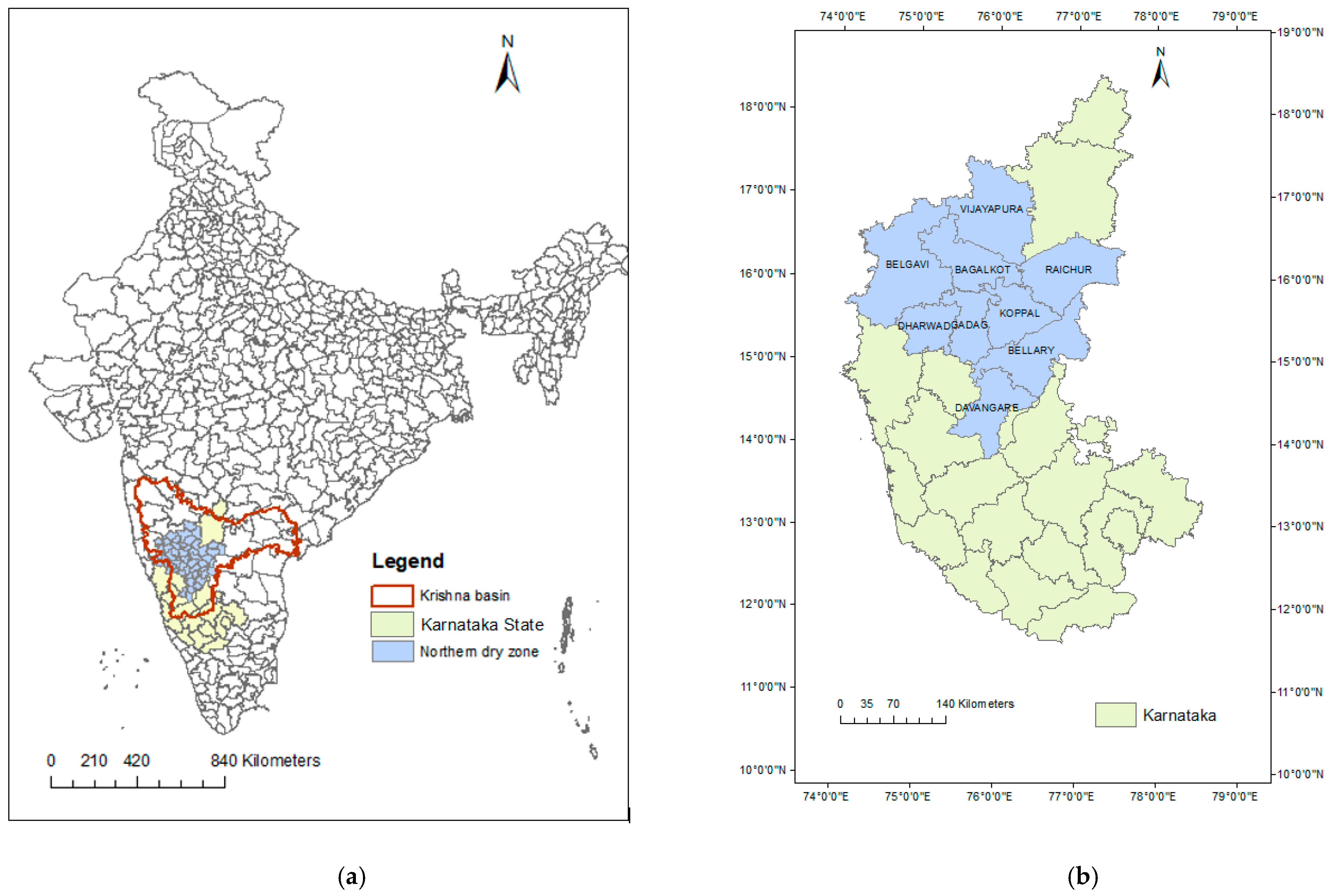
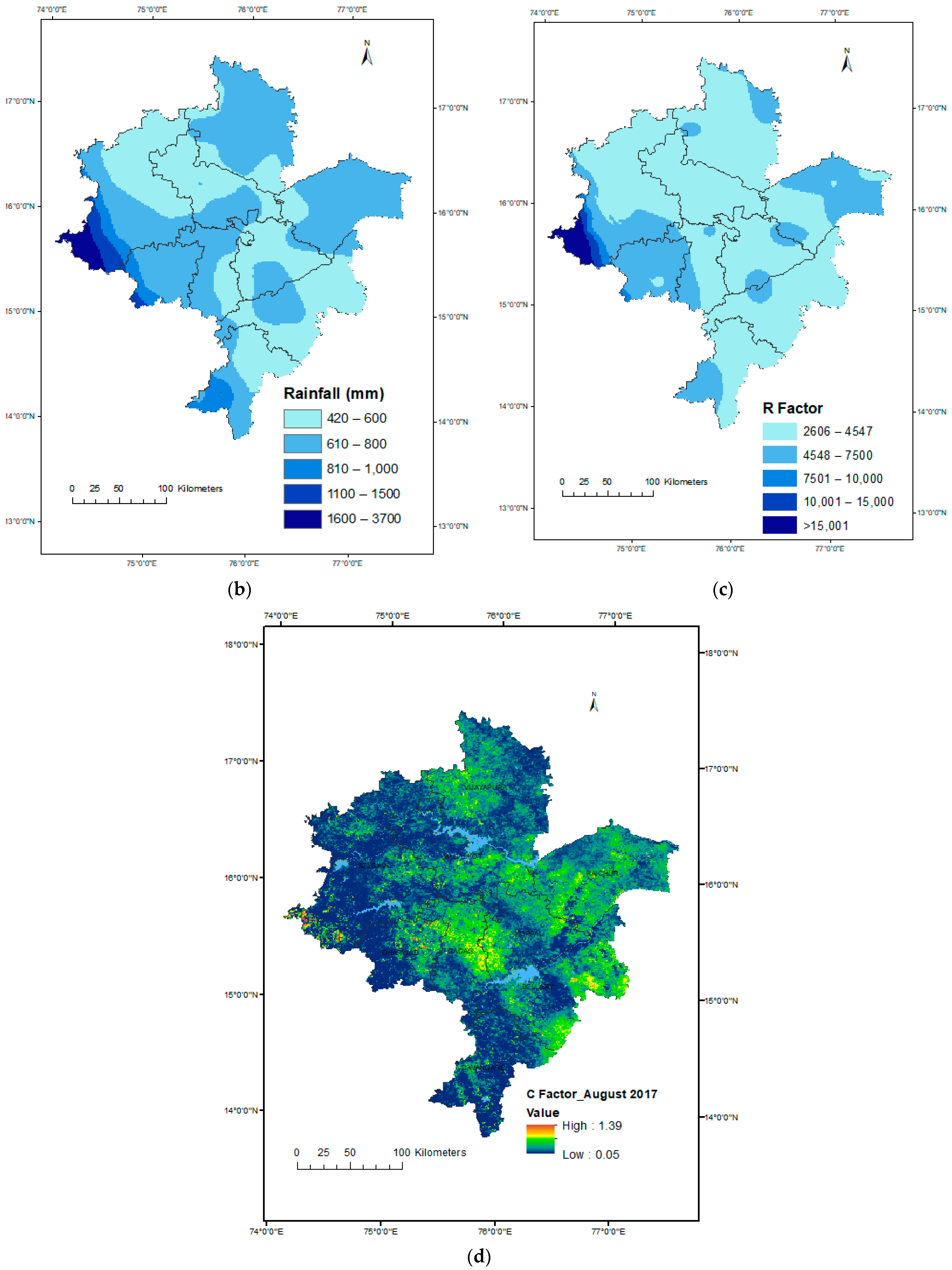
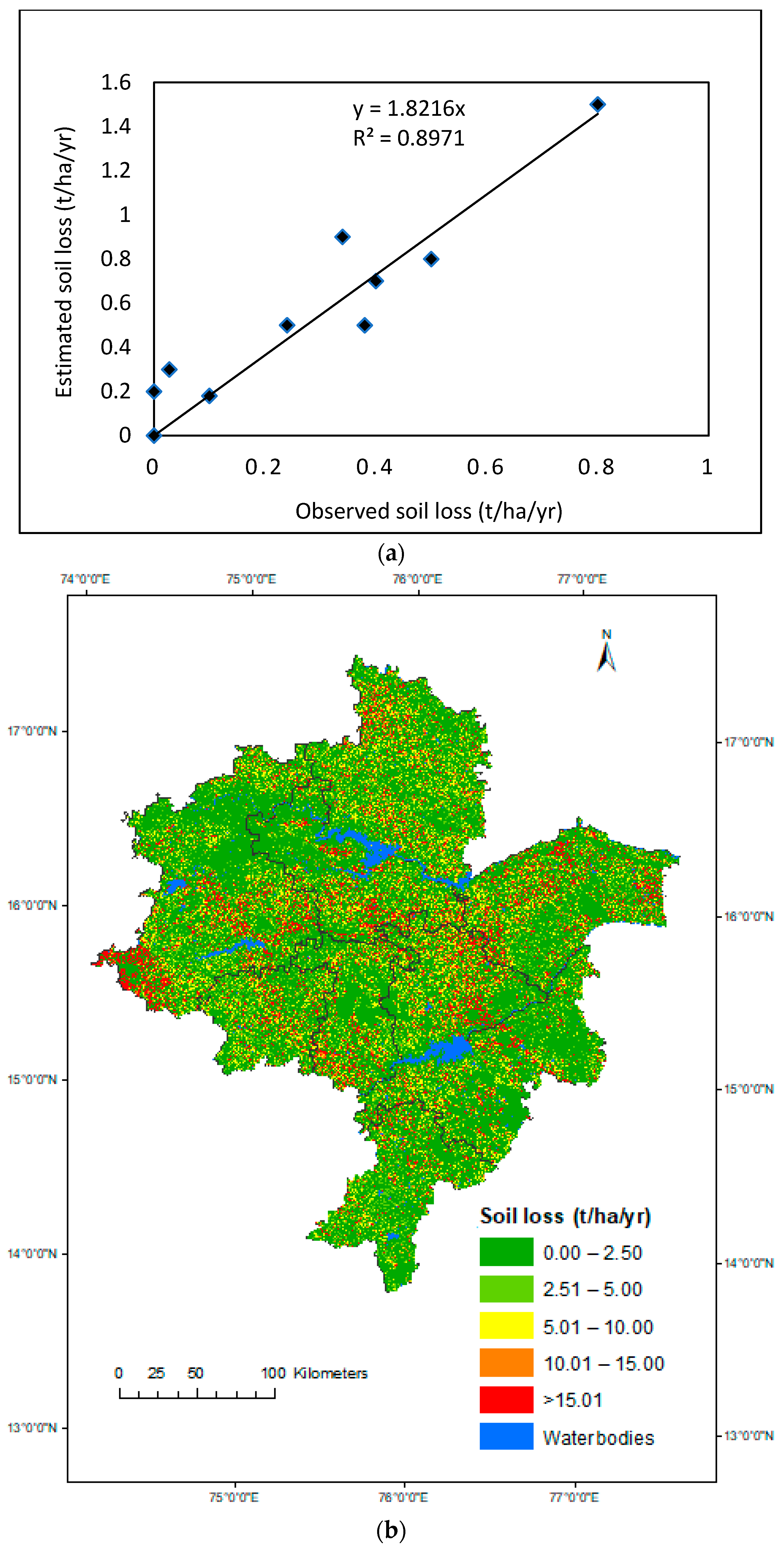
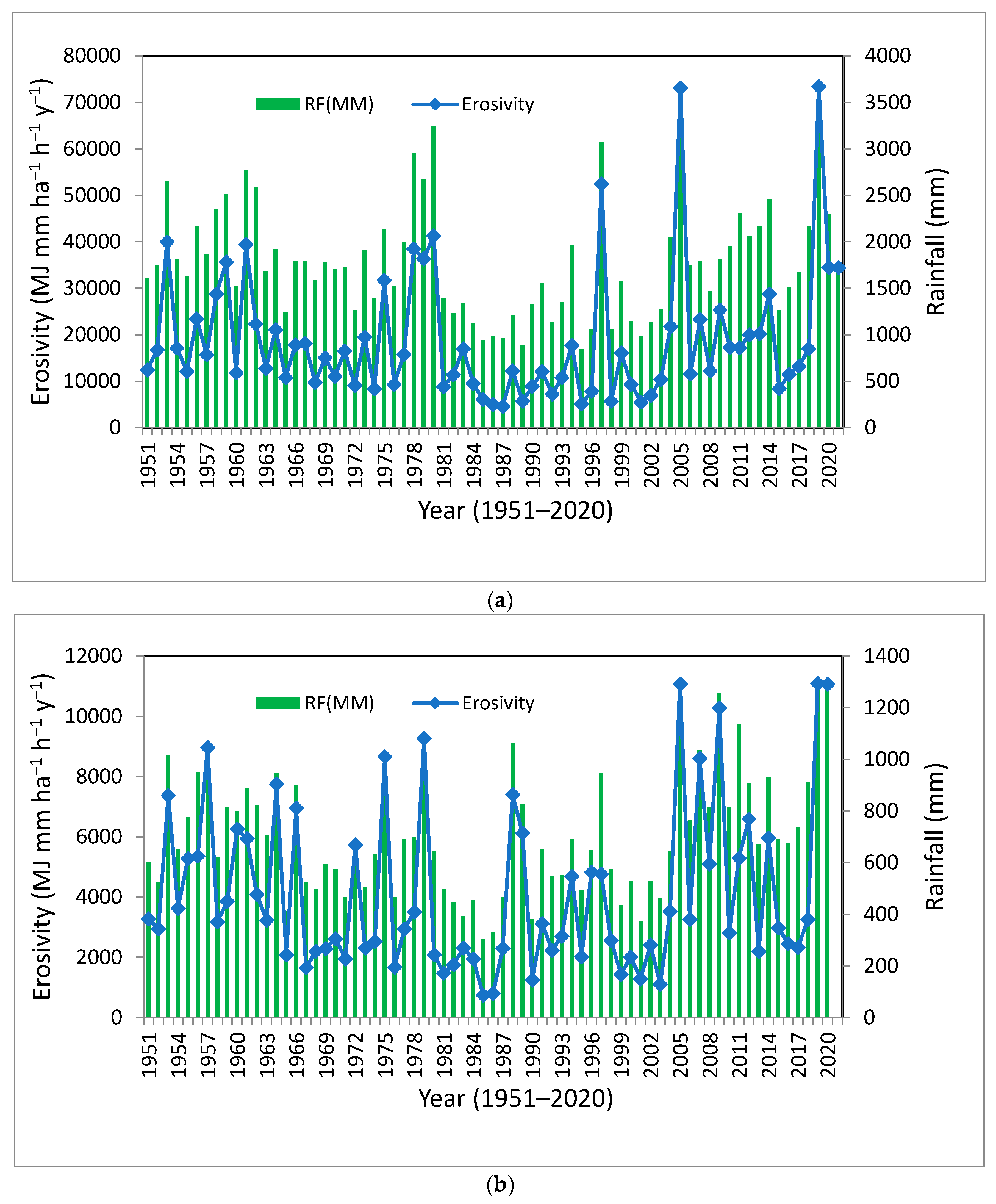
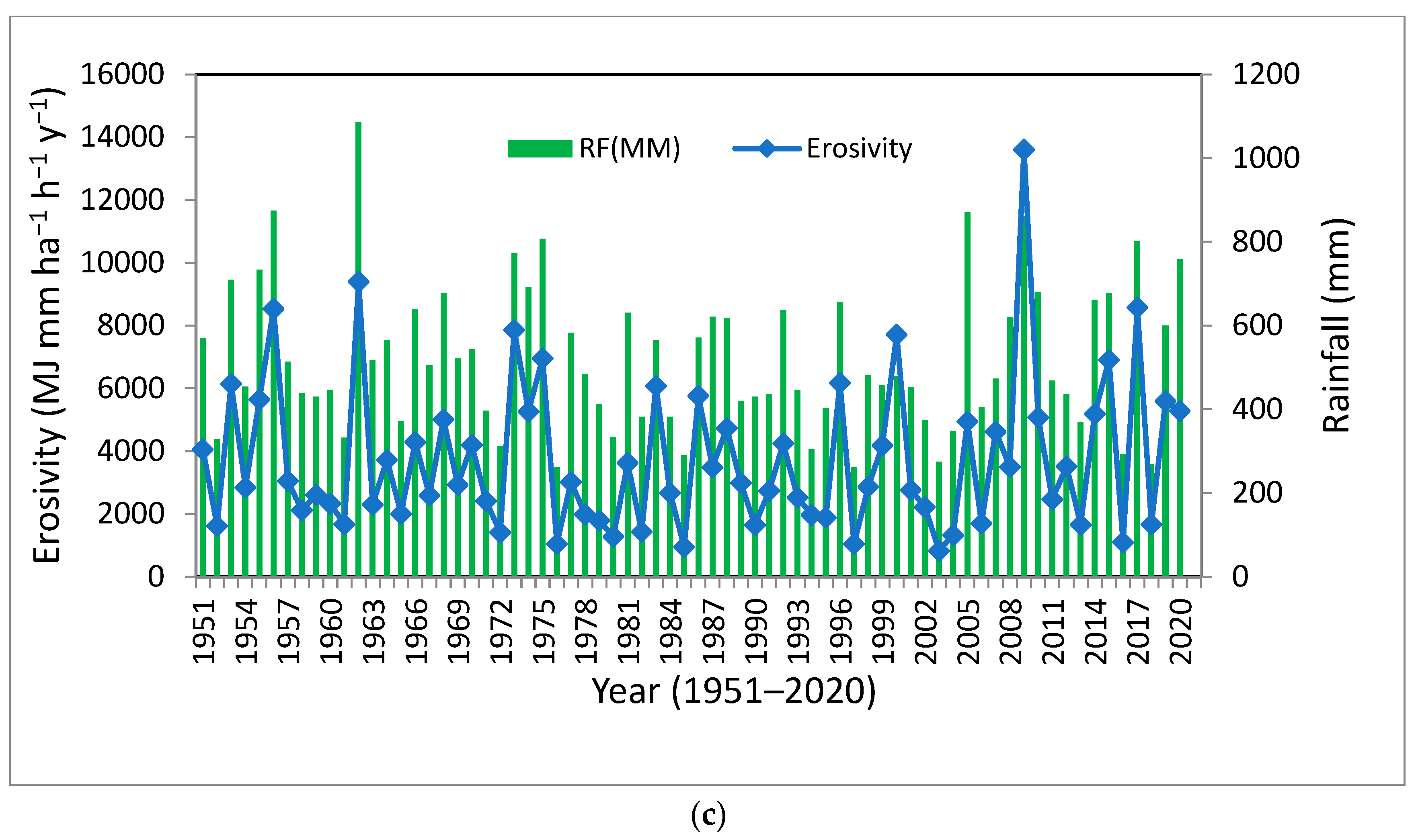
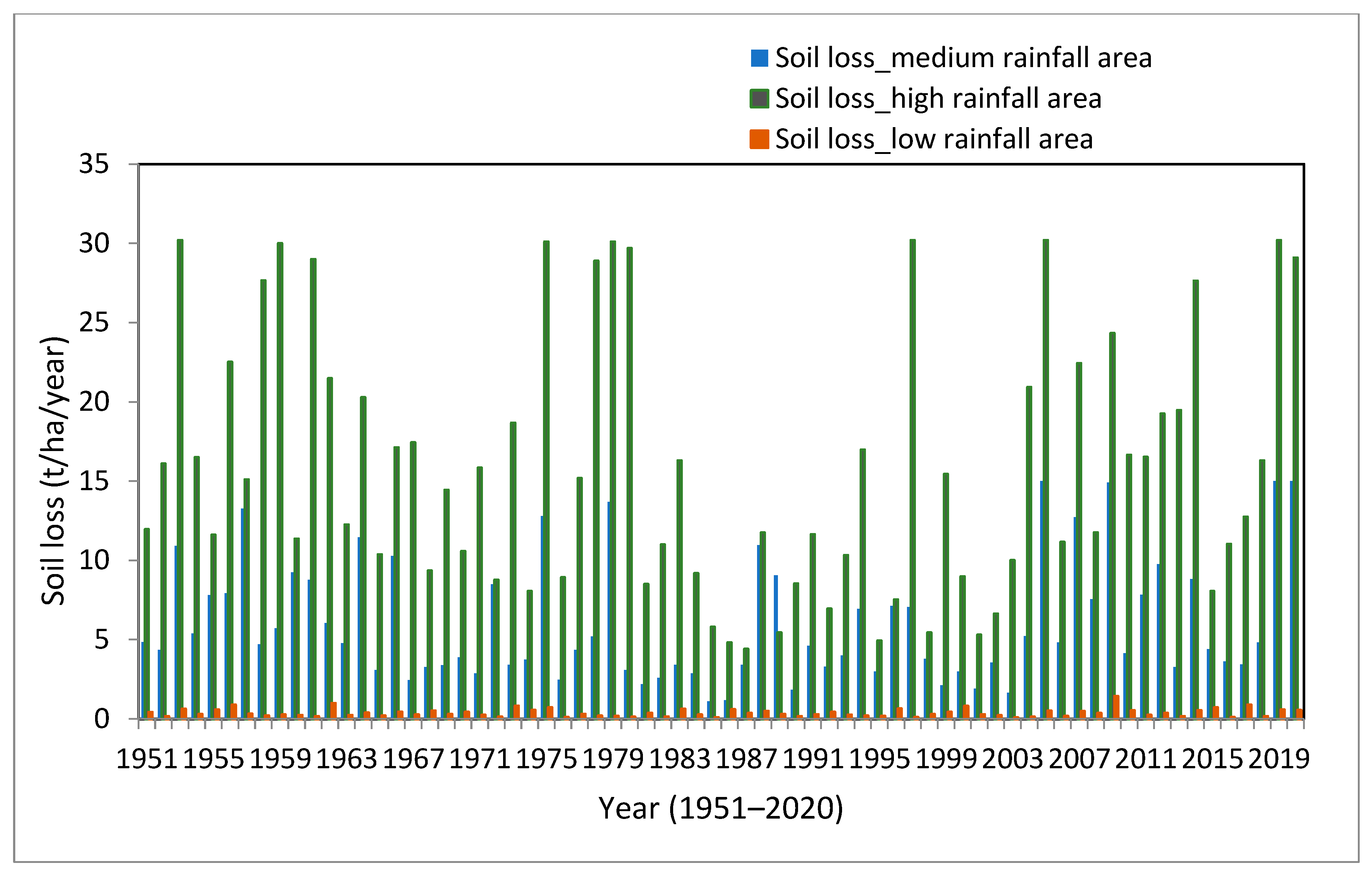
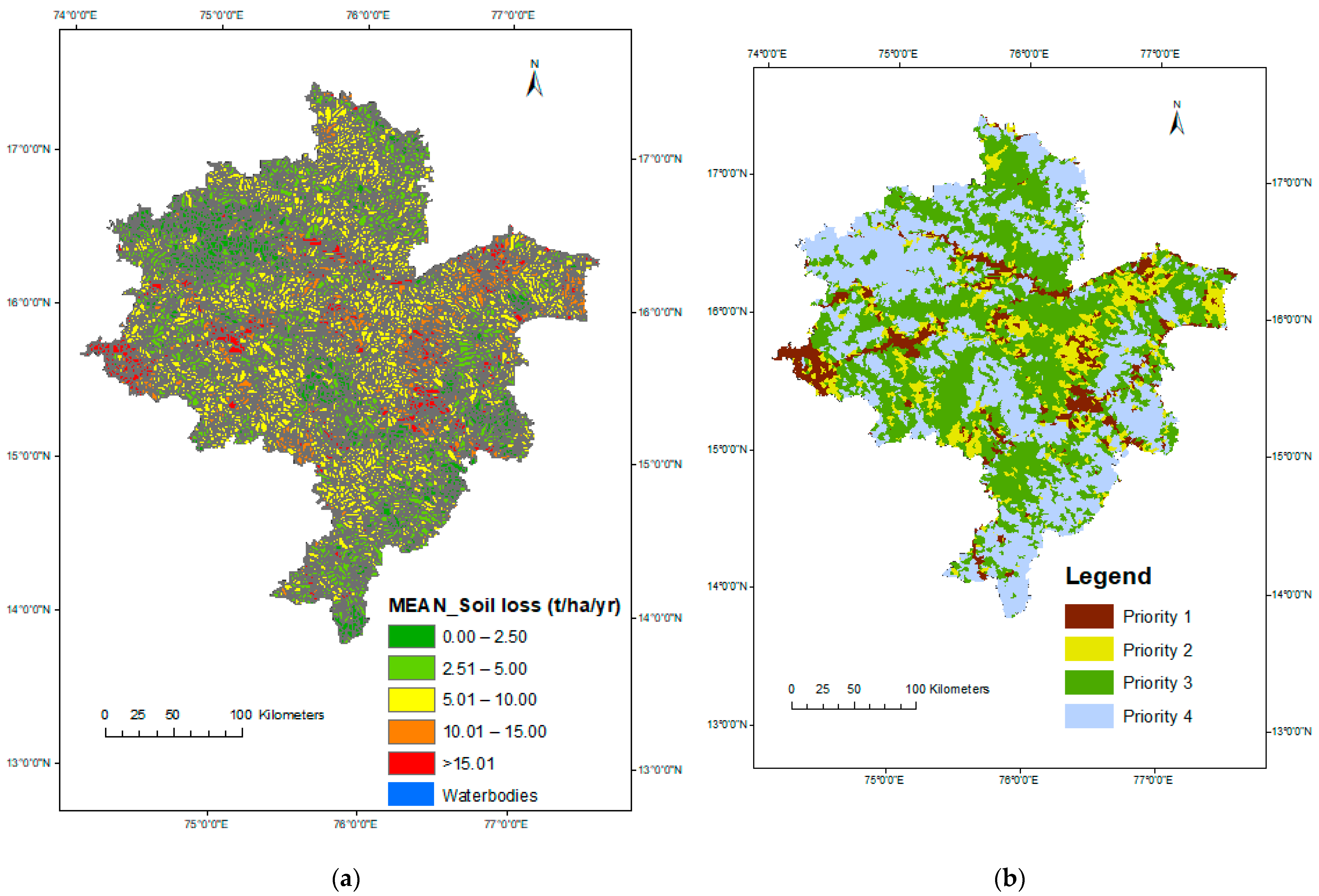
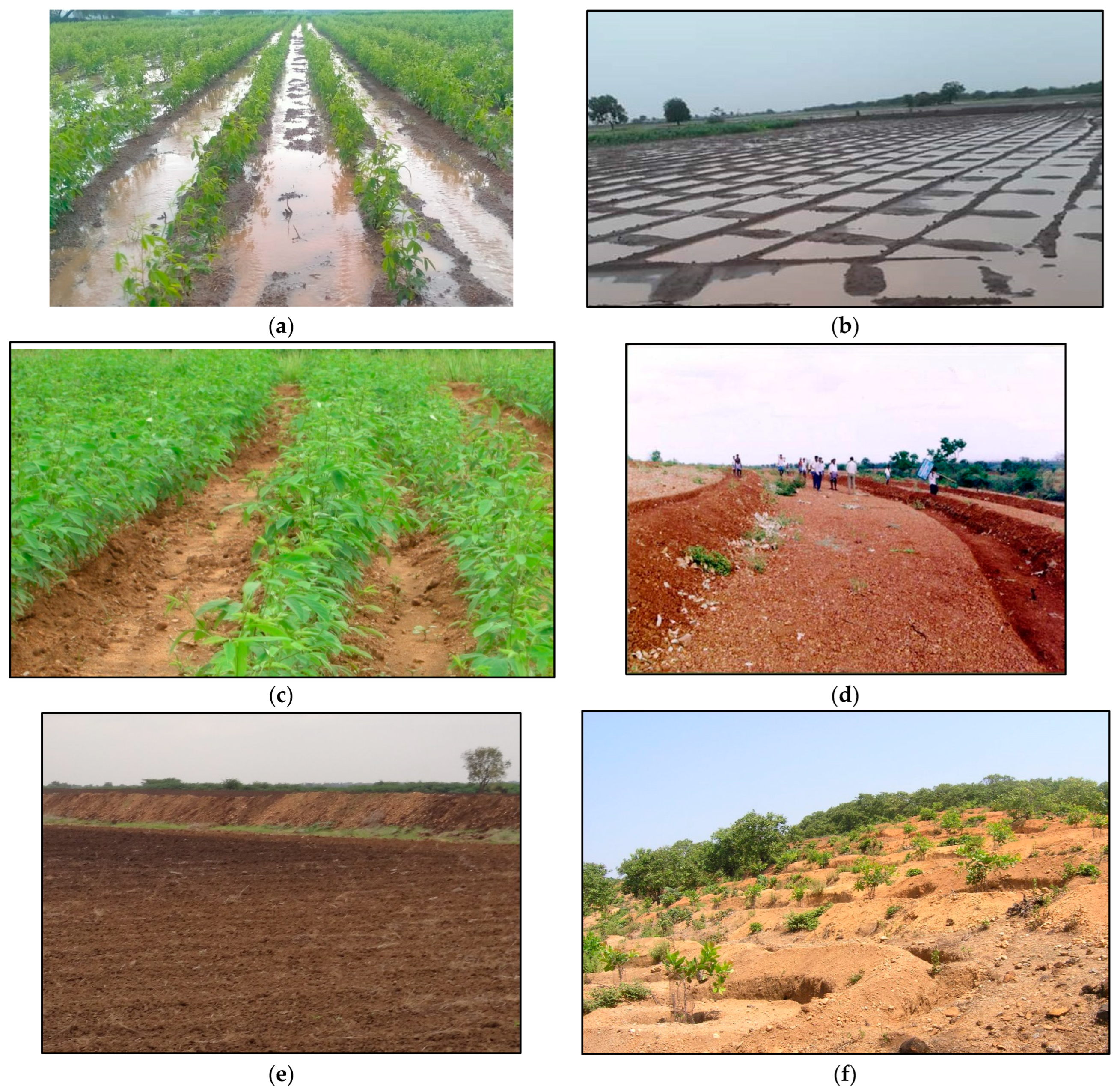
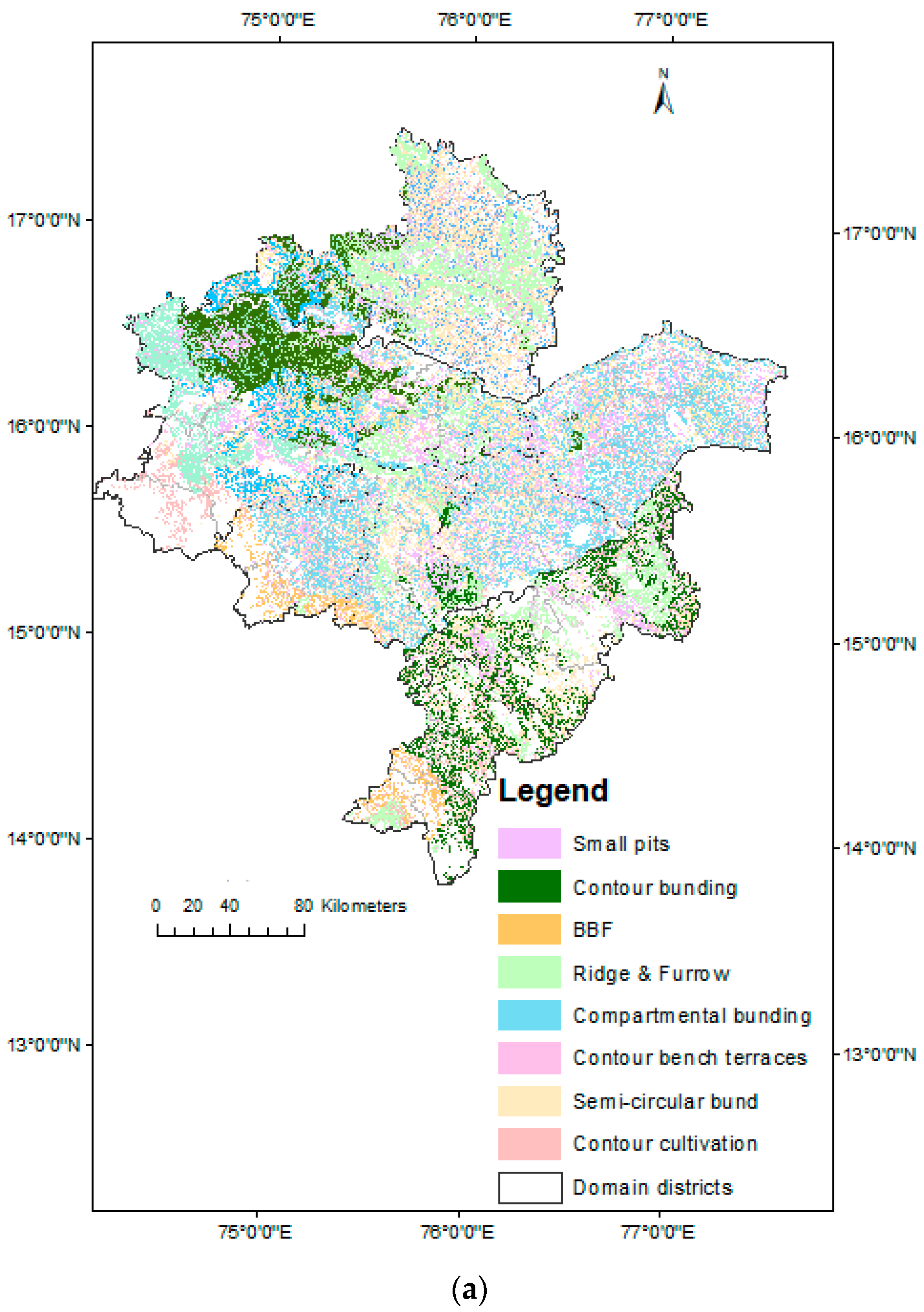
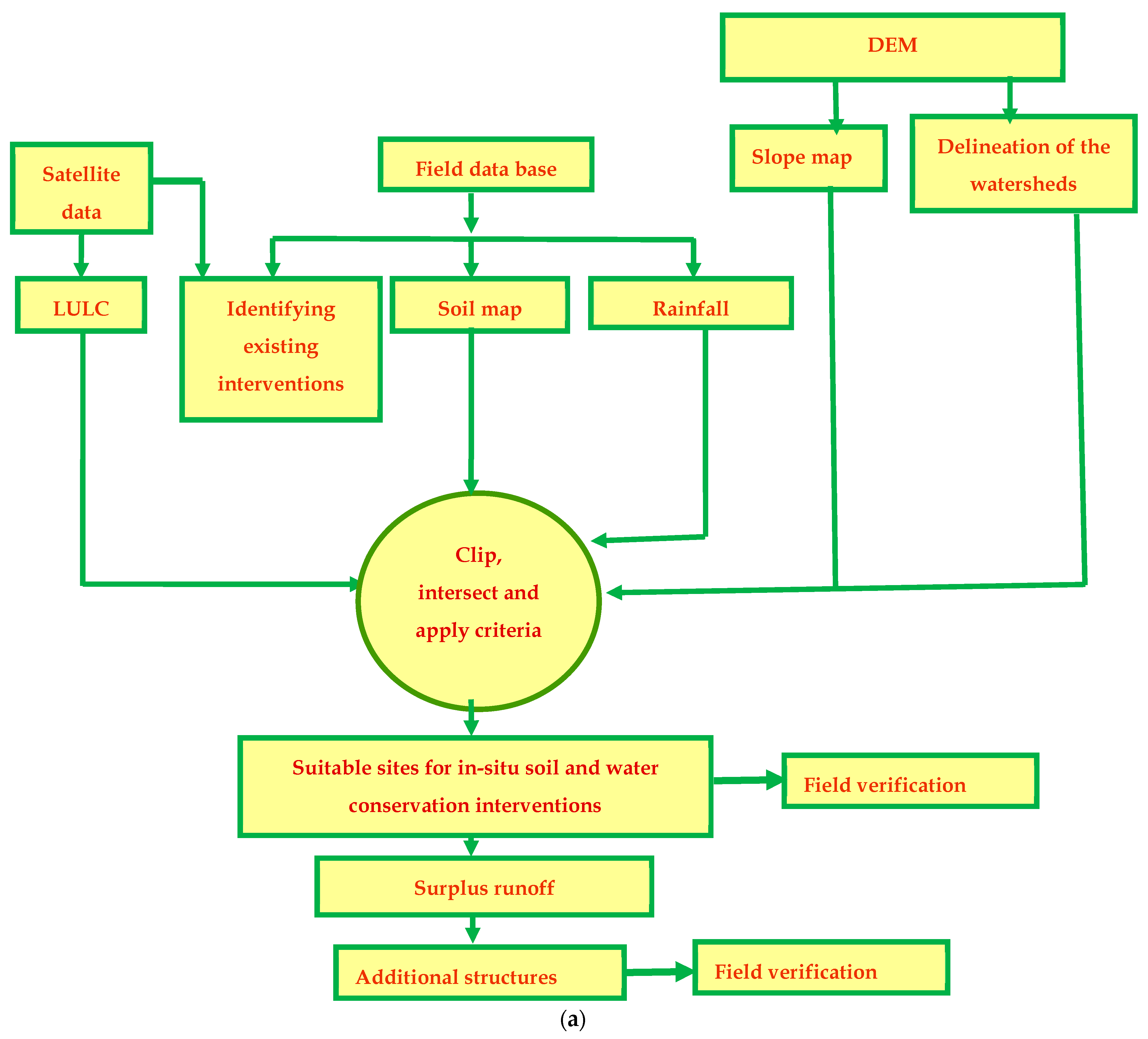
The selected study area lies in Karnataka State of Southern India and is frequently subjected to prolonged dry spells, high soil erosion, declining groundwater levels, and reductions in crop yield. In order to make this region sustainable, estimation of soil loss, selection and prioritization of suitable interventions, and its adoption are very important. In this study, spatial soil loss estimation models were developed sub-district-wise using the Revised universal soil loss equation (RUSLE) and GIS for a period of 70 years (1951 to 2020). The observed soil loss data for the period of 2011 to 2015 were used for validation of the model (R2 = 0.89) and were found satisfactory. The average annual rainfall ranged spatially from 420 to 3700 mm, erosivity (R) ranged from 2606 to >15,000 MJ mm ha−1 h−1 year−1, and average annual soil loss varied from <2.0 to >15.0 t ha−1 y−1 in the northern dry zone of Karnataka. Most of the study area had an average annual rainfall of 550 to 800 mm and the soil loss was <10.0 t ha−1 y−1. A higher erosivity and soil loss occurred in the western part of the selected area where high rainfall is predominant. A considerable variability in rainfall, erosivity, and soil loss was found in high, medium, and low-rainfall regions from 1951 to 2020. The spatial soil loss was estimated catchment-wise and prioritized to determine the vulnerable areas. It was found that 7.69% of the area with soil loss ≥ 15.0 t ha−1 y−1 needs top priority for planning interventions (Priority 1) followed by 10.49% of the area with soil loss ranging from 10.0 to 15.0 t ha−1 y−1 (Priority 2) and 42.7% of the area under 5.0 to 10.0 t ha−1 y−1 (Priority 3), and the remaining area has lower priority. In order to make Northern Karnataka more sustainable, suitable site-specific moisture conservation practices and water-harvesting/groundwater recharge structures were planned using geospatial techniques. Among the selected moisture conservation interventions, conservation furrow and contour cultivation are very suitable for all the nine districts followed by compartmental bunding and semi-circular bunds. Out of the total area, conservation furrow was found suitable for 45.3% of the area, contour cultivation for 24.3% of the area, and compartmental bunding and semi-circular bunds for 16.8 and 16.9% of the areas, respectively. The study indicated that a considerable amount of topsoil is lost as erosion and, hence, planning and adoption of suitable in situ soil and water conservation practices and water-harvesting/groundwater recharge structures are the need of the hour for the sustainable management of this region. The identified locations were validated using visual interpretations, ground truth, and recorded data.
Keywords: erosivity; GIS; Northern Karnataka; soil loss; RUSLE; soil and water conservation erosivity; GIS; Northern Karnataka; soil loss; RUSLE; soil and water conservation