
Chlorophyll and Suspended Solids Estimation in Portuguese Reservoirs (Aguieira and Alqueva) from Sentinel-2 Imagery


Abstract
1. Introduction
2. Materials and Methods
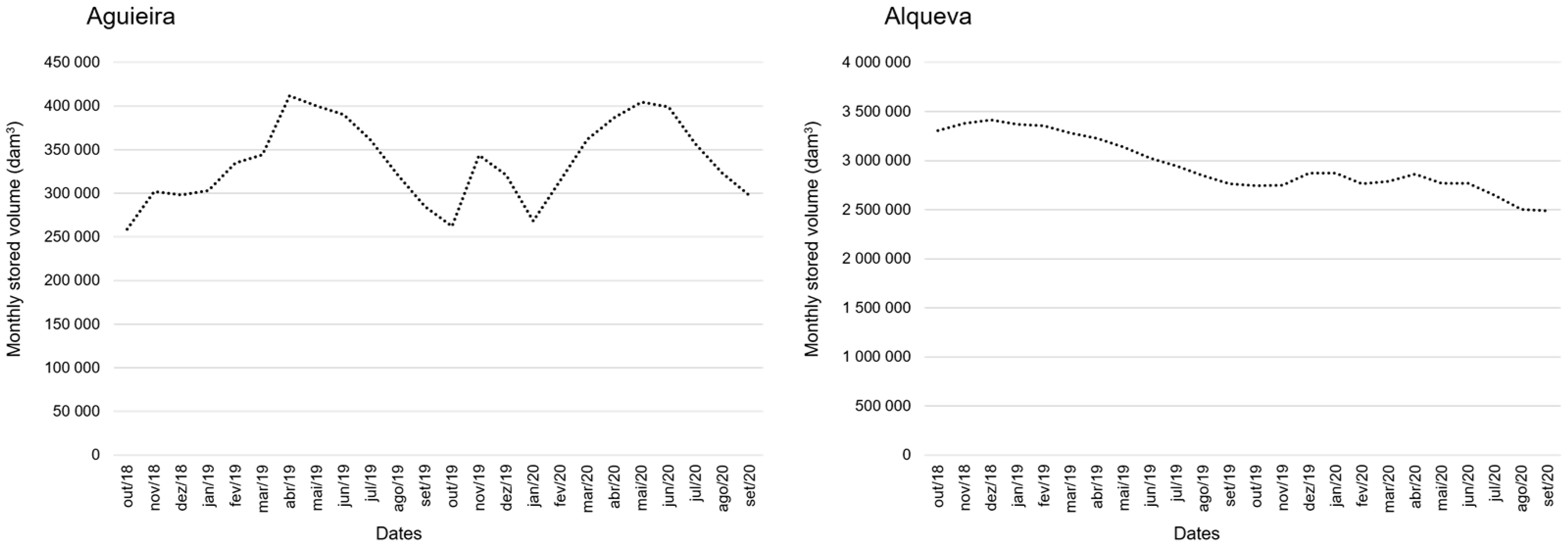
2.1. Study Area
2.2. Materials
2.2.1. In Situ Data
2.2.2. Sentinel-2 Multispectral Imagery Data Collection
2.3. Methodology
2.3.1. Processing and Outputs: C2RCC in SNAP
2.3.2. Data Analysis
3. Results
3.1. In Situ Data & SNAP-C2RCC Estimates
3.2. In Situ Data vs. SNAP-C2RCC Estimates
4. Discussion
5. Conclusions
Author Contributions
Funding
Institutional Review Board Statement
Informed Consent Statement
Data Availability Statement
Conflicts of Interest
Appendix A

| Variables | KMO Value |
|---|---|
| pH | <0.5 |
| Cond | 0.54 |
| O2 | 0.59 |
| Temp | <0.5 |
| BOD5 | 0.80 |
| TSS | 0.65 |
| VSS | 0.66 |
| Chl a | 0.71 |
| Turb | 0.81 |
| DOC | 0.58 |
| TH | 0.66 |
| Fe | 0.76 |
| Mn | 0.78 |
| As | 0.82 |
| Cd | <0.5 |
| Cu | <0.5 |
| Hg | <0.5 |
| Ni | <0.5 |
| Pb | <0.5 |
| Zn | <0.5 |
| COD | <0.5 |
| NH4 | 0.75 |
| N | 0.80 |
| NO3 | <0.5 |
| NO2 | <0.5 |
| P | 0.68 |
Appendix B
| Season | Site | Chl a a | TSS b | pH c | Cond c | O2 c | Temp c | BOD5 b | VSS b | Turb d | DOC e | TH f | Fe g | Mn g | As g | Cd g | Cu g | Hg g | Ni g | Pb g | Zn g | COD h | NH4 i | N j | NO3 k | NO2 l | P m |
|---|---|---|---|---|---|---|---|---|---|---|---|---|---|---|---|---|---|---|---|---|---|---|---|---|---|---|---|
| Aut18 | A1 | 5.429 | 8.240 | 8.400 | 86.00 | 8.790 | 24.50 | 0.810 | 4.170 | 0.018 | 0.059 | 22.10 | 36.00 | 3.260 | 1.770 | 0.070 | 0.740 | 9.0 × 10⁻¹⁸ | 9.0 × 10⁻¹⁸ | 1.000 | 1.400 | 10.00 | 9.0 × 10⁻¹⁸ | 0 | 1.300 | 9.0 × 10⁻¹⁸ | 9.0 × 10⁻¹⁸ |
| A2 | 10.10 | 10.09 | 7.620 | 96.60 | 7.970 | 23.20 | 0.770 | 6.020 | 0.036 | 0.082 | 1.700 | 220.0 | 14.20 | 2.130 | 0.020 | 2.870 | 0.040 | 1.100 | 1.000 | 16.00 | 18.00 | 9.0 × 10⁻¹⁸ | 9.0 × 10⁻¹⁸ | 9.0 × 10⁻¹⁸ | 0.020 | 0.030 | |
| A4 | 3.438 | 10.75 | 7.400 | 87.40 | 7.360 | 24.50 | 0.480 | 7.420 | 0.038 | 0.043 | 1.800 | 190.0 | 29.20 | 3.340 | 0.010 | 2.420 | 0.020 | 0.800 | 0.400 | 11.00 | 9.0 × 10⁻¹⁸ | 9.0 × 10⁻¹⁸ | 9.0 × 10⁻¹⁸ | 2.400 | 0.010 | 0.030 | |
| Al1 | 0.980 | 4.280 | 7.931 | 501.0 | 6.580 | 16.60 | 0.560 | 2.280 | 2.3 × 10⁻³ | 0.074 | 13.70 | 46.00 | 13.00 | 2.980 | 0.030 | 1.510 | 0.020 | 0.600 | 0.300 | 5.200 | 9.000 | 9.0 × 10⁻¹⁸ | 9.0 × 10⁻¹⁸ | 4.500 | 9.0 × 10⁻¹⁸ | 0.060 | |
| Al2 | 3.596 | 3.830 | 8.019 | 491.0 | 7.440 | 17.20 | 0.450 | 2.280 | 0 | 0.138 | 16.20 | 7.000 | 6.540 | 2.350 | 9.0 × 10⁻¹⁸ | 0.620 | 9.0 × 10⁻¹⁸ | 0.500 | 0.100 | 2.700 | 16.00 | 9.0 × 10⁻¹⁸ | 9.0 × 10⁻¹⁸ | 0.500 | 0.020 | 0.030 | |
| Al3 | 1.812 | 4.720 | 8.124 | 515.0 | 6.990 | 16.80 | 0.740 | 4.060 | 0.023 | 0.067 | 16.70 | 15.00 | 10.90 | 3.540 | 9.0 × 10⁻¹⁸ | 0.520 | 9.0 × 10⁻¹⁸ | 0.600 | 9.0 × 10⁻¹⁸ | 7.10 | 12.00 | 0.170 | 9.0 × 10⁻¹⁸ | 9.0 × 10⁻¹⁸ | 0.120 | 0.070 | |
| Al4 | 2.183 | 3.610 | 8.047 | 541.0 | 6.580 | 17.60 | 1.070 | 2.060 | 0.014 | 0.090 | 17.50 | 23.00 | 9.500 | 4.850 | 9.0 × 10⁻¹⁸ | 0.520 | 9.0 × 10⁻¹⁸ | 0.700 | 9.0 × 10⁻¹⁸ | 6.500 | 18.00 | 0.200 | 9.0 × 10⁻¹⁸ | 0.800 | 0.520 | 0.080 | |
| Al5 | 31.26 | 15.42 | 8.389 | 692.0 | 11.55 | 16.60 | 4.350 | 10.08 | 0.044 | 0.248 | 23.10 | 140.0 | 28.70 | 2.370 | 0.020 | 1.730 | 9.0 × 10⁻¹⁸ | 1.200 | 0.500 | 9.600 | 17.00 | 9.0 × 10⁻¹⁸ | 1.300 | 5.600 | 0.080 | 0.160 | |
| Spr19 | A1 | 26.32 | 13.45 | 9.200 | 83.10 | 11.90 | 14.40 | 0.550 | 11.07 | 0.072 | 0.100 | 1.600 | 45.00 | 4.340 | 0.930 | 0.020 | 2.370 | 0.020 | 0.600 | 0.500 | 6.700 | 53.00 | 0.070 | 9.0 × 10⁻¹⁸ | 2.800 | 0.040 | 0.010 |
| A2 | 30.62 | 19.05 | 8.990 | 89.20 | 12.40 | 15.00 | 0.860 | 14.60 | 0.069 | 0.230 | 1.700 | 57.00 | 4.780 | 0.930 | 0.010 | 0.980 | 0.020 | 0.600 | 0.200 | 12.80 | 51.00 | 9.0 × 10⁻¹⁸ | 9.0 × 10⁻¹⁸ | 3.300 | 0.070 | 0.010 | |
| A4 | 27.90 | 17.50 | 9.150 | 78.20 | 12.20 | 15.50 | 1.120 | 13.50 | 0.074 | 0.243 | 1.600 | 71.00 | 6.040 | 2.200 | 0.030 | 0.850 | 0.020 | 0.300 | 0.600 | 6.800 | 50.00 | 0.090 | 0.700 | 1.200 | 0.020 | 0.020 | |
| Al1 | 2.285 | 7.750 | 8.544 | 517.0 | 9.640 | 23.00 | 0.560 | 6.080 | 9.2 × 10⁻³ | 0.380 | 16.40 | 9.000 | 4.330 | 1.750 | 9.0 × 10⁻¹⁸ | 4.360 | 9.0 × 10⁻¹⁸ | 0.600 | 9.0 × 10⁻¹⁸ | 2.700 | 59.00 | 0.050 | 0.600 | 9.0 × 10⁻¹⁸ | 0.010 | 0.010 | |
| Al2 | 0.936 | 7.420 | 8.710 | 515.0 | 9.390 | 23.70 | 2.250 | 6.420 | 0.012 | 0.384 | 16.50 | 12.00 | 3.860 | 1.600 | 9.0 × 10⁻¹⁸ | 3.490 | 9.0 × 10⁻¹⁸ | 0.500 | 9.0 × 10⁻¹⁸ | 1.000 | 51.00 | 9.0 × 10⁻¹⁸ | 0.600 | 9.0 × 10⁻¹⁸ | 0.020 | 9.0 × 10⁻¹⁸ | |
| Al3 | 2.494 | 7.420 | 8.790 | 538.0 | 9.990 | 23.10 | 0.840 | 5.750 | 2.3 × 10⁻³ | 0.386 | 17.30 | 15.00 | 4.890 | 1.750 | 9.0 × 10⁻¹⁸ | 3.890 | 9.0 × 10⁻¹⁸ | 0.600 | 0.100 | 4.100 | 53.00 | 0.110 | 0.600 | 0.600 | 0.040 | 0.010 | |
| Al4 | 7.832 | 12.75 | 8.540 | 570.0 | 12.72 | 23.80 | 1.730 | 9.420 | 0.016 | 0.352 | 18.30 | 18.00 | 10.90 | 2.180 | 9.0 × 10⁻¹⁸ | 3.240 | 0.140 | 0.600 | 0.100 | 1.200 | 54.00 | 0.080 | 0.700 | 0.700 | 0.070 | 0.010 | |
| Al5 | 56.65 | 20.42 | 9.050 | 714.0 | 16.93 | 23.00 | 11.39 | 14.08 | 0.074 | 0.460 | 19.90 | 85.00 | 55.30 | 4.910 | 9.0 × 10⁻¹⁸ | 3.390 | 9.0 × 10⁻¹⁸ | 1.100 | 0.500 | 3.200 | 60.00 | 0.580 | 2.100 | 0.900 | 1.700 | 0.090 | |
| Aut19 | Al1 | 3.534 | 10.02 | 8.233 | 525.0 | 8.050 | 16.60 | 1.930 | 8.620 | 0.023 | 0.041 | 17.40 | 44.00 | 54.70 | 4.310 | 9.0 × 10⁻¹⁸ | 0.720 | 0.040 | 0.800 | 9.0 × 10⁻¹⁸ | 6.100 | 44.00 | 9.0 × 10⁻¹⁸ | 9.0 × 10⁻¹⁸ | 9.0 × 10⁻¹⁸ | 0.020 | 0.070 |
| Al2 | 8.276 | 24.72 | 8.331 | 521.0 | 8.040 | 16.90 | 1.330 | 21.72 | 0.021 | 0.053 | 17.80 | 200.0 | 52.00 | 3.690 | 9.0 × 10⁻¹⁸ | 1.120 | 0.020 | 0.900 | 0.200 | 5.900 | 44.00 | 9.0 × 10⁻¹⁸ | 0.500 | 9.0 × 10⁻¹⁸ | 0.040 | 0.050 | |
| Al3 | 2.747 | 7.880 | 8.322 | 545.0 | 8.540 | 16.90 | 1.280 | 6.380 | 0.018 | 0.044 | 17.90 | 67.00 | 21.20 | 3.710 | 9.0 × 10⁻¹⁸ | 0.600 | 0.040 | 0.600 | 0.100 | 5.400 | 43.00 | 0.190 | 0.700 | 9.0 × 10⁻¹⁸ | 0.040 | 0.040 | |
| Al4 | 2.806 | 9.780 | 8.260 | 578.0 | 7.510 | 16.90 | 1.240 | 7.050 | 0.021 | 0.067 | 18.10 | 93.00 | 33.30 | 4.780 | 9.0 × 10⁻¹⁸ | 0.950 | 0.060 | 0.900 | 0.200 | 8.300 | 52.00 | 0.280 | 1.000 | 0.500 | 0.660 | 0.050 | |
| Al5 | 40.10 | 29.97 | 8.376 | 769.0 | 10.96 | 14.60 | 3.850 | 23.37 | 0.092 | 0.087 | 26.40 | 280.0 | 97.30 | 3.080 | 0.010 | 1.110 | 0.020 | 1.600 | 0.700 | 6.300 | 44.00 | 0.810 | 1.600 | 1.700 | 0.120 | 0.070 | |
| Spr20 | A1 | 26.16 | 15.19 | 6.830 | 90.90 | 12.92 | 21.90 | 0.550 | 10.82 | 0.008 | 0.056 | 1.400 | 180.0 | 4.740 | 1.410 | 0.020 | 1.860 | 1.850 | 2.300 | 0.400 | 32.20 | 44.00 | 0.070 | 9.0 × 10⁻¹⁸ | 2.700 | 0.040 | 0.020 |
| A2 | 42.08 | 17.54 | 6.680 | 92.10 | 14.18 | 20.50 | 0.860 | 10.96 | 0.008 | 0.072 | 1.500 | 190.0 | 61.00 | 1.310 | 0.020 | 2.090 | 1.570 | 1.700 | 0.300 | 27.70 | 48.00 | 0.070 | 9.0 × 10⁻¹⁸ | 2.200 | 0.040 | 0.030 | |
| A4 | 31.75 | 11.23 | 6.800 | 88.10 | 13.28 | 22.40 | 1.120 | 6.633 | 0.008 | 0.046 | 1.300 | 190.0 | 7.770 | 2.830 | 0.010 | 1.700 | 0.630 | 1.500 | 0.300 | 24.70 | 47.00 | 0.100 | 9.0 × 10⁻¹⁸ | 0.600 | 0.010 | 0.030 | |
| Al1 | 2.197 | 6.250 | 8.780 | 540.0 | 8.290 | 32.00 | 0.730 | 5.817 | 7.7 × 10⁻³ | 0.056 | 18.50 | 210.0 | 9.580 | 2.020 | 0.050 | 1.800 | 4.780 | 3.200 | 2.100 | 691.00 | 40.00 | 9.0 × 10⁻¹⁸ | 9.0 × 10⁻¹⁸ | 9.0 × 10⁻¹⁸ | 0.020 | 0.040 | |
| Al2 | 2.281 | 7.083 | 8.870 | 506.0 | 8.480 | 33.30 | 0.700 | 5.917 | 2.6 × 10⁻³ | 0.056 | 18.30 | 190.0 | 7.100 | 2.300 | 0.020 | 2.260 | 2.200 | 2.400 | 0.500 | 89.20 | 46.00 | 9.0 × 10⁻¹⁸ | 9.0 × 10⁻¹⁸ | 9.0 × 10⁻¹⁸ | 0.020 | 0.050 | |
| Al3 | 3.675 | 6.317 | 8.960 | 558.0 | 8.430 | 31.70 | 1.470 | 4.617 | 7.7 × 10⁻³ | 0.069 | 19.10 | 200.0 | 6.000 | 2.700 | 0.020 | 2.210 | 2.370 | 2.700 | 0.400 | 51.30 | 50.00 | 9.0 × 10⁻¹⁸ | 0.600 | 0.800 | 0.090 | 0.030 | |
| Al4 | 20.78 | 10.02 | 9.210 | 509.0 | 10.01 | 32.00 | 1.810 | 5.562 | 0.038 | 0.115 | 18.40 | 210.0 | 12.90 | 4.420 | 0.020 | 2.370 | 2.370 | 2.900 | 0.400 | 41.20 | 55.00 | 9.0 × 10⁻¹⁸ | 0.800 | 9.0 × 10⁻¹⁸ | 0.090 | 0.060 | |
| Al5 | 45.42 | 28.50 | 8.590 | 588.0 | 7.040 | 32.00 | 4.360 | 23.84 | 0.082 | 0.153 | 19.60 | 570.0 | 79.20 | 7.780 | 0.020 | 2.660 | 2.040 | 3.300 | 1.000 | 51.40 | 56.00 | 0.160 | 1.000 | 9.0 × 10⁻¹⁸ | 0.040 | 0.180 |
Appendix C

References
- Pekel, J.F.; Cottam, A.; Gorelick, N.; Belward, A.S. High-resolution mapping of global surface water and its long-term changes. Nature 2016, 540, 418–422. [Google Scholar] [CrossRef]
- Zhou, S.; Zhang, X.; Liu, J. The trend of small hydropower development in China. Renew. Energy 2009, 34, 1078–1083. [Google Scholar] [CrossRef]
- Corrigan, J.R.; Egan, K.J.; Downing, J.A. Aesthetic Values of Lakes and Rivers. In Encyclopedia of Inland Waters, 1st ed.; Likens, G.E., Ed.; Elsevier Science Publishers: Amsterdam, The Netherlands, 2009; pp. 14–24. [Google Scholar] [CrossRef]
- Corman, J. Cleaner Chinese lakes. Nat. Geosci. 2017, 10, 469–470. [Google Scholar] [CrossRef]
- Costanza, R.; D’Arge, R.; De Groot, R.; Farber, S.; Grasso, M.; Hannon, B.; Limburg, K.; Naeem, S.; O’Neill, R.V.; Paruelo, J.M.; et al. The value of the world’s ecosystem services and natural capital. Nature 1997, 387, 253–260. [Google Scholar] [CrossRef]
- Mishra, D.R.; Ogashawara, I.; Gitelson, A.A. Remote Sensing of Inland Waters: Background and Current State-of-the-Art. In Bio-Optical Modeling and Remote Sensing of Inland Waters, 1st ed.; Mishra, D.R., Ogashawara, I., Gitelson, A.A., Eds.; Elsevier Science Publishers: Amsterdam, The Netherlands, 2017; pp. 11–34. [Google Scholar]
- Scheffer, M.; Carpenter, S.R. Catastrophic regime shifts in ecosystems: Linking theory to observation. Trends Ecol. Evol. 2003, 18, 648–656. [Google Scholar] [CrossRef]
- European Community. Directive 2000/60/EC of the European Parliament and of the Council of 23 October 2000 establishing a framework for Community action in the field of water policy. Off. J. Eur. Parliam. 2000. [Google Scholar] [CrossRef]
- Blabolil, P.; Logez, M.; Ricard, D.; Prchalová, M.; Říha, M.; Sagouis, A.; Peterka, J.; Kubečka, J.; Argillier, C. An assessment of the ecological potential of Central and Western European reservoirs based on fish communities. Fish. Res. 2016, 173, 80–87. [Google Scholar] [CrossRef]
- Kampa, E.; Hansen, W. Definition of Maximum Ecological Potential. In Heavily Modified Waters in Europe: Synthesis of 34 Case Studies in Europe, 1st ed.; Springer: Berlin, Germany, 2004; pp. 137–152. [Google Scholar]
- Irz, P.; Laurent, A.; Messad, S.; Pronier, O.; Argillier, C. Influence of site characteristics on fish community patterns in French reservoirs. Ecol. Freshw. Fish 2002, 11, 123–136. [Google Scholar] [CrossRef]
- Wetzel, R.G. Rivers and Lakes—Their distribution, origins and forms. In Limnology: Lake and River Ecosystems, 3rd ed.; Elsevier Science Publishers: Amsterdam, The Netherlands, 2001; pp. 15–42. [Google Scholar]
- Ansper, A.; Alikas, K. Retrieval of Chlorophyll a from Sentinel-2 MSI Data for the European Union Water Framework Directive Reporting Purposes. Remote Sens. 2019, 11, 64. [Google Scholar] [CrossRef]
- Carvalho, L.; Mackay, E.B.; Cardoso, A.C.; Baattrup-Pedersen, A.; Birk, S.; Blackstock, K.L.; Borics, G.; Borja, A.; Feld, C.K.; Ferreira, M.T.; et al. Protecting and restoring Europe’s waters: An analysis of the future development needs of the Water Framework Directive. Sci. Total Environ. 2019, 658, 1228–1238. [Google Scholar] [CrossRef]
- Danovaro, R.; Carugati, L.; Berzano, M.; Cahill, A.E.; Carvalho, S.; Chenuil, A.; Corinaldesi, C.; Cristina, S.; David, R.; Dell’Anno, A.; et al. Implementing and Innovating Marine Monitoring Approaches for Assessing Marine Environmental Status. Front. Mar. Sci. 2016, 3, 3–213. [Google Scholar] [CrossRef]
- Tyler, A.; Hunter, P.D.; Spyrakos, E.; Groom, S.; Constantinescu, A.M.; Kitchen, J. Developments in Earth observation for the assessment and monitoring of inland, transitional, coastal and shelf-sea waters. Sci. Total Environ. 2016, 572, 1307–1321. [Google Scholar] [CrossRef] [PubMed]
- Gordon, H.R.; Brown, O.; Evans, R.H.; Brown, J.W.; Smith, R.C.; Baker, K.S.; Clark, D.K. A semianalytic radiance model of ocean color. J. Geophys. Res. Space Phys. 1988, 93, 10909–10924. [Google Scholar] [CrossRef]
- Morel, A.Y.; Gordon, H.R. Report of the working group on water color. Bound.-Layer Meteorol. 1980, 18, 343–355. [Google Scholar] [CrossRef]
- Morel, A. Bio-optical Models. In Encyclopedia of Ocean Sciences, 1st ed.; John, H.S., Ed.; Elsevier Science Publishers: Amsterdam, The Netherlands, 2001; pp. 317–326. [Google Scholar] [CrossRef]
- Preisendorfer, R.W. Hydrologic Optics. Environ. Res. 1976, 1, 392. [Google Scholar]
- Giardino, C.; Bresciani, M.; Stroppiana, D.; Oggioni, A.; Morabito, G. Optical remote sensing of lakes: An overview on Lake Maggiore. J. Limnol. 2014, 73, 201–214. [Google Scholar] [CrossRef]
- Drusch, M.; Del Bello, U.; Carlier, S.; Colin, O.; Fernandez, V.; Gascon, F.; Hoersch, B.; Isola, C.; Laberinti, P.; Martimort, P.; et al. Sentinel-2: ESA’s Optical High-Resolution Mission for GMES Operational Services. Remote Sens. Environ. 2012, 120, 25–36. [Google Scholar] [CrossRef]
- Donlon, C.; Berruti, B.; Buongiorno, A.; Ferreira, M.-H.; Féménias, P.; Frerick, J.; Goryl, P.; Klein, U.; Laur, H.; Mavrocordatos, C.; et al. The Global Monitoring for Environment and Security (GMES) Sentinel-3 mission. Remote Sens. Environ. 2012, 120, 37–57. [Google Scholar] [CrossRef]
- Ingmann, P.; Veihelmann, B.; Langen, J.; Lamarre, D.; Stark, H.; Courrèges-Lacoste, G.B. Requirements for the GMES Atmosphere Service and ESA’s implementation concept: Sentinels-4/-5 and -5p. Remote Sens. Environ. 2012, 120, 58–69. [Google Scholar] [CrossRef]
- Torres, R.; Snoeij, P.; Geudtner, D.; Bibby, D.; Davidson, M.; Attema, E.; Potin, P.; Rommen, B.; Floury, N.; Brown, M.; et al. GMES Sentinel-1 mission. Remote Sens. Environ. 2012, 120, 9–24. [Google Scholar] [CrossRef]
- Sentinel-2-Missions-Sentinel Online–Sentinel. Available online: https://sentinel.esa.int/web/sentinel/missions/sentinel-2 (accessed on 28 May 2021).
- Brockmann, C.; Doerffer, R.; Peters, M.; Stelzer, K.; Embacher, S.; Ruescas, A. Evolution of the C2RCC neural network for Sentinel 2 and 3 for the retrieval of ocean colour products in normal and extreme optically complex waters. Eur. Space Agency 2016, 740, 54. [Google Scholar]
- Matthews, M.W. A current review of empirical procedures of remote sensing in inland and near-coastal transitional waters. Int. J. Remote Sens. 2011, 32, 6855–6899. [Google Scholar] [CrossRef]
- Shanmugam, P. CAAS: An atmospheric correction algorithm for the remote sensing of complex waters. Ann. Geophys. 2012, 30, 203–220. [Google Scholar] [CrossRef]
- Topp, S.N.; Pavelsky, T.M.; Jensen, D.; Simard, M.; Ross, M.R.V. Research Trends in the Use of Remote Sensing for Inland Water Quality Science: Moving Towards Multidisciplinary Applications. Water 2020, 12, 169. [Google Scholar] [CrossRef]
- Modabberi, A.; Noori, R.; Madani, K.; Ehsani, A.H.; Mehr, A.D.; Hooshyaripor, F.; Kløve, B. Caspian Sea is eutrophying: The alarming message of satellite data. Environ. Res. Lett. 2020, 15, 124047. [Google Scholar] [CrossRef]
- Sòria-Perpinyà, X.; Urrego, P.; Pereira-Sandoval, M.; Ruiz-Verdú, A.; Peña, R.; Soria, J.M.; Moreno, J. Monitoring the ecological state of a hypertrophic lake (Albufera of València, Spain) using multitemporal Sentinel-2 images. Limnetica 2019, 38, 457–469. [Google Scholar] [CrossRef]
- Potes, M.; Rodrigues, G.; Penha, A.M.; Novais, M.H.; Costa, M.J.; Salgado, R.; Morais, M.M. Use of Sentinel 2–MSI for water quality monitoring at Alqueva reservoir, Portugal. Proc. Int. Assoc. Hydrol. Sci. 2018, 380, 73–79. [Google Scholar] [CrossRef]
- Duan, H.; Ma, R.; Xu, J.; Zhang, Y.; Zhang, B. Comparison of different semi-empirical algorithms to estimate chlorophyll-a concentration in inland lake water. Environ. Monit. Assess. 2010, 170, 231–244. [Google Scholar] [CrossRef]
- Hadjimitsis, D.G.; Clayton, C. Assessment of temporal variations of water quality in inland water bodies using atmospheric corrected satellite remotely sensed image data. Environ. Monit. Assess. 2009, 159, 281–292. [Google Scholar] [CrossRef] [PubMed]
- APA. Plano de Ordenamento da Albufeira da Aguieira. Diário da República 2007. 1ª série–Nº 8 190, pp. 1–2. [CrossRef]
- INAG. Available online: https://sniambgeoviewer.apambiente.pt/GeoDocs/geoportaldocs/_Agua/DRH/MonitorizacaoAvaliacao/EstadoMassasAgua/ModelacaoQualidadeAgua_AAP/I_RelatorioModelacao_CasteloBode.pdf (accessed on 28 May 2021).
- Pinto, I.; Rodrigues, S.; Lage, O.; Antunes, S. Assessment of water quality in Aguieira reservoir: Ecotoxicological tools in addition to the Water Framework Directive. Ecotoxicol. Environ. Saf. 2021, 208, 111583. [Google Scholar] [CrossRef]
- Presidência do Conselho de Ministros. Resolução do Conselho de Ministros nº 186/2007. Diário Da República 2007, 1ª série–Nº 246.
- Geraldes, A.M.; Silva-Santos, P. Monitorização da comunidade zooplanctónica da albufeira da Aguieira (bacia do Mondego, Portugal): Que fatores a influenciam? Captar Ciênc. E Ambient. Para Todos 2011, 3, 12–23. [Google Scholar]
- Pedroso, N.M.; Sales-Luís, T.; Santos-Reis, M. Use of Aguieira dam by Eurasian otters in Central Portugal. Folia Zool 2007, 56, 365. [Google Scholar]
- Geraldes, A.M.A.; Pasupuleti, R.; Silva-Santos, P. Influence of Some Environmental Variables on the Zooplankton Community of Aguieira Reservoir (Iberian Peninsula, Portugal): Spatial and Temporal Trends. Asian J. Environ. Ecol. 2016, 1, 1–10. [Google Scholar] [CrossRef][Green Version]
- Rodrigues, C.M.; Moreira, M.; Guimarães, R.C.; Potes, M. Reservoir evaporation in a Mediterranean climate: Comparing direct methods in Alqueva Reservoir, Portugal. Hydrol. Earth Syst. Sci. 2020, 24, 5973–5984. [Google Scholar] [CrossRef]
- SNIRH > Dados Sintetizados. Available online: https://snirh.apambiente.pt/index.php?idMain=1&idItem=1.3 (accessed on 28 May 2021).
- CLC 2018—Copernicus Land Monitoring Service. Available online: https://land.copernicus.eu/pan-european/corine-land-cover/clc2018 (accessed on 28 May 2021).
- Kottek, M.; Grieser, J.; Beck, C.; Rudolf, B.; Rubel, F. World Map of the Köppen-Geiger climate classification updated. Meteorol. Z. 2006, 15, 259–263. [Google Scholar] [CrossRef]
- APHA. Standard Methods for the Examination of Water and Wastewater, 17th ed.; American Public Health Association: Washington, DC, USA, 1989.
- Lorenzen, C.J. Determination of Chlorophyll And Pheo-Pigments: Spectrophotometric Equations. Limnol. Oceanogr. 1967, 12, 343–346. [Google Scholar] [CrossRef]
- Stramski, D.; Boss, E.; Bogucki, D.; Voss, K. The role of seawater constituents in light backscattering in the ocean. Prog. Oceanogr. 2004, 61, 27–56. [Google Scholar] [CrossRef]
- Copernicus Open Access Hub. Available online: https://scihub.copernicus.eu/dhus/#/home (accessed on 28 May 2021).
- ESA Sentinel Application Platform (SNAP) v8.0. Available online: http://step.esa.int (accessed on 22 July 2021).
- Hair, J.F.; Black, W.C.; Babin, B.J.; Anderson, R.E. Multivariate Data Analysis, 8th ed.; Cengage Learning: Boston, MA, USA, 2018. [Google Scholar]
- Kato, T. Prediction of photovoltaic power generation output and network operation. In Integration of Distributed Energy Resources in Power Systems: Implementation, Operation and Control, 1st ed.; Funabashi, T., Ed.; Elsevier Science Publishers: Amsterdam, The Netherlands, 2016; Volume 1, pp. 77–108. [Google Scholar] [CrossRef]
- R Core Team. R: A Language and Environment for Statistical Computing; R Foundation for Statistical Computing: Vienna, Austria, 2019; Available online: https://www.R-project.org/ (accessed on 28 May 2021).
- Palmer, S.; Kutser, T.; Hunter, P.D. Remote sensing of inland waters: Challenges, progress and future directions. Remote Sens. Environ. 2015, 157, 1–8. [Google Scholar] [CrossRef]
- Plowey, M.A. Multi-Scale Approach to Monitoring the Optically Complex Coastal Waters of the Baltic Sea: A comparison of Satellite, Mooring, and Ship-based Monitoring of Water Quality. Master’s Thesis, Stockholm University, Stockholm, Sweden, 2019. [Google Scholar]
- Kyryliuk, D.; Kratzer, S. Evaluation of sentinel-3A OLCI products derived using the case-2 regional coastcolour processor over the Baltic Sea. Sensors 2019, 19, 3609. [Google Scholar] [CrossRef]
- Johansen, R.; Beck, R.; Nowosad, J.; Nietch, C.; Xu, M.; Shu, S.; Yang, B.; Liu, H.; Emery, E.; Reif, M.; et al. Evaluating the portability of satellite derived chlorophyll-a algorithms for temperate inland lakes using airborne hyperspectral imagery and dense surface observations. Harmful Algae 2018, 76, 35–46. [Google Scholar] [CrossRef]
- Huang, C.; Shi, K.; Yang, H.; Li, Y.; Zhu, A.-X.; Sun, D.; Xu, L.; Zou, J.; Chen, X. Satellite observation of hourly dynamic characteristics of algae with Geostationary Ocean Color Imager (GOCI) data in Lake Taihu. Remote Sens. Environ. 2015, 159, 278–287. [Google Scholar] [CrossRef]
- Yacobi, Y.Z.; Gitelson, A.; Mayo, M. Remote sensing of chlorophyll in Lake Kinneret using highspectral-resolution radiometer and Landsat TM: Spectral features of reflectance and algorithm development. J. Plankton Res. 1995, 17, 2155–2173. [Google Scholar] [CrossRef]
- Pereira-Sandoval, M.; Ruescas, A.; Urrego, P.; Ruiz-Verdú, A.; Delegido, J.; Tenjo, C.; Soria-Perpinyà, X.; Vicente, E.; Soria, J.; Moreno, J. Evaluation of Atmospheric Correction Algorithms over Spanish Inland Waters for Sentinel-2 Multi Spectral Imagery Data. Remote Sens. 2019, 11, 1469. [Google Scholar] [CrossRef]
- Toming, K.; Kutser, T.; Uiboupin, R.; Arikas, A.; Vahter, K.; Paavel, B. Mapping Water Quality Parameters with Sentinel-3 Ocean and Land Colour Instrument imagery in the Baltic Sea. Remote Sens. 2017, 9, 1070. [Google Scholar] [CrossRef]
- Mishra, D.R.; Ogashawara, I.; Gitelson, A.A. Atmospheric Correction for Inland Waters. In Bio-Optical Modeling and Remote Sensing of Inland Waters, 1st ed.; Mishra, D.R., Ogashawara, I., Gitelson, A.A., Eds.; Elsevier Science Publishers: Amsterdam, The Netherlands, 2017; pp. 78–109. [Google Scholar]
- Nilsson, C. Reservoirs. In Encyclopedia of Inland Waters, 1st ed.; Nilsson, C., Ed.; Elsevier Science Publishers: Amsterdam, The Netherlands, 2009; pp. 625–633. [Google Scholar] [CrossRef]
- EVDC. Available online: https://evdc.esa.int/orbit/ (accessed on 28 May 2021).
- Downing, J.A. Limnology and oceanography: Two estranged twins reuniting by global change. Inland Waters 2014, 4, 215–232. [Google Scholar] [CrossRef]
- Diversity II. Available online: http://www.diversity2.info/ (accessed on 28 May 2021).
- eartH2Observe. Available online: http://www.earth2observe.eu/ (accessed on 28 May 2021).
- Brower, J.E.; Zar, J.H.; von Ende, C.N. Field and Laboratory Methods for General Ecology, 4th ed.; WCB McGraw-Hill: Boston, MA, USA, 1997. [Google Scholar]
- Williamson, C.E.; Morris, D.P.; Pace, M.L.; Olson, O.G. Dissolved organic carbon and nutrients as regulators of lake ecosystems: Resurrection of a more integrated paradigm. Limnol Oceanogr 1999, 44, 795–803. [Google Scholar] [CrossRef]


| Reservoir | Data Source | Autumn 2018 | Spring 2019 | Autumn 2019 | Spring 2020 |
|---|---|---|---|---|---|
| Aguieira | In situ | 5–7 October | 6 April | 12 November | 10 May |
| Satellite | 7 October | 31 March | - | 19 May | |
| Alqueva | In situ | 16 November | 15 May | 18 November | 27 May |
| Satellite | 16 November | 15 May | 18 November | 26 May |
| Season | Site | Chl a | Chl-S20m | Chl-S60m | TSS | TSS-S20m | TSS-S60m |
|---|---|---|---|---|---|---|---|
| Aut18 | A1 | 5.429 | 11.65 | 6.231 | 8.240 | 9.382 | 13.78 |
| A2 | 10.10 | 42.71 | 9.973 | 10.09 | 14.89 | 2.935 | |
| A4 | 3.438 | 6.816 | 3.699 | 10.75 | 21.66 | 8.598 | |
| Al1 | 0.980 | 8.982 | 0.993 | 4.280 | 1.607 | 2.322 | |
| Al2 | 3.596 | 1.654 | 1.958 | 3.830 | 1.874 | 2.683 | |
| Al3 | 1.812 | 2.044 | 7.387 | 4.720 | 6.625 | 4.746 | |
| Al4 | 2.183 | 4.125 | 0.799 | 3.610 | 24.51 | 4.196 | |
| Al5 | 31.26 | 5.474 | 15.45 | 15.42 | 24.84 | 23.94 | |
| Spr19 | A1 | 26.32 | 31.50 | 18.27 | 13.45 | 9.866 | 10.67 |
| A2 | 30.62 | 29.75 | 7.863 | 19.05 | 19.51 | 0.458 | |
| A4 | 27.90 | 12.18 | 4.131 | 17.50 | 24.25 | 1.163 | |
| Al1 | 2.285 | 3.513 | 4.082 | 7.750 | 1.607 | 9.045 | |
| Al2 | 0.936 | 0.425 | 0.908 | 7.420 | 1.874 | 7.560 | |
| Al3 | 2.494 | 2.005 | 6.839 | 7.420 | 6.625 | 11.79 | |
| Al4 | 7.832 | 5.023 | 6.564 | 12.75 | 24.51 | 13.83 | |
| Al5 | 56.65 | 27.16 | 63.41 | 20.42 | 24.84 | 19.49 | |
| Aut19 | Al1 | 3.534 | 3.813 | 6.839 | 10.02 | 10.62 | 11.19 |
| Al2 | 8.276 | 5.986 | 16.36 | 24.72 | 30.35 | 16.34 | |
| Al3 | 2.747 | 15.04 | 3.098 | 7.880 | 5.143 | 6.450 | |
| Al4 | 2.806 | 3.642 | 3.447 | 9.780 | 24.24 | 9.400 | |
| Al5 | 40.10 | 40.22 | 42.13 | 29.97 | 30.73 | 30.02 | |
| Spr20 | A1 | 26.16 | 0.800 | 0.577 | 15.19 | 0.183 | 0.030 |
| A2 | 42.08 | 2.663 | 0.259 | 17.542 | 3.063 | 0.018 | |
| A4 | 31.75 | 9.928 | 1.070 | 11.233 | 4.838 | 2.385 | |
| Al1 | 2.197 | 3.270 | 3.546 | 6.250 | 7.993 | 25.92 | |
| Al2 | 2.281 | 2.892 | 3.156 | 7.083 | 12.32 | 3.135 | |
| Al3 | 3.675 | 3.530 | 1.099 | 6.317 | 6.542 | 5.812 | |
| Al4 | 20.78 | 21.80 | 21.87 | 10.02 | 8.101 | 10.41 | |
| Al5 | 45.42 | 49.37 | 49.54 | 28.50 | 9.931 | 19.20 |
| Reservoir | Parameter | 20 m Product | 60 m Product | |
|---|---|---|---|---|
| Chl a | NRMSE (%) | 55.0 | 57.8 | |
| Aguieira | NMBE (%) | −16.4 | −43.6 | |
| TSS | NRMSE (%) | 80.3 | 112 | |
| NMBE (%) | −15.8 | −85.3 | ||
| Chl a | NRMSE (%) | 16.7 | 8.9 | |
| Alqueva | NMBE (%) | −4.2 | 1.7 | |
| TSS | NRMSE (%) | 32 | 21.9 | |
| NMBE (%) | 7.2 | 2.0 |
| Reservoir | Parameter | 20 m Product | 60 m Product | |
|---|---|---|---|---|
| Chl a | NRMSE (%) | 56.0 | 50.9 | |
| Aguieira | NMBE (%) | 18.9 | −32.9 | |
| TSS | NRMSE (%) | 53.7 | 100.4 | |
| NMBE (%) | 31.6 | −64.0 |
Publisher’s Note: MDPI stays neutral with regard to jurisdictional claims in published maps and institutional affiliations. |
© 2021 by the authors. Licensee MDPI, Basel, Switzerland. This article is an open access article distributed under the terms and conditions of the Creative Commons Attribution (CC BY) license (https://creativecommons.org/licenses/by/4.0/).
Share and Cite
Neves, V.H.; Pace, G.; Delegido, J.; Antunes, S.C. Chlorophyll and Suspended Solids Estimation in Portuguese Reservoirs (Aguieira and Alqueva) from Sentinel-2 Imagery. Water 2021, 13, 2479. https://doi.org/10.3390/w13182479
Neves VH, Pace G, Delegido J, Antunes SC. Chlorophyll and Suspended Solids Estimation in Portuguese Reservoirs (Aguieira and Alqueva) from Sentinel-2 Imagery. Water. 2021; 13(18):2479. https://doi.org/10.3390/w13182479
Chicago/Turabian StyleNeves, Vítor Hugo, Giorgio Pace, Jesús Delegido, and Sara C. Antunes. 2021. "Chlorophyll and Suspended Solids Estimation in Portuguese Reservoirs (Aguieira and Alqueva) from Sentinel-2 Imagery" Water 13, no. 18: 2479. https://doi.org/10.3390/w13182479
APA StyleNeves, V. H., Pace, G., Delegido, J., & Antunes, S. C. (2021). Chlorophyll and Suspended Solids Estimation in Portuguese Reservoirs (Aguieira and Alqueva) from Sentinel-2 Imagery. Water, 13(18), 2479. https://doi.org/10.3390/w13182479