Article

High-Resolution Simulations of the Urban Thermal Climate in Suzhou City, China

1
Jangsu Climate Center, Nanjing 210008, China
2
CMA-NJU Joint Laboratory for Climate Prediction Studies, Institute for Climate and Global Change Research, School of Atmospheric Sciences, Nanjing University, Nanjing 210023, China
3
Suzhou Meteorological Bureau, Suzhou 215021, China
*
Author to whom correspondence should be addressed.
Atmosphere 2019, 10(3), 118; https://doi.org/10.3390/atmos10030118
Submission received: 16 January 2019 / Revised: 13 February 2019 / Accepted: 26 February 2019 / Published: 4 March 2019
(This article belongs to the Special Issue Urban Thermal Risk)

Abstract

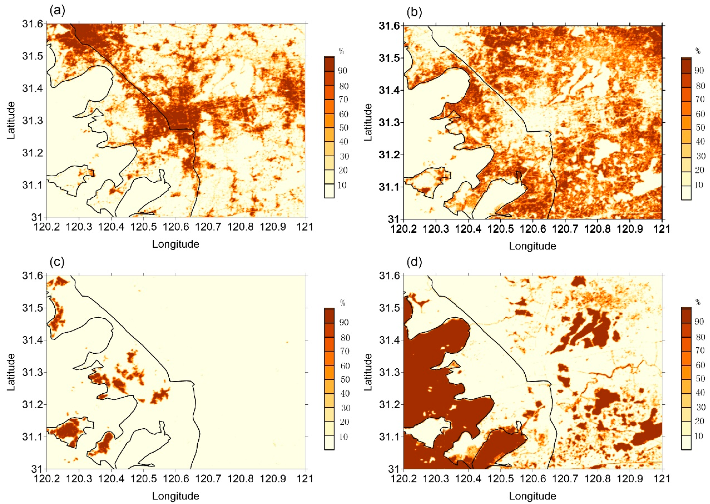
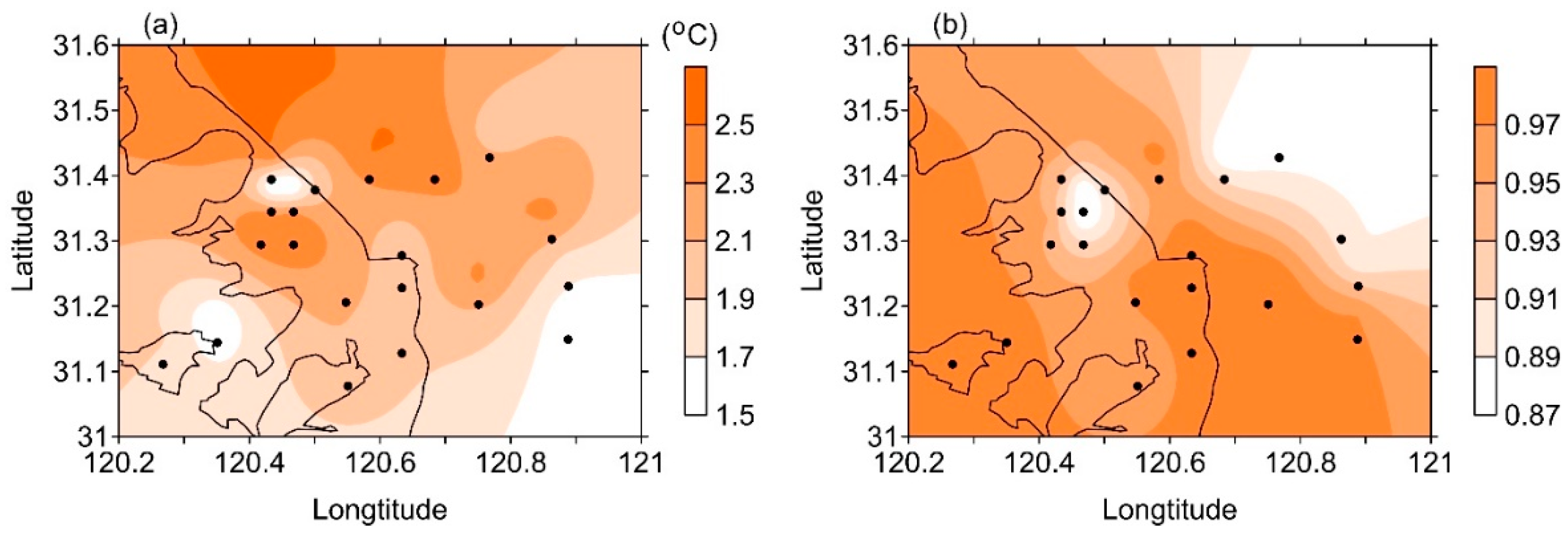
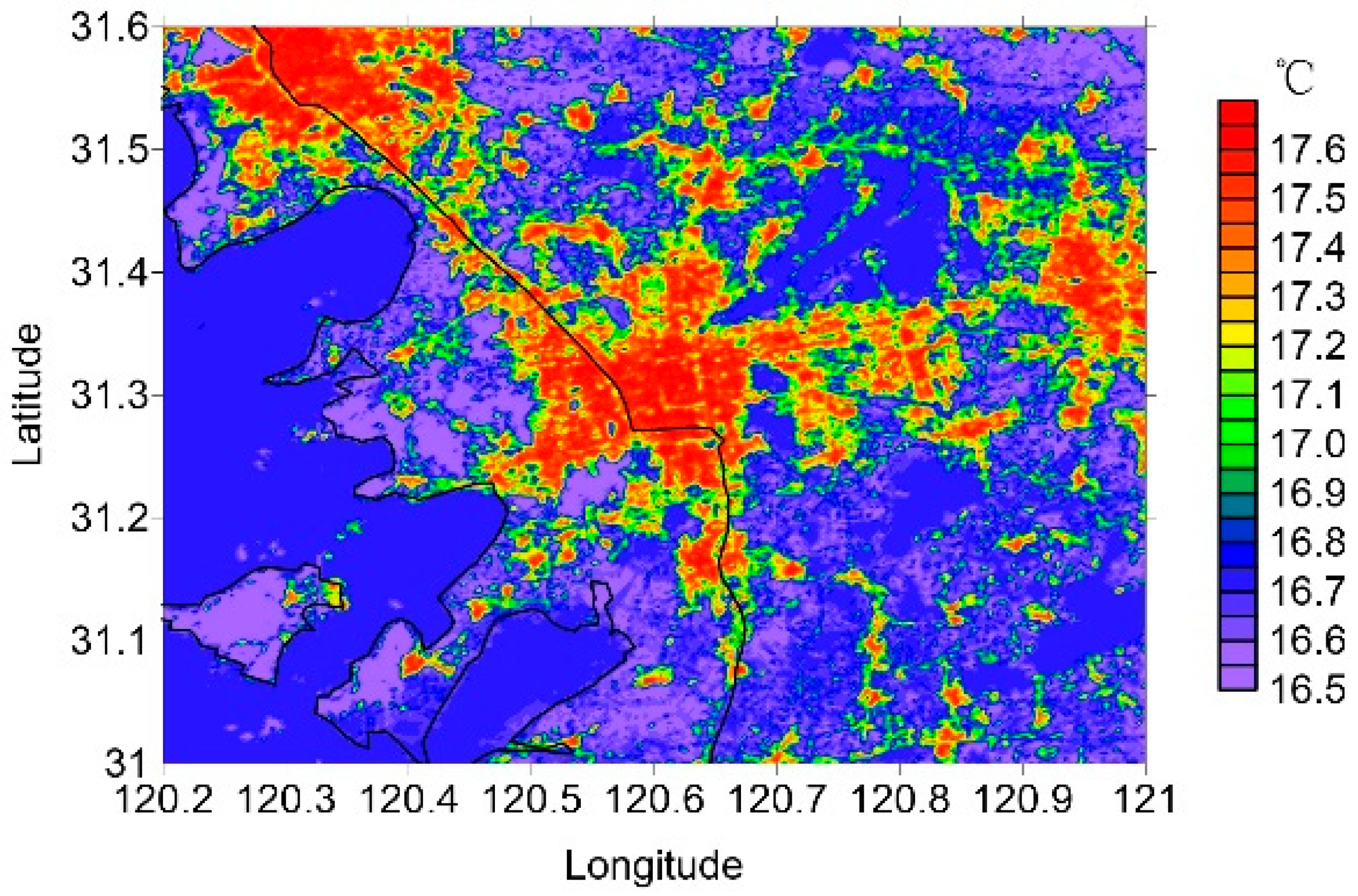
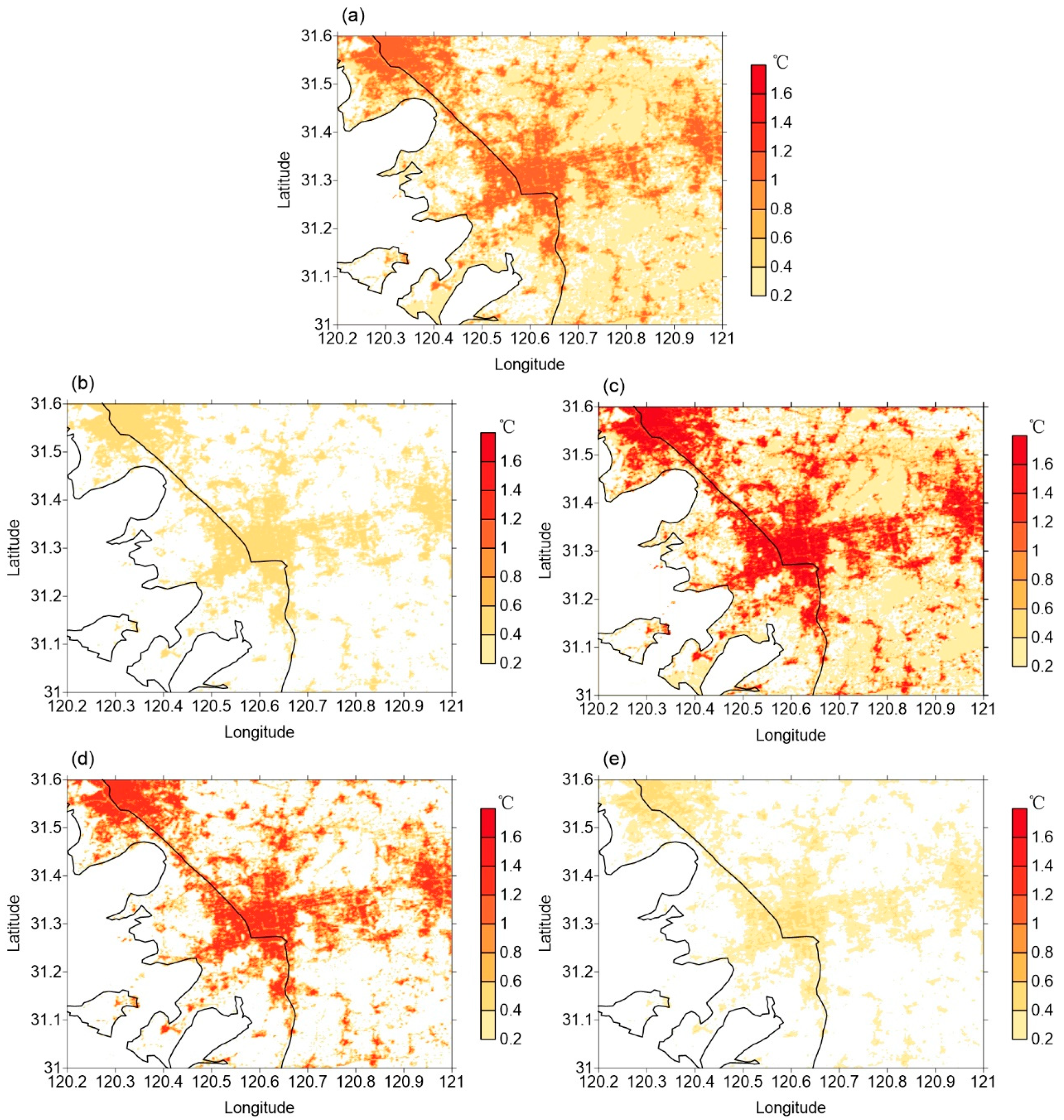
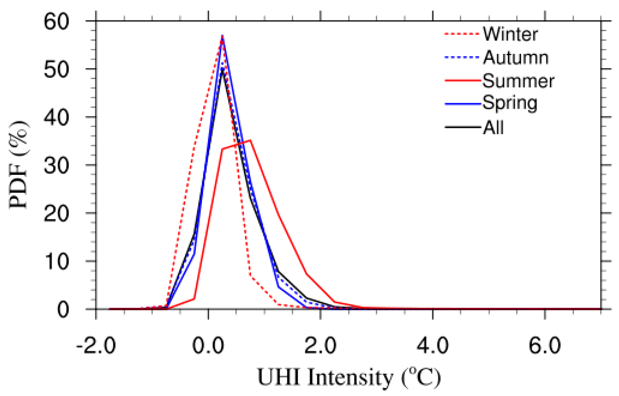
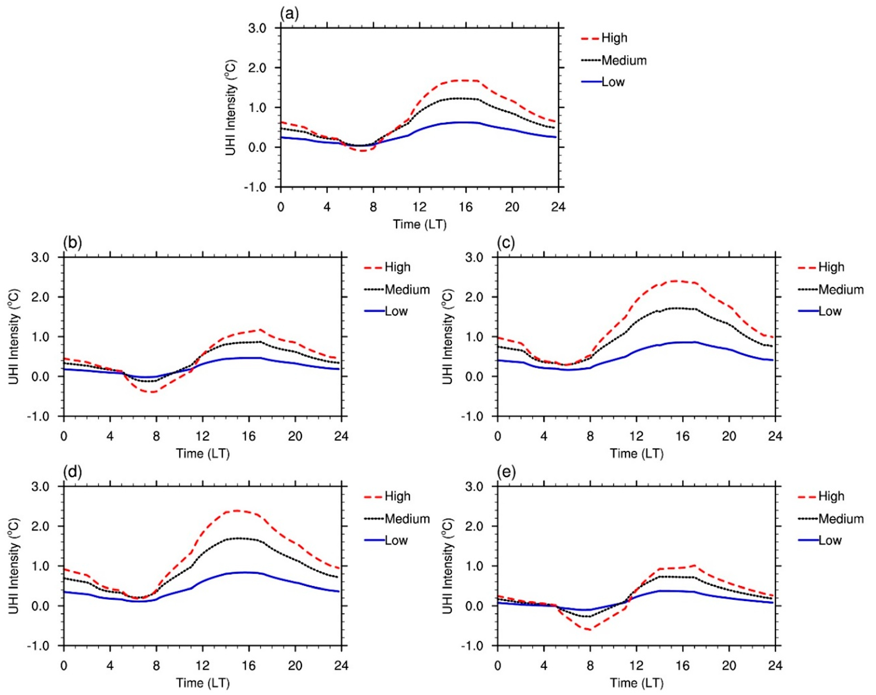
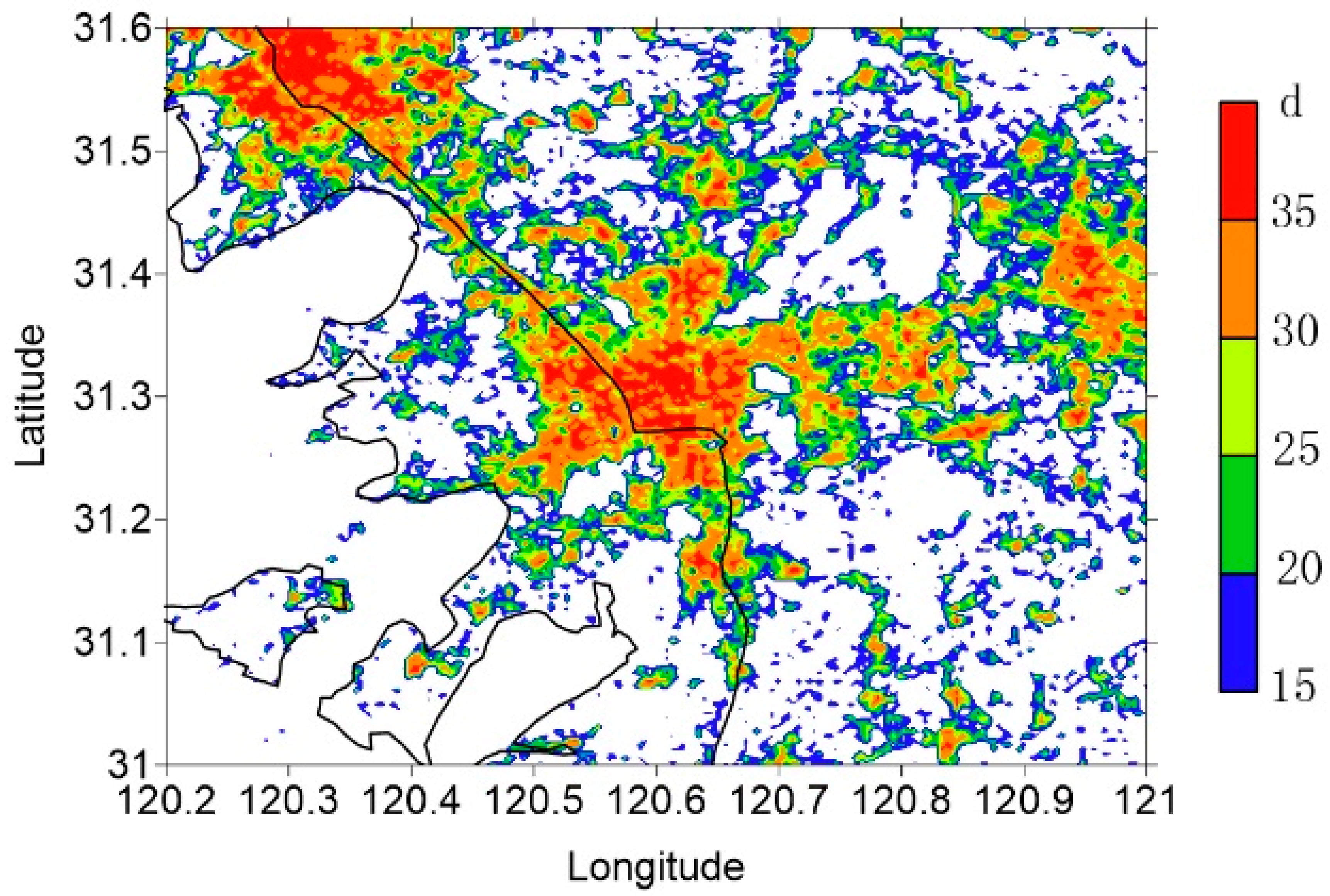
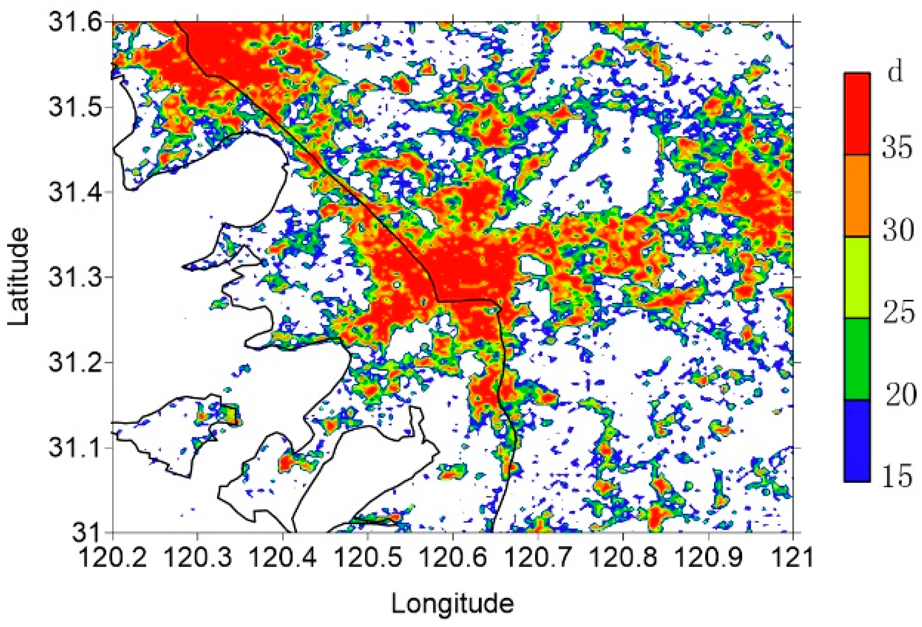
City thermal discomfort conditions have been exacerbated by the rapid urbanization processes in China. High-resolution urban thermal climate simulations can help us to understand urban climate features and produce better urban designs. In this paper, a single-layer urban canopy model (UCM) combined with Landsat satellite data and high-resolution meteorological forcing data was used to simulate very-high-resolution characteristics of temperature and humidity at the urban canopy level, and the heat index at the pedestrian level was also estimated. The research shows that the National center of environmental forecasting, Oregon state university, Air force and Hydrological research lab (NOAH)-UCM model can simulate the distribution of meteorological elements for different land uses in a fine and effective manner, making it an effective approach to obtaining the fundamental data for urban climate analysis. The spatial distribution pattern of urban heat islands in Suzhou is highly consistent with urban land cover fraction. High-density and medium-density urban areas are centers of urban heat islands, and the annual number of high-temperature days and heat indices over the high-density and medium-density urban areas are markedly higher than those in low-density cities and suburbs, indicating that urban development has a significant impact on the urban thermal environment.
Keywords: urban climatic analysis map; urban canopy model; surface energy balance; urban heat island intensity index; ventilation capacity index urban climatic analysis map; urban canopy model; surface energy balance; urban heat island intensity index; ventilation capacity index