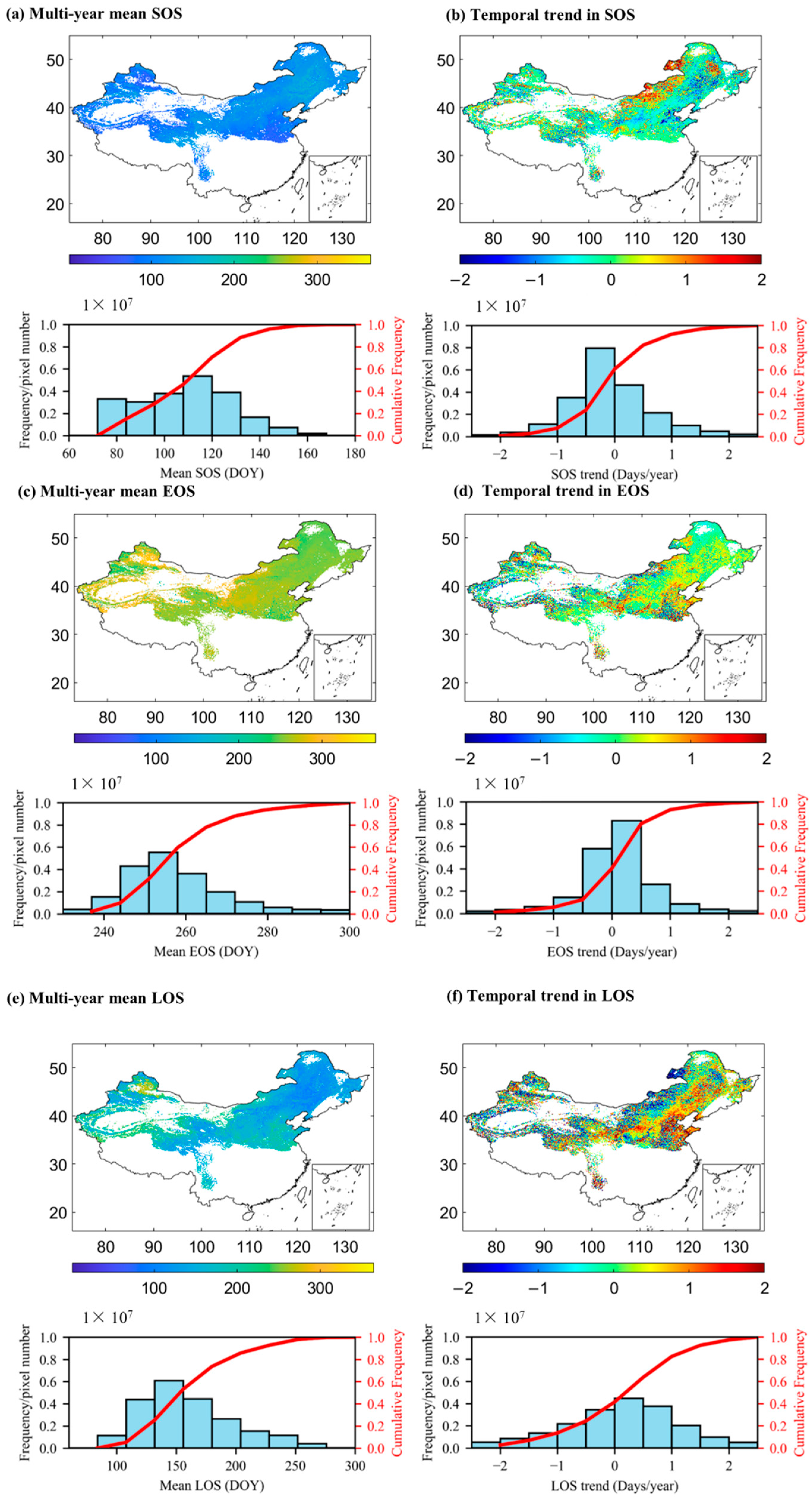
Correction: Mai et al. Improved Land Surface Phenology Detection in China’s Drylands and Associated Spatiotemporal Trends. Remote Sens. 2026, 18, 2073



Reference
- Mai, Y.; Peng, J.; Deng, J.; Tang, D.; Li, Z.; Kuang, Y. Improved Land Surface Phenology Detection in China’s Drylands and Associated Spatiotemporal Trends. Remote Sens. 2026, 18, 2073. [Google Scholar] [CrossRef] [Scilit]

Disclaimer/Publisher’s Note: The statements, opinions and data contained in all publications are solely those of the individual author(s) and contributor(s) and not of MDPI and/or the editor(s). MDPI and/or the editor(s) disclaim responsibility for any injury to people or property resulting from any ideas, methods, instructions or products referred to in the content. |
© 2026 by the authors. Licensee MDPI, Basel, Switzerland. This article is an open access article distributed under the terms and conditions of the Creative Commons Attribution (CC BY) license.
Share and Cite
Mai, Y.; Peng, J.; Deng, J.; Tang, D.; Li, Z.; Kuang, Y. Correction: Mai et al. Improved Land Surface Phenology Detection in China’s Drylands and Associated Spatiotemporal Trends. Remote Sens. 2026, 18, 2073. Remote Sens. 2026, 18, 3046. https://doi.org/10.3390/rs18173046
Mai Y, Peng J, Deng J, Tang D, Li Z, Kuang Y. Correction: Mai et al. Improved Land Surface Phenology Detection in China’s Drylands and Associated Spatiotemporal Trends. Remote Sens. 2026, 18, 2073. Remote Sensing. 2026; 18(17):3046. https://doi.org/10.3390/rs18173046
Chicago/Turabian StyleMai, Yongjian, Jie Peng, Jianming Deng, Dong Tang, Zifan Li, and Yaning Kuang. 2026. "Correction: Mai et al. Improved Land Surface Phenology Detection in China’s Drylands and Associated Spatiotemporal Trends. Remote Sens. 2026, 18, 2073" Remote Sensing 18, no. 17: 3046. https://doi.org/10.3390/rs18173046
APA StyleMai, Y., Peng, J., Deng, J., Tang, D., Li, Z., & Kuang, Y. (2026). Correction: Mai et al. Improved Land Surface Phenology Detection in China’s Drylands and Associated Spatiotemporal Trends. Remote Sens. 2026, 18, 2073. Remote Sensing, 18(17), 3046. https://doi.org/10.3390/rs18173046