Article

A New Method for Extracting Short-Term Deformation Signals from InSAR Time Series and Its Application to the Haihe River ‘23·7’ Basin-Wide Extreme Flood Event


1
Key Laboratory of Intraplate Volcanoes and Earthquakes, China University of Geosciences, Ministry of Education, Beijing 100083, China
2
School of Geophysics and Information Technology, China University of Geosciences, Beijing 100083, China
3
Institute of Earthquake Forecasting, China Earthquake Administration, Beijing 100036, China
*
Author to whom correspondence should be addressed.
Remote Sens. 2026, 18(17), 2847; https://doi.org/10.3390/rs18172847
Submission received: 2 July 2026 / Revised: 5 August 2026 / Accepted: 13 August 2026 / Published: 22 August 2026

Abstract

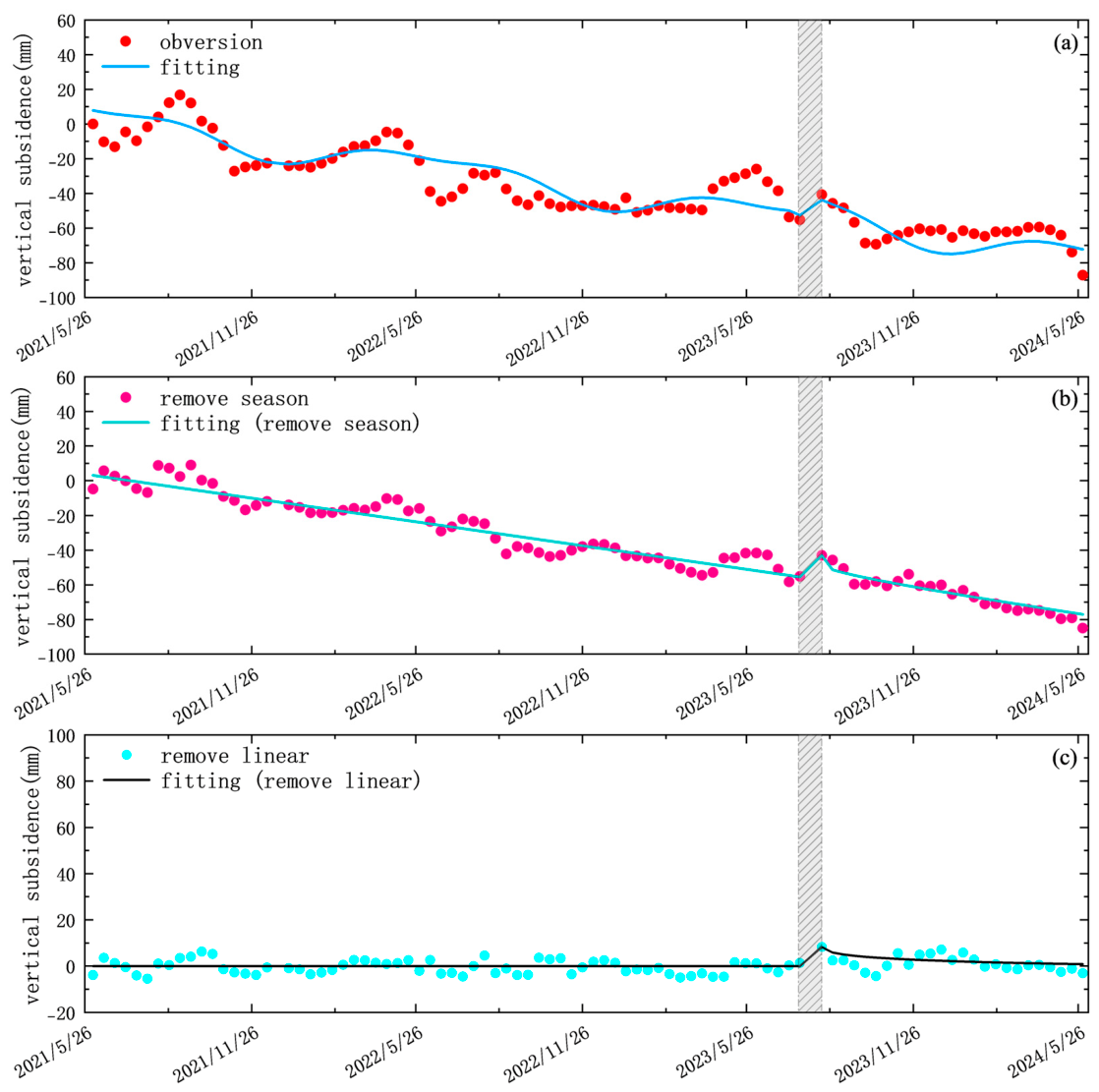
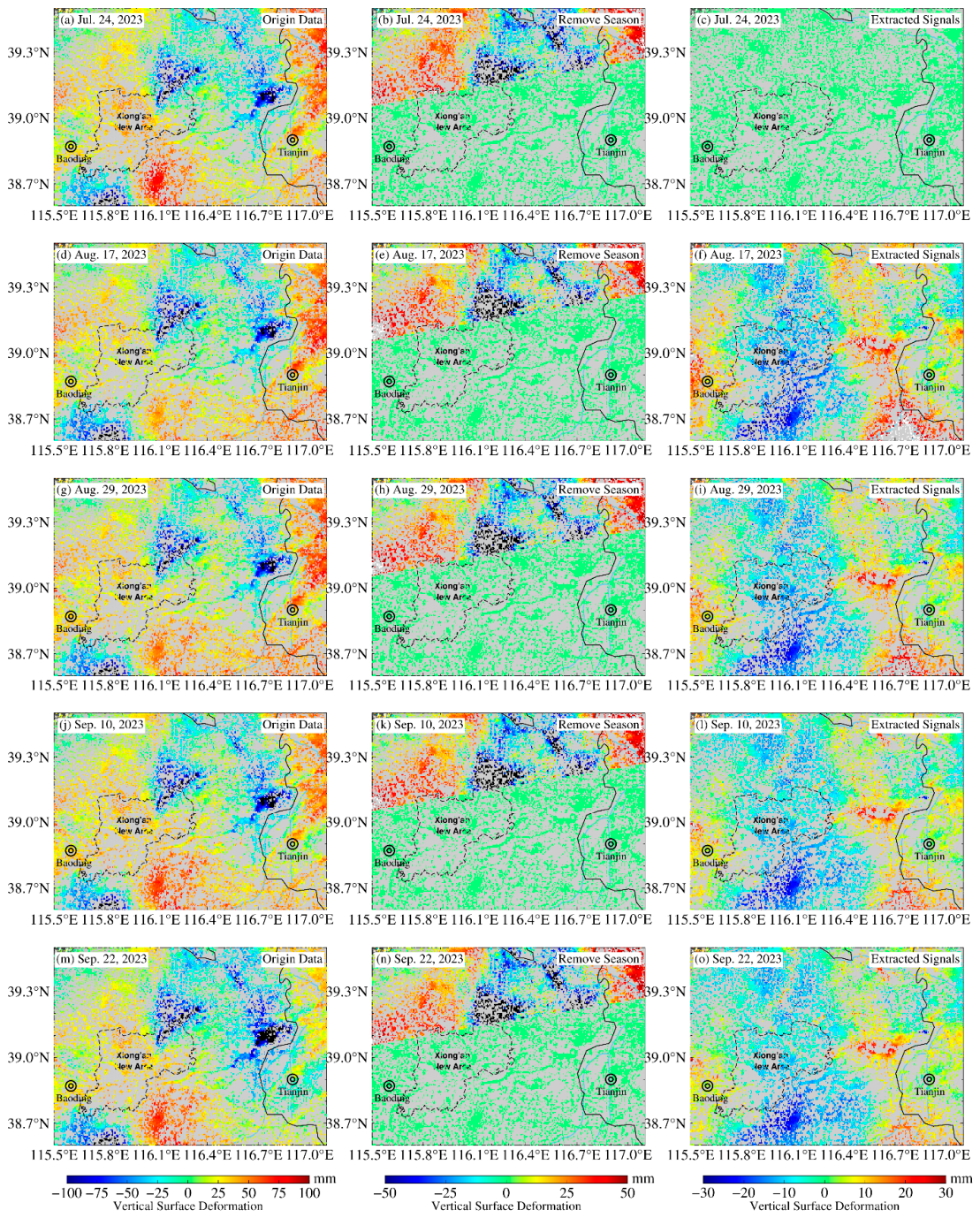
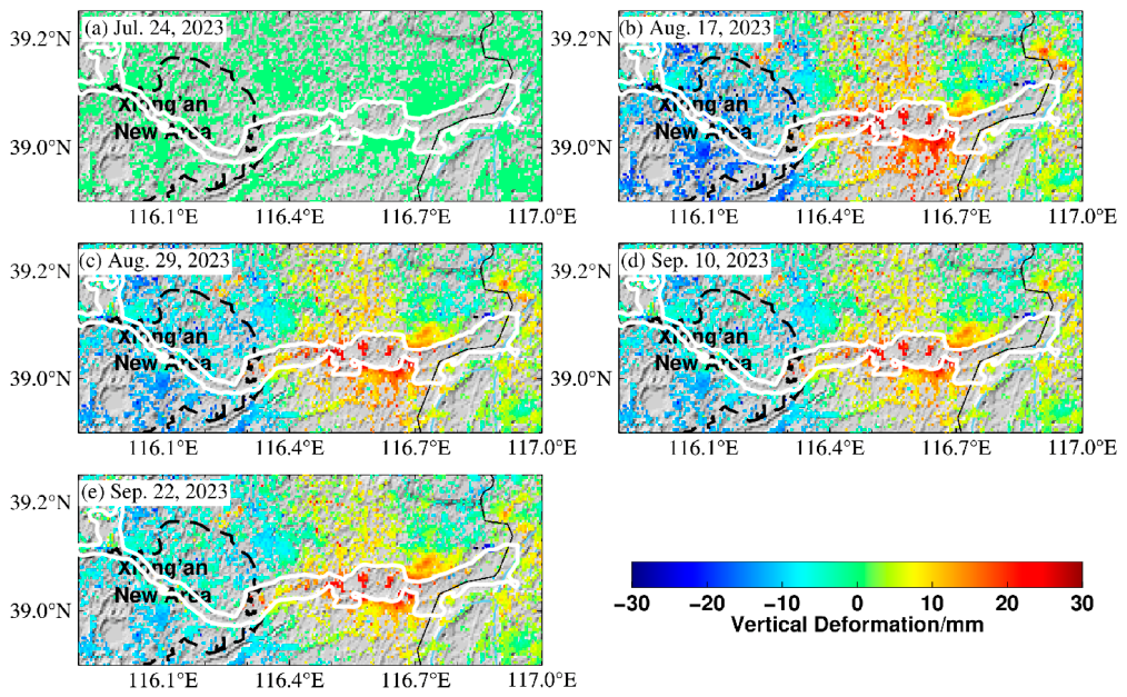
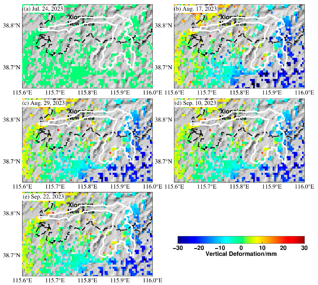
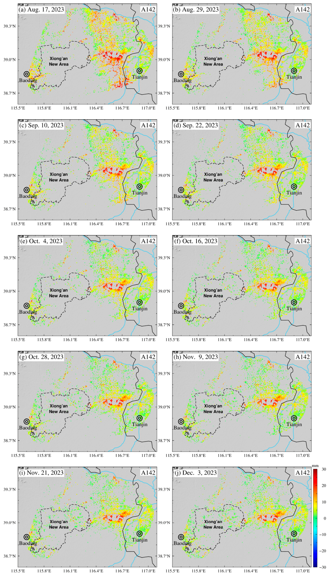
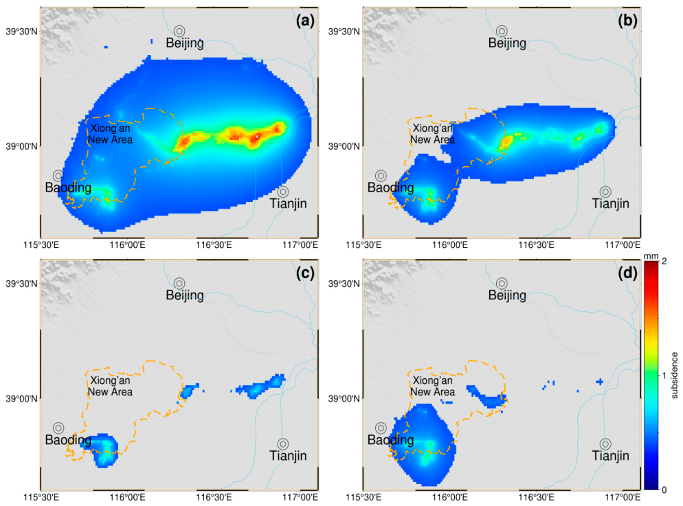
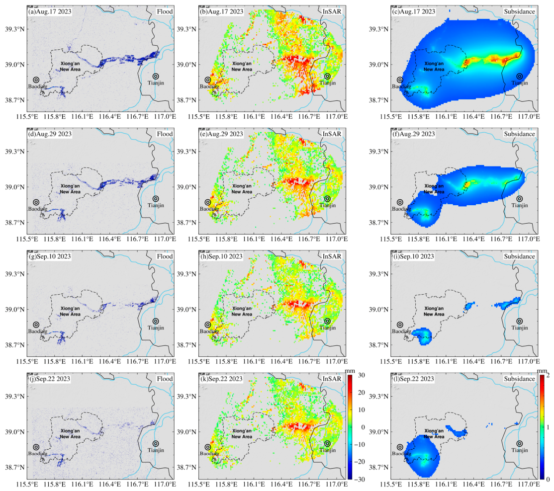
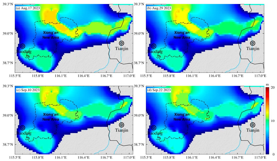
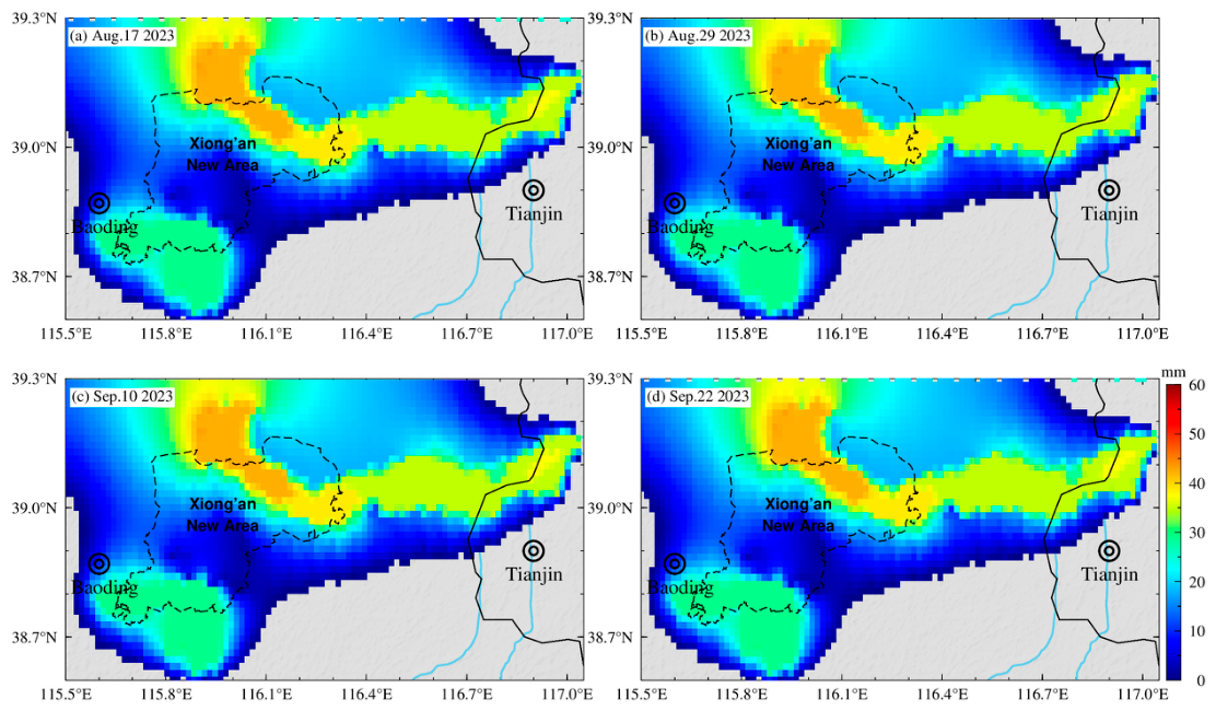
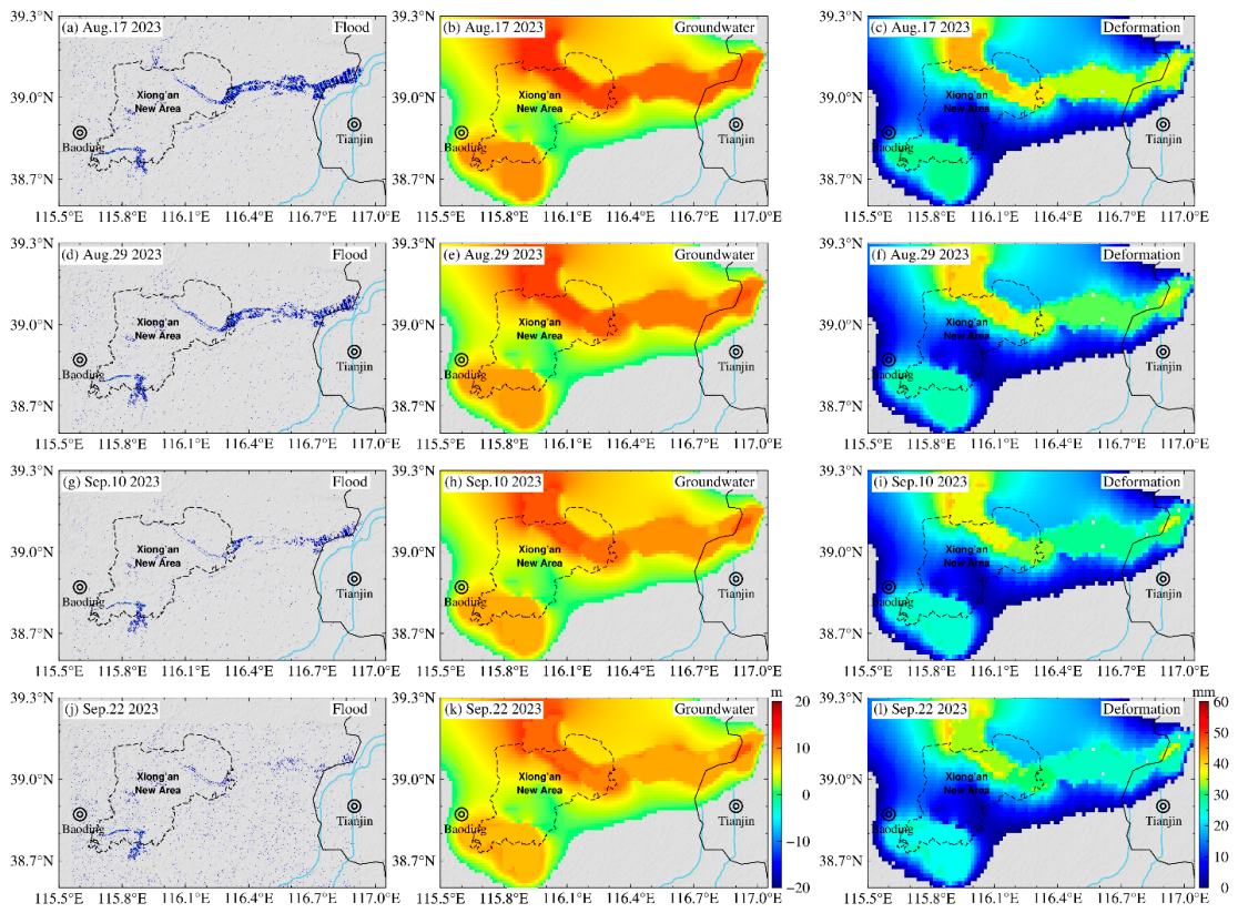
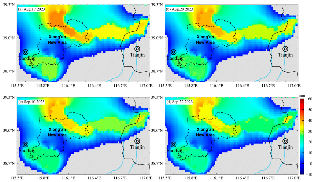
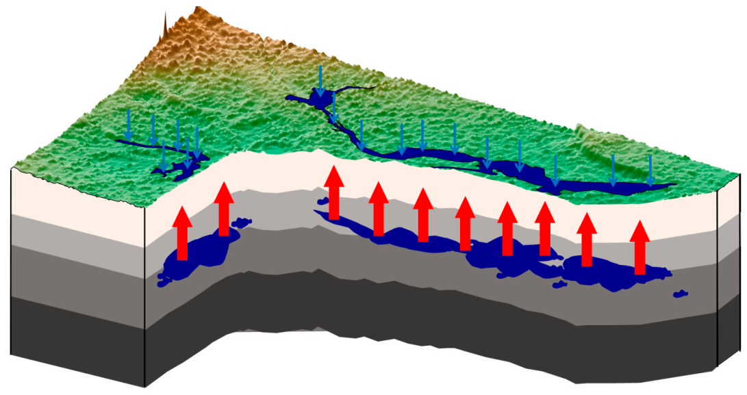
To address the critical challenge of extracting short-period surface deformation signals induced by extreme floods from InSAR time series, this study focuses on the catastrophic flood that struck the Haihe River Basin in July 2023 (hereinafter referred to as the “23·7” flood, with a total duration of approximately 65 days) and proposes a novel method for transient deformation signal extraction. Using Sentinel-1A satellite data and the PS-InSAR technique, we constructed a multivariate composite fitting function comprising a linear trend term, annual and semi-annual seasonal terms, a step term, and a logarithmic decay term. Through nonlinear least-squares fitting, this approach achieves effective separation of long-term tectonic deformation, seasonal fluctuations, high-frequency noise, and transient flood-related signals. The results show that the W-shaped floodplain east of Xiong’an New Area does not exhibit the expected subsidence induced by water loading but instead features pronounced surface uplift of up to 30 mm. Multi-physics forward modeling reveals the underlying mechanism: the elastic subsidence caused by surface water loading, calculated via the LoadDef spherical loading theory, amounts to only ~2 mm. In contrast, forward modeling based on the GMS three-dimensional groundwater seepage model and the principle of effective stress indicates that the pore water rebound effect can produce surface uplift of up to ~36 mm. The superposition of these two effects is highly consistent with InSAR observations in terms of magnitude, direction, and spatial distribution, confirming that the flood-induced surface deformation is dominated by the pore water rebound effect driven by rapid groundwater recharge, rather than subsidence from water loading. The proposed framework extends the application potential of geodetic techniques for monitoring short-period extreme hydrological events.
Keywords: “23·7” Haihe River Basin catastrophic flood; PS-InSAR; loading theory; principle of effective stress; poroelastic rebound effect “23·7” Haihe River Basin catastrophic flood; PS-InSAR; loading theory; principle of effective stress; poroelastic rebound effect