UAV Image-Based 3D Reconstruction Technology in Landslide Disasters: A Review
Abstract
1. Introduction
2. UAV-Based Landslide Monitoring
2.1. UAV Types for Landslide Monitoring
2.1.1. Multirotor UAVs
2.1.2. Fixed-Wing UAVs
| Fixed-Wing UAV | Multirotor UAV (Light) | Multirotor UAV (Heavy) |
|---|---|---|
| Hi-Target V100 [57] | DJI Phantom 4 Pro [58] | DJI Matrice 350 [58] |
| Maximum Flight Time: 150 min | Maximum Flight Time: 30 min | Maximum Flight Time: 55 min |
| Maximum Flight Speed: 30 m/s | Maximum Flight Speed: 20 m/s | Maximum Flight Speed: 23 m/s |
| Maximum Payload: 2 kg | Aircraft Weight: 1.388 kg | Maximum Payload: 2.7 kg |
| Maximum Flight altitude: 6000 m | Maximum Flight altitude: 6000 m | Maximum Flight altitude: 7000 m |
| Adaptability to Work Environment: Open Areas | Adaptability to Work Environment: Complex Terrain | |
 |  |  |
2.2. Categories of UAV-Mounted Monitoring Sensors
2.2.1. Optical Sensors
2.2.2. LiDAR Sensors
3. UAV-Based 3D Reconstruction Techniques
3.1. Three-Dimensional Reconstruction Based on Image
3.2. Three-Dimensional Reconstruction Based on UAV LiDAR
3.3. Three-Dimensional Reconstruction Based on Hybrid Methods
4. Applications of UAV 3D Reconstruction in Landslides
4.1. Application of UAV-Based 3D Reconstruction in Landslide Emergency Investigation
4.2. Application of UAV-Based 3D Reconstruction in Landslide Monitoring
4.3. Application of UAV-Based 3D Reconstruction in Disaster Assessment
5. Challenges and Future Perspectives
6. Conclusions
Author Contributions
Funding
Informed Consent Statement
Conflicts of Interest
Abbreviations
| UAV | Unmanned Aerial Vehicle |
| LiDAR | Light Detection and Ranging |
| GNSS | Global Navigation Satellite System |
| VTOL | Vertical Takeoff and Landing |
| AHRS | Attitude and Heading Reference System |
| VLOS | Visual Line of Sight |
| VI | Vegetation Indices |
| NDVI | Normalized Difference Vegetation Index |
| NBV | Next Best View |
| ETE | Explore-Then-Exploit |
| SfM | Structure from Motion |
| MVS | Multiview Stereo |
| SIFT | Scale-Invariant Feature Transform |
| SURF | Speeded0-Up Robust Features |
| ORB | Oriented FAST and Rotated BRIEF |
| GIS | Geographic Information System |
| GPS | Global Positioning System |
| BIM | Building Information Modeling |
| PDE | Partial Differential Equation |
| NURBS | Non-Uniform Rational B-Spline |
| DEM | Digital Elevation Mode |
| DOM | Digital Orthophoto Map |
| DSM | Digital Surface Model |
| UAVSAR | Unmanned Aerial Vehicle Synthetic Aperture Radar |
| COSI-Corr | Co-Registration of Optically Sensed Images and Correlation |
| GB-InSAR | Ground-Based Interferometric Synthetic Aperture Radar |
| TLS | Terrestrial Laser Scanning |
| POS | Position and Orientation System |
| BVLOS | Beyond Visual Line of Sight |
| ML | Machine Learning |
| ICP | Iterative Closest Point |
| CNN | Convolutional Neural Network |
| mIoU | mean Intersection over Union |
| RMSE | Root Mean Square Error |
| LSTM | Long Short-Term Memory |
| ResNet | Residual Network |
| FAA | Federal Aviation Administration |
| EASA | European Union Aviation Safety Agency |
| CAAC | Civil Aviation Administration of China |
| UTC | Unmanned Aerial Vehicle Training Certificate |
| ASFC | Aeronautical Sports Federation of China |
References
- Shao, X.; Xu, C. Earthquake-induced landslides susceptibility assessment: A review of the state-of-the-art. Nat. Hazards Res. 2022, 2, 172–182. [Google Scholar] [CrossRef]
- Zhao, B.; Su, L.; Xu, Q.; Li, W.; Xu, C.; Wang, Y. A review of recent earthquake-induced landslides on the Tibetan Plateau. Earth-Sci. Rev. 2023, 244, 104534. [Google Scholar] [CrossRef]
- Huang, Y.; Xu, C.; He, X.; Cheng, J.; Huang, Y.; Wu, L.; Xu, X. Distribution characteristics and cumulative effects of landslides triggered by multiple moderate-magnitude earthquakes: A case study of the comprehensive seismic impact area in Yibin, Sichuan, China. Landslides 2024, 21, 2927–2943. [Google Scholar] [CrossRef]
- Korup, O.; Seidemann, J.; Mohr, C.H. Increased landslide activity on forested hillslopes following two recent volcanic eruptions in Chile. Nat. Geosci. 2019, 12, 284–289. [Google Scholar] [CrossRef]
- Paredes, A.; Martini, L.; Iroumé, A.; Picco, L. Modeling landslide activity and sediment connectivity after eruptions: Insights from the Blanco River (Chile). Sci. Total Environ. 2023, 883, 163745. [Google Scholar] [CrossRef]
- Lei, Q.; Sornette, D. Unified failure model for landslides, rockbursts, glaciers, and volcanoes. Commun. Earth Environ. 2025, 6, 390. [Google Scholar] [CrossRef] [PubMed]
- Huang, F.; Chen, J.; Liu, W.; Huang, J.; Hong, H.; Chen, W. Regional rainfall-induced landslide hazard warning based on landslide susceptibility mapping and a critical rainfall threshold. Geomorphology 2022, 408, 108236. [Google Scholar] [CrossRef]
- Zhang, Z.; Zeng, R.; Meng, X.; Zhao, S.; Wang, S.; Ma, J.; Wang, H. Effects of changes in soil properties caused by progressive infiltration of rainwater on rainfall-induced landslides. Catena 2023, 233, 107475. [Google Scholar] [CrossRef]
- Liu, S.; Du, J.; Yin, K.; Zhou, C.; Huang, C.; Jiang, J.; Yu, J. Regional early warning model for rainfall induced landslide based on slope unit in Chongqing, China. Eng. Geol. 2024, 333, 107464. [Google Scholar] [CrossRef]
- Sato, T.; Shuin, Y. Variation in the frequency and characteristics of landslides in response to changes in forest cover and rainfall in Japan over the last century: A literature review. Catena 2025, 249, 108639. [Google Scholar] [CrossRef]
- Ramos-Scharrón, C.; Arima, E.; Hughes, K. An assessment of the spatial distribution of shallow landslides induced by Hurricane María in Puerto Rico. Phys. Geogr. 2022, 43, 163–191. [Google Scholar] [CrossRef]
- Sammonds, P.; Alam, A.; Day, S.; Stavrianaki, K.; Kelman, I. Hurricane risk assessment in a multi-hazard context for Dominica in the Caribbean. Sci. Rep. 2023, 13, 20565. [Google Scholar] [CrossRef] [PubMed]
- Brien, D.L.; Reid, M.E.; Cronkite-Ratcliff, C.; Perkins, J.P. Topographic controls on landslide mobility: Modeling hurricane-induced landslide runout and debris-flow inundation in Puerto Rico. Nat. Hazards Earth Syst. Sci. 2025, 25, 1229–1253. [Google Scholar] [CrossRef]
- Al-Rawabdeh, A.; He, F.; Moussa, A.; El-Sheimy, N.; Habib, A. Using an unmanned aerial vehicle-based digital imaging system to derive a 3D point cloud for landslide scarp recognition. Remote Sens. 2016, 8, 95. [Google Scholar] [CrossRef]
- Wen, T.; Chen, N.; Huang, D.; Wang, Y. A medium-sized landslide leads to a large disaster in Zhenxiong, Yunnan, China: Characteristics, mechanism and motion process. Landslides 2025, 1–19. [Google Scholar] [CrossRef]
- Wang, Z.; Wen, T.; Chen, N.; Tang, R. Assessment of Landslide Susceptibility Based on the Two-Layer Stacking Model—A Case Study of Jiacha County, China. Remote Sens. 2025, 17, 1177. [Google Scholar] [CrossRef]
- Ren, C.; Zhi, X.; Pu, Y.; Zhang, F. A multi-scale UAV image matching method applied to large-scale landslide reconstruction. Math. Biosci. Eng 2021, 18, 2274–2287. [Google Scholar] [CrossRef]
- Lucieer, A.; Jong, S.M.d.; Turner, D. Mapping landslide displacements using Structure from Motion (SfM) and image correlation of multi-temporal UAV photography. Prog. Phys. Geogr. 2014, 38, 97–116. [Google Scholar] [CrossRef]
- Hussain, Y.; Schlögel, R.; Innocenti, A.; Hamza, O.; Iannucci, R.; Martino, S.; Havenith, H.B. Review on the geophysical and UAV-based methods applied to landslides. Remote Sens. 2022, 14, 4564. [Google Scholar] [CrossRef]
- Fang, C.; Han, Z.; Wang, W.; Zio, E. Routing UAVs in landslides Monitoring: A neural network heuristic for team orienteering with mandatory visits. Transp. Res. Part Logist. Transp. Rev. 2023, 175, 103172. [Google Scholar] [CrossRef]
- Clark, M.K.; Zekkos, D.; Manousakis, J. Enabling 3D landslide event statistics using satellite and UAV-enabled topographic differencing. Landslides 2025, 22, 1041–1058. [Google Scholar] [CrossRef]
- Comert, R.; Avdan, U.; Gorum, T. Rapid mapping of forested landslide from ultra-high resolution unmanned aerial vehicle data. In Proceedings of the International Archives of the Photogrammetry, Remote Sensing and Spatial Information Sciences, Istanbul, Turkey, 18–21 March 2018; Volume 42, pp. 171–176. [Google Scholar]
- Vivaldi, V.; Bordoni, M.; Mineo, S.; Crozi, M.; Pappalardo, G.; Meisina, C. Airborne combined photogrammetry—Infrared thermography applied to landslide remote monitoring. Landslides 2023, 20, 297–313. [Google Scholar] [CrossRef]
- Pardeshi, S.D.; Autade, S.E.; Pardeshi, S.S. Landslide hazard assessment: Recent trends and techniques. SpringerPlus 2013, 2, 523. [Google Scholar] [CrossRef] [PubMed]
- Mao, Z.; Yu, H.; Ma, X.; Liang, W.; Gao, G.; Tian, Y.; Shi, S. Refinement analysis of landslide risk assessment for wide area based on UAV-acquired high spatial resolution images. Stoch. Environ. Res. Risk Assess. 2024, 38, 1–25. [Google Scholar] [CrossRef]
- Bekar, A.; Antoniou, M.; Baker, C.J. Low-cost, high-resolution, drone-borne SAR imaging. IEEE Trans. Geosci. Remote Sens. 2021, 60, 1–11. [Google Scholar] [CrossRef]
- Sun, J.; Yuan, G.; Song, L.; Zhang, H. Unmanned Aerial Vehicles (UAVs) in Landslide Investigation and Monitoring: A Review. Drones 2024, 8, 30. [Google Scholar] [CrossRef]
- Moreira, L.; Lübeck, D.; Wimmer, C.; Castro, F.; Góes, J.A.; Castro, V.; Alcântara, M.; Oré, G.; Oliveira, L.P.; Bins, L.; et al. Drone-borne P-band single-pass InSAR. In Proceedings of the 2020 IEEE Radar Conference (RadarConf20), Florence, Italy, 21–25 September 2020; pp. 1–6. [Google Scholar]
- Wang, X.; Li, K.; Chehri, A. Multi-sensor fusion technology for 3D object detection in autonomous driving: A review. IEEE Trans. Intell. Transp. Syst. 2023, 25, 1148–1165. [Google Scholar] [CrossRef]
- Shih, N.J. AI-assisted 3D Preservation and Reconstruction of Temple Arts. arXiv 2025, arXiv:2503.10031. [Google Scholar]
- Sutariya, V.; Bathani, J.; Ajudia, R.; Kumar, A. Hybrid VTOL UAVs: A Comprehensive Review of Technology, Applications. In Proceedings of the Advances in Design and Automation: Select Proceedings of ICFAMMT 2024, Ahmedabad, India, 19–21 January 2024; Springer: Berlin/Heidelberg, Germany, 2025; p. 367. [Google Scholar]
- Gao, D.; Li, K.; Cai, Y.; Wen, T. Landslide displacement prediction based on time series and PSO-BP model in three georges reservoir, China. J. Earth Sci. 2024, 35, 1079–1082. [Google Scholar] [CrossRef]
- Wang, Y.; Sun, X.; Wen, T.; Wang, L. Step-like displacement prediction of reservoir landslides based on a metaheuristic-optimized KELM: A comparative study. Bull. Eng. Geol. Environ. 2024, 83, 322. [Google Scholar] [CrossRef]
- Garnica-Peña, R.J.; Alcántara-Ayala, I. The use of UAVs for landslide disaster risk research and disaster risk management: A literature review. J. Mt. Sci. 2021, 18, 482–498. [Google Scholar] [CrossRef]
- Wu, H.; Zhong, Q.; Deng, Z.; Shan, Y.; Zhao, K. Numerical investigation of the effect of landslide relative density on the impulse wave amplitude. Ocean. Eng. 2024, 309, 118563. [Google Scholar] [CrossRef]
- Ji, H.; Luo, X. 3D scene reconstruction of landslide topography based on data fusion between laser point cloud and UAV image. Environ. Earth Sci. 2019, 78, 534. [Google Scholar] [CrossRef]
- Zhao, D.; Han, J.; Liu, X.; Zuo, Z.; Zheng, K. Exploration of the Application of Fine Reconstruction of Unmanned Aerial Vehicles in Landslide Disaster Investigation and Management. In Proceedings of the International Hydropower Development Conference, Beijing, China, 29–31 October 2024; Springer: Berlin/Heidelberg, Germany, 2024; pp. 489–502. [Google Scholar]
- Siebert, S.; Teizer, J. Mobile 3D mapping for surveying earthwork projects using an Unmanned Aerial Vehicle (UAV) system. Autom. Constr. 2014, 41, 1–14. [Google Scholar] [CrossRef]
- Putro, S.; Nucifera, F.; Febriarta, E. Commercial multirotor UAV campaign on data acquisition for disaster management. In Proceedings of the IOP Conference Series: Earth and Environmental Science, Yogyakarta, Indonesia, 11–12 September 2020; IOP Publishing: Bristol, UK, 2021; Volume 884, p. 012031. [Google Scholar]
- Eker, R.; Aydın, A. Long-term retrospective investigation of a large, deep-seated, and slow-moving landslide using InSAR time series, historical aerial photographs, and UAV data: The case of Devrek landslide (NW Turkey). Catena 2021, 196, 104895. [Google Scholar] [CrossRef]
- Mineo, S.; Caliò, D.; Pappalardo, G. UAV-based photogrammetry and infrared thermography applied to rock mass survey for geomechanical purposes. Remote Sens. 2022, 14, 473. [Google Scholar] [CrossRef]
- Caliò, D.; Mineo, S.; Pappalardo, G. Digital rock mass analysis for the evaluation of rockfall magnitude at poorly accessible cliffs. Remote Sens. 2023, 15, 1515. [Google Scholar] [CrossRef]
- Caliò, D.; Mineo, S.; Pappalardo, G. Aerial photogrammetry used as a quick procedure for rock mass stability analysis in a nature reserve. Ital. J. Eng. Geol. Environ. 2023, 82, 11–20. [Google Scholar]
- Francioni, M.; Calcaterra, D.; Di Martire, D.; Guerriero, L.; Mugnozza, G.S.; Sciarra, N. Deep-Seated Landslide and Rockfalls Threatening the Village of Pietracamela in Central Italy: Deciphering Phenomena from Interferometric Synthetic Aperture Radar and Point Cloud Analysis. Remote Sens. 2024, 16, 3151. [Google Scholar] [CrossRef]
- Mineo, S.; Caliò, D.; Intelisano, M.; Pappalardo, G. Landslide studying and monitoring by combining digital models from aerial visible and infrared photogrammetry. Landslides 2025, 22, 1789–1804. [Google Scholar] [CrossRef]
- Rau, J.Y.; Jhan, J.; Lo, C.; Lin, Y. Landslide mapping using imagery acquired by a fixed-wing UAV. In Proceedings of the International Archives of the Photogrammetry, Remote Sensing and Spatial Information Sciences, Zurich, Switzerland, 14–16 September 2011; Volume 38, pp. 195–200. [Google Scholar]
- Anders, N.; Masselink, R.; Keesstra, S.; Suomalainen, J. High-res digital surface modeling using fixed-wing UAV-based photogrammetry. Proc. Geomorphometry 2013, 1, 2–5. [Google Scholar]
- Liu, C.C.; Chen, P.L.; Matsuo, T.; Chen, C.Y. Rapidly responding to landslides and debris flow events using a low-cost unmanned aerial vehicle. J. Appl. Remote Sens. 2015, 9, 096016. [Google Scholar] [CrossRef]
- Hsieh, Y.C.; Chan, Y.C.; Hu, J.C. Digital elevation model differencing and error estimation from multiple sources: A case study from the Meiyuan Shan landslide in Taiwan. Remote Sens. 2016, 8, 199. [Google Scholar] [CrossRef]
- Peppa, M.; Mills, J.; Moore, P.; Miller, P.; Chambers, J. Accuracy assessment of a UAV-based landslide monitoring system. In Proceedings of the International Archives of the Photogrammetry, Remote Sensing and Spatial Information Sciences, Prague, Czech Republic, 12–19 July 2016; Volume 41, pp. 895–902. [Google Scholar]
- Peppa, M.V.; Mills, J.P.; Moore, P.; Miller, P.E.; Chambers, J.E. Brief communication: Landslide motion from cross correlation of UAV-derived morphological attributes. Nat. Hazards Earth Syst. Sci. 2017, 17, 2143–2150. [Google Scholar] [CrossRef]
- Pellicani, R.; Argentiero, I.; Manzari, P.; Spilotro, G.; Marzo, C.; Ermini, R.; Apollonio, C. UAV and airborne LiDAR data for interpreting kinematic evolution of landslide movements: The case study of the Montescaglioso landslide (Southern Italy). Geosciences 2019, 9, 248. [Google Scholar] [CrossRef]
- Hassanalian, M.; Abdelkefi, A. Classifications, applications, and design challenges of drones: A review. Prog. Aerosp. Sci. 2017, 91, 99–131. [Google Scholar] [CrossRef]
- Tanteri, L.; Rossi, G.; Tofani, V.; Vannocci, P.; Moretti, S.; Casagli, N. Multitemporal UAV survey for mass movement detection and monitoring. In Proceedings of the Advancing Culture of Living with Landslides: Volume 2 Advances in Landslide Science, Ljubljana, Slovenia, 29 May–2 June 2017; Springer: Berlin/Heidelberg, Germany, 2017; Volume 2, pp. 153–161. [Google Scholar]
- Teo, T.A.; Fu, Y.J.; Li, K.W.; Weng, M.C.; Yang, C.M. Comparison between image-and surface-derived displacement fields for landslide monitoring using an unmanned aerial vehicle. Int. J. Appl. Earth Obs. Geoinf. 2023, 116, 103164. [Google Scholar] [CrossRef]
- Afif, M.; Wibowo, D.; Raharjo, P.; Winduhutomo, S.; Puswanto, E. UAV (Unmanned Aerial Vehicle) for Landslide Analysis Case Study in Grenggeng Village, Kebumen District, Central Java. In Proceedings of the IOP Conference Series: Earth and Environmental Science, Virtual, 25–26 August 2021; IOP Publishing: Bristol, UK, 2021; Volume 887, p. 012036. [Google Scholar]
- Hi-Target. Hi-Target UAV. 2025. Available online: https://www.zhdgps.com/detail/UAV-V100 (accessed on 4 August 2025).
- DJI. DJI UAV. 2025. Available online: https://www.dji.com/cn/camera-drones?site=brandsite&from=nav (accessed on 4 August 2025).
- Stumpf, A. Landslide Recognition and Monitoring with Remotely Sensed Data from Passive Optical Sensors. Ph.D. Thesis, Université de Strasbourg, Strasbourg, France, 2013. [Google Scholar]
- Eker, R.; Aydın, A.; Hübl, J. Unmanned aerial vehicle (UAV)-based monitoring of a landslide: Gallenzerkogel landslide (Ybbs-Lower Austria) case study. Environ. Monit. Assess. 2018, 190, 1–14. [Google Scholar] [CrossRef] [PubMed]
- Melis, M.T.; Da Pelo, S.; Erbì, I.; Loche, M.; Deiana, G.; Demurtas, V.; Meloni, M.A.; Dessì, F.; Funedda, A.; Scaioni, M.; et al. Thermal remote sensing from UAVs: A review on methods in coastal cliffs prone to landslides. Remote Sens. 2020, 12, 1971. [Google Scholar] [CrossRef]
- Pappalardo, G.; Caliò, D.; Cavallaro, L.; Musca, A.; Rapicavoli, D.; Cannizzaro, F.; Caliò, I. Multi-hazard assessment of a masonry railway bridge in landslide areas. Procedia Struct. Integr. 2024, 62, 460–467. [Google Scholar] [CrossRef]
- Godone, D.; Allasia, P.; Borrelli, L.; Gullà, G. UAV and structure from motion approach to monitor the maierato landslide evolution. Remote Sens. 2020, 12, 1039. [Google Scholar] [CrossRef]
- Furukawa, F.; Laneng, L.A.; Ando, H.; Yoshimura, N.; Kaneko, M.; Morimoto, J. Comparison of RGB and multispectral unmanned aerial vehicle for monitoring vegetation coverage changes on a landslide area. Drones 2021, 5, 97. [Google Scholar] [CrossRef]
- Guan, Y.; Grote, K. Assessing the potential of UAV-based multispectral and thermal data to estimate soil water content using geophysical methods. Remote Sens. 2023, 16, 61. [Google Scholar] [CrossRef]
- Zocchi, M.; Kasaragod, A.K.; Jenkins, A.; Cook, C.; Dobson, R.; Oommen, T.; Van Huis, D.; Taylor, B.; Brooks, C.; Marini, R.; et al. Multi-sensor and multi-scale remote sensing approach for assessing slope instability along transportation corridors using satellites and uncrewed aircraft systems. Remote Sens. 2023, 15, 3016. [Google Scholar] [CrossRef]
- Choi, S.K.; Ramirez, R.A.; Lim, H.H.; Kwon, T.H. Multi-source remote sensing-based landslide investigation: The case of the August 7, 2020, Gokseong landslide in South Korea. Sci. Rep. 2024, 14, 12048. [Google Scholar] [CrossRef]
- Chen, H.W.; Chen, C.Y.; Lu, Y.J.; Lin, T.J. Using multispectral images and field inclinometer data to analyze topographic changes related to and the reactivation mechanism of a large-scale landslide at Caoling in Taiwan. Environ. Earth Sci. 2024, 83, 519. [Google Scholar] [CrossRef]
- Chen, Z.; Zhang, C.; Tang, Z.; Fang, K.; Xu, W. Three-Dimensional Reconstruction and Deformation Identification of Slope Models Based on Structured Light Method. Sensors 2024, 24, 794. [Google Scholar] [CrossRef]
- Baroň, I.; Bečkovskỳ, D.; Míča, L. Application of infrared thermography for mapping open fractures in deep-seated rockslides and unstable cliffs. Landslides 2014, 11, 15–27. [Google Scholar] [CrossRef]
- Frodella, W.; Gigli, G.; Morelli, S.; Lombardi, L.; Casagli, N. Landslide mapping and characterization through infrared thermography (IRT): Suggestions for a methodological approach from some case studies. Remote Sens. 2017, 9, 1281. [Google Scholar] [CrossRef]
- Adam, E.; Mutanga, O.; Rugege, D. Multispectral and hyperspectral remote sensing for identification and mapping of wetland vegetation: A review. Wetl. Ecol. Manag. 2010, 18, 281–296. [Google Scholar] [CrossRef]
- Lin, J.; Wang, M.; Yang, J.; Yang, Q. Landslide identification and information extraction based on optical and multispectral uav remote sensing imagery. In Proceedings of the IOP Conference Series: Earth and Environmental Science, Beijing, China, 16–17 May 2016; IOP Publishing: Bristol, UK, 2017; Volume 57, p. 012017. [Google Scholar]
- Dahigamuwa, T.; Yu, Q.; Gunaratne, M. Feasibility study of land cover classification based on normalized difference vegetation index for landslide risk assessment. Geosciences 2016, 6, 45. [Google Scholar] [CrossRef]
- Jaboyedoff, M.; Derron, M.H. Landslide analysis using laser scanners. In Developments in Earth Surface Processes; Elsevier: Amsterdam, The Netherlands, 2020; Volume 23, pp. 207–230. [Google Scholar]
- DJI. Livox Mid-40. 2025. Available online: https://enterprise.dji.com/cn/zenmuse-l2 (accessed on 4 August 2025).
- HESAI. Hesai PandarXT-32. 2025. Available online: https://www.hesaitech.com/cn/product (accessed on 4 August 2025).
- Vargas Rivero, J.R.; Gerbich, T.; Buschardt, B.; Chen, J. Data augmentation of automotive lidar point clouds under adverse weather situations. Sensors 2021, 21, 4503. [Google Scholar] [CrossRef]
- Huang, Y.; Yu, M.; Xu, Q.; Sawada, K.; Moriguchi, S.; Yashima, A.; Liu, C.; Xue, L. InSAR-derived digital elevation models for terrain change analysis of earthquake-triggered flow-like landslides based on ALOS/PALSAR imagery. Environ. Earth Sci. 2015, 73, 7661–7668. [Google Scholar] [CrossRef]
- Song, S.; Kim, D.; Choi, S. View path planning via online multiview stereo for 3-d modeling of large-scale structures. IEEE Trans. Robot. 2021, 38, 372–390. [Google Scholar] [CrossRef]
- Junhao, W.; Yunjie, W.; Aoshuang, M.; Jianjun, G.; Xiang, D.; Shuangting, W. Multidimensional extraction of UAV tilt photography-based information of loess landslide and its application. Geol. China 2021, 48, 388–401. [Google Scholar]
- Xiong, G. Application of 3D model of UAV tilt photography in landslide geological disaster monitoring. In Proceedings of the Fifth International Conference on Geology, Mapping, and Remote Sensing (ICGMRS 2024), Wuhan, China, 12–14 April 2024; Volume 13223, pp. 59–64. [Google Scholar]
- Maboudi, M.; Homaei, M.; Song, S.; Malihi, S.; Saadatseresht, M.; Gerke, M. A review on viewpoints and path planning for UAV-based 3-D reconstruction. IEEE J. Sel. Top. Appl. Earth Obs. Remote Sens. 2023, 16, 5026–5048. [Google Scholar] [CrossRef]
- Zhang, H.; Yao, Y.; Xie, K.; Fu, C.W.; Zhang, H.; Huang, H. Continuous aerial path planning for 3D urban scene reconstruction. ACM Trans. Graph. 2021, 40, 1–15. [Google Scholar] [CrossRef]
- Zhang, S.; Liu, C.; Haala, N. Three-dimensional path planning of uavs imaging for complete photogrammetric reconstruction. ISPRS Ann. Photogramm. Remote Sens. Spat. Inf. Sci. 2020, 1, 325–331. [Google Scholar] [CrossRef]
- Shang, Z.; Shen, Z. Topology-based UAV path planning for multi-view stereo 3D reconstruction of complex structures. Complex Intell. Syst. 2023, 9, 909–926. [Google Scholar] [CrossRef]
- Dai, A.; Papatheodorou, S.; Funk, N.; Tzoumanikas, D.; Leutenegger, S. Fast frontier-based information-driven autonomous exploration with an mav. In Proceedings of the 2020 IEEE International Conference on Robotics and Automation (ICRA), Paris, France, 31 May–31 August 2020; pp. 9570–9576. [Google Scholar]
- Batinovic, A.; Petrovic, T.; Ivanovic, A.; Petric, F.; Bogdan, S. A multi-resolution frontier-based planner for autonomous 3D exploration. IEEE Robot. Autom. Lett. 2021, 6, 4528–4535. [Google Scholar] [CrossRef]
- Dharmadhikari, M.; Dang, T.; Solanka, L.; Loje, J.; Nguyen, H.; Khedekar, N.; Alexis, K. Motion primitives-based path planning for fast and agile exploration using aerial robots. In Proceedings of the 2020 IEEE International Conference on Robotics and Automation (ICRA), Paris, France, 31 May–31 August 2020; pp. 179–185. [Google Scholar]
- Batinovic, A.; Ivanovic, A.; Petrovic, T.; Bogdan, S. A shadowcasting-based next-best-view planner for autonomous 3D exploration. IEEE Robot. Autom. Lett. 2022, 7, 2969–2976. [Google Scholar] [CrossRef]
- Lee, I.D.; Seo, J.H.; Kim, Y.M.; Choi, J.; Han, S.; Yoo, B. Automatic pose generation for robotic 3-D scanning of mechanical parts. IEEE Trans. Robot. 2020, 36, 1219–1238. [Google Scholar] [CrossRef]
- Kompis, Y.; Bartolomei, L.; Mascaro, R.; Teixeira, L.; Chli, M. Informed sampling exploration path planner for 3d reconstruction of large scenes. IEEE Robot. Autom. Lett. 2021, 6, 7893–7900. [Google Scholar] [CrossRef]
- Yan, F.; Xia, E.; Li, Z.; Zhou, Z. Sampling-based path planning for high-quality aerial 3D reconstruction of urban scenes. Remote Sens. 2021, 13, 989. [Google Scholar] [CrossRef]
- Koch, T.; Körner, M.; Fraundorfer, F. Automatic and semantically-aware 3D UAV flight planning for image-based 3D reconstruction. Remote Sens. 2019, 11, 1550. [Google Scholar] [CrossRef]
- Sadeghi, A.; Asghar, A.B.; Smith, S.L. On minimum time multi-robot planning with guarantees on the total collected reward. In Proceedings of the 2019 International Symposium on Multi-Robot and Multi-Agent Systems (MRS), New Brunswick, NJ, USA, 22–23 August 2019; pp. 16–22. [Google Scholar]
- Zhou, X.; Yi, Z.; Liu, Y.; Huang, K.; Huang, H. Survey on path and view planning for UAVs. Virtual Real. Intell. Hardw. 2020, 2, 56–69. [Google Scholar] [CrossRef]
- Zhu, Q.; Wang, Z.; Hu, H.; Xie, L.; Ge, X.; Zhang, Y. Leveraging photogrammetric mesh models for aerial-ground feature point matching toward integrated 3D reconstruction. ISPRS J. Photogramm. Remote Sens. 2020, 166, 26–40. [Google Scholar] [CrossRef]
- Berra, E.; Peppa, M. Advances and challenges of UAV SFM MVS photogrammetry and remote sensing: Short review. In Proceedings of the 2020 IEEE Latin American GRSS & ISPRS Remote Sensing Conference (LAGIRS), Santiago, Chile, 22–26 March 2020; pp. 533–538. [Google Scholar]
- Mutlag, W.K.; Ali, S.K.; Aydam, Z.M.; Taher, B.H. Feature extraction methods: A review. J. Phys. Conf. Ser. 2020, 1591, 012028. [Google Scholar] [CrossRef]
- Jiang, X.; Ma, J.; Xiao, G.; Shao, Z.; Guo, X. A review of multimodal image matching: Methods and applications. Inf. Fusion 2021, 73, 22–71. [Google Scholar] [CrossRef]
- Lowe, D.G. Object recognition from local scale-invariant features. In Proceedings of the Seventh IEEE International Conference on Computer Vision, Kerkyra, Greece, 20–27 September 1999; Volume 2, pp. 1150–1157. [Google Scholar]
- Lowe David, G. Distinctive Image Features from Scale-Invariant Interest Points. Int. J. Comput. Vis. 2004, 60, 91–100. [Google Scholar] [CrossRef]
- Xu, J.; Attia, A.; Arlinghaus, L.R.; Kirschner, A.N.; Osmundson, E.C.; Kang, H.; Luo, G. Selective Size Imaging using Filters via diffusion Times (SSIFT): A new contrast-free highly-specific MR cancer imaging method. In Proceedings of the ISMRM, Paris, France, 16–21 June 2018. [Google Scholar]
- Chater, A.; Lasfar, A. New approach to the identification of the easy expression recognition system by robust techniques (SIFT, PCA-SIFT, ASIFT and SURF). TELKOMNIKA (Telecommun. Comput. Electron. Control) 2020, 18, 695–704. [Google Scholar] [CrossRef]
- Zeng, Q.; Adu, J.; Liu, J.; Yang, J.; Xu, Y.; Gong, M. Real-time adaptive visible and infrared image registration based on morphological gradient and C_SIFT. J. -Real-Time Image Process. 2020, 17, 1103–1115. [Google Scholar] [CrossRef]
- Bay, H.; Ess, A.; Tuytelaars, T.; Van Gool, L. Speeded-up robust features (SURF). Comput. Vis. Image Underst. 2008, 110, 346–359. [Google Scholar] [CrossRef]
- Panchal, P.; Panchal, S.; Shah, S. A comparison of SIFT and SURF. Int. J. Innov. Res. Comput. Commun. Eng. 2013, 1, 323–327. [Google Scholar]
- Rublee, E.; Rabaud, V.; Konolige, K.; Bradski, G. ORB: An efficient alternative to SIFT or SURF. In Proceedings of the 2011 International Conference on Computer Vision, Barcelona, Spain, 6–13 November 2011; pp. 2564–2571. [Google Scholar]
- Li, S.; Wang, Q.; Li, J. Improved ORB matching algorithm based on adaptive threshold. J. Phys. Conf. Ser. 2021, 1871, 012151. [Google Scholar] [CrossRef]
- Dai, Y.; Wu, J. An improved orb feature extraction algorithm based on enhanced image and truncated adaptive threshold. IEEE Access 2023, 11, 32073–32081. [Google Scholar] [CrossRef]
- Liu, L.; Wang, C.; Feng, C.; Gong, W.; Zhang, L.; Liao, L.; Feng, C. Incremental SFM 3D Reconstruction Based on Deep Learning. Electronics 2024, 13, 2850. [Google Scholar] [CrossRef]
- Gupta, S.K.; Shukla, D.P. 3D reconstruction of a landslide by application of UAV and structure from motion. In Proceedings of the 20th AGILE Conference on Geographic Information Science, Lund, Sweden, 9–12 May 2017; pp. 9–12. [Google Scholar]
- Gupta, S.K.; Shukla, D.P. Application of drone for landslide mapping, dimension estimation and its 3D reconstruction. J. Indian Soc. Remote Sens. 2018, 46, 903–914. [Google Scholar] [CrossRef]
- Liu, J.; Ma, Y.; Jiang, S.; Wang, L.; Li, Q.; Jiang, W. Matchable image retrieval for large-scale UAV images: An evaluation of SfM-based reconstruction. Int. J. Remote Sens. 2024, 45, 692–718. [Google Scholar] [CrossRef]
- Wu, H.; Zheng, D.F.; Zhang, Y.J.; Li, D.Y.; Nian, T.K. A photogrammetric method for laboratory-scale investigation on 3D landslide dam topography. Bull. Eng. Geol. Environ. 2020, 79, 4717–4732. [Google Scholar] [CrossRef]
- Chang, K.J.; Tseng, C.W.; Tseng, C.M.; Liao, T.C.; Yang, C.J. Application of unmanned aerial vehicle (uav)-acquired topography for quantifying typhoon-driven landslide volume and its potential topographic impact on rivers in mountainous catchments. Appl. Sci. 2020, 10, 6102. [Google Scholar] [CrossRef]
- Luo, H.; Zhang, J.; Liu, X.; Zhang, L.; Liu, J. Large-scale 3d reconstruction from multi-view imagery: A comprehensive review. Remote Sens. 2024, 16, 773. [Google Scholar] [CrossRef]
- Kühner, T.; Kümmerle, J. Large-scale volumetric scene reconstruction using lidar. In Proceedings of the 2020 IEEE International Conference on Robotics and Automation (ICRA), Paris, France, 31 May–31 August 2020; pp. 6261–6267. [Google Scholar]
- Li, X.; Zhang, J.; Bu, S.; Chen, L.; Li, K.; Xia, Z.; Zhang, Y.; Jia, X. Cluster-aliv: Aerial lidar-inertia-visual dense reconstruction for cluster uav. IEEE Robot. Autom. Lett. 2025, 10, 5329–5336. [Google Scholar] [CrossRef]
- Görüm, T. Landslide recognition and mapping in a mixed forest environment from airborne LiDAR data. Eng. Geol. 2019, 258, 105155. [Google Scholar] [CrossRef]
- França Pereira, F.; Sussel Gonçalves Mendes, T.; Jorge Coelho Simões, S.; Roberto Magalhães de Andrade, M.; Luiz Lopes Reiss, M.; Fortes Cavalcante Renk, J.; Correia da Silva Santos, T. Comparison of LiDAR-and UAV-derived data for landslide susceptibility mapping using Random Forest algorithm. Landslides 2023, 20, 579–600. [Google Scholar] [CrossRef]
- Han, L.; Duan, P.; Liu, J.; Li, J. Research on Landslide Trace Recognition by Fusing UAV-Based LiDAR DEM Multi-Feature Information. Remote Sens. 2023, 15, 4755. [Google Scholar] [CrossRef]
- Sestras, P.; Badea, G.; Badea, A.C.; Salagean, T.; Oniga, V.E.; Roşca, S.; Bilaşco, c.; Bruma, S.; Spalević, V.; Kader, S.; et al. A novel method for landslide deformation monitoring by fusing UAV photogrammetry and LiDAR data based on each sensor’s mapping advantage in regards to terrain feature. Eng. Geol. 2025, 346, 107890. [Google Scholar] [CrossRef]
- Wang, Y.; Cheng, Y. Construction and analysis of 3D scene model of landscape space based on UAV oblique photography and 3D laser scanner. J. Digit. Landsc. Archit 2018, 3, 283–290. [Google Scholar]
- Zhao, B.; Zhang, H.; Hongjian, L.; Li, W.; Su, L.; He, W.; Zeng, L.; Qin, H.; Dhital, M.R. Emergency response to the reactivated Aniangzhai landslide resulting from a rainstorm-triggered debris flow, Sichuan Province, China. Landslides 2021, 18, 1115–1130. [Google Scholar] [CrossRef]
- Dhital, S. UAV Technology, Its Application, Principle and Workflow to Disaster Monitoring and Emergency Response. Available online: https://www.researchgate.net/publication/363948628_UAV_technology_its_application_principle_and_workflow_to_disaster_monitoring_and_emergency_response (accessed on 12 June 2025).
- Chen, L.; Ding, Y.; Hu, H.; Zhu, Q.; Xiang, B.; He, Y.; Wang, D. Landslide extraction using fused local and nonlocal attentional features on edge device toward embedded UAV emergency response. IEEE Trans. Geosci. Remote Sens. 2024, 62, 1–20. [Google Scholar] [CrossRef]
- Zhu, Y.; Xia, B.; Huang, J.; Zhou, Y.; Su, Y.; Gao, H. Automatic Detection System for Rainfall-Induced Shallow Landslides in Southeastern China Using Deep Learning and Unmanned Aerial Vehicle Imagery. Water 2025, 17, 2349. [Google Scholar] [CrossRef]
- Chen, B.; Maurer, J.; Gong, W. Applications of UAV in landslide research: A review. Landslides 2025, 22, 1–20. [Google Scholar] [CrossRef]
- Kyriou, A.; Nikolakopoulos, K.; Koukouvelas, I.; Lampropoulou, P. Repeated UAV campaigns, GNSS measurements, GIS, and petrographic analyses for landslide mapping and monitoring. Minerals 2021, 11, 300. [Google Scholar] [CrossRef]
- Wang, Y.; Li, J.; Sun, L.; Duan, P.; Wang, R. Evaluation of UAV-based 3D modeling methods for landslides under different route plans. Environ. Earth Sci. 2024; under review. [Google Scholar]
- Galve, J.P.; Pérez-García, J.L.; Ruano, P.; Gómez-López, J.M.; Reyes-Carmona, C.; Moreno-Sánchez, M.; Jerez-Longres, P.S.; Ghadimi, M.; Barra, A.; Mateos, R.M.; et al. Applications of UAV Digital Photogrammetry in landslide emergency response and recovery activities: The case study of a slope failure in the A-7 highway (S Spain). Landslides 2025, 22, 1–14. [Google Scholar] [CrossRef]
- Zhao, C.; Lu, Z. Remote sensing of landslides—A review. Remote Sens. 2018, 10, 279. [Google Scholar] [CrossRef]
- Xu, Q. Understanding the landslide monitoring and early warn-ing: Consideration to practical issues. J. Eng. Geol. 2020, 28, 360–374. [Google Scholar]
- Delbridge, B.G.; Bürgmann, R.; Fielding, E.; Hensley, S.; Schulz, W.H. Three-dimensional surface deformation derived from airborne interferometric UAVSAR: Application to the Slumgullion Landslide. J. Geophys. Res. Solid Earth 2016, 121, 3951–3977. [Google Scholar] [CrossRef]
- Xie, D.; Hu, R.; Wang, C.; Zhu, C.; Xu, H.; Li, Q. A simulation framework of unmanned aerial vehicles route planning design and validation for landslide monitoring. Remote Sens. 2023, 15, 5758. [Google Scholar] [CrossRef]
- Gómez-Gutiérrez, Á.; Gonçalves, G.R. Surveying coastal cliffs using two UAV platforms (multirotor and fixed-wing) and three different approaches for the estimation of volumetric changes. Int. J. Remote Sens. 2020, 41, 8143–8175. [Google Scholar] [CrossRef]
- Cheng, Z.; Gong, W.; Tang, H.; Juang, C.H.; Deng, Q.; Chen, J.; Ye, X. UAV photogrammetry-based remote sensing and preliminary assessment of the behavior of a landslide in Guizhou, China. Eng. Geol. 2021, 289, 106172. [Google Scholar] [CrossRef]
- Ahmad, N.; Shafique, M.; Hussain, M.L. Landslide assessment by using multi-temporal UAV datasets: A case study in northern Pakistan. Arab. J. Geosci. 2021, 14, 1855. [Google Scholar] [CrossRef]
- Zheng, X.; Yang, X.; Ma, H.; Ren, G.; Yu, Z.; Yang, F.; Zhang, H.; Gao, W. Integrative landslide emergency monitoring scheme based on GB-INSAR interferometry, terrestrial laser scanning and UAV photography. J. Phys. Conf. Ser. 2019, 1213, 052069. [Google Scholar] [CrossRef]
- Liang, R.; Dai, K.; Xu, Q.; Pirasteh, S.; Li, Z.; Li, T.; Wen, N.; Deng, J.; Fan, X. Utilizing a single-temporal full polarimetric Gaofen-3 SAR image to map coseismic landslide inventory following the 2017 Mw 7.0 Jiuzhaigou earthquake (China). Int. J. Appl. Earth Obs. Geoinf. 2024, 127, 103657. [Google Scholar] [CrossRef]
- Wang, H.; Zhang, L.; Yin, K.; Luo, H.; Li, J. Landslide identification using machine learning. Geosci. Front. 2021, 12, 351–364. [Google Scholar] [CrossRef]
- Duan, G.; Su, Y.; Fu, J. Landslide displacement prediction based on multivariate LSTM model. Int. J. Environ. Res. Public Health 2023, 20, 1167. [Google Scholar] [CrossRef]


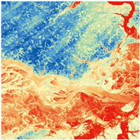
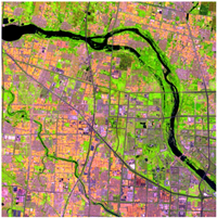
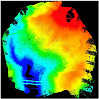
| Visible Light Camera | Thermal Infrared Camera | Multispectral Camera | LiDAR |
|---|---|---|---|
| Main Application: High-resolution color imaging | Main Application: Infrared radiation and temperature detection | Main Application: Multispectral vegetation classification | Main Application: Laser ranging, 3D modeling |
| Drawbacks: Dependent on daylight conditions | Drawbacks: Lower spatial resolution | Drawbacks: Limited spatial resolution | Drawbacks: Atmospheric interference, high cost |
| Specific influencing factors: Image contrast decreases by 40% under rainy conditions, and more than 50% of texture information is lost under foggy conditions. | Specific influencing factors: heavy-fog conditions reduce point cloud density by approximately 30%, while rainy/overcast conditions increase the error by 5–10 cm. | ||
 |  |  |  |
| Algorithm | Accuracy | Speed | Memory Usage | Best Applicability | Limitations |
|---|---|---|---|---|---|
| SIFT | High | Medium | High | Vegetation-covered areas; complex textures | High computational cost |
| SURF | High | Fast | Medium | Exposed slopes; moderate vegetation | Less robust to extreme lighting changes |
| ORB | Medium | Very fast | Low | Real-time monitoring; bare ground | Lower accuracy in complex scenes |
| Indicators | LiDAR | Oblique Photogrammetry |
|---|---|---|
| Accuracy | High (usually 2–5 cm, affected by point density, vegetation, etc.) | Low (usually 5–10 cm, affected by image resolution, overlap, control points, etc.) |
| Vegetation Penetration Capability | Strong | Weak |
| Data Volume | Large (requires noise reduction) | Small (dependent on image quality) |
| Cost | High | Low |
| Indicators | UAV Monitoring | Traditional GNSS Monitoring |
|---|---|---|
| Monitoring point density/coverage | Continuous areal coverage | Discrete point monitoring |
| Cost (10,000 CNY/km2) | 0.5–1 | 2.5–5 |
| Spatial Resolution (UAV)/Point Spacing (GNSS) | 0.1–0.3 m (depends on image resolution) | Usually 5–50 m (depends on deployment strategy and cost) |
| Data acquisition time | Fast (hourly, depending on area size) | Installed points: real-time; new points: hourly to daily (depends on terrain, accessibility) |
| Data processing and preliminary analysis time | Variable (hourly to daily, depending on data volume, method) | Installed points: near real-time; new points: included in deployment |
| Overall emergency response time | Usually several hours to 2 days (depends on task complexity) | Installed points: minutes to hours; new points: several hours to several days |
| Application scenarios | Large-scale areas, complex terrain, dangerous areas | Single point monitoring |
| Penetration capability | Weak (lower than LiDAR sensors) | None |
Disclaimer/Publisher’s Note: The statements, opinions and data contained in all publications are solely those of the individual author(s) and contributor(s) and not of MDPI and/or the editor(s). MDPI and/or the editor(s) disclaim responsibility for any injury to people or property resulting from any ideas, methods, instructions or products referred to in the content. |
© 2025 by the authors. Licensee MDPI, Basel, Switzerland. This article is an open access article distributed under the terms and conditions of the Creative Commons Attribution (CC BY) license (https://creativecommons.org/licenses/by/4.0/).
Share and Cite
Chen, Y.; Liu, X.; Zhu, B.; Zhu, D.; Zuo, X.; Li, Q. UAV Image-Based 3D Reconstruction Technology in Landslide Disasters: A Review. Remote Sens. 2025, 17, 3117. https://doi.org/10.3390/rs17173117
Chen Y, Liu X, Zhu B, Zhu D, Zuo X, Li Q. UAV Image-Based 3D Reconstruction Technology in Landslide Disasters: A Review. Remote Sensing. 2025; 17(17):3117. https://doi.org/10.3390/rs17173117
Chicago/Turabian StyleChen, Yong, Xu Liu, Bai Zhu, Daming Zhu, Xiaoqing Zuo, and Qingquan Li. 2025. "UAV Image-Based 3D Reconstruction Technology in Landslide Disasters: A Review" Remote Sensing 17, no. 17: 3117. https://doi.org/10.3390/rs17173117
APA StyleChen, Y., Liu, X., Zhu, B., Zhu, D., Zuo, X., & Li, Q. (2025). UAV Image-Based 3D Reconstruction Technology in Landslide Disasters: A Review. Remote Sensing, 17(17), 3117. https://doi.org/10.3390/rs17173117


